Tag: UAV navigation

  • UAV Navigation-Grupo Oesía integrates Iridium terminal into flight control system

    UAV Navigation-Grupo Oesía integrates Iridium terminal into flight control system

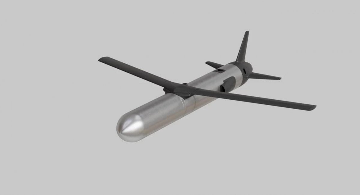
    UAV Navigation-Grupo Oesía, a developer of flight control systems for UAVs, has completed integration and validation of ATMOSPHERE’s Iridium terminal into its VECTOR family of flight control computers. The integration was tested in flight conditions.

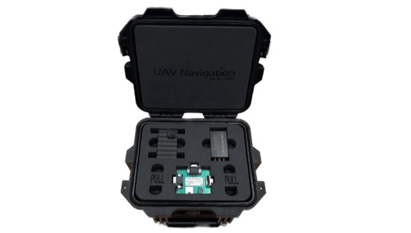
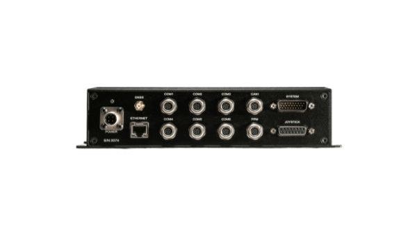
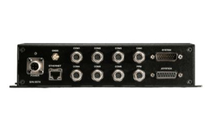
    ATMOSPHERE’s Iridium terminal has been integrated into UAV Navigation-Grupo Oesía’s flight control system via RS-232 serial communication. The integration enables command and control beyond visual line of sight.

    During flight tests, the communication link remained stable, with telemetry performance comparable to traditional radio systems.

    The guidance, navigation and control system allows autonomous operation without requiring a control station link during flight. The integration supports two-way communication for mission updates and re-tasking. UAV Navigation-Grupo Oesía said the integration expands options for beyond visual line of sight operations.

    The integration is part of the company’s effort to enhance operational capabilities for its clients. The system’s interoperability has been expanded to work with additional communication infrastructures and mission profiles. Iridium’s global coverage and low-latency service enable operators to maintain control of platforms in remote areas, over oceans or in environments where radio links may be unavailable.

    The development applies to defense, security and industrial applications where beyond visual line of sight (BVLOS) operations require reliable communication. UAV Navigation-Grupo Oesía provides autonomous flight solutions.

  • UAV Navigation, Septentrio to enhance anti-jamming capabilities for UAVs

    UAV Navigation, Septentrio to enhance anti-jamming capabilities for UAVs

    UAV Navigation-Grupo Oesía has collaborated with Septentrio, a division of Hexagon, to enhance navigation resilience for unmanned aircraft systems. The partnership focuses on ensuring compatibility between UAV Navigation’s guidance, navigation and control systems and Septentrio’s GNSS receivers.

    The collaboration integrates Septentrio’s high-precision real-time kinematic (RTK) capabilities with AIM+ anti-jamming and anti-spoofing technology. The anti-spoofing protection utilizes the Galileo Open Service Navigation Message Authentication (OSNMA) service alongside Septentrio’s proprietary algorithms to defend against signal interference and manipulation.

    UAV Navigation’s flight control system now automatically detects when a Septentrio OSNMA-enabled receiver is connected and prioritizes its data within the navigation logic. This integration demonstrates the interoperability capabilities of the Spanish company’s systems while providing enhanced protection against GNSS jamming and spoofing threats.

    Both companies seek to advance secure, reliable and high-precision navigation solutions for unmanned systems operating in challenging electromagnetic environments. The integration aims to maintain navigation accuracy and mission effectiveness when traditional GNSS signals face interference or manipulation.

  • Ukraine’s Ruta missile to get EW-immune navigation system

    Ukraine’s Ruta missile to get EW-immune navigation system

    The Ruta OWA drone — actively used by Ukrainian forces for strikes at ranges up to 300 km — is being improved with a new visual navigation system, tested in combat conditions.

    The Ruta, manufactured by Destinus, is essentially a miniature cruise missile. It is often referred to as a “missile drone.” It will receive a new navigation system enabling high-precision strikes in GPS-denied contested environments, especially those from enemy electronic warfare (EW) countermeasures.

    The new navigation and guidance system will be provided by Spanish company UAV Navigation, part of Grupo Oesía, which entered an agreement with the Ukrainian Destinus on May 13.

    The agreement will focus on Ruta in its first phase. Ruta is the first low-cost missile (LCM) drone developed by Destinus designed to operate in highly contested scenarios. The system incorporates an advanced guidance, navigation and control system, developed by UAV Navigation-Grupo Oesía, which has been validated in real-world combat conditions, including GNSS-denied environments or under jamming and spoofing attacks.

    Ruta offers autonomous flight capabilities, target-referenced navigation, terminal optical guidance, and coordinated swarm operations, enabling the execution of complex synchronized attack maneuvers to saturate or deceive defense systems. The platform flies at a cruising speed of Mach 0.8, has a range of up to 500 km, and a terminal impact accuracy of 15 square meters.

  • UAV Navigation-Grupo Oesía unveils GNSS-denied navigation kit

    UAV Navigation-Grupo Oesía unveils GNSS-denied navigation kit

    Image: UAV Navigation-Grupo Oesía
    Image: UAV Navigation-Grupo Oesía

    UAV Navigation-Grupo Oesía has released its GNSS-denied navigation kit designed to offer navigation capabilities in challenging environments.

    The kit combines UAV Navigation’s attitude and heading reference system (AHRS), the POLAR-300, with its Visual Navigation System, the VNS01, designed to offer unmatched dead reckoning navigation capabilities with minimal drift.

    The technology offers users improved navigational accuracy, with error rates as low as 0-1% over covered distances. This is made possible by the kit’s visual-based technology, which allows for precise attitude and position estimation to stabilize flights in challenging conditions. The kit is equipped with advanced algorithms that can detect and counter sophisticated spoofing and jamming techniques to offer reliable and secure navigation, even in the face of potential signal disruptions.

    As technology advances and geopolitical challenges emerge, the demand for reliable and secure navigation for UAVs intensifies. Offering operational integrity in both the civil and defense sectors is paramount, especially with the rise of disruptive systems designed to interfere with radio-electronic navigation and communication.

  • Device released for multi-GCS, multi-UAS and maritime operations

    Device released for multi-GCS, multi-UAS and maritime operations

    Image: UAV Navigation
    Image: UAV Navigation

    UAV Navigation-Grupo Oesía has released the GHU-100 ground control hub unit that helps platform manufacturers connect multiple ground devices to form a single network segment.

    The GHU-100 enables multi-UAV and multi-ground control system (GCS) operation and is also designed to fulfill all requirements of maritime operations. This includes control of NMEA inputs, real-time kinematic corrections, and more. The ground control station hub unit also increases UAV flight safety, as it is independent from the computer OS and its potential PC crashes.

    The GHU-100 is designed to increase a system’s robustness while maintaining a high flexibility with its extensive input/output capabilities, which makes it easy to integrate into complex and advanced GCS architectures. It also implements critical functionalities on a self-developed real-time operating system to ensure secure missions in all environments.

  • UAV Navigation joins Qascom on OSNMAplus project

    UAV Navigation joins Qascom on OSNMAplus project

    The companies will combine their experience to guarantee robust and reliable navigation thanks to the Galileo constellation

    The OSNMA scheme. (Image: ESA)
    The OSNMA scheme. (Image: ESA)

    UAV Navigation is participating in the OSNMAplus project consortium led by Qascom, an Italian enterprise in the domain of GNSS authentication.

    The OSNMAplus project aims to develop services and technologies that make use of novel services provided by Galileo, particularly use of OSNMA and I/NAV improvements.

    The OSNMA service is a data authentication function for Galileo Open Service users worldwide, freely accessible to all. OSNMA provides receivers with the assurance that the received Galileo navigation message is coming from the system itself and has not been modified. The I/NAV improvements are part of a recently released update of the Galileo Interface Control Document, aiming at optimizing the navigation performance of Galileo even further.

    “With the OSNMAplus project, we’re providing technological solutions that will facilitate the adoption of OSNMA in new and existing navigation systems,” said Carlo Sarto, OSNMAplus project manager. “We’re also providing cloud-based services and multiplatform SDK that can be used in consumer devices to improve the OSNMA experience and increase the robustness of the navigation solution.”

    The OSNMAplus technologies will be subject to an extensive test campaign. The OSNMA-based navigation will be tested in a flying drone to assess effective resilience against potential malicious GNSS interference.

  • UAV Navigation defines operational envelope for VECTOR-600 autopilot

    UAV Navigation defines operational envelope for VECTOR-600 autopilot

    An independent study conducted by UAV Navigation has defined the operational envelope of the VECTOR-600 autopilot based on the Specific Operations Risk Assessment (SORA) methodology. The operational envelope defines the operational risk profile within which an aircraft can operate safely, taking into consideration all risk mitigations included within the system.

    The SORA methodology evaluates the safety risks involved with the operation of an unmanned aerial system (UAS) of any class, size or type of operation. The concept of operation (ConOps) is normally used as the input for this analysis; the output takes the form of the Specific Assurance and Integrity Level (SAIL) for a particular operation, which indicates the level of robustness that must be demonstrated for the operational safety objectives.

    In this case, instead of performing a conventional SORA analysis from the ConOps to the SAIL output, this study was performed the other way around because the objective of the study was to identify the operational envelope of the sytem.

    EUROCAE ED-280, the guidelines for UAS safety and analysis for specific categories of low and medium levels of robustness, recommends to any operator a detailed definition of different mission and platform points: the ConOps, the entire UAS architecture including functions, systems, and implementation, identification and classification of failure conditions; verification that safety objectives are fulfilled and a complete probable failure analysis using FMEA-like techniques and Fault Tree Analysis (FTA).

    UAV Navigation prepared an FMECA and FTA analysis performed by a third-party and independent company on the VECTOR-600 autopilot and its onboard sensor suite, the POLAR-300. The study concluded that within the operational envelope of the VECTOR-600, any failure – however remote the probability – is highly unlikely to result in a catastrophic outcome, such as the loss of the aircraft. The conclusions reached indicate that the system is perfectly suited for VLOS/BVLOS operations – including appropriate restrictions where applicable. The system has proved its robustness and suitability for safe operations over a wide range of missions usually performed by professional UAS.

    The analysis is available on request to all clients interested. Contact UAV Navigation for more information.

    Photo: UAV Navigation
    Photo: UAV Navigation

  • UAV Navigation releases Visual Navigation System for GNSS-denied environments

    UAV Navigation releases Visual Navigation System for GNSS-denied environments

    The Visual Navigation System improves navigation in GNSS-denied environments by means of visual odometry techniques

    Photo: UAV Navigation
    Photo: UAV Navigation

    UAV Navigation has released its new Visual Navigation System (VNS), a new capability for manufacturers and end users of NATO Category I and II unmanned aerial systems (UAS).

    The compact and lightweight device — provided as an optional peripheral to the main flight control system — enables the safe and efficient navigation of UAVs in GNSS-denied environments. The VNS combines visual odometry techniques and pattern identification with the rest of the sensors onboard the aircraft to ensure that the absolute position, orientation and relative movement of the aircraft over the ground is calculated with extremely high accuracy.

    The planning and execution of UAV missions in environments in which the GNSS signal is either unavailable or unreliable is becoming more critical. For some missions, the datalink to the ground control station may be subject to interference, or the operation dictates that the flight must be performed without a datalink from the outset.

    Under these circumstances, UAS traditionally rely on an inertial navigation system (INS) to complete the mission. However, all such inertial systems accumulate navigational drift due to sensor noise, propagation models and the difficulty in characterizing external forces. This positional error limits any such UAS operation because an accurate position cannot be guaranteed.

    The new VNS, combined with the company’s Vector range of flight control systems, effectively addresses this problem by using data independent from GNSS and more accurate than INS. The system identifies patterns in the terrain below to assist in canceling out any accumulated error, allowing the UAS to operate for long periods without losing positional precision.

    Because of its reduced size and weight, the VNS can be installed in Category I and II UAS, enabling them to take advantage of this navigation technique without penalizing autonomy or payload capacity.

    The new VNS — developed entirely by the Spanish company UAV Navigation, part of the Oesía Group — has produced outstanding results during flight testing, both on fixed-wing platforms (typically with higher airspeeds and greater service ceilings) and rotary-wing platforms (where high vibrations and hover maneuvers are typically a problem). The new VNS has proved its ability to provide accurate navigation information for flights where there may be an intermittent loss of GNSS signal, and also when a flight must be executed from the outset without GNSS data.

    Download the Visual Navigation System brochure here.

  • UAV Navigation puts Vector-600 autopilot through paces

    UAV Navigation puts Vector-600 autopilot through paces

    The Vector-600 autopilot. (Photo: UAV Navigation)
    The Vector-600 autopilot. (Photo: UAV Navigation)

    UAV Navigation has confirmed the safety and reliability of its Vector-600 autopilot for civil applications with an independent study. The study was performed as part of the European Union VaNeT project, and conducted by third-party company Anzen Engineering.

    An autopilot system in an unmanned aerial vehicle (UAV)  is the heart of the flight control system. For the Vector-600, the study included a reliability prediction report (RPR), failure mode effects and criticality analysis (FMECA) and fault tree analysis (FTA).

    Reliability Prediction Report. The RPR analyzes probability of failure of every single sensor and component inside a system. It helps define component failure rates and, consequently, a prediction of the time that the VECTOR-600 is expected to operate free of failures under given operating conditions. According to this, the VECTOR-600 has shown a mean time between failures of more than 19,500 hours.

    Failure Mode Effects and Criticality Analysis. A FMECA study identifies potential failures of system functions and assesses their effects, so that mitigation actions can be defined. It is a bottom-up analysis considering each single elementary failure mode and assessing its effects.

    Fault Tree Analysis. Fault trees are a classic deductive analysis technique useful for both qualitative and quantitative analysis. For the Vector-600, a quantitative FTA provided probability estimates for major hazards, as well as identifying single-point failure modes and guiding further design for hazard reduction. According to the results, Vector-600 showed a probability of loss of mission per flight hour of 1,809E-05 under its operating conditions.

    “The FMECA, RPR, and FTA analysis performed by the external and independent company Anzen have proven that our most advanced autopilot, Vector-600, is one of the most reliable GNC [guidance, navigation and control] systems for NATO Class I and II unmanned aircrafts available in the market and enables our clients to execute missions ensuring safety,” UAV Navigation stated in a press release.

    The EU regulation framework defines three classes of operations: open, specific and certified. In specific and certified category operations, including most professional UAS flights, operators and aircraft manufacturers need to prove safe operation of their platforms. For this reason, the study of the reliability of the systems involved in the UAV becomes a must to demonstrate the system can operate free of failures under specific operational conditions.

    The full analysis report is available on request.

  • UAV Navigation integrates avoidance system into autopilots

    UAV Navigation integrates avoidance system into autopilots

    Photo: UAV Navigation
    Photo: UAV Navigation

    Autopilot platform developer UAV Navigation is integrating Iris Automation’s detect-and-avoid Casia software into its advanced autopilot solution, Vector. UAVs equipped with Vector and Casia now can detect uncooperative crewed aircraft in their airspace and autonomously or manually take corrective action, avoiding potential collisions.

    The integration comes as Iris Automation releases Casia Software v2.2. The release also includes improvements to performance, track fusion and flight data uploads. Casia Software is embedded in all Casia systems and uses computer vision and artificial intelligence to detect and classify aircraft intruders, similar to human pilots.

    Vector autopilots are specifically designed to execute flight completely autonomously, even if the remote-control datalink becomes unavailable or fails. They are used by a wide range of commercial clients flying rotary wing, target drone, fixed wing, and VTOL uncrewed aerial vehicles, worldwide.

    UAV Navigation specializes in the design of guidance, navigation and control solutions for unmanned aerial vehicles (UAVs). Iris Automation is a safety avionics technology company pioneering detect-and-avoid (DAA) systems and aviation policy services that enable customers to build scalable operations for commercial drones.

  • Tallysman provides full-band GNSS helical antenna

    Tallysman provides full-band GNSS helical antenna

    Photo: Tallysman Wireless
    Photo: Tallysman Wireless

    Tallysman Wireless Inc. has added its first full-band GNSS antenna to its line of helical antennas.

    The full-band GNSS HC990E embedded helical antenna is designed for precise positioning, covering the GPS/QZSS-L1/L2/L5, QZSS-L6, GLONASS-G1/G2/G3, Galileo-E1/E5a/E5b/E6, BeiDou-B1/B2/B2a/B3, and NavIC-L5 frequency bands, including the satellite-based augmentation system (SBAS) available in the region of operation [WAAS (North America), EGNOS (Europe), MSAS (Japan), or GAGAN(India)], as well as L-band correction services.

    The HC990E embedded helical antenna is designed and built for high-accuracy positioning. It is packaged in a very light and compact form factor, making it suitable for a wide variety of applications, especially lightweight unmanned aerial vehicle (UAV) navigation.

    The HC990E is 60-mm wide and 25-mm tall, weighing 12 grams. It features a precision-tuned helical element that provides an excellent axial ratio and operates without the requirement of a ground plane. The HC990E also features a low-current, low-noise amplifier (LNA) and pre-filter to prevent harmonic interference from high-amplitude signals, such as 700 MHz band LTE and other nearby in-band cellular signals.

    The HC990E antenna base has a flying lead with a UFL connector. To facilitate the installation, Tallysman provides an optional embedded helical mounting ring, which traps the outer edge of the antenna circuit board to the host circuit board or any flat surface. Tallysman also supports the installation and integration of embedded helical antennas to enable successful implementation and provide optimal antenna performance.

  • UAV Navigation autopilot powers Power4Flight engines

    UAV Navigation autopilot powers Power4Flight engines

    UAV Nav logoUAV Navigation’s range of Vector-autopilots is now integrated with Power4Flight’s IntelliJect EFI, designed for use in small-engine aerospace applications.

    Using the robust and extensive communication capabilities of UAV Navigation autopilots, the IntelliJect EFI’s engine control unit can communicate and deliver critical parameters through the CAN port. This way, the autopilot is able to automatically control and monitor the engine. The operator will be capable of controlling and receiving real-time status information from the engine in the UAV Navigation’s advanced ground-control station Visionair.

    The IntelliJect EFI is highly configurable for a variety of engine types (two-stroke, four-stroke, triples, twins and singles), including Power4Flight’s engines or any other manufacturer engine.

    Power4Flight propulsion systems and electronics are used in a wide range of unmanned aircraft systems. With this integration, the fuel injection systems of the American manufacturer will be able to send performance parameters, such as RPM, temperatures, pressures, throttle range and error to the autopilot, and receive commands.