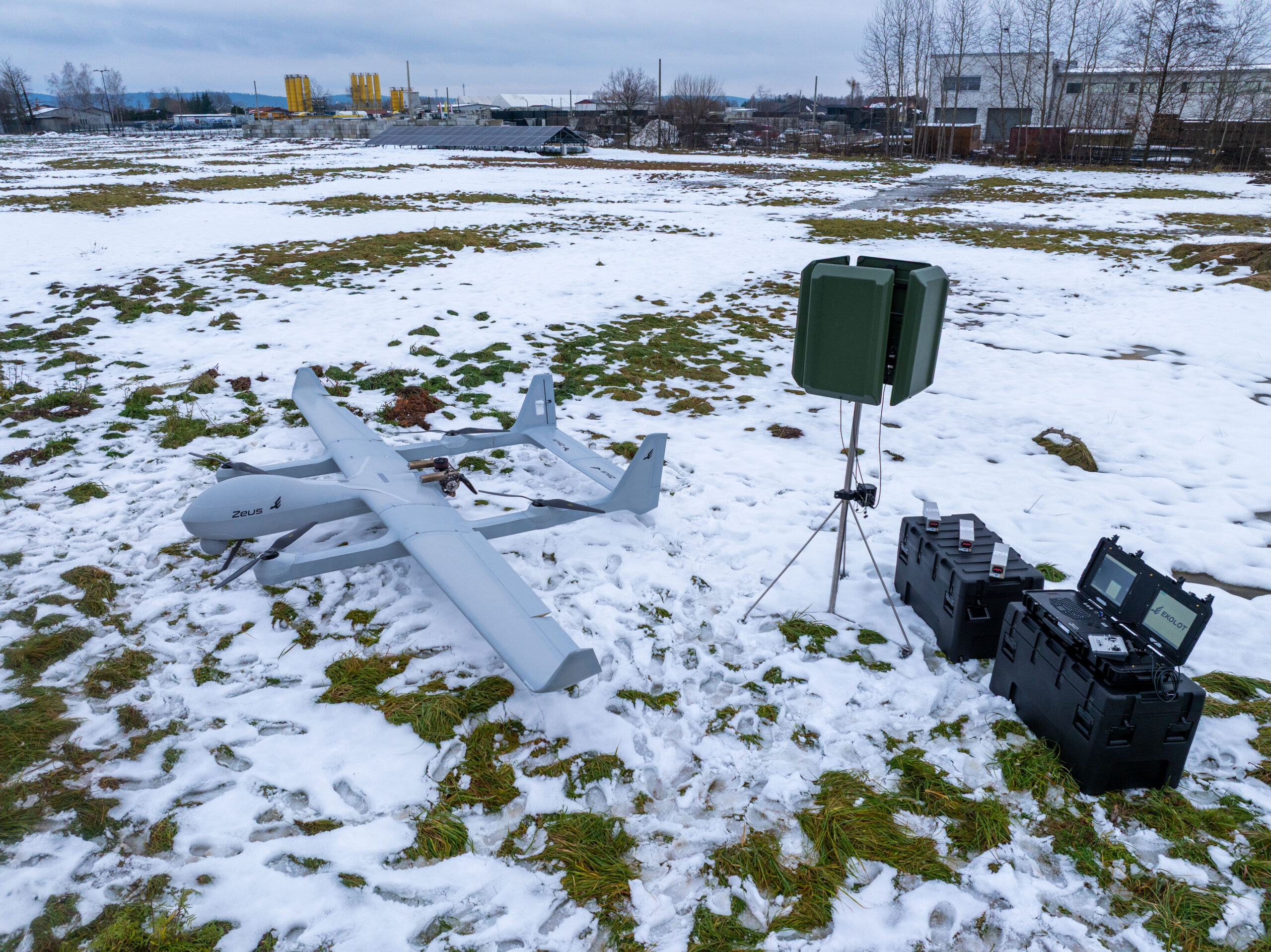
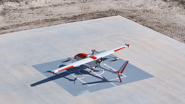
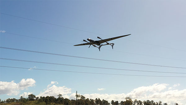
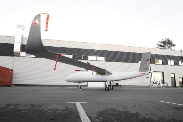
UAV Navigation-Grupo Oesía, a provider of flight control systems for unmanned aerial vehicles, will collaborate with Poland-based Ekolot Aerospace and Defense (EAD) to integrate its advanced flight control system into Zeus, Ekolot’s new fixed-wing vertical take-off and landing (VTOL) platform.
The collaboration brings together UAV Navigation’s guidance, navigation and control solutions with Ekolot’s vision to create a new generation of VTOL aircraft. The result is Zeus, a family of platforms in a maximum take-off weight (MTOW) range from 100 to 250 kg that combines the aerodynamic efficiency of a fixed-wing design with the versatility of vertical take-off and landing. These features make it useful for civil, defense and security missionsin remote or challenging environments.
The Zeus family aims to fill the gap between small tactical UAVs and heavy MALE-class systems. Zeus is a modular and convertible concept. A single base airframe
accepts VTOL or conventional take-off and landing conversion kits
supports multiple MTOW (150kg, 200kg, 250kg for VTOL and 250kg – 350kg for conventional)
allows for payloads of 30 – 120kg on VTOL versions and up to 150 kg on conventional; Zeus G variant
delivers exceptional endurance of 12–24 hours and a modular, payload-agnostic configuration.
integrates UAV Navigation-Grupo Oesía’s advanced autopilot systems, which provide precise flight control and a wide range of advanced capabilities for dual-use unmanned missions, including robust performance in GNSS-denied environments through high-precision inertial navigation and the visual navigation system.
The companies aim to reinforce their presence in the Polish market and support Ekolot Aerospace & Defense’s expansion across the Latin American region. EAD emphasizes the importance of partnering with a company that not only provides critical systems such as flight control, but also offers a team of highly qualified experts in the unmanned industry.
UAV Navigation-Grupo Oesía reaffirms its commitment to driving innovation in navigation and flight control systems for unmanned aircraft, consolidating its position as a benchmark in guidance, navigation and solutions for UAS executing complex operations in hostile environments and high-demand missions.
The CR8894SXF+ is an advanced controlled reception pattern antenna (CRPA) for anti-jamming. It is engineered to provide efficient interference protection and real-time situational awareness across critical infrastructure, marine and defense environments where GNSS continuity is mission critical. It is specifically designed to provide a low-power and lightweight solution in a compact size. It features advanced in-band null forming to protect GPS L1/L2 and Galileo E1/E5b signals, helping ensure resilient positioning, navigation and timing in environments with contested, congested or degraded radio frequency conditions. The antenna incorporates Calian’s eXtended Filtering interference mitigation technology to maintain performance and reliability when RF threats are present. The CRPA supports in-band null-forming of 20 dB to 40 dB and out-of-band rejection up to 80 dB across 700 MHz to 2,500 MHz. It includes two independent low-noise amplifier channels, allowing continued operation if one signal band is compromised. The antenna forms nulls in both upper (L1/E1) and lower (L2/E5b) GNSS bands to actively suppress jamming sources. A serial output interface provides real-time feedback, enabling users to monitor RF conditions and system status.
The BlackNaute autonomous positioning, navigation and timing (PNT) system integrates Safran’s HRG dual-core inertial navigation technology, the Skylight multi-mode GNSS receiver board, and an atomic clock to offer navigation resilience in challenging electronic warfare environments. BlackNaute’s built-in atomic clock is designed to maintain precise timing, which is essential for secure communications and collaborative combat operations. The system features advanced anti-jamming and anti-spoofing algorithms, which have been validated in more than 16,000 operational cases. These capabilities allow BlackNaute to detect compromised signals and automatically switch to autonomous and trusted navigation and timing sources to ensure continuity of operations. Its modular design allows it to be adapted across a variety of platforms. Airbus Helicopters has selected the NH90 to be equipped with this new Embedded GNSS and Time INS (EGTI).
Suite enhanced for greater accuracy, coverage and insight
Photo: US Navy
HawkEye 360’s GNSS-I Detection suite includes powerful enhancements to its GNSS interference detection capabilities. The upgrades — designed with defense, intelligence and national security operations in mind — offer unprecedented accuracy, coverage and insight into global GPS jamming and spoofing threats. The update includes a new wider frequency algorithm that better distinguishes individual emitters, incorporates GPS spoofing detection, and is terrain adjusted for better geolocation accuracy, delivering greater situational awareness and more precise geolocation of interference sources worldwide. The enhanced product suite supports strategic decision-making by providing timely, precise insight into potential signal disruptions, enabling stakeholders to better assess risk, respond confidently, and maintain operational continuity in dynamic environments.
For complex intelligence, surveillance and reconnaissance missions
Photo: ESEN-UAS
The GöKHUN unmanned aerial system (UAS) is a tactical vertical take-off and landing (VTOL) drone system developed for versatile missions on land or at sea. GöKHUN combines the compact mobility of a NATO Class I UAV with the performance data of a Class II tactical system. It uses the SP 210 FI GS 2-stroke engine from Sky Power International. With a take-off weight of up to 110 kg and a maximum fuel and payload capacity of 26 kg, the GöKHUN can remain in the air for up to 16 hours with a minimum payload. Even with a demanding sensor load of 12 kg, it can achieve a flight duration of around nine hours, making it suitable for long-endurance reconnaissance and surveillance missions. The GöKHUN’s cruising speed is between 96 and 158 km/h. The maximum range with direct line-of-sight is over 150 km, with the system reaching a service ceiling of approximately 5,500 m.
The GöKHUN unmanned aerial system (UAS) from Turkish company ESEN is a tactical vertical take-off and landing (VTOL) drone system that does not require a runway, offering maximum flexibility in operational use.
Developed for versatile missions on land or at sea, GöKHUN combines the compact mobility of a NATO Class I UAV with the performance data of a Class II tactical system. The GöKHUN UAS uses the modern SP 210 FI GS 2-stroke engine from Sky Power International.
With a take-off weight of up to 110 kg and a maximum fuel and payload capacity of 26 kg, the GöKHUN can remain in the air for up to 16 hours with a minimum payload. Even with a demanding sensor load of 12 kg, it can achieve a flight duration of around nine hours, making it suitable for long-endurance reconnaissance and surveillance missions.
The GöKHUN’s cruising speed is between 96 and 158 km/h. The maximum range with direct line-of-sight is over 150 km, with the system reaching a service ceiling of approximately 5,500 m.
GöKHUN can take off and land in an area measuring 10 x 10 meters, regardless of topographical conditions and without any infrastructure. This also allows it to be deployed in remote or difficult-to-access regions and on ships.
The GöKHUN was designed for complex intelligence, surveillance and reconnaissance (ISR) missions. In addition, the system is suitable for a wide range of other applications such as environmental monitoring, disaster relief, border surveillance, anti-smuggling operations and precision agriculture. With its integrated vision-based navigation system GöRDES, the drone is independent of GNSS signals and can be reliably controlled even in GPS-denied environments.
All safety-relevant systems such as navigation, flight control, data transmission and power supply are designed with double or triple redundancy. If the connection to the ground station is lost, the UAV returns autonomously to its starting point. In addition, GNSS interference protection ensures robust operation even under electronic interference.
The GöKHUN is also designed for mobility and speed. Two technicians can have the system up and run in around 15 minutes, and it can be transported in two standard vehicles. Thanks to its modular design, the system is easy to maintain and can also be easily adapted to different deployment scenarios. A particularly outstanding feature is its ability to operate two different payloads simultaneously, for example EO/IR sensors for day and night operation or different communication and reconnaissance systems. It is controlled via an integrated ground station with a data terminal, which can also be transferred to other carrier vehicles during an operation.
The system’s high environmental resistance, with an operating temperature range of −30°C to +55°C, and its ability to fly stably at wind speeds of up to 40 knots underlines its robustness. With its ITAR-free design, GöKHUN meets international export requirements and complies with NATO standards AEP-83/84. The system can be easily integrated into existing tactical networks, making it attractive to international partners.
Overall, GöKHUN combines tactical range, modular architecture, simple logistics and operational independence. With its high endurance, vertical take-off capability and safe mission execution in complex environments, the system is ideal for modern applications in security-critical but also in civil areas, whether for border surveillance, disaster relief or as an ISR platform at sea. Its independence from GNSS signals and flexible payload configuration make the GöKHUN UAS a state-of-the-art solution in the field of unmanned aerial reconnaissance.
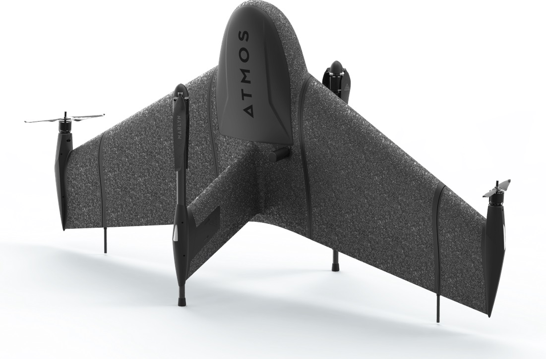
Atmos has integrated the Sony a7R mark III and IV camera into its vertical take-off and landing (VTOL) fixed-wing UAV, the Marlyn Cobalt. This will increase coverage and accuracy achieved in a single flight for surveyors.
Both cameras have an ISO of 32,000, which is expandable to 102,400, and camera sensors with high megapixel count — 42,4 MP for the a7R III and 61 MP for the a7R IV. When combined with Zeiss’ 35 mm and 21 mm lenses, it enables UAV surveyors to achieve ground sample distance levels below one 1 cm.
The integration of the two cameras enables Marlyn Cobalt users to map an area of 210 hectares with centimeter-level accuracy in a single flight.
The Carbonix Volanti vertical take-off and landing (VTOL) drone. (Photo: Carbonix)
Fugro is partnering with Australian drone manufacturer Carbonix to establish a new long-range drone capability. It is Fugro’s first partnership working towards long-range beyond-visual-line-of-sight (BVLOS) missions, bolstering Fugro’s existing geographic information system (GIS) capability.
Carbonix will supply Volanti and Ottano vertical take-off and landing (VTOL) drones over the next 27 months, to further enhance Fugro’s remote operations.
Fugro is engaged in the transition to remote and autonomous operations with a global network of nine remote operation centres (ROCs). From these centers, Fugro operates boats and other vehicles, and provides survey, inspection and piloting services to the global maritime industry.
Carbonix will support Fugro’s Australian long-range maritime and land projects from the sky, using aerial surveying and data-capture technology, while integrating with Fugro’s ROCs for the joint development of systems technology and capabilities.
Topcon’s ultra-compact B111A GNSS receiver board can provide scalable positioning from sub-meter differential GPS to sub-centimeter real-time kinematic (RTK) positioning. The board’s flexible design — low power consumption, comprehensive communication interfaces and peripheral support — make it easy to integrate the B111A into any precise positioning application, Topcon said.
Besides in surveying and mapping, survey drones are now used in a broad spectrum of applications ranging from construction and mining to agriculture and environmental monitoring.
The Atmos Marlyn Cobalt is a vertical-takeoff-and-landing (VTOL) fixed-wing mapping drone developed by Atmos with the goal of allowing users to effortlessly collect accurate geospatial information and turn it into actionable insights. “Our mission is to provide professionals with the tool with which they can plan a better future with precision,” said Ruud Knoops, Atmos CEO.
To provide precise positioning accuracy, a GNSS board needs to compensate for inaccuracies caused by satellite constellations, receiver hardware and atmospheric conditions.
The use of Topnet Live — Topcon’s GNSS real-time correction service — provides high-accuracy positioning and survey-grade results to professionals through a 24/7 cross-border, consistent and reliable access. The combination removes the need for base stations, increasing efficiency leading to higher productivity and decreased costs.
A roundup of recent products in the GNSS and inertial positioning industry from the May 2022 issue of GPS World magazine.
SURVEYING
Measurement Workflows
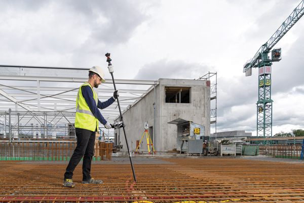
Field-to-office inspection with survey-grade accuracy
Photo: Trimble
Trimble Access field software now connects with Infotech’s Appia service to streamline the workflow from survey to construction. Aimed at the inspection process for civil infrastructure projects, the software provides high-accuracy measurement workflows for daily work reports and inspection reporting for engineering, construction and public agencies. By streamlining the connection between data collected by Trimble GNSS rovers and simultaneously syncing Trimble Access, Infotech Mobile Inspector and Infotech Appia, inspectors can now complete their daily work reports more efficiently in the field and reduce errors. With manual processes removed, inspectors can more accurately represent infrastructure assets.
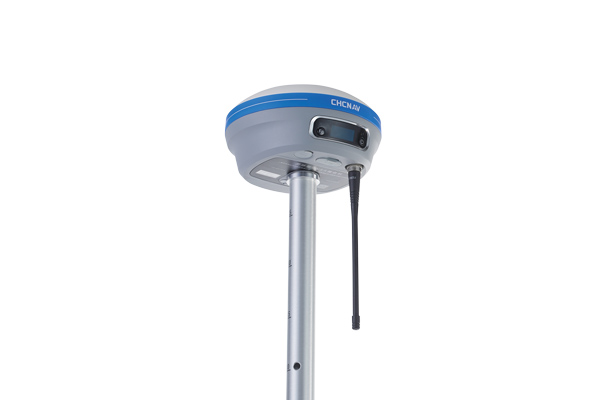
For surveying, mapping and construction professionals
Photo: CHCNav
The i83 GNSS receiver is powered by a multi-band GNSS receiver, iStar technology, and a calibration-free, high-end inertial measurement unit (IMU) for faster and reliable field GNSS surveying. The third-generation high-gain antenna with advanced CHCNAV iStar algorithm improves GNSS satellite signal tracking efficiency by more than 30%. The i83 GNSS receiver features 1,408 GNSS channels for high performance across GPS, GLONASS, BeiDou, Galileo and QZSS constellations. Its onboard GNSS technology delivers centimeter-level positioning, maintains reliable fixed real-time kinematic (RTK) accuracy, and collects points faster than previous models, even in demanding conditions. The i83 receiver’s built-in IMU automatically compensates for pole tilt. In less than 5 seconds, the 200-Hz inertial module is initialized to ensure survey-grade accuracy over a pole-tilt range of up to 30 degrees. Productivity is dramatically increased, RTK usability greatly improved, and potential human error reduced, whether you are an engineer, site foreman or surveyor.
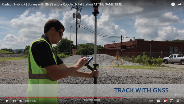
Simplifies surveying with both GPS and total station
Photo: Carlson Software
SurvPC Hybrid+ is a module for SurvCE version 6 software that enables surveying with mixed brands of GNSS receivers and total stations. SurvCE is a data-collection software package from Carlson Software. SurvPC Hybrid+ provides driver support for numerous devices, allowing the surveyor to interface with both types. Features include Follow Me, Smart Lock, Smart Staking, Cross Check, Backup Tracking, Hybrid-Resection, Auto-Localize, and Easy Setup Wizard.
SurPad 4.2 is designed to help surveyors work efficiently at all types of land surveying and road engineering projects in the field. It runs on eSurvey handhelds, Android smartphones and tablets, and third-party Android devices. It integrates with professional receiver control, point collection, stakeout, geographic information system (GIS) data collection, road measurement, road design, cross-section measurement and railway stakeout. SurPad 4.2 provides multiple operation and communication systems, has mapping and CAD functions, and has a coordinate system. It also includes a survey mode encompassing topo, control, quick point and COGO civil engineering programs.
The Leica AP20 AutoPole provides tilt compensation, automatic pole-height readings and unique target identification for automated total stations. It combines an intelligent sensor module with the AP Reflector Pole and operates with existing Leica Geosystems’ automated total stations to create a solution for autonomous workflows. Tilt compensation decreases measurement time and increases flexibility and safety on site by enabling measurement of points in inaccessible or risky locations. By updating the pole height automatically in the field software, the system ensures that the height on record is always correct.
INSITE Data Reviewer moves geospatial data validation to the cloud, giving key stakeholders the ability to collaborate in real time. The third module in the INSITE Lifecycle suite of products, INSITE Data Reviewer provides reviewers real-time access to aerial imagery, lidar data and geographic information system (GIS) layers via the cloud to standardize quality control. This increases data validation speed and reduces costs of geospatial projects. The INSITE Lifecycle suite combines Project Tracker, Data Delivery and Data Reviewer modules through which users can see their projects executed on a map, from data acquisition through processing.
Eos Laser Mapping for ArcGIS is now available on Android devices. It allows mobile crews to capture high-accuracy laser offsets directly into ArcGIS Field Maps with Arrow Series GNSS receivers. The solution combines technology from geographic information system (GIS) provider Esri, laser rangefinders from Laser Tech, and Eos’ own Arrow Series GNSS receivers. The release supports three workflows: standard laser offset (range-azimuth), range-range (range-intersect) and range-backsight (a total station-like method).
The MV60 micro-electromechanical system (MEMS) accelerometer delivers high performance and reliability in a small, rugged and low-cost package. The MV60 measures the acceleration experienced by an object during movement and is designed for use in inertial measurement units and navigation systems deployed on land, air and sea vehicles to measure velocity. It has a compact footprint of 1.2 square inches and shock survivability of up to 5,000 g. It also offers bandwidth of greater than 300 Hz — important for environmentally demanding missions.
Receivers support Japan’s cm-level augmentation service
Photo: Septentrio
Three multi-frequency GNSS receivers now support the Centimeter-Level Augmentation Service (CLAS), receiving the L6 signal that transmits high-accuracy corrections from Japan’s QZSS constellation. The mosaic-CLAS receiver is in a small form-factor suitable for high-volume industrial applications. The AsteRx-m3 CLAS OEM board combines PPP-RTK CLAS with dual-antenna heading functionality. The AsteRx SB3 CLAS features a ruggedized IP68 enclosure to protect it in harsh environments.
The S1-V300 medium-altitude long-endurance (MALE) unmanned aerial system (UAS) prototype is based on the Saker MALE UAS design that achieved operational capability in 2020. The prototype features a new design and a more powerful heavy fuel engine with 260 HP, offering greater speed, payload and endurance of 28 hours with a range of 4,020 km. The aircraft features unique UAVOS avionics solutions and a redundant flight control system that will enable complex missions, including overland and maritime intelligence, surveillance and reconnaissance (ISR) missions. The improved S1-V300 prototype is equipped with both line-of-sight and beyond-visual-line-of-sight (BVLOS) datalink systems for over-the-horizon operations. It can be integrated with multiple ISR sensors, including electro-optical infrared cameras and a synthetic aperture radar that offers all-weather, day/night performance for a wide-area search capability.
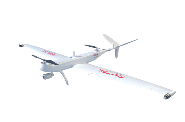
Dragonfish Lite and Pro now available in United States
Photo: Autel Robotics
The rugged Dragonfish UAVs are capable of vertical takeoff and landing (VTOL) with both multi-rotor and winged flight, with an endurance of up to 180 minutes. They are suitable for professional applications such as energy, mining, defense and surveillance. Maximum winged flight speed is 30 m/s (108 km/h, 67 mph), and maximum video transmission range is 30 km (18.6 miles) with a base station. The aircraft can make a smart decision to either land or return to base in case of issues such as loss of GPS signal, loss of operator communications, or low battery power. The tilt-rotor system will automatically transition to multi-rotor mode if adverse conditions cause fixed-winged flight to stall or become unsustainable. The Dragonfish battery, barometer, positioning system, compass and inertial measurement unit all have backup modules to ensure flight safety.
The SureCam connected dash camera system now features a method for capturing video footage from SureCam cameras using Geotab’s telematics device and rule-based system. This results in a seamless display of video within the MyGeotab platform. The enhanced SureCam fleet video solution leverages Geotab’s numerous data-based rules, such as improper seat belt usage and speeding. It also uses G-force triggered alerts that detect unsafe driving behaviors and automatically captures video footage that can be reviewed later. A new Video Request feature in GeoTab enables fleet managers to preview and download additional SureCam video, enabling them to investigate call-ins and other minor incidents that may not have been triggered by an event-based rule.
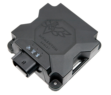
Momentum IoT’s long-life Eagle 1 tracker works without external power for more than six months after a single charge. The device switches on-the-fly between narrowband internet of things (NB-IoT) and LTE Cat-M. The Eagle 1 leverages Telit’s dual-mode ME310G1 module, which delivers low power consumption in a small footprint. The Eagle 1 detects movement with a built-in accelerometer. Using movement and signals from its GPS receiver to determine vehicle trip starts and stops, the device can go into hibernation mode during periods when the vehicle is not in use, further reducing power consumption. Applications include garbage and storage bins, portable toilets, roll-off containers, message-boards, coolers, and other equipment typically stationed in non-powered, remote places for extended periods.
The AR3 maritime surveillance drone, usually launched horizontally, can be launched vertically with attachable propellers. (Photo Tekever)
Tekever, a European maritime surveillance provider, has unveiled a new version of its AR3 unmanned aerial system (UAS). The AR3 now has a “hot-swappable” vertical-takeoff-and-landing (VTOL) capability, able to switch from horizontal launch to vertical. It also now has integrated synthetic aperture radar (SAR).
Tekever made the announcement at AUVSI Xponential 2022 in Orlando, Florida. The company specializes in maritime surveillance services that deliver actionable real-time intelligence. The AR3 is a shipborne UAS designed to support multiple types of maritime and land-based missions up to 16 hours. With the upgrade, the AR3 becomes more operationally flexible, the company said.
“Users no longer have to choose between having pure fixed-wing assets for longer endurance missions, or fixed-wing VTOL assets for more challenging deployment conditions,” explained Ricardo Mendes, Tekever CEO. “The AR3 combines both capabilities and provides users with the ability to decide the configuration just moments before takeoff.”
The newly added SAR provides the AR3 with a vastly greater operational range, and the ability to effectively detect, recognize and identify targets under any weather condition. Covering more than 20,000 square nautical miles per mission, the new AR3 is the suitable for wide-area surveillance missions.
“Our SAR, which we named Gamasar in honor of the Portuguese navigator Vasco da Gama, is designed and built by Tekever specifically to provide our customers with capabilities that are typically only available through much larger systems,” Mendes said. “With an extremely reduced logistics footprint, the unprecedented VTOL flexibility and the unique capabilities provided by Gamasar, the new AR3 is a game changer that provides our customers with tremendous value and cost effectiveness.”
LIFT Aircraft Co. has been awarded a U.S. Air Force contract to continue experimentation and flight test efforts around its HEXA copter.
LIFT Aircraft Co. has been awarded a Phase 3 contract through the U.S. Air Force’s Agility Prime Program to continue experimentation and flight test efforts around HEXA, LIFT’s all-electric, single-seat vertical-takeoff-and-landing (VTOL) aircraft.
Since 2020, LIFT Aircraft has conducted flight testing with the support of the U.S. Air Force under a Phase 2 Small Business Innovation Research (SBIR) contract.
Working with Air Force subject-matter experts, LIFT achieved initial military airworthiness approval (military flight release) and proven transportability by moving the aircraft inside a C-130 military cargo plane. The company also explored a multitude of potential use-cases alongside the Agility Prime Test Team.
The Phase 3 contract will continue experimentation and use-case development through a fast-paced, rigorous flight testing program. The program will begin at Eglin AFB and may expand to other locations. It includes efforts such as flight envelope expansion, acoustics testing and developmental testing of a modular cargo adaptation for the airframe.
The aim is to accelerate and further develop HEXA for public and military applications such as emergency first response, personnel transport, base logistics and search-and-rescue missions. The development effort will also help accelerate the testing required for LIFT’s planned rollout of commercial flight locations.
“This partnership provides continued access to the unmatched expertise of the U.S. Air Force,” said LIFT Director of Business Development, Kevin Rustagi. “We’re excited about continuing to explore and develop a unique capability to the military: an aircraft that offers air mobility at a cost point comparable with ground transportation that, in the future, with mere hours of training, allows any service member to become a pilot.”
Testing will initially be performed at Eglin Air Force Base near Destin, Florida, alongside the 96th Test Wing and with the support of Air Force eVTOL initiative, Agility Prime.
LIFT has already begun coordinating with Col. Doug Creviston of the 96th Operations Group, which has tested systems for the F-15 Eagle, F-16 Falcon and A-10 Thunderbolt.
Photo: Lift
“LIFT is a great example of why Agility Prime exists — to further applications of eVTOL technology for both military and civilian use,” said Lt. Col. John Tekell, Air Force Agility Prime Lead at AFWERX.
Agility Prime has taken a flexible approach to contracting with the Phase 3 SBIR for LIFT. The contract is designed to be as agile as possible — it allows not only the Air Force, but any governmental entity to contract for flight-test activities with LIFT’s HEXA aircraft on an as-needed basis.
“This contract was designed to enable flexible flight test as a service of multiple HEXA aircraft for any government stakeholder, location and desired experiment,” said Sterling Alley, technology transition lead and LIFT program manager at Agility Prime. “We want it to be able to serve as a contract vehicle that accelerates HEXA towards fielding not just for the USAF, but the DOD and USG in general. We have a large number of interested stakeholders looking at use-cases for the aircraft and welcome growing the community even further in the future.”
“LIFT’s Phase III SBIR contract award is a meaningful vote of confidence from the U.S. Air Force,” said Eric Horan, former U.S. Navy government contracting officer and founding partner of Decisive Point, a venture capital firm that invests in dual-use technology startups and has invested in LIFT. “It means the Air Force has determined LIFT’s previous development and testing contracts were successful. This is an important step towards scaling access to LIFT’s HEXA eVTOL aircraft throughout the Department of Defense and federal government at large.”
Northrop Grumman and Martin UAV (a Shield AI company) have completed successful flight testing of a V-BAT unmanned aircraft system (UAS) with new features including GPS-denied navigation and target designation capabilities.
The enhanced V-BAT’s flexible vertical take-off and landing (VTOL) capability is based on a platform deployed to address the U.S. Army’s Future Tactical Unmanned Aircraft System (FTUAS) mission. For FTUAS, the U.S. Army is seeking a rapidly deployable, GPS-denied navigation-capable, expeditionary VTOL system capable of persistent aerial reconnaissance for U.S. Army brigade combat teams, special forces, and Ranger battalions.
The offering is based on Martin’s UAV V-BAT UAS. According to Northrop Grumman, it is compact, lightweight, simple to operate, and can be set up, launched and recovered by a two-soldier team in confined environments. The V-BAT also is designed with sufficient payload capacity to carry a range of interchangeable payloads, including electro-optical/infrared (EO/IR), synthetic aperture radar (SAR), and electronic warfare (EW) payloads, depending on mission-specific requirements. Additionally, Shield AI’s recent acquisition of Martin UAV will enable rapid development of GPS-denied and autonomy capabilities for V-BAT through the future porting of Shield AI’s autonomy stack, Hivemind, onto V-BAT.
Northrop Grumman and Martin UAV conduct flight testing of Martin UAV’s V-BAT aircraft for the U.S. Army’s Future Tactical Unmanned Aircraft System effort in Camp Grafton, North Dakota. (Photo: Northrop Grumman)
This month, the four-pound Integrity dual-rotor UAV on Mars continues to fly and may be moving into a scouting role. Plus, there are continuing efforts to move UAV electronics towards a “certifiable” level to support integration in regular airspace. Finally, a newly launched parcel delivery drone has increased carrying capacity.
The excitement around flying an unmanned helicopter on Mars is gradually dissipating as Ingenuity racks up more flights and the NASA team prepares for an elongated flight schedule following the initial 30-day flying experiment. Data from the Martian UAV passes back and forth through the Perseverance rover, which now has things of its own to do and places to go. An initial 30-foot crawl a couple of days ago signaled the beginning of the rover’s ground activities, which are the main focus of the mission.
However, the little UAV has achieved plenty and appears to have lots of life left to fly. We’re now up to five flights, with the latest taking Ingenuity more than 420 feet, flying at a height of 15 feet to a new landing spot, ahead of where the rover intends to travel.
Before landing, NASA took the UAV up to 33 feet, where future flights should be able to better view features for the rover to investigate. Integrity’s role may now transition to scouting an advance path for rover exploration — one of the principle objectives for the little UAV.
A tiny speck in the distance, NASA’s Ingenuity UAV flies on Mars looking for a new landing spot during its fourth flight. (Photo: NASA)
NASA is planning a few additional trips for Integrity in the next week or so — adequate power is being captured by the top-mounted solar cell to fly and keep the vehicle warm through the cold Mars nights, and the miniaturized avionics systems are holding up well. Hopefully, we will still hear of new accomplishments in weeks to come. Incidentally, Perseverance can now capture the sound of the UAV’s spinning blades and the background wind on the surface of Mars.
FAA certification for drones
News here on Earth is about much more capable unmanned vehicles, new innovations and new applications, and efforts seem to be gaining ground toward certifying UAS and their systems to recognized Federal Aviation Administration (FAA) standards, so integration into the National Airspace System (NAS) might roll out sooner than expected.
When a manufacturer produces an electronic component and qualifies it to the necessary FAA standards, it does not automatically make it a certified product. It only becomes certified on a particular model of aircraft or UAV when the vehicle is certified for operational use by the FAA. There are similar standards and certification requirements in Europe and around the rest of the world.
Enter George
Photo: uAvionix
uAvionics in Leesburg, Virginia, recently launched a new certifiable UAS autopilot — with the cute name of “George.” As older aviation enthusiasts might recall, this moniker was what the World War II pilots of long-range piston engine bombers sometimes called their rudimentary autopilots, which held wings level on long-endurance flights.
With triplex gyros and accelerometers, dual processors and compasses, and a barometer, the unit is lightweight and low power, but has been developed to all the principal aviation requirements, including software and environmental standards.
George joins uAvionics’ line of other aviation qualified/certifiable hardware for UAVs. This includes the ping200X ADS-B for beyond-visual-line-of-sight (BVLOS) detect and avoid, and the trueFYX TSO-C145e certified GPS receiver.
Seeking Certification
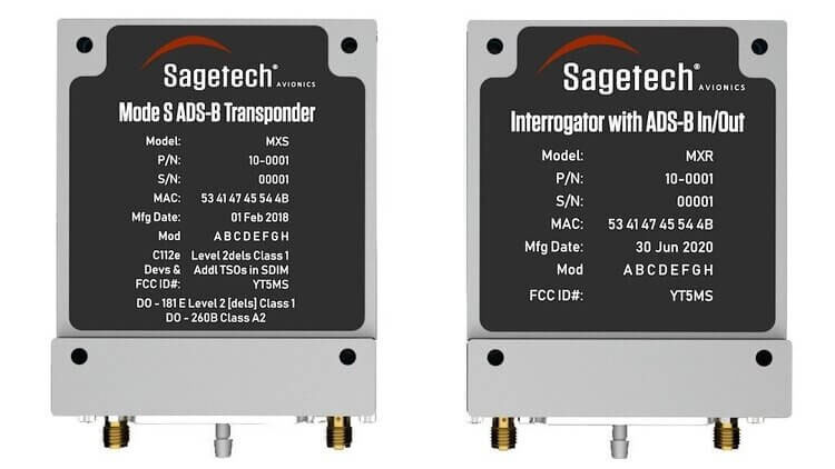
Sagetech in White Salmon, Washington, is another supplier working hard toward certifiable equipment for unmanned aircraft. Sagetech’s detect-and-avoid (DAA) solution makes use of its ADS-B transponder, which can be paired with other airborne collision avoidance system (ACAS) components.
Sagetech offers a design engineering service to enable UAV operators and manufacturers to come up with a certifiable solution while FAA standards are still being developed.
Embention in Alicante, Spain, also advertises several certifiable autopilots, power and control components for unmanned aircraft. It manufactures a variety of Nmand-branded UAVs along with multi-rotor UAV solutions, including a drone recharging station.
Three times the cargo
Meanwhile, drone-delivery capability continues to advance with the recent introduction of the certifiable Wingcopter 198.
The Wingcopter 198 drop-winch cargo drone. (Photo: Wingcopter)
The vertical-take-off-and-landing (VTOL) delivery drone has a triple-drop winch mechanism that allows for delivery of up to three packages per flight. The UAV takes off and lands vertically, thanks to its tilt-rotor design, and can carry a payload of up to 13 pounds. It can travel up to 47 miles on one electrical charge at up to 93 mph; with fewer packages, a range of up to 68 miles may be possible.
The VTOL UAV has redundant design elements that position it to support FAA certification. It has eight redundant motors. Also, the autopilot, airspeed sensor and battery are dual redundant. Consequently, the Wingcopter 198 is undergoing FAA-type certification in the United States.
The Wingcopter 198 also has artificially aided downward-looking cameras to support management of parcel delivery, as well as obstacle avoidance and landing.
To sum up, life may not yet be over for the Integrity UAV on Mars as it moves into a route-scouting role for the rover. There is more progress toward certifiable configurations of equipment to support unmanned integration into the NAS. Finally, last-mile parcel deliveries could benefit from higher capacity certified drone carriers.
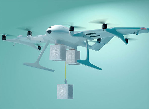
UAV Navigation has developed a flight-control solution specifically for vertical-take-off-and-landing (VTOL) fixed-wing drones.
Interest in using VTOL platforms has grown in the past few years, according to the company. A hybrid between fixed-wing and rotary-wing platforms, VTOLs provide operators with versatility.
The company’s fixed- and rotary-wing development teams worked together on the flight-control solution. Technological capabilities from other solutions — referenced navigation or the development of missions in environments without GNSS signals and under threat of jamming attack — have been incorporated in an organic way to facilitate a complete and reliable system.
The hardware developed by UAV Navigation has the MIL-STD-810F and MIL-STD 461F certification, proving the system has been tested by an independent body that certifies its extraordinary behavior in adverse conditions.
“Our extensive experience with fixed-wing and rotary-wing platforms allows us to know the strengths and challenges that these platforms face as a mission is performed,” said Miguel Ángel de Frutos, CTO of UAV Navigation. “Taking this as a starting point, we have managed to develop a specific solution for VTOL platforms that not only has the same technological capabilities as our existing solutions, but also enables missions to be carried out with the highest possible security.”
One of the main challenges with VTOL platforms is the transition from vertical to horizontal flight and vice versa. UAV Navigation’s solution facilitates and automates this critical moment as much as possible, while optimizing battery use. A series of safety and emergency procedures allow the aircraft to always reach a safe landing zone and overcome possible errors in the engine.
An adaptable VTOL software architecture allows users to customize and configure the solution through the ground control station.
Partnership with AnsuR Technologies
UAV Navigation is partnering with AnsuR Technologies to enable streaming high-definition (HD) video from small UAVs carrying a 200-kbps satcom terminal.
With the partnership, the Asmira software solution fro AnsuR provides the ability to optimize sending video and images for satellite communications. Asmira, together with the Cobham Aviator UAV 200 and the antenna pointing solution Polar-300, provided by UAV Navigation, can deliver cost-effective high quality video transmission for small satellite platforms.
Integrated into the platform’s onboard network, UAV Navigation’s Polar AHRS delivers the attitude and steering information of the platform so the Cobham device can establish contact with the satellite.
The Polar AHRS, a device designed to meet the demanding needs of the aeronautical sector, includes all the necessary sensors in a compact device to provide precise information to the servos in a gimbal or an antenna, enabling its control. Once a stable satellite link is established, the Asmira software delivers HD-quality video at rates down to 100 kbps and can support SD quality below 50kbps.
The partnership enables good-quality streaming for long-range surveillance, infrastructure monitoring and search-and-rescue missions where videos are critical.