Author: Janice Partyka

  • Automakers No Longer the Neanderthals of Tech

    Automakers No Longer the Neanderthals of Tech

    Start of the 550 mile piloted drive from Silicon Valley to Las Vegas: Ricky Hudi, Executive Vice President Electric/Electronic Development, (left) and Ewald Gössmann, Excecutive Director Electronic Research Lab California (ERL), (third from right) drop the flag for the Audi A7 piloted driving concept car.  Photo: Audi
    Start of the 550 mile piloted drive from Silicon Valley to Las Vegas: Ricky Hudi, Executive Vice President Electric/Electronic Development, (left) and Ewald Gössmann, Excecutive Director Electronic Research Lab California (ERL), (third from right) drop the flag for the Audi A7 piloted driving concept car. Photo: Audi

    In the wake of CES and the North American International Auto Show in Detroit, it’s clear that times are a-changing. Self-driving concept cars filled three football-field-sized areas to show off what lies ahead. Verizon and Ford did a cosmic switcheroo, with Verizon morphing into the auto space and Ford starting a transformation into a mobility company. Automated reality/augmented reality isn’t as big as would be expected, and is suffering from a lack of content. Wearables continue to do remarkable things, notably in the health and fitness sector, and smart watches will become more exciting with interaction to vehicles and home.

    Janice Partyka
    Janice Partyka

    When Mark Field, current CEO of Ford, announced the Ford Sync from the CES stage in 2007, attendees found the presence of an auto company at CES to be out of place. The auto industry was considered Neanderthals of tech. Today, the most exciting mobile technology is vehicle related, and more exciting developments from the auto industry were seen in Las Vegas, rather than Detroit.

    Field was back at CES with a visionary perspective that Ford isn’t going to be just about cars and trucks. He is broadening Ford’s focus to mobility in preparation of the changes in transportation that will occur in response to global megatrends of urbanization, growth of the middle class, air-quality issues and evolving consumer attitudes. To test out new ideas of flexible user-ship and collaborative transportation, Ford is operating 25 experiments around the world to test out solutions for specific mobility challenges. Ford is looking to be a leader and enabler of a market where people may be sharing or swapping vehicles or relying on crowd-based transportation. It is refreshing to see out-of-the-box thinking from Detroit.

    Ford Mobility Experiment in London — driving-on-demand with Ford fleet. Photo: Ford
    Ford Mobility Experiment in London — driving-on-demand with Ford fleet. Photo: Ford

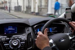
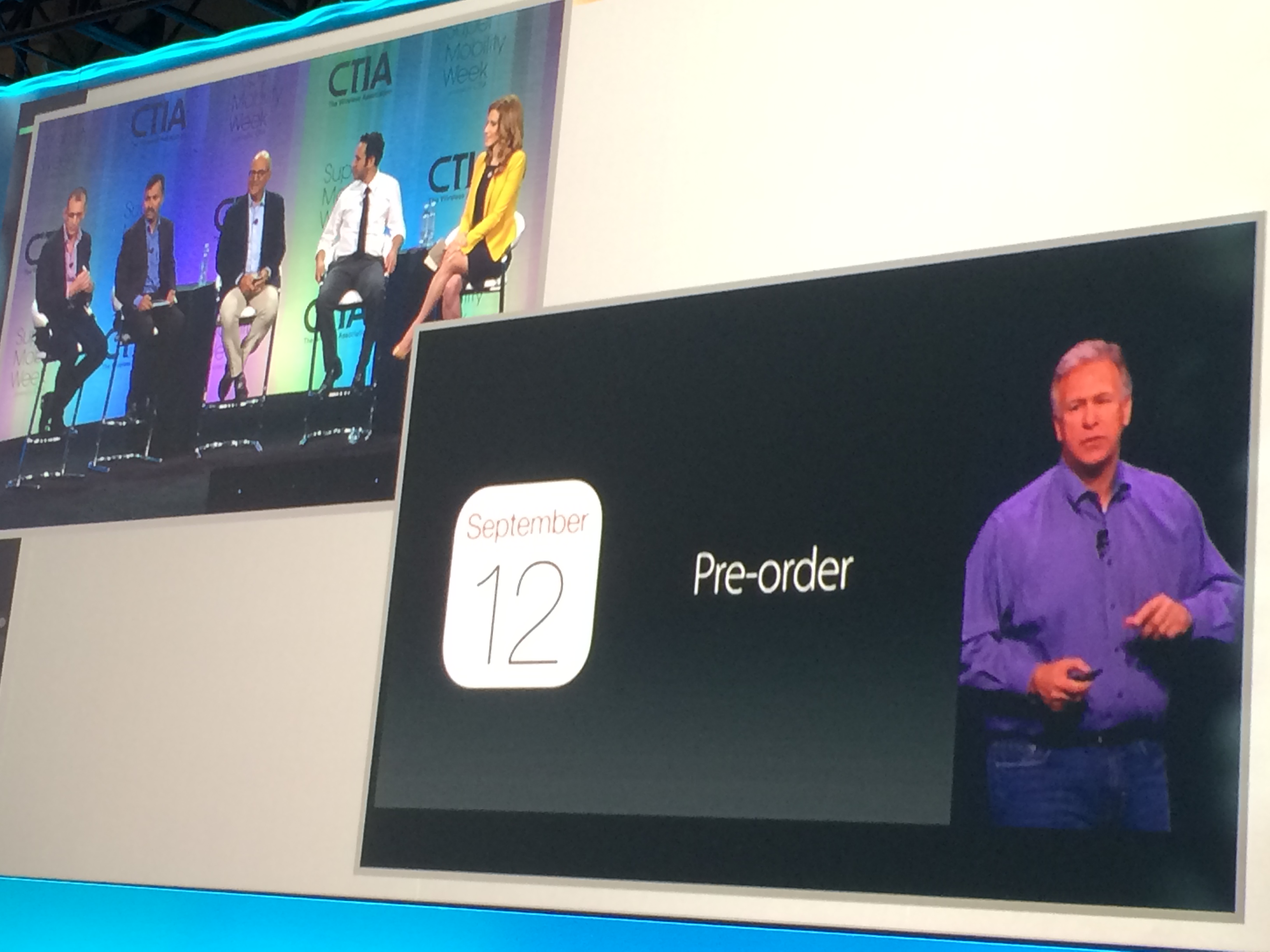
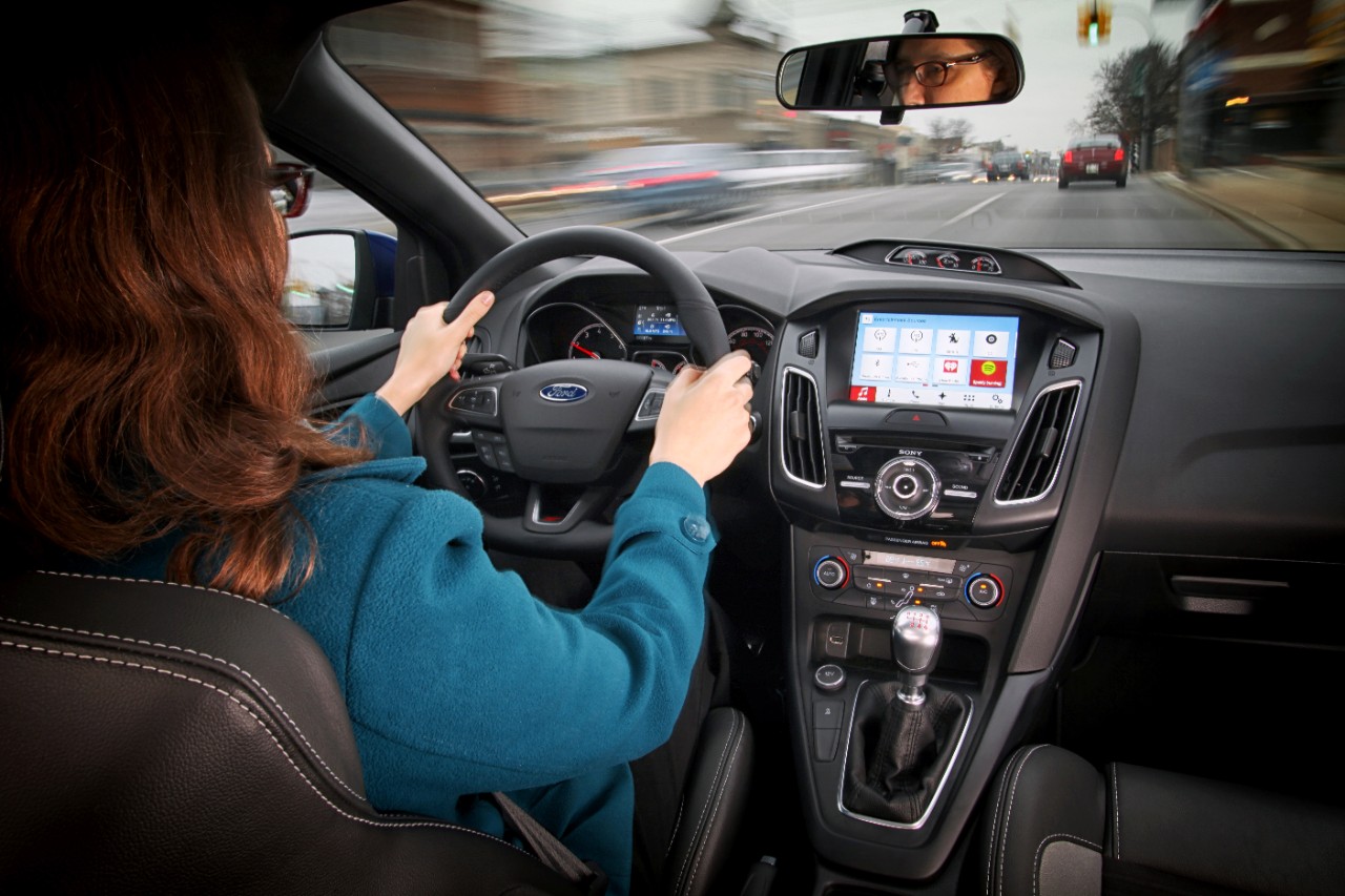
    Far from its beginnings in 2007, Ford announced SYNC 3, an updated version of its in-vehicle communication and information system. SYNC technology is already in 10 million vehicles on the road. SYNC 3 will be released in new car models this year and will include more conversational speech recognition, a more smartphone-like experience with a touch screen and easier-to-read graphics. In addition, AppLink 3.0 will roll out and give drivers the ability to access their navigation app — much as they do on a smartphone — on in-vehicle touch screens.

    Ford SYNC 3. Photo: Ford
    SYNC 3 has been designed to keep the drivers eyes on the road and hands on the wheel, even when controlling their favorite phone apps. Photo: Ford

    You may recall that GM had announced OnStar would be dropping Verizon for AT&T communications staring in 2015. The announcement of Verizon Vehicle, a new connected vehicle service that duplicates some of the features of OnStar, must be the impetus. The subscription-based service will be compatible with all vehicle models sold in the U.S. since 1996. The service will include GPS-directed roadside assistance, crash notification, emergency assistance with a live agent, a hotline to connect with mechanics on vehicle issues, maintenance alerts, and stolen vehicle location assistance. Notably, the offering doesn’t include navigation, a mainstay of OnStar, but readily available on smartphones. The service uses an OBD II dongle and a head unit that can attach to a visor and contains a Bluetooth speaker and call buttons.

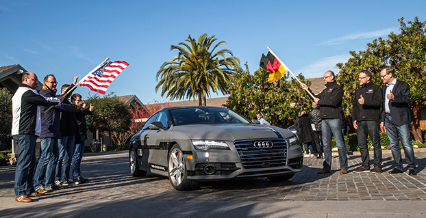
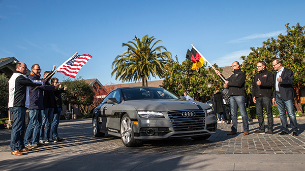
    Mercedes-Benz, Audi and BMW all showed advances in self-driving vehicles. Mercedes-Benz demoed the F015 Luxury in Motion concept car, which is fully autonomous and completely powered by a battery and fuel cell. Audi impressed by having its own concept vehicle drive itself from Palo Alto, California, to Las Vegas. BMW offered demonstrations of its i3 electric car, with ActiveAssist technology, able to prevent collisions at speeds up to 15 mph.

    Delphi and Valeo technology suggest that current adaptive cruise-control systems may soon add self-steering. Drivers could allow the car to take over in stop-and-go traffic and on long highway segments. Although unlikely to see production in the short term, Delphi showed the full capabilities of its self-driving technology in an urban environment.

    The next big feature to be commercialized during our wait for automated driving is self-parking. As demonstrated by BMW, the driver arrives at a parking garage entrance, gets out of the car, and sends it to find a parking place. When ready to depart, the driver summons the car, which drives itself to a special pickup zone in front of a parking garage. BMW says it will be offering self-parking cars in one to two years.

    The Sony Walkman, now $1,100. Photo: Sony
    The Sony Walkman, now $1,100. Photo: Sony

    Unfortunately, augmented reality hasn’t quite lived up to the hype, but Hyundai is showcasing a production-ready augmented reality heads-up display concept. It’s an easy-to-understand system with animated information and warnings to describe road conditions ahead. For instance, it provides warnings when another car is about to unexpectedly enter the car’s lane, and shows arrows leading to exit ramps, highlighted street signs and one-way street markings. Hyundai has linked the augmented heads-up display to a wearable band that will vibrate with warnings. The band includes a heart-rate monitor that can notify 911 if a driver’s heart rate changes rapidly.

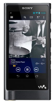
    I don’t want to neglect the things in life that don’t change. It is comforting to know that Palm Pilots, record players and Walkmans are back at CES. The new Sony Walkman will set you back $1,100. So things do change.

  • Industry Battles Indoor Location Rules

    Janice Partyka
    Janice Partyka

    The FCC will soon make a ruling on indoor location rules for 911 calls. If you worked in the location industry in the late 1990s, you may remember when the FCC ruled that wireless carriers would have to automatically locate a mobile phone that dialed 911 from the outdoors. From a seat on the E9-1-1 Institute’s board, a non-profit organization that supported Congress on 911 public safety issues, I watched the wireless carriers fight meaningful 911 location accuracy standards and monitoring.

    With the large number of calls to 911 from the indoors today, the FCC is about to require carriers to automatically provide emergency dispatchers with indoor location information on calls. In the short term, the FCC is proposing indoor location that would provide sufficient information to identify a building, with more granular accuracy in the long term at the room or office suite level. In addition to horizontal locations, the FCC proposes adding vertical location, a critical metric for multi-storied buildings.

    The comment period for the FCC’s proposal just ended and it is now up to the agency to act. During the comment period, carriers, public safety entities and vendors fought over accuracy rules and monitoring. NENA and APCO, leading public safety organizations, negotiated a consensus agreement on indoor location rules that many other prominent public safety agencies have decried as objectionable. It is surprising that NENA and APCO would sign on to such a watered-down version of the FCC proposal.

    On a better note, indoor location for commercial applications is an industry bright spot. Hyper-location is king and is moving beyond retail to enterprise, personal asset tracking (please find my keys) and the connected home. “Over the past 12 months there has been a considerable change in deployments as companies have moved from a handful of deployments to getting into the hundreds and thousands of stores,” said Patrick Connolly of ABI Research.

    In 2015, Connolly also expects to see camera analytics companies like Shoppertrak, Irisys and Brickstream have an increasing presence as they expand their offerings into BLE, Wi-Fi and in-store analytics. LED lights for location positioning within retail outlets and large public venues are on Connolly’s list for market growth in the coming year. The lights enable communication with the cameras on customers’ smartphones to determine their locations. Retailers can send information, redemptions, maps and services to customers via their mobile device at precise locations within the store.

    I’d like to close the year with a “departure.” In Los Angeles, a proposed cemetery on the tony bluffs of Malibu would forego headstones, raised or flat, and depend on the grieved using GPS to find the burial spots of loved ones. A small disc on the plot would verify the coordinates. GPS as we didn’t imagine it.

  • Connected Car Show: Issues Arise as Automakers Look to Autonomous Vehicles

    Hacking, Privacy, and Consumer Acceptance Top the List

    Vehicle styling, speed and looks took the back seat while capabilities driven by GPS, sensors and data were up front at this week’s Los Angeles Auto Show’s Connected Car Expo. Privacy and security, distractibility and safety, and human interfaces were all hot issues. The terms connected car and autonomous cars were being used interchangeably, as a continuum of an evolving set of capabilities. The least-asked question: If we build an autonomous vehicle, will it sell or become an expensive niche product? And how will the market respond to mechanical failures or accidents, even if the vehicles are proved to be overall safer and more reliable?

    Not Happy with Navigation. With little to individually distinguish car models, auto makers are looking to infotainment to uniquely brand their vehicles. Yet drivers identify navigation and multimedia among the “lower quality” features of their vehicles. While consumers report that the quality of almost all other features of their vehicles are improving, they indicate that the quality of their navigation and multimedia are declining. “The problem is overly complex systems,” reports Renne Stephens of J.D. Power. “Usability is now considered by consumers as a factor of quality.”

    Car makers are under enormous pressure to add functionality demanded by consumers, and make the whole experience simpler. Many of the features embraced by automakers have not attracted the interest of drivers. Stephens reports that valued features include surround view camera with rear vision, wireless charging station, near field communication and smartphone field integration. What they don’t value are eye tracking, tactile touch screens, hand gesture control and laser headlights.

    Hacking. Discussions on security were enlivened with the inclusion of hacker Chris Valasek. You may remember that last year Valasek and his partner, Charlie Miller, hacked into the steering and brakes of a Prius and Ford Escape, solely by attaching a laptop to the vehicles. Members of an Israeli intelligence unit reported that they had remotely hacked into a vehicle wirelessly via an aftermarket insurance dongle (in this case, Zubie) that was plugged into the vehicle’s OBDII port. Dongles might make people safer drivers, but could they lead to an unwanted adventure?

    Valasek and Miller created a list of the most hackable vehicles with the Jeep Cherokee, Cadillac Escalade and Toyota Prius as the most vulnerable. The Dodge Viper, Audi A8 and Honda Accord top the most secure list. Malicious attacks could range from enabling a microphone to eavesdrop to the catastrophic, such as controlling steering or brakes.

    Valasek assured conference goers that hacking vehicles isn’t easy. No matter how many layers of protection are created, no vehicle that communicates with the outside world will be hack-proof. Last month, automakers announced that they are forming a consortium that will be dedicated to deterring “black hat hackers” and will create a venue for the auto industry to share information about hacking attempts.


    Dreams and Nightmares. The best-case scenario for the automotive OEMs is a connected vehicle industry in which they control the ecosystem and derive high revenues, as well as driverless cars starting to become common around 2024. In reality, the OEMS may encounter lagging consumer acceptance, perhaps shattered by catastrophic accidents, reliability issues or privacy troubles. Regulation might cause insurmountable constraints. The driverless car could become a niche product and a costly failure.

    In another possible scenario, the connected autonomous vehicle becomes a success, but the tech and digital companies win the market with parallels similar to how the PCs took the industry from IBM. The OEMs become a pipeline with little value and the tech companies take home the bacon. If the market fails, the VCs will stop investing and some of these tech companies may fold. The Tesla offers an example of how this scenario might unfold.

    Privacy. Automakers are making a commitment to privacy in the vehicle far beyond that made by companies like Apple or Google, which are vying for a piece of connected vehicles. Nineteen automakers just signed a set of principles delivered to the Federal Trade Commission. “Google may want to become an automaker, but we don’t want to become Google,” said Mitch Bainwol of the Alliance of Automobile Manufacturers. The OEMs provide assurance that they will not share information from vehicles that is streamed back to automakers or that is downloaded from the vehicle’s computers. They pledge information won’t be handed over to authorities without a court order, sold to insurance or other companies or used to bombard them with ads for Starbucks, gas stations or other businesses they drive past, without their permission.

    “You just don’t want your car spying on you,” said Marc Rotenberg of the Electronic Privacy Information Center. “That’s the practical consequence of a lot of the new technologies that are being built into cars.” The automakers signing on to the principles are: Aston Martin, BMW, Chrysler, Ferrari, Ford, General Motors, Honda, Hyundai, Kia, Maserati, Mazda, Mercedes-Benz, Mitsubishi, Nissan, Porsche, Subaru, Toyota, Volkswagen and Volvo.

    Uptake. About half of us like to drive and the other half just want to get there, reports futurist Peter Schwartz. Younger populations are increasingly in the transport camp, as illustrated by the popularity of Uber, Lyft and Zip Cars. How to win the whole market is to “automate the boring parts of driving,” says Håkan Samuelsson of Volvo.”

    J.D. Powers reports that consumers perceive the autonomous vehicle as a driver completely detached from the driving experience. This isn’t too close to the reality that is within reach; the driver will need to be engaged and ready to assume control when called upon. But the dream of catching a few winks on the way to work is a good one. Will this vision be led by Detroit or Silicon Valley? We should find out soon.

  • Mapping Our Inner GPS

    How does our brain understand where our body is in space, and navigate us from home to work? The components of Google Maps are easy for us to discern. We readily understand the mix of GPS location, an extensive map and a sophisticated way-finding algorithm. Our ability to understand our body’s innate relationship to location is far more complex. Discovery of the “inner GPS” of the brain was recently recognized with the 2014 Nobel Prize in Physiology or Medicine, awarded to John O’Keefe, May-Britt Moser and Edvard Moser.

    O’Keefe discovered the first component of the brain’s positioning system. He found that a type of nerve cell in the brain’s hippocampus, our short-term memory storage bin, was always activated when a rat was at a certain place in a room. As a rat ran through a maze, a particular sequence of individual neurons fired. Other nerve cells were activated when the rat was positioned elsewhere. O’Keefe concluded that these “place cells” formed a map of the room.

    When the rats slept, the same sequences of place cells that were fired earlier in the day fired again. Researchers think that this replay helps to transfer the rat’s memory of the maze from the hippocampus into long-term storage. Place cells also attach to memories of a particular location. When sitting at a table, a person or maybe even a rat might remember a pizza that was eaten at that spot.

    Many decades later, the Mosers discovered another component of the brain’s positioning system. They identified “grid cells,” which are thought to act like a dead reckoning system and generate a coordinate system to allow for precise positioning and pathfinding. The grid cells create a location to put place cells and organize position locations. Rats running around an open floor (hopefully not mine), will fire neurons that map out a grid of equilateral triangles that serve as a spatial map. Grid cells can function in complete darkness, without visual cues. Together, place and grid cells make it possible to determine position and to navigate.

    While place and grid cells were first discovered in rats, studies using brain imaging indicate that they also occur in humans. Alzheimer’s patients and those with other neurological diseases are sometimes unable to recognize familiar locales and lose their way. The areas of the brain with the place and grid cells are in the precise area of the brain that is usually affected by Alzheimer’s disease.

    With nav apps and access to cell phones, we don’t need to exercise our innate mapping and positioning abilities as much. I wonder if the neurons that were created to help us find our way will suffer from underuse. The opposite seems to be true. A study found that the hippocampi of experienced London taxi drivers were significantly bigger than those of us regular folks. Perhaps a byproduct of Google Maps is a stunted hippocampus. My head feels smaller already.

  • What Mattered at CTIA

    What Mattered at CTIA

    The morning sunlight steams into the Sands Expo Center.
    The morning sunlight steams into the Sands Expo Center.

    To those attending CTIA’s Super Mobility Week in Las Vegas September 9-11, it was clear that we’ve entered a period of divergence. Sensors, multiple platforms, all sorts of devices, computing in clouds, processing in clouds, car companies, connected houses, smart watches and indoor location positioning are being touted as part of the “Internet of Things” that will work together seamlessly. Some day. The connected car was a highlight of the show and Ford held (purportedly) the automotive industry’s first developers’ conference. The exhibit floor was jammed with machine-to-machine (M2M) solutions, some positioned for the Internet of Things, most for traditional telematics. In the past, wearable devices were in the show’s fringe, but new smart watches have mainstreamed wearables.

    Telematics solutions were plentiful at CTIA, but these companies are all looking for new markets. The second-largest telematics market in the world is China, but it has been a bit of a mystery. C.J. Driscoll and Associates’ report on the Chinese commercial telematics market was just released. “There are five million fleet vehicles in China that use a tracking system,” says Clem Driscoll. “Regulations are part of the impetus for telematics, but the cost of transporting goods in China is very high, so economics play a role in the adoption.” Almost all telematics devices sold in the U.S. market are being manufactured in China.

    Jeff Lawson, CEO of Twilio, comparing "hardware people" and "software people," says Tesla's Model S interior forgoes extra buttons for useful, adaptable software.
    Jeff Lawson, CEO of Twilio, comparing “hardware people” and “software people,” says Tesla’s Model S interior forgoes extra buttons for useful, adaptable software.

    Ford, a newbie at CTIA, entered the conference with a bang, hosting what it claimed to be the first developers’ conference for the automobile. Developers from 17 countries participated and received access to simulated vehicle data, including speed, fuel economy and GPS, based on data from Los Angeles. As the night wore on, I expect the floor was littered with spent energy drinks, coffee and pizza in the all-night coding session. Currently, there are 60 apps developed for Ford; the company forbids apps with games, videos and complicated demands on the driver. Ford had been at the forefront of the connected vehicle and already has connected collision avoidance, adaptive cruise control, smartphone integration, and parallel parking assistance.

    GM is furthest ahead in bringing cars to market with embedded connectivity and, unlike Ford, has plans for an app store. Embedding connectivity into the car greatly deepens the functionality of car apps and also allows for over-the-air updates of firmware and software (FOTA and SOTA). Maintenance issues can be caught quickly. “Software and firmware updates save OEMs the $400-$500 that it costs each time a vehicle is serviced at the dealer for a recall,” said Egil Juliussen of market research firm IHS. “Currently, 70 percent of recalls come into the dealers, but with over-the air-updates, I expect about 95 percent of car owners will obtain updates.” Juliussen expects to see self-driving vehicles on highway lanes in 2017, followed by automated lane switching and local road driving in 2025. His assessment is consistent with other automotive experts.

    CTIA President Meredith Atwell Baker laughs as The Daily Show's Larry Wilmore provides news updates between opening keynotes.
    CTIA President Meredith Atwell Baker laughs as The Daily Show’s Larry Wilmore provides news updates between opening keynotes.

    Besides pleading to the FCC for more spectrum, most keynote speakers talked about technologies or products that require LTE (often called 4G) for fast connectivity. GM, in partnership with AT&T, leads U.S. car makers in LTE deployment. The 2015 Chevrolet Malibu is the first 4G LTE-equipped GM vehicle, to be followed by more than 30 more GM models by the end of the year. In 2016, GM plans to roll out “Super Cruise” for hands-free highway driving, at both highway and stop-and-go speeds, as well as lane following, speed control and braking that will be available in an undisclosed Cadillac model in 2017.

    To spur usage, a three-month free data trial is being offered by GM, and 90 percent of owners with cars equipped with LTE are participating. Billing for in-car connectivity is complicated. Few OEMs have a mechanism for collecting ongoing fees, such as for data services. With the GM offering, current customers of AT&T can add a car (similar to adding another phone) onto a phone plan for $10 per month. Otherwise, data can be purchased in increments, the same way some pre-paid phone plans work.

    CTIA fielded a panel of experts moderated by CNBC's Julia Boorstin to respond to Apple's Live Event.
    CTIA fielded a panel of experts moderated by CNBC’s Julia Boorstin to respond to Apple’s Live Event.

    Google and Apple each want to get a proprietary connected platform into vehicles as a way to control the integration of apps with vehicles, as well as to “own” the ecosystem. The traditional automotive players, including the OEMs, have banded together to create MirrorLink, a collaborative, standards-based non-proprietary platform, an effort facilitated by the Car Connectivity Consortium. MirrorLink is being created by collaborators from 105 countries who grapple with standardization issues. “The biggest concern we have right now, is how to get the platform distributed throughout the world,” remarked Alan Ewing of Car Connectivity Consortium. “In three years we will be talking about the ecosystem of apps, and you will see 100 more times than what we see today.” Who prevails with this platform — MirrorLink, Apple or Google — will have a huge advantage.

    The location services that deliver content to vehicles and devices have been in the foreground, but there is a quieter category of location services. Companies like LocationSmart and Locate are automatically identifying the location of customers (with permission) for enterprises that include asset management, mobile gaming, financial security services, and customer management services. Initially, the services were based on identifying the location of callers to customer service centers, who could then route callers accordingly. A broader set of use cases is now seen. “We’ve moved far beyond traditional location determination,” says Mario Proietti of LocationSmart. “For instance, LocationSmart is providing financial service companies with the location of a customer’s phone, which is matched with the location of financial transactions.” If a credit card is being used at a store in Chicago while the customer’s cell phone is in Miami, fraud may be involved.

    An engaging heat map of all attendees in the exhibit hall demonstrated the power of indoor positioning. On the hall’s ceiling, Mexia Interactive installed Wi-Fi/Bluetooth sensors to receive attendees’ cellular signals. The sensors were spaced at about every 10,000 square feet. Mexia has the distinction of being the only exhibitor mentioning a bathroom use case. A customer is using the sensors to keep 90 bathrooms clean. After the sensor receives signals from a set number of phones, the cleaning staff receives an alert to service the bathroom.

    The show floor heat map, by Mexia, uses sensors throughout Sands Expo to show where people are connecting to Wi-Fi.
    The show floor heat map, by Mexia, uses sensors throughout Sands Expo to show where people are connecting to Wi-Fi.

    Things people said:

    • “Wearable smart watches are not quite enough to get everyone to buy one.”  — Steve Mollenkopf, CEO, Qualcomm
    • “Wearables are highly unregulated. Experiential apps will always have a privacy component.  The most privacy-sensitive areas are fitness, health and children.” — Rudy Zefo, Vice President, Intel.
    • “Of consumers looking to buy a car within the next two years, 50 percent are willing to switch brands to get connected services.” — Ralph de la Vega, President and CEO, AT&T Mobile and Business Solutions.

    What will we be talking about at CTIA 2015? I’m betting that we will still be focused on the connected car and the Internet of Things.  I expect to see more automotive and indoor location companies, and of course, smart watches. And yes, there will be more pleas for added spectrum.

  • Connected Car Isn’t a Smart Car

    Janice Partyka
    Janice Partyka

    The most interesting thing in mobile and location in 2014 is the connected vehicle. Back in the early 1990s, a bigger vision of smarter highways began to be explored. The technology was refined, and resulted in successful demos of cars talking to each other and to roadside infrastructure like traffic lights. If you lived in Southern California, you might remember seeing platoons of automated vehicles zipping along a closed section of Route 15.

    Since those heady days, the timing and visioning for smart highways and vehicles were tempered by the massive cost of the infrastructure required. Now we are seeing the “connected vehicle” starting to roll out of the doors of dealerships, but with a different and more limited type of connectivity than we started to envision in the 1990s.

    Reminiscent of the mission started decades ago, a new year-long “smart car” project and demo will be held in Ann Arbor, Michigan. The objective of the smart car project is to determine whether wireless communication between vehicles can improve safety  Three thousand cars, buses and trucks will utilize data recorders and a technology similar to Wi-Fi that can transmit information about accidents or hazardous traffic conditions.

    Drivers participating in the demo will be warned of sudden changes in traffic patterns or potential collisions through data transmitted from similarly equipped cars and roadside devices. Eight major automakers will provide vehicles and engineering assistance to the study.

    Currently, some new car models are equipped with active safety devices that can alert drivers if they are drifting out of a traffic lane or traveling too close to another car. But the smart car demo differs because will share safety information with other smart cars on the road.

    The smart car system can give drivers visual or audio warnings about sudden traffic changes experienced by another connected vehicle. Several cameras installed in the connected vehicles will also capture data on how the drivers respond to accidents and sudden changes in traffic conditions.

    Today’s connected vehicle is sometimes referred to as a smartphone on wheels, a limited vision of what can be. Now is the time to determine if the savings of fewer accidents or increased capacity on our roads will outweigh the cost of new infrastructure and added functionality in vehicles.


  • Who Will Win at Indoor Location?

    Janice Partyka
    Janice Partyka

    Where are bets on new technology being placed? Prominent venture capital (VC) firms are investing in companies with indoor location solutions. But with more than 50 companies to choose from and at least ten unique technologies, it is hard to judge who will make it into the winner’s circle. There is no early leader to put money on, and unlike other location-based markets like mapping, I expect this market to support many competitors and not be dominated by a few. The vertical markets that are ripe for indoor location have different needs for accuracy, cost and speed. Promising applications include retail, advertising, manufacturing, asset tracking, gaming, intelligence and public safety, but who knows what other applications will emerge. GPS has infiltrated everyday life in ways unimagined at its start.

    With no obvious front-runner technology, many companies hedge their bets and offer multiple technology solutions. With infrastructure already installed throughout the great indoors, the easiest solution may appear to be Wi-Fi triangulation. While the cost may be attractive, the accuracy is not precise enough for many apps. Other solutions include Wi-Fi fingerprinting, Bluetooth, sensors and beacons.

    Some companies are offering technologies outside of the mainstream. ByteLight provides a solution based on LED lights mounted in the ceiling that generate fast pulses that can’t be seen by people. A smartphone can detect the pulses and triangulate position by identifying different lights by pulse pattern. Indoor Atlas and Indoo.rs use sensors to detect Earth’s natural magnetic fields for positioning. Camera technology is being used by WhereLab and Omiimii. Object recognition software determines location.

    The accuracy requirements of applications will drive the choice of technologies. Low accuracy is more than 11 meters, and medium accuracy is six to ten meters. High accuracy is one to five meters. High-accuracy solutions are generally more expensive and require more infrastructure.

    Apple iBeacon Changes to Opt-Out

    Anything that Apple does garners attention, including iBeacon for indoor location, which uses low-energy Bluetooth to communicate to phones and computers. Apple has some showcases, including a few Eagle and Safeway grocery stores using the iBeacon to send marketing messages to customers. The Peeble smartwatch added iBeacon support and reportedly can zero in on a lost phone. iBeacon technology at some of the Virgin Atlantic gates can trigger an app to automatically display a boarding pass as a traveler approaches. BeHere automates classroom attendance.

    I often write about privacy issues, and so I wonder, where are the techno-privacy advocates challenging Apple on iBeacon? You would think that there would be a tangle of permissions required of users, including turning on the beacon and giving an app permission to locate the user and for receiving notifications. Apparently, Apple thought the permissions were unwieldy. Apple users had to opt-in to turn on iBeacon, but in March with the new iOS release, the default changed to opt-out.

    Apple users may be unaware that an app using iBeacon doesn’t need to be open to interact with the phone. If the Safeway app is installed, the user will receive messages from the store, even when the app isn’t running and phone screen is locked. Even though iBeacons don’t track users or collect data from them, I find this functionality to be unsettling.


    Advertising in Minority Report was very personal.
    Advertising in Minority Report was very personal.


    Stores are having trouble competing with online shopping and are looking for ways to interact with shoppers when they come through the door. That interaction might be loyalty points, greetings or personalized special offers. Only three percent of retailers currently have the ability to identify customers coming through their doors, according to a survey of top retailers by Boston Retail Partners. ABI Research predicts beacons will be installed at 30,000 locations worldwide by year’s end. If beacons alone can generate such widespread usage so quickly, it is easy to see why indoor positioning technology companies have been a magnet for VCs.

    Do you remember the scene in the movie Minority Report when Tom Cruise enters a clothing store? As Cruise passes by advertisements, they address him by name. Indoor location can get creepy.

  • Regulating Navigation and Mapping Apps?

    Steven Spriggs was pulled over by a motorcycle cop for using his iPhone while driving. He immediately held it up to show the officer that he was using Apple Maps, and not talking or texting. More about Mr. Spriggs later. With approval of the pending transportation bill in Congress, smartphone maps and navigation will be regulated. The National Highway Traffic Safety Administration (NHTSA) would receive the power to regulate apps like Google Maps or Apple Maps. NHTSA’s job would be to review navigation apps and order changes to decrease driver distractibility.

    Guess who is in favor of this new regulation for smartphone apps? Automakers. Embedded navigation systems, those found in the dashboard of vehicles, are already regulated by NHTSA. Smartphone navigation apps are a much cheaper option than the systems offered by automakers, who are looking for a more level playing field and a way to slow down the smartphone navigation juggernaut.

    The downside to this regulation is big. If it was just Apple and Google mapping, oversight would be simpler, but Apple App Store and Google Play Store are filled with hundreds of mapping and navigation apps. Logistically it doesn’t seem possible for the NHTSA to review all of the apps efficiently without causing interference in the market. NHTSA doesn’t currently have the budget, infrastructure or staffing to be successful.

    The forum of the radio show “Car Talk” is alive with discussion on NHTSA’s desire to control navigation. The vast majority of posters point out the distraction from using a paper map or being lost. “Personally, I prefer a full-sized road atlas on the seat beside me for all my navigation needs. Taking occasional readings with a sextant helps, but is difficult while eating my Big Mac and holding the wheel with my knee,” Paul Carney writes with sarcasm. On the other side, Victor Cooper responds, “YES! It is long overdue. And I think it is about time we treat texting while driving the same as we do drunk driving…criminal penalties and all.”

    I think regulation on mapping and navigation may help make the apps simpler to use and less distracting. Before passing a regulatory law, I’d like NHTSA to successfully demonstrate a review system that doesn’t impede innovation, significantly delay new products, or make it overwhelming difficult for small start-ups.

    So what happened to Steven Spriggs? The police officer went ahead and wrote a $165 ticket for using a cell phone while driving, despite Spriggs argument that the law didn’t apply to navigation apps. Spriggs challenged his ticket in California’s state appeal court and won. The $165 went back into Spriggs’ pocket and map users everywhere sighed with relief,

  • European Court Rules on Privacy — Is Location Next?

    European Court Rules on Privacy — Is Location Next?

    google-afterThe highest court in the European Union has granted the right to be forgotten by a search engine. Will location privacy be next on the docket? We are seeing the beginnings of the in-car smartphone-type apps market and are watching for approaching hockey-stick style growth that is a year or two away. Google has added rich, engaging features to maps. And we take a look at results from indoor location advertising. Read more.

    The European Court (EU) of Justice, made a curious and powerful ruling on privacy. The court stated that upon request, Google is obliged to remove reputation-hurting information that is generated by searching a person’s name. Like Mr. González, who brought this case to court, many of us have things in our distant past that we don’t want to be aired each time we are Googled. Perhaps it is an old bankruptcy or a youthful prank gone bad. The continuous re-airing of this information can make it hard for people to move forward in their lives. But while the court rule serves a purpose, it is poorly conceived and vague. The administrative complexity for search engines to comply is staggeringly onerous. And the information that it seeks to shield will still reside in websites.

    How does this relate to location privacy? The EU Court of Justice is in the mood for privacy restrictions, and the use and handling of location data may be in their scopes. Also, sensitive location information can turn up in Google searches. A person in the EU will be able to request to have it shielded. Location information can be revealing. There may be records of check-ins from the café outside a rehab center or other treatment center, for instance.

    Market, Fast Approaching. Companies are falling over each other for a piece of a new market about to burst open — software apps within vehicles. Analysts at IHS Automotive expect there will be 370 million smartphone apps for cars in use by 2020, a hefty growth from the 6.9 million units projected by the end of this year. Aha Radio is in Honda cars. General Motors is embedding Pandora, the music streaming app. 4G Internet connectivity will be in some GM and Audi models next year. BMW is opening app stores, this year in Europe and next year in the U.S.

    The Players. Google and Apple (Google Projected Mode and Apple CarPlay) are poised to together dominate the market for auto apps integration, but other companies are in pursuit as well, including MirrorLink, Aha by Harman, and Ford Sync AppLink. North America is ahead of the global rush. Let’s hope some money flows into Detroit.

    Google v. Apple. Information about Googles’ Projected Mode is scarce. Daimler posted an ad for a software engineer to help implement Google’s new in-car system, referred to as “Google Projected Mode.” The employment ad described Project Mode as a way to “seamlessly integrate” Android smartphones into a dashboard’s head unit. There is no mystery about Apple’s CarPlay, an extension of IOS. CarPlay simplifies the in-car experience by offering the same look and feel as an iPhone.

    GM Pulls Ahead. Ford was the early automotive leader to offer smartphone-type apps with its Sync system, but more recent versions of the offering have had issues. They weren’t alone. Other car makers have had confusing interfaces that often contained annoying bugs. IHS now predicts that vehicle OEM adoption and integration will be led by General Motors. “Apps for autos are growing rapidly and will have a profound impact on auto infotainment and connectivity in the next decade,” said Egil Juliussen of IHS Automotive. “Auto apps will influence the competitive landscape among auto manufacturers and will even change the brand market share between them. OEMs will have to keep up to remain competitive.”

    Better Google Maps. Google’s navigation system will now offer less congested or otherwise quicker routes during navigation, a byproduct of Google’s purchase of Waze. In addition, the navigation system will now advise on the best traffic lane, replacing less precise directions such as “keep left at the fork.” Google has partnered with cab provider Uber to show how long it would take to get home via cab when searching for public transit or walking directions. Google maps also now enable users to save entire cities for offline use.

    Indoor Location Pays? In order for retailers to adopt indoor location technology, there needs to be clear returns. “A body of information is now gathering that verifies the effectiveness of these technologies,” reports Dominque Bonte of ABI Research. “We can see how limited trials are showing increases of advertising local search click-through rates from 0.1 to 3.5 percent, indoor location applications increasing basket sizes 10 percent, and how smartphones are significantly changing the cross channel shopping habits of users.”

  • Why Data from Automated Vehicles Needs Serious Protection

    Concerns about data privacy aren’t going away and, in fact, are growing. Many retailers that have adopted in-store tracking technology to enhance shopping experiences and gather information on customer behavior have met with backlash. Increasingly, people are turning to a new crop of apps to safeguard how personal information is used in other apps. We have apps to guard other apps. The world is getting more confused and scary. The Heartbleed bug and other threats have heightened concern about an even more threatening vulnerability of our connected world. So how will drivers feel about increasingly automated vehicles that generate huge masses of data of an exceedingly personal nature? What happens when it is hacked?

    Automated vehicles require multiple types of sensors to obtain information about the vehicle, its movement, and the surrounding environment, which includes the roadway, other vehicles, obstacles and infrastructure. All sorts of ambient information may be captured. Perhaps activity outside of your house, or your kids on their way to school, or the licenses of cars in your driveway will be caught on camera.

    The massive amount of data collected needs to be crunched, and only some of it will be processed within the vehicle. Other captured data will be sent off-board to the cloud for handling, with results then returned to the vehicle. The amount of data that will be created by automated vehicles is uncertain, but I’ve seen estimates of 1 GB per second. Whatever it is, it will be immense.

    What’s collecting data in a driverless vehicle? Lidar, a laser technology that uses reflected light, is identifying everything around the vehicle with great precision. Cameras are taking pictures to detect phases of traffic lights, identify stop signs, and map road lane markings. GPS is tracking the location of the vehicles and helping with navigation. Sonar is detecting objects and measuring their distance, speed and direction. And each vehicle is exchanging positioning, braking, heading and speed data with other vehicles on the road to prevent collisions.

    The data generated is both of a critical and personal nature. And data that is moving in and out of the vehicle to be processed elsewhere or to communicate with other vehicles is particularly vulnerable. The consequences are far greater than a violation of privacy or a stolen identity. The operation of vehicles is at risk to be maliciously disrupted to disastrous outcome. This isn’t an issue we can put off until driverless vehicles are closer in reach. Vehicles today are increasingly equipped with safety and entertainment features that capture critical or sensitive data, any of which could present a threat in the wrong hands.


  • Missing Plane, New Mapping Abilities, and GPS Jamming

    As the tragedy of Malaysia Airlines Flight 370 riveted our attention, many sprang into action. More than two million volunteers scoured online satellite images for signs of the plane via Tomnod, a crowdsourcing project of DigitalGlobe.

    Volunteers like Robert Wilkinson are asked to view satellite photos and tag any signs of wreckage, rafts, oil spills and other objects that may be of interest. “It took me the first hour to understand that I was looking at waves or tidal pools rather than debris or anything useful to the search,” said Wilkinson. “After that, I might have seen one or two things that I couldn’t explain, but I tagged them appropriately.”

    All images that are tagged are reviewed by special algorithms before being viewed by experts. Tomnod reported that more than 650,000 objects had been tagged, and the maps had been viewed more than 98 million times.

    Calls on Flight 370. This month, the Internet was full of questions about mobile communications and the missing Malaysia airplane. People didn’t understand why passengers on board the flight hadn’t made mobile emergency calls. On September 11, 2001, it was widely recalled, some passengers were able to make phone calls from the hijacked planes. Flight 370 was likely too high or going too fast to enable phones to register with cell towers. Experts say that planes flying above 5-10,000 feet would have difficulty making connections. Radar analysis estimated that the plane may have been flying as low as 12,000 feet or as high as 45,000 feet. On 9/11, passengers made calls when the plane was low or used satellite air phones available in business class.

    GPS and Football. Security at places where large crowds congregate is always a concern. At last month’s Super Bowl, GPS devices tracked and monitored the team vehicles. To protect the GPS, a product from Exelis was used to detect and locate GPS interference sources to protect critical GPS signal-dependent infrastructure. Eight sensors were positioned in an array pattern to detect and locate any jamming sources.

    Lost in Space. Google’s Project Tango is showcasing a prototype phone brimming with software and sensors that creates a 3D map of the environment. A select group of developers has been given the device and are expected to create innovative applications, including navigation by sight. We do know that one of these devices will be heading to the International Space Station and will be part of a project to enable robots to explore the inside and outside of the craft. The terrestrial uses of the device will include being able to map the interior of a house (the sofa goes where?), navigate through complicated buildings, provide accessibility for those with impaired vision, and emergency response. Project Tango may find interesting uses with 3D printing, which is riding a wave of interest.

    GPS and LED Lights. Philips has been demonstrating an indoor location-based shopping service based on location positioning from LED lighting infrastructure. The system works by using lighting fixtures that form a dense network that not only provides light, but also acts as a positioning grid. Each fixture is identifiable and able to communicate its position to an app on a shopper’s smart device. ByteLight is another company with LED indoor location technology. Wi-Fi and Bluetooth low-energy (BLE) beacons are more established for indoor positioning.

    Truck Market on the Move. Market demand remains strong for mobile resource management (MRM) devices, particularly among local fleets, reports C.J. Driscoll & Associates. “Manufacturers of light and heavy commercial vehicles are becoming increasing involved with telematics,” says Clem Driscoll. “Heavy truck manufacturers are primarily focused on enabling remote vehicle diagnostics.” Many of the large MRM companies are establishing added offices around the world.

    Awkward Timing. INRIX is launching Russia’s first comprehensive traffic information and driver services platform. Russia has many challenges including difficult traffic conditions. The service, available on Audi cars, was developed through an exclusive partnership with Russia’s navigation services provider cdcom. INRIX XD Traffic in Russia provides real-time traffic and incident information covering more than 236,000 kilometers of roadways across 55 cities.

  • FCC Ready for Indoor Location Rules for 911 Calls

    FCC Ready for Indoor Location Rules for 911 Calls

    Janice Partyka
    Janice Partyka

    Last week, the FCC proposed to update 911 regulations to require carriers to be able to locate 911 calls that are made indoors. The current rules were made in 1996 and only required carriers to locate outdoor calls. Then, the outdoor-only rule made sense. We used wireline indoors, and complex indoor technology wasn’t in sight. That is no longer the case. Nearly 73 percent of 911 calls in California are made from wireless phones. The FCC wants to start small; in the near term, wireless carriers would need to identify the building, as well as the floor, from where the call is being made. I’ll get to the proposed long-term rules in a bit.

    How do I think this will play out? Dialing back in time to the turn of the century, you will recall that the carriers were stomping their feet in outrage over FCC rules that required carriers to send the location of an outdoor 911 call to dispatch centers. The word onerous was used generously by the carriers. K Street filled its pockets lobbying the FCC to water down location accuracy requirements and reporting. There were certainly some challenges complying with the FCC rules, but they were greatly overstated.

    Back then, I served two terms on the board of the E911 Institute, which supported a caucus in Congress devoted to promoting emergency response. The board included wireless carriers, vendors and public safety professionals. While, on the face of it the carriers were providing support for E911, at the same time, they were working hard to take teeth out of the implementation. We will see how the carriers respond this time.

    So let’s look at the FCC’s proposed rules for the long-term. The commission is proposing more detailed indoor location accuracy standards that would require identification of the specific room, office or apartment where a wireless 911 call is made. Imagine a call being placed from a college dorm or arena and the value is clear. And with regard to the technology, my retailer in the mall can trace my location throughout the mall, before and after I enter their store. As usual, the commercial arena has showed us what’s possible. Let’s see what the carriers say this time about stricter rules on location.