Quectel Wireless Solutions, a supplier of IoT modules and antennas, and Point One Navigation, a provider in precision location technology, have announced the LG69T-AM, the latest addition to the LG69T GNSS Module Series. Point One’s positioning engine powers the LG69T-AM and enables centimeter-level global accuracy by integrating augmented GNSS in a module with open-source API.
The LG69T-AM GNSS module features STMicroelectronics’ Teseo V dual-band L1/L5 positioning receiver platform with 80 tracking and four fast acquisition channels compatible with GPS, GLONASS, Galileo, BeiDou, QZSS and NAVIC.
The LG69T-AM leverages Point One’s RTK and SSR technology for centimeter-level accuracy and ultra-fast convergence time. It is designed for easy integration with minimal e-BOM modification and is well-suited for mass market adoption without the need for an expensive external co-processor. Due to its small package size, light weight, and excellent power consumption, it is ideal for applications such as robotics and precision agriculture.
Embedded in the LG69T-AM is Point One’s FusionEngine and its Polaris correction service client. FusionEngine is compatible with standards-based corrections services including those based on RTCM.
Polaris is Point One’s own GNSS correction service that unlocks better than 10cm absolute accuracy with a coast-to-coast footprint in the United States and coverage across Europe. It offers a variety of connectivity options including delivery over cellular and L-band. The network is purpose-built for precision agriculture customers and includes advanced anti-jam, interference mitigation, end to end security and automatic integrity monitoring unmatched by any other provider.
Years ago, a trucker driving down the western slope of the Rocky Mountains lost his brakes. As his truck accelerated, he hoped to make it to the next runaway truck ramp before losing control. However, when he reached it, he saw a car parked at its base with a group of teenagers drinking beers. In a split-second decision, he veered to the left instead and went off the cliff. In the coming years, faced with the same moral dilemma, what would a self-driving truck do?
Matteo Luccio
Many similar scenarios have been discussed in the technical literature on self-driving vehicles. Most of them are variations on the “trolley problem” presented to generations of college philosophy students since it was first formulated by philosopher Philippa Foot in 1967 and adapted by Judith Jarvis Thomson in 1985. In the trolley problem, a person can choose to divert a trolley from the main track, saving five people who are working on it but killing a person on the other track who otherwise would not have been involved.
When faced with an inevitable crash, should a self-driving car slam into a wall to save the lives of three children crossing the street or, in effect, target them to save its two occupants? Most people, when polled, choose the former. When shopping for a new car, however, those same people are more likely to buy one that will make their own safety its highest priority.
Human drivers react to emergencies instinctively — motivated by neither forethought nor malice — and in real time. By contrast, the choices made by autonomous vehicles are predetermined by programmers; their control systems can potentially estimate the outcome of various options within milliseconds and take actions that factor in an extensive body of research, debate and legislation. Therefore, our judgment is harsh if those vehicles make what we deem to be the “wrong” choice.
However, there is no universal agreement as to what constitutes the “right” choice, other than the fact that people generally prefer self-driving cars to minimize the number of lost lives and to privilege people over animals and younger people over older ones. General principles such as “to minimize harm” are of little help in complex and dynamic real-life situations.
Self-driving cars, in addition to their many other benefits, will dramatically reduce traffic accidents and fatalities, because they will never be distracted, drowsy, drunk or drugged. Yet accidents will still happen, and their outcomes will be largely determined far in advance.
The mass introduction of self-driving cars onto public roads will require overcoming technical, legal and ethical challenges. As a society, we will have to agree on a uniform set of ethical codes that will guide these vehicles’ decision-making processes in emergencies. This will force us to explicitly quantify the value of human life and property, and encode it in software. These are hard and uncomfortable choices.
Autonomous systems, fusing data from multiple sensors, will guide these vehicles. It is up to us to decide whom they will target and whom they will spare.
After a three-day delay, on Dec. 4, at 7:19 p.m. EST (00:19 GMT) launch service provider Arianespace launched Galileo satellites 27 and 28 on a Soyuz launcher from Europe’s Spaceport in French Guiana.
Manufactured by OHB, the satellites are operated by SpaceOpal for the EU Space Program Agency (EUSPA), which, in turn, is operating the mission on behalf of the European Commission.
These satellites are the first of Batch 3, comprising 12 additional first-generation Galileo satellites commissioned in 2017 to bring the constellation to full operational capability. They will be used to further expand the constellation up to 38 satellites and act as backups and spares for satellites that reach their end of life.
“Today’s lift-off marks the 11th Galileo launch of operational satellites in 10 years: a decade of hard work by Europe’s Galileo partners and European industry, over the course of which Galileo was first established as a working system then began initial services in 2016,” said Paul Verhoef, ESA director of navigation. “With these satellites, we are now increasing the robustness of the constellation so that a higher level of service guarantees can be provided.”
“Galileo is already delivering meter-scale accuracy everywhere on Earth,” added Matthias Petschke, the responsible director at the European Commission. “The Galileo partners are far from resting on their laurels, however. These two satellites will further reinforce Galileo and will — along with other launches to follow — enable novel signals and services, helping to ensure that Galileo retains its first-place status for many years to come.”
Soyuz launcher VS-26, operated by Arianespace and commissioned by ESA, lifted off with the pair of 715 kg satellites from the Guiana Space Center in Kourou, French Guiana. All the Soyuz stages performed as planned, with the Fregat upper stage releasing the satellites into their target orbit close to 23,525 km altitude, around 3 hours and 54 minutes after liftoff.
The satellites will spend the coming weeks being maneuvered into their final working orbit at 23,222 km using their onboard thrusters, at the same time as their onboard systems are gradually checked out for operational use – known as the Launch and Early Operations Phase.
The Soyuz rocket was produced by the Progress Space Rocket Center, which is a part of the Russian space agency Roscosmos. This is the 14th time this partnership aimed to send a Galileo mission to space. This mission, known as Galileo FOC-M9, was the 61st mission launched by Arianespace on behalf of ESA and carried the 83rd and 84th satellites for the partnership.
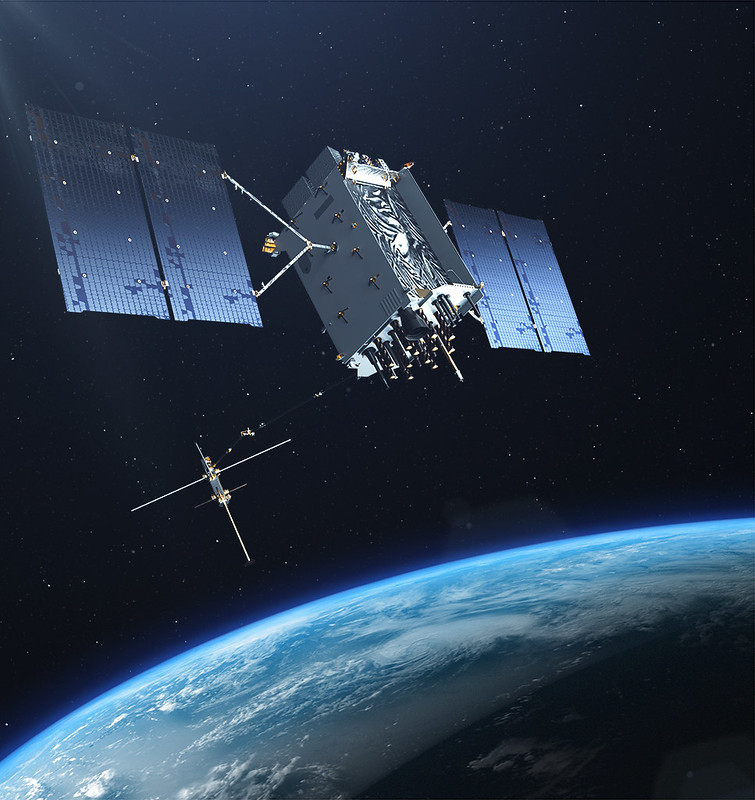
The U.S. Space Force exercised its second contract option valued at approximately $737 million for the procurement of three additional GPS III Follow On (GPS IIIF) space vehicles (SVs) from Lockheed Martin on Oct. 22, 2021. This contract option is for GPS IIIF satellites 15, 16 and 17 (SV15-17).
GPS IIIF satellites build off the innovative design of Lockheed Martin’s next generation GPS III satellites (SV 01-10), which provide three times greater accuracy, up to eight times improved anti-jamming capability and increased resiliency, in addition to modernization, compared to legacy GPS satellites in today’s constellation. GPS III also adds a new L1C civil signal that is compatible with other global navigation satellite systems, such as Galileo.
“GPS IIIF satellites will add new capabilities and advanced technology to the GPS constellation, including Regional Military Protection (RMP); an upgraded Nuclear Detection Detonation System (NDS) payload; a safety-improving Search and Rescue payload; and an accuracy-enhancing Laser Retroreflector Array (LRA),” said Dave Hatch, Lockheed Martin’s GPS IIIF program management director. “The RMP capability further reinforces GPS III/IIIF as a warfighting system, providing up to 60x greater anti-jamming for our warfighters operating in contested environments.”
The GPS IIIF SV11-12 satellites were included in the original September 2018 GPS IIIF contract award to Lockheed Martin to build up to 22 GPS IIIF satellites. Under that contract, the government exercised the first GPS IIIF production option for SV13-14 in October 2020.
GPS IIIF SV13 and beyond will incorporate the company’s LM2100 Combat Bus, an enhanced space vehicle that provides even greater resiliency and cyber-hardening against growing threats, as well as improved spacecraft power, propulsion and electronics. This evolved bus incorporates many common components and procedures to streamline manufacturing. LM2100 Combat Bus vehicles are also capable of hosting Lockheed Martin’s Augmentation System Port Interface (ASPIN), which would allow for future on-orbit servicing and upgrade opportunities.
Today Lockheed Martin is close to finishing production on the original GPS III SV1-10 contract. GPS III SV01-05 have been launched and handed over to the Space Force for on-orbit operations. GPS III SV06-08 have been completed and placed in storage at the company’s facility waiting for the Space Force to call them up for launch. SV09 is a fully integrated space vehicle now going through final testing.
On October 26, 2021, the final GPS III satellite of the original GPS III contract – GPS III SV10 – completed an operation known as “core mate” to assemble it into a full space vehicle at Lockheed Martin’s GPS III Processing Facility. It will proceed into the vehicle testing campaign before year-end.
Analog Devices, Inc. (ADI) recently received four Electronics Industry 2021 Awards presented by Datateam Business Media. The awards honor the best professionals, products, projects, and companies across the electronics sector. ADI received awards in the following categories: environmental leadership, excellence in innovation (for the ADAR3000 beam forming integrated circuit), aerospace/military/defense product of the year, and embedded solution product of the year (for the MAX78000 artificial intelligence microcontroller). It also received the “Highly Commended” distinction in the Internet of Things product of the year category.
Established in 2018, the Electronics Industry Awards annually recognize the best people, products, and business practices at the forefront of innovation. The awards winners are determined by a 50/50 weighted decision from an industry vote and a panel of expert judges to ensure the winners are selected for technical expertise and outstanding reputations.
Handheld Group, a manufacturer of rugged mobile computers, has announced a new version of its NAUTIZ X9 PDA: an ultra-rugged enterprise handheld built for fieldwork in the most challenging outdoor and industrial environments.
With an upgraded platform, the Nautiz X9 Android rugged handheld runs Android 11 and is Android Enterprise Recommended (AER). The device, which has a sturdy magnesium casing, is targeted for mobile computing and data collection in industrial and field applications.
The Nautiz X9 ultra-rugged PDA offers:
MIL-STD 810G ruggedness for drops, vibrations, humidity, and broad operating temperature
IP67 rating for waterproof, dust-tight performance
a sunlight-readable 5-inch multi-touch display with glove and rain mode
a high speed 8-core MediaTek processor with 3 GB RAM and 32 GB storage
the Android 11 operating system with GMS
4G/LTE, dual band 802.11 a/b/g/n/ac wireless LAN, low-energy 5.0 BT and NFC
built-in GPS/GLONASS/Galileo capabilities as standard
dual cameras including 13-megapixel rear-facing, and 5-megapixel front-facing
optional high-quality, high-speed 2D imager
multiple enterprise-focused accessories
maxGo software to quickly apply custom settings to larger deployments
The new version of the Nautiz X9 is expected to start shipping this month.
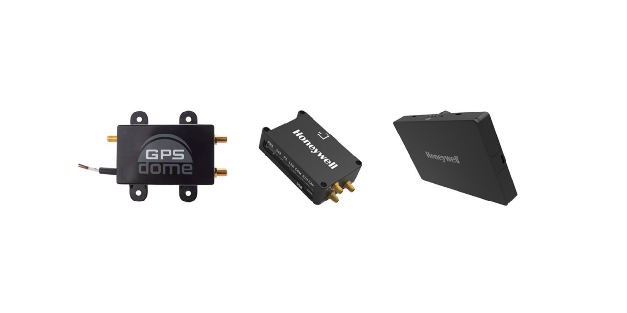
Honeywell has launched two new resilient navigation systems: the Honeywell Compact Inertial Navigation System and Honeywell Radar Velocity System. These systems, jointly with GPSdome, an anti-jamming system developed by Honeywell’s partner InfiniDome, are designed for commercial and military customers needing reliable navigation solutions that are small and light and have a low power consumption.
The systems will provide multiple layers of protection that allow continued operations even in GNSS-challenged or denied environments.
Honeywell’s philosophy of resilient navigation revolves around multiple layers of resiliency achieved by a combination of GNSS anti-jamming, inertial navigation and alternative navigation systems.
The GPSdome is a small add-on device that provides the first layer of protection against GNSS jamming attempts, ensuring continuity of operation during low-power jamming conditions and the ability to achieve the crucial first GPS lock even in GPS-challenged environments. The device is compatible with any off-the-shelf GNSS receiver and antenna. Honeywell signed a collaboration agreement with infiniDome in August to jointly develop and deliver GPS signal protection systems.
The new Honeywell Compact Inertial Navigation System is about the size of a deck of cards and uses tactical-grade inertial sensors to provide accurate position information to commercial and military customers. This second layer of resiliency provides the ability to navigate during shorter GNSS outages. This is especially useful in urban canyons where GNSS availability is intermittent or in strong jamming environments where anti-jamming systems are not enough.
Peter Teunissen, senior professor at Curtin University, was named as Australia’s top researcher in two fields — geophysics and radar, positioning and navigation — by The Australian’s “2021 Research Magazine.” Teunissen, who has seen the field of satellite technology expand at a phenomenal rate over the past few decades, said that dependence on GNSS has penetrated all levels of society. “The timing systems we are using for computers, the synchronization of timing – that’s all linked to GNSS,” he says. “All those satellites are equipped with the most accurate atomic clocks. We are all now dependent on those GNSS systems.”
Teunissen moved to Australia more than a decade ago from The Netherlands and was awarded an Australian Research Council Federation Fellowship. He specializes in interferometric GNSS, the use of satellite signals for the high precision measurement of the parameters of water and land masses; has been associated with Curtin University since 2009; and is now an award-winning and internationally-recognized expert in the field of satellite technology.
“Cubesat” mini-satellites increasingly deployed by universities and corporations have also caught Teunissen’s attention, who calls them “the future for increasing the number of satellites and constellations.”
The U.S. President’s National Space-based Positioning, Navigation and Timing (PNT) Advisory Board will meet on December 9 and 10 at the Sheraton Pentagon City Hotel in Arlington, VA, according to a post on the group’s website.
The meeting is open to the public. Interested parties are encouraged to attend.
The agenda, while still not finalized, is expected to include a full day public meeting on Thursday, December 9, and a half day on Friday, December 10.
Previous in-person meetings have included program updates from government departments and briefings on cutting edge government and industry projects on the first day. The second day normally sees updates from international representatives and open discussion of current issues among the board members.
The Advisory Board’s size is expected to increase at this meeting with three previous members leaving and nine newly appointed members being added.
A formal announcement of the meeting is expected in the Federal Register on Monday, November 15. Confirmation of the new membership roster is expected at about the same time.
The PNT Advisory Board was established in 2004 by National Presidential Security Directive 39, “U.S. Space-Based Positioning, Navigation, and Timing Policy.” It operates under the rules of the Federal Advisory Committee Act and is tasked with providing advice “… on U.S. PNT policy, planning, program management, and funding profiles in relation to the current state of national and international space-based PNT services.”
The Advisory Board has regularly advised the government on all aspects of space-based PNT, including the need for a holistic “PTA” approach – “Protect” signals, “Toughen” user equipment, and “Augment” services with alternative PNT sources.
This will be the first in-person meeting of the board since November 2019. A virtual meeting was held in July 2020.
After the conclusion of the government Advisory Board meeting on Friday, December 10, the non-profit Resilient Navigation and Timing Foundation will hold its annual membership meeting and lunch at the same venue.
“Original equipment manufacturer (OEM)” is a widely used but poorly defined term. In general, it refers to a manufacturer that provides components or sub-assemblies to another one for use in the latter’s end products. In the GNSS industry, the purchasers of OEM boards typically are manufacturers of products that require positioning or navigation capabilities, such as guidance systems for tractors, UAVs or automobiles. Sometimes, such manufacturers integrate the OEM GNSS receivers with other sensors, such as inertial measurement units and lidar devices. Often, the OEM also will provide technical support to the integrator.
Much of the OEM business is not visible to the end user of the equipment that contains OEM components, let alone to the casual observer, because those components are “inside the box,” such as a guidance system, and “the box,” in turn, is under the hood or in some other hidden place. There is almost never a sticker on the outside analogous to the one that says “Intel inside” on many computers to distinguish the Intel CPU inside from, say, an AMD processor. Furthermore, OEM sales are typically obscured by confidentiality provisions in OEM licensing agreements that also address issues of branding, payment, quality assurance, and the timing of deliveries.
Integrators can choose from a wide variety of OEM GNSS boards depending on their intended use; the environment in which they will operate; their performance requirements; and their size, weight, power consumption and (of course) cost. OEM GNSS boards range from development kits that assist users to integrate GNSS into their product design to differential, multi-frequency, and, increasingly, multi-constellation boards.
In the following pages, six GNSS OEM manufacturers address these questions:
How do you define OEM?
What distinguishes your latest generation of OEM receiver boards from previous ones?
What are the markets for your GNSS OEM receiver boards? Which ones are growing the most?
Additionally, each one showcases a product.
JAVAD GNSS Ready for Lift-Off
JAVAD GNSS has been transitioning to a new position in the market since the passing in May 2020 of its founder, president and CEO Javad Ashjaee, a giant of the GNSS industry. For several decades, the company eschewed mass production for such markets as the automobile industry and cellular phones, choosing instead to focus primarily on high-accuracy surveying applications.
“Our founder really loved the surveying market, created a lot of technology, and drove the rest of the industry through the evolutionary process to where it is today,” said Tom Hunter, the company’s chief sales officer. “You can see a little bit of JAVAD GNSS in just about any GNSS-based land survey product on the market today.”
At the heart of each of JAVAD GNSS’ OEM boards is a proprietary ASIC. The boards it sells are the same ones it uses in its own reference stations, land survey products and marine systems, Hunter said. Aerospace is a key focus, an industry that requires very high accuracy, precision and reliability despite operating in environments of extreme shock, vibration, acceleration and temperatures.
Photo: Javad GNSS
“Our successes have been in working with many of the companies that build these very large launch vehicles used to carry heavy payloads into orbit,” Hunter said. “Our customers are companies such as Orbital, Northrop Grumman and SpaceX.” Those heavy-duty launch vehicles, he pointed out, must also follow a pre-described flight path. “You don’t want to start another world war because another country sees something heading its way.”
Tracing All Components. JAVAD GNSS’ boards “have complete component traceability,” Hunter said. The company does not buy any of its components from brokers. “We have to buy either directly from the manufacturer or from the manufacturers’ designated distributor, and it has full part traceability in our own factory in San Jose, California.” Should a component ever fail, the company could quickly trace when and where it was made. “That’s very important when we’re dealing with customers such as NASA, the Air Force or Boeing, because the safety of flight depends upon the performance and the quality of the product.”
The company will soon supply a receiver that will spend about four and a half to five years in orbit on a cluster of small low-Earth-orbit satellites, Hunter said. (See “JAVAD Board Guides ESA Vega Mission” below.)
To make sure none of its products are exported illegally from the United States, JAVAD GNSS also traces where each one ends up. “We know where every one of those boards is.”
JAVAD GNSS must guarantee its aerospace customers, which have invested millions of dollars in designing their systems, that each model of its devices will remain exactly the same. Hence, it bought from some manufacturers their entire inventory of certain components, in case they discontinued making them, and certifies each
JAVAD GNSS’ products are more expensive than those from other manufacturers because they are better, Hunter claimed. “We use really high-performance, temperature-compensated oscillators in our boards to make sure we have precise timing. We use a custom ASIC that we designed and built. Our receivers have 864 channels, so they can receive just about anything broadcast in the L-band.” The company constantly upgrades its devices to match modernization of the signal structures.
“I can remember when the rest of the industry was saying, ‘You have a 12-channel GPS receiver? You’re nuts! I mean, who uses that much information?’,” Hunter recalled. “Today, we’re using every signal that comes out of GPS, whether it be L1, L2, L5, L1C, and the same thing with all of the GNSS constellations.” For example, when Japan will begin to broadcast its new QZSS signal soon, “we’re ready not only to find it, but to track it, decode it, and utilize it for position and timing solutions.” Anti-jamming and in-band interference rejection are standard in JAVAD GNSS’ products, while those from other manufacturers require external filtering or different types of antennas, Hunter pointed out.
New Leaders and Markets
After Javad Ashjaee — JAVAD GNSS’ founder, president and CEO — died in May 2020, Tom Hunter, who co-founded Ashtech with Ashjaee in 1987, returned to the company after a five-year retirement.
“He left the company with an awful lot of technology, a lot of patents, and a lot of people who knew how to design and build products, not only for today, but for the future,” Hunter explained. “They needed some guidance.”
So, in January, Nedda Ashjaee — Javad Ashjaee’s daughter and his close collaborator for the previous 25 years — and the board of directors asked Hunter to rejoin the company. “They said that they wanted me to help them make sure that we can be on a path where we can use our core technologies and enter into new market segments and new marketplaces.”
Hunter added, “We made some changes to how we introduce surveying products into the marketplace.” The company no longer sells its products directly to end users. Rather, it goes through a new process and channel for getting products into the marketplace. It also brought on board a new chief technology officer this summer who will be driving engineering efforts. “We are becoming market driven. And to do that we needed to expand our marketing, sales and engineering capabilities. We are changing every aspect of the company,” Hunter said.
JAVAD GNSS actually consists of two companies in San Jose: JAVAD GNSS, which designs, markets and sells products, and JAVAD GNSS EMS, which manufactures them. It also has a presence in Moscow — the company hired many engineers following the collapse of the Soviet Union, many of whom had worked on GLONASS. “Javad looked at that as an opportunity to hire them and use them to develop a multiple constellation receiver,” Hunter recalled. However, as a subcontractor for U.S. government projects, it is much easier for JAVAD GNSS to operate on U.S. soil with engineers who are U.S. citizens. “We’re expanding our San Jose operation to include on-site engineering development, not only in RF, but also in digital signal-processing software.” The company will continue to receive schematics from its Russian subsidiary. “Instead of exporting technology, we’re importing it.”
JAVAD GNSS is now moving into markets that did not interest Javad Ashjaee. It recently launched new products in the machine control, marine navigation and accurate heading markets, as well as the agricultural and construction markets, with integrated sensors that can be readily installed on various machines. Other GNSS manufacturers have been producing such devices for decades, Hunter acknowledges. However, he adds, “ours will be able to use multiple sources not only for satellite- and terrestrial-based corrections, but a combination of those.”
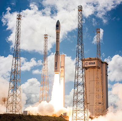
A JAVAD OEM GNSS board is at the heart of the navigation system of the Vega space vehicle developed by the European Space Agency to launch small satellites into low Earth orbit. It provides great flexibility of mission at an affordable cost and represents the European solution for space accessibility. (Photo: Avio, Italy)
JAVAD Board Guides ESA Vega Mission
AJAVAD OEM GNSS board is at the heart of the navigation system of the Vega space vehicle developed by the European Space Agency (ESA). ESA developed Vega to launch small satellites into low Earth orbit. It provides great flexibility of mission at an affordable cost and represents the European solution for space accessibility.
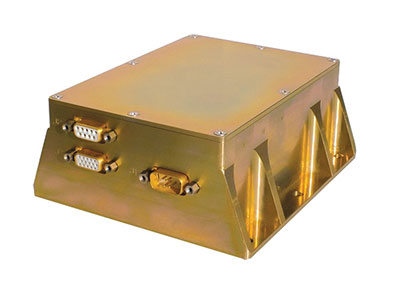
The JAVAD OEM GNSS board is embedded in the gle/RGU/G2T/HDA/MB1 for space missions. (Photo: GreenLake Engineering)
The JAVAD OEM GNSS board is embedded in the gle/RGU/G2T/HDA/MB1 — a cost-effective, high-performance, compact and rugged GNSS receiver specifically designed and environmentally qualified. Installed on the upper stage of the VEGA launcher, it allows accurate trajectory verification during the entire flight mission.
ESA’s initial request was for a GNSS unit built with commercial off-the-shelf components, thus maintaining low costs, but which could still operate in the extreme vibration and shock conditions typical of a space launcher. After an initial feasibility analysis, GreenLake Engineering — a subsidiary of Instrumentation Devices — developed the unit mechanically and electronically to satisfy ESA technical specifications. Its biggest challenge was to pass ESA’s extensive qualification and quality process.
For many years, Instrumentation Devices (based in Como, Italy) and JAVAD GNSS have been partners. Instrumentation Devices sub-contracted for the Vega project with Avio (based in Colleferro, near Rome), which is the prime contractor with ESA. Avio is an international group that designs and produces space launchers and both liquid and solid propulsion systems for space transportation.
ESA supervised the project and is responsible for all activities relating to flight safety and qualification of the equipment installed on board. JAVAD GNSS supported GreenLake Engineering with the integration and low-level configuration of the OEM board for this challenging application.
A Massey Ferguson tractor guided by a NovAtel GNSS OEM receiver. (Photo: Hexagon | NovAtel)
GNSS Makers Share Insights
OEMs Discuss Their Boards, Markets and Company Growth
Five prominent GNSS original equipment manufacturers discuss their current products and future markets.
How do you define OEM?
While all six manufacturers agree on the general definition of OEM given above, they focus on different aspects. OEM customers of JAVAD GNSS “require reliable, accurate and stable high precision measurements for positioning and timing,” Hunter said.
The performance of OEM products from Hexagon | NovAtel reflects on its customers and itself, Gerein said. “Our OEM receiver cards are selected, valued and relied upon as the core positioning elements in many applications across vertical markets. We offer full rebranding options with custom logos, colors and industrial designs to seamlessly integrate our technology into their offerings.”
At Trimble, OEM customers “combine Trimble’s GNSS technology with their domain expertise to deliver solutions to the end customer,” Norse said.
For Hemisphere GNSS, OEM clients can range “from a tinker/maker hobbyist working with GNSS, to a large multinational organization designing navigation solutions for global clients,” Burnell said, but the company looks at all of them “in the same light.” Additionally, “Some OEM clients have all the tools they need already built into the Hemisphere products, while others come to us looking for advanced or custom features to help set their products apart in the market.”
Septentrio has a worldwide support team that assists its OEM clients “in all the stages of their integration process, from validation to product release,” Freulon said.
What distinguishes your latest generation of OEM receiver boards from previous ones?
Septentrio’s most recent OEM receiver boards integrate the latest Septentrio GNSS and INS technology and algorithms. AsteRx-m3 OEM receiver boards use all GNSS constellations, can track all available satellites, and can be used as a base station to deliver RTK corrections or as a rover with a single or dual antenna.
Improvements include lower power consumption, increased security with secure boot, and greater resilience with anti-jamming and anti-spoofing. Its new receiver boards, Freulon said, “are backward compatible with extended capabilities of the latest GNSS signals and several variants of the inertial navigation system.” Upcoming software releases will include Galileo’s free High Accuracy Service (HAS) as well as OSNMA, the latest anti-spoofing mechanism.
Trimble’s latest generation of OEM GNSS boards are based on Trimble Maxwell 7 technology, which features the company’s seventh-generation baseband GNSS ASIC (application-specific integrated circuit). Trimble designed the Maxwell family of products to maximize the quality of observables derived from available signals transmitted from all GNSS constellations as well as satellite-based augmentation systems, Norse explained. This results in stronger signals, greater availability, reduced power consumption, advanced multipath mitigation and protection against spoofing.
The boards also run Trimble’s ProPoint positioning engine, which improves performance in challenging environments such as tunnels, urban canyons and tree canopies and provides continuous RTK using a base station or Trimble RTX correction services delivered via cellular or satellite connections.
JAVAD GNSS’ latest OEM products are “more cost effective” and integrate an IMU with an 874-channel multi-GNSS band module with up to 200Hz positioning and data output. “All are still proudly made in the United States,” Hunter said.
NovAtel’s OEM7 receiver boards feature added options for interference robustness and situational awareness “to help protect the user’s GNSS signals from an increasingly crowded RF spectrum and growing jamming and spoofing threats,” Gerein said. The company enhanced the sensor fusion capabilities with SPAN GNSS+INS technology, enabling a deeply coupled integration with IMUs that strengthens positioning through GNSS interruptions and allows the rapid reacquisition of signals post-outages. The boards are compatible with PPP TerraStar Correction Services “for precise positioning anywhere in the world.”
Hemisphere GNSS’ Phantom and Vega series of OEM board products can track all L-band GNSS signals, enabling the company’s OEM clients to upgrade the capabilities of their integrations and “tap into the performance of multi-GNSS, multi-frequency RTK and Atlas PPP solutions,” Burnell said.
The boards consume less power than the previous generation and introduce Hemisphere’s Cygnus automatic interference mitigation technology, which monitors the GNSS signal bands for interference and automatically deploys filters “with no need for integrators or users to understand signal theory,” Burnell explained. Cygnus, which turns off the filters when the interference fades away, is “automatic interference mitigation for the masses.”
What are your markets for your GNSS OEM receiver boards? Which ones are growing the most?
NovAtel said its receiver cards are highly configurable and integrate easily across a wide range of markets, including survey, mobile mapping, agriculture, defense, marine and autonomous platforms for both on- and off-road applications.
In particular, the company’s OEM7 cards “uniquely support the defense market and their requirements for increased protection against jamming and spoofing in mission-critical applications.” The cards also “meet the positioning availability and increasingly rigid product quality standards required in agriculture, automotive and autonomous system markets.”
Trimble lists precision agriculture, construction, mining, forestry, autonomous vehicles, port automation, distribution centers and mobile mapping among the uses of its GNSS OEM receiver boards. “We are seeing growth in markets where reliable, robust and high-precision positioning is required for a solution such as autonomous platforms,” Norse said.
Septentrio reports growing demand for its mosaic GNSS modules “due to their small footprint and impressive performance.” OEM boards, Freulon said, “remain very popular for applications where a quick integration is needed or where ultimate performance is expected.”
However, the most important markets for its OEM boards remain “UAV, together with industrial-grade automations in agriculture, construction or logistics.”
Septentrio sees an increase in “the number of positioning and mapping systems that require the ultimate performance of our receivers, especially when combined with other sensors,” Freulon said. In particular, he cites the performance of its single- and dual-antenna AsteRx-m3 receiver boards and of the AsteRx3i INS boards, which “provide a solution which combines industrial-grade IMU and GNSS all on a single OEM board, greatly simplifying the integration process in systems where both positioning and orientation are needed.”
Hemisphere GNSS, which has a significant OEM presence in the agriculture, marine, survey and GIS markets, reports seeing growth in several markets. “We have seen significant growth in all aspects of autonomous integrations, from ground vehicles for on-road or off-road, to in-flight applications with UAVs, to maritime applications focusing on dynamic positioning in both nearshore and offshore environments,” Burnell said. “There is a recognition that using precision navigation equipment benefits everyone and protects our environment through efficiencies of operation, either in resource management or by improved operational capacity.”
JAVAD GNSS lists maritime positioning and docking, timing, launch vehicle positioning and range safety, autonomous vehicle testing, in orbit positioning and drone guidance among the markets for its OEM receiver boards, with space-related applications the fastest growing market.
OEM7700. (Photo: Hemisphere GNSS)
Briefly describe one of your GNSS OEM receiver boards.
The OEM7700 receiver card from NovAtel is used in agricultural auto-steering applications. “The OEM7700 can receive all GNSS constellations across all frequencies, enabling a highly available position,” Gerein said. “When combined with TerraStar corrections and our SPAN GNSS+INS technology for sensor fusion applications, the OEM7700 ensures highly precise positioning scalable from meter- to centimeter-level accuracy.”
OEM7700 receiver boards help the company’s agriculture customers “solve the positioning challenge of repeatable pass-to-pass accuracy for auto-steering,” Gerein said. Plus, the card meets their strict environmental requirements for agriculture vehicles.
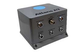
Photo: iXblue
Septentrio’s OEM client iXblue uses the company’s AsteRx OEM boards inside its Atlans A7 positioning and orientation system. “Atlans A7 was developed in close cooperation with Septentrio and is designed to provide continuous and accurate positioning in urban environments,” Freulon said.
Atlans A7 combines iXblue’s inertial navigation system (INS), which is based on a fiber-optic gyroscope (FOG), with Septentrio’s multi-frequency GNSS receiver technologies. To develop this INS-GNSS mobile mapping solution, experts from iXblue and Septentrio worked closely with the aim to develop a smart coupling method that combines the advantages of the two companies’ technologies. The same smart coupling technique is also applied in the post-processing software for an optimal result. The main advantage of Atlans A7 is to maintain a high heading precision in any circumstance, which “allows precise georeferencing for both land and air applications and drastically limits the drift during GNSS outages,” Freulon said.
AX940. (Photo: Trimble)
At Trimble, Norse cites the case of an agribusiness company that wanted to make its robotic tractors able to drive autonomously, requiring centimeter-level positioning and orientation at high update rates in challenging environments. The company chose the Trimble AX940i because of its “combination of GNSS and inertial technology in an easy-to-install smart antenna.” The Trimble ProPoint engine tightly couples the onboard IMU sensor data with the GNSS observations to provide up to 100-Hz outputs utilizing the NMEA-2000 standard or other interfaces. Additionally, Trimble VRS Now service provides instant access to RTK corrections and an operator can use the built-in Wi-Fi to configure and monitor the receiver from nearby.
The HydroBoard II flotation platform contains the RiverSurveyor M9 acoustic device, which measures the flow rates of rivers, streams and irrigation canals. (Image: Hemisphere GNSS)
Hemisphere GNSS’ Phantom 34 RTK receiver and antenna is employed by SonTek in its RiverSurveyor M9 product used by water districts and the U.S. Geological Survey to help monitor and manage water resources. The M9 is one in a series of SonTek products focused on determining flow rates for rivers, streams and irrigation canals. It consists of a small flotation platform with an acoustic doppler current profiler that measures the flow rate of the water column underneath it, a data telemetry system, and the Phantom 34 RTK to pinpoint the data collected.
The platform is floated from shore to shore across a channel using a tether, measuring along the way. “Using RTK simplifies collecting measurements as the survey will have continuous velocity profile measurements the entire way across the waterway,” Burnell said.
“What’s new with GPS?” people often ask me when I tell them my job. Recently, I have been responding by telling them about the other three GNSS constellations now fully available. However, as reflected every month in these pages, that is but one of many developments that combine to make satellite navigation ever more accurate, reliable and ubiquitous.
While the GPS program is old by the standards of the digital age, it has never been static. In the 1970s, when GPS was developed, the expected accuracy for civilians was tens of meters, though pioneering commercial users began right away to chip away at the system’s limitations by developing differential GPS (DGPS), carrier-phase positioning, and other techniques. By the end of the next decade, better signal processing and the implementation of DGPS had brought civilian accuracy to about one meter. In the 1990s, phase-ambiguity resolution made real-time centimeter accuracy standard for surveyors.
As the adoption of cell phones exploded, it became imperative to locate them to preserve the 911 system. Initially, this was done using the time-of-arrival of signals to handsets from towers, because it was assumed that GPS receivers could not be made sufficiently small, cheap, fast, power-efficient and accurate to work in cell phones. The implementation of assisted GPS, now standard in all smartphones, largely solved those problems.
Precision for civil GPS users increased by an order of magnitude in May 2000, when President Clinton ordered the removal of Selective Availability, and substantially once enough satellites began to broadcast the L2 civil (L2C) code, enabling ionospheric corrections. Later, the modernized signals in the L5 band enabled sub-meter accuracy without augmentations and very long-range operations with augmentations. There are now more than 80 signals in that band, on GPS, Galileo and BeiDou satellites. On the military side, the effort to deploy M-code signals, cards and receivers continues.
Over the years, in addition to modernized satellites and signals, improvements have included the development of PPP, RTK and hybrid techniques; the proliferation of local, regional and global correction services; improved jamming and spoofing detection; and the increasing integration of GNSS receivers with other RF receivers as well as with inertial, optical, radar, lidar and other sensors.
Future improvements may include:
signal authentication
commercial systems in low Earth orbit that would have a signal strength on the surface three orders of magnitude greater than current GNSS, greatly boosting indoor reception and protection from jamming
inertially aided extended coherent integration, a.k.a. “supercorrelation,” which makes moving GNSS receivers more sensitive to signals they receive directly than to reflected ones
3D-mapping-aided GNSS, which enhances the positioning algorithms by identifying non-line-of-sight signals; this is being pioneered by Google in nearly 4,000 cities, relying on its 3D city models and machine learning.
The moment I send this month’s issue to the printer, I will think of more past and future improvements. As soon as you receive it, many of you will think of yet more. What’s new with GPS? A lot.
Though marvelous, GNSS are also highly vulnerable. eLoran, which has no common failure modes with GNSS, could provide continuity of essential timing and navigation services in a crisis.
GPS fits Arthur C. Clarke’s famous third law: “Any sufficiently advanced technology is indistinguishable from magic.” Yet, it also has several well-known vulnerabilities — including unintentional and intentional RF interference (the latter known as jamming), spoofing, solar flares, the accidental destruction of satellites by space debris and their intentional destruction in an act of war, system anomalies and failures, and problems with satellite launches and the ground segment.
Over the past two decades, many reports have been written on these vulnerabilities, and calls have been made to fund and develop complementary positioning, navigation and timing (PNT) systems. In recent years, as vast sectors of our economy and many of our daily activities have become dependent on GNSS, these calls have intensified.
A key component of any continent-wide complementary PNT would be a low-frequency, very high power, ground-based system, because it does not have any common failure modes with GNSS, which are high-frequency, very low power and space-based. Such a system already exists, in principle: it is Loran, which was the international PNT gold standard for almost 50 years prior to GPS becoming operational in 1995. At that point, Loran-C was scheduled for termination at the end of 2000.
However, beginning in 1997, Congress provided more than $160M to convert the U.S. portion of the North American Loran-C service to enhanced Loran (eLoran). In 2010, when the U.S. Loran-C service ended, its modernized and upgraded successor was almost completely built out in the continental United States and Alaska. During the following five years, Canada, Japan, and European countries followed the United States’ lead in terminating their Loran-C programs.
Today, however, eLoran is one of several PNT systems proposed as a backup for GPS.
The National Timing Resilience and Security Act of 2018 required the Secretary of the U.S. Department of Transportation (DOT) to “provide for the establishment, sustainment, and operation of a land-based, resilient, and reliable alternative timing system” as a backup to GPS. In January 2020, the DOT awarded contracts to 11 companies to demonstrate their technologies’ ability to act as a backup for GPS. Of these companies, two were working on eLoran projects.
Technical advisers to the federal PNT Executive Committee have been advocating and recommending that the government implement eLoran for the past 11 years. Yet, while the U.S. government announced in 2008, and again in 2015, its intention to build an eLoran system, it has not done so yet.
Not Your Grandfather’s Loran
In the 1980s, I used Loran-C to navigate on sailing trips off the U.S. East Coast. It had an accuracy of a few hundred feet and required interpreting blue, magenta, black and green lines that were overprinted on nautical charts. The system was a modernized version, launched in 1958, of a radio navigation system first deployed for U.S. ship convoys crossing the Atlantic during World War II. Its repeatability was greater than its accuracy: lobster trappers could rely on it to return to the same spots where they had been successful before, though they may have had some offset from the actual latitude and longitude.
By contrast, eLoran has an accuracy of better than 20 meters, and in many cases, better than 10 meters. It was developed by the U.S. and British governments, in collaboration with various industry and academic groups, to provide coverage over extremely wide areas using a part of the RF spectrum protected worldwide. Unlike GNSS, eLoran can penetrate to some degree indoors, under very thick canopy, underwater and underground, and it is exceptionally hard to disrupt, jam or spoof.
Unlike Loran-C, eLoran is synchronized to UTC and includes one or more data channels for low-rate data messaging, added integrity, differential corrections, navigation messages, and other communications. Additionally, modern Loran receivers allow users to mix and match signals from all eLoran transmitters and GNSS satellites in view.
Finally, eLoran can be used for integrity monitoring of GPS — and vice versa. “Think of a resiliency triad, consisting of GNSS (global), eLoran (continental), and an inertial measurement unit, a precise clock, or a fiber connection,” said Charles A. Schue, CEO of UrsaNav. “It is extremely difficult to jam or spoof all three sources at the same time, in the same direction, and to the same amount.”
For the eLoran system to cover the contiguous United States, between four and six transmission sites could provide overlapping timing coverage, and 18 transmission sites could provide overlapping positioning and navigation.
U.S. Developments
The INVEST in America Act authorizes $157 million for the Department of Homeland Security to conduct research in five separate areas, one of which is positioning, navigation and timing resiliency; however, none of this money is for eLoran per se. The regular DOT appropriation for next year has $17 million for PNT-related research, $10 million of which is for “GPS Backup/Complementary PNT Technologies Research.” However, neither of these bills has yet been finalized, let alone passed into law, so they may change.
“These are very complex systems, with five- to seven-year sales cycles,” pointed out Schue, “and the process is even slower now due to the pandemic. With adequate funding, eLoran signals could start becoming available in the contiguous United States within a year of a service contract being signed. We should recall that GPS — as, indeed all of the GNSS — was brought online gradually as satellites were developed and launched into space. There should be no expectation that any other nationwide system would be available at the flip of a switch instead of through gradual implementation.”
the former Loran-C transmission antenna at Værlandet, Norway. (Photo: UrsaNav)
International Developments
Loran-C and eLoran operate internationally. Saudi Arabia, China and Russia continue to operate Loran-C or Chayka systems. In October 2020, a Chinese paper described how the nation is expanding Loran to its west to cover the whole country to protect itself from disruptions of space-based services. A previously published report made it clear that they are upgrading or have upgraded from Loran-C to eLoran. South Korea has an ongoing project to upgrade its Loran-C to eLoran. It also seems the project will ensure that the South Korean system will be useable on its own, even if the Russian and Chinese systems with which it normally cooperates are not available for some reason, according to Dana Goward, president of the Resilient Navigation and Timing Foundation.
The United Kingdom is still committed to eLoran, and operates one station that has been used as an alternative time reference to GNSS. “However, as the sole station still transmitting in that area of Europe it’s of no use for positioning,” said Nunzio Gambale, CEO of Locata Corporation. “Unfortunately, the EU’s shutdown of their old Loran sites seems to have been completed, and no EU-based Loran sites remain operational. Their actions leave scant hope for Loran’s resurrection any time soon as an alternative to GNSS positioning in Europe. That’s a shame, because eLoran has beneficial PNT characteristics that other alternate technologies will struggle to replicate.”
A deck officer on a ship takes a relative bearing using a pelorus. Loran-C was developed in large part for maritime navigation. (Photo: aytugaskin/iStock/Getty Images Plus/Getty Images)
Advocacy
“There is fairly good agreement across the PNT community that there is no sole solution [to GPS vulnerabilities],” Schue said. “It needs to be a system of systems.”
The PNT community, he said, is working with Congress and the administration “to move ahead with actual RFPs to start the contracting process — instead of continuing to admire the problem.” UrsaNav, NextNav, OPNT and other companies and organizations “are working together as best as we can to tell the federal government that we all believe in a system-of-systems approach and that there ought to be some tangible forward motion.”
While DOT has the lead on providing PNT resiliency, it and the departments of Defense and Homeland Security need to cooperate on this, Schue argued. “Many, if not all, of the other departments — such as Commerce, Energy, State, Interior and Agriculture — also have a stake.”
GNSS will remain for a reason. “Unless a new national terrestrial PNT system moves the game forward for many markets, it’s just far too easy to remain with the GNSS system, which is fundamentally free,” Gambale said. “That’s a really difficult price point to compete with, unless you’re delivering significant new value to the market.”
The time to act is now. “This issue has been studied to death for more than 20 years,” Goward said. “There are technologies ready to deploy. It is time for action. A failure of national PNT will be catastrophic.”