The tremendous benefits of having four complete GNSS constellations
In 2020, with the completion of China’s BeiDou-3 (aka BDS) and Europe’s Galileo, the number of available global navigation satellite system (GNSS) constellations doubled.
Analogously to the addition of GLONASS to GPS a quarter century earlier, but much more so, this sharp increase in the number of available satellites and frequencies greatly improved the precision of satellite-based positioning, the speed of first fix, and the confidence in the results — especially in GNSS-challenged places, such as under thick canopy and in deep urban canyons.
Additionally, this new ability to track three or four GNSS constellations makes the overall positioning solution more resilient to malicious RF interference (jamming and spoofing), to accidental GNSS service disruptions such as Galileo’s one-week service outage in July 2019, and to deliberate withholding of service such as might occur in times of war.
While all this may make little practical difference to a driver needing to know which highway exit to take or to a pedestrian looking for the nearest pharmacy, it is very valuable in high-end applications, such as surveying and construction. In fact, surveyors who have transitioned to using all the available constellations are ecstatic.
This month’s cover story, on the benefits of having four complete GNSS constellations, is in two parts. First, Oliver Montenbruck and Peter Steigenberger discuss “the practical relevance and implications of having four GNSS in parallel for both mass-market and high-end users.” Next, I present the comments of three surveyors and a receiver manufacturer:
Gavin Schrock, PLS, is a practicing land surveyor, the operator of a cooperative real-time GNSS network in Washington state, and a technology writer
James Richards is the senior land and utility surveyor at Benchmark Surveys in Venny Bridge, UK
Choice Sterling is the survey manager at Kiewit Corporation in Federal Way, Washington
Xiaohua Wen is the CEO and founder of Tersus GNSS, a manufacturer of GNSS surveying receivers based in Australia.
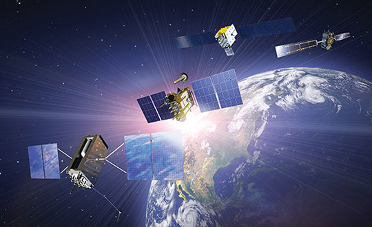
(Satellites from left) GPS: In July 1995, GPS achieved full operational capability (FOC). GLONASS: In December 1995, the (then) Soviet system achieved FOC. BeiDou: On June 23, 2020, China launched the final satellite of the BeiDou-3 constellation. Galileo: The constellation has 21 usable satellites.(Credit: Satellites from public sources; background image: NASA/Chaykovsky Igor/Shutterstock.com)
James Richards Senior Land and Utility surveyor Benchmark Surveys, Venny Bridge, UK
James Richards, Benchmark Surveys
What kinds of surveying projects do you run?
We run many different types of surveying projects. From small single-story bungalow extensions and redevelopment to development of new home sites of several hundred acres. We cover land, underground utility, and measured-building surveys of any size project, using the latest equipment in total stations, laser scanners, drones, GPS receivers, ground-penetrating radar (GPR) and electromagnetic location (EML).
How have you transitioned to using multiple constellations?
Ordnance Survey benchmarks in the UK are no longer maintained. Therefore, it has been a must to move forward with the surveying world and use multi-constellation GNSS equipment. We have stayed at the forefront of GNSS receivers, starting with a Topcon GRS1 then moving onto a Trimble R10 and a Topcon HiPer SR. Now, I feel we’ve taken another leap with the Trimble R12i, working in areas where we previously did not even consider using a GNSS receiver.
How does the availability of four complete GNSS constellations, plus two regional ones, benefit your work?
The availability of four complete GNSS constellations and two regional ones gives us more reliability as well as improved position and time accuracy in the data that we receive. It also gives us better coverage over the entire UK, including near buildings and under foliage. The Trimble R12i has 672 available channels, which makes it future-proof to new frequencies and additional space vehicles.
Choice Sterling Survey manager, Kiewit Corporation Federal Way, Washington
What kinds of surveying projects do you run?
I am the survey manager on $1–3 billion mega projects, ranging from bridges and highways to tunnels and rail, including a couple of projects for the U.S. Department of Defense.
How have you transitioned to using multiple constellations?
The use of multiple constellations became available as we adopted technologies that could capitalize on their availability. Through the latest hardware and software, we have begun leveraging GNSS to a greater magnitude than we would have just a few years back.
How does the availability of four complete GNSS constellations, plus two regional ones, benefit your work?
Not long ago, the use of GPS for construction staking was an extremely risky proposition given its unreliability, primarily in the vertical component, and lack of confidence in its horizontal accuracy. With residuals exceeding most construction tolerances, GPS was primarily utilized for earthwork or to establish geodetic pairs that could then be traversed to establish control for more precise work. With the utilization of multiple GNSS constellations, we have gained confidence in the accuracy of our results and have started leveraging GPS for construction staking where we were once not willing to take the risk.
Having the ability to leverage GPS under a canopy of trees or against structures or walls has proved invaluable when running traverses or levels, typically enabling us to use a single person rather than a two-person crew. Increased confidence in repeatability and accuracy while using GPS has been a game changer when working on projects where efficiency and cost management are of the greatest importance.
How have you transitioned to manufacturing multiple-constellation GNSS receivers?
Early in 2016, we produced a GNSS receiver evolution road map to take advantage of GPS/GLONASS modernization, the continuing development of Galileo and QZSS, and the completion of BeiDou-3. In 2019, we released our current GNSS receiver, which has 576 tracking channels and supports all five major GNSS constellations (GPS, GLONASS, Galileo, BeiDou-3 and QZSS) and triple-band broadcasts (GPS L1+L2C+L2P+L5, GLO G1+G2+G3, GAL E1+E5a+E5b, BDS B1+B2a+B2b and QZSS L1+L2C+L5). We expect to release our next generation receiver, with 832 channels, in February 2022. It will support all available constellations (GPS, GLO, GAL, BDS, QZSS, IRNSS/NavIC, SBAS) and all civil signals, including the AltBoc and AceBoc.
How does the availability of four complete GNSS constellations, plus two regional ones, benefit your end users?
The most significant advantage of modern GNSS receivers is their robust high-accuracy performance with the aiding of the new constellations and signals, especially in harsh GNSS environments, such as deep canyons and heavy foliage. It greatly extended the RTK fix capability, and now reliable GNSS RTK fix solutions can be easily achieved in areas where it was impossible to do in the past.
In the past, multipath always has been a problem for RTK GNSS receivers, as it might cause blunder errors. The improved RTK fix reliability based on robust RTK integrity monitoring takes advantage of the redundancy of observations to identify and isolate deteriorated observations and confirm the fixed result. Additionally, RTK achieves RTK fix solutions faster and maintains the RTK fix solutions easier with better accuracy than before.
Compared to the dual-band (L1+L2) of GPS plus GLONASS, the triple-band (and multi-band) can allow long-range RTK capability, which can provide reliable RTK solutions with a remote GNSS base station far from the 20–30 km base and rover separation of the past. It also will provide more confidence in RTK positioning during the coming ionospheric disturbance peak in 2023.
Gavin Schrock, PLS, shared his thoughts on how the evolution of GNSS has affected surveying. Schrock is a practicing land surveyor, the operator of a cooperative real-time GNSS network in Washington state, and a technology writer.
Gavin Schrock has been using satellite navigation since the early days of GPS and the Doppler-based Transit system before that. “I am a bit of a dinosaur,” he said. “What I find interesting about the evolution of GPS, especially when it went to multi-constellation, is that it instills more confidence in what somebody is doing, in several ways.”
For commercial use of GPS, the first units were static and required post-processing. “If you were out in the wide open sky and could get your minimum of four to five satellites and observe enough data, you could process that and get outstanding precision — less than 3 cm in 3D in a reasonable amount of time with 95% confidence,” Schrock said. “Now, with more satellites, you can get it a lot faster and in more places.” Using certain procedures, early GPS adopters could get down to millimeters. “You can get that precision now, but you get there a heck of a lot faster.”
An obstructed view of the sky, tree canopy, multipath and other factors limit where surveyors can use GNSS. One of the ways the new constellations and signals help, Schrock explained, is through the evolution of processing. “I like to call it the fourth wave of GNSS field equipment for high precision — for surveying, machine control and construction. In just the past few years, many of the manufacturers have had to put huge processors in their high-end rovers to process many more satellites and signals, as well as new RTK [real-time kinematic] engines with improved onboard multipath mitigation.”
While some rovers built a decade ago could track and use many of these signals, this new wave of gear, with more powerful processing, takes much greater advantage of the multi-constellation. The updated interface control document (ICD) for BeiDou-3 was released just over two years ago; it may still take a lot of development work to enable older receivers to take advantage of it, if it is even possible, he said. By contrast, “Many newer units hit the ground running with full constellation capabilities.”
“Much of the new wave can do amazing things in the way they can mix and match signals, though there are different approaches to this,” Schrock said. “They can do such things as processing many satellites and multiple signals from each, under one filter for a more robust solution. You might have L1, L2, L5, B3, E1, E5a, and E5b in the mix, to name a few. Then you have the alternative BOC modulation (AltBOC), where it is kind of processed together to give a wide lane solution. That can really bring in your high precision a lot faster and, in many cases, improve on the high precision that you used to get with your old rovers.”
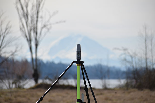
Mount Rainier (above) serves as the backdrop for a field project by Schrock (right). (Photo: Gavin Schrock)
How GLONASS Brought Change
Surveyors using equipment more than four years old, which Schrock calls “legacy gear,” often cannot take full advantage of the availability of multiple constellations. “Years ago, there was a mini-boost when manufacturers began to include GLONASS; you suddenly had more satellites. Early GLONASS was a mess, but it got better. It remains a little noisy, but you have extra satellites. When you are trying to get a minimum of five satellites to do your RTK or your network RTK, we really struggled when it was GPS only. GLONASS changed that. You could work in many more places, without worrying about the time of day and looking up what the satellite’s availability was going to be and have to plan ahead.”
The latest boost, thanks to the two new GNSS constellations, is “much more impactful” than the addition of GLONASS was, Schrock said. Galileo now has five or more usable signals, depending on how each manufacturer chooses to use them. In addition to the extra satellites, “you also have more modernized signals. They are not as noisy as the old GLONASS ones. GPS signals are still very clean, and about half of the GPS satellites now broadcast the L5 signal, which you can throw into the mix.”
RTK units now can mix and match satellites from different constellations in outstanding ways, Schrock said. “The advantages are great when you are struggling in canopy. You still must be cautious, but you can check repeatability much more quickly.”
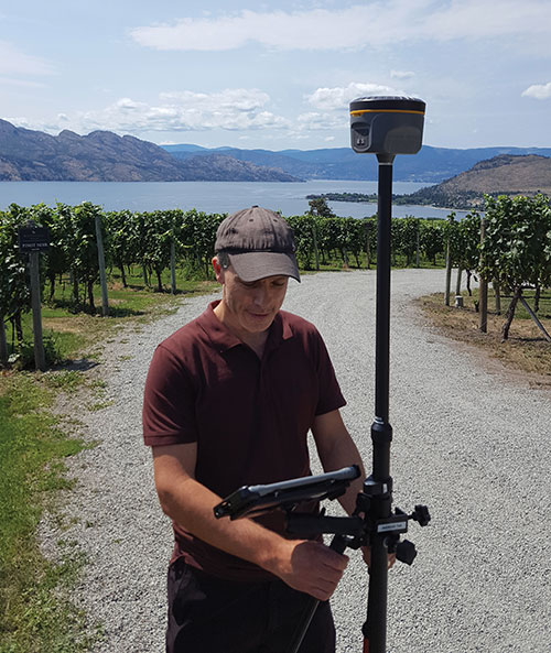
GNSS today: A four-leaf field test of a South rover with MicroSurvey software. (Photo: Gavin Schrock)
In the old days, Schrock recalled, when surveyors used GPS only, carried giant receivers and huge antennas, and did long static sessions, they had to return to sites for repeat observations on different days and at different times.“The method was based on the premise that if you can repeat a solution with a different geometry, that gives you more confidence. Now you may have up to 40 satellites in view. In Asia, 50 in view is not uncommon, because they have India’s NavIC constellation and Japan’s QZSS in view as well. The rover will pick and choose the best ones to use for that solution. So now, instead of having to go back 40 minutes later or the next day to get a different geometry, in several of the manufacturers’ field software, you have a way to just ask it to pick different geometries.” Comparing these geometries to the results from repeated occupations on multiple days, Schrock saw no difference.
Some users of the network he operates are “over the moon,” he said. One construction company told him multi-constellation fundamentally changed the way it approaches parts of their construction projects and cited the confidence factor. Adding GLONASS and Galileo to their mix, users told him “I’ve been missing out all these years. I should have gotten into this earlier!” Schrock has not received as much positive feedback from end users as within the past few years. “[Multi-constellation] has made a lot of difference, including in the way I approach my own field projects.”
First, there was one. In July 1995, the U.S. Air Force declared the Global Positioning System had met all the requirements for full operational capability (FOC). Soon thereafter, there were two. In December of that same year, Russia’s Globalnaya Navigazionnaya Sputnikovaya Sistema (Global Navigation Satellite System, or GLONASS), also achieved FOC. For a quarter century, that was it.
Then, last year, the number doubled, as both the European Union’s Galileo and China’s BeiDou Navigation Satellite System (BDS, named after the Big Dipper asterism, which is known in Chinese as Beidou) achieved FOC.
The Indian Regional Navigation Satellite System (IRNSS, aka Navigation Indian Constellation, or NavIC, which means “sailor” or “navigator” in Hindi) and Japan’s Quasi-Zenith Satellite System (QZSS, also known as Michibiki) are not global yet, but plan to become so. Currently, NavIC is an autonomous regional satellite navigation system, and NavIC-based trackers are compulsory on commercial vehicles in India. QZSS currently complements GPS to improve coverage in East Asia and Oceania, but Japan plans to have an operational constellation of seven satellites for autonomous capability by 2023. The Korea Positioning System (KPS) plans to join the party by 2035.
Who’s next? Will it be another country or a private company? Given that the state-sponsored systems are free to end users, I don’t see what the business model would be for a private GNSS constellation, unless it were to piggyback on one built mainly for another purpose.
Surveyors who have begun to routinely use three or more constellations are over the moon. One, quoted in this month’s cover story, recalls that “the use of GPS for construction staking was an extremely risky proposition” because its residuals exceeded most construction tolerances. Using multiple GNSS constellations, however, has increased confidence in the accuracy of results to the point that some construction companies are relying on GNSS receivers for staking. Additionally, multi-constellation receivers can now increasingly be used under tree canopies and against structures, whether natural or built.
Whatever their mix of military, political and commercial motivations for building, deploying and operating their own GNSS constellations in addition to the original two, the European Union, China, India, Japan, Korea and whichever entity may follow are greatly improving satellite-based positioning, navigation and timing (PNT) for all users everywhere — by increasing accuracy, shortening the time to first fix, and making GNSS more impervious to jamming and spoofing.
In 1978, the year that the U.S. Department of Defense launched the first NAVSTAR GPS satellite (“NAVSTAR” was later dropped from the system’s name), Neil Young sang “Four Strong Winds” (originally written by Ian Tyson and performed by him with his wife Sylvia as the Canadian folk-duo Ian and Sylvia).
Now, GNSS has “four strong winds,” two lighter ones and several more breezes to follow. As a sailor and a navigator, I welcome them heartily. As this magazine’s editor-in-chief, I don’t mind that, like Jeep, Kleenex, Popsicle and Xerox, GPS probably will stick in popular culture as a generic term for global satellite navigation systems way past its accurate description of what is in the box.
Simulator vendors explain their evolution in response to changes in GNSS/PNT, comment on technical challenges they face, and outline principal markets.
GNSS receivers — which were never as simple as FM radio receivers or garage door remote controls — are becoming increasingly complex. The causes for this include continuing efforts to:
reduce their size, weight, and power (SWAP)
utilize new signals from up to four GNSS constellations
integrate them with other sensors, such as inertial measurement units (IMUs), cameras, and lidars
take advantage of a growing number of public and private, global, regional, and local correction services
meet the requirements of booming new markets, such as autonomous vehicles
mitigate the threats posed by the proliferation of unintentional and intentional RF interference, the latter better known as jamming, and by spoofing.
In short, receiver manufacturers must constantly adapt to a GNSS/PNT landscape that is, as one of the respondents to this Q&A put it, “ever evolving.”
In turn, the growing complexity of GNSS receivers requires increasingly sophisticated simulators to test receivers and their integrations in controlled conditions before field testing and deployment. Increasingly, this is achieved by replacing with software what was once done in hardware. Simulation remains a vital, though often underappreciated, segment of our industry.
On the following pages, five simulator vendors briefly explain their evolution in response to changes in GNSS/PNT, comment on the principal technical challenges they face, and outline their principal markets.
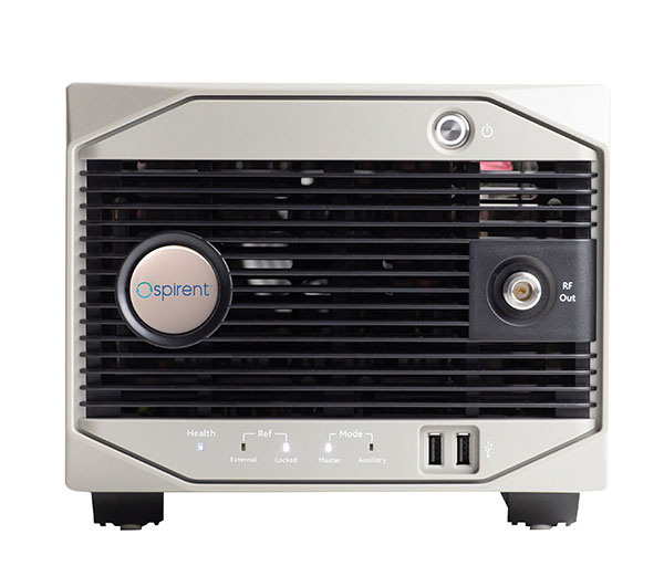
Spirent Federal Systems’ GSS6450 RF record and playback GNSS simulator is portable, for testing automotive applications in the field. (Photo: Spirent Federal)Lisa Perdue Product Line Director, Simulation Orolia
OROLIA
How has your approach to simulation changed over the years and in response to what changes in GNSS/PNT?
We have transitioned away from the GNSS simulator approach of using fixed, allocated hardware that we used in our early simulators to the more modern software-defined approach we use today. Given the ever-evolving PNT landscape, it is difficult to design hardware that will support all future GNSS and PNT simulation needs. Instead, we focus on the development of the Skydel software platform, which can then be used with the supported COTS hardware or turnkey system to generate the necessary signals. This gives us the benefit of maximum scalability and flexibility while being truly future proof.
The software-defined approach also allows us to offer Skydel in new and exciting ways. We aim to make PNT simulation accessible to everyone and we can do that through subscription and cloud-based simulation services.
What are currently the greatest technical challenges to GNSS/PNT simulation?
Today GNSS is only a part of the PNT picture. GNSS receivers are often tightly integrated with other sensors and many times the GNSS receiver cannot be isolated to test it on its own. Other sensors must also be stimulated or simulated and included as part of testing. Correction services are becoming more common, but many are proprietary with no public specification. With no common standards available, it can be technically challenging to create a one-size-fits-all test solution.
We tackle these challenges through our plug-in feature. The plug-in architecture allows you to expand the capabilities of Skydel by adding your own features or complex integration with other systems. It allows you to exchange information with the Skydel Engine and even integrates it into the Skydel UI. With our open-source SDK, which includes example plug-ins, you can create your data outputs synchronized to the GNSS simulation, such as IMU or correction services data.
In what markets and applications are your simulators used? Are they used only in labs or also in the field?
At Orolia, we say ‘Skydel Everywhere.’ Skydel is used in applications ranging from military encrypted receiver testing (SAASM, M-Code, PRS) to commercial applications supporting any of the GNSS signals available.
Skydel is used in systems that are found in labs, but you can also find Skydel at an individual engineer’s desk, or even home offices. In the field, Skydel has provided simulation and threat generation capability to authorized test ranges and field test events.
The broadsim software-defined GNSS is powered by Orolia’s Skydel GNSS simulator engine. (Photo: Orolia)
RACELOGIC
Julian Thomas Managing Director Racelogic
How has your approach to simulation changed over the years and in response to what changes in GNSS/PNT?
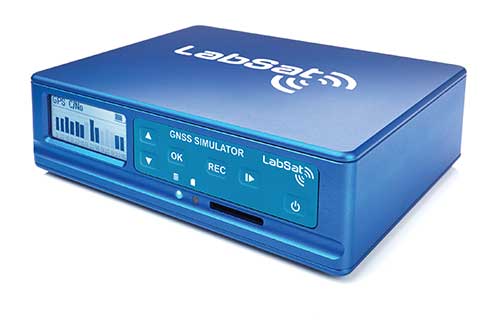
Over the years, GNSS technology has changed significantly but our approach of identifying a need and creating a solution hasn’t changed since we launched our first LabSat GNSS simulator. We created LabSat because we needed a cost-effective, accurate and easy to use record and replay simulator that we could use for product development and production line testing for our VBOX Automotive and VBOX Motorsport technologies. This need could not be met by any other simulator manufacturer, so we developed our own solution, which in turn became LabSat. Although our approach has not changed, the needs of users, including our own engineers, have, so we continue to develop and improve LabSat to meet these needs.
With the increasing number of satellite launches in market segments such as communication and navigation, the number of requests for testing space-qualified receivers has increased dramatically. To test these kinds of scenarios, we have been making some major upgrades to simulate rocket launches and Earth orbit trajectories that require very different characteristics from land-based simulation.
As the number of constellations and signals has expanded very rapidly, the number of simultaneous signals that need to be simulated has put a far greater requirement on the computing power needed to render them. We have been working very hard on optimizing our routines to make the most of the new breed of high-performance multi-core processors. The result has been a big decrease in the time taken to create a scenario, and an increase in the number of signals that can be simulated in real-time.
What are currently the greatest technical challenges to GNSS/PNT simulation?
The biggest challenge is in simulating a large number of constellations and signals in real-time without using dedicated, expensive hardware to create them. The good news is that with the latest Intel Xeon processors boasting up to 40 cores and 80 threads, a much larger number of signals can now be created in real-time using off-the-shelf PC components.
In what markets and applications are your simulators used? Are they used only in labs or also in the field?
With the global pandemic causing national lockdowns, many engineers switched to working from home. Our largest growth in the simulator market has therefore been due to providing these engineers with a small, low cost, easy to use simulator that they can have on their desks at home, allowing them to continue to develop GNSS applications without having to go into the office. The markets these engineers work within are as varied as the markets that use GNSS technology.
We have also seen a big increase in the use of our simulators to test mass produced satellites used in providing global internet coverage. These satellites are being produced in large volumes, and the need for a low cost, reliable testing method on the production line has driven strong growth in this area.
Our simulators are often used in the field to gather data for in-lab testing, as small size and battery life are very important factors in this environment.
SPIRENT FEDERAL SYSTEMS
Phillip Bonilla Senior Systems Engineer
How has your approach to simulation changed over the years and in response to what changes in GNSS/PNT?
Spirent has provided highly accurate simulation solutions since the early phases of GPS availability, starting with defined hardware for each signal type. As the GNSS landscape has grown, Spirent has worked closely with leading developers, adding key flexibility and functionality to adapt and provide a growing product portfolio. By adopting a robustly defined system architecture, and employing signal-agnostic hardware, Spirent simulators can generate any of the available constellations and frequencies, with no more than a few clicks of a mouse.
While broadening the support for the increasing number of constellations has been a focus, so too has the necessity to provide users with high numbers of available channels and auxiliary simulation needs. To complement GNSS simulation, significant effort is being devoted to resilient application testing, providing users with flexible solutions for introducing jamming and spoofing to the test environment. Our agnostic hardware supports signal generation using software defined radio (SDR), including interference sources and user-defined IQ signal data. As customer demands have grown, alternative RF and PNT sensors have been—and continue to be—incorporated, allowing users an expanded and comprehensive test environment.
The new spirent simulator generates alternative RF navigation signals concurrently with GNSS signals. (Photo: Spirent Federal)
What are currently the greatest technical challenges to GNSS/PNT simulation?
Today, nearly all industries rely on GNSS or other PNT sources to some extent. With such varied and widespread use, laboratory testing is critical, and maintaining the highest levels of accuracy, reliability and robustness remains one of the greatest challenges. For modern hardware-in-the-loop configurations, simulation systems must be able to keep latency consistent to enable powerful post-processing of results. With this challenge in mind, we at Spirent design and manufacture our own hardware, ensuring precision and ultra-low latency.
Another significant test challenge posed by modern applications is the growth in vehicle speed and maneuverability. Creating a truly realistic test environment for supersonic and even hypersonic vehicles with high rates of spin and jerk places huge demands on a simulator. Spirent recently has introduced the industry’s first 2 kHz update rate, enabling the most accurate trajectories for the most mobile technologies.
Lastly, positioning engines are becoming more complex. In addition to GNSS and inertial, vision systems and a range of other sensors and signals-of-opportunity are providing developers greater opportunity for precision and robustness. Therefore, a core part of Spirent’s mission statement is delivering test equipment that is designed to be integrated into wider test benches and ensuring that equipment is always orders of magnitude more accurate than any device under test.
In what markets and applications are your simulators used? Are they used only in labs or also in the field?
Spirent simulators are used in all phases of the product life cycle across nearly all applications. Receiver manufacturers use our solutions beginning with initial research and development, throughout product development, and well into production and field testing. Along with the ability to use Spirent’s simulators for live range testing, Spirent’s GSS6450 record and playback system enables users to record the real world in high dynamic detail for repeatable lab testing.
JACKSON LABS
Gregor Said Jackson President and CTO
How has your approach to simulation changed over the years and in response to what changes in GNSS/PNT?
Initially, we saw a large demand for GPS-only solutions. We are shipping units into this market and it is growing more than 30% year over year for us. Recently, customers are looking to also supporting other constellations. There is an emerging market for LEO simulation capability. Many LEO constellations are becoming reality, such as OneWeb, Kuiper, Starlink, Iridium, Xona, and others, and customers are more frequently asking if we can support these types of signals in our simulators. Demand also is arising for additional base-band signals to accommodate the RF signals, such as synchronized raw IMU data and other observables. Jamming and spoofing signals also are being requested and reproducing these as faithfully as possible is a big challenge for synthesized simulation. Lastly, we see demand rising for mil-type secure applications, such as M-Code, PRS (Galileo) and P(Y) code SAASM of course. The complexity of future simulators will rise in lockstep with the complexity of the RF spectrum coming to us from space.
What are currently the greatest technical challenges to GNSS/PNT simulation?
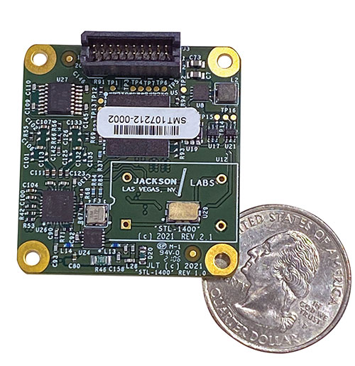
The STL-1400 positioning and timing receiver is designed for battery-operated low SWaP-C applications. (Photo: Jackson Labs)
A faithful reproduction of the real live-sky RF signals would rank high on this list. There are almost an unlimited number of out-of-band and in-band benign and adversary RF signals on a typical GNSS antenna these days, and more recently the sun has been acting up with solar flare activity that can disrupt GNSS signals. As GNSS receivers mature and become capable of tracking four, five or more carrier frequencies and constellations at once it becomes increasingly challenging to supply these types of signals from a simulator, and at a reasonable price-point. Sometimes, a wideband recording and playback system can do a better job at reproducing live-sky signals, however these systems are limited to playing back the same exact mission over and over again of course, and thus are not very flexible.
In what markets and applications are your simulators used? Are they used only in labs or also in the field?
Our simulators are built for two different applications: the first is a traditional type of GPS signal simulation where a Windows application allows a user to set up static or dynamic scenarios, allows them to upload NMEA playback files, create jamming or spoofing signals, and generally tweak the RF signal in many ways, such as modifying power levels and antenna patterns and even creating space vehicle failures in real time. Our customers range from car, aircraft, and avionics manufacturers, to R&D labs, to the government and academia.
Our simulators also are used for a hardware-in-the-loop application that we call transcoding. It allows glueless retrofitting of existing GPS equipment with any and all the emerging PNT solutions such as LEO positioning and timing, celestial navigation, INS/IMU, CSAC holdover, and concurrent/multi-frequency GNSS using a 1×1-in. transcoder module. Our transcoders fly on Air Force aircraft, are used to retrofit telecom equipment, and allow deep-indoors and underground GPS reception. Transcoders created an entirely new market for simulators.
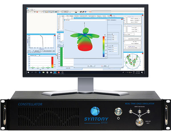
SYNTONY GNSS
Sylvain Daubas GNSS Simulators R&D Teams
How has your approach to simulation changed over the years and in response to what changes in GNSS/PNT?
Manufacturers of GNSS receivers are targeting more precision and availability, especially in urban areas, which require acquiring more signals from more constellations and greater effort to minimize multipath errors. This confirms that an SDR design for signal generation is decisive to keep systems cost-efficient, as it directly benefits from Moore’s law. For instance, our new RTGS4-12 configuration is about four times more powerful (240 channels) than our previous standard configuration, for a similar budget level.
Regarding precision and RF quality, our simulators benefit from the same RF cards as Echo, our high-fidelity record and playback equipment, with a state-of-the-art RF front end: three channels at a 100 MHz sampling rate and a 16 bit IQ. The capacity to simulate protected signals is also crucial: with PRN Link, Constellator is ready for any present or future signal with encrypted spreading codes.
What are currently the greatest technical challenges to GNSS/PNT simulation?
Building a CRPA simulator is not an easy task, as this requires extreme levels of phase and time synchronization between several RF outputs, typically four, seven or more. This can be done in two ways: with a dedicated new RF board running with a single synthesizer for all channels or using the classical one, to which one should add a complex calibration mechanism. SYNTONY has made the tough choice, investing more at first in a mono-synthesizer version. However, this will benefit our customers, for which the usage will be simplified and it will save them a lot of time by shortening the calibration phase. This version already is available for sale.
On another note, it is a significant challenge to keep our product and its interfaces user friendly while also enabling our clients to configure each of the more than 500 parameters available (at the last count). We also keep in mind that new signals may appear, from LEO constellations for instance, answering to new needs such as autonomous driving. Constellator is HW ready for them, only requiring a software update.
In what markets and applications are your simulators used? Are they used only in labs or also in the field?
Constellator currently is mainly used in laboratories, in many market segments. Because it was initially built in partnership with spacecraft manufacturers, it benefits from the high standards of performance of space industries and includes several advanced space-dedicated features.
On top of the typical usage inside the labs, two other SYNTONY simulator products that are directly derived from Constellator are used in the field:
ECHO Recorder & Playback is used to record the GNSS environment with ultra-high fidelity: today @ 100Mhz, and before the end of 2021 even up to @ 200Mhz. ECHO has been used by our customers in cars, trains and often in aircraft test flights. Another usage of ECHO is to detect and record scintillation phenomena, as we will soon do in Brazil.
SubWAVE (GNSS coverage extension for underground places) allows indoor positioning with precision, directly compatible with standard GPS receivers, which can be crucial for safety or operational reasons. We have installed SubWAVE inside subways stations and tunnels (for example, in Stockholm, Paris and New York), in road tunnels (soon in France, in the “Tunnel du Mont Blanc”), in an underground bus terminal (also in Stockholm), in underground train stations (in Switzerland), and before the end of 2021 also in an underground mine (in Finland).
Northrop Grumman and Martin UAV (a Shield AI company) have completed successful flight testing of a V-BAT unmanned aircraft system (UAS) with new features including GPS-denied navigation and target designation capabilities.
The enhanced V-BAT’s flexible vertical take-off and landing (VTOL) capability is based on a platform deployed to address the U.S. Army’s Future Tactical Unmanned Aircraft System (FTUAS) mission. For FTUAS, the U.S. Army is seeking a rapidly deployable, GPS-denied navigation-capable, expeditionary VTOL system capable of persistent aerial reconnaissance for U.S. Army brigade combat teams, special forces, and Ranger battalions.
The offering is based on Martin’s UAV V-BAT UAS. According to Northrop Grumman, it is compact, lightweight, simple to operate, and can be set up, launched and recovered by a two-soldier team in confined environments. The V-BAT also is designed with sufficient payload capacity to carry a range of interchangeable payloads, including electro-optical/infrared (EO/IR), synthetic aperture radar (SAR), and electronic warfare (EW) payloads, depending on mission-specific requirements. Additionally, Shield AI’s recent acquisition of Martin UAV will enable rapid development of GPS-denied and autonomy capabilities for V-BAT through the future porting of Shield AI’s autonomy stack, Hivemind, onto V-BAT.
Northrop Grumman and Martin UAV conduct flight testing of Martin UAV’s V-BAT aircraft for the U.S. Army’s Future Tactical Unmanned Aircraft System effort in Camp Grafton, North Dakota. (Photo: Northrop Grumman)
The Air Wolf just prior to Burns Flat dawn launch. (Photo: Kratos)
Kratos Defense & Security Solutions, a provider of national security solutions, has announced that its Air Wolf Tactical Drone System has completed a 100 percent successful flight at the recently approved Burns Flat, Oklahoma Range Facility. The Kratos Air Wolf Mission, which was the inaugural flight at the Burns Flat Range location, included multiple new payloads carried by the Air Wolf UAV, including a proprietary Kratos artificial intelligence/autonomy system, which has been developed by Kratos specifically for high performance, jet UAV aircraft.
Air Wolf is one of several drones in Kratos’ family of jet drones that are flying today, also including the attritable UTAP-22 Mako, XQ-58A Valkyrie, and, in conjunction with the company’s partner Dynetics, the reusable X-61A Gremlins drone. According to the company, the newly approved Burns Flat Test Range and Facility is an important new strategic asset available to it, enabling the company to accelerate its drone testing and demonstration, further increasing its ability to rapidly develop and demonstrate jet drones, supporting subsystems, and other tactical systems and aircraft.
Kratos develops and fields technology, platforms, and systems for United States national security-related customers, allies, and commercial enterprises. The company specializes in unmanned systems, satellite communications, cyber security/warfare, microwave electronics, missile defense, hypersonic systems, training, combat systems and next generation turbo jet and turbo fan engine development.
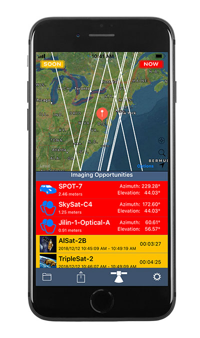
Orbit Logic’s SpyMeSat mobile app (available via the Apple App Store and Google Play) now includes an augmented reality (AR) interface for better awareness of overflying imaging satellites. The AR view overlays the orbit and position of satellites that can image your location, providing a better understanding of satellite viewing geometry and potential obstructions. For example, it makes it possible to know if an image taken by that satellite of your position would be obscured by a tree or a building. The AR interface also displays relevant information about the satellite and its capabilities, including the timing and dynamic geometry of the pass as well as the resolution achievable by satellite sensors.
In addition to real-time imaging satellite awareness, SpyMeSat provides on-demand access to recent archive satellite imagery and the ability to request new tasking directly from a mobile device. Multi-phenomenology data (optical, infrared, synthetic aperture radar, and more) is available through an in-app process of preview, select, payment, and delivery that can be completed in seconds, providing archived satellite imagery for any location on demand. When archive imagery is insufficient and new data is required, users can review available satellites, better understand the data collection environment through the AR interface, and purchase tasking based on cost, responsiveness, and capability.
While the standard SpyMeSat enables marketplace interactions between the public and commercial satellite imagery providers, Orbit Logic also develops custom mobile applications for better situational awareness and easier data-access/tasking supporting specific missions. The new AR interface will enhance these users’ mission effectiveness by facilitating better understanding of how data collection might be impacted by surrounding terrain or other spatial factors. Examples of bespoke SpyMeSat deployments include government versions for government assets and versions for awareness of satellite communications opportunities for contact scheduling, data transfer, and command uplink.
Orbit Logic specializes in mission planning and scheduling solutions for aerospace and geospatial intelligence. Its COTS products create better plans faster with fewer resources for all mission phases. Orbit Logic services are available to configure, customize, and integrate its mobile, web-based, desktop, and flight software applications to provide turn-key operational solutions that leverage the latest available technologies to meet customer goals and exceed their expectations.
EagleView, a geospatial technology provider of software, aerial imagery and analytics, and Skyline Software Systems, a provider of 3D Earth visualization software, have partnered to enable customers to visualize their geospatial data in new ways. Through this new partnership, EagleView’s high-resolution ortho and oblique imagery can be converted into 3D Mesh layers with Skyline’s PhotoMesh and viewed, edited, and analyzed on Skyline’s TerraExplorer platform.
EagleView customers will be able to utilize Skyline’s TerraExplorer web-based GIS viewer and editor to see, analyze, and share their imagery in an immersive environment. Accurately measuring distance, area, and volume is now easier than ever, which is critical for planning and zoning to verify regulations or estimate the costs of flattening a site. With floodplain analysis, disaster management can identify flood risks before they happen, and with viewshed calculations E911 can pre-plan for high-profile events. Other key analytic features for customers will include the ability to analyze shade, view contour and slope maps, and view in underground mode. Beginning immediately, the additional 3D Mesh capability is now available as an add-on to any new Reveal Essentials+ Property or Neighborhood image capture.
Skyline offers a comprehensive platform of applications, tools, and services that enable the creation and dissemination of interactive, photo-realistic 3D environments. Its products are production proven in both the defense and commercial markets.
EagleView develops geospatial technology, providing software, imagery, and analytics. The company has the largest geospatial data and imagery library in history, covering 94 percent of the U.S. population. Its technology with more than 300 patents creates highly differentiated software, imagery, and analytics products for a diverse customer base.
The U.S. General Services Administration (GSA) has selected Hexagon US Federal as a prime contractor for ASTRO, a 10-year, indefinite-delivery/indefinite-quantity (IDIQ) contract with an estimated $90 billion value.
The ASTRO contract is being administered by the Federal Systems Integration and Management Center (FEDSIM). Sponsored by the Department of Defense (DoD), ASTRO is comprised of 10 pools to deliver services related to manned, unmanned and optionally manned platforms and robotics.
Hexagon was selected as one of multiple awardees for the Data Operations Pool, which includes all data collection, processing, exploitation, and dissemination activities associated with manned, unmanned, and optionally manned platforms and/or robotics supporting mission performance. The formal government kick-off is anticipated to take place in November 2021.
Hexagon is a provider of digital reality solutions, combining sensor, software, and autonomous technologies, putting data to work to boost efficiency, productivity, quality and safety across industrial, manufacturing, infrastructure, public sector and mobility applications.
Hexagon US Federal provides technology and professional services for C5ISR, installation security, GIS, and cyber security. Dedicated to the delivery of Hexagon technology and services to the U.S. government, including defense, intelligence, and civilian organizations, the company builds solutions that help its customers design, build, maintain, manage, operate, and protect.
Kongsberg Geospatial has released TerraLens 9.3, the latest version of its real-time software development toolkit for geospatial visualization. In this release of TerraLens, the product development team has focused on improving performance for 3D visualization for large viewports and on multi-domain visualization features for joint all-domain command and control applications. Leveraging the power of modern GPUs and multi-core processors, the latest release of TerraLens is significantly faster, with new presentations focused on enhancing situational awareness.
With increased multithreading in its map handling, TerraLens can load and display vector, raster, and elevation formats smoothly without pre-processing. This is ideal for applications that have disk size constraints or for customers that have a short turn-around time between receiving map data updates and needing to use them. For applications with stringent start-up constraints or map formats that are not optimized for quick runtime access, the pre-processing option still exists, to help ensure minimal time for an initial map display.
The rendering of maps and dynamic presentations has also been optimized with increased threading in the graphics kernel, and the minimization of costly graphics state changes with batched rendering calls. Improved data culling ensures that only visible items will be rendered. These improvements are especially noticeable when displaying large numbers of dynamic tracks and objects, and frequently projected information.
This release of TerraLens also includes a slate of new tools and features, including support for OGC 3D Tiles, which can be used to create a high-resolution 3D view that is especially suited to cityscapes, while a new API to control the resolution of the terrain mesh allows applications to balance runtime performance with higher resolution terrain over which to drape map imagery. Elevation warnings can now be displayed using color ramps on both terrain and OGC 3D Tiles, as well as on primitive lines and area fills.
TerraLens continues to evolve to meet the latest map and symbology standards. Support has been added for the latest military symbology, providing MIL-STD-2525D and App-6B symbol sets. The SDK also features new mapping updates including enhanced support to discover WMS and WMTS map layers as well as monitoring the status of web requests. Support has been added for DAFIF 8.1 and S-57 Inland ENC levels. Developers will be able to track when maps have completed loading in the TerraLens viewport. TerraLens 9.3 also continues to support the latest development environment needs, including Visual Studio 2019, CLI .Net Core, and Linux RedHat8.
TerraLens has been fielded in some of the most demanding applications in the world including AEGIS, Global Hawk, THAAD, NATO AWACS, and the Joint Battle Command-Platform.
Based in Ottawa, Canada, Kongsberg Geospatial creates precision real-time software for air traffic control and UxS and situational awareness. The company’s products are primarily deployed in solutions for air-traffic control, command and control, and air defense. During nearly three decades of providing dependable performance under extreme conditions, Kongsberg Geospatial has become the leading geospatial technology provider for mission-critical applications where lives are on the line. Kongsberg Geospatial is a subsidiary of Kongsberg Defence & Aerospace.
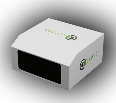
Cepton, a provider of automotive lidar solutions, will showcase its automotive-grade, long-range Vista-X90 lidar device at two upcoming tradeshows in Europe: IAA Mobility 2021 in Munich, Germany (September 7-12) and AutoSens in Brussels, Belgium (September 15t-16).
Photo: Ception
Vista-X90 combines high performance, auto-grade reliability and low cost to meet the critical requirements for mass-market automotive applications. During both events, Cepton representatives will be available to talk about Cepton’s lidar offering for a range of smart mobility applications, including advanced driver assistance systems (ADAS), autonomous vehicles (AV) and smart infrastructure.
With a compact and embeddable design, Vista-X90 is optimized for ease of vehicle integration, offering multiple placement options, such as in the headlamp, in the fascia, behind the windshield, or on the roof. Featuring Cepton’s next-generation ASIC technology, the Vista-X90 supports AUTOSAR and over-the-air (OTA) functionality, with advanced capabilities for functional safety, cybersecurity, and extrinsic calibration.
Visitors to the Cepton booth at IAA and AutoSens will also be able to learn about Cepton’s award-winning lidar solutions portfolio that extends beyond automotive and supports smart infrastructure applications such as smart roads and rail, electronic tolling, and more.
Cepton provides intelligent, lidar-based solutions for a range of markets such as automotive (ADAS/AV), smart cities, smart spaces, and smart industrial applications. Cepton’s patented MMT-based lidar technology enables reliable, scalable and cost-effective solutions that deliver long-range, high-resolution 3D perception for smart applications.
Founded in 2016 and led by industry veterans with more than two decades of collective experience across a wide range of advanced lidar and imaging technologies, Cepton is focused on the mass market commercialization of high performance, high quality lidar solutions. Cepton is headquartered in San Jose, California, USA, with a presence in North America, Germany, Japan, India, and China, to serve a fast-growing global customer base.
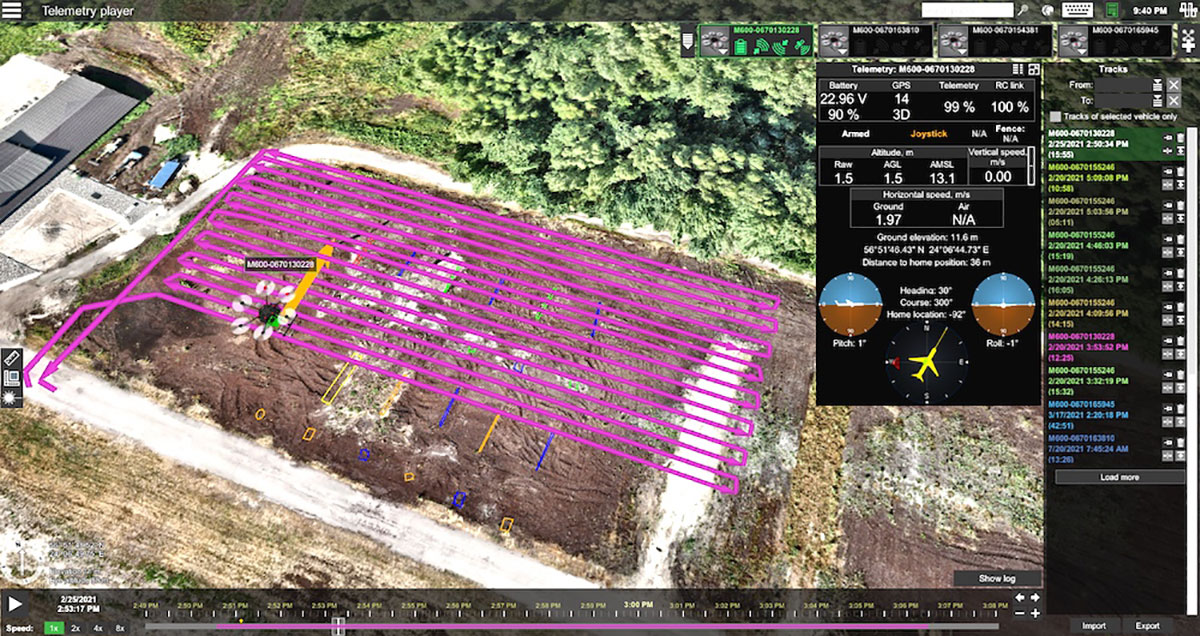
Telemetry view of drone survey mission in UgCS. (Image: SPH Engineering)
SPH Engineering and AirData UAV have partnered to offer pilots a way to track and manage their fleets by automatically synchronizing flight data from SPH Engineering’s UgCS to AirData.
SPH Engineering and AirData have worked closely to provide an automatic method to synchronize flight logs with AirData. The new integration will transmit detailed and comprehensive flight information from UgCS and will leverage AirData’s crash prevention algorithms, pilot and equipment alerting, as well as maintenance tracking with no manual steps required.
UgCS by SPH Engineering is a tool for enhanced UAV mission planning and flight control software solution. Today, it is used in more than 150 countries in a wide range of areas including environmental, archeological, engineering and mining, agricultural and biological. The UgCS Educational program aims to support universities with a safe and efficient tool to test innovative ideas involving surveying and inspecting with a drone. SPH Engineering is a multiproduct drone software company and UAV integration services provider.
AirData is an online drone fleet data management and real-time flight streaming platform, serving more than 200,000 users with 19 million flights uploaded to date, processing an average of 20,000 flights a day, with high-resolution data stored per each flight. It is used by large fleet operators around the world not only as a logbook, but also as a comprehensive flight safety data analysis and crash prevention platform, with advanced maintenance, pilot tracking and live streaming.