The UB351/352 GPS/GLONASS/BDS tri-system penta-frequency OEM boards are based on Unicore’s mature multi-GNSS system on chip (SoC). UB351/352 both use a low-power consumption design, support multipath mitigation and offer millimeter-level carrier-phase observations with centimeter-level RTK positioning accuracy.
Instant RTK and high-precision heading advanced technologies are particularly appropriate for applications requiring high-precision positioning, navigation and heading. UB351/352 have been used in several applications in overseas projects, and can be integrated into unmanned aircraft vehicles (UAV) and in precision agriculture.
Characteristics
UB351: BDS B1/B3+GPS L1/L2+GLONASS L1; UB352: GPS L1/L2+GLONASS L1/L2+BDS B1
46 x71 millimeters; small and compatible with industry standard compact size GNSS boards
Optional onboard MEMS; designed for intelligent machine control with improved positioning performance under complex conditions
Supports WAAS + TDIF algorithm, designed for precision agriculture
NovAtel debuted two new inertial measurement unit (IMU) products within its SPAN technology portfolio at ION GNSS+ 2016, which was held Sep. 12-16 in Portland, Oregon.
SPAN couples NovAtel’s GNSS precise positioning technology with robust inertial navigation systems (INS) to provide continuous 3D position, velocity and attitude solutions, the company says in a news release.
IMU-µIMU-IC
The compact IMU-µIMU-IC is a high performing, fully commercial MEMS IMU. Small in size, it is suitable for aerial and hydrographic survey and space constrained industrial applications. The µIMU is available as a complete assembly in an environmentally sealed enclosure or as a standalone OEM product, both compatible with the company’s OEM6 and OEM7 SPAN receivers.
NovAtel also developed an enclosure for its Honeywell HG1900 IMU, which was previously available only as an OEM product. The IMU-HG1900 IMU offers a hybrid package of Honeywell’s micro electromechanical systems (MEMS) gyros and RBA accelerometers. The enclosure provides system integrators with design versatility, offering LED indicators and simplified cabling that can be extended in length as required. Both cabling and connectors are available off-the-shelf, NovAtel says.
“These two IMUs are part of our new IMU enclosure family, which now provides four sizes of enclosures – from the small Litef- µIMU to our high performance IMU-ISA-100C,” says Neil Gerein, portfolio manager for NovAtel. “We’ve worked hard to bring our customers the very latest in IMU technology and to expand IMU choices to ensure the optimal positioning performance for their application.”
Shipments of the new IMU enclosures will be available in Q4 of 2016, according to NovAtel.
Powerful research tool for the GNSS scientific and R&D community
The SX3 is a modular multi-GNSS software receiver that tracks all known and in future upcoming GNSS signals in view in real time on a standard laptop. The included RF front-end offers four RF frequency chains with 50-MHz bandwidth each, covering the entire GNSS L-band spectrum and the IRNSS S-band spectrum.
The USB 3.0 interface enables high-speed data transfer with up to 8-bit quantization. Customers can fully concentrate on their applications instead of dealing with potentially obscure code when using open source.
The signal view graphical user interface provides easy access to signal processing configuration properties and gives real-time feedback for important aspects, such as channel output, correlation function and RF spectrum.
Applications
Multipath and spoofing signal evaluation
Interference monitoring
Weak signal scintillation
Ionospheric scintillation
Sensor fusion (IMU, magnetometer)
Release notes (v3.2.1)
New SX3 front-end mode providing sample rate of 100 MHz
SX3 front-end temperature log-file
Automatic calibration of Galileo E5ab (AltBOC) tracking when using SX3 front end
Add scintillation monitor module and dedicated configuration “ScintillationMonitor.nsr”
Geodetics Inc.’s newest mobile mapping product, Geo-MMS, is a fully integrated lidar mapping payload for integration with unmanned aerial systems (UAS).
The Geo-MMS includes an inertial navigation system (INS) coupled with a lidar sensor. Raw data from the integrated GPS, inertial measurement unit (IMU) and lidar sensors are recorded on the internal data-recording device and can be post-processed using Geodetics’ lidar tool software package to directly geo-reference the lidar point clouds with LAS-format output. Geo-MMS is available with a wide range of sensors.
Geo-MMS can be used in various applications in both military and commercial industries such as precision agriculture; mining; utilities; asset management; oil; construction and infrastructure inspections; intelligence, surveillance and reconnaissance (ISR); sense and avoid; coastal surveillance; and situational awareness.
As a company based in the United States, Geodetics can also accommodate defense SAASM and M-code path requirements.
The afternoon festival included races and demonstrations of the unmanned aerial vehicles (UAVs). In a cage topped by a 100-meter-long net, drones competed in races, going as fast as 100 kilometers per hour as drone operators guided their UAVs through a brightly colored obstacle course.
The festival had an educational goal, reports phys.org, with displays on the regulations, the drone’s various uses, and workshops on piloting them.
The festival also was an occasion for the postal service to demonstrate its delivery drone, which weighs 3.7 kilos (eight pounds) and can carry three kilos of mail over 20 kilometers (12 miles).
Behind the security gates, 150,000 attended, and 30,000 watched the live stream.
NTP attacks on time servers and other vital topics will be explored in GPS World‘s Sept. 22 “GPS/GNSS and Cybersecurity” webinar, sponsored by Microsemi. Sign up now for free attendance and participation in the free-form Q&A that will follow the four expert presentations.
In its most general form, spoofing can be conducted using RF as well as cyber attacks. Cyber attacks can be in the form of malicious software, falsified maps, man in the middle attacks, signing location with stolen credentials, reference station manipulation, lying — and more!
The role of timing in cybersecurity.
Log-file time-stamp accuracy and client/server time synchronization.
New protection technologies: meeting accuracy, reliability & security imperatives.
GPS jamming effect on time servers: analogous to unplugging the GPS antenna
Network attacks on NTP time servers: Synchronizing to “free time” is risky practice.
Why you need a security-hardened NTP reflector: resistant to nearly all kinds of network attacks.
Four-level protection against malicious signals: pre-correlation, correlation, measurement and solution level defenses, their pros and cons.
Benefits of sensor fusion for secure receiver design.
Example implementation: deep GNSS/Inertial integration for jamming suppression and spoofing mitigation.
The VersaSync is a new generation time and frequency server from Spectracom. The high-performance GNSS master clock and network time server delivers accurate, software-configurable time and frequency signals in all circumstances, including GNSS-denied environments.
It is based on a platform-approach to maximize versatility without restricting performance, which maintains or improves high-performance standards from larger form factors while reducing the footprint. The result is a rugged and compact design suitable for air, land or sea applications.
Standard VersaSync configurations are designed in accordance to VITA 75, which was developed for easy integration of subsystems in mobile platforms. The overall volume is under 1 liter, the weight is less than 1 kilogram, and its power consumption is approximately 10 watts.
The list of design features for harsh environmental conditions include mil-performance circular connectors, a sealed enclosure (IP65), and an efficient heat transfer via the conduction-cooled based plate. Spectracom is currently confirming its extensive reliability and compatibility modeling to military specifications.
Versatility is also the theme for the VersaSync’s internal time-base, compatibility with external time and frequency reference sources, and time and frequency signal generation. It is available with a choice of a very low-phase noise ovenized crystal oscillator (OCXO) or chip-scale atomic clocks (CSAC), and can accommodate other high-precision internal time references. Similarly, it is available with various GNSS receivers including multi-constellation receivers and SAASM encrypted GPS with an upgrade path to M-code.
Software-defined digital timing I/Os offer mission-to-mission configurability of virtually any timing signal. Network synchronization and management also offers a high degree of flexibility. Two gigabit Ethernet interfaces are available for network synchronization protocols (NTP and PTP) as well as for configuration, status, logging and upgradability.
Applications
UAVs
flight test
telemetry
mobile communication systems
C4ISR (command, control, communications, computers, intelligence, surveillance and reconnaissance)
The P326 and P327 support 394 channels and are scalable, offering centimeter-level accuracy in single-frequency or full performance multi-frequency, multi-GNSS, Atlas-capable mode. The platform enables simultaneous tracking of all satellite signals including GPS, GLONASS, BeiDou, Galileo and QZSS, making it a robust and reliable solution.
The updated power-management system efficiently governs the processor, memory and ASIC — important for multiple integration applications such as handheld and battery-powered devices. The small form factor (41 x 71 millimeters) 34-pin P326 module is a drop-in upgrade for many Hemisphere products. The P327 module (41 x 72 millimeters) is a drop-in upgrade for standard 20-pin modules from other manufacturers.
Eclipse P326 and P327 Features
Athena GNSS engine offers world-class performance
Atlas L-band corrections provide position accuracy down to 2 centimeters RMS, positioning sustainability with Tracer technology, and convergence time as low as 10 minutes
Exclusive access to Hemisphere’s Advanced Technology Features: aRTK works when RTK corrections fail and SureFix verifies the fix with virtually 100 percent reliability
DT Research has released the DT395CR and DT395GS rugged tablets. While designed for field professionals, the tablets cost less than consumer-grade tablets over the lifetime of the product, DT Research said.
The DT395GS rugged tablet by DT Research.
Both DT395 tablets are highly durable to withstand extreme environments, designed with fully integrated options to eliminate easily broken attachments in mission-critical scenarios, and include security, privacy and productivity settings.
The DT395GS tablet is designed for field applications with a high-accuracy GNSS module that is compatible with existing GIS software for mapping applications and brings together the advanced workflow for GIS data capture, accurate positioning and data transmission. The u-blox M8 GNSS module is capable of concurrent reception of GPS and GLONASS for up to 2-meter accuracy.
“Many businesses have adopted mobile tablets with the goal of increasing productivity by leveraging the versatile tablet form-factor,” said Daw Tsai, president of DT Research. “But companies within construction, field service, logistics, manufacturing and warehousing have found that consumer-grade tablets are too fragile for their environment — requiring costly repairs and replacements that introduce expensive downtime. Our new DT395 rugged tablets give vertical industries exactly what they need with high reliability and lower TCO (total cost of ownership) over the lifetime of the product.”
According to a VDC Research study, the average annual TCO of a ruggedized tablet is 22 percent lower than the average annual TCO of a non-rugged tablet. The study found average failure rates for non-rugged tablets is 15.2 percent compared to 6.9 percent for rugged tablets. Lost productivity, as a result of mobile device failure, was a leading contributor to higher TCO for non-rugged tablets. Mobile workers lost an average of 52-80 minutes of productivity when their mobile device failed. (Source: VDC Research, “Total Cost of Ownership Models for Mobile Computing and Wireless Platforms,” Third Edition.)
Unlike consumer-grade tablets, the DT395CR and DT395GS ruggedized tablets are designed to be used in a variety of indoor and outdoor environments with full HD anti-reflection outdoor viewable displays. The tablets are IP65 and MIL-STD-810G rated to withstand 4-foot drops and extreme temperatures (-4° F to 140° F), and resist water, dust and humidity.
“We tried iPads, but they were not suited for our environment,” said Marty Phillips, director of engineering at Murray Equipment, Inc. “Our customers do millions of dollars of fertilizer loading within an eight-week window in a broad range of weather conditions. If a remote control tablet is down for even an hour, it’s a significant revenue loss. We have used DT Research rugged tablets in our automated liquid-handling facilities across the U.S. for more than three years with no downtime or repair/replacement costs. The reliability of DT Research’s rugged tablets is unmatched.”
Both the DT395CR and DT395GS have an 8.9-inch display with 1920 x 1200 resolution and capacitive touch, and weigh 2.87 pounds. The tablets run on an Intel Atom Quad Core CPU with 4GB RAM running Microsoft Windows 10 IoT Enterprise OS.
Security, privacy and productivity settings
“Security, privacy and productivity are a growing concern in many organizations,” Helen Fanucci, GM of Americas Device IoT Experience, Microsoft. “We are pleased to see DT Research utilize the Windows 10 IoT Enterprise-grade security to support mission-critical rugged tablets for customers and deliver a safer device experience, which enhances productivity for a variety of mobile scenarios in manufacturing, field service, logistics and other industries.”
The DT395 tablets leverage advanced Windows 10 IoT Enterprise OS security including Device Guard, combining hardware and software security to lock down a device so that it can only run trusted applications. The DT395 also includes lock-down features to protect against malicious users while providing a custom-defined user experience.
Bluetooth, Wi-Fi, and RFID can pose a security issue when using consumer-grade tablets within a business environment. DT Research DT395 rugged tablets can be purpose-built with a camera privacy mode and
preconfigured with Bluetooth, RFID and Wi-Fi disable functions. The DT395 rugged tablets can also eliminate access to internet or social media applications to address productivity challenges.
Customizable options
DT Research offers customizable options for the DT395CR and DT395GS including an optimized OS and BIOS. Customers can choose to have the options below fully-integrated.
3G WWAN or 4G LTE
2D Barcode Scanner
Class 1 Bluetooth (1000 feet)
Camera (5 Megapixel back camera)
GNSS Module (u-blox M8)
HF/RFID 13.56MHz reader
HDMI-in and Ethernet port
Six-pin push/pull connector for EIA/RS-232/485/422, USB port and Ethernet port
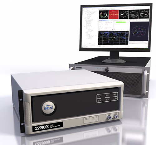
Simulate signals from all GNSS and regional navigation
Spirent’s GSS9000 constellation simulator.
The Spirent GSS9000 Multi-Frequency, Multi-GNSS RF Constellation Simulator can simulate signals from all GNSS and regional navigation. It offers a four-fold increase in RF signal iteration rate (SIR) over Spirent’s GSS8000 simulator.
The GSS9000 SIR is 1000 Hz (1 ms), enabling higher dynamic simulations with more accuracy and fidelity. It includes support for restricted and classified signals from the GPS and Galileo systems, as well as advanced capabilities for ultra-high dynamics. It can evaluate resilience of navigation systems to interference and spoofing attacks, and has the flexibility to reconfigure constellations, channels, and frequencies between test runs or test cases.
Hardware changes can be made in the field, supported by the new on-board calibrator module. The GSS9000 is extensible and can support the widest range of carriers, ranging codes, and data streams for the Galileo, GPS, GLONASS and BeiDou systems, as well as regional/augmentation systems. Multi-antenna/multi-vehicle simulation for differential-GNSS and attitude determination, and interference/jamming and spoofing testing are also supported.
GSS9000 Attributes
1000-Hz simulation iteration rate (SIR) and hardware update rate (HUR) enabling real-time remote control and trajectory delivery with extremely low latency and simulation of ultra-high dynamic motion
160 channels plus 640 embedded multipath channels across 10 independent frequencies in one chassis
Single RF version and dual RF version for differential GNSS and multi-vehicle simulation
0.3 mm RMS pseudorange accuracy, 120,000 m/s relative velocity
Highly flexible configurations selectable via a “cabinet” of license keys
Complete portability of Spirent SimGEN scenarios
In-field upgradeability
Future-proofed for all advances in GNSS technology
With more than 70 percent of calls to emergency services coming from mobile phones, getting necessary help — fast — to the caller can be challenging if they don’t know where they are or can’t communicate for any number or reasons related to the emergency. Current emergency solutions rely on cell-tower location, with a location radius of up to several kilometers, or assisted GPS, subject to errors indoors and unable to establish a floor level in tall buildings.
The U.S Federal Communications Commission estimates “improved location accuracy which results in reducing wireless E911 response time by one minute can result in saving over 10,000 lives annually.”
Google has created and rolled out in two European countries the Emergency Location Service in Android, with other regions to follow. The feature, when supported by the caller’s network, sends location from phone to emergency services when an emergency number is dialed. The feature is solely for the use of emergency service providers, and the caller’s precise location is never seen or handled by phone apps, integrating Wi-Fi, GPS, and cell towers to produce a more reliable emergency location indoors and outdoors.
Emergency Location Service is supported by more than 99 percent of existing Android devices (version 2.3 out and upwards) through Google Play services. The service activates when supported by the mobile network operator or emergency infrastructure provider.
The new geographical location system can identify the source of a mobile phone emergency call to typically within 0.003 square kilometers (less than half the size of a football field) instead of an average of around 12 square kilometers.
According to a British telecomm communiqué, “We see 84 percent being less than 50 m radius, with 16 percent up to 9 meters, 27 percent between 10 and 19 meters’ radius and 41 percent with 20–49 meter radius.”
When an emergency call is made with an enabled Android smartphone, the phone automatically activates its location service and sends its position by text message to the 999 service. This usually takes less than 20 seconds. This text message is not visible on the handset and is not charged for.
The text is automatically matched to the voice call and compared to the network’s cell-based information to ensure it is valid. The location is then made available to the appropriate emergency service, supplementing the cell-based information.
Because Google has tweaked its core Android Play Services software, it no longer needs each handset manufacturer to modify their handsets. Instead they can all be enabled as part of Google’s regular updates to its Android mobile operating system. This means the service will reach more handsets much more quickly.
NovAtel has introduced its new VEXXIS series of GNSS antennas. NovAtel made the announcement at ION GNSS+, which is being held this week in Portland, Oregon.
The VEXXIS series includes two lines of antennas, the new GNSS-800 series and the GNSS-500 series introduced earlier this year. The series offers the latest advancements in GNSS antenna technology for multi-constellation and multifrequency GNSS applications.
The VEXXIS GNSS-800 series of antennas provide exceptional tracking performance previously unachievable in such a small form factor. Patented multi-point feeding network and radiation pattern optimization technology provides stable phase center and enhanced multipath rejection as well as exceptional low elevation satellite tracking while achieving high peak zenith gain.
The new technology enables the antenna to track the maximum number of satellites in any environment for an enhanced positioning solution. The GNSS-800 family of antennas are the toughest high precision antennas NovAtel has designed to date, ensuring their survivability in even the harshest operating environments.
The VEXXIS GNSS-500 series of antennas were designed with a low profile, aerodynamic enclosure, useful for ground vehicles in applications such as agriculture, machine control and mobile mapping.
Featuring the same multi-point feeding network as the GNSS-800 family, GNSS-500 antennas offer excellent multipath rejection and stable phase center. Signal reception is unaffected by the rotation of the antenna or satellite elevation, simplifying placement and installation. Vehicle mounting is easy with the antennas’ magnetic or screw mounting options.
VEXXIS GNSS-500 antennas are available for immediate ordering. GNSS-800 antennas will be available in the fourth quarter of 2016.