Sponsored by: NavCom
Broadcast date: Thursday, March 19, 2015
Moderator: Alan Cameron, Group Publisher, GPS World and Geospatial Solutions
Speakers: Mark Wilson, Vice President, Sales, IFEN Inc.; Neal Fedora, Director, Engineering, Spirent Federal Systems Inc.; Julian Thomas, Founder, Racelogic; Darren Fisher, GNSS Market Manager, Spectracom
Summary: More signals (e.g., GPS + Galileo + BDS) and special techniques that are well-adapted to mobile users (gentle antenna motion, use of cameras) allow one to get away with using less expensive antennas and yet still resolve the ambiguities needed for centimeter-accurate positioning.
Author: GPS World Staff
-
Fix the Future Now with Signal Simulators
-
New Frontiers in Unmanned Flight: Hey You, UAV!
Sponsored by: NavCom
Broadcast date: Thursday, May 21, 2015
Moderator: Alan Cameron, Editor-In-Chief and Publisher, GPS World
Speakers: Donald Chance Mark Jr., Aviation Attorney, Fafinski Mark & Johnson; Tony Murfin, Professional OEM & UAV Editor, GPS World; James Spicer
UAV Researcher, Stanford University; Adrien Perkins, UAV Researcher, Stanford GPS Laboratory; Peter Cosyn, Director of Research & Development, Gatewing, a Trimble company
Summary: Explosive growth in the Unmanned Aerial Vehicle (UAV) market segment and an unsettled regulatory framework make for a confusing picture. Our experts will clarify the confusion, explain product design trends and describe in detail the operation of one new micro-UAV in particular. With the industry poised for the opening of the regulation floodgates to address a growing commercial demand, we will hear from developers, both independent and at large GNSS companies, and from a legal expert who will discuss today’s and tomorrow’s likely regulatory framework. Attendees also will learn how robust, cost-effective Hybrid GNSS Technologies offer unique capabilities for UAV navigation in environments where traditional GPS receivers may fail.
Tony Murfin answers submitted questions in this post-webinar report. -
Say Goodbye Proprietary GPS Devices, Hello TerraGo Edge
Broadcast date: Thursday, May 28, 2015
Sponsor: TerraGo
Moderator: Alan Cameron, Editor-In-Chief and Publisher, GPS World
Speaker: Michael Gundling, Vice President of Product Management, TerraGo
Summary: Say goodbye to expensive, single-use GPS handheld devices. That’s not the way it works anymore. TerraGo Edge replaces single-use GPS handheld devices and enables mobile workers and field crews to easily collect field data, share that data with others in real-time using any iOS or Android device and sync that information with headquarters at a fraction of the cost. With TerraGo Edge, you can save a significant amount of money, increase the ROI on your current GIS investments and improve productivity. -
New Product Trends in UAV, Survey, Mapping, and Geospatial Data Collection and Analysis
Sponsored by: NavCom
Broadcast date: Thursday, October 16, 2014
On-Demand Available Until: Friday, October 16, 2015
Speakers: Alan Cameron, Group Publisher, GPS World and Geospatial Solutions, and Eric Gakstatter, Editor, Survey Scene & Geospatial Solutions Monthly
Summary: UAVs (unmanned aerial vehicles) are taking over the surveying industry, thanks to their ever-improving sensors and the fact that they are getting lighter and can therefore remain in the air for longer. They complete surveying and inspection tasks that would otherwise be difficult to tackle, and do so with impressive cost-efficiency. UAV trends and technology were among the focal points at the InterGeo conference in Berlin in early October. -

BeiDou industry on path similar to GPS
The seventh China Satellite Navigation Conference (CSNC) met in May in Changsha, capital of Hunan province in south-central China. Chairman Mao attended high school and teaching college here, and the city has many monuments and stories about his younger days.
This was the seventh different host city for CSNC, as the China Satellite Navigation Office (CSNO) spreads the prestigious conference among various provinces.
The 2016 conference was every bit as big as last year’s in terms of number of attendees, papers presented, exhibit hall space and booths (77 exhibitors). I co-chaired the joint CSNC-Institute of Navigation (ION) panel with Dr. Jun Su. The session was well attended by both local Chinese experts and international visitors.
The collaboration between these two large GNSS technical organizations is an excellent trend as both benefit from the cross-fertilization. This September, there will also be a joint CSNC-ION panel at ION GNSS+ in Portland.
Industry Boom. The domestic Chinese satellite navigation industry is thriving, based on the growing availability of Beidou signals combined with the baseline GPS constellation. Government projects for a wide range of applications provide ample markets for domestic suppliers to build a solid business.
In general, however, the high-volume cellular handset market is still the domain of the traditional global suppliers, not only because of their experience with high-volume applications, but also the trend toward handset vendors requiring a complete platform solution including modem.

CSNC shows that startup companies seven years ago have grown into large, vertically integrated higher end suppliers, opening the low-cost, general purpose market sector for new entrants. I noticed a corresponding cyclic trend in the domestic industry, which is similar to the way the GNSS business evolved in other regions. The initial entrants, who were small startups seven years ago, have become relatively large, vertically integrated companies supplying higher end, higher value systems. Most of these are in the agriculture, fleet tracking and survey industry, and many of them are now publicly traded companies. This has opened up the low-cost, more general-purpose portion of the market for new entrants.
Several of those new companies were founded by people who have left their initial startups on acquisition to start again. Although this industry is somewhat geographically isolated market-wise (they service mostly domestic customers), the parallels to way the GPS market developed 15 years ago in the United States are absolutely uncanny.
Perhaps in an industry based on cyclical orbits of satellites, it shouldn’t come as a big surprise that there is an overarching cyclical trend in the way markets develop around the world. I look forward to attending CSNC 2017 as it returns to Shanghai, site of the second CSNC in 2011.
-

Handheld Nautiz X2 rugged Android device now available
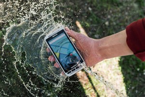
Photo: Handheld Group Handheld Group has launched the new Nautiz X2 enterprise handheld, which integrates a high-quality scanner, camera and mobile phone.
The rugged Nautiz X2, available now, can be used in challenging outdoor environments with moisture, dust, extreme temperatures and potential drops, the company says.
The Nautiz X2 features include:
- Computing power from a quad-core processor and Android 5.1 Lollipop OS.
- High-quality, high-speed scanners with 1D or 2D capability.
- An integrated camera with8-megapixel clarity, autofocus and flash.
- 4G/LTE Android phone functionality.
- Google GMS, which gives users access to Google Maps and Play Store apps.
- A sunlight-readable, 4.7-inch capacitive display with multi-touch sensitivity.
“The challenge in designing market-leading devices in a given product category is to balance key factors like technology, design, materials and general usability as well as keeping the cost in mind,” says Johan Hed, Handheld Group director of product management. “The brilliance of the Nautiz X2 is that it has that tangible in-the-hand sense of form and fit of a high-end technology device, and we are still able to offer it at an impressive value.”
The Nautiz X2 measures 150 millimeters by 73.5 millimeters, is 16 millimeters deep at the keyboard and weighs 230 grams.
It has an IP65 ingress protection rating against dust, sand and water immersion, the company says. The handleld also meets stringent MIL-STD-810G military test standards for overall durability and resistance to humidity, shock, vibrations, drop, salt and extreme temperatures, and the touchscreen is made of Gorilla Glass for durability.
-
GPS ground control making progress, but needs more money
The Pentagon is seeking an additional $39.2 million from Congress to help develop the United States Air Force’s next-generation GPS ground control system (OCX), reports Inside Defense. Without the additional funding, the OCX would be delayed an additional four months and cost $90 million more to complete, the Pentagon said.
The embattled OCX showed progress in its July 7 quarterly review, according to an Air Force statement. Acquisition Undersecretary Frank Kendall and Air Force Secretary Deborah Lee James — “with support of Lt. Gen. Samuel Greaves, Space and Missile Systems Center commander and Air Force program executive officer for Space — concluded Raytheon has made progress implementing these critical changes.”
On June 30, the Air Force declared a Nunn-McCurdy breach for its next-generation GPS control system. The declaration means that the U.S. Air Force notifies Congress that the program would exceed baseline cost estimates by at least 25 percent, triggering regimented cost control measures.
“Factors that led to the critical Nunn-McCurdy breach include inadequate systems engineering at program inception, Block 0 software with high defect rates and Block 1 designs requiring significant rework,” a statement from the Air Force said. “Additionally, the complexity of cybersecurity requirements on OCX and impact of those requirements on the development caused multiple delays. The corrective actions to resolve these problems took much longer than anticipated to implement.”
The program enters a review period led by Kendall, which is scheduled to conclude in October.
In December, Kendall did not rule out a re-compete, and the Pentagon announced it was delaying initial operations for the ground system until July 2021. The GPS III satellites cannot use their full capabilities with the current ground control systems, but the Air Force plans to use old ground systems retrofitted to work with the GPS III designs until the OCX is operational.
-
DOT conducts more testing for GPS adjacent band compatibility study
The Department of Transportation (DOT) is conducting additional testing of GPS/GNSS receivers this month as part of the DOT Adjacent Band Compatibility Study, according to a Federal Register notice.
The goal of the study is to evaluate the adjacent radio frequency band power levels that can be tolerated by GPS/GNSS receivers, and advance the DOT’s understanding of the extent to which such power levels impact devices used for transportation safety purposes, among other GPS/GNSS applications.
In April, radiated testing of GNSS devices took place in an anechoic chamber at the U.S. Army Research Laboratory at the White Sands Missile Range in New Mexico.
The study provides for testing categories of receivers that include aviation (non-certified), cellular, general location/navigation, high-precision and networks, timing and space-based receivers. Approximately 12 receivers, representing each of these receiver categories, will be selected for additional testing from those receivers tested in April.
More information on adjacent band compatibility can be found on the GPS.gov page.
-

senseFly mapping and survey UAVs come with Skyward safety tools
Skyward and senseFly are partnering to deliver a custom operations management software and consulting services package for senseFly aircraft.
The package, available for customers in North America through the senseFly distribution network or Skyward, gives operators a preconfigured Skyward account with senseFly flight log import, senseFly manuals, customized preflight checklists, and other information specific to senseFly operations.
These features are part of the Skyward drone operations management platform that includes up-to-date airspace information and tools to plan and log flight; manage personnel, equipment and flight hours; and meet regulatory reporting requirements.
Customers will also have access to a team of regulatory and drone operations experts and benefit from Skyward expertise to define their flight operations procedures and write related operating manuals.
“Ensuring the highest level of safety and ease of use has always been essential in the design of our lightweight drones,” said Jean Christophe Zufferey, senseFly CEO. “By providing easy access to Skyward, we are now extending this seamless experience toward operation and fleet management. Our professional customers will get an elegant and efficient way to keep up with the constantly evolving regulations, while making sure they operate their fleet of drones efficiently and in full compliance.”
Operators using Skyward and senseFly together are able to meet regulatory compliance and insurance requirements. The partnership will create an end-to-end solution that delivers professional results for drone operators in mapping, surveying, GIS, industrial inspection and agriculture.
“Businesses operate drones because they return value, and senseFly builds some of the best professional drones in the industry to provide that value,” said Jonathan Evans, Skyward CEO. “Many of our customers are flying eBee and albris drones already because, quite simply, they get the job done. We will continue to deepen the technical integration across our platforms to provide a seamless and elegant user experience for our joint users.”
Learn more about the partnership and join the waitlist.
The eBee drone by senseFly. -

Terrestrial beacons bring wide-area location indoors
Extraordinary though satellite navigation may be, GPS and other satellite-based constellations are limited when there is not a line-of-sight or near-line-of-sight path to at least three (and preferably more) satellites. These systems also do not provide sufficiently accurate and reliable altitude information for most applications, especially indoors. Finally, power consumption is an issue for user equipment.
It has been easy to overlook these limitations as the enormous benefits of GNSS have become pervasive, but the increasing demand especially for indoor geolocation now requires a robust solution designed for the indoors and urban canyons. Support for Terrestrial Beacon System (TBS) location technologies was incorporated in Release 13 of the Third Generation Partnership Project (3GPP). These technologies are complementary to GNSS, and provide a comprehensive solution to these limitations.
One of the TBS in development is the Metropolitan Beacon System (MBS) implementation by NextNav, which is the subject of this article. NextNav is deploying the first MBS network in the United States, using spectrum in the 920–928 MHz band, on licenses that cover about 98 percent of the U.S. urban population.
3GPP is the standards development organization for cellular wireless specifications, and is in part responsible for the popularization of GPS through its standardization in the 3GPP Release ’98 specifications. Release ’98 enabled wireless operators to adopt GPS and bring their economies of scale to GPS positioning.
Release 13 support has similar potential for MBS, enabling support for MBS in any Release 13-compliant LTE network throughout the world. As with the original standardization of GPS in 1999, incorporation of MBS in this release was driven primarily by the need for wireless carriers to provide accurate indoor geolocation for E911 calls.
MBS complements GPS by providing precise geolocation and timing indoors, in urban canyons, and other locations where GPS signals are either unreliable or unavailable. MBS receivers work seamlessly with GPS so they are as transparent to the user as satellite-based systems. MBS can provide floor-level altitude and navigation in indoor environments.

Typical mall experience: green dots show NextNav computed positions relative to ground truth (red line). How it works
MBS transmitters are similar in many respects to GPS satellites that are deployed terrestrially. Unlike communications systems, MBS is deployed with a view toward minimizing dilution of precision (DOP) so that the signals available at any indoor or outdoor location will meet the unique requirements for accurate geolocation. DOP is an indicator of the three-dimensional positioning accuracy of a radio positioning system’s signals as they are “viewed” by a receiver.
GPS signals are typically 30 dB below the thermal noise floor at the Earth’s surface, and thus GPS receivers require a significant amount of processing resources for acquisition and tracking. Acquisition time can be quite long, up to 12 minutes in the absence of almanac and ephemeris information. Modern commercial implementations with some assistance information is typically closer to 30 seconds.

Mall store accuracy tests depicting indoor tracking performance in suburban mall environment. Dots show MBS-drive information, with no additional data from inertial or other sensors. Throughout this time the receiver is running at full bore, drawing a considerable amount of current, the bane of any battery-operated device. MBS mitigates these problems because the 30-Watt radiated power of each terrestrially located transmitter combined with a satellite-like link budget provides greater received signal-to-noise ratio.
The result is an acquisition time without assistance information of 6 seconds or less, and 1 second if assistance information is available. The ease of acquiring and tracking MBS signals has significant implications for power draw and power management strategies.

Metropolitan beacon rooftop transmitter. Although deploying a wireless network of any kind is a complex endeavor, MBS benefits from the ability to cover an area using fewer beacons, thanks to its relatively high RF output power (but much lower than cellular signals) and robust processing gain.
The transmitters typically share space with existing cellular systems on towers and building rooftops and are compact. The antenna is typically a 5-foot, vertically mounted, omnidirectional element.
The system provides for redundancy at both the transmitter and network levels, and the signals are encrypted for security. Like GPS, location can be calculated by the user’s device.
Baseband Change. MBS was designed to be like another constellation on a multi-constellation GNSS processor, and primarily constitutes a firmware change to modern baseband designs. The primary receiver changes are related to the analog components (accommodation for a different frequency band and higher dynamic range).
Enabling MBS in a smartphone requires a few inexpensive passive components and slight modifications to the antenna. From an RF perspective, NextNav’s MBS operating frequency is sandwiched between bands currently used by wireless carriers, so few if any changes to a standard FR lineup is required.
Tackling cellular first
Most of the billions of mobile phones shipped every year incorporate GPS receivers. Because GPS does not work reliably inside a building, however, mobile devices must fall back to ad hoc positioning methods based on communications infrastructure. This has become increasingly important because mobile wireless devices are used predominately indoors at least 70 percent of the time, according to a study by J. D. Power and Associates. This makes reliable indoor geolocation essential for consumer, commercial and public safety interests.
The MBS architecture was designed to integrate into the GPS ecosystem and integrate organically within modern mobile devices, without the need for separate chips or elaborate reengineering.
The additional benefit of determining altitude along with horizontal position is also significant. Indoors, context is determined as much by the vertical as the horizontal — for example, in a multi-level shopping mall. In emergency-response scenarios, critical seconds or minutes can be shaved off of response time if the floor in which an emergency is occurring can be reliably determined.Control-plane architecture (LTE) for NextNav E2E. Power and the IoT. The Internet of Things offers substantial productivity gains. Nevertheless, there have been limitations to the rapid adoption of certain IoT technologies. Among these is a fierce battle among competing low-power wireless communication standards. Lower power operations are the key for many IoT implementations, and location is one area where power savings, especially for wide-area location, are critical.
While MBS is generally designed to complement GPS, in IoT operations it has the potential to replace GPS in some cases due to power savings available from the system. Due to its terrestrial nature, the MBS signal is much stronger than GPS, enabling significant power savings. Many applications are expected to be enabled by such a system, whether for very long-life applications with intermittent position reporting to always-on location (that is, persistent tracking). Location capabilities on wearable devices are also very desirable, but because of power constraints, provision of location through GPS has been difficult to realize.
The general benefits of a terrestrial constellation also apply to non-power-limited applications, especially in urban environments and those where altitude is a critical feature. Driverless cars and unmanned aerial systems, for example, rely on GPS but also need precise 3D location accuracy.

Vertical accuracy performance of mass-market devices. 
Another example of vertical accuracy performance of mass-market devices. Applications in 5G small cells
The fifth generation of carrier wireless, 5G represents another potentially significant application of MBS technology. Achieving 5G’s ambitious goals — standards are expected to be complete by 2019 — will require a massive infrastructure increase, including small base stations, or femtocells, that must be time-synchronized to avoid interfering with each other. A large percentage of these are expected to be deployed indoors.
This means wireless carriers, neutral hosts and other infrastructure operators will need to bring timing synchronization signals inside. This typically requires GPS receivers to be placed on rooftops with the received signal fed to multiple indoor locations by running cables throughout the facility.
To an operator in a metropolitan area with hundreds or even thousands of indoor small cells, this represents a large investment in capital equipment and limits customer-based installation. MBS can provide a timing signal that can be received indoors through the use of a modified multi-constellation GNSS chipset, a low-cost and convenient alternative.
Beyond cellular
The enablement of MBS in 3GPP has drawn attention from those seeking geolocation for a range of other devices. EF Johnson Technologies, a provider of radios and other equipment for public safety applications, demonstrated the integration of MBS in its Viking P25 (Project 25) radios. As P25 radios are the standard for mission-critical voice in the public safety community, the ability to carry MBS information could be a key feature for first responders.
Elder care, monitoring family members, security guards, assets, and hospitality employees: any application that experiences service limitations due to indoor lack of availability is a candidate to augment service with MBS service, or, if power is a very serious issue, simply rely on MBS alone.
Summary
MBS complements GNSS systems by providing indoor coverage, altitude positioning and lower power consumption. By leveraging the existing GNSS ecosystem, low-cost, high-volume receivers can be adopted and service become seamless among satellite and terrestrial systems.
Other indoor PNT technologies
The 2013 CSRIC Trials administered by the FCC also tested technologies from Qualcomm, Polaris Wireless and True Position.
GPS World plans to publish articles about these and other alternative technologies in upcoming issues.
-

Google to provide raw GNSS measurements
User location takes center stage in new Android OS
Raw GNSS measurements from Android phones. Yep, they are coming. At Google we have been working with our GNSS partners to give application developers access to raw GNSS measurements from a phone.
This is really exciting, and marks a new era for our GNSS community. At Google I/O in May, we announced that raw GNSS measurements are available to apps in the Android N operating system, which will be released later this year. This means you can get pseudoranges, Dopplers and carrier phase from a phone or tablet.
When can you get it? Well, it will take some time to proliferate throughout the ecosystem, but the first phone that will provide raw measurements will be the Nexus phone that we will launch later this year, and then next year you will see new Android handsets start to support it, as it will become a mandatory feature in Android.
Tutorial. At the Institute of Navigation’s ION-GNSS+ conference this September, Frank van Diggelen and I will teach a tutorial where you can learn to access and use these raw measurements. This will be a hands-on course where you collect, view and process raw measurements. You will leave the class with the data, Google software tools, and the knowledge of how to use them.
This tutorial is open only to ION-GNSS+ attendees. To register for the conference, visit www.ion.org/gnss/registration.cfm.
Then, to tailor this tutorial to your own needs, visit this online form and let us know what you’d like us to cover in the class.
The keynote presentation at Google I/O 2016, held May 12-20 at Shoreline Amphitheater in Mountain View, California. More from Google I/O
Finally, I’d like to give you some highlights from Google I/O, the annual developer-focused conference held by Google in the San Francisco Bay Area.
During the keynote, Google CEO Sundar Pichai made many references to location, context and places. This was really exciting to see. We are innovating and working on a lot. It is amazing, even to me, after more than 13 years in the field of location, arriving at Google just under two years ago, to see how location and a user’s context are at the center of our connected world.
At Google, we are exposing as much as we can to the ecosystem so that innovation can thrive around us.
Sundar Pichai’s keynote address shows that user’s location is at the center for the knowledge graphs that we are building.
Conversational examples were shown on Google Assistant and on how it can be used to get things done in the world. Sundar spoke on how location and context are the key to this future, noting that a user standing next to a famous sculpture can simply ask: “Who designed this?”
All Google I/O talks from the Android Location and Context Team can be found at these YouTube links :
