Author: GPS World Staff

  • Averna Introduces Portable, Multi-Channel RF Recorder for GNSS Applications

    Averna Introduces Portable, Multi-Channel RF Recorder for GNSS Applications

    Photo: Averna
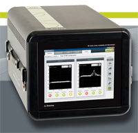
Averna, developer of test solutions and services for communications and electronics device makers, announces the availability of a field-ready multi-channel RF Recorder for RF applications covering 330 MHz to 2.5 GHz.

    The Averna RP-5300 RF Recorder is an advanced tool for both field testing and performance testing, Averna said. With 50 MHz of recording bandwidth at 16-bits, it can record multiple GNSS signals in up to two bands (L1, L2, L5), such as GPS or GLONASS. Its compact size and integrated display was designed for field operation.

    Wireless products need to perform well in the complicated and difficult-to-predict RF environments found in the real world. Simulators can bring the design up to a certain point in the development process, but Averna’s RF Recorder captures all the multi-path, interference and general degradation of signals that end-users will experience. Capturing the segment of spectrum of interest, from minutes to hours, allows a technician to return to the lab with data necessary to diagnose and solve the problem, while building a library of environments to harden their products for the future, Averna said.

    “Recording live, impaired, RF signals of interest in the field, without demodulation or alteration, reduces the need for traditional field-testing of RF receivers,” said Brendan Wolfe, director of product management at Averna. “We are thrilled to bring to the GNSS market a portable and high-fidelity multi-channel RF recorder designed for the optimal capture of real-life RF environments.”

    The RP-5300 comes preloaded with Averna’s RF Studio Recorder. RF Studio is workflow software for making trouble-free RF recordings, managing collected data, and analyzing or playing back collected RF environments. With RF Studio Recorder, the intended signals are captured during and after a recording session without the need for RF experts on site, Averna said.

    Key features include:

    • 50 MHz recording bandwidth to capture multi-GNSS signals
    • Two channels to capture signals operating at different frequencies
    • Up to 11 hours of recording time with external RAID (2×50 MHz channels @ 16-bit-depth)
    • Field-ready with an integrated touchscreen display, ruggedized chassis and compact size
    • Simple field setup, intuitive user interface and test-case profiles

    For customers interested in a complete solution of RF recording to playback, Averna recommends the Averna RP-5300 Series be paired with the Averna URT-5000, a world-class RF Player and Signal Generator.

  • 2012 CoreLogic Storm Surge Report Reveals more than 4 Million U.S. Homes at Risk

    CoreLogic released its annual Storm Surge Report detailing exposure of single-family homes to storm-surge damage within several predefined geographic areas in the United States. The 2012 CoreLogic Storm Surge Report provides the first-ever property-level analysis of residential property risk along the Atlantic and Gulf Coasts broken down by region and by individual state, in addition to a snapshot of risk within previously reported major metro areas.

    According to the announcement, this year’s report indicates that just over four million homes in the U.S. along the Atlantic and Gulf Coasts are at risk of hurricane-driven storm-surge damage, with more than $700 billion in total property exposure. In the Atlantic Coast region alone, there are approximately 2.2 million homes at risk, valued at more than $500 billion. Total exposure along the Gulf Coast is nearly $200 billion, with just under 1.8 million homes at risk for potential storm-surge damage.

    “Though more frequently impacted states like Florida, Texas and Louisiana get the most attention when it comes to hurricane vulnerability and destruction, Hurricane Irene made it very clear last summer that hurricane risk is not confined to the southern parts of the country,” said Dr. Howard Botts, vice president and director of database development for CoreLogic Spatial Solutions. “That’s why we felt it was important this year to highlight storm-surge risk in a brand new way to establish a better understanding of exposure throughout the states that are most at risk of a direct hurricane hit. As we got a glimpse of during Irene, our 2012 report shows even a Category 1 storm could cause property damage in the billions along the northeastern Atlantic Coast and force major metropolitan areas to shut down or evacuate.”

    CoreLogic reported they generated the Storm Surge Report using the company’s extensive database of parcels to identify the properties that fall within the perimeter of each category of the storm-surge inundation polygon. A parcel is the individual property associated with an address, and is the most granular way to analyze properties exposed to natural hazards. To determine residential exposure value, the proprietary CoreLogic storm-surge model was paired with the company’s industry-leading database of residential valuations for structures at the parcel level. CoreLogic identified every property contained within each category of the storm surge polygon and matched the structure valuation for each residence. Valuations for individual geographic areas were then totaled by hurricane category. The final results depict the value of the total residential properties as of April 2012 exposed to each potential storm surge event.

    A full list of all Core Based Statistical Areas (CBSAs) at risk for storm-surge damage, as well as the top ten zip code areas at risk associated with each CBSA, is available at http://www.corelogic.com/about-us/researchtrends/2012-storm-surge-cbsa-fact-tables.aspx. Maps detailing storm surge risk are also available for all CBSAs upon request.

    According to the announcement, CoreLogic developed the Storm Surge Report to enhance understanding of the additional risk that storm surge poses to homes located in areas prone to tropical storms.  Storm surge is triggered primarily by the high winds and low pressure associated with hurricanes, which cause water to amass inside a storm as it moves across the ocean before releasing as a powerful rush overland when the hurricane moves onshore.  In addition to the property damage and potential lives lost to flooding, the speed and force associated with storm-surge waves can significantly increase geographic and economic impact in hurricane disaster areas.

    “The data we compile is useful for insurance providers and financial services companies, to help them better understand potential exposure to damage for homes—particularly those that do not fall into designated FEMA Special Flood Hazard Areas,” said Botts.  “Homeowners who live outside of high risk flood zones are not required to carry flood insurance under the National Flood Insurance Program (NFIP), and may not be fully aware of the risk storm surge poses to their home or property.  When a storm strikes the coast, storm-surge flooding can inundate homes far inland and cause significant losses from powerful surge waters, damaging debris and standing water left behind.”

    According to the 2012 report, Florida tops the list of states with the highest total number of properties at risk of being impacted by the effects of storm-surge risk at approximately 1.4 million homes and with the highest total potential exposure to damage at more than $188 billion. Louisiana ranks second in total properties at risk with nearly 500,000, while New York is second in total value of coastal properties possibly exposed at $111 billion.  Differences in the rankings between the total number of properties and total property value at risk are due to varying levels of home values, trends in primary residence versus, vacation homes, and population density between the states throughout the Atlantic and Gulf regions.

    At the metro-level, cities examined in the analysis include New York, N.Y.; Virginia Beach, Va.; Miami, Fla.; New Orleans, La.; Tampa, Fla.; Boston, Mass.; Houston, Texas; Cape Coral, Fla.; Jacksonville, Fla.; Charleston, N.C.; Bradenton, Fla.; Philadelphia, Pa.; Mobile, Ala. and Corpus Christi, Texas. According to the U.S. Census Bureau, two of the top five and five of the top 20 most densely populated cities in the U.S. are located along either the Gulf or Atlantic Coast.  The report reveals that the 10 cities with the highest total potential exposure to storm-surge damage represent more than two million properties, with total property value at risk exceeding $420 billion.  The New York City metropolitan area, which encompasses northern New Jersey and Long Island as well, contains both the highest total number of properties as well as the highest financial exposure of properties at risk, with estimated values at more than $168 billion.

    “The summer of 2011 gave us some startling insight into the damage that even a weak storm can cause in the New York City metro area,” said Botts. “Hurricane Irene was downgraded to a tropical storm as it passed through New Jersey and New York City, but the impact of the storm was still estimated at as much as $6 billion.  Economic losses mounted swiftly as businesses shuttered, the New York City mass transit system came to a sudden halt and emergency response teams were called into action to prepare for the worst.”

    CoreLogic said it’s important to note is that the total properties and structural values included in the CoreLogic analysis are based on all homes that could potentially be damaged from hurricane-driven storm surge, and are not meant to infer that a single storm or storms in a specific hurricane season will result in these damage totals.

    This is the third annual CoreLogic Storm Surge Report. The report complements the Federal Emergency Management Agency (FEMA) flood zone information to provide a comprehensive picture of potential damage exposure at the property level, as many properties located outside designated flood zones are still at risk for storm-surge damage.

    To request storm surge data for a particular zip code, CBSA or county not detailed in the report, or for a complete copy of the 2012 CoreLogic Storm Surge Report, visit http://www.corelogic.com/about-us/researchtrends/2012-storm-surge-report.aspx.

  • Wright State Wins 2012 ION Robotic Lawn Mower Competition

    Wright State Wins 2012 ION Robotic Lawn Mower Competition


    Photo: The Institute of Navigation (ION)

    The Institute of Navigation (ION) announces that Wright State University won top prize at the ninth annual 2012 Robotic Lawn Mower Competition held May 31 – June 2 at Siebenthaler’s Beaver Valley Garden Center in Dayton, Ohio.

    Sponsored by the Institute of Navigation Satellite Division and the Air Force Research Laboratory (AFRL) Sensors Directorate, the ION Annual Robotic Lawn Mower Competition is a national event for college and university students, future engineers and problem solvers, that challenges them to design and operate a robotic, unmanned lawn mower using the art and science of navigation to rapidly and accurately mow a field of grass.

    Eleven teams participated during the three day competition, each using unique design approaches. Teams included students and faculty advisors from Auburn University, Auburn, Alabama; Case Western Reserve University, Cleveland, Ohio; University of Florida, Gainesville, Florida (two teams); California State University, Fullerton, Fullerton, California; Miami University, Oxford, Ohio; University of Michigan Dearborn, Dearborn, Michigan; University of North Florida, Jacksonville, Florida; Syracuse University, Syracuse, New York; Southern Polytechnic State University, Marietta, Georgia; and Wright State University, Dayton, Ohio.

    The 2012 ION Robotic Lawn Mower Competition consisted of two separate categories: Basic Autonomous Mowing (Static) and Advanced Autonomous Mowing (Dynamic). The teams were judged in each category based on their total scores; 80% of the total score was  based on the mowing competition and 20% of the total score was based on the presentation and report.

    First place in the advanced Dynamic Competition, with $15,000 in prize money, was awarded to Wright State University, Dayton, Ohio. Second place in the Dynamic Competition, with $10,000 in prize money, was awarded to Miami University, Oxford, Ohio. Third place in the Dynamic Competition, with $5,000 in prize money, was awarded to Case Western Reserve University, Cleveland, Ohio.

    First place in the beginning Static Competition was awarded to the California State University, Fullerton, California. Second place prize in the Static Competition was awarded to the Syracuse University, Syracuse, New York. Third place in the Static Competition was awarded to the University of Michigan, Dearborn, Dearborn, Michigan.

    In addition to The Institute of Navigation Satellite Division and the Air Force Research Laboratory, sponsors included Honeywell, John Deere, The Joint Services Data Exchange, Northrop Grumman and Siebenthaler’s Garden Center.

    The Tenth Annual ION Robotic Lawn Mower Competition will be held May 30 – June 1, 2013, in Dayton, Ohio.


  • NovAtel SAASM to See First Action in Aerial Drones

    The new OEM625S Selective Availability Anti-Spoofing Module (SAASM) GNSS receiver from NovAtel, launched in a cooperative effort with SAASM expert L-3 Interstate Electronics Corporation (IEC), will get its first applications in the unmanned aerial vehicle (UAV) sector. NovAtel has brought forth the new product in part to meet requirements of UAV manufacturers who are now mandated to have SAASM onboard as well, for in-theater operations in areas of military activity.

    “The new SAASM regulations meant that integrators were looking at having to incorporate another receiver alongside their NovAtel unit, complicating user interface factors and increasing onboard space requirements,” said NovAtel Product Manager Neil Gerein. “The OEM625S gives our customers a drop-in form factor that easily replaces their existing NovAtel OEM receiver.”

    “NovAtel has supplied UAV integrators on the civil scientific side almost since our inception,” Gerein said, adding, “the military has become more and more involved in this market in recent years for budget and various other strategic reasons.” He mentioned that in its 20-year history selling GPS products, for the last 17 years NovAtel has provided receivers and expertise to U.S. and Canada defense contractors, and to defense research labs in Allied countries. Antcom, a wholly-owned NovAtel subsidiary specializing in antennas and microwave products, makes the majority of its sales into military areas.

    Examples of such products in this area — not necessarily from NovAtel customers, who remain unidentified — include hand-launched mini-UAVs like the Aerovironment RQ-11 Raven and Elbit Skylark I, and runway-capable tactical UAVs such as Textron RQ-7 Shadow, Aeronautics DS Aerostar, IAI Searcher II, and InSitu’s ScanEagle UAV system, quickly evolving into a mainstay with the U.S. Navy and its allies thanks to a partnership with Boeing.

    The InSitu ScanEagle was first developed to track dolphins and tuna from fishing boats, to ensure that fish labeled “dolphin-safe” actually are so. The same characteristics needed by commercial fishing boats — low infrastructure launch and recovery, small size, 20-hour long endurance, automated flight patterns — are key for naval operations from larger vessels, and for battlefield surveillance.

    At present the OEM625S, combining a commercial dual-frequency NovAtel GNSS receiver with an L-3 IEC XFACTOR SAASM, provides single-point positioning with SAASM for authorized defense customers. The SAASM position is provided via a dedicated communication port, as well as through NovAtel’s software command protocol, allowing for maximum flexibility. The small form factor and low power consumption expands range of potential defense applications requiring robust SAASM GPS positioning.

    The OEM625S measures 60 x 100 x 9.1 millimeters, and runs on field-upgradeable software. NovAtel will accept orders for the OEM625S from authorized customers starting in Q3 2012.

  • INTERGEO 2012: Cloud Computing will Dominate the GIS Environment

    INTERGEO 2012, which is taking place October 9-12 in Hanover, Germany, announced the conference will show that the key topics at INTERGEO, such as capturing, processing, archiving and presenting data can be made available on an entirely new basis using cloud computing. Accessing geoinformation systems (GIS) via the cloud unlocks a whole new range of uses and makes them more accessible to new user groups who have found existing solutions too complex and ultimately too expensive.

    Otmar Didinger, President of the Rheinland-Pfalz Regional Authority for Surveying and Geoinformation, on how the cloud can benefit users: “It solves the issue of how they can access information without having to worry about where it is located.” Didinger cites WebAtlasDE. As part of this national pilot project, the Regional Surveying Authorities in Germany are providing access to their geodata. Merged into a single standardised national inventory, this geodata forms the basis of a web service. Similar to Google Maps, users surf a map that covers the whole of Germany and is based largely on the very latest official data, presented in a more professional format. Authorities, companies and citizens can access the store of geodata at WebAtlasDE (e.g. via www.geoportal.de) and combine it with their own information. This creates an excellent basis for making a whole range of decisions relating to everything from infrastructure management to sales campaigns.

    According to the announcement, Johannes Schöniger was the man responsible for the ambitious aim of making a high-performance IT system – a cloud solution – available in a short space of time. As Strategic Account Director Geoinformation Germany at Fujitsu Technology Solutions GmbH, he was certain of one thing in particular: “Cloud Computing is a pioneering and sustainable operator model. Just as with geoinformation, it’s no longer a question of whether or not we want cloud computing. Instead, we have to choose whether to actively engage with it and look to the future or not. If we do, we can ride the wave, if we don’t, it will come crashing down on us sooner or later.” Schöniger is in no doubt: “Cloud computing will dominate the GIS environment over the coming years.”

  • JPL Team Uses GPS for Tsunami Early Warning


    Led by Dr. Attila Komjathy, who received his Ph.D. from the University of New Brunswick in 1997, a team from NASA’s Jet Propulsion Laboratory has demonstrated a technique that has the potential to significantly improve tsunami monitoring and warning.

    The technique uses data from multiple Global Positioning System receivers on the ground to measure small perturbations in the ionosphere’s electron density caused by a tsunami.

    The changing sea level of a tsunami, even far from a coast, generates waves in the atmosphere that make it all the way up to the ionosphere, some 350 kilometres or so above the sea surface. Here, they disturb the electrons that affect the propagation of GPS signals. The disturbance is so small that ordinary GPS receivers do not notice the passage of the waves. However, with advanced software processing of the data collected by specialized receivers used, for example, by surveyors and geodesists, the waves can be visualized and used to track the progress of the tsunami.

    The JPL team has dramatically demonstrated their technique for the devastating tsunami associated with last year’s massive offshore Japanese earthquake. They used data from the more than 1,000 receivers of Japan’s permanent GPS monitoring network. The propagating ionospheric waves can be clearly seen in a video the team has posted to YouTube.

    The video can also be downloaded from the GGE website.

    An earlier report on NASA’s tsunami-detection work can be found here.

    NASA is investing in research to obtain real-time GPS measurements from around the world so that researchers can integrate this technology into a global tsunami warning system. Additional potential applications might include the remote sensing of ionospheric perturbations generated by other natural hazards such as earthquakes and volcanic eruptions and human-made events such as nuclear tests.

    Dr. Komjathy was one of the first to investigate the use of GPS signals to study the ionosphere. His pioneering Ph.D. research under Prof. Richard Langley was awarded a Gold Medal from the Governor General of Canada.

  • TomTom and Nike Launch New Range of the Nike+ Sportwatch

    TomTom and Nike Launch New Range of the Nike+ Sportwatch

    Photo: Nike

    TomTom and Nike today unveil a new range of the Nike+ Sportwatch, coinciding with the launch of a brand new Nike+ website www.nikeplus.com. The range includes several editions and color combinations, and introduces a starter product for those new to running.

    Whether they own an original or new edition, all Nike+ Sportwatch users can now access Nike’s intelligent measure of athletic ability, Nikefuel. This converts a runner’s mileage into universal units that measure movements in a wide variety of different sports. As a result, it’s easy for people to compare their performance against that of athletes in other sports, and share their achievements with friends, the companies said.

    “Our extended range of products will be very useful to those adding running into their exercise regime. And the new NikeFuel measurement brings added motivation, allowing people to share and compare their performance with friends in other sports,” says Corinne Vigreux, managing director, TomTom.

    The new Nike+ Sportwatch colors have been chosen to match Nike’s apparel and shoe ranges. They include black/anthracite, anthracite/blue glow, and high-impact volt green. The anthracite/blue glow edition is available as a starter product, priced at €149.

  • GeoEye to Receive Payment of $111 Million from the National Geospatial Intelligence Agency

    GeoEye, Inc. announced that it has successfully passed a major milestone for the development of the GeoEye-2 satellite under the EnhancedView program. GeoEye’s completion of this milestone triggers the $111 million cost-share payment from the National Geospatial-Intelligence Agency (NGA).

    GeoEye reports that this critical milestone demonstrates the company’s capabilities to meet all of the U.S. government’s EnhancedView program requirements, on time and under this firm-fixed-price contract.

    Matt O’Connell, GeoEye’s CEO and president, said, “This is a terrific achievement by our team and a great confirmation of our strong partnership with the NGA, especially during these uncertain economic times. We look forward to providing the NGA with the highest resolution color imagery from GeoEye-2, which will be an important long-term security asset to the DoD and the intelligence agencies of the United States.”
    “GeoEye-2, designed and built by Lockheed Martin Space Systems, includes market-leading technology features, such as robust tasking capabilities, faster imagery collection rates and a new state-of-the-art, ITT Exelis Geospatial Systems camera,” said Carl Alleyne, GeoEye’s vice president of Engineering.
  • Intergraph Showcases New Spatial Modeling Technology at Hexagon 2012

    At this week’s Hexagon 2012, Intergraph announced it is showcasing the exciting capabilities of ERDAS Imagine’s next-generation Spatial Modeler. This revolutionary technology provides a unique environment for the creation of solutions, combining ERDAS Imagine’s processing capabilities with the powerful vector analysis functionality of GeoMedia.


    According to the announcement, ERDAS Imagine’s existing spatial modeling capabilities enable you to graphically create models of complex raster imagery processing workflows. Those with less domain knowledge can easily execute the models to obtain the same accurate, reliable results as more expert users. By reducing training time and helping automate complicated workflows, the ability to process imagery using automated spatial models has become a quintessential feature for many customers.

    Integraph reports that the new spatial modeling framework expands this proven technology by providing full extensibility and true interoperability with other systems, enabling you to construct complete geoprocessing workflows. You can also enhance existing solutions with the spatial modeling technology, allowing you to add new types and operations, providing full extensibility.

    “Integrated within a new graphical user interface and extensible through third-party scripting environments such as Python, the next-generation spatial modeling capability will support desktop and on-demand enterprise geoprocessing,” said Mladen Stojic, Vice President – Geospatial, Intergraph. “With this new capability, GIS modeling with vector operators meets image processing with raster operators, all within one graphical environment. This is all based an open and commonly accepted scripting environment, brought to you by a single company.”

    The new spatial modeling framework offers the option of creating models graphically using drag-and-drop components or through widely used Python scripting. To learn more, please visit http://www.intergraph.com/geospatial

  • Intermap Introduces NEXTMap World 30

    Intermap announced the release of NEXTMap World 30, the first and only commercial 3D terrain product to provide seamless, void free coverage, with a 30 meter ground sampling distance, across the entire 150 million square kilometers of the Earth’s surface.

    According to the announcement, satellite images provide 2D datasets, which are not always sufficient for business planning purposes or government feasibility studies. Filling the void for accurate and reliable height data, Intermap’s NEXTMap World 30 offers the most comprehensive digital surface models for the entire world. The NEXTMap World 30 dataset can benefit planners in multiple industries including telecommunications, energy, agriculture, risk planning, water management, topographic mapping, military and a host of government services.

    Intermap reports the key benefits of NEXTMap World 30 include:

    • Accurate: NEXTMap World 30 aggregates data from ASTER, SRTM and GTOPO using worldwide control, combined with Intermap’s proprietary data fusion technology, to create the most seamless, void-filled and consistent dataset with accuracies starting at 5 meters.
    • Comprehensive: Other products available in the market offer up to only 30 percent of the Earth’s surface. With NEXTMap World 30, customers have available to them 100 percent coverage of the earth’s surface. The combination of photogrammetry, interferometry and LiDAR technologies provides the most detailed and current elevations of the entire Earth.
    • Affordable: NEXTMap World 30 pricing can be as low as $0.01 per square kilometer.
    • Updated: NEXTMap World 30 is regularly enhanced with the very latest and best elevation data. Under the NEXTMap Maintenance program, customers can enjoy regular NEXTMap World 30 updates automatically.
    • Flexible: NEXTMap World 30 is ideal for applications such as image orthorectification, line-of-sight calculations, feature extraction and topographic map development, flood risk management, infrastructure planning, precision farming, emergency response and 3D visualization.

    “The availability of Intermap’s NEXTMap World 30 product will have a tremendous impact on plantation planning and management,” said LF Lee, Managing Director, Agribusiness Publishing Sdn Bhd, in Malaysia. “In the plantation industry, for example, knowledge of land elevation and bare ground or terrain elevations is essential to identifying and screening out unsuitable areas initially; and for planning of infrastructures, land conservation measures and drainage requirements later on. Unfortunately, most developing countries—where plantation projects are usually located—only have access to topographic sheets with wide contour intervals of dubious reliability.”

    “Intermap’s new NEXTMap World 30 data will definitely fill the void for accurate and reliable height data,” said Perry Mandeville, President of PT Earthline in Jakarta, Indonesia. “With Asia growing so quickly, there is a need for quality 3D geospatial information that 2D satellite images cannot provide.”

    “NEXTMap World 30 is an excellent way for governments and commercial enterprises to cost-effectively perform their important elevation work,” said Todd Oseth, Intermap president and CEO. “We’re looking forward to bringing the benefits of NEXTMap World 30 to customers and partners everywhere.”


  • Intuicom Introduces Rugged MCR-900 900MHz Transceiver for RTK

    Photo: Intuicom Inc.

    Intuicom Inc. announced the MCR-900 to help increase productivity by extending the reach of wireless communications. Utilizing superior frequency hopping spread spectrum (FHSS) technology, the MCR-900 provides long-range data transport with continuous throughput of 115 Kbps. The MCR-900 offers the capability and flexibility to meet a variety of wireless networking challenges.

    According to the announcement, designed for broad functionality, the MCR- 900 offers the flexibility to serve in simple point to point communication or in more complex multipoint and IP-bridged networks. For example, when combined with the Intuicom RTK Bridge™-C, the MCR-900 provides a way to extend the reach of RTK corrections far beyond normal cellular coverage. This application will enable precision applications such as farming, survey, and construction that use GPS/GNSS-based RTK corrections to work in areas where it would otherwise be impossible.
    “The MCR-900 has been tested in the most extreme environments and continues to run day in and day out.  It fits in perfectly with our overall Machine Control portfolio at Leica Geosystems and we’re proud to offer it to our customers,” said Nick Guadagnoli, OEM Business Development Manager for Leica Geosystems Machine Control Division.
  • Location-Sharing App Glympse to Be Put in Mercedes A-Class

    Today from the Detroit Telematics Conference, location-sharing app maker Glympse announced it is teaming up with Mercedes-Benz to give users real-time location sharing in their cars by integrating Glympse into the new Mercedes-Benz A-Class.

    Drivers will be able to use the in-dash Mercedes DriveStyle to select a recipient, set a timer, and “send a Glympse” to anyone they choose. The recipient of the Glympse will receive a text or email link, which will show the driver’s real-time location on an interactive map.

    Consistent with Glympse’s approach to location sharing, when the timer expires, the location sharing will automatically stop. Because Glympse is a universal sharing solution, the recipient doesn’t require any special software or device, just a web browser.

    With its smart phone apps, Glympse shares location with others in real time. Users on iPhone, Android, Blackberry, and Windows phones can send a Glympse to others via email, SMS, Facebook, or Twitter. Now, that functionality is being integrated right into the A-Class.