Author: GPS World Staff

  • Korea will launch its own satellite positioning system

    Korea will build its own navigation satellite system by 2034, providing independent positioning and navigation signals over an area spanning a 1,000-kilometer radius from the country’s capital, Seoul.

    The Ministry of Science and information and communications technology (ICT) announced that it would finalize a plan for the Korean Positioning System (KPS) at a Space Committee meeting on Feb. 5.

    According to a preliminary statement from the Ministry of Science and ICT, the KPS initiative will develop a ground test in 2021, core satellite navigation technology by 2022 and begin actual satellite production in 2024. The system will comprise a total of seven navigation satellites, three of them geostationary above the Korean Peninsula.

    Figure from the 2016 paper shows a conceptual view of real-time WADGPS operation. The reference station transmits observation data at 1 Hz frequency to the master station. The master station is operated in real time and creates correction information and basic integrity information thereby configuring a message. A message is sent to the satellite communication simulation device according to its own transmission protocol. The satellite communication simulation device performs broadcasting of WADGPS correction information into the L1 band. A message created in every sec is coded with reserved GPS PRN C/A code and modulated with L1 frequency. Since additional correction information transmission medium such as geostationary orbit satellite or pseudolite is not considered in this study, radio frequency (RF) signals are created using simulation devices and performance was verified while connecting the signal with user receivers via cable. Additionally, a commercial communication network was used to transfer correction messages in order to verify user performance, which is located remotely. (Image: Korean Journal of Positioning, Navigation, and Timing)
    Figure from the 2016 paper shows a conceptual view of real-time WADGPS operation. The reference station transmits observation data at 1 Hz frequency to the master station. The master station is operated in real time and creates correction information and basic integrity information thereby configuring a message. A message is sent to the satellite communication simulation device according to its own transmission protocol. The satellite communication simulation device performs broadcasting of WADGPS correction information into the L1 band. A message created in every sec is coded with reserved GPS PRN C/A code and modulated with L1 frequency. Since additional correction information transmission medium such as geostationary orbit satellite or pseudolite is not considered in this study, radio frequency (RF) signals are created using simulation devices and performance was verified while connecting the signal with user receivers via cable. Additionally, a commercial communication network was used to transfer correction messages in order to verify user performance, which is located remotely. (Image: Korean Journal of Positioning, Navigation, and Timing)

    Korea currently relies on the U.S. GPS system, which has suffered repeated local area jamming emanating from North Korea.

    “As the GPS becomes a necessity in everyday life, broken signals for any reason can set off a nationwide chaos,” said an official for satellite navigation at the Korea Aerospace Research Institute (KARI).

    Officials stated the the KPS will also improve  available un-aided accuracy of GPS in its service area from about 10 meters now to less than one meter.

    “Advanced nations are trying to secure strong GPS capabilities by sending up satellites to prevent a chaos that can take place while they depend on other nations’ satellites,” stated the KARI spokesperson.

    The initiative appears to be separate from the Korean Wide Area Differential GPS System, whose development was the subject of a 2011 paper presented at the Institute of Navigation (ION) International Technical Meeting. The abstract for that paper stated:

    “[The] project is scheduled for 2010 to 2014 under the contract with the Ministry of Land, Transport and Maritime affairs (MLTM). After that, Korea will launch a geostationary multifunctional satellite with a navigation payload which will be broadcasting augmenting signals for GPS.”

    In March 2016, the Korean Journal of Positioning, Navigation, and Timing published a paper titled “Performance Analysis of WADGPS System for Improving Positioning Accuracy,” by Hyoungmin So , Jaegyu Jang, Kihoon Lee, unpyo Park and Kiwon Song. Its conclusion section stated:

    “In this paper, configuration of observation reference stations and master station and initial experiment results were presented to verify accuracy correction performance of the WADGPS. The wide area correction algorithm was implemented using eight reference stations and one master station. For the initial performance verification, static and dynamic experiments were conducted. The experiment result showed that the static experiment had a horizontal accuracy performance with a level of 1 m (95 percent). In the dynamic experiment using a vehicle, performance degradation occurred compared to that of static experiment. The reason for this was due to the measured value error at the user receiver caused by multipath and visibility limitation. In summary, the implementation and performance of the algorithm of early stage were verified. For the future study, user operation characteristics will be considered and additional performance analysis on created correction information will be conducted.”

  • U.S. Air Force jamming GPS in Southwest sky this week and next

    The U.S. Air Force is intermittently jamming its own GPS signals over southern Nevada and Utah this week and next as part of a massive air-to-air combat training exercise, Red Flag 18-1, based out of Nellis Air Force Base in Nevada. The jamming aims to challenge aircrews and their weaponry under realistic fighting conditions. The Air Force has warned that navigation systems including those found in commercial flights may be disrupted or jammed completely across the southwest U.S. during that time, ending February 16. So far no major commercial airline disruptions, flight delays or re-routings have been reported.

    The U.S. military, heavily and perhaps overly reliant on GPS, is developing a range of position, navigation, and timing (PNT) technologies being to help overcome the loss of GPS during combat, an increasingly likely scenario now and in years to come. Some have speculated that this year’s exercise specifically has in mind a possible conflict on the Korean Penisula. GPS jamming has regularly emanated from North Korea over the past several years.

    “We’re trying a few new and different things with Red Flag 18-1,” said Col Michael Mathes, 414th Combat Training Squadron commander. “This primarily is a strike package focused training venue that we integrate at a command and control level in support of joint task force operations. It’s a lot of words to say that we integrate every capability we can into strike operations that are flown out of Nellis Air Force Base.”

    The exercise, which the Air Force conducts annually, typically involves a variety of attack, fighter and bomber aircraft with added participation from the U.S. Navy, U.S. Army, Marine Corps, Royal Australian Air Force and Royal Air Force. This year’s Red Flag is the largest in the exercise’s 42 year history.

    Nellis Air Force Base in southern Nevada. (Image: USAF)
    Nellis Air Force Base in southern Nevada. (Image: USAF)

    Affected Areas. “Arrivals and departures from airports within the Las Vegas area may be issued non-Rnav re-routes with the possibility of increased traffic disruption near LAS requiring airborne re-routes to the south and east of the affected area,” stated an Air Force bulletin. “Aircraft operating in Los Angeles (ZLA) center airspace may experience navigational disruption, including suspension of Descend-via and Climb-via procedures. Non-Rnav SIDs and STARs may be issued within ZLA airspace in the event of increased navigational disruption. Crews should expect the possibility of airborne mile-in-trail and departure mile-in-trail traffic management initiatives.”

    Alternate Capabilities. Many Air Force planes have onboard inertial navigation systems, using accelerometers, gyroscopes, and magnetic sensors to continuously calculate position without GPS signal data, as well as at a higher hertz rate. When available, GPS signals can be used to correct inertial calculations, which tend to drift over time. Fighter planes can also use AESA-scanned array radars teamed with an inertial system for navigation over short ranges. Aircraft electro-optical and infrared sensors can also read terrain over short distances to provide additional navigation.

    If strike aircraft have reliable communications or datalinks, other aircraft such as E-8 JSTARS, flying outside the GPS-disrupted zone, may be able to relay position and targeting information. Some missiles carried by strike aircraft have laser-guiding instead of or in addition to GPS-guiding.


  • Mobile device monitors fieldworkers in dangerous conditions

    Mobile device monitors fieldworkers in dangerous conditions

    Winter weather can make fieldwork more dangerous. If a worker falls off a structure, becomes trapped or is otherwise incapacitated, in a remote location or working alone, he or she could be without aid for hours.

    The Mobile Defender Model-S (MD-S) by SecuraTrac is designed to monitor field workers and provide alerts to keep them safe. It provides global GPS services and is able to withstand extreme conditions and uses.

    In an emergency situation, taking out a cell phone or tablet to make a call or send a message is not always possible.

    The MD-S monitors worker status and can immediately call for help if a problem is detected. The worker can also press a button to be connected to responders.

    The MD-S features SecuraTrac’s new fall advisory capability and more than 30 days of battery life on a single charge, the company said.

  • Launchpad: Spoofer detection for surveyors

    OEM

    RF front-end board

    7-channel multi-GNSS multi-band for software-defined receiver

    The NT1065/66_USB3 multi-channel GNSS RF front-end board is based on NTLab’s RF ICs: NT1065 (four channels for GPS / GLONASS / Galileo / BeiDou / IRNSS / QZSS, L1/L2/L3/L5 bands) and new NT1066 (two channels for all previously mentioned GNSS signals, plus one extra-channel for IRNSS S-band). The board supports USB3 connection, allowing users to process captured satellite signals on a PC or DSP platform. The board is accompanied by comprehensive software and manuals. Features include six channels for L1/L2/L3/L5-band signals + one channel for S-band signals simultaneous reception; up to four coherent channels; IF bandwidth up to 32 MHz; acquisition of wideband signals up to 64 MHz (such as Galileo E5) by two coherent channels; USB3 interface (up to 800 Mbit/s); ability to connect four x CRPA. NTLab offers an academic discount program for universities, colleges and institutes, allowing them to purchase this powerful research tool with significant savings.

    NTLab, www.ntlab.com

    GNSS OEM RTK boards

    With rover radio for wireless applications

    Three new Tersus GNSS HRS kits feature high-precision BX305, BX306 and BX316 GNSS RTK boards. The kits consist of RTK receivers, GNSS antennas, RS05R radio station modems, radio station antennas, and related cables and converters. Embedded in the receivers are the Tersus RTK boards. They are compact-design, energy-efficient, centimeter-level accurate GNSS real-time kinematic (RTK) boards that bring high-precision positioning accuracy to the market. Different from the standard BX305/306/316 GNSS kits, the new HRS versions are equipped with the RS05R lightweight and robust UHF rover radio for wireless applications. It provides reliable data communication for demanding conditions that require a combination of stability, high performance and long-range operation. The kits can be used in a variety of applications, such as unmanned aerial vehicles (UAVs), surveying, mapping, precision agriculture, construction engineering and deformation monitoring.

    Tersus GNSS, www.tersus-gnss.com

    SURVEY & MAPPING

    Spoofer detection

    Spoofing alerts for surveyors

    Spoofer detection is now available on all JAVAD GNSS original equipment manufacturer (OEM) boards. When a receiver equipped with a JAVAD board detects more than one correlation peak for any PRN code, it warns the user of the presence of spoofing (false signals) and identifies the spoofed satellites. The receivers then switch to other signals and sensors that are not being spoofed to maintain accurate positioning. The user can also employ the receiver to try to identify the direction from which the spoofing signals are originating.

    JAVAD GNSS, www.javad.com

    Laser scanner

    Scanning range reaches 1 kilometer

    The ScanStation P50 combines all the features of the P40 plus a longer range scanning capability of more than 1 kilometer. The rugged, versatile laser scanner enables professionals to 3D capture at great distances with angular accuracy paired with low-range noise and survey-grade dual-axis compensation. The ScanStation P50 opens new business opportunities for reality-capture professionals, helping them to scan what was previously unreachable such as big mine pits, long bridges, dams and skyscrapers. With its range, the P50 enables users to scan any tall or wide infrastructure or dangerous sites from a remote and safe position. This newest member of the P-Series provides the highest quality 3D data and high-dynamic range (HDR) imaging at an extremely fast scan rate of up to 1 million points per second and ranges of more than 1 kilometer.

    Leica Geosystems, leica-geosystems.com

    TRANSPORTATION

    Smartphone data analysis

    Integrates gamification and real-time data

    Azuga FleetMobile: Standalone Smartphone Edition (SSE) is a smartphone-based solution for driver behavior monitoring, mobile timecard management and GPS tracking. Azuga FleetMobile SSE leverages data analysis components of the original Azuga FleetMobile application, including driver behavior monitoring, location-based timestamps for timecards, gamification and driver rewards, without requiring separate hardware installation via a vehicle’s OBD port. Azuga’s GPS fleet-tracking offerings feature a driver rewards program to help fleets reduce accidents by up to 70 percent. The standalone application, which works on both Android and iOS smartphones, integrates gamification and real-time data to encourage self-coaching and healthy competition. Azuga’s data science team can then leverage information about driving behaviors and combine them with route patterns, fleets’ vehicle health information and environmental factors to identify opportunities for performance improvements in fleet operations.

    Azuga, azuga.com

    Vehicle tracker

    Able to receive MobileEye ADAS alerts

    The RIFA series of full-featured GPS trackers have built-in gyro and G-sensors, and supports OBDII and J1939 protocols. In addition to 4G/3G communication, it provides options to use low-power wide-area networks (LPWAN) such as NB-IOT or LoRa, which can reduce communication costs significantly. The unique CAN-to-ADR (automotive dead reckoning) function provides accurate positioning in situations of weak GPS signals, such as driving in tunnels, indoor parking facilities, urban canyons or when GPS signal obstruction hinders positioning, without additional cabling for wheel speed input.

    Antzer Tech, www.antzer-tech.com

    UAV

    Thermal imaging payloads

    Ethernet/IP-Based connectivity

    The ThermalCapture IRnet provides an Ethernet interface for live data streaming to new and existing FLIR Tau 2 drone cores and FLIR Vue Pro/R cores. The market has increased its demand for connectivity by Ethernet, with professional drone manufacturers choosing Ethernet for communication on board UAVs. The ThermalCapture IRnet allows for real-time access via Ethernet while recording radiometric data to microSD, bringing real-time access in drone flight operations to thermal imaging data. It stores the full 14-bit radiometric thermal data on a microSD card. Real-time access remains available while radiometric data are being recorded; operators can also control the camera and settings via Ethernet. Using Ethernet also offers data privacy.

    TeAx, thermalcapture.com

    Airborne lidar mapping

    Centimeter-level accuracy for 3D mapping products

    The Think 3D Stormbee multicopter integrated with Trimble’s AP15 provides efficiency, accuracy and performance for lidar surveys from unmanned vehicles. The Stormbee is a directly georeferenced UAV lidar solution for 3D industrial mapping applications, designed to collect survey-grade spatial data more cost effectively and efficiently than static lidar. Stormbee’s 3D mapping technologies include Faro’s Focus 130 laser scanner, Trimble’s AP15 high-performance GNSS/inertial receiver, Applanix’s POSPac UAV GNSS/inertial post-processing software and Stormbee Beeflex software for lidar point-cloud generation. By using the high-performance Trimble AP15 with two antennas and the Applanix post-processing software (POSPac MMS) for georeferencing the lidar data, Stormbee provides an accurate real-time and post-mission solution for all motion variables.

    Think 3D, think3d.be

    Applanix, applanix.com

  • Aerial imagery assists telecom service providers

    Providing high-speed internet access to businesses and residences is a highly active and expanding field. It closely involves geographic information systems (GIS) to efficiently achieve fiber to the home (FTTH) or fiber to the premises (FTTP), the installation and use of optical fiber from a central point directly to individual buildings such as residences, apartment buildings and businesses for high-speed internet access.

    A free webinar on Jan. 18 will cover — among several other related topics — the integration of high-accuracy aerial imagery into this process. David K. Nelson, GISP, a GIS manager in telecommunications for Black & Veatch, will make the presentation. It will be complemented by a talk on how to “Plan Virtually, Manage Efficiently with High-Definition (HD) Aerial Maps” by imagery provider Nearmap, and one on use of HD aerial imagery for city storm-water management.

    Photo: Black & Veatch
    David Nelson, GIS manager, telecom, for Black & Veatch

    Nelson is responsible for developing GIS solutions for projects with the Black & Veatch’s telecommunications division. With over 13 years of experience in public and private sectors, Nelson is a visionary for adopting and enabling geospatial technologies and location content that drive operational efficiency. His presentation will cover such topics as GIS-centric approach for all projects; file-based vs. data-based transition; geospatial archives of all data; and integration with other technology platforms.

    In a case study, he will take webinar attendees through a FTTH project design and execution example.

    Black & Veatch is an engineering, consulting and construction company with more than 100 offices worldwide, specializing in infrastructure development in power, oil and gas, water, telecommunications, government, mining, data centers, smart cities and banking and finance markets.

    FTTH project: fiber to the home. (Image: Black & Veatch)
    FTTH project: fiber to the home. (Image: Black & Veatch)

    The annual Black & Veatch Strategic Directions: Smart Cities & Utilities Report explores progress made across the smart city and smart utility landscape. This year’s report examines how modern, digital infrastructure is being used to optimize operations and create a sustainable future for our cities and utilities.

    “From urban mobility to the proliferation of electric vehicles, transportation is changing rapidly, inviting opportunity in how people and goods move across cities. The next generation of wireless technology is upon us, further encouraging connectivity and enabling smart cities in myriad ways. Grid modernization continues as utilities work to create a customer-centric grid through a combination of smart devices, distributed energy and communications.”

    Read more about the free webinar: “Truth on the Ground is Best Seen from the Air: How aerial imagery is propelling government and commercial organizations to higher levels of operational efficiency.”

    Advances in aerial imagery including high-resolution maps and a streamlined process to capture, manage and deliver imagery in the cloud is transforming the way governments and businesses operate. With Aerial photography and instant access to current 2.8-in. GSD aerial views, Black and Veatch has increased efficiency in their telecommunications projects including assessment of ground conditions, construction and asset management. In Indiana, The City of Carmel’s Engineering Department has applied aerial imagery to enhance planning, operations and storm water management.

    In this webinar, you will:

    • Learn about the latest advances in aerial imagery including how imagery is supporting a variety of government and business applications today
    • See real-world use cases of imagery in telecommunication, engineering and city government to improve operational efficiency
    • Understand how imagery can be used standalone and within GIS and CAD products
    • See the latest demos of Nearmap imagery including vertical, panorama and oblique views


  • How GIS — and you — can aid in disaster response

    Whether you are on the helping end of a disaster aiding in the rescue and recovery, or on the receiving end being aided, GIS is supercharging the rescue efforts.

    How can I help you if I don’t know where you are?

    Hurricane Harvey hits. The storm was worsening. Winds were sustained at over 120 mph. Landfall of Hurricane Harvey was expected in 48 hours. Worse, the storm was forecast to stall once overland creating the single worst rain event in United States history.

    Texas Governor Greg Abbott  encouraged people to evacuate, especially those in low lying areas. Mayor Turner had only hours to decide the possible fate of millions. Making the call not to evacuate a category 4 hurricane approaching the city could be political suicide. Consider the fallout after Hurricane Katrina. The models clearly showed the extent of flooding and how many people would be trapped in their cars on flooded roads.

    “You cannot put 6.5 million people on the road,” said Houston Mayor Sylvester Turner. The mayor’s ultimate decision not to issue an evacuation declaration was based on geospatial models, and as devastating as they were, it showed a better outcome if everyone stocked up, stayed put, and helped each other out after the storm. At least by staying home we will know where people are after the storm.

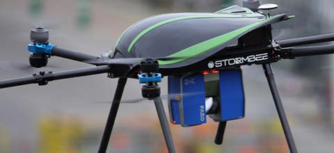
    Gov. Abbott fully mobilized the National Guard and another 30 state agencies responded to the crisis. U.S. Federal Emergency Management Agency (FEMA) calls to action went out to the Coast Guard and volunteer organizations. Small boats, raised axel trucks and Vietnam-era looking personnel carriers were brought in for support, along with helicopters, drones and search and rescue airplanes.

    First responders were issued full body waders and foul weather gear. Thousands of hypothermia blankets were stockpiled and cargo trucks carrying food, water and cots headed south. Volunteers from the Cajun Navy, Team Rubicon, the Red Cross, Open Street Maps, Samaritan’s Purse and others positioned their able-bodied forces along the periphery of the storm’s path ready to move in as soon as given the word.

    Thursday afternoon the winds and rains began getting increasingly worse. Darkness fell and by 10 p.m. the eye of the storm had made landfall. Rivers and streams began overflowing due in part to the storm surge moving waters upstream. Streets no longer drained the waters. The flooding continued to rise.

    Tremendous thermodynamic forces. Hurricanes aren’t a single, solid storm, though they may look like it from satellite imagery. They are enormous atmospheric depressions like a hole formed in the sky and air masses from thousands of miles around rush in to fill the void. These converging air masses create immense thermodynamic forces extending outward from a central vortex in long sweeping radial bands like blades of an enormous turbine.

    A hurricane is the cumulative fury of these destructive forces storm after storm after in rapid succession. Winds increase and decrease as the radial bands pass overhead becoming stronger and more constant as the eye approaches. Every plank, nail and screw is tested. Immense gusts like giant hammers breaks away loose thing. Strains of timber and steel shriek in the wind. In seconds sounds of groaning trees and the air fills with flying debris. Rain comes down in torrents.

    But in between these spiral bands it slows, sometimes stopping all together, even sunshine or moonlight might break through, but to believe the storm is over would be wrong — maybe dead wrong. Another band will sweep in with gusting, howling wind, thick, heavy clouds and dark skies, and rain, more and more rain, and the rising waters turning into gushing floods. Moments of endless terror turn into hours, the waters rising higher ever higher.

    Finally, 49 inches of rain and three days later the storm ended moving offshore. Its destruction shut down the fourth largest city in the United States.

    “…Texans have suffered a great hardship, their warmth and resiliency is truly inspiring,” said Gov. Abbott. The overwhelming willingness of people and organizations to help once the storm passed brought its own challenges. A convergence of rescue and recovery teams began.

    Leaders needed. It was obvious a coordinated effort needed to happen. Volunteers and organizations needed to work in unison. FEMA had to establish that order. The coordination center was formed, not unlike other disasters, but this time another dimension was added to it. FEMA was aware of social media’s ability to positively impact rescue operations tapping into briefly during Superstorm Sandy, the last large scale disaster to hit the United States, but FEMA lacked the necessary skills and expertise to capitalize on the technology.

    It is times like these that the greatest of all resources is realized. When asked what is the greatest asset, the answers most often given are manpower, money, equipment or supplies; however, even if there are plenty of the above, it is quickly realized the greatest resource is leadership. In times of crises, normal authority is laid aside and given to those who can bring order to the chaos.

    Christopher Vaughn, the geospatial information officer for FEMA, and Adrian Gardner, the chief information officer for FEMA, were those individuals stepping up to the task at hand. They understood getting better data faster and putting it into geospatial context held the answer. Once done that would be the foundational layer. All the other elements could then be added, like imagery, lots and lots of imagery, both before and after; and then overlay crowdsourced data.

    Vaughn, working with his counterparts in the Department of Homeland Security, brought in Homeland Infrastructure Foundation Level Data (HIFLD) layers, along with the Civil Air Patrol and DigitalGlobe’s Open Data Program. Launched in 2017, the program provides before and after imagery. Vaughn understood that the citizen-as-a-censor model provided raw, real-time and relevant information. It had to be tapped into to get control of the rescue operations.

    Sophia Liu, Ph.D., an Innovation Specialist and expert in crowdsource efforts was brought in from the United States Geographic Survey (USGS). Liu was the key to unlocking the crowd. She shared her greatest challenge was the misconceptions around the use of social media and an apprehension to using it without proper approvals from public relations. It took some convincing to change these mindsets.

    What helped tip the scales in her favor was Hurricane Irma coming right on the heels of Hurricane Harvey and then Hurricane Maria. The disasters were coming in way too fast and the detractors were drowned out by the need for information. Once they saw the value of crowdsourcing, there was little resistance.

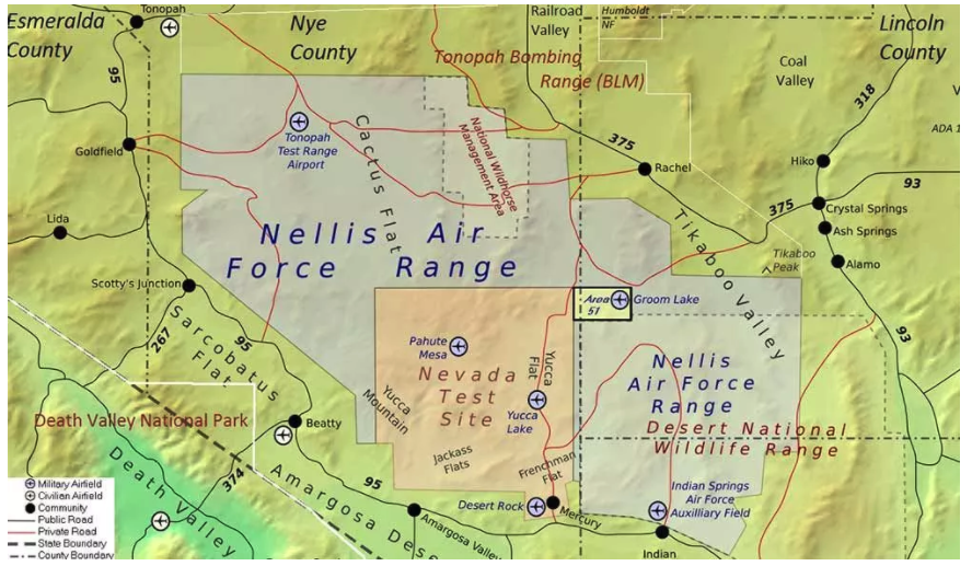
    Challenges in Puerto Rico. The results spoke for themselves. In Puerto Rico, within only a few weeks of Hurricane Maria’s devastation, 1.4 million homes were analyzed for damage and 24,000 miles of roads were digitized through volunteer groups like GIS Corps and OpenStreetMaps.

    One of the greatest challenges in Puerto Rico was the lack of street addresses. That is more common than one might realize. In many parts of the world there is no established address system and locations are more or less oriented to significant landmarks. It is difficult for Americans to understand, but in other cultures generations of families grow up in the same neighborhoods. Everyone knows everyone else. Location is personal. In the case of disasters this poses a huge challenge, especially when roads and landmarks are destroyed, and people have evacuated.

    The company What3Words (W3W) is tackling this issue. W3W works uses a pixelated Earth system of 3 meter by 3 meter squares. Each grid can be defined by a set of three words. As I write this I am sitting in bump.cans.dome.

    W3W does away with traditional numerical latitude and longitude. It works in any language, in fact, eight countries have partnered with W3W as either the nation’s official addressing system or an alternate system, and the United Nations has it among their disaster reporting tools. Art Kalinski, the former writer of this column wrote an article last year about W3W, what3words: The geospatial advancement of the year?

    In Puerto Rico, since there aren’t addresses except in urban areas, the remainder of the island had to be geospatially configured to communicate “where” something was located. Digitizing Puerto Rico is a huge geospatial effort that would take years through normal government protocols and cost millions of dollars.

    Instead, by enlisting the support of the crowd, it was accomplished in weeks, proving the power if crowdsourcing operations.

    Crowdsourcing to the rescue. The power of the crowd was unlocked even more by using geoforms for filling out damage reports like bridge assessments, damaged roads, debris removal, etc. This allowed navigation apps to route around impassable areas saving time and ultimately lives. No more sending a rescue vehicle out only to find it can’t access the area because a tree is down, a bridge is collapsed, or flood waters are too high. Those delivering food could do so to where the people were.

    Interactive, real-time, geospatial, command and control forever changed dispatching. Instead of waiting for teams to return before retasking them with new assignments dispatching could be of done on the fly as survivors were identified. The nearest rescue craft with available space could be routed to the exact location.

    GIS allowed dispatchers to see where all the rescue teams were and how many survivors they had onboard and how many more they could take on. Data about each survivor was recorded allowing preparations for the arrival of anyone with special needs and the person’s information could immediately show up on a notification board that they had been found and rescued, important for family and friends to know.

    The information also helps with forecasting needs of shelters and the reporting of numbers to those in operational authority.

    Daily coordination calls were conducted over a variety of platforms with all interested and active participants. Important information was posted on a shared cloud drive. Slack, the peer to peer online collaboration platform was used so FEMA and the various groups were able to collaborate and keep the three different hurricane rescue operations segregated.

    Recovery continues. The recovery efforts continue in Houston, Florida, Puerto Rico and the Virgin Islands. In efforts to increase the attention GIS played in mitigating damage from these disasters and the value of crowdsourced information FEMA hosted several events. The final event was held on Saturday, October 21, 2017. It was information about the situation on the ground in the multiple locations and the ongoing operations. It was also a celebration of the successes achieved during these crises; and, a tinge of sadness marked the event bringing to a close to some great working relationships.

    If you are interested, there are still ways to get involved no matter what your skillset or expertise. If you have a desire to help, there are opportunities either on scene in the theater of operation, or remotely working from your computer at home. Check with the organizations mentioned below. Even a couple hours of your time can help.

    What GIS offers next. GIS in the future of disaster response will make greater use of emerging technologies. Drones will fly preprogrammed paths ahead of a disaster if given enough time, and the imagery and the drone’s flight path will be stored. Then, immediately after the event passes drones will fly the same programmed path capturing imagery with the exact oblique and nadir angles as the original dataset.

    Change detection analysis can then be used to find the exact locations of change. This method will become increasingly valuable using high resolution 3D imagery point clouds and used in a change detection system.

    Geospatial artificial intelligence systems will identify the areas of greatest damage and assist by directing other resources such as mobile data signals to direct rescue operations towards possible survivors even using the last reported mobile data signal. It can direct human analysts to those specific areas that are inconclusive or require manual verification. This will increase analysis from several weeks to several days.

    That is in the future, the near future, perhaps next year’s hurricane season, or tornado season, or snowstorms this winter.

    This year, in total, there were 10 Atlantic hurricanes resulting in 431 deaths and an estimated $3.17 billion in damage; which by comparison, is 1/10th the number of casualties from Hurricane Katrina yet nearly twice the level of damage. It just so happens, I went through Hurricane Katrina living along the coast in Bay Saint Louis, Missouri, at the time where the eye the storm passed over. I tried to evacuate but being caught in a 13 hour traffic jam I was unable to outrun the storm. I personally experienced a category 4 hurricane. You may have picked that up in the opening of this article. Those experiences were very real. You might have also picked up my meteorological background from my days in the U.S Navy as a weather analyst.

    By the end of 2017, more than hurricanes had inflicted damage. Wildfires in the western U.S. killed another 36 people and destroyed 6,000 buildings. Now, with winter upon us, there will be snowstorms, and GIS will help with those recovery efforts as well.

    We are lucky to live in this day and age. Whether you are on the helping end of a disaster aiding in rescue and recovery, or on the receiving end being aided, GIS is supercharging the rescue efforts.

    Disaster response agencies and support groups

    Most of the above groups support all types of disaster response efforts and many do so throughout all regions of the world.

  • With Unicore, BeiDou navigates its way to global CES stage

    UM442 Module.

    With the successful launch of newest BeiDou-3 navigation satellites, Beidou’s pace of globalization is quickening. As a provider of China’s domestic GNSS core products, Unicore Communications brought its full range of products to the Consumer Electronics Show (CES), which took place Jan. 9-12 in Las Vegas.

    Unicore’s exhibits are targeting intelligent drive and the internet of things (IoT).

    UM442 Evaluation Kit: UM442-BOX2 evaluation box, navigation antenna x2

    For intelligent drive, Unicore is showcasing its UM482 high-precision GNSS module, which is designed for high-end L3 self-driving and robots.

    Unicore also is introducing a cost-effective low-power GNSS module — UM442 — which is suitable for L2 ADAS applications and community-based GNSS navigation and maps.

    UM442 is a cost-efficient high-precision real-time kinematic (RTK) and heading module that can simultaneously track GPS, BDS, GLONASS and Galileo. It also supports SBAS and QZSS.

    Based on high-performance data-sharing technology and the simplified operation system of the Nebulas II chip, the UGypsophila RTK algorithm dramatically optimizes matrix processing. Therefore, the UM442 can track many more satellites and shorten the initialization time to 5 seconds.

    Satellite view during a UM442 road test using the UGypsophila RTK algorithm. UM442 achieves centimeter-level RTK positioning using a low-cost ceramic antenna.

    With on-board MEMS and the U-Fusion integrated navigation algorithm, UM442 can achieve accurate and reliable positioning even in the most challenging environments such as urban canyons and tunnels.

    UM442 also provides attitude information such as rolling angle and pitching angle, which is suitable for many new applications such as community-based navigation maps and ADAS. Even with a low-cost ceramic antenna, the UM442 can achieve centimeter-level RTK positioning, as well as a 0.2-degree/1-meter baseline heading accuracy.

    At CES, Unicore plans to introduce BeiDou products into the large volume market of consumer electronics. Ufirebird is an ultra-small, ultra-low-power multi-GNSS positioning system-on-chip (SoC), using 28-nm technology. The chip supports BDS, GPS, GLONASS and Galileo signals, and the software can be extended to support WAAS/QZSS/EGNOS/MSAS/GANGAN enhanced signals.

    Unicore’s UFirebird-UC6226 low-power GNSS SoC is designed for mobile devices.

    Two packaging methods are available: WLCSP and QFN40. For WLCSP packaging, the chip size is only 1.73 x 2.87 mm, and for QFN40 packaging, the chip is AEC-Q100 compliant, aimed for highly reliable automotive-grade applications.

    UC6226 is equipped with a built-in sensor hub capable of providing access for multiple sensors for fusion positioning. It supports Wi-Fi, Bluetooth, GNSS hybrid positioning, and better than 1-m differential positioning accuracy.

    Compared with Unicore’s previous generation GNSS SoC, UC6226 has reduced power consumption by 60%. The minimum tracking power consumption is lowered to 18 mW, significantly improving battery endurance.

    With a built-in anti-jamming module, LNA and -162dB sensitivity, UC6226 can maintain accurate and precise positioning under complex environments.

    UC6226 has been successfully applied by China’s bicycle sharing companies. In addition, the chip will be used in intelligent watches, smartphones, smart cameras and many other IoT devices requiring smaller size, lower power consumption.

  • High-quality aerial imagery brings city added $60K; webinar shows how

    Located in low, gently rolling hills just north of Indianapolis, Carmel, Indiana is one of the fastest-growing communities in the country. It has nearly tripled in population since 2000 and now numbers 91,000 inhabitants.

    Considering the growth expected for 2017 and 2018, the City of Carmel needed a visual tool better able to manage the city’s expansion projects across several government departments.

    After years of using low-resolution aerial imagery provided by the county, the City of Carmel realized it needed something better for analyzing and displaying accurate information.

    The Carmel Storm Water Department turned to Nearmap to provide high-quality aerial images that are frequently updated to integrate with its existing applications, including ArcMap and ArcGIS.

    Nearmap now supplies the city with high-resolution imagery that aids data accuracy, verifies customer claims, educates developers, enforces compliance, and prepares presentations for internal government meetings. As an unexpected bonus, since implementing Nearmap, the department has collected $60,000 more in revenue in 2017.

    Shane Burnham, a GIS technician, and John Thomas, storm water administrator, both with the City of Carmel Engineering Department, will give a presentation on the city’s use of aerial imagery in a webinar on Thursday, January 18.  The webinar is free, but attendees must pre-register.

    Burnham provides GIS services for City of Carmel’s Engineering and Planning departments. He serves as departmental Cityworks Administrator and asset management specialist and has published custom GIS web applications during his career. Thomas focuses on impervious surface analysis using aerial imagery and GIS data in support of storm water administration and billing.

    Truth on the Ground is Best Seen from the Air: How aerial imagery is propelling government and commercial organizations to higher levels of operational efficiency” will also feature speakers from Black & Veatch, an engineering, consulting and construction company with more than 100 offices worldwide, specializing in infrastructure development in power, oil and gas, water, telecommunications, government, mining, data centers, smart cities and banking and finance markets; and from Nearmap, an international provider of high resolution aerial imagery.

    Carmel Courthouse. (Photo: City of Carmel, Indiana.)
    Carmel Courthouse. (Photo: City of Carmel, Indiana.)

    Carmel was named Number 1 among Niche’s “Best Places to Live in 2017”. Niche is a website that analyzes public data sets and reviews to produce rankings, report cards, and profiles for every K-12 school, college, and neighborhood in the U.S.

    More about the free webinar:

    Advances in aerial imagery including high-resolution maps and a streamlined process to capture, manage and deliver imagery in the cloud is transforming the way governments and businesses operate. In this webinar, you will:

    • Learn about the latest advances in aerial imagery including how imagery is supporting a variety of government and business applications today.
    • See real-world use cases of imagery in telecommunication, engineering and city government to improve operational efficiency.
    • Understand how imagery can be used standalone and within GIS and CAD products.
    • See the latest demos of Nearmap imagery including vertical, panorama and oblique views.
  • Expert Opinions: How will autonomous traffic safety issues affect the GNSS industry?

    Expert Opinions: How will autonomous traffic safety issues affect the GNSS industry?

    Q: How will safety issues raised by increasing autonomous traffic — in the air and on roads — affect the GNSS industry?


    Sanchit Agarwal, VP, Field Operations, Nearmap

    A: Due to increasing autonomous traffic, the GNSS industry will have to adopt the concepts of collective tracking mechanisms in the shared ecosystem. Inherently, all the cars/drones (rovers) will have the sensors to track the traffic “on-the-fly” and make intelligent navigation decisions, but in case of any system malfunction, the collective tracking of devices can facilitate “social” interactions between the rovers. This will serve as an added layer of security in case an autonomous social member goes rogue!


    Zak M. Kassas, Assistant Professor, University of California, Riverside

    A: Future autonomous vehicles will demand full situational awareness and extremely reliable, accurate and secure navigation systems. GNSS will not meet the stringent demands of these autonomous vehicles. To address the inevitable situations where GNSS signals become unusable (due to attenuation or interference) or untrustworthy (due to spoofing), receivers should be coupled with sensors such as IMUs, lidar and cameras, and exploit the plenitude of ambient signals of opportunity such as cellular, digital TV and Wi-Fi.


    Jonathan Auld, VP of Engineering and Safety Critical Systems, Novatel

    A: Safety issues raised by increasing autonomous automotive and airborne traffic will escalate the product development standards and performance requirements of GNSS software, hardware, and correction services used. The GNSS industry is challenged to increase accuracy on lower cost platforms by utilizing multi-frequency, multi-constellation, sensor fusion and precise point positioning. To be able to rely on GNSS in auto-guidance applications, the industry also needs to incorporate GNSS integrity functionalities into our products.

  • PNT Roundup: Measuring range of motion, new app offers urban guiding

    PNT Roundup: Measuring range of motion, new app offers urban guiding

    Measuring recovering patients’ range of motion

    Positioning on a micro-scale is the task of a new sensor that reports on range of motion (ROM) achieved in stretching exercises and other post-operative activities by at-home patients after discharge from hospital. Telit, a company active in sensors for the Internet of Things (IoT), announced that U.K.-based 270 Vision Limited has selected Telit’s BlueMod+SR Bluetooth module for its BPMpro Mark 2 sensor for remote, precision measurement of patient ROM.

    The BPS (Body Performance Measurement) wearable sensor is a medical device that measures patient ROM before and during rehabilitation. Post-surgery, patients are discharged to be remotely monitored at home as they undertake their daily routine using a BPMpro sensor. The captured sensor output displays on a patient tablet running BPMpathway software and streams live to the clinician, who can use this data to assess the patient’s progress. With the patient recovery data collected by BPMpathway, clinicians can tailor an orthopedic patient’s post-operative support to meet their individual needs, without having to wait for a face-to-face consultation.

    The BlueMod+SR module is a very small form factor dual-mode Bluetooth 4.0 module (17 x 10 x 2.6 mm). Range in line of sight is about 100 meters. Dual mode means it supports classic Bluetooth basic rate (BR) and enhanced data rate (EDR) operations as well as Bluetooth low energy (LE).


    New app promises better-than-GPS urban guiding

    Attention, GPS World readers living in or visiting Central London, Mountain View, California or San Francisco. Public beta of a new app ­(iOS only) will take you by the hand — er, phone — and lead you around the fair city; those cities only, at present. More intriguing, it claims to deliver “better than GPS accuracy.”

    This augmented reality (AR) navigation employs an AR-native framework, Apple’s ARKit. Blippar touts its AR City app for something it calls “urban visual positioning…which localizes users with higher accuracy than GPS, thanks to computer vision.” The app uses visual inertial odometry, interpreting movement seen through the camera, to minimize position errors, that is, in a sense, to correct GPS.

    Holding the phone in front of one’s face in tourist fashion, the user receives nearby points of interest based on what he or she can actually see. The app feature three layers of information:

    AR Basic Navigation. A visualization of walking routes through augmented reality.

    Enhanced Map Content. Overlays of information and content related to user location in AR — for example, streets and points of interest.

    Urban Visual Positioning. Recognition, positioning and directional information via computer vision.

    AR basic navigation, available everywhere that is supported by Apple Maps, visualizes routes with arrows shown in augmented reality. AR basic navigation uses GPS to estimate the absolute position of the user, and visual inertial odometry (VIO) to track their local movement. Blippar integrates GPS and VIO by building on the ARCL library, which uses Apple’s ARKit for VIO and Core Location for GPS.

    GPS alone doesn’t give a high enough level of accuracy when looking at the map and has an average error rate of 16 m in cities, according to Blippar, which claims its urban visual positioning provides more than twice its accuracy.

  • Speaker details announced for Autonomous Safety-Critical Workshop

    Speaker details announced for Autonomous Safety-Critical Workshop

    A free Cognizant Autonomous Systems for Safety Critical Applications (CASSCA) Workshop will be held 8:30 a.m.-5:30 p.m. on Jan. 29 at the Hyatt Regency Reston in Reston, Virginia. This is scheduled to take place the day before and at the same location as the Institute of Navigation’s International Technical Meeting and Precise Time & Time Interval Systems and Applications (ION ITM/PTTI) 2018 conference.

    The workshop is complimentary but registration is required to attend.

    The workshop consists of a full day of presentations and discussions on the opportunities and challenges associated with developing fully autonomous systems that are cognizant and trustworthy for safety-critical applications by leading experts in the field. Speakers include:

    • David Corman, Program Manager, Cyber-Physical Systems Program; National Science Foundation (NSF). Dr. Corman’s current research interests are in the field of Cyber Physical Systems (CPS), security for CPS, unmanned systems, manufacturing, and technologies supporting Smart and Connected Communities.
    • Paul DeBitetto, Vice President, Software Engineering; Top Flight Technologies. Dr.  DeBitetto leads all Top Flight’s Software and Embedded Systems Development. That includes product-related flight control, simulation, computing, sensing, data communications, security-related controls and software solutions.
    • Finch Fulton, Deputy Assistant Secretary for Transportation Policy; Department of Transportation (DOT)
    • Joao Hespanha, Professor and Chair of Department of Electrical and Computer Engineering; University of California, Santa Barbara. His current research interests include hybrid and switched systems; multi-agent control systems; distributed control over communication networks (also known as networked control systems); the use of vision in feedback control; stochastic modeling in biology; and network security.
    • Robert Peterson, Professor and Director of Center for Insurance Law and Regulation; Santa Clara University.
      Mr. Peterson teaches torts, insurance law and regulation, evidence and products liability, and other courses. He is a past chair of the California State Bar Standing Committee on Insurance Law, and is director of the Law School’s Center for Insurance Law and Regulation.
    • Signe Redfield, Roboticist and Mission Manager; Naval Research Laboratory (NRL). Dr. Redfield’s primary interests include performance evaluation of autonomous systems, foundations of robotics, and cooperative behaviors for autonomous underwater vehicles.
    • Giorgio Rizzoni, Professor and Director of Center for Automotive Research (CAR); The Ohio State University. The CAR is an interdisciplinary university research center that conducts research on advanced automotive and transportation technologies and systems engineering, focusing on sustainable mobility, advanced propulsion systems, human safety and the environment.
    • Steven Rogers, Senior Scientist for Automatic Target Recognition and Sensor Fusion; Air Force Research Laboratory (AFRL). Dr. Rogers serves as the principal scientific authority and independent researcher in the field of multi-sensor automatic target recognition and sensor fusion.

    The workshop is organized by Zaher (Zak) M. Kassas, an assistant professor at the University of California, Riverside and director of the Autonomous Systems Perception, Intelligence & Navigation (ASPIN) Laboratory.  His research focuses on cyber-physical systems, autonomous vehicles, intelligent transportation systems, navigation systems, and software-defined radio. He has co-authored two cover stories in GPS World magazine, “LTE cellular steers UAV: Signals of opportunity work in challenged environments” and “Opportunity for Accuracy: Terrestrial SOPs attractive supplement to GNSS.”

    To register for the CASSCA Workshop, go to www.ion.org/cassca.

    Registration is also now open for the ION International Technical Meeting (ITM) and Precise Time and Time Interval Systems Applications Meeting (PTTI), which begin the next day (January 30-February 1) at the same location. See www.ion.org/itm for more information.

  • First GPS III satellite receives commands from OCX

    First GPS III satellite receives commands from OCX

    The first advanced GPS III satellite successfully established remote connectivity and communicated with the next-generation Operational Control System (OCX), further validating the U.S. Air Force’s modernized GPS is ready to launch its first satellite.

    On Nov. 2, GPS III Space Vehicle 01 (GPS III SV01), the first of 10 GPS III satellites designed by Lockheed Martin, and OCX, being developed by Raytheon Corporation, successfully completed Factory Mission Readiness Testing (FMRT).

    The FMRT validated the command and control interaction between GPS III and the OCX’s Launch and Checkout System (LCS) through a simulated full launch and early orbit mission event sequence.

    During this end-to-end system demonstration, command signals were sent from the latest OCX LCS software installed at Lockheed Martin’s Launch and Check Out Capability node in Denver to Schriever Air Force Base in Colorado Springs, Colorado.

    From there, the commands were uplinked back to the GPS III SV01 satellite, currently awaiting a call up for launch at Lockheed Martin.

    “During FMRT, GPS III SV01 received and successfully processed OCX commands that are routinely sent during launch, transfer orbit maneuvers, deployments and payload initialization,” said Mark Stewart, Lockheed Martin’s vice president for Navigation Systems. “We thoroughly tested the first GPS III satellite just like we are going to fly it in 2018.”

    GPS III SV01 and OCX first “talked” to each other during a link check on October 3, 2017.

    “This was the first time the launch and checkout system directly interfaced with the GPS III satellite,” said Bill Sullivan, vice president of Raytheon’s GPS OCX program. “We’re making consistent, steady progress, and that’s driving us toward a successful launch next year.”

    The demo further verifies the space-to-ground compatibility between GPS III satellites and OCX. During a 2013 Compatibility & Integration test, Lockheed Martin’s GPS III Nonflight Satellite Testbed (GNST) — a full-sized, functional satellite prototype — also connected with and received commands from an earlier version of Raytheon’s OCX LCS software.

    On Sept. 22, the Air Force declared GPS III SV01 “available for launch,” with launch expected in 2018. The successful FMRT was the final validation that GPS III SV01 is ready to be shipped to the launch pad.

    GPS III will have three times better accuracy and up to eight times improved anti-jamming capabilities. Spacecraft life will extend to 15 years, 25 percent longer than the newest GPS satellites on-orbit today. GPS III’s new L1C civil signal also will make it the first GPS satellite to be interoperable with other international global navigation satellite systems, like Galileo.

    OCX will revolutionize GPS command and control and mission management capabilities. It will control all legacy and new signals, provide protection against evolving cyber threats, and reduce operation and sustainment costs through efficient software architecture, automation and performance-based logistics. OCX represents a quantum leap in capabilities over the current system, providing flexibility and adaptability to meet future GPS mission needs.

    The GPS III and OCX teams are led by the Global Positioning Systems Directorate at the U.S. Air Force Space and Missile Systems Center. Air Force Space Command’s 2nd Space Operations Squadron (2SOPS), based at Schriever Air Force Base, Colorado, manages and operates the GPS constellation for both civil and military users.