QY Research has released its Global GNSS Chips Market Research Report 2017, a comprehensive study on the global GNSS chip market. The report is segmented based on applications, end-users, technology and geography.
The report covers key players, current trends and influences on the global market. Investment return analysis, SWOT analysis and feasibility studies were used to analyze the key global market players’ growth in the industry.
Highlights of the report include:
A complete backdrop analysis, including an assessment of the parent market.
Important changes in market dynamics.
Market segmentation.
Historical, current and projected market size, including value and volume.
Reporting and evaluation of recent industry developments.
Qualcomm Technologies’ Snapdragon automotive platforms were selected to power the next-generation of infotainment systems in the Geely Auto Group vehicles.
According to Qualcomm, these systems include the world’s first-announced infotainment offering with an integrated 4G LTE modem using the Snapdragon 820Am automotive platform.
Geely also expects to use Snapdragon automotive platforms on upcoming generations of its iNTEC technology package, which includes G-Netlink, a system that allows drivers to interface with their vehicles in a number of ways, as well as G-Pilot, an intelligent drive technology designed to support a high degree of driving comfort, assistance and autonomy.
“China is emerging as a source of automotive innovation, not only benefiting Chinese customers but also the rest of the world, by quickly adopting and commercializing leading-edge car attechnology,” said Patrick Little, senior vice president and general manager for automotive at Qualcomm Technologies. “We are pleased to work with Geely and the Chinese automotive ecosystem to help define the future of connected car experiences and use our industry-leading technologies to accelerate its realization.”
According to the company, select Geely models are expected to use the Snapdragon 820Am variant of the platform with an integrated X12 LTE modem, supporting up to 600 Mbps downlink and 150 Mbps uplink speeds.
In addition, Geely vehicles featuring Snapdragon automotive platforms are expected to be available from 2020 onward, the company reported. Geely’s connected cars featuring telematics applications are already available using Snapdragon LTE modems.
Northrop Grumman Corporation has been awarded a contract from the U.S. Air Force for technology maturation and risk reduction in support of next-generation navigation systems.
Under the $49 million contract from the Air Force Life Cycle Management Center, Northrop Grumman will provide the preliminary hardware and software architecture design for the Embedded GPS/Inertial Navigation System (INS)-Modernization, or EGI-M, technology. The modernized system is expected to be available for platform integration starting in 2019.
Northrop Grumman’s EGI-M will be based upon modular, open systems architecture to support the rapid insertion of new capabilities and adaptability based on unique platform requirements. Additionally, EGI-M will incorporate M-code-capable GPS receivers, which will help to ensure the secure transmission of accurate military signals.
“We are dedicated to ensuring mission success and the safety of warfighters by providing an EGI-M solution that offers robust, accurate and reliable positioning, navigation and timing [PNT] information, even in GPS-denied conditions,” said Dean Ebert, vice president, navigation and positioning systems business unit, Northrop Grumman Mission Systems.
EGI-M technology is designed for compatibility with current systems on legacy aircraft, allowing ease of integration and rapid adoption of new capabilities.
EGI-M will also comply with the Federal Aviation Administration’s NextGen air traffic control requirements that aircraft flying at higher altitudes be equipped with Automatic Dependence Surveillance-Broadcast (ADS‑B) Out by January 2020.
ADS-B Out transmits information about an aircraft’s altitude, speed and location to ground stations and to other equipped aircraft in the vicinity.
Applanix is collaborating on advanced research for autonomous vehicle guidance and control systems with the University of Waterloo Centre for Automotive Research (WatCAR) in Ontario, Canada. Applanix is a Trimble company.
Applanix will provide WatCAR with its positioning and orientation system for testing autonomous guidance and control systems in real-world conditions. Applanix will also provide the Trimble GNSS-inertial board set for integration with car systems and sensors to enable precise positioning.
The Applanix POS LV is a robust, reliable and repeatable positioning solution for on- and off-road vehicles. Applanix technology will be used by WatCAR to assess the performance of the guidance and control systems on board their autonomous vehicles.
The testing will take place in challenging weather conditions and environments including on roads under repair, with lane reductions and closures, are wet or covered in snow, and where there is poor visibility.
An SUV in an anechoic chamber at WatCAR.
Applanix will also provide WatCAR with Trimble on-board GNSS-inertial board set designed for high-performance, high-volume original equipment manufacturer applications. These products, currently used in a variety of autonomous vehicle programs, include the Trimble AP GNSS-inertial board set that includes a high-precision inertial measurement unit.
Small, rugged and low powered, the AP board sets provide the precise positioning needed for autonomous vehicle applications as they navigate their environment. Designed for use on all sizes and types of vehicles, the AP boards feature Trimble’s high-performance precision GNSS receivers and Applanix’ IN-Fusion GNSS-inertial integrated technology that produces uninterrupted position, roll, pitch and true heading measurements of moving platforms. Integrating easily with vehicle sensors, the AP board sets provide precise vehicle control when interacting with a constantly changing environment.
The relationship with WatCAR will aid in improving the core technologies that deliver high-end systems capabilities for a variety of Trimble markets.
The Waterloo Centre for Automotive Research in Canada conducts advanced research to further automotive innovation and competitiveness. From active safety to automated driving through lightweighting and advanced powertrains, 130 faculty researchers comprise the largest university-based automotive activity in the country. Leading-edge studies for industry partners around the world enhance vehicles, components and their materials with new approaches and integration of innovative technologies.
“We are excited to collaborate with the University of Waterloo and WatCAR on this leading research in autonomous vehicle technology,” said Louis Nastro, director of land products at Applanix. “Applanix has been committed to meeting the needs of autonomous vehicle manufacturers for more than a decade, as first demonstrated in the early days of the DARPA Grand Challenge. And today, we are also part of many autonomous vehicle programs deployed worldwide in commercial applications.”
“The Trimble AP products, first introduced in 2009, are designed for use in small, mass market vehicles where size, weight and cost factors are important,” Nastro said. “They have also been designed to easily integrate with the industry’s leading sensors, making them an ideal solution for autonomous vehicle navigation systems and sub-systems.”
“We welcome the opportunity to work with Applanix, a leader in reference systems. Their technology identifies, with very high accuracy, the exact location of our vehicle at all times,” said Ross McKenzie, managing director at WatCAR. “Applanix is a valued industry partner and their team is great to work with. Going forward we anticipate a solution that will enable autonomous vehicles to traverse the real world reliably and safely.”
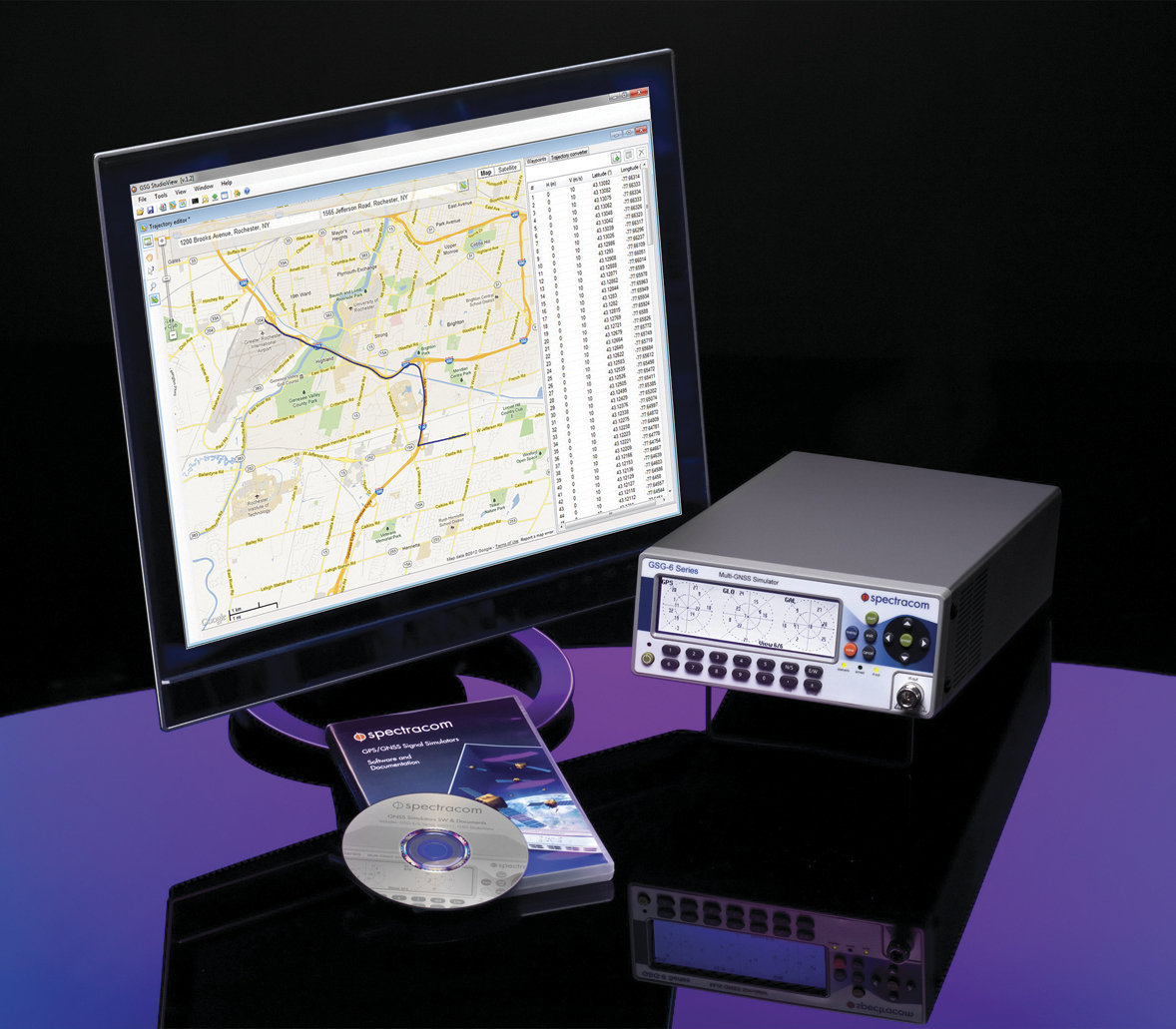
Orolia, through its Spectracom brand, has introduced built-in scenarios for testing eCall In Vehicle Systems compliance to the GNSS requirements of the regulation as an option with its latest Spectracom GSG simulator products.
In an initiative to bring life-saving rapid assistance to motorists involved in a collision, European Union (EU) regulation 2015/758 requires new vehicle types of M1 and N1 anywhere in the EU to be equipped with eCall in-vehicle systems as of March 31, 2018.
Spectracom’s GSG-6 Simulator with monitor.
In case of a crash, eCall systems automatically call the nearest emergency centre while sending the exact location, dramatically reducing response times. EU member states that do not comply will be refused EC type-approval for new types of motor vehicles.
Spectracom is providing options to ensure that automotive manufacturers who plan to continue selling into this market are equipped with the right tools for testing the eCall regulatory compliance of their equipment.
The Spectracom GSG line of GNSS simulators efficiently simulate all the major GNSS constellations needed for testing compliance of critical signal receiving equipment in a variety of eCall scenarios including:
Positioning accuracy under different conditions
Time-to-first-fix
GNSS receiver sensitivity
Re-acquisition performance following signal outages
Playing specific static and dynamic trajectory scenarios
Changing RF transmit power level manually or remotely sequenced as required by standard
“The eCall regulations require significant effort on the part of the auto industry to comply, and we are pleased to be including standard eCall scenarios as an option for our popular line of Spectracom GSG simulators,” said Lisa Perdue, GSG product manager at Spectracom. “We work in partnership with our automotive industry clients and will continue evolving the simulation product line to meet their needs for compliance testing with life-saving regulations.”
Sierra Wireless, a provider of fully integrated device-to-cloud solutions for the Internet of Things (IoT), is offering global, dual-mode low-power wide-area (LPWA) cellular modules. The AirPrime WP77 smart wireless modules simplify LPWA deployments for customers developing products that need to connect to multiple networks where different LPWA technologies are supported.
The Sierra Wireless AirPrime WP Series.
The WP series simplifies development for secure telematics and gateway applications, providing a dedicated application CPU core running the Linux-based open source Legato application framework.
With integrated GNSS for tracking and location-based services, low-power modes and a comprehensive set of interfaces for connecting sensors and companion chips, including Wi-Fi and Bluetooth, customers can develop multi-service platforms for the transportation market, and use the WP77 for applications requiring low throughput and optimized power performance.
The WP77 supports both LTE-M (Cat-M1) and NB-IoT (Cat-NB1) with optional 2G fallback, allowing customers to deploy the same device with multiple network operators worldwide. For those deploying in regions where 4G LTE coverage is not as widely available, 2G fallback ensures their devices stay connected to the network.
ABI Research forecasts that cellular LPWA network technologies will begin to see rapid growth from 2018 onward as carriers upgrade their networks in 2017, however, carriers have varying plans and timelines for LTE-M and NB-IoT.
“A module with dual-mode, global coverage will be very attractive for global equipment manufacturers, especially for applications such as telematics, metering, and location tracking, which we expect will lead the way for LPWA volume deployments,” said Dan Shey, managing director and vice president at ABI Research.
With the commercialization of LTE-M and NB-IoT LPWA technologies, cellular is now a superior option for many IoT applications that were previously restricted to short-range technologies due to cost and battery life. LPWA technologies combine lower cost, broader coverage and better battery life with globally available and secure cellular networks and will connect millions more things to the Internet.
“With the AirPrime WP77 modules, IoT developers have everything they need in a single module to quickly build low-power connected products that can be deployed anywhere in the world,” said Dan Schieler, senior vice president and general manager, Embedded Solutions, Sierra Wireless. “The integrated open source Legato platform and AirVantage cloud provide our customers with a proven device-to-cloud architecture to design innovative LPWA solutions that extend the IoT into new applications.”
Spirent Federal Systems, a provider of GPS and GNSS simulators, has begun developing MNSA-capable GNSS simulators for the Modernized Navstar Security Algorithm.
Spirent Federal is developing software that will support M-code using MNSA. M-code is an updated GPS military signal that is being rolled out as part of the modernization of the current GPS constellation.
GPS modernization began in 2000 when the GPS Selective Availability feature was set to zero. Since that time, the U.S. Air Force has been working on newer generation satellites that will transmit new civilian and military signals.
Until now, AES and SDS have been the only methods authorized to be used within a GNSS simulator to produce M-code.
Spirent Federal Systems has been a provider of AES M-code and SDS M-code capable simulators for many years, but as the long awaited MNSA M-code signals become available, Spirent Federal Systems will be making this option available to authorized users on the GSS9000 series simulator.
Polynesian Exploration Inc. has launched its high-accuracy navigation system for demanding applications such as autonomous driving and unmanned aerial vehicles (UAVs).
Polynesian Exploration is a navigation startup founded by a group of navigation-industry veterans in Silicon Valley in October 2016.
The navigation system is designed to fully utilize the advantages of both GNSS and inertial navigation systems (INS) to provide centimeter-level position and velocity accuracy with dual frequency real-time kinematic, together with accurate attitude information (roll, pitch and heading).
The system provides superior short-term stability against satellite signal outages and highly accurate heading whether the system is static or moving, Polynesian Exploration said.
The rugged and waterproof system will be ready for shipment starting July 1.
Polynesian Exploration described the demand for high-accuracy GNSS/INS solutions this way:
By the year 2020, four GNSS are expected to be fully operational, which are GPS, GLONASS, Galileo and BeiDou. The abundance of measurements from multiple constellations around the world will enable unprecedented improvements in the accuracy, continuity and integrity of GNSS navigation systems.
Although GNSS signals have grown to become ubiquitous, all radio-navigation systems are subject to radio frequency interference, short signal blockages and severe multipath errors in certain environments (such as urban canyons).
INS can potentially mitigate integrity and continuity risks caused by those issues to a certain degree. Additionally, INS is able to compute and output user’s position, velocity and attitude at high frequencies. Reporting information to users at a high-frequency is essential for many vehicle control applications, such as self-driving cars, UAV flight stability or autonomous landing.
We design our navigation systems with various performances depending on user demands, which include, but are not limited to, up to 400-Hz position, velocity, attitude outputs and meters to center-meter level position accuracy.
They can also be operational in all weather conditions and will be available globally.
Additionally, we are able to integrate special sensors for each unique application as requested by our customers. We are driven by customer satisfaction and strive to offer the best experience for our customers.
The second set of 10 Iridium NEXT satellites, launched June 25 by SpaceX, are functioning nominally and have begun the testing and validation process.
The batch of 10 satellites was launched from Vandenberg Air Force Base in California, increasing the total number of Iridium NEXT satellites in space to 20.
“We are thrilled with yesterday’s success,” said Scott Smith, chief operating officer at Iridium. “These new satellites are functioning well, and we are pressing forward with the testing process.”
“Since the last launch, the team at our Satellite Network Operations Center has been anxiously awaiting this new batch of satellites. There is a lot of work to do, and we are up for the challenge,” he said.
Now, and for approximately the next 45 days, the newly launched satellites will undergo a series of testing and validation procedures, ensuring they are ready for integration with the operational constellation.
Once testing is completed, Iridium will also hand over control of Aireon’s Automatic Dependent Surveillance-Broadcast hosted payload, to the team at Aireon’s Hosted Payload Operations Center, in Leesburg, Virginia.
The Trimble VRS Now GNSS correction service is now available in France. The service is designed for a variety of geospatial and construction applications including surveying, cadastral, land administration, and urban and rural construction that would benefit from easy access to high-accuracy, centimeter-level positioning.
Trimble also now provides Galileo support for VRS Now. Powered by the Trimble Pivot Platform, VRS Now in Europe fully supports GPS, GLONASS, BeiDou, QZSS and the Galileo satellite system.
Galileo support improves network performance and reliability with access to additional satellites, particularly in urban canyons or other harsh environments. The increased number of visible satellites provides additional data observations that enhance positioning integrity to better mitigate errors.
“Trimble continues to aggressively expand its VRS Now footprint in Europe,” said Patricia Boothe, general manager of Trimble’s Advanced Positioning Division. “With the addition of correction services in France, Trimble VRS Now covers over 179 million square kilometers (732 million square miles) across 10 countries.”
VRS Now coverage is available throughout the majority of France as well as Belgium, The Czech Republic, Estonia, Germany, Great Britain, Ireland, Luxembourg, the Netherlands and Sweden using a compatible GNSS receiver or display.
Subscriptions are available through Trimble’s Authorized Business Partners or Trimble’s online store.
The GPS tracking device market is expected to exhibit significant growth potential between 2017 and 2023, according to a new report by Research and Markets.
The key driving factors for the growth of the GPS tracking device market include the increase in sales of commercial vehicles, smaller size, affordable price and high return on investment. Moreover, the advent of cellular technology reduced the service cost, while the decline in GNSS/GPS IC makes inroads in cellphone that provide the scale of economies to GNSS/GPS module supplier.
The report is titled GPS Tracking Device Market by Type, Deployment Type, Industry & Geography – Global Forecast to 2023.
Other findings:
Transportation and logistics to hold the largest share of the overall GPS tracking device market.
APAC will be the fastest-growing market for GPS tracking device during the forecast period.
Telit has launched BlueMod+S42M, a Bluetooth low-energy (BLE) 4.2, standalone, single-mode module with embedded 3-axis accelerometer, temperature and humidity sensors.
The cost-effective component is optimized for efficiency and simplicity in end-device design and manufacturing, delivering reliable BLE functionality with robust endpoint security, motion and environmental sensors and essential features that reduce development costs, bill of materials, and time to market.
Designed for large-scale projects, the BlueMod+S42M expedites device design across a wide range of industrial and consumer applications areas, the company said. The embedded sensors are for high-value, fragile asset tracking, and time- or temperature-sensitive applications such as cold chain monitoring in the pharmaceutical and agriculture industries.
The release of the certified BlueMod+S42M complements the Telit portfolio of Bluetooth and BLE modules and directly addresses the demand in the rapidly growing BLE-dependent market. A report released by IndustryARC Analysis, forecasts Bluetooth Low Energy enabled devices shipments to increase to 8.4 billion units by 2020 at a CAGR of 29 percent.
“Cost, power, and reliability are critical to the success of IoT applications that demand efficient BLE solutions,” said Ronen Ben-Hamou, Telit EVP of products and solutions. “Our new qualified Bluetooth module caters to designers of all levels with tight development, materials and manufacturing cost constraints and even tighter timelines. The beauty of the +S42M is it’s simplicity: single-chip SoC (system on chip), feature packed, sensibly priced, exceptional power savings and extensive interoperability.”
Full applications can be embedded in the BlueMod+S42M, which is a self-contained SoC requiring no additional external supporting components. It is equipped with an on-board micro controller, integrated chip antenna, passive components, T°/Humidity sensor, and an accelerometer.
Leveraging a rich subset of features from Telit’s diverse family of BlueMod+Sx modules, including a GATT interface and terminal I/O profile combination, the new BlueMod+S42M greatly simplifies and accelerates the development of applications, Telit said.
In addition to efficient performance and low power consumption, BlueMod+S42M includes value-added features that further streamline development:
Bluetooth v4.2 Qualified Module
RED, SRCC Certified
Generic GATT Client and Server
LE Secure Connections
Configurable DIS (Device Information Service)
LE Data Length Extension
Terminal I/O for Easy Transparent Data Transfer (BLE- SPP like)
Embedded Sensors
Over-the-Air Updates
Sample Code for iOS and Android
WeChat Air Sync Protocol
Designers using the BlueMod+S42M have access to comprehensive development and integration tools including evaluation and development kits.
Visit Telit at the Sensors Expo in San Jose, California, June 27-29, booth 1244.