Author: GPS World Staff

  • Galileo boosts GNSS corrections services

    Trimble’s RTX-based correction services now support the Galileo constellation. As a true five-constellation technology that uses GPS, GLONASS, BeiDou, QZSS and now Galileo satellites, Trimble RTX delivers improved real-time positioning performance to its users worldwide.

    With accessibility to the Galileo constellation, users now have visibility to more satellites, which can be advantageous for extreme latitudinal positions or in environments where line-of-sight may be limited.

    Surveyors, farmers, mapping and GIS professionals now have a more versatile and robust correction solution wherever they may work, even in the most challenging terrain locales.

    Benefits of adding Galileo to Trimble RTX correction services includes:

    • Increasing the number of in-view satellites, improving the accuracy and reliability of corrections
    • Improving positioning integrity using observations from additional satellites to better mitigate errors
    • Operating at higher cut-off angles, delivering better performance in urban canyons and other less than optimal environments
    • Minimizing multipath and interference through the addition of available satellite signals

    “Trimble is continually investing in its correction service technology to remain at the forefront of the industry,” said Mark Richter, marketing director for Trimble’s Networks and Services business. “Our focus is to ensure that the latest GNSS developments are leveraged to continue to deliver productivity improvements for our customers across the globe.”

  • Japan launches second Michibiki QZSS satellite

    Japan launches second Michibiki QZSS satellite

    Mitsubishi Heavy Industries Ltd. and the Japan Aerospace Exploration Agency (JAXA) successfully launched a second navigation satellite on June 1.

    The H-IIA Launch Vehicle No. 34 (H-IIA F34) delivered into orbit Michibiki No. 2 of the Quasi-Zenith Satellite System (QZSS) at 9:17:46 a.m. (JST) from JAXA’s Tanegashima Space Center.

    The launch and flight of the rocket proceeded as planned, and the separation of the satellite was confirmed 28 minutes and 21 seconds after the launch time.

    The first Michibiki satellite was launched in September 2010.

    Watch a video of the launch.

    Credit: The Japan News

  • TerraGo Edge version 4 uses iOS, Android flexibility

    TerraGo Edge version 4 uses iOS, Android flexibility

    The profession of land surveying has taken advantage of many technological location and measuring advancements, yet most of the data collectors used today are still based upon aging proprietary data collectors and even older operating system platforms.

    A common tool for most surveyors is the smartphone or tablet, so TerraGo developed an application that takes advantage of the nimble programming of iOS and Android.

    The TerraGo Edge 4 mapping application utilizes all the best features of today’s mobile technology, according to TerraGo. Besides an intuitive interface, Edge 4 allows users to customize how their data is collected and presented, including overlays on Google and Apple maps.

    Depending on the user’s needs, Edge 4 can use the device’s Bluetooth connection to an external GNSS receiver for greater accuracy.

    Sharing is also easy with publishing and ArcGIS exporting plug-ins, all in a mobile environment most users are familiar with using every day, the company said.

    GPS and GIS features include:

    • Sub-meter and centimeter precision
    • Real-time GPS monitor
    • Full NMEA GPS metadata display and capture
    • GPS accuracy settings
    • RTK support
    • Dynamic BT device list
    • Auto-record GPS Lines and Polygons
    • Import and export Esri file geodatabase, Shapefile, KML, CSV, JSON
    • OGC GeoPackage (SQLite) vector and raster

    Learn more on the TerraGo Edge features page.

    TerraGo Edge version 4.0 offers a completely redesigned app based on customer feedback, field user observations and task-centered design cycles, as well as a host of new features including the addition of Google and Apple basemaps.

    “The new interface is so much more than just a ‘look and feel’ change; it will allow us to more efficiently execute projects and improve data quality in less taps and less time, which is a force multiplier when you’re talking about thousands of data points per day,” said Scott Riccardella, director of oil and gas business development at Structural Integrity Associates. “Having the right tool is essential to getting any job done right, and TerraGo is ahead of the game when it comes to giving my field teams the best possible tool for the fastest, most accurate and highest-quality asset inspections.”

    “We have completely rebuilt the mobile user interface from the ground up to improve all aspects of the app’s performance, and while users will notice the stunning graphics and aesthetics, the real value is that the feature or data you need is always just one tap away,” said Dave Basil, vice president of product development at TerraGo. “By incorporating the latest native design elements like tabbed navigation, responsive split screens and adaptive list views, we found ways to improve the speed and efficiency of the work our customers do every day.”

    TerraGo Edge’s latest features include:

    • Reimagined user experience: Rebuild of the Edge mobile user interface incorporating both years of user feedback from the field and interactive design cycles with live users.
    • Google and Apple maps: Standard, satellite and hybrid maps are available for data collection and are paired with new precise location pin icons for a cutting edge data collection experience.
    • Tabbed app navigation: With the new, easier to reach tabbed navigation, it’s easier to collect data in the field.
    • Quick capture button: Allows users to create notes, complete forms, take photos, drop points and draw lines/polygons from virtually anywhere in the app, with only one tap.
    • Unlimited attachments: Now users can attach as many forms, photos or videos as you would like to a single note.
    • Responsive split screen view: When holding a tablet or larger mobile device in landscape mode, new split screens will automatically allow userse to view lists/maps or lists/details on one screen.
    • Detailed list view: The new detailed list view shows more of the important note data making it easier to find notes, and enables one-tap actions directly from the list.
    • One-tap forms and maps lists: Now users can view all the form templates, and instantly create notes using them, or view all your offline maps and directly access them, from one master list.
    • Precise location: Users can capture a more accurate location when creating notes by using the center crosshair target and coordinate level accuracy for dropping points and drawing lines/polygons.
    • Filter by map extent: This new feature keeps the notes on a map and in a list dynamically in sync.
    • Quick basemap preview: Preview online and offline basemaps in real-time from the selection screen to choose a map with one tap and no toggling back and forth.
    • Arc2Edge plug-in: ArcGIS Desktop users can directly share maps and features with mobile users, allowing them to roundtrip updates and new features from the field back to ArcGIS.
  • u-blox, SIM Technology terminate asset purchase agreement 

    u-blox and SIM Technology Group Limited of Shanghai, China, have announced that u-blox will not be acquiring the SIMCom cellular module product line as previously planned.

    Despite best efforts on the part of SIM Technology Group and u-blox, the companies could not close the deal as originally intended and were unable to find alternatives that worked for both while sustaining the intended benefits. Both parties have therefore decided to  terminate the Asset Purchase Agreement and Technology Assignment Contract with all ancillary agreements.

    “While we are disappointed that the deal has not come to fruition, u‑blox and SIM Technology Group Limited continue to have a good relationship and expect to find other ways of working together in the future,” said u-blox CEO Thomas Seiler.

    “Our strategy for cellular products remains focused on growth,” Seiler said. “For some time now we have been working on adapting our product range to achieve a stronger geographical diversification mainly for the Asian markets, where we make 50 percent of our global revenue. The strong move to LTE based connectivity will naturally open new strategic windows. Our strong focus and investment in our own chipset development especially for IoT applications is a key part of our strategy. Our guidance indicates a continued strong growth.”

    As a result of this situation, u-blox has revised its guidance figures for 2017 back to levels as provided on Jan.11, 2017, and foresees for FY 2017 continued growth in all regions expecting revenues of between CHF 410 and 425 million, with EBIT in the range of CHF 60 to 65 million.

  • ANSI establishes UAS standardization collaborative

    A May 19 meeting convened by the American National Standards Institute (ANSI) confirmed there is broad-based support among key stakeholders from the private and public sectors for ANSI to establish an Unmanned Aircraft Systems (UAS) Standardization Collaborative (UASSC).

    The UASSC will work to coordinate and accelerate the development of the standards and conformity assessment programs needed to facilitate the safe, mass integration of UAS (drones) into the national airspace system of the United States.

    Initial priority areas of focus are expected to include:

    • UAS airworthiness
    • command and control systems
    • remote identification
    • flight operations, including operations over people and beyond visual line of sight
    • licensing, training, qualification and certification
    • sense and avoid systems
    • safety and risk management

    An initial kick-off meeting is anticipated in the third quarter of 2017. To stay up to date regarding future developments, email Jim McCabe, ANSI senior director, standards facilitation, at [email protected].

    The collaborative will also focus on international coordination and adaptability, with the goal of fostering the growth of the UAS market. The work effort will entail the development of a standardization roadmap to identify existing standards and standards in development, define where gaps exist and recommend additional work that is needed, along with a timeline for its completion and organizations that can perform the work.

    ANSI Standardization Collaboratives are formed to support emerging technologies and national and global priorities by advancing cross-sector coordination in the development and compatibility of standards and conformance programs.

    Ultimately, the purpose of such initiatives is to describe the current standards landscape, articulate standardization needs, inform resource allocation for standards participation, and drive coordinated standards activity while minimizing duplication of effort.

    As a neutral facilitator, ANSI has a successful track record of having convened a number of such collaboratives in areas as diverse as homeland security, electric vehicles, energy efficiency in the built environment and, most recently, additive manufacturing.

    The May 19 meeting drew close to 70 participants representing more than 40 organizations from industry, trade associations, standards developing organizations (SDOs), federal agencies, academia and others. The public- and private-sector co-chairs for the meeting were Earl Lawrence, director of the UAS Integration Office, Federal Aviation Administration, and Brian Wynne, president and CEO of the Association for Unmanned Vehicle Systems International (AUVSI).

    ANSI has been in dialogue with numerous stakeholders over the past year on this topic, including via panel discussions during the 2016 ANSI Joint Member Forum and at the April 2017 ANSI Company Member Forum. A number of SDOs already are involved in UAS standardization, underscoring the need for coordination to achieve a coherent set of standards.

    “Given our history of bringing public- and private-sector stakeholders together to identify standardization needs to support new technologies, ANSI is well suited to facilitate the need for standards coordination in this exciting new technology area,” said ANSI president and CEO S. Joe Bhatia.

  • u‑blox, Commsignia and NXP collaborate to drive V2X

    V2X companies u‑blox, Commsignia and NXP Semiconductors announced a strategic collaboration to address the rapidly growing demand for reliable vehicle‑to‑vehicle (V2V) and vehicle‑to‑infrastructure (V2I) technology.

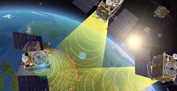
    The adoption of V2X technology in North America and European markets equips new vehicles with the ability to securely and anonymously share information with other similarly equipped vehicles, infrastructure and even pedestrians within a radius of up to 1 km.

    IEEE 802.11p V2X technology is the only proven and production ready technology today that can reliably see around corners, the companies said. V2X information will augment the awareness of drivers to improve safety, reduce congestion and emissions, thereby delivering real savings and benefits to all road users today and in the future for self-driving autonomous vehicles.

    This collaboration builds on the strengths of all three companies to deliver substantial time-to-market advantages and benefits to automotive customers, with future-proof solutions that optimize investments and mitigate risks.

    Automotive manufacturers are looking for ways to bring V2X to market now, ramping up to 100 percent implementation in new cars within the next five years. This collaboration between three of the market leaders will accelerate the adoption of V2X technology thanks to the availability of fully integrated hardware and software solutions in a fully‑fledged and secure (US DOT SCMS compliant) V2X system.

    https://youtu.be/fyGDrtVbUOY

    “This collaboration focuses on delivering production-ready Vehicle‑to‑Vehicle (V2V) and Vehicle‑to‑Infrastructure (V2I) systems like our V2X communication module,” said Costas Meimetis, director of product strategy, u-blox. “We are already present in the market through our THEO module family, this collaboration will strengthen our position and allow u‑blox to innovate faster, bringing new solutions to market starting. Our expertise and this collaboration means we are uniquely positioned to meet the increasing demand from automotive manufacturers, who must meet new legislation in key markets.”

    “NXP’s status as a Dedicated Short‑Range Communication (DSRC) V2X technology leader, is a key reason u‑blox chose NXP’s RoadLINK solution, a complete automotive-grade 2 +105C ambient, V2X system solution with best‑in‑class performance to power their V2X module,” said Rob Hoeben, senior director, V2X segment. V2X is the only ADAS technology that operates in real-time, lowest latency and sees around corners, facilitating self-driving autonomous vehicles.

    V2X, IEEE 802.11p-based, is complementary to 5G versions of V2X and both technologies are expected to co-exist for the foreseeable future. NXP has participated in several V2X demos and trials, including truck platooning, achieving short separation distances between trucks.

    NXP’s RoadLINK solution, which is now in production with a major North American OEM, will help ensure the u-blox module can deliver accurate and reliable communications to and from a vehicle.

    “Commsignia leads the market with the best end‑to‑end V2X software suite for connecting cars and smart city infrastructure,” said Jozsef Kovacs, CEO of Commsignia. “Combined with the NXP RoadLINK chipset and u‑blox module, automotive manufacturers can benefit from the enhanced performance of a secure and fully integrated solution to implement V2X technology in new vehicle designs, so taking the next step towards improving the safety and efficiency of our roads.”

    u-blox, Commsignia and NXP, will be demonstrating live how this collaboration is enabling life-saving V2V applications at the TU-Automotive Detroit Conference and Expo June 7‑8. The demo entitled “Fast track to safe & secure V2X” will show the following use cases:

    • Blind Spot Warning (BSW)
    • Emergency Electronic Brake Light (EEBL)
    • Co-operative Forward Collision Warning (FCW)
    • Lane Change Assist (LCA)
    • Left/Right Turn Assist (LRTA)
    • Control Loss Vehicle Warning (CLW)
    • Intersection Movement Assist (IMA)
  • Upgrades to monitoring stations support EGNOS

    Upgrades to monitoring stations support EGNOS

    Upgrades to the monitoring stations underpinning Europe’s EGNOS satnav augmentation system will support its evolution, said the European Space Agency.

    The current 40 Ranging and Integrity Monitoring Stations (RIMS) sites across Europe and beyond are the bedrock of the European Geostationary Navigation Overlay Service (EGNOS), supplying highly accurate and robust satnav information that can be relied on for safety-critical purposes.

    Thales EGNOS V3 RIMS rack.

    Once a second, these stations gather raw satnav data to transmit information on signal quality and range measurements to the GPS satellites, allowing EGNOS to identify and remove any error in the signals.

    The resulting corrections are then passed to users via a trio of geostationary satellites, delivering a several-fold increase in precision plus “integrity” — a guarantee of navigation service — for safety-of-life applications.

    The result is that the EGNOS-augmented signals are guaranteed to meet the extremely high performance standards set out by the International Civil Aviation Organisation standard, adapted for Europe by Eurocontrol, the European Organisation for the Safety of Air Navigation.

    The signals from space can therefore be relied on routinely for safety-critical tasks, such as vertically guiding aircraft during landing approaches.

    “These current RIMS V2 stations have some inherent limitations, which we’ve sought to tackle in this upgraded V3 design,” said Didier Flament, ESA’s EGNOS programme manager.

    Airbus EGNOS V3 RIMS rack.

    “For instance, our current stations work only with GPS frequencies L1/L2 P(Y), while the future post-2020 EGNOS system will be operating on a multi-constellation basis, additionally employing modernized GPS signals, notably on both the L2 (L2C) and L5 frequency bands, as well as other signals from Galileo, on the similar E1 and E5 frequency bands.

    “Our experience working with RIMS has emphasized the significance on performance of factors such as signal scintillation — caused by the ever-changing ionosphere, the electrically active layer of the upper atmosphere — as well as other environmental threats such as interference and multipath signal reflection.

    “So this upgraded design increased robustness to these factors, based on more stringent development and operating standards, along with innovative radio-frequency environment monitoring.

    “It also includes upgraded receiver technology to accurately monitor potential GPS and Galileo signal distortion — ‘evil waveform’ signal anomalies — in full compliance with international standards.”

    The RIMS V3 stations will be based in the same or similar secure location as today’s stations — typically airports or space-based telecommunication sites.

    Dual tracking antenna concept incorporated in EGNOS V3 RIMS design.

    The individual RIMS antennas themselves can be relatively compact, about 50 cm high, with links to receiver and computing equipment.

    Most of the RIMS V2 station antennas are currently surrounded by dedicated protection structures that limit the impact of interference and multipath local effects.

  • Trimble to acquire Müller-Elektronik for precision agriculture

    Trimble has signed an agreement to acquire privately held Müller-Elektronik, a German company specializing in implement control and precision farming solutions.

    The transaction is expected to close in the third quarter of 2017, subject to customary closing conditions and clearance or expiration of the waiting period under the German Act Against Restraints of Competition. Financial terms were not disclosed.

    With more than 375 employees, Müller is precision farming company known for developing, producing and selling electronic control units and embedded software that provides vehicle and implement control for tractors, combine harvesters, field sprayers, drill machines, seeders, spreaders and slurry tankers to improve the management of inputs such as seed, fertilizer and pesticides.

    Müller was a key contributor in the development of the ISOBUS communication protocol, which allows one terminal to control several implements and machines, regardless of manufacturer. ISOBUS standardizes the control settings, reduces downtime and minimizes installation and interface challenges, simplifying data exchange and machine control. The implement control solutions developed by Müller have now become widely adopted by leading agriculture OEMs and aftermarket channels.

    Combining the technology and strengths of Trimble and Müller will enable the development of new and exciting solutions for farmers worldwide, who often struggle to integrate and use disparate hardware and software products across various brands of agricultural equipment. The addition of Müller-Elektronik will enable the creation of an ecosystem where farmers, advisors and retailers can easily build field prescriptions and transfer that prescription to the implement, enabling farmers to more easily adopt precision agriculture solutions.

    “Our planned acquisition of Müller-Elektronik recognizes the growing importance of the implement in variable rate application solutions as well as the importance of an integrated platform that is agnostic to equipment brand,” said Darryl Matthews, Trimble senior vice president. “Müller’s ISOBUS solutions are already compatible with a significant range of equipment manufacturers. This capability, together with existing Trimble competencies, will enable us to expand our role in the growing market for variable rate applications. We plan to continue to fully support existing Müller customers and partners.”

    “Trimble is a leading provider of precision agriculture hardware and farm management software,” said Christian Müller, managing director for Müller-Elektronik. “Bringing Trimble together with Müller’s leading ISOBUS solutions will create an industry-changing opportunity to deliver a system-wide integration that is uniquely available through the combination of the companies. Our systems, combined with farm management software, will enable OEMs to provide integrated plug-and-play solutions straight from the factory, while also helping the growing aftermarket channel looking to support its customers with mixed fleet operations with an ISOBUS solution.”

    The acquisition of Müller-Elektronik will include the company’s other operations, WTK Elektronik, a German-based company, ME-France, ME Sudamerica, an Argentina-based company, and Mueller Electronics Inc., a North American-based company. The Müller-Elektronik businesses will be reported as part of Trimble’s Resources and Utilities Segment.

  • Spirent helps civil aviation industry respond to GNSS interference threats

    Spirent Communications plc is offering a solution that enables the civil aviation industry to evaluate the growing threat of GNSS interference, jamming and spoofing.

    The new GSS200D Interference Detector was developed as part of Spirent’s partnership with Nottingham Scientific Limited.

    Spirent’s GSS200D interference detector.

    As skies and airports become more congested, there is increasing pressure on airports to be safely accessible at all times — which cannot be achieved by relying solely on non-precision approaches with high minimums or on today’s expensive and rigid ground-based infra­structure such as ILS (Instrument Landing Systems).

    Ground-Based Augmentation System (GBAS) and instrument approach procedures based on Satellite Based Augmentation Systems (SBAS), such as Localizer Performance with Vertical Guidance (LPV) and Required Navigation Performance (RNP), provide Air Traffic Management with flexible, cost-effective alternatives while providing equivalent operational performance.

    For example, the European Geostationary Navigation Overlay Service (EGNOS) launched the LPV-200 service in Europe that enables aircraft approaches without the need for visual contact with the ground until a height of only 200ft. above the runway.

    With this service, accessibility, sustainability, efficiency and safety of the landing are greatly improved, especially in bad weather conditions.

    Spirent’s new GSS200D solution monitors the radio bands used by EGNOS, as well as other GNSS augmentation systems such as the Wide Area Augmentation System (WAAS) or the GPS Aided Geo Augmented Navigation system (GAGAN), to ensure awareness of interference that could compromise positioning information.

    Since local interference near the runway in the GNSS bands could degrade position accuracy or lead to a total loss of the navigation service, it is critical to continuously monitor and understand the RF environment and level of interference around airports.

    The GSS200D collects quantitative data on interference allowing assessment of the risks, so that robust mitigation plans can be created. The new Spirent solution has been trialed at a number of European airports, and has collected numerous interference signatures from both unintentional man-made interference and intentional jamming.

    “As more airports begin to use GNSS-based instrument approach procedures, they need to know what could be affecting their GNSS signals,” said Martin Foulger, general manager of Spirent’s positioning business. “With this latest solution we can detect interference in the key radio bands, based on levels defined by the United Nations International Civil Aviation Organization and European Organisation for Civil Aviation Equipment. This enables the aviation industry to gain a much better understanding of the electronic environment, helping to avoid dangerous situations going forward.”

    For more information on Spirent’s GNSS testing solutions, visit the website. To learn how to test receivers of GPS, Galileo and other GNSS, download Spirent’s latest eBook.

  • Hydrographic surveys to improve maritime safety in Papua New Guinea

    Papua New Guinea

    Fugro has been awarded six contracts by the National Maritime Safety Authority (NMSA) of Papua New Guinea. The hydrographic survey packages are expected to contribute to capacity development in the country, which has more than 5,000 kilometers of coastline.

    The surveys will be conducted using a combination of Fugro’s Airborne Lidar Bathymetry (ALB) and multi-beam echo sounder (MBES) sensors, and a seamless dataset will be delivered to the NMSA.

    “As a pioneer of ALB development, Fugro has a solid track record in applying this advanced technology for mapping shallow water environments safely and cost- effectively,” said Paul Seaton, Fugro’s regional business development manager for Asia Pacific.

    The surveys in deeper waters will be performed by vessel, and Fugro will also conduct a comprehensive tides campaign throughout the survey area.

    The contracts are part of the Asian Development Bank-funded Maritime Waterways Safety Project that aims to improve the safety and efficiency of the country’s international and national shipping in coastal areas and waterways. By improving the maritime environment and making coastal shipping safer, the project will facilitate travel, trade and tourism for rural communities.

    Fugro has also begun a hydrographic survey encompassing an area of Norwegian waters of 15,000 square kilometers. The contract was awarded by the Norwegian Hydrographic Service and has a value of 34.5 million NOK (approximately €3.8 million).

    The survey is part of the MAREANO program, for which Fugro has successfully completed a number of surveys since 2006. The Norwegian program maps depth and topography, sediment composition, contaminants, biotopes and habitats. It takes place in the Barents Sea with various areas located above the 78th parallel and typical water depths ranging from 80 to 3,500 meters.

  • First Galileo open service performance report published

    Click for PDF.

    The European GNSS Agency (GSA) has published its first Galileo Open Service quarterly performance report.

    The report, which covers the first three months of 2017, is available online in the GSC Electronic Library, or directly here.

    Following the Declaration of Initial Services in December 2016, the GSA will publish a new Galileo Initial Services Open Service report after each quarter. The quarterly reports aim to provide the public with the latest information on the Galileo Open Service’s performance.

    The document reports on such parameters as:

    • Galileo Initial Open Service ranging performance
    • Galileo Coordinated Universal Time (UTC) dissemination and Galileo to GPS time offset (GGTO) determination performance
    • Galileo positioning performance
    • Timely publication of Notice Advisory to Galileo Users

    Each of these parameters is examined with respect to their minimum performance levels (MPLs), as declared in the European GNSS (Galileo) Open Service Definition Document (OS-SDD).

    Highlights from Q1 2017

    In the first quarterly reporting period after the Declaration of Galileo Initial Services, the measured Galileo Initial Open Service performance figures generally exceeded the MPL targets specified in the OS-SDD by significant margins.

    Some highlights from the report:

    • Availability of the Galileo ranging service at the worst user location, with monthly values of 100 percent, is significantly above expectations, where the MPL is 87 percent.
    • The signal in space ranging accuracy shows a 95th percentile monthly accuracy better than 1.07 [m] for individual space vehicles.
    • Availability of the Galileo UTC time determination service was achieved, with a monthly value of 100 percent, compared to the [OS-SDD] MPL target of 87 percent.
    • Availability of GGTO determination (not declared as a service in this phase) was 100 percent in January and March. February showed a slightly lower figure of 96.44 percent, although still well above the [OS-SDD] MPL target of 80 percent.
    • Excellent values were achieved for UTC time dissemination service accuracy. The measured Galileo Initial Open Service performance figures generally exceeded the MPL targets specified in the OS-SDD by significant margins.

    For up-to-date information, check the European GNSS Service Centre (GSC) website. For all support related to Galileo, contact the Galileo Help Desk. The Help Desk allows close interaction with users, both to support the exploitation of Galileo services and to collect relevant information on signal performance as observed by the users themselves.

  • Swift Navigation releases firmware 1.1 upgrade for Piksi Multi

    Swift Navigation releases firmware 1.1 upgrade for Piksi Multi

    The Piksi Multi. Photo: Swift

    Swift Navigation has released its first major firmware upgrade for its flagship product, the Piksi Multi GNSS module.

    The upgrade is available at no cost to Piksi Multi users and expands on dynamic real-time kinematic (RTK) application support, increasing functionality for users, expanding use-case applications and allowing users to better leverage existing infrastructure and facilitate post-processing.

    Firmware version 1.1 updates include:

    • Increased Data Output Rates to Support Dynamic Use Cases
    • GNSS Measurements (Raw Data) – Up to 20 Hz
    • RTK Output Support
    • Low Latency Mode – Up to 20 Hz
    • Time-Matched/Heading Mode – Up to 5 Hz
    • IMU (Raw Data) – Up to 200 Hz

    Moving Baseline RTK Support. The capability to do real-time, precise relative positioning between two receivers where both receivers can now be in motion.

    RTK-Based Heading Support. The capability to do real-time RTK-based heading for direction finding — even when stationary — without the need for expensive navigational equipment such as gyrocompasses.

    Improved 1 PPS Support. The Piksi Multi Pulse Per Second (PPS) feature has been upgraded to support more customization.

    Standalone RINEX Conversion Utility Tool. The tool allows end-users using RTKLIB, such as those with UAV surveying applications, additional tools to support their post-process kinematic needs.

    Improved Compatibility with Existing Infrastructure (RTCM 3.1 Input). This added support enables end-users to better leverage existing base station infrastructure to receive RTK corrections (observations, station coordinates, etc.) from already deployed Continuously Operating Reference Stations (CORS).

    For detailed information about the upgrades, refer to the Piksi Multi Firmware 1.1 Release. For detailed instructions on how to upgrade a Piksi Multi device, refer to Section 7 of the Getting Started Guide, Piksi Multi – Upgrading Firmware. For firmware release binaries and product support documentation, visit support.swiftnav.com.