The versatility of the ZEB Horizon device enabled the Deep Time team to map the complex and challenging environment. (Photo: GeoSLAM)
Geospatial 3D mapping specialist GeoSLAM provided the technology to scan one of Europe’s largest caves as a part of the Deep Time isolation study.
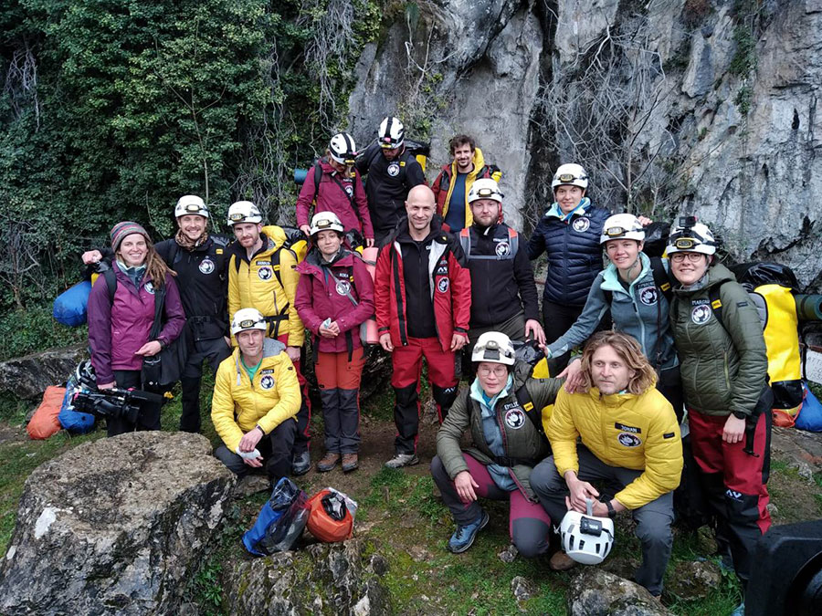
For 40 days, 15 participants set up camp in the Lombrives cave in southwestern France with no clocks or sunlight, and zero contact with the outside world. Conducted by the Human Adaptation Institute, the experiment aimed to explore the links between the human brain and time, in order to gain insight into the limits of human adaptability to isolation.
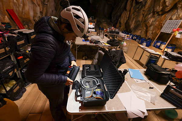
Throughout the mission, the “deeptimers” organized tasks to complete within the cave setting to help structure their days. Their first task was to conduct a recce of the location.
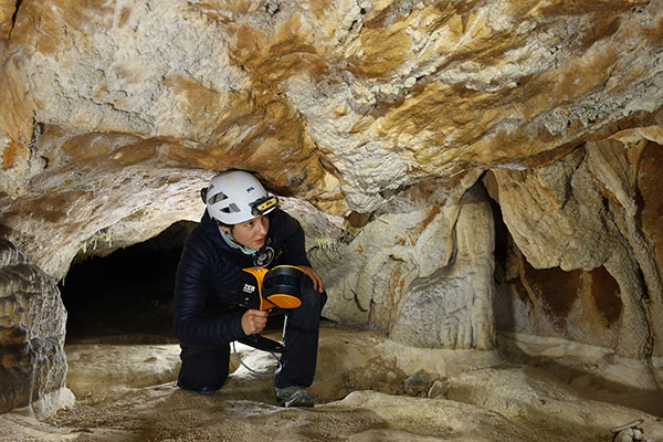
GeoSLAM technology was called upon to conduct a digital scan of the 3-km Lombrives cave — a cave system consisting of both narrow passages and expansive chambers up to 70 meters in height, formed more than 125 million years ago.
The handheld ZEB Horizon is put to the test by a Deep Time participant. (Photo: GeoSLAM)
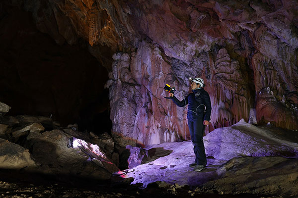
The team used the lightweight ZEB Horizon device, which harnesses GeoSLAM’s unique SLAM (simultaneous localization and mapping) algorithm, putting to the test the device’s 100-m range capabilities. Its versatility and walk-and-scan method of data collection allowed the team the flexibility to crouch, crawl and scan the depths and narrow canals of the cave, including 90-m deep wells.
Traditional tripod-based systems used for digital mapping rely heavily on GPS to collect accurate data. SLAM technology however, overcomes this limitation by cutting out GPS altogether, enabling scans to be carried out in complex and enclosed spaces, including underground.
A Deep Time participant sets up GeoSLAM’s ZEB Horizon scanner. (Photo: GeoSLAM)
With low light levels, an ambient temperature of 10 degrees and humidity levels of 100 percent, the physical and psychological impacts the team experienced were documented on camera.
“We are thrilled to have been associated with the Human Adaption Institute on such an exciting and historic project,” said Tomas Blaha, GeoSLAM channel manager for Europe. “The handheld capabilities of the ZEB Horizon device provided easy-to-use technology for the members of the team with no professional surveying experience. The study tested the limits of human endurance in a challenging environment, and the same can be said of the technology to survey the Lombrives cave. Using traditional static and GPS-based scanners would have been impossible for this project, so we are delighted that the ZEB Horizon’s adaptability and ruggedness played its part in an historic piece of research.”
The 15 participants stand outside the Lombrives cave, France. (Photo: GeoSLAM)
The Earth Archive Initiative is an unprecedented scientific effort to create a digital twin of the entire surface of the Earth – and everything on it.
By scanning the planet’s land surface with very high-resolution lidar, the Earth Archive will create a true three-dimensional digital twin of our world — an open source, digital record of the Earth that will reflect the landscape exactly as it was at the time of scanning.
The geospatial data captured will serve as the baseline for understanding and exploring our world.
A virtual conference, billed as the “Chapter I : The Amazon,” takes place June 15-16, and will provide updates on the unique project from academics, non-government organizations, technology providers and the public. Registration is free.
The Amazon Basin is the first region chosen for scanning and the focus of the conference. “While our scope is the entire planet, we’ve tasked ourselves with first scanning areas that are not only most susceptible to change, but also deep in value for understanding our past,” a project spokesperson explained.
“The 2021 inaugural Earth Archive Congress is centered on our initial campaign to scan the entire Amazon Basin. The Amazon rainforest plays a monumental role in the Earth’s climate, has an incredibly rich Indigenous history, and boasts a remarkable level of ecological diversity — but is vanishing before our eyes.
“With the ability to digitally preserve landscapes at any moment in time, very high resolution lidar can enhance archaeological, anthropological, and conservation studies and provide needed information to help advance sustainable development, as well as provide us with more groundbreaking revelations of the Amazon’s astounding past.”
Registration at the Earth Archive Virtual Congress is complimentary.
Geospatial data is key to logistics, including for the huge increase in e-commerce we are experiencing following the 2020 COVID-19 shutdown.
The best customer service is if the customer doesn’t need to call you, doesn’t need to talk to you. It just works. — Jeff Bezos
This past year has been a boon for the e-commerce industry. It increased from 4% of retail sales a decade ago and pushed past 20% in 2020, reaching nearly $800 billion — a 32% jump in 10 years.
Online businesses climbed to all-time highs. A few examples stand out. Amazon’s stock increased in value 83% over the course of last year. That type of growth happens with startups and small-cap companies but is usually unheard of with large blue-chip stocks.
Along with Amazon’s growth last year, FedEx had $69 billion in annual sales. DoorDash, an e-commerce food delivery company, has a market valuation of $45 billion, making it larger than Domino’s Pizza, Texas Roadhouse and Yum! Brands combined; and Yum! Brands owns KFC, Pizza Hut and Taco Bell.
The e-commerce global trend in online sales is expected to reach $4.9 trillion in four years based on only 2.14 billion online shoppers. That is less than one-third of the world’s population. There is a lot more room to grow. This past year moved the trend several years forward.
Where are all those goods stored?
Photo: Navy Petty Officer 2nd Class Jasen Moreno-Garcia/U.S. Navy
Each consumer requires an average logistics space of 35 square feet. In the United States alone, there are more than nine billion square feet of warehouse space, and when online sales increase another 10% it will require 3 to 4 billion square feet more of space to keep up with demand.
The increase in freight driven by this trend is captured in the chart below published by the Federal Reserve, with data provided by the U.S. Department of Transportation. The blue line is increasing freight transportation services, while the red line indicates on-hand inventories.
As transportation increases and becomes more reliable — a reflection of the overall health of the logistics supply chain — the amount of on-hand inventory decreases, allowing sellers to free up space and save money, or offer greater variety knowing that stocks can readily be backfilled.
However, when inventories get too low, the system is subject to severe supply shocks, making prices more sensitive to the law of supply and demand. The grey-shaded areas on the chart are economic downturns officially recognized as recessions.
If delivery took six-to-eight weeks these days, it would signal a crisis somewhere in the world.
21st-century logistics
Goods from global corporations now arrive at each customer’s doorstep. This is 21st-century logistics. Home delivery in two days or less is the expectation. The compression of time in this industry is astounding when compared to “the way things used to be.” The way things are compared to the way things used to be reminds me of hearing my grandparents talk about life before automobiles.
Back in my day, ordering from a catalog required calling the company and speaking to a representative. The call had to be made from a corded landline, and long-distance charges might apply. If ordering a gift for someone in the household, it was difficult to be clandestine with everyone nearby. The other option was to mail in an order form. Either way, delivery took a minimum of six to eight weeks, and sometimes more. If delivery took that long these days, it would signal a crisis somewhere in the world.
Knowing where to pre-position supplies ahead of anticipated demand is a geospatial problem. Most think of this in terms of sales to customers and deliveries ahead of seasonal demands, but many countries in the world are facing this dilemma right now figuring out the best way to distribute COVID-19 vaccines. That challenge is taking place in your own community and has been a long-standing public health challenge.
Beginning in the mid-2000s, geospatial information systems (GIS) were brought in to help control outbreaks of the deadly Ebola virus. In 2014, I took a Penn State geospatial intelligence course. The final exam addressed the geospatial challenges of fighting an epidemic. Theoretically, it was difficult to get the required goods to the right place at the right time. But now, it’s not an exercise, and getting it right is not an option.
If you have received the COVID-19 vaccine, you can appreciate the pharmaceutical industry for developing vaccines in record time. However, getting the vaccines to everyone is a logistics challenge, and GIS is the unsung hero. Logistics is the life blood of empires — it is the game of kings and generals. With it, wars are won and commonwealths prosper; without it, empires crumble to dust.
How Geospatial Data Guides the Goods
Back to the traditional understanding of supply chains from seller to buyer. The needs of the buyer are simple: faster, better, cheaper. For the seller, it is much more complex, and considerations deal heavily with location.
Where is the best place to have a distribution center?
Is it more important to be close to a multi-modal transfer station, or to population centers, or are land prices more important?
What about access to highways?
What are the trade-offs in delivery times being further away from the population?
Is the trade-off worth it for the cost of land and lower taxes?
Geospatial data can answer all of these questions, even going so far as to run “what-if” scenarios.
At the local level, transportation logistics schedules the most efficient routing to deliver more packages along the shortest path. This saves time and fuel, as shown in the image below using Maptitude software. Radiuses can also be calculated based on drive times instead of distances.
Caliper truck routing software can be used for planning deliveries that account for vehicle capacities, time windows, multiple depots and more. (Image: Caliper)
Navigation routing applications are dynamic, and pick-ups are automatically routed to drivers while out on delivery runs. Dynamic routing avoids delays such as accidents and road closures.
This same type of technology is used for emergency services to respond to a call. Ambulances, police and fire trucks all use dynamic routing to get to distress calls as soon as possible.
Global transportation logistics also need to account for international laws and regulations as cargo passes through each country. These regulations can be onerous, but the logistics industry has worked out the legalities to ensure a seamless, uninterrupted flow from ship to train to airplane to truck and to final delivery. It is symbolized by the universal 40-foot international shipping container standardized throughout the world.
At each facility, inventories are tracked. Each item passing through receives a time and location stamp. Estimated delivery times are sent via text message to your mobile device or email. When the item is out for delivery, it is possible to watch it on a map as the delivery truck makes its way towards your location. When the item is delivered to your doorstep, a picture of it is sent to your phone with an alert that the package was delivered.
Only a few days earlier, the manufacturer — perhaps on the other side of the world — placed the item in a box and taped it shut; even though you ordered it in your language, the order received by the manufacturer was in their language. The package started its journey to you at the next scheduled pickup, maybe within an hour of you placing the order. Shortly afterward, your order was on a ship or an airplane. As you went about your usual business, the incredibly efficient system of e-commerce sped your package around the world to deliver it to your doorstep.
Logistics has undergone a revolution built upon the most advanced technological innovations: robotics, artificial intelligence, machine learning, mobile devices, cloud computing, electronic payment processing, and a vast geospatial framework.
In fact, it is a continuously operating, seamless, geospatial mesh running on a global scale across all time zones that allows the industry to function. Every aspect of the logistics supply chain relies upon GIS in some way, from land, air and sea navigation from global location-based systems down to inside a warehouse for storage and retrieval of merchandise. Modern-day logistics is a geospatial industry connecting goods and services to consumers, putting the GIS in lo-gis-tics.
Image: U.S. DOT
Can GIS predict the future?
Regarding whether GIS can predict a market correction… I’ll not make a prediction, but the Transportation Services Index (TSI) for March is due to be released today, May 12. If it is down from February, it would mean two months of back-to-back decline. April’s numbers won’t come out until June. However, here is an indicator of where things currently stand. The ports of Long Beach and Los Angeles, CA, the largest shipping ports in the United States is five days behind schedule, which is down from over 10 days in January.
The TSI is a leading indicator of the economy. When 20% of sales are online in a consumer-based economy, the wellbeing of the commonwealth is measured one delivery at a time.
“Trade isn’t about goods. Trade is about information. Goods sit in the warehouse until information moves them.” — C. J. Cherr
William Tewelow
William Tewelow works for the Federal Aviation Administration. He is a graduate of the FAA management fellowship program. He served on special assignment to the U.S. Department of Transportation leading a national strategic geospatial initiative for the White House Open Data Partnership. He is a Geographic Information Systems Professional (GISP) and a speaker for the Maryland STEMnet Scholar program.
He was among the first in the nation to earn a Geospatial Specialist Certification from the U.S. Department of Labor while working at NASA Stennis Space Center. He has degrees in Geographic Information Technology, Intelligence Studies, and is completing a masters degree in Organizational Management.
William is a 23 year veteran for the U.S. Navy serving as a Geospatial Specialist, Imagery Intelligence Specialist, a Naval Aviator, a Meteorologist, and a Tactical Oceanographer. He is married, enjoys writing and traveling.
His favorite quote is, “A man’s mind changed by a new idea can never go back to its original dimension.” — Oliver Wendell Holmes
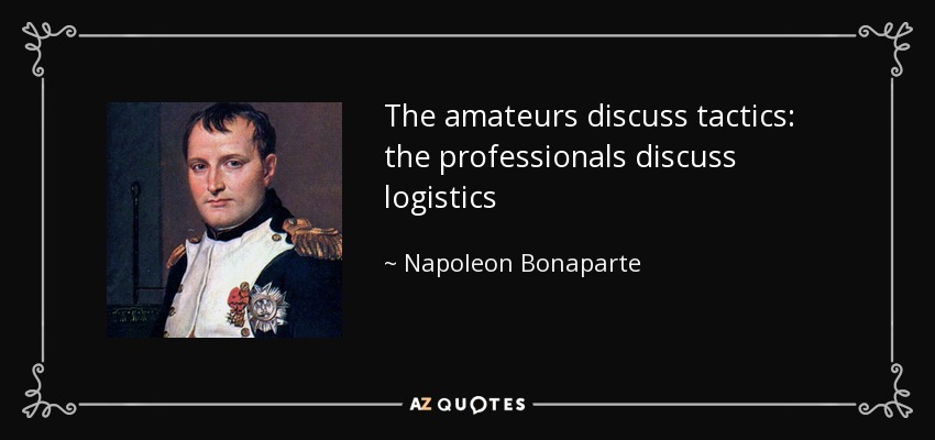
Partnership with Fujitsu will help city track bicycles, e-scooters and ridesharing companies
The mobility department of Munich, Germany, has selected Hexagon Geospatial to implement a smart monitoring system to better manage and understand the impacts of shared mobility services in the city.
Hexagon will partner with Fujitsu to provide Munich a software-as-a-service (SaaS) solution for tracking, visualizing and analyzing internet of things (IoT) data from a variety of mobility providers. The solution will monitor shared vehicles, such as e-scooters, bikes and cars, and will be the first of its kind in Germany.
The solution will also feature a dynamic digital twin of the city, allowing users to fuse the real and digital worlds and receive constant updates. Along with Hexagon’s M.App Enterprise software, Fujitsu will provide the necessary infrastructure for the project, which is designed to evolve constantly according to officials’ needs.
Hexagon was selected from among 14 competitors based on the technical completeness and capabilities of its offering and established expertise in the transportation domain. With this smart monitoring system in place, the city can continually monitor and guide future mobility concepts based on data.
“Shared mobility is a big issue around the world, and the city of Munich is on the leading edge of leveraging technology to manage these services,” said Maximillian Weber, senior vice president, EMEA, Hexagon’s Safety & Infrastructure and Geospatial divisions. “We are excited to deliver a system that will help officials better identify and understand transportation patterns with the goal of improving future city mobility.”
Tracking eScooters in Munich with Hexagon’s M.App Enterprise. (Image: Hexagon Geospatial)
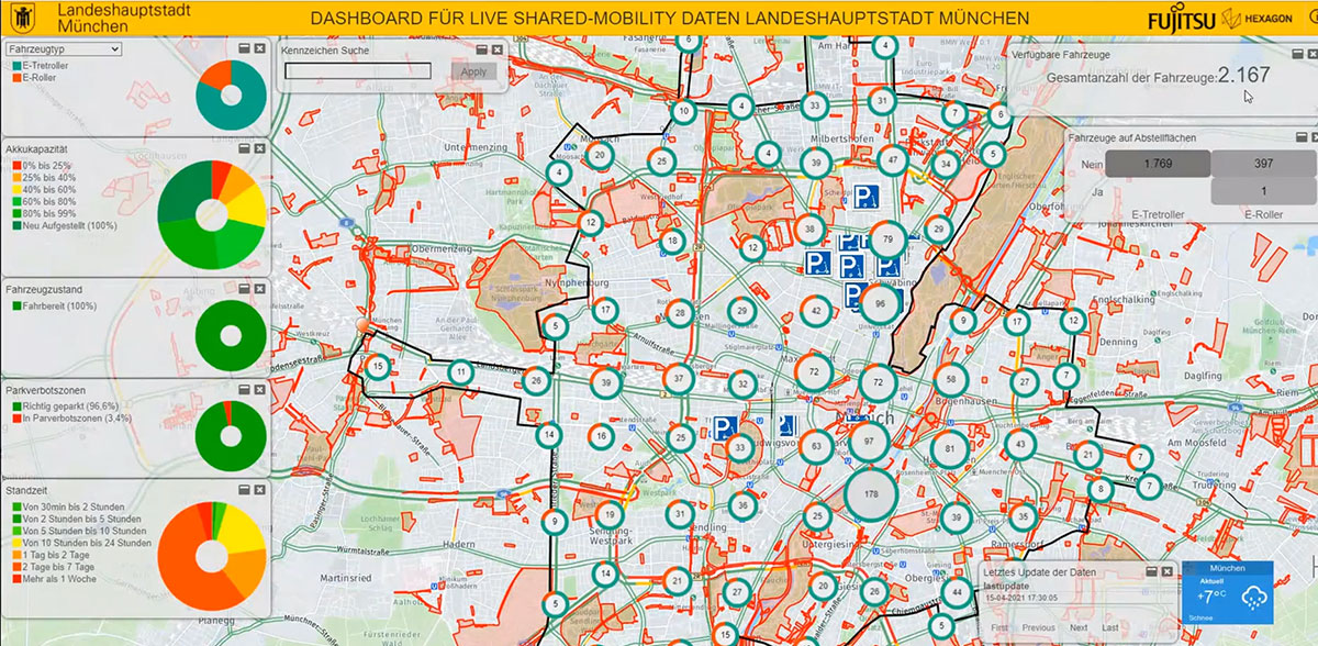
Emlid is offering two positioning modules for mapping with unmanned aerial vehicles (UAVs). Both the Reach M+ and Reach M2 provide centimeter-level accuracy in real-time kinematic (RTK) and post-processed kinematic (PPK) modes, enabling precise UAV mapping with fewer ground control points.
The Reach M+ single-band receiver has a baseline up to 20 kilometers in PPK. The Reach M2 is a multi-band receiver with a baseline up to 100 kilometers in PPK.
Usually autopilot triggers the camera and records the coordinate it has at that moment. When the drone is flying at 20 m/s and GPS works at 5 Hz, the UAV autopilot will have position readings only every four minutes, which is not suitable for precise georeferencing. In addition, there is always a delay between the trigger and the actual moment the photo is taken.
Reach solves this problem by connecting directly to the camera’s hot-shoe port, which is synced with the shutter. The time and coordinates of each photo are logged with a resolution of less than a microsecond. Reach captures flash sync pulses with sub-microsecond resolution and stores them in a raw data RINEX log in the internal memory. This method allows ground control points to be used only to check accuracy.
The Reach RS2. (Photo: Emlid)
The Reach M2 PPK UAV mapping kit consist of the Reach M2 multi-band GNSS receiver onboard the aircraft that records the location of each photo at a frequency of 20 Hz. It is combined with the Reach RS2 GNSS multi-band receiver on the ground, drastically reducing the number of ground control points and simplifying the setup process on site, while maximizing the accuracy to centimeter levels even in remote areas.
The M2 tracks GPS/QZSS (L1, L2), GLONASS (L1, L2), BeiDou (B1, B2), Galileo (E1, E5) and SBAS (L1C/A), and receives a fixed solution almost instantly.
Drone company Parrot is partnering with Rapid Imaging, a technology provider delivering geospatial augmented reality (AR) and situational awareness solutions to government and enterprise users.
The partnership pairs Parrot ANAFI USA platform drones and the FreeFly SDK with Rapid Imaging’s SmartCam3D SDK, a geospatial augmented reality and situational awareness platform for unmanned aircraft systems.
SmartCam3D overlays geospatial data such as street vectors, road names, points of interest, polygons and other pertinent map entities onto real-time, full-motion video (FMV) provided by ANAFI USA’s 4K HDR video, 32x zoom and live video streaming capabilities. This provides mission personnel with advanced situational awareness as they perform critical drone operations.
SmartCam3D also allows end-users to interact with live drone video in the same ways they would a map display, such as dropping a pin to mark a location or geocoding a selection from the real-time video stream.
These situational awareness capabilities provide opportunities across a variety of mission sets: airborne law enforcement, insurance, industrial inspections, natural disaster response, real estate and search-and-rescue operations.
The SmartCam3D SDK is a turn-key solution for UAS platform providers seeking to enrich their offerings with geospatial augmented reality and situational awareness tools. Features include geospatial AR, allowing users to enjoy a “Google Maps” type experience but with live drone video as the background layer rather than a satellite image. Granular declutter options allow users to select the types of map entities displayed on their live video feed.
Custom GIS data integration allows users to import their own geospatial data to display. Pin-dropping allows users to mark locations within the live video with AR annotations and communicate those locations to a map display.
Also, forward- and reverse-geocoding allow professional drone pilots to designate a point in the video and immediately receive the geospatial data associated with that point (lat/long or address) or designate a location and mark the location with an AR annotation within the video display.
Finally, cross-Cuing allowing end-users to simultaneously navigate a full-motion-video display and map display.
“Leveraging Parrot ANAFI USA’s precise GPS coordinates and advanced flight features, SmartCam3D® provides first responders and military personnel with up-to-date geospatial AR overlays on live video, combining the benefits of both a 2D map display and a Full-Motion-Video display into a single operating picture.” said Jerome Bouvard, director of Strategic Partnerships, Parrot. “This new partnership will provide easy-to-comprehend data to better assist first responders into making quick and accurate decisions during high-stress missions.”
All data captured through SmartCam3D during sensitive missions is secure, as Parrot drone users must opt-in to share flight data with Parrot’s secure to store footage. Parrot ANAFI USA also features secure digital (SD) card encryption, which ensures complete protection of photos and videos if the drone or the SD card is lost.
The SmartCam3D SDK is available for Android, iOS, Linux, and Windows systems for use with ANAFI and ANAFI USA platform drones.
In recent years, sinkholes have been occurring around the world. A new service offers a sinkhole detection prediction tool using satellite imagery analysis.
Synspective Inc., a satellite data and analytic solution provider, has released a sinkhole detection feature that predicts ground sinking area.
Sinkholes are often caused by human activities (underground tunneling, oil/gas pumping, underground coal drilling, groundwater pumping, etc.). When these sinkholes occur in residential areas, they can cause significant damage to buildings and sometimes even loss of life.
The sinkhole detection function developed by Synspective is a unique prediction algorithm that uses data science and machine learning to combine and detect the characteristics of spatial and temporal variations. With this technology, it is possible to identify areas where sinkholes are likely to occur in advance, areas where cave-ins have occurred, and areas where cave-ins are in progress after they have occurred.
This function will be implemented in Land Displacement Monitoring, a solution service announced in 2020 that analyzes ground deformation over a wide area using satellite data. The input data is automatically updated, and the platform handles the processing and analysis of the complex satellite imagery. Since it can be viewed in a web environment, it can be checked at any time from the office as well as from the field.
This new service’s expected use is multifaceted — it can be applied in many land risk-management projects such as construction projects, airport maintenance projects, and subway development projects, among others.
In addition, remote area/site surveying can be extremely relevant in disaster struck areas where human access is restricted or dangerous, or where social movement is restricted due to the COVID-19 virus impact.
Aerial imagery company Nearmap is partnering with Geographic Technologies Group (GTG), which helps local government agencies throughout the United States and Canada with geographic information systems (GIS).
GTG offers local governments with GIS services including strategic planning, consulting, comprehensive data services, mapping services, software development, training and on-call support. GTG also provides ongoing GIS maintenance for villages, towns, cities, counties, multi-regional agencies, public works and public utilities, water districts, and Native American and Alaskan Tribes.
“Our range of high-resolution aerial content — from vertical to oblique, 3D and AI [artificial intelligence] — integrates easily with GTG’s applications and acts as a valuable component to the strategic planning services offered by GTG,” said Karl Terrey, director, Global Alliances at Nearmap. “Our imagery is refreshed multiple times per year and, when combined with GTG’s technology, allows cities, towns, counties and state governments to make decisions based on conditions in their communities in near real time, at a fraction of the cost.”
Nearmap’s 3D imagery provides local governments with the ability to quickly export custom areas for use in platforms such as Esri, Bentley Systems and Autodesk. Nearmap AI enables governments to instantly identify attributes about properties required for the appraisal process. Nearmap AI Packs enable users to determine the type of access made visible in MapBrowser for items such as impervious surfaces, vegetation and solar panels at citywide scale.
Nearmap’s library of aerial imagery provides some of the most accurate imagery available with updates occurring up to three times a year throughout more than 430 markets in North America, including 700 urban and regional areas accounting for more than 70 percent of the United States population.
“Our goal has always been to break through boundaries, solve problems, and introduce a new kind of decision support for our clients,” said James Kelt, vice president of corporate software at GTG. “We began using Nearmap’s aerial imagery a few years ago because we recognized it as a way to differentiate ourselves and push the envelope. Our clients love the imagery and the more we worked with Nearmap, the more it made sense to find a way to partner so we could provide this added value to all of our customers.”
Precision-mapping company ProStar Holdings Inc. has integrated its PointMan software into the Vivax Metrotech vLoc3 with a GNSS real-time kinematic (RTK) receiver to create a utility-locate device.
Using the RTK-Pro internal cellular module with 4G LTE capabilities, the operator can connect to the NTRIP RTK caster that provides RTCM 3 corrections.
With the integration of PointMan with the vLoc3 RTK-Pro, critical buried infrastructure can be captured, recorded and displayed at survey-grade without additional external equipment or post-processing. The integration provides centimeter accuracy of the precise location of buried utilities in real time.
Data collected includes the type of utility, the depth of cover and the utility’s precise location.
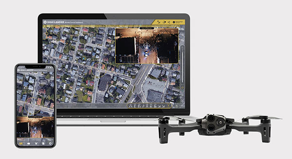
Parrot drones professional users benefit from an advanced control during complex fleet operations
Drone company Parrot is partnering with High Lander, which provides drone fleets with autonomous flight, intelligent airspace control, and coordinated air continuity through its Mission Control platform.
Combining Parrot ANAFI USA and ANAFI platform drones with High Lander’s Mission Control software, professionals can now access drone features through an easy-to-use dashboard.
“Parrot is continuously striving to provide our professional users with extended capabilities — allowing them to rapidly adapt their drone operations to fit their changing and urgent needs,” said Jerome Bouvard, Parrot director of strategic partnerships. “Drone automation and intelligence are at the heart of our product and software developments. This new partnership with High Lander represents another step towards enhanced automation and control capability of our drones.”
Using real-time device reporting and telemetry, first responders can autonomously manage their drone fleets while performing takeoff and landing, route-planning, and other crucial tasks — all from the intuitive comfort of the Mission Control Operations Center dashboard. The software’s seamless interface paired with the ANAFI USA’s ease-of-operation and rapid deployment provide more safety for responders and allow faster intervention during critical moments. Mission Control’s customized live link generation can also provide team-members onsite with an instant view of a drone’s video feed for fast assistance during search-and-rescue missions.
For surveying and mapping missions, operators can use improved control modes including Path (which sets an automated plan including multiple waypoints, telemetric, gimbal and payload settings) and Modeling & Mapping (which allows operators to survey an area in detail) as they efficiently create 2D maps and 3D models using Parrot ANAFI’s precise GPS coordinates capabilities.
Operators can also benefit from Mission Control’s Payload Sidebar, which enables switching instantly to thermal imaging, an invaluable tool for missions in search and rescue, police pursuits, or solar panel inspections. Parrot ANAFI USA’s integrated FLIR Boson Thermal sensor and 32x zoom make it easy to identify thermal anomalies and centimetric hot spots from an altitude of up to 40 meters.
“As a hardware-free system, Mission Control is compatible with leading drone manufacturers’ solutions, now including Parrot, to provide our customers with the freedom of customizing their drone fleets with best-in-class UAVs,” said High Lander CTO Ido Yahalomi.
High Lander is working with a number of prominent organizations including police departments, sheriff’s offices, fire stations, and forestry services, and has 12 active clients who will now be able to use Parrot’s ANAFI USA and ANAFI drones in their fleets.
The High Lander Pilot app is available for download on Android and iOS systems for use with ANAFI and ANAFI USA platform drones.
For more information about ANAFI USA, contact Parrot through the ANAFI USA contact form.
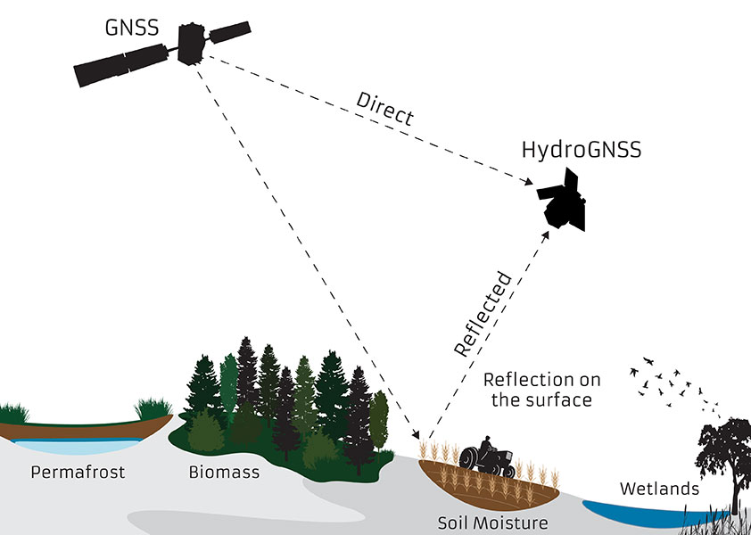
The small satellite will measure climate variables using GNSS Reflectometry
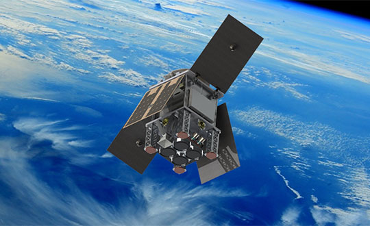
The European Space Agency (ESA) has selected HydroGNSS from Surrey Satellite Technology Ltd. (SSTL) for its second Scout Earth Observation small satellite mission. HydroGNSS is a 40-kg satellite that will be built and operated by SSTL.
ESA selected the first ESA Scout satellite, ESP-MACCS, in December 2020. ESP-MACCS focuses on understanding and quantifying processes in the upper atmosphere over the tropics — processes that play an important role in the overall evolution of the atmosphere.
HydroGNSS will take measurements of key hydrological climate variables, including soil moisture, freeze thaw state over permafrost, inundation and wetlands, and aboveground biomass, using GNSS reflectometry. It will complement missions such as ESA’s SMOS and Biomass, Copernicus Sentinel-1 and NASA’s SMAP.
Both small satellites are expected to be the first in a series of ESA Scout missions demonstrating how small satellites on a budget of less than €30 million and a three-year schedule can play an important role in Earth observation, and be scaled up for future missions.
Knowledge of these variables helps scientists understand climate change and contributes towards weather modelling, ecology mapping, agricultural planning and flood preparedness.
“SSTL pioneered GNSS reflectometry, providing the payloads on TechDemoSat-1 and the NASA CYGNSS mission for measuring ocean wind speeds, and I am delighted that we will now launch the first satellite mission specifically addressing hydrological measurements using this innovative technique,” said Phil Brownnett, SSTL managing director.
Previously, addressing hydrological variables such as these has required sizable and higher cost satellites with large aperture antennas, but GNSS reflectometry uses existing signals from GNSS as radar signal sources. These signals are reflected off the land, ice and ocean and can be collected by a low power receiver on a small satellite in low Earth orbit, and used to yield important geophysical measurements.
Image: SSTL
SSTL is working closely with partners to tackle the scientific and technological challenges involved. Partners include Sapienza, Tor Vergata and IFAC-CNR in Italy; FMI in Finland; IEC/IEEC in Spain; and NOC and the University of Nottingham in the United Kingdom (UK),
“The decision to implement HydroGNSS after ESP-MACCS demonstrates that the Earth observation community is very interested in the concept of Scout missions. We are confident that this interest will further flourish when we see the first data in 2024,” said Toni Tolker-Nielsen, ESA’s acting director of Earth Observation Programmes.
As well as the already established GNSS-Reflectometry measurements, new techniques will be explored on HydroGNSS, including use of Galileo signals, dual polarization, dual frequency and recovery of coherently reflected components. These new measurements are expected to improve the separation, resolution and quality of the climate variables under observation.
The HydroGNSS mission exemplifies the UK’s innovation in climate change research, according to SSTL. The 26th United Nations Climate Change Conference takes place in the UK Nov. 1-12.
Image: SSTL
“The UK is leading the way in using space to tackle climate change, with Earth Observation satellites providing some of the most important data to monitor our environment as we build back greener,” said Science Minister Amanda Solloway. “Using a UK satellite just the size of a microwave oven, this pioneering mission will build on the UK’s expertise in space research by measuring changes in the Earth’s water, providing crucial information to address climate change, improve farming and support wider disaster management.”
HydroGNSS paves the way for an affordable future constellation that can offer measurements with a temporal-spatial resolution not accessible to traditional remote-sensing satellites, thus offering new capacity to monitor very dynamic phenomena and helping to fill the gaps in our monitoring of the Earth’s vital signs for the future.
A roundup of recent products in the GNSS and inertial positioning industry from the April 2021 issue of GPS World magazine.
OEM
STL receiver
For Satellite Timing and Location service
Photo: JLT
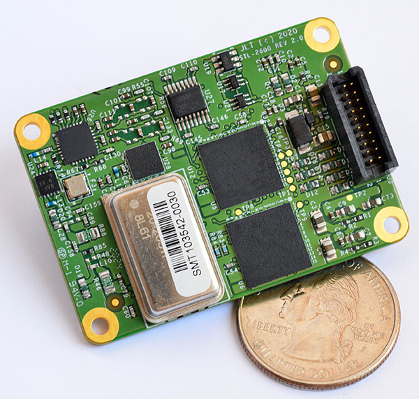
The STL-2600 Satellite Timing and Location (STL) commercial receiver was designed in partnership with Satelles Inc., the STL service provider. The STL-2600 provides a GNSS-independent, low-cost capability to generate UTC nanosecond timing and meters-accurate positioning anywhere in the world. The STL signal has 30-db (1,000 times) higher power compared to GPS signals, allowing the receiver to operate deep indoors independent of any GPS/GNSS signal. It is also useful in marine applications where GNSS signals are regularly denied or manipulated and for stationary high-accuracy timing applications such as 5G. It can be directly connected to JLT’s GPS Transcoder products for glueless retrofit capability of existing customer legacy GPS-only receiver systems to Galileo, GLONASS, BeiDou, QZSS and SBAS as well as adding the STL and optional atomic holdover capability to these legacy systems.
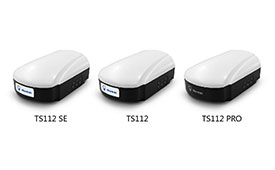
The TS112 family of smart antennas is designed for demanding applications such as agricultural machine autosteering systems that require high positioning accuracy. They offer scalable positioning solutions with increased GNSS availability, reliability and accuracy. Each of the three models embeds Harxon X-Survey four-in-one technology. The high-gain and wide beamwidth multi-constellation GNSS antennas integrate 4G, Bluetooth and Wi-Fi in a compact unit. They feature multi-point feeding technology, ensuring high phase-center stability and real-time kinematic (RTK) centimeter-level positioning accuracy. They integrate a high-precision GNSS module with multi-band GNSS receiver and Harxon’s four-in-one multifunctional GNSS antenna in a compact housing.
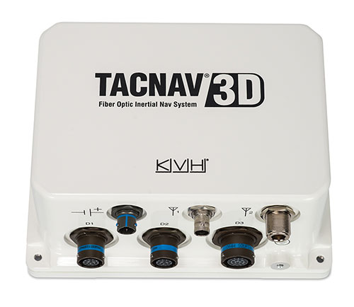
The TACNAV 3D tactical navigation system is now available with the P-1775 inertial measurement unit (IMU) featuring KVH’s new photonic integrated chip (PIC) technology. PIC technology features an integrated planar optical chip that replaces individual fiber-optic components to simplify production while maintaining or improving accuracy and performance. KVH’s IMUs with PIC technology are designed to deliver improved bias stability and greater accuracy. The fiber-optic gyro (FOG)-based TACNAV 3D tactical navigation system provides an assured positioning, navigation and timing (A-PNT) solution with an embedded GNSS and optional chip-scale atomic clock (CSAC).
IoTeX has selected Nordic Semiconductor’s nRF9160 low-power System-in-Package (SiP) with integrated LTE-M/NB-IoT modem and GPS receiver to provide the cellular internet of things (IoT) connectivity for its Pebble Tracker. The Pebble Tracker provides trusted location, environment and motion-tracking data for global asset tracking and industrial supply chain applications. Critical features strengthen security from hacking and data corruption, meeting the demand of applications that require strong data security and integrity protection throughout the supply chain. There are two versions of Pebble Tracker. The first targets blockchain and IoT developers, while a second commercial version is designed for the asset tracking and industrial supply chain markets. The product combines an environmental sensor, a motion sensor (gyroscope and accelerometer), and an ambient light sensor. It enables cellular network connectivity and integrated GPS support in a global version supporting precise, long-range tracking of asset data using established cellular infrastructure.
Enables transmission of corrections via the internet
Emlid Caster is an easy way to transmit corrections between real-time kinematic (RTK)-capable devices via the internet. Emlid Caster has a simple interface. Users can create their personal mount point and connect one base and up to five rovers. It works not only with Emlid products but any other device supporting NTRIP. For example, users can pass RTK corrections to the DJI Phantom 4 RTK drone from the Reach RS2 receiver as a base station. Emlid Caster is free and available worldwide. Once signed up, personal NTRIP credentials are generated automatically for a base and a rover.
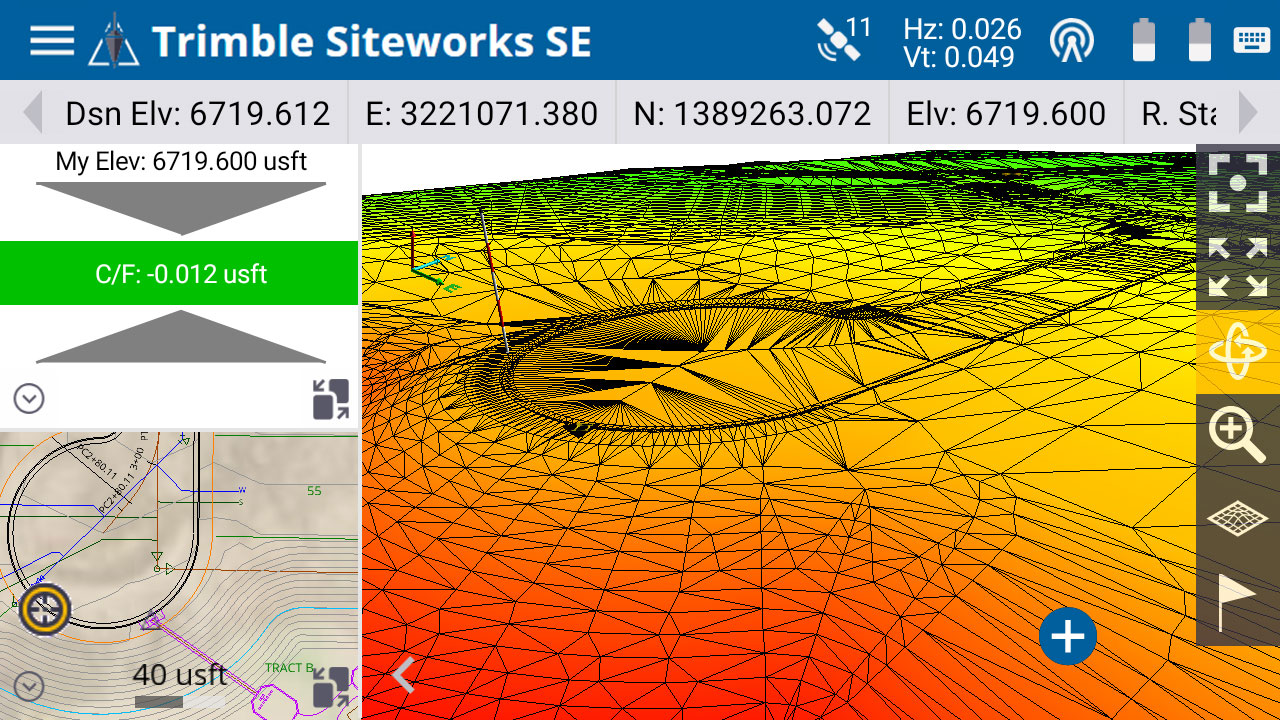
The Trimble Siteworks SE Starter Edition. (Screenshot: Trimble)
The Trimble Siteworks SE Starter Edition is an entry-level construction surveying software program. With the program and a construction GNSS receiver, a supervisor, foreman, grade checker or site engineer can easily check a grade, slope or alignment and navigate the project more accurately and in less time than with traditional survey methods. It also can give more personnel on the jobsite access to survey technology, enabling more productive and efficient field crews. Trimble Siteworks SE Software is a simplified version of Trimble Siteworks Software, intended for users who do not require a full feature set and are interested in a lower-cost version to connect to GNSS only. Contractors can easily upgrade to the full version.
The Leica CityMapper-2L configuration is designed for airborne urban mapping projects at low altitude operation. Lower flying heights can be required by air traffic control (ATC) restrictions and in areas with low cloud cover. It features a 71-mm focal length at nadir, suitable for 5-cm ground sample distance (GSD) data acquisition at flying heights of 940-m above ground level. The new lenses offer similar coverage and productivity for a specific GSD as existing configurations for standard and high-flying heights, while significantly expanding the operation envelope. The CityMapper-2 hybrid airborne sensor combines oblique imaging and a lidar in one system. The sensor efficiently creates digital twins of cities. The system includes two 150 MP nadir cameras (RGB and NIR), four 150 MP oblique cameras and a 2-MHz linear-mode lidar sensor.
Full-waveform flash data for autonomous vehicle development
Photo: LeddarTech
Leddar PixSet is a publicly available sensor dataset for advanced driver assistance and autonomous driving research and development. The dataset includes full-waveform data from LeddarTech’s Leddar Pixell, a 3D solid-state flash lidar sensor. LeddarTech is offering these datasets free of charge for academic and research purposes. It allows academic and engineering research teams specializing in advanced driver-assistance systems (ADAS) and autonomous driving technology to use existing sets of sensor data to test and develop advanced software and to run simulations without having to assemble new sensor suites and collect their own dataset. An instrumented vehicle was utilized in the development of the dataset. The various scenes were recorded in high-density urban and suburban environments as well as on the highway.
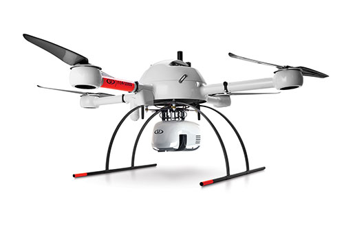
The mdLiDAR1000HR aaS drone lidar survey package is designed for professionals responsible for geospatial data collection, such as corridor mapping, mining (volume calculation), construction site monitoring, recording environmental changes over time, forestry, contour mapping, archaeology and cultural heritage, and more. The drone lidar system has a 90° field of view for both scanned points and imagery. It repeatedly provides a precision of 1.6 cm (.052 feet) when flown at 40 m (130 ft) at a speed of 8 m/s (18 mph). It integrates the Velodyne Puck Lite lidar sensor.
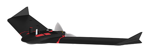
The fixed-wing eBee Ag drone can provide a complete assessment of a farm and crops faster than traditional field scouting. With its dual-purpose Duet M camera, eBee Ag captures accurate RGB and multispectral data that enable farmers to effectively assess crop health and help catch early indicators of pests, diseases and weed infestations that threaten crop yields. It features real-time kinematic (RTK) functionality for greater mapping precision. With its available RTK, the drone can achieve absolute accuracy down to 2.5 cm (1.0 inches) with RGB. Highly accurate index maps allow farmers to understand each acre while managing problematic areas field-wide.
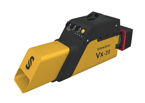
The Vx15-300 and Vx20-300 UAV lidar solutions are new additions to Yellowscan’s Vx product series. A new terrain software module allows users to automatically classify grounds from off-ground, as well as export various digital elevation models. Both integrate the Riegl Mini-VUX 3 airborne laser scanner (1.55 kg / 3.4 lbs), designed specifically for integration with UAVs. The scanner offers a selectable 100-kHz, 200-kHz and 300-kHz laser-pulse repetition rate (PRR). At 300-kHz PRR, the sensor provides up to 100,000 measurements per second at 120° field of view, and thus a dense point pattern on the ground for UAV-based applications that require the acquisition of small objects.
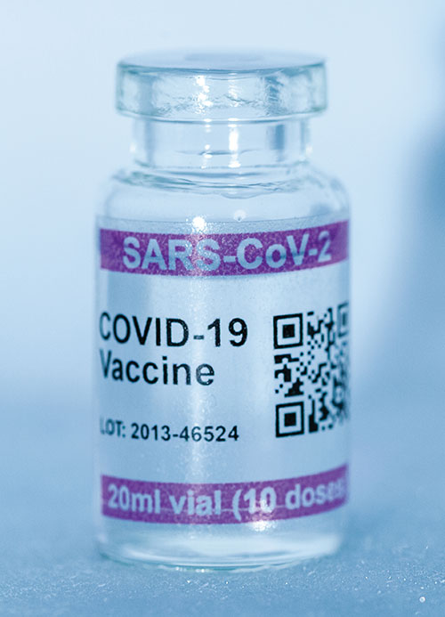
Cryo-Vacc containers use helium — a fraction of the weight of nitrogen — to provide safe transportation of vaccines at the required extremely low temperatures and for periods of up to 30 days, without the need for any power supply. Now in prototype, the containers work with both air and ground transportation. A temperature range of -150°C to 8°C, makes it versatile for a range of vaccines — including those for COVID-19 — that need to be transported for up to 25 days or longer in transit, where access to an external power source is not possible. Combined with cold-chain monitoring and asset tracking technology from Beyond Wireless (a World Health Organization-certified provider), Cryo-Vacc can provide accurate temperature readings of vaccines in transit, as well as GPS-based tracking to ensure the custody chain can be audited.
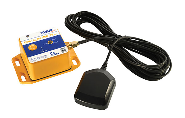
The tamper-proof MSR175plus GPS data logger records potentially damaging shock events as well as the associated ambient conditions with the exact geographic position via its GPS/GNSS receiver. It contains two 3-axis-acceleration sensors (±15 g/±200 g), a temperature sensor (-20 to +65° C), a humidity sensor (0 to 100% relative humidity), air pressure sensing (0 to 2000 mbar), and an ambient light sensor (0 to 65,000 lux). It helps ensure compliance with transport specifications and provides irrefutable data for identifying damage liability for help with insurance claims. An external connector is ready for a cable-connected antenna. The removable, rechargeable 2400 mAh LiPo-battery enables recording for up to 8 weeks (at least one year without GPS-based tracking).