Category: Mapping

  • LiDAR Mapping Forum Considers Geospatial Trends, UAVs

    ILMF 194-W2

    The International LiDAR Mapping Forum, set for February 23-25 in Denver, is a technical conference and exhibition focused on data acquisition, fusion, processing and point clouds for aerial surveying and mapping used to support transport, urban modeling, coastal zone mapping, utility asset management, and more.

    Geospatial Technology Trends. ILMF is considered by many the premier conference for the latest geospatial technological developments, from innovations in photogrammetry to advances in aerial LiDAR systems. Attendees can explore an international exhibition of leading hardware and software suppliers showing their newest releases, and attend sessions where more than 60 experts will present best practices and case studies for cutting-edge technologies such as:

    • Geiger-Mode LiDAR
    • Focal Plane Array (FPA) LiDAR
    • Mobile Mapping Systems (MMS)
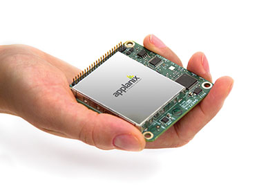
    • Unmanned Aerial Vehicles

    ILMF-288-WFocus on UAVs. This year, ILMF features a UAV workshop and pavilion, where industry leaders discuss the current regulatory landscape and legal guidelines, UAVs versus aerial LiDAR, training and insurance considerations and more.  Additional program content will cover topics like “Does Camera Quality Matter in sUAS Photography?” and “LiDAR Scanning with Supplementary UAV Captured Images for Structural Inspections.”

    Other topics covered at the conference include:

    • Data fusion
    • Extracting from point clouds
    • Managing large data sets/point clouds
    • Airborne, terrestrial and bathymetric LiDAR
    • Coastal zone, defense and flood plain LiDAR
    • Corridor and utilities mapping
    • Data classification, GIS

    Organizers say participants can gain much from networking with and gaining valuable information from other precision-measurement and imaging professionals across disciplinary lines. Attendance at ILMF 2015 is expected to exceed 800, and will include professionals from these organizations who have already registered:

    • ILMF-WAECOM
    • American Transmission Co
    • BAE Systems
    • Ball Aerospace
    • BNSF Railway
    • Bonneville Power Administration
    • Devon Energy Corporation
    • Dewberry
    • NASA
    • National Geospatial-Intelligence Agency
    • NAVAIR
    • U.S. Department of Agriculture
    • U.S. Department of Transportation
    • U.S. Forest Service
    • U.S. Geological Survey
    • Woolpert

    Registration is open.

    Photos: Tracy Cozzens

  • NGA Awards Harris Corp. $770M in Mapping Contracts

    Harris Corporation has been awarded a potential $770 million in indefinite delivery/requirements contracts for up to five years to provide geospatial data services for the National Geospatial-Intelligence Agency.

    Under Foundation GEOINT Content Management (FGCM) contracts, Harris will create high-quality data and products of the Pacific, North America, South America, and Africa regions of the world for use by the U.S. intelligence community and military. FGCM will contribute to and maintain a comprehensive, geospatially accurate map of the world that can be accessed quickly as intelligence, operational, and crisis needs arise.

    Harris will use its One Feature One Time database, which automatically eliminates data redundancy and stores the most current representation of each geospatial feature. This capability ensures data currency and significantly reduces the time required for processing and delivery of products compared with traditional methods.

    “Our unique solution provides improved accuracy, reduced production costs and significantly faster turn-around of geospatial products and content,” said Bill Gattle, vice president and general manager, National Programs, Harris Government Communications Systems. “This major win continues our legacy of providing high quality, responsive geospatial products to the intelligence and military communities.”

  • zLense Offers Real-Time 3D Depth Mapping for Broadcasts

    zLense3-W

    zLense, a specialist provider of virtual production platforms to the film, production, broadcast and gaming industries, is offering a depth-mapping camera that captures 3D data and scenery in real-time and adds a 3D layer to the footage. The camera is optimized for broadcasters and film productions.

    The technology processes space information, making new and real three-dimensional compositing methods possible, enabling production teams to create 3D effects and use state-of-the-art CGI in live TV or pre-recorded transmissions, with no special studio set up.

    With the zLense Virtual Production platform, directors can produce simulated and augmented reality worlds, generating and combining dynamic virtual reality (VR) and augmented (AR) effects in live studio or outside broadcast transmissions. The depth-sensing technology allows for a full 360-degree freedom of camera movement and gives presenters and anchormen greater liberty of performance. Directors can combine dolly, jib arm and handheld shots as presenters move within, interact with and control the virtual environment and, in the near future, using only natural gestures and motions. zLense1

    “We’re poised to shake up the Virtual Studio world by putting affordable high-quality real-time CGI into the hands of broadcasters,” said Bruno Gyorgy, President of zLense. “This unique world-leading technology changes the face of TV broadcasting as we know it, giving producers and program directors access to CGI tools and techniques that transform the audience viewing experience.”

    Doing away with the need for expensive match-moving work, the zLense platform dramatically speeds up the 3D compositing process, making it possible for directors to mix CGI and live action shots in real-time pre-visualization and take the production values of their studio and OB live transmissions to a new level. The solution is quick to install, requires just a single operator, and is operable in almost any studio lighting.

    “With minimal expense and no special studio modifications, local and regional TV channels can use this technology to enhance their news and weather graphics programs — unleashing live augmented reality, interactive simulations and visualizations that make the delivery of infographics exciting, enticing and totally immersive for viewers,” he continued.

    The zLense Virtual Production platform combines depth-sensing technology and image-processing in a standalone camera rig that captures the 3D scene and camera movement. The matte box sensor unit, which can be mounted on almost any camera rig, removes the need for external tracking devices or markers, while the platform’s built-in rendering engine cuts the cost and complexity of using visual effects in live and pre-recorded TV productions. The zLense Virtual Production platform can be used alongside other, pre-existing, rendering engines, VR systems and tracking technologies.

    The VFX real-time capabilities enabled by the platform include:

    • Volumetric effects
    • Additional motion and depth blur
    • Shadows and reflections to create convincing state-of-the-art visual appearances
    • Dynamic relighting
    • Realistic 3D distortions
    • Creation of a fully interactive virtual environment with interactive physical particle simulation
    • Wide shot and in-depth compositions with full body figures
    • Real-time Z-map and 3D models of the picture.
  • Mapping Our Inner GPS

    How does our brain understand where our body is in space, and navigate us from home to work? The components of Google Maps are easy for us to discern. We readily understand the mix of GPS location, an extensive map and a sophisticated way-finding algorithm. Our ability to understand our body’s innate relationship to location is far more complex. Discovery of the “inner GPS” of the brain was recently recognized with the 2014 Nobel Prize in Physiology or Medicine, awarded to John O’Keefe, May-Britt Moser and Edvard Moser.

    O’Keefe discovered the first component of the brain’s positioning system. He found that a type of nerve cell in the brain’s hippocampus, our short-term memory storage bin, was always activated when a rat was at a certain place in a room. As a rat ran through a maze, a particular sequence of individual neurons fired. Other nerve cells were activated when the rat was positioned elsewhere. O’Keefe concluded that these “place cells” formed a map of the room.

    When the rats slept, the same sequences of place cells that were fired earlier in the day fired again. Researchers think that this replay helps to transfer the rat’s memory of the maze from the hippocampus into long-term storage. Place cells also attach to memories of a particular location. When sitting at a table, a person or maybe even a rat might remember a pizza that was eaten at that spot.

    Many decades later, the Mosers discovered another component of the brain’s positioning system. They identified “grid cells,” which are thought to act like a dead reckoning system and generate a coordinate system to allow for precise positioning and pathfinding. The grid cells create a location to put place cells and organize position locations. Rats running around an open floor (hopefully not mine), will fire neurons that map out a grid of equilateral triangles that serve as a spatial map. Grid cells can function in complete darkness, without visual cues. Together, place and grid cells make it possible to determine position and to navigate.

    While place and grid cells were first discovered in rats, studies using brain imaging indicate that they also occur in humans. Alzheimer’s patients and those with other neurological diseases are sometimes unable to recognize familiar locales and lose their way. The areas of the brain with the place and grid cells are in the precise area of the brain that is usually affected by Alzheimer’s disease.

    With nav apps and access to cell phones, we don’t need to exercise our innate mapping and positioning abilities as much. I wonder if the neurons that were created to help us find our way will suffer from underuse. The opposite seems to be true. A study found that the hippocampi of experienced London taxi drivers were significantly bigger than those of us regular folks. Perhaps a byproduct of Google Maps is a stunted hippocampus. My head feels smaller already.

  • Leica, Aibotix, and Headwall Offer Airborne Sensor Solution

    The Airbotix X6.
    The Aibotix X6.

    Leica Geosystems, Aibotix and Headwall Photonics are offering an integrated high-performance airborne sensor solution using a hyperspectral imager and the Aibot X6 unmanned aerial vehicle (UAV). The Nano-Hyperspec sensor is optimized for size, weight and power to enable aerial acquisition of all spectral and spatial data within the scene of interest. A UAV with integrated Headwall sensor has been successfully flown and was presented at InterGeo 2014, held last week in Berlin.

    Precision agriculture, forestry, geological research, and environmental monitoring are application areas that can benefit from the airborne hyperspectral imaging solution, the companies said. Equipped with the hyperspectral imager, the Aibot X6 can, for example, take pictures of fields or vineyards to determine the chlorophyll content, plant health, and invasive species, and offer farmers information on the state of the plants and harvest. By means of UAV and hyperspectral imager, farmers can measure before harvest, where the grain is driest or should be mowed first. Or, they can determine where rain has washed away fertilizer and where they must re-fertilize.

    For geological mapping, landfills and open mine sites can be overflown to quickly and efficiently track precious metals or minerals. Environmental monitoring and research to derive contamination of soil or water can be determined spectrally from the air quickly using the Aibotix UAV and Nano-Hyperspec sensor.

    The Nano-Hyperspec sensor measures 76.2 x 76.2 x 119.4 millimeters and weighs less than 0.68 kg. The sensor is integrated with a high-speed data processor and high-capacity flash storage. It collects image data across 640 spatial bands and 270 spectral bands with a Visible-Near-Infrared (VNIR) range of 400-1000 nm. The field of view is exceptionally wide, meaning that flight swath efficiency is maximized to cover as much territory as possible while the UAV is aloft. Further, it delivers crisp image data not only directly underneath the flight path but off to the edges.

    The integrated data storage is 480 GB, which will yield more than two hours at a frame-rate collection rate of about 100 fps, which is matched to the actual performance of the UAV itself. The direct-attached GPS with IMU yields the ability to generate ortho-rectified imagery data products.

    The Nano-Hyperspec comes pre-loaded with an airborne version of its Hyperspec III application software that manages sensor operation, image acquisition, and sensor performance while aloft. Hyperspec III software is designed to work in a complementary fashion with the GPS/IMU as well as incoming LiDAR data to collect spectral data and generate a completely integrated hyperspectral data cube.

  • Topcon to Add 3D Mobile Mapping System to Product Lineup

    The IP-S3 3D mobile mapping system, by Topcon.
    The IP-S3 3D mobile mapping system, by Topcon.

    Topcon Positioning Group will add the IP-S3 to its line of 3D mobile mapping systems by the end of this year. The fully integrated high-density digital imaging system is more compact, lightweight, and designed to scan at a rate up to five times faster than previous models.

    Scanning at 700,000 points-per-second, the system is designed to offer data-rich results with its 30 MP panoramic imagery. Weighing 18 kg (39 lb.), the IP-S3 is engineered to offer simplified installation.

    “The IP-S3 is a mobile mapping powerhouse,” said Charles Rihner, vice president of the Topcon GeoPositioning Group. “It bundles years of mobile mapping experience to glean a high-density and high-resolution camera in a unit that is much smaller than its predecessors. It is so lightweight that a single person could mount it on a vehicle without assistance from anyone else.”

    The system pairs with Topcon Mobile Master Office software to perform all post-processing functions in a single application.

    “Mobile Master Office software offers a complete workflow in a single package, turning raw sensor data collected by the IP-S3 system into rich and precise point clouds and images,” said Rihner.

    The system is planned for release in late 2014.

  • Trimble Offers Pipeline Construction Software for Oil and Gas

    The Trimble Access Pipelines launcher.
    The Trimble Access Pipelines launcher.

    Trimble announced today an addition to its Trimble Access family of field software applications: Trimble Access Pipelines. Designed for surveyors involved in oil and gas pipeline installation, Trimble Access Pipelines addresses challenges encountered by pipeline surveyors by automating common pipeline survey tasks. The software solution saves time by simplifying attribute and inventory collection and integrating all the data into one easy-to-use data collection workflow.

    The announcement was made today at InterGeo 2014, the world’s largest conference on geodesy, geoinformatics and land management.

    Trimble Access Pipelines, a new addition to the ever-increasing suite of applications available for Trimble Access field software, offers a streamlined workflow for pipe inventory collection and validation, weld mapping and as-built measurements. The software significantly reduces project time and redundancies by collecting pipe attribute data, recording the relationship between welds and pipes, and electronically linking the joint attributes to measured welds. Using the application, pipeline surveyors can capture the necessary data so construction can proceed without costly delays.

    Trimble-Access-Pipeline-Screen-W

    The complete end-to-end solution is enabled when combining the power of Trimble Access Pipelines and Trimble Business Center. Trimble Access Pipelines can quickly generate customized reports for the tally and weld map data or the surveyed pipeline directly on the controller. All field data can be seamlessly transferred into Trimble Business Center to produce rich, complete deliverables including as-built plots using the Trimble Business Center Advanced Drafting module.

    “One of the most time consuming challenges pipeline surveyors face is the collection of pipe attribution detail and recording the information with weld positions,” said Benoit Mallen, business area manager of Oil and Gas for Trimble’s Geospatial Division.”With Trimble Access Pipelines, we have leveraged Trimble’s strength in positioning technology and combined it with a workflow-specific application to create a streamlined solution that can meet the needs of geospatial professionals working in the oil and gas industry.”

    Trimble Access Pipelines and Trimble Business Center Software version 3.30 are available now through Trimble’s Geospatial Distribution Channel.

    A free trial of the Trimble Access Pipelines application as well as other available modules for Trimble Access are available to all existing Trimble Access users, and can be activated and installed using the Trimble Access Installation Manager. For more information on Trimble Field software, visit www.trimble.com/Survey/Field-Software.

  • Applanix Offers Single-Board GNSS-Inertial System for UAV Mapping

    apx-15-in-hand
    Photo: Applanix

    Applanix, a mobile mapping and positioning company, has introduced a new product that enables major improvements in unmanned airborne mapping: the Applanix APX-15 UAV GNSS-Inertial System. The announcement was made at InterGeo, being held this week in Berlin.

    The APX-15 UAV is designed to maximize the efficiency of mapping from small unmanned aerial vehicles (UAVs) by reducing — or even eliminating — Ground Control Points (GCPs). Sidelap is also significantly reduced, increasing the area flown per mission. The Applanix APX-15 UAV provides performance in a small package and, with the included POSPac UAV post-mission software, produces a highly accurate position and orientation solution for direct georeferencing of cameras, LIDARs and other UAS sensors, the company said.

    “Applanix has recognized the need to provide the growing UAS mapping market with the same highly efficient solutions that it pioneered for airborne mapping over 15 years ago,” said Joe Hutton, Director of Inertial Technology and Airborne Products at Applanix Corporation. “We are offering a cost-effective solution that meets the size, weight, power and cost requirements of small UAS, and maintains the Applanix pedigree for quality and performance.”

    The APX-15 UAV, measuring just 6 cm x 6.7 cm and weighing only 60 grams, features a high-performance, survey-grade, multi-frequency GNSS receiver and low-noise MEMS inertial sensors all on a single board. The Applanix IN-Fusion GNSS-Inertial integration technology runs directly on the GNSS receiver, resulting in an ultra-compact design, while superior performance is achieved from the inertial sensors using the Applanix SmartCal software compensation technology.

    With 220 channels, the APX-15 UAV tracks all available GNSS satellite signals including GPS L1/L2/L2C/L5 and GLONASS L1/L2, QZSS, BeiDou and Galileo, and provides a highly accurate post-mission and real-time RTK GNSS-inertial position and orientation solution to support guidance and control, precision landing and sensor geo-referencing.

    APX-15 UAV is expected to be available worldwide in the first quarter of 2015 through the Applanix sales channel.

  • NGA Issues Advisory Notice on Web Mercator for Mission-Critical Operations

    The National Geospatial-Intelligence Agency (NGA) has issued an advisory notice on the use of Web Mercator for mission-critical operations.

    The notice outlines application risks to operations and adherence to Department of Defense World Geodetic System 1984 (WGS 84).

    “This message outlines the risks associated with the use of Web Mercator applications for DoD and GEOINT user community operations. The NGA Geomatics Office has assessed the use of Web Mercator and other non-WGS 84 spatial reference systems may cause geo-location / geo-coordinate errors up to 40,000 meters. This erroneous geospatial positioning information poses an unacceptable risk to global safety of navigation activities, and Department of Defense, intelligence community, and allied partner systems, missions, and operations that require accurate and precise positioning and navigation information. The NGA Geomatics Office reminds the community to use DoD approved World Geodetic System 1984 (WGS 84) applications for all mission critical activities.”

    Many popular commercial visualization, mapping and mobile web device applications use a Web Mercator spherical earth reference. “These applications are not an equal alternative to DoD WGS 84, as they do not provide the same geo-coordinates or geo-location accuracies,” the advisory states.


  • Live from InterGeo

    Geospatial Solutions/GPS World staff will be reporting from InterGeo October 7-9. The massive trade show, held this year in Berlin, is considered the world’s leading conference trade fair for geodesy, geoinformation and land management. With more than 16,000 visitors from 80 countries, it is one of the key platforms for industry dialogue.

    Staff members attending include GPS World Editor and Publisher Alan Cameron, Survey/GIS Editor Eric Gakstatter, and Digital Editor Joelle Harms. All three are accepting meeting invitations for companies interested in discussing their products and services. Contact [email protected].

    VIDEOS

    Supergeo Technologies, Inc., chats with Eric Gakstatter, GPS World and Geospatial Solutions contributing editor, about its different GIS solutions for worldwide users.

    PHOTOS


    BLOGS

    InterGeo: The Worldwide GIS Showcase (09/25/14)

    NEWS

    Sokkia Introduces NET AXII Measuring Station (10/07/2014)

    Topcon Announces Latest Addition to 3D Layout Line (10/07/2014)

    Trimble Offers Expanded GNSS Portfolio for Surveyors (10/07/2014)

    Trimble Offers Pipeline Construction Software for Oil and Gas (10/07/2014)

    Carlson Software Introduces Surveyor2 Data Collector at InterGeo (10/07/14)

    Carlson Launches GIS360 for Android at InterGeo (10/07/14)

    Hemisphere GNSS Offers New Survey-Grade GNSS Antennas (10/07/14)

    Applanix Offers Single-Board GNSS-Inertial System for UAV Mapping (10/07/14)

    Icaros to Unveil Versatile Nadir/Oblique Aerial Mapping System at InterGeo (10/03/14)

    InterGeo Event Considers Land Management Challenges (10/03/14)

    Trend- and Media-Forum at InterGeo Features Innovation, China (10/03/14)

    Juniper System, Soil Instruments Partner on Geotechnical Monitoring (10/03/14)

    Oxford Technical Solutions Launches Board Set for System Integrators (10/03/14)

    Orbit GT Showcases UAS Mapping Pro at InterGeo (10/03/14)

    Icaros to Demonstrate Measuring Tool for Oblique Imagery at InterGeo  (09/24/14)

    EUROGI Conference to Be Held in Conjunction with InterGeo (08/11/14)


    Join Us for Our Post-Show Webinar

    New Product Trends in UAV, Survey, Mapping, and Geospatial Data Collection and Analysis
    InterGeo Post-Show Report

    Thursday, October 16, 10 a.m. PDT/ 1 p.m. EDT / 5 p.m. GMT

    Summary: UAVs (unmanned aerial vehicles) are taking over the surveying industry, thanks to their ever-improving sensors and the fact that they are getting lighter and can therefore remain in the air for longer. They complete surveying and inspection tasks that would otherwise be difficult to tackle, and do so with impressive cost-efficiency. UAV trends and technology will be among the focal points at the InterGeo conference in Berlin in early October.

    Our correspondents will return with a fresh report, moderated by GPS World Editor and Publisher Alan Cameron and Survey Scene Editor Eric Gakstatter.

    Register for free!

  • Icaros to Unveil Versatile Nadir/Oblique Aerial Mapping System at InterGeo

    Icaros, Inc., a provider of aerial remote sensing and 3D visualization solutions, will unveil the IDM 1000 digital oblique mapping system next week at the 2014 InterGeo Conference in Germany. The versatile Icaros Digital Mapper (IDM) 1000 combines a high-accuracy photogrammetric nadir camera with four high-quality oblique sensors in a modular airborne imaging package.

    “Icaros developed the IDM 1000 for mapping organizations that want to maximize their investment in an aerial sensor system,” said Tom Bosanko, CEO of Icaros. “The IDM 1000 can be configured to meet the geospatial application needs of traditional photogrammetric imaging as well as 3D oblique mapping, all in one flexible system.”

    Icaros will display the IDM 1000 in booth #A4.009 Hall 4.1 at the InterGeo Conference and Trade Fair being held in Berlin October 7-9.

    The modular IDM 1000 package is built around the IDM 200 nadir camera with a new mount supporting up to four 45-degree oblique sensors. The standard IDM 1000 configuration includes an 80-megapixel (MP) nadir natural-color (RGB) sensor, four 36-MP oblique RGB sensors, modular mount, embedded GPS/INS, flight planning and management system, and the Icaros Photogrammetric Suite (IPS) of software tools.

    “Clients have the option of purchasing the IDM 1000 as a complete solution,” said Bosanko. “Or they can buy and operate the IDM 200 as a stand-alone unit and add the oblique cameras and mount later as their mapping offerings expand to include 3D modeling and oblique visualization.”

    The IDM camera family offers eight sensor-design alternatives, including near infrared and thermal infrared imaging. Each IDM camera delivers sub-pixel accuracy, high-dynamic range and true-color pixel collection. Depending on altitude, the pixel GSD ranges from 1 cm to 100 cm in nadir or oblique operations. The IDM 1000 can be flown on rotor or fixed wing aircraft and modified for flight on some UAVs.

    Aerial oblique imagery is used extensively in tax appraisal and assessment, and its applications are expanding rapidly into facility management, infrastructure monitoring, building energy audits, public safety and other GIS markets that benefit from creation of accurate 3D models and elevation data sets. The IDM 1000 is considered ideal to serve in the energy, utility, oil & gas, mining, urban development, security and defense markets.

    “The IDM 1000 package includes all of the software needed to process nadir and oblique imagery and perform advanced photogrammetric measurements,” said Bosanko. “The new Icaros Measurement Tool (IMT) is included.”

    The IMT is a universal oblique measurement tool. It enables customers working within Esri’s GIS environment to view and measure structures in oblique aerial imagery captured by any commercial oblique sensor system, including those from Pictometry, Vexcel/Microsoft, IGI, Leica, and Midas. IMT works equally well measuring images captured by oblique sensors mounted on unmanned aerial vehicles (UAVs).

    As GIS users continue the move to 3D, oblique imagery will be critical for constructing accurate image-based realistic 3D models. IMT enables users to manipulate and view oblique imagery while leveraging other geospatial data layers within their GIS environment. This capability allows users to navigate multi-image scenes in three dimensions while zooming and panning.

    The IMT software will also be demonstrated in the Icaros booth at InterGEO.


  • Orbit GT Showcases UAS Mapping Pro at InterGeo

    Orbit GT_AS-MappingPro11

    Orbit GeoSpatial Technologies will showcase Orbit UAS Mapping Pro, version 11.0, at InterGeo, October 7-9 in Berlin.

    “Orbit’s UAS Mapping Pro 11.0 is an impressive product for all professional UAV systems engaged in mapping,” said Peter Bonne, CEO at Orbit GT. “Based on our seven-year experience in high-precision UAS mapping, this software covers the complete UAS workflow for mapping purposes.”

    Orbit UAS Mapping Pro includes preflight setup, post-processing, orthocreation, dense DEM creation, creation of contour lines, extraction of profiles, calculation of volumes and stereo-viewing. It also includes digitizing tools to convert raw data to 3D vector data ready for GIS or CAD.

    Orbit’s approach to continue support for photogrammetric techniques joins with detailed user control over processing tools. Reports list the results in high detail for professional use.

    Orbit GeoSpatial will exhibit in booth E2-038 in Hall 2.1.