Septentrio and Altus will be presenting their high-performance RTK systems at ION GNSS+ 2014. Attendees are invited to learn more at:
The Triple-frequency Multi-system RTK Engine for Challenging Environments (Session A1 room 18, Wed. 9/10 @11:48)
Gap Bridging in Precise Point Positioning (Session B6 room 19, Fri. 9/12 @3:20)
High-performance RTK provides accurate positioning
in urban environments or under dense canopies
while suffering high ionosphere activities or
when coping with sparse networks
for maintaining a smooth transition during outages
Plus, there is no baseline impact, even at greater than 40 kilometers. Visit booth 318/320 in the Exhibit Hall to learn more about the technology behind the performance.
Loctronix Corporation, a provider of positioning, navigation, and timing (PNT) solutions for GNSS-challenged environments, has unveiled the HGX Interference Detection System (IDS) for identifying and monitoring intentional and unintentional interference sources. The IDS is being demonstrated September 10-11 at ION GNSS+ 2014, in Tampa, Florida.
“The IDS can detect sources of interference ranging between 5 dB and 60 dB GNSS jamming to signal (J/S) ratio. Featuring a novel profiling function, the IDS not only detects, but can identify the type of interference given a database of known/previously recorded profiles,” stated Michael Mathews, Loctronix’ CEO and founder.
According to Mathews, “The greater dependence of GNSS within critical infrastructure — including, transportation, communications, finance and the growing availability of jammers — requires new tools to respond to potential threats. The IDS is the first tool to combine the powerful capabilities of Loctronix Spectral Compression Positioning (SCP) technology for identification and characterization of signals with traditional GNSS signal processing to provide full situational awareness of GPS/GNSS operations. The IDS system will benefit government, military, and commercial/industrial applications wherever there is a critical dependence upon quality GNSS data.”
The IDS was developed using the Loctronix HGX hybrid sensor toolkit along with the company’s ASR-2300 ASR Workbench software defined radio platform. The standard implementation supports L1 GNSS bands and measurement rates of 10 measurements per second. Partner-licensed custom/solutions can support multiple bands (such as L2, L5) with greater bandwidths and measurement rates. Multiple sensitivity modes enable monitoring of sub-thermal and high-power interference.
The HGX toolkit API will be available for specialization of the system for custom/embedded applications and adaptation to other hardware platforms. Visit Loctronix in Booth 422.
MobileFocus, a technology demonstration event held at Caesar’s Palace in Las Vegas Sept. 9, showcased dozens of companies previewing new smartphones, tablets, GPS devices and wireless receivers. This year’s Western-themed barbeque dinner event gave exhibitors of all sizes a chance to meet one-on-one with end users and demonstrate their innovations.
TEOCO, a provider of assurance, analytics and optimization solutions to communications service providers, has expanded the testing capabilities of its AIRCOM Device Test Lab in Columbia, Maryland, with additional test systems from Rohde & Schwarz. Combined with Rohde & Schwarz’s conformance and carrier test case support, the R&S TS-LBS Location Based Services (LBS) and the R&S CMW-PQA Performance Test Systems enable TEOCO to support new industry and carrier testing requirements for next-generation wireless technologies including carrier aggregation, IMS, VoLTE, RCS, E911 over IMS, LTE A-GNSS, LTE OTDOA and LTE eCID.
Release 10 and beyond, also referred to as LTE-Advanced, allows for a substantial uplift in the capacity and throughput of LTE, in addition to mobile device performance improvements. In LTE-Advanced, carrier aggregation (CA) is a key feature that allows the combination of multiple carriers to increase bandwidth and ultimately data rates in the network. To meet this need, the R&S CMW-PQA test system performs automated testing of a devices downlink, uplink and bidirectional data performance with or without carrier aggregation under simulated network conditions.
LBS is already a key technology enabling a myriad of new applications that people depend on every day. LTE and additional satellite constellations are being leveraged to improve availability and performance of location technologies indoors and outdoors. Higher customer expectations are driving the need for more advanced testing methodologies, and the R&S TS-LBS test system supports field-to-lab testing where real-world conditions are captured with high performance 16-bit resolution, and replayed in the lab for more accurate simulation.
“We are excited to expand our testing capability and capacity for LTE-Advanced and LBS-enabled devices,” said Hemant Minocha, Executive Vice President at TEOCO. “And given the increase in test complexity and costs, we are pleased to be working with a partner such as Rohde & Schwarz whose expertise in conformance and carrier acceptance testing and breadth of test cases helps future-proof our investment while delivering the quality and results our customers have come to expect.”
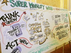
GPS World reports live from CTIA Super Mobility Week in Las Vegas Sept. 9-12. The first ever Super Mobility Week now combines the former CTIA annual conference and MobileCON, and is expected to draw 1,100 exhibitors from around the world and features major product launches and trade news.
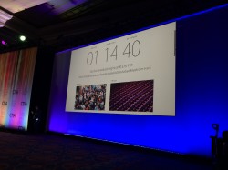
GPS World Digital Editor Bethany Chambers, Wireless Editor Janice Partyka and LBS Editor Kevin Dennehy will be reporting all week here on GPSWorld.com, on Facebook and on Twitter @GPSWorld. The convention has some unique twists, including a house band led by Thomas Dolby (producer of 1982 hit “She Blinded Me With Science”) and the largest-ever tradeshow heat map, showing event popularity by tracking Wi-Fi connections throughout the conference.
The morning sunlight steams into the Sands Expo Center.
The former spring CTIA conference and fall MobileCON show have now been wrapped into one large fall Super Mobility Week. Photo: GPS World
The line to register formed long before the 8 a.m. opening time on Day 1 at CTIA Super Mobility Week.
Crowds head to and from CTIA Super Mobility Week registration on Day 1.
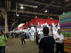
Super Mobility Week attendees have miles of walking in the next three days. Sands Expo has 2.25 million square feet of show floor and meeting space.
A screen counts down to the Apple Live Event, an announcement that had the crowd abuzz.
Thomas Dolby leads a string quartet in a cover of “Bittersweet Symphony.”
CTIA President & CEO Meredith Atwell Baker opens Super Mobility Week.
CTIA President Meredith Atwell Baker laughs as The Daily Show’s Larry Wilmore provides news updates between opening keynotes.
Michel Combes, CEO of Alcatel-Lucent, speaks about the “video first” world we live in during the mobile video panel. Photo: GPS World
In the same panel, Hulu’s Tim Connolly reminisces about attending CTIA back when it was an “IT show.”
CTIA fielded a panel of experts moderated by CNBC’s Julia Boorstin to respond to Apple’s Live Event.
CTIA’s opening keynotes attracted a standing-room-only crowd.
Photo: GPS World
CTIA CEO Meredith Atwell Baker opens Day 2 of CTIA, saying of government regulation “We need engagement not from D.C. but from where you live.” Photo: GPS World
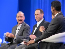
AT&T’s Ralph de la Vega and Glenn Lurie moderated the Connected Car panel at CTIA. Photo: GPS World
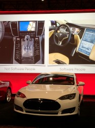
A connected Chevy Corvette and Tesla Model S sit beside the stage during the Day 2 Morning Keynote. Photo: GPS World
Jeff Lawson, CEO of Twilio, speaks on “The Ways of the Software People.” Photo: GPS World
Jeff Lawson, CEO of Twilio, comparing “hardware people” and “software people,” says Tesla’s Model S interior forgoes extra buttons for useful, adaptable software. Photo: GPS World
SAP CEO Bill McDermott’s book Winner’s Dream comes out in October. Photo: GPS World
Photo: GPS World
The show floor heat map, by Mexia, uses sensors throughout Sands Expo to show where people are connecting to Wi-Fi. Photo: GPS World
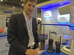
Tobias Eger, product marketing manager for Israel-based Galtronics, displays some of the company’s GPS antennas. Photo: GPS World
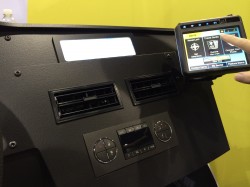
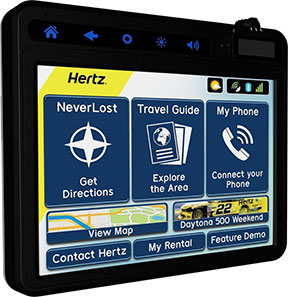
Hertz NeverLost GPS navigation system incorporates Bluetooth connection, hands-free calls, travel guides, weather, and flight information. Photo: GPS World
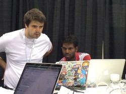
Igor Barinov of Santa Clara, California, and Bhaskar Vooradi of Detroit pour over their work during the Ford App Pursuit Hackathon on the CTIA show floor, with $50,000 at stake. Photo: GPS World
Joshua Carr of Winchester, England, works on his idea for a Ford AppLink app. He’ll present his idea September 11 on the final day of CTIA Super Mobility Week. Photo: GPS World
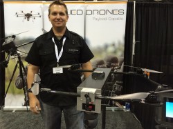
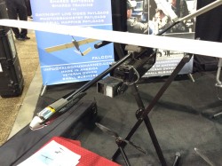
Joshua Kornoff, president of Allied Drones, started building UAVs for Hollywood special effects and now has branched into other areas. Photo: GPS World
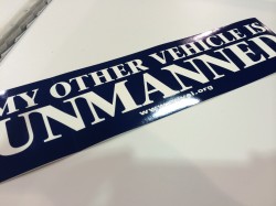
A bumper sticker from the Association for Unmanned Vehicle Systems. Photo: GPS World
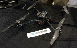
Skyworks, started by University of Nevada – Las Vegas students, is now launching drones for indoor use. Photo: GPS World
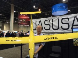
Cody Remington, sales manager for UASUSA, says his company’s UAVs are “efficient and aesthetically pleasing.” Photo: GPS World
Falcon Unmanned differentiates itself by having a modular payload that’s plug-and-play, says President Chris Miser. Photo: GPS World
CNBC broadcasts live from the Super Mobility Week show floor. Photo: GPS World
Taoglas antennas on display at CTIA. Photo: GPS World
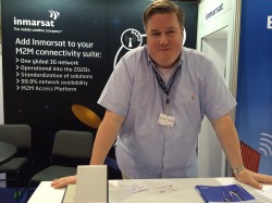
Joel Schroeder, director for strategic development at Inmarsat, says the mix of devices, air time and a standardized API management platform, has the company primed for growth in the next year. Photo: GPS World
The show floor features 1,100 booths. Photo: GPS World
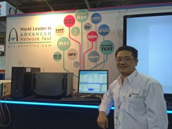
James Trinh, regional sales manager for Aeroflex, says “all the technologies converging at once means more complexing — and more need for testing.” Photo: GPS World
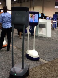
Suitable Technologies demonstrated its remote presence system, BeamPro, on the show floor. Photo: GPS World
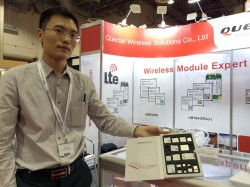
Jaron Xu, Marketing Director for Quectel Wireless, displays some of the modules the Shanghai-based company is just starting to market in the U.S. Photo: GPS World
On the last day of the CTIA Super Mobility Week, attendees were registering for the 2015 show, also in Las Vegas. Photo: GPS World
Thomas Seiler, CEO of u-blox AG, and Nick Papadopoulos, president of u-blox America, speak exclusively to GPS World about what makes u-blox the industry leader in embedded wireless technology and about the innovations on display at CTIA. They also give a preview of new products that will be coming out soon.
GNSS modules are a relatively new area of business for the London-based Telit, already the leader in cellular modules. Taneli Tuurnala, CEO of Telit GNSS Solutions, admits that Telit is currently the No. 2 player in the GNSS market. But that won’t last, he says. And here’s why.
Thorsten Hertel, PhD, OTA Specialist for Rohde & Schwarz, gives GPS World a demonstration of the DST200 RF Diagnostic Chamber, which provides accurate radiated testing of wireless devices. He also highlights some recent updates.
Get to Know Maxtena (9/11/14) – On the CTIA show floor, Vanja Maric, Director of Sales & Marketing for Maxtena, explains more about Rockville, Md.-based Maxtena, “the antenna innovations company.”
What To See at the u-blox Booth at CTIA (9/10/14) – In this first clip of our interviews with u-blox executives, Nick Papadopoulos, president of u-blox America, Inc., tells CTIA Super Mobility Week show-goers what they should see at the u-blox booth, #5229 on the show floor.
Taneli Tuurnala: What’s New from Telit (9/9/14) – See the first clip of our interview with Telit GNSS Solutions CEO Tuurnala, on what to expect in the next six months from the company.
Crowds streamed into the Sands Expo and Convention Center, Las Vegas, to the sounds of ’80s music icon Thomas Dolby and a string quartet covering the ’90s hit “Bittersweet Symphony,” but the buzz wasn’t about the morning keynote speech that would kick off CTIA Super Mobility Week. Instead, the impending Apple Live Event had taken over as a countdown clock ticked on the big screen.
The Apple circus — though alluded to in introductory remarks by CTIA Chairman Dan Mead, CEO of Verizon Wireless, and CTIA President Meredith Atwell Baker — would have to wait. First on the agenda: Several topics affecting the industry, with an emphasis on spectrum allocation.
Atwell Baker set up the three-day show, the first combining the CTIA conference with MobileCON. She cited dozens of figures about the incredible growth of the industry before focusing in on the need for a successful spectrum incentive auction with projected 886% mobile data usage growth by 2019.
“The U.S. had the third-lowest amount of spectrum dedicated to LTE,” she said. “How do we close the gap? The AWS-3 and 600MHz auction are a great start. We hear the wireless carriers may sit out of these auctions. Really? Given our track record, I’m incredulous wireless carriers wouldn’t bring billions of dollars to these auctions.”
The Federal Communications Commission (FCC) has been pushing for the spectrum incentive auctions to reallocate spectrum from television broadcasters to wireless providers for ever-increasing mobile usage.
In introducing Tom Wheeler, chairman of the FCC, Atwell Baker lauded his determination to bring the auctions to fruition.
Wheeler jumped right into his list of the Top 3 issues facing the business for the standing-room only crowd: the incentive auction, net neutrality and competition in the wireless industry.
Wheeler balanced his concerns with equal doses of praise, lauding CTIA for a “very thoughtful” paper arguing that mobile broadband should not be subject to the same rules as fixed broadband while alternately questioning why some consumers have been led to believe they have unlimited data usage or why others are targets for throttled usage.
“I’m hard-pressed to understand how either practice, much less the two together, could be a reasonable way to manage a network,” he said.
He also touched on the need to keep competition alive in the business and avoid the “walled gardens” of the past that created barriers to entry in the market.
“Where competition exists the commission must protect it. This industry has always told policymakers, ‘We’re different, we’re competitive, but in the last couple of years the FCC and Department of Justice had to be poised to protect that dynamic.”
Wheeler pointed out the wireless industry’s $260 billion 10-year infrastructure investment as “living proof that profit and progress can go hand in hand” before concluding on the topic of a shared front: spectrum allocation.
“Our greatest public asset is that which we cannot see: Spectrum. Your government has heard your cry for more spectrum. The Congress responded with a creative and courageous solution,” he said, “an incredibly complex, never-before attempted undertaking.”
Open Garden, a finalist at CTIA’s Super Mobility Week Startup Showcase, has announced a new generation Mobile Network for IoT devices, and a tracking device is the first to leverage the new technology.
With the increasing number of connected devices and the need for ubiquitous data transmission, device manufacturers are faced with very few options that fit their constraints in terms of cost, device size, battery life, and reliable connectivity, Open Garden said.
The TrackR easily attaches to valuable items that can then be located via an app using TrackR’s Distance Indicator or via Crowd GPS. Photo: Open Garden
The Open Garden Network makes it easy for devices to seamlessly access other devices and the Internet via secure peer-to-peer connections. Devices automatically detect nearby enabled smartphones or tablets via Bluetooth LE (Low Energy) and can pass data through them securely until the proper destination or recipient are reached. No pairing or configuration are required on the device owner’s part. To enable access to the network, device manufacturers use a simple digital access key, available from Open Garden and its partners.
TrackR, the first device to leverage the new technology, is a small, coin-sized device that attaches to valuable items such as keys, wallet, luggage, or bike. Using the TrackR app for iPhone and Android, a user can locate lost items in seconds. When an item goes missing, the device broadcasts a wireless signal. When another TrackR app user comes within 100 feet of the lost item, their phone sends a message to TrackR’s server with the updated GPS location of the item, and then the owner receives a GPS update on where the item is located.
With the Open Garden Network, TrackR users will also receive GPS updates when users of Open Garden’s apps or partners’ apps or devices come within the range. The system is completely secure and anonymous, the “finder” never knows they found anything.
“Open Garden provides an elegant solution to scale the TrackR community,” said Christian Johan Smith, TrackR’s President and co-founder. “We are excited to partner with Open Garden to expand our Crowd GPS network to deliver the best tracking experience.”
“With the 250,000 devices in the market, TrackR is one of the most successful IoT devices to date. IoT devices require connectivity and simplicity. Because the Open Garden Network is 100-percent software based, it scales infinitely and the costs are extremely low,” said Micha Benoliel, Open Garden’s CEO and co-founder. “Open Garden’s technology also enables operators to generate additional revenues while embracing the IoT revolution.”
Telit Wireless Solutions, a global provider of machine-to-machine (M2M) modules and services, has debuted its first m2mAIR Cloud-ready wireless modules, designed to simplify the development and deployment of comprehensive M2M and Internet of Things (IoT) applications using the m2mAIR Cloud service. Telit said this is an important step toward realizing the company’s vision of the Internet of Things made Plug & Play.
Telit Cloud-ready modules let developers connect and integrate things-to-cloud with just a few simple clicks in little time. Cloud-ready modules feature embedded APIs that are compatible with the well-known Telit on-board AppZone and Python environments and reduce hundreds of lines of code to 16 simple AT commands to move data automatically between remote devices in the field and relevant applications. All the necessary developer resources and support are included and an Evaluation Kit is available for rapid prototyping of custom m2m and IoT device solutions.
The m2mAIR Cloud Platform-as-a-Service, powered by deviceWISE, offers a simple “pay-as-you-grow” usage-based subscription plan — reducing risk, time-to-market, complexity and cost versus building your own point-solution. deviceWISE is an open, developer-friendly, carrier-grade platform, compatible with the TIA TR-50 standard. m2mAIR Cloud features comprehensive management and configuration capabilities to connect, collect, and control anything with bi-directional data transfers between remote devices and the Cloud — from basic entry-level solutions to full-scale enterprise-grade deployments across the globe.
Interested developers can register for a free trial of the m2mAIR Cloud service. According to Telit, the easy-to-use portal has all the necessary visualization tools and dashboards needed for most remote tracking, monitoring and control applications across all industries and markets, out of the box. m2mAIR Cloud also meets the stringent requirements of global organizations that rely on mission-critical reliability, security, scalability and enterprise-grade performance with built-in business system integration. Furthermore, it includesAPIs that lets developers create their own web-based and mobile applications and dashboards, from simple functions to big data analytics.
“When we acquired ILS Technology this time last year, we added the final element needed to become a true one stop shop for companies building IoT applications,” said Oozi Cats, CEO of Telit Wireless Solutions. “Today, we are pleased to have completed not only personnel and operational integration, but also the technology integration to realize our ONE STOP. ONE SHOP vision. Connecting your “things” to the cloud has never been easier. We fully intend to populate the Internet of Things with hundreds of millions of m2mAIR Cloud-ready modules in the coming years to drive innovation that makes businesses and industries operate more profitably, and will change the way people live, work and play.”
The click-to-Cloud simplicity of Cloud-ready Telit modules and the m2mAIR Cloud service will be on display this week in the M2M Zone at CTIA, booth #5628.
The award-winning in-vehicle system now offers more customization capabilities for travelers along with new navigation tools for convenience and personalization when planning trips. The new system syncs directly with the recently launched Hertz NeverLost Companion app, giving travelers access to more than 10 million U.S. destinations on their mobile devices to plan trips at their leisure, then instantly begin navigation in their Hertz rental.
“Our innovation goes beyond a typical navigation device, offering hands-free calls and instant Bluetooth connection, personal and customizable rental information, exploratory travel guides, weather, flight information, and even access to a concierge to provide the traveler with an enhanced rental experience,” said Mark P. Frissora, Hertz chairman and CEO. “With the latest Hertz NeverLost, customers can experience a new way of trip planning and navigation with a one-of-a-kind travel tool that allows them to see more, do more and discover more.”
Hertz NeverLost is available to rent along with a Hertz vehicle and offers groundbreaking features for rental GPS systems within the car rental industry, including:
Hands-Free Calls – For ease and safety on the road, pair with a smartphone to make and receive calls and access contacts. Phone numbers for points of interest within the device can also be dialed.
Travel Guide – Explore the city and discover local events. Quickly search through thousands of points of interest and get even more out of the trip with accompanying audio, images and descriptions.
Weather, Flights & More – Discover special events and local attractions and get access to weather and flight information.
NeverLost Concierge – Live concierge operators are available to help search for destinations, build custom trips and send route information directly to the NeverLost system.
Companion App – Stay connected with the NeverLost Companion app to sync favorites, explore the area and search for destinations from any location.
My Favorites – Enter download codes or use the USB flash drive to access trips built on NeverLost.com, the Companion app, or excursions built by the NeverLost Concierge team.
Contact Hertz – The device is programmed with all necessary Hertz phone numbers. And with hands-free calling, Hertz can be contacted with a paired smartphone with the press of a button.
Rental Record Info – View current rental record information on the device.
“We’re thrilled to be rolling out the newest version of Hertz NeverLost across the U.S. to offer travelers a sophisticated, yet easy-to-use navigation tool when renting with Hertz,” said Rob Moore, Hertz Chief Technology Officer. “With the instantaneous connection to our new Companion app, the NeverLost system has become a first-of-its-kind within the travel industry, shaping the wave of the future for navigation technology.”
Hertz NeverLost GPS navigation system, demonstrated at CTIA Super Mobility Week, now incorporates Bluetooth connection, hands-free calls, travel guides, weather, flight information and more.
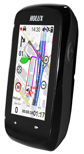
The Holux SporTrek 1305 for avid cyclists features a u-blox positioning module. Photo: Holux
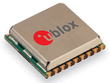
Holux Technology, a maker of professional and consumer GPS products, has launched its next-generation bike computer, the SporTrek 1305, which integrates a u-blox MAX GPS/GNSS module. The new device delivers GPS and wireless health-monitoring features on a compact, three-inch color touchscreen display.
The device delivers a variety of useful information such as speed, heart rate, distance, altitude, map, and route, and comes with a calendar and stopwatch. SporTrek 1305 is the designed for touring, competitive cycling and mountain biking.
The device integrates a compact u-blox MAX GPS/GNSS module that supports GPS as well as GLONASS, QZSS and all SBAS. The module is targeted at applications requiring small size, low power, fast acquisition, and reliable operation in GPS hostile environments.
“Since 1994, Holux has been manufacturing a wide range of battery-operated GPS products for sports, automotive and safety devices. We count on extremely fast, low-power and accurate global positioning technology to deliver the features our customers demand,” said Eddy Huang, director, Marketing & Sales at Holux. “u-blox’ advanced satellite positioning module provides us with the performance, small size, and low power consumption that we need in a consistent, future-proofed form factor.”
u-blox MAX GPS/GNSS module. Photo: Holux
The SportTrek 1305 is shock and water resistant able to operate in all weather conditions. Equipped with Bluetooth Smart for accessories (such as heart-rate straps), it can also connect to heart-rate monitor / combo (speed and cadence) sensors and smartphone connection and notification, providing navigation and performance training data.
It also integrates a patented “carbon reduction” feature that informs the user about the amount of equivalent carbon emissions saved compared to driving, and converts the data into the corresponding number of trees planted to achieve the same effect.
SporTrek 1305 can be integrated with ezTour Plus software to share track route and analysis of physical states, and it can also be used to plan routes using the ezTour Planner feature. Users can integrate their own paper maps and third-party application as well.
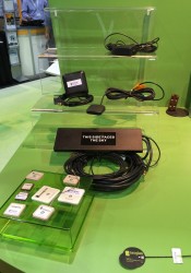
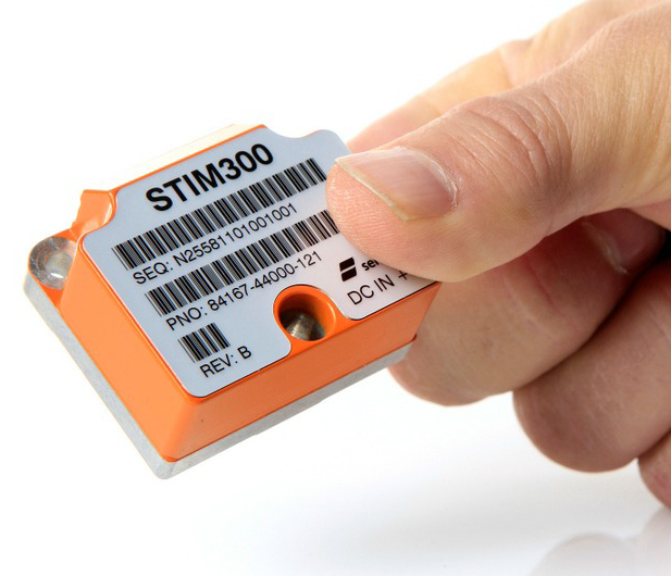
The STIM300 is a small, tactical-grade, low-weight, high-performance non-GPS aided IMU. It contains three highly accurate MEMS gyros, three high-stability accelerometers and three inclinometers. The IMU is factory calibrated and compensated over its temperature operating range.
The STIM series is designed for use below and on the ocean, on land, in the air, and in orbit and space. The STIM300 IMU is well suited for stabilization, guidance and navigation applications in the industrial, aerospace and defense markets. It is a crucial building block for inertial navigation systems in UAVs, AUVs, AGVs, UGVs and ROVs, Sensonor said.
The STIM300 is also used for camera turret stabilization and for use in various handheld devices that require a small IMU to secure operations during GPS outage.
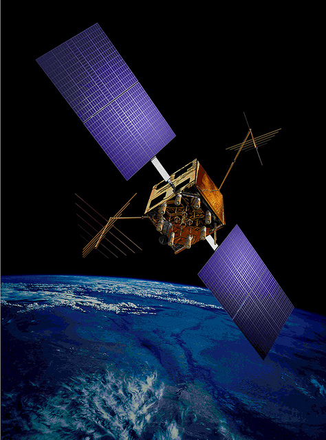
The U.S. Air Force’s fleet of GPS Block IIR and IIR-M satellites, manufactured by Lockheed Martin, have reached 200 collective years of operational life. The 20 satellites make up about two thirds of the current GPS constellation.
Originally launched between 1997 and 2009 to add capabilities to the GPS constellation and to replace other aging satellites, the 12 GPS IIR and eight IIR-M satellites have maintained an availability record of 99.96 percent, which represents only 10 minutes of down time per satellite during all their years of operation.
The 200-year milestone will be celebrated with a brief cake-cutting “ceremony” during ION GNSS, on Wednesday at 12:30 p.m., at the Lockheed Martin booth.
“This is a tremendous GPS operations and sustainment performance milestone, and we applaud the men and women of the Second Space Operations Squadron of the Air Force’s 50th Space Wing, as well as the industry team who support them,” said Mark Stewart, vice president for Lockheed Martin’s Navigation Systems mission area. “The world relies on GPS every day for things like synchronizing global banking and investing, shipping and transportation, search and rescue operations, ATM transactions and even precision farming.”
This spring, the IIR-M satellites played a major role in the continued modernization of the GPS constellation. To help manufacturers develop and test next-generation advanced civil GPS receivers, under the direction of Air Force Space Command and in collaboration with the Department of Transportation, these satellites began early broadcasting of test civilian navigation, or CNAV, messages on a new signal planned for all future satellites.
Making these milestones even more significant is the fact that the GPS IIR and IIR-M satellites were designed to last 7.5 years, or collectively about 150 years. All 12 IIR satellites are currently operating beyond their design life with the oldest operating for more than 16.5 years. Three of eight GPS IIR-M satellites have surpassed their expected life span and all satellites will have done so in 2017.
To meet evolving GPS user demands, Lockheed Martin is developing the next-generation GPS III satellites. These satellites will deliver three times better accuracy, provide up to eight times improved anti-jamming capabilities, and include enhancements which extend spacecraft life to 15 years, 25 percent longer than the newest Block IIF satellites. GPS III will be the first generation of GPS satellite with a new L1C civil signal designed to make it interoperable with other international GNSS.