The European Union Aviation Safety Agency (EASA) and EuroControl have published a joint action plan designed to strengthen the safety and resilience of European aviation operations amid the growing challenge of GNSS interference.
GNSS provides aircraft with precise positioning, navigation and timing information that is essential for a wide range of functions. Interference with the signals has become a regular occurrence, in particular on the edge of conflict zones, and poses a threat to safety. The action plan focuses on maintaining safety in the near term while limiting impacts on airspace capacity and containing the threat of GNSS interference. It sets out short, mid- and long-term measures to mitigate the threat with harmonized operational procedures and to strengthen the robustness of GNSS‑based operations by clearly defining who needs to act, and by when.
“While the potential threat to aviation safety from GNSS interference has so far been mitigated by short-term actions such as raising pilot awareness, it is clear that more needs to be done,” said Florian Guillermet, EASA executive director. “This action plan lays out and prioritizes short, mid and longer-term actions and, importantly, also assigns roles to the various aviation actors. By working together with EuroControl and pooling our expertise, we have been able to create a strong plan that will enable the wider sector to come together to counter this threat.”
“GNSS interference remains a significant and evolving challenge for European aviation, making today’s action plan an important step forward in our collective response,” said Raúl Medina, director-general, EuroControl. “The action plan concretely supports our Member States and aviation partners as we work together to ensure the evolution and resilience of aviation’s critical infrastructure — one of the core goals of EuroControl’s Trajectory 2030 strategy. I welcome the strong cooperation and close coordination with EASA and all our partners across the aviation sector on this plan, which demonstrates our shared commitment to safety, and aims at delivering tangible benefits for the network, operators and passengers by making GNSS‑based operations more robust.”
Key elements of the joint action plan The action plan is built on several core pillars designed to strengthen Europe’s ability to detect, manage and mitigate GNSS interference.
Through joint monitoring and data-sharing, EASA and EuroControl aim to establish a common, validated operational picture of GNSS interference events across Europe, enabling more accurate detection, reporting and situational awareness. By pooling expertise and operational data, the two organisations will deepen their understanding of interference patterns, operational impacts and associated safety risks, with the aim of delivering consistent and harmonized guidance to air navigation service providers (ANSPs), airlines, and national authorities to ensure rapid and aligned responses to interference incidents.
In close partnership, EASA and EuroControl will develop updated operational guidance for flight crews and air traffic controllers to help them manage disruptions effectively and maintain safe operations in degraded navigation environments and join forces and expertise for investigations into ongoing GNSS interference. The two organisations will also promote improved mechanisms for timely information exchange through Member States, ensuring that events with both civil and military dimensions are addressed in a coordinated and transparent manner to minimize disruption and preserve airspace capacity.
The action plan envisages close collaboration with A/C manufacturer and avionics industry to support the development of more robust, interference‑resilient avionics solutions over the longer term. It addresses the concerns expressed in a letter sent on June 6, 2025, by 13 EU Member States to the European Commission that called for immediate and coordinated European action to address the growing number of Radio Frequency Interference (RFI) events affecting GNSS‑based systems. The action plan also integrates proposals and guidance from international partners including the International Civil Aviation Organization (ICAO), and the International Air Transport Association (IATA).
Background GNSS enables more efficient flight paths, reduces fuel consumption, and supports the implementation of Performance-Based Navigation (PBN), which allows aircraft to fly more direct routes and operate safely in areas with limited ground-based infrastructure.
However, the growing challenge of RFI — whether intentional (jamming or spoofing) or unintentional — poses a threat to the resilience of these systems. The most severe interference typically occurs near conflict zones, but GNSS performance may be affected well beyond these areas. Although aircraft can operate safely without GNSS, disruptions can reduce resilience and the continuity of operations.
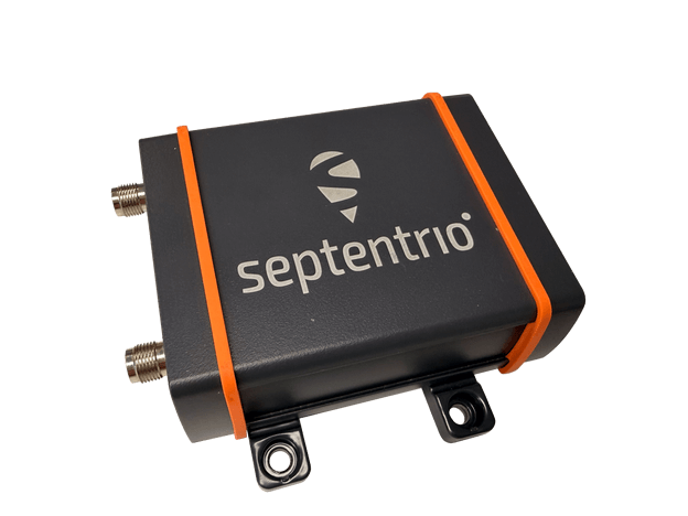
Septentrio, part of Hexagon, offers a new enclosed multi-frequency GNSS receiver: AsteRx EB.
The cost-effective product offers uncompromised high-accuracy positioning and GNSS heading for industrial robots, port logistics, marine, and scalable automation applications. Its IP67 enclosure protects the receiver from harsh weather conditions, while built-in advanced GNSS+ algorithms ensure reliable operation in environments that are challenging for GNSS, such as areas with foliage or near GNSS interference sources.
The RAIM+ integrity monitoring system ensures truthful positioning, which is essential for autonomous navigation. The compact enclosure of AsteRx EB enables easy installation, reducing time-to-market.
“AsteRx EB is an ideal boxed receiver for customers who need reliable, resilient, and highly accurate positioning in a compact form factor and at a price point that makes rapid scale-up possible,” said Danilo Sabbatini, Product Manager at Septentrio, part of Hexagon.
In a dual-antenna configuration, AsteRx EB delivers sub-degree GNSS heading for systems that require orientation in addition to RTK positioning. The built-in AIM+ anti-jamming and anti-spoofing technology protects the receiver from intentional or unintentional GNSS interference.
AsteRx EB extends Septentrio’s lineup of enclosed GNSS receivers. Like mosaic-go, it can be used for quick and easy testing or evaluation of Septentrio’s reliable positioning technology. Thanks to its robust housing, it can be deployed in a wide range of industrial applications. For systems exposed to very harsh weather conditions or intense mechanical stress, the AsteRx RB3 ultra-rugged receiver provides the highest level of protection.
As GPS World readers know, the growing prevalence of GPS/GNSS jamming and spoofing outside of conflict zones interrupts vital aviation safety technologies and presents challenges to maritime commerce and the global economy. An alarming example is playing out along the Baltic Sea and the North Sea, prompting 13 coastal European nations and Iceland to highlight in January 2026 “growing GNSS interference” and collectively reinforce requirements to comply with existing regulations and international law designed to ensure the safety of all maritime vessels engaged in shipping.
As commercial aircraft report navigation anomalies and maritime operators experience false position data in congested waterways, global authorities are sounding alarms that GNSS interference will continue to rise without immediate action. In March 2025, the International Civil Aviation Organization (ICAO), International Telecommunication Union (ITU), and International Maritime Organization (IMO) issued a joint warning expressing “grave concern” that disruptions from GNSS jamming and spoofing constitute an urgent threat to public safety, telecommunications networks and international commerce.
Compounding harmful interference incidents led the GPS Innovation Alliance (GPSIA) to act. Defeating illegal and harmful interference outside of combat zones requires a coordinated, whole-of-government strategy that focuses on stopping bad actors through deterrence and enforcement, and directing resources toward preventing and sanctioning those violating international commitments and laws prohibiting jamming and spoofing. Investing in GPS modernization and integrating innovative signals from complementary PNT satellite systems into devices and receivers will deliver PNT that surpasses today’s technologies to the global community.
Roadmap for Action
In September 2025, GPSIA led a coalition of leading industry groups in sending a letter to the Departments of Defense and Transportation that called for urgent action to address GPS jamming and spoofing. We noted the United States has the technology and expertise to solve this issue, and the administration has the power to act. GPSIA followed the letter with a whole-of-government strategy providing a clear roadmap for the administration. While some recommendations have been implemented, other opportunities remain.
Focus on the Real Culprits
The culprits in each of these scenarios are bad actors putting public safety and global commerce at risk with harmful interference outside conflict zones. The global community relies on several unique technologies that can be impacted by harmful interference, such as cellular and Wi-Fi signals, radars and automated information systems. The misplaced focus on faint GNSS signals or dependencies on GNSS derail collective efforts to immediately regain interference-free global commerce and bolster public safety.
Governments and international organizations mandate certain industries integrate safety-of-life technologies into their operations — and they do, at great cost. Officials should in turn be given the political support and resources to stop bad actors from intentionally interfering with them.
What to Do Next
Public and continued diplomatic engagement are critical. By amplifying European counterparts, condemnations from senior U.S. officials can raise the reputational costs for bad actors and reaffirm international norms that protect GNSS signals and other technologies from harmful interference.
Engaging with the ICAO is important. The U.S. should reinforce its commitment to providing modern civil GPS signals that support navigation in international airspace and encourage ICAO to prioritize the enforcement of global GNSS protections.
GPSIA also recommends Executive agencies establish an interagency task force that rapidly identifies and disseminates information about interference events with civil operators, including sanitized intelligence information on intentional jamming and spoofing of commercial aircraft and ships.
Civil operators also should be invited to participate in interference coordination calls and reporting. Sharing radio-frequency interference data, incident reports and threat assessments among military and civil agencies and operators is essential to preserving public safety. The Performance-based Operations Aviation Rulemaking Committee’s recommendations for continuity of operations during GPS disruption events should continue to be implemented with urgency.
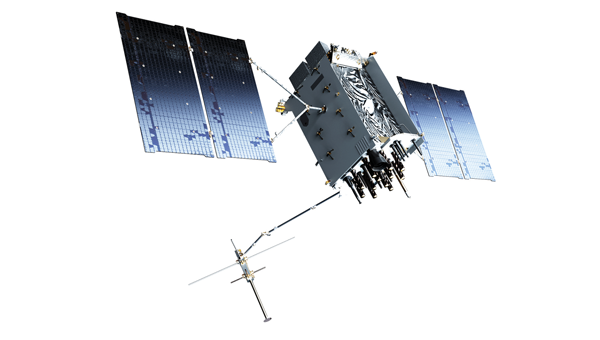
The GPS III satellite has additional anti-interference features. (Image: Lockheed Martin)
Deterrence and information sharing must be coupled with sustained enforcement. Federal agencies have taken welcome action to interdict illegal jamming equipment, reporting an 830% increase in seizures since 2021. We applaud the U.S. government for prioritizing resources to stop the illegal import and sale of these devices.
GPSIA commends the Kingdom of Norway’s annual Jammertest, which allows receiver and device manufacturers to test interference detection and counter jamming and spoofing. These realistic test scenarios, together with strengthened enforcement and prioritized intelligence collection and analysis, will enhance public safety.
Modernize GPS
While GPS satellites continue operating with an extraordinary 99.99% availability and no outages on record, the health of the constellation and jamming and spoofing incidents affecting receivers and devices, demand action. The final GPS III satellite is scheduled to launch this spring. Next-generation GPS IIIF satellites are being built. Their launches should be prioritized to reduce the number of satellites on orbit that are one system or subsystem away from failure. GPSIA welcomed the passage of the FY2026 Defense Appropriations Bill, which bolstered national and economic security by investing needed funding for modernized GPS IIIF satellites and long-term PNT leadership.
Notably, the current GPS program plan does not include counter-spoofing technologies. Implementing counter-spoofing authentication capabilities for Wide Area Augmentation System (WAAS) signals would further strengthen aviation resilience.
Ground infrastructure modernization is equally important. The GPS ground station must be able to command and monitor GPS III and IIIF satellites and the modern L5 aviation signal.
Streamline Regulatory Activities
Regulatory modernization represents another area of progress. In September 2025, the State Department removed jam-and spoof-resistant Controlled Reception Pattern Antennas (CRPAs) from the International Traffic in Arms Regulations (ITAR), fulfilling one recommendation from GPSIA’s strategy.
Certification processes also must evolve, and integration of CRPAs into aircraft should be accelerated. The modern L5 signal and counter spoofing signal authentication signals must be incorporated into FAA-certified and other receivers as soon as possible.
Recommendations for the FCC
President Trump’s December 2025 Executive Order (EO), “Ensuring American Space Superiority,” directs U.S. departments and agencies to detect and counter threats to U.S. space infrastructure. It also states that his administration will enable industry to develop and deploy advanced space capabilities, including terrestrial and cislunar PNT applications. This EO should serve as a “North Star” for the FCC, resulting in increased enforcement resources to address illegal jamming and spoofing, and a regulatory environment prioritizing innovative, advanced commercial satellite PNT systems that complement GPS. Demonstrating American leadership in space demands that we step forward, not backwards, in our PNT capabilities.
The FCC is evaluating the record developed in its Notice of Inquiry, Promoting the Development of PNT Technologies and Solutions, and is reportedly considering future rulemaking. The FCC’s task is not to replace GPS, but to ensure that the regulatory environment protects its spectrum, increases enforcement actions against those perpetuating harmful interference and enables innovation that complements this foundational system. This balanced approach will fulfill President Trump’s mandate, preserving public safety and economic security, and ensure continued American leadership in PNT.
Global Safety and Commerce
Baltic and North Sea shipping lanes have become a flashpoint for GPS jamming and spoofing, prompting 13 European nations and Iceland to issue a joint warning in January 2026 over interference threatening maritime safety and global commerce. (Photo: Dmitri Toms / iStock / Getty Images Plus / Getty Images)
The FCC’s Notice of Inquiry uncovered dozens of PNT technologies, ranging from those in the marketing stage, to hyper-localized solutions, to proposals to exploit “signals of opportunity.” Creativity and ingenuity abound in the commission’s record, but the docket’s many filings lacked technical details to evaluate whether the systems advance the nation’s PNT leadership.
The hallmarks of GPS are its worldwide coverage, and the continuity, availability, integrity and accuracy of its signals. Our modern global community deserves complementary PNT systems and signals that meet or exceed GPS capabilities. A few satellite-based solutions stood out as holding promise to do so.
Systems operating in low-Earth orbit (LEO) can transmit stronger signal power due to their proximity to Earth, improving performance in urban environments and contested spectrum conditions. Systems operating in different frequency bands, such as TrustPoint’s C-band system, add spectral diversity, making it far more difficult for an adversary to disrupt all PNT services simultaneously. When combined with modernized GPS signals and authentication capabilities, this layered approach can deliver robust services while complementing the foundational role of GPS.
Terrestrial systems cannot replicate global coverage of satellite constellations. They are also vulnerable to wildfires, hurricanes and other disasters.Building parallel terrestrial networks would require significant investment while delivering a fraction of modernized satellite systems’ capabilities. Nor do terrestrial signals provide the continuity, availability, integrity and accuracy of satellite systems.
The Progress is Real
GPSIA is pleased to report that progress is being made in several areas outlined in its “whole-of-government” strategy. It’s time to accelerate that progress. In May 2026, GPSIA members will convene to evaluate this strategy and outline what more the PNT industry can do to play a part in defeating harmful interference. Our members also will meet with government officials to underpin that government-led enforcement and solutions to jamming and spoofing can further illustrate the importance of PNT to U.S. leadership in space, and national security, public safety and the global economy.
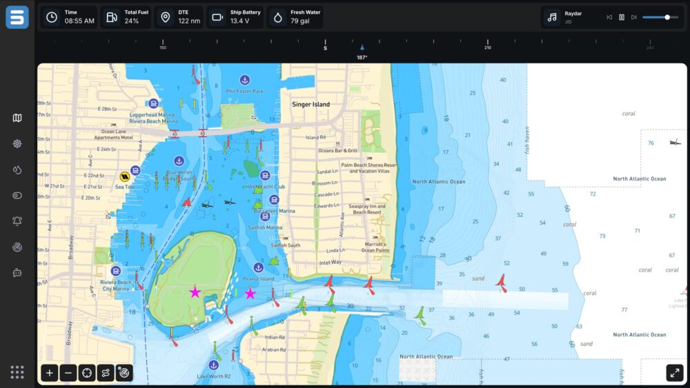
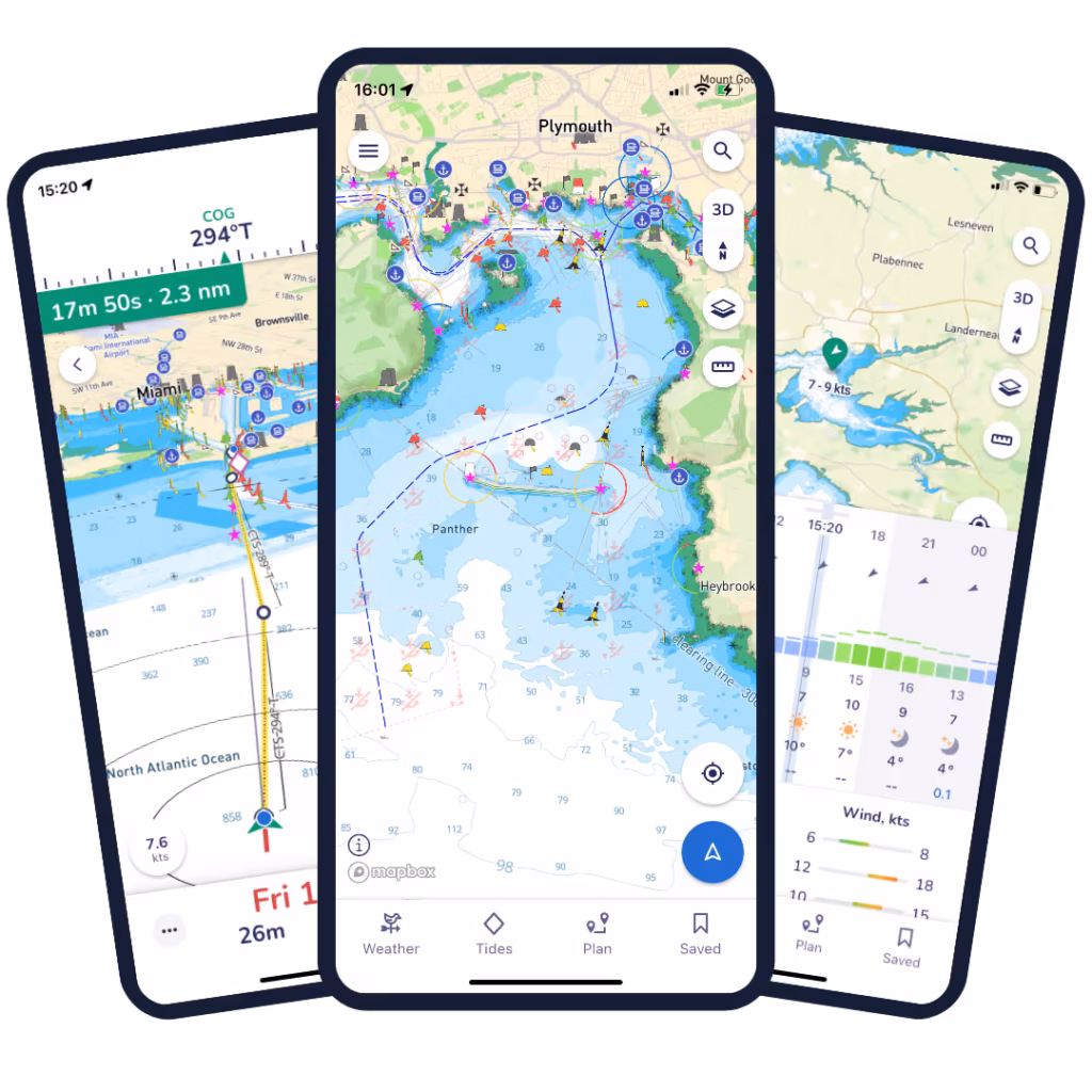
Marine technology company Savvy Navvy has partnered with Seaward Automation to integrate its full navigation solution to their Command vessel management system, completing a fully integrated helm experience for boaters worldwide.
Officially launching at the Palm Beach International Boat Show taking place March 25-29, the integration combines Seaward Automation’s innovative vessel system with Savvy Navvy’s intuitive, data-rich navigation charts.
The Command interface enables real-time control of critical vessel systems while consolidating multiple standalone displays into a single integrated helm experience. It is fully customizable for OEM integration or refit applications, ensuring a seamless fit for any vessel.
Credit: Savvy Navvy
In less than 18 months since launch, award-winning Savvy Integrated has quickly gained traction with marine manufacturers and boat builders looking for modern and flexible navigation solutions.
Seaward Automation specializes in advanced, logic-based automation solutions for sportfishing vessels and pleasure craft, as well as sailing yachts and commercial marine platforms. Its full vessel automation platform, Command, launched less than a year ago.
Savvy Navvy provides smart routing, giving users the optimal route and dynamic ETAs based on real-time data: departure time, chart information, weather conditions, tide, boat specifications and local regulations.
A live demo of Savvy Navvy on the Command platform will be available at the boatshow, Slip A215.
GNSS receivers combined with inertial navigation systems (INS) have been widely applied to various mobile platforms.
However, in Arctic regions, GNSS positioning accuracy is severely degraded from low satellite elevation angles, frequent ionospheric disturbances, and insufficient visible satellites.
Moreover, the limited validation of existing onboard navigation systems further exacerbates the challenges of Arctic navigation.
To address these issues, a new research paper describes a hybrid neural network model based on temporal convolutional networks (TCN) and long short-term memory (LSTM) networks. The hybrid solution has been tested in the Artic with successful results.
The paper, “Robust GNSS/INS Integrated Navigation in Arctic GNSS-Challenged Environments Based on TCN-LSTM and MDAREKF,” is authored by Wei Liu, Tengfei Qi, Yuan Hu, Kaiwei Zhu, Tsung-Hsuan Hsieh and Shengzheng Wang of Shanghai Maritime University (DOI 10.1088/1361-6501/ae5279).
The proposal combines the pseudo-measurement information of GNSS predicted by the model with INS for integrated navigation to compensate for the interruption of GNSS and correct the error of INS.
Considering the potential bias in predicted pseudomeasurements, an adaptive robust extended Kalman filter (AREKF) algorithm based on Mahalanobis distance is further developed to dynamically adjust the innovation covariance matrix, thereby enhancing filter robustness.
Field experiments conducted on an Arctic survey vessel demonstrate that the proposed TCN-LSTM combined with AREKF significantly improves both the robustness and accuracy of integrated navigation under GNSS-constrained environments. In particular, during GNSS outages of 50 seconds, 140 seconds and 400 seconds, the proposed method reduces the horizontal root mean square error (RMSE) by 47%, 38% and 76% respectively.
Collaboration focused on enabling plug-and-play, GPS-denied navigation capabilities for next-generation maritime platforms
Anello Photonics and Mythos AI are accelerating deployment of resilient, plug-and-play navigation solutions for the maritime sector. The collaboration brings together Anello’s advanced inertial sensing technology and Mythos AI’s intelligent autonomy software to address the growing need for resilient navigation in GPS-challenged environments.
Anello is creator of the Silicon Photonics Optical Gyroscope (SiPhOG). By combining SiPhOG-based inertial navigation with advanced sensor fusion and AI-driven collaborative autonomy, Anello and Mythos AI are delivering a fully integrated, plug-and-play solution that maintains performance when satellite signals are degraded or unavailable. It is designed to drop seamlessly into both next-generation and legacy maritime platforms. A multi-mission open systems architecture enables scalable deployment across defense, commercial and hybrid maritime operations.
Strategic focus on maritime autonomy and USVs
The initiative is particularly relevant to the rapidly evolving unmanned surface vehicle (USV) market. As USVs take on expanded roles in offshore energy, maritime security, hydrography, environmental monitoring and defense missions, complete end-to-end dependable navigation is essential to safe and effective operations.
A resilient, GPS-independent navigation capability enables:
greater operational assurance in GPS-denied or contested maritime environments
enhanced autonomy and mission continuity during signal disruptions
reduced integration complexity for OEMs and system integrators
scalability across a broad range of vessel sizes and mission profiles.
Anello and Mythos AI will collaborate with OEMs, integrators and end users to align the solution with evolving operational and regulatory demands.
A roundup of recent products in the GNSS and inertial positioning industry from the January-February 2026 issue of GPS World magazine.
Autonomous
1. Delivery Drones
Volatus deploys medical supplies in Canada
Image: Trimble
Volatus Aerospace has integrated the Trimble PX-1 RTX solution into its commercial delivery drone service to achieve accurate and robust positioning and heading. The Trimble module provides Volatus’ clients with a turnkey solution for highly accurate aerial data acquisition and fully remote drone operations in real-world missions, including beyond visual line of sight (BVLOS). The PX-1 RTX uses Trimble’s CenterPoint RTX corrections along with compact, high-performance GNSS-inertial hardware to deliver real-time, centimeter-level positioning and highly precise inertial-derived true heading measurements. This technology reduces operational risks associated with poor sensor performance or magnetic interference by providing enhanced positioning redundancy.
For border protection and long-range surveillance missions
Image: CopterPIX
The ERE95 Mini by CopterPIX operational platform is fully capable of GNSS-denied missions and integrates a long-range, anti-jamming communication system supporting distances of more than 20 km. It has an endurance of 2 hours and can carry up to 5 kg of payload for up to 1 hour. It also has integrated daylight and thermal imaging for advanced surveillance. With a fully foldable frame, the platform collapses into a backpack-sized kit, making it suitable for rapid mobility and field operations. Its modular “puzzle” architecture allows quick adaptation of SDR modules, optical payloads, and navigation solutions, enabling mission-specific configurations. To support rapid field deployment, the ERE95 Mini features a mechanical and electrical quick-connect interface, allowing operators to switch payloads in seconds and maintain continuous operational readiness across all missions.
Integrated into long-endurance unmanned aircraft system
Image: AeroVironment
AeroVironment has integrated its visual navigation system (VNS) kit with the Puma Long Endurance (LE) small unmanned aircraft system, delivering GNSS-denied navigation capability. The VNS kit uses advanced computer vision and onboard processing to deliver precise, GNSS-independent navigation. Using a suite of downward-facing sensors, cameras and onboard computing, the VNS kit performs visual inertial odometry to capture and analyze terrain imagery, estimating true aircraft position in real time. The system fuses continuous visual data from the cameras with motion inputs from onboard inertial sensors to calculate precise position, velocity and orientation — allowing the aircraft to know where it is and where it is going when GNSS is not available. It automatically transitions between GNSS-enabled and GNSS-denied modes with zero pilot input, ensuring uninterrupted mission continuity in contested environments.
Low power, small footprint setup for close-airspace awareness
Photo: MatrixSpace
The Portable 360 Radar is a rugged, easily transportable radar kit that delivers reliable close-airspace awareness with panoramic coverage for rapid-response counter-drone operations, from safeguarding stadiums and large public gatherings to border security and battlespaces. The MatrixSpace platform unifies threat awareness across multiple networked Portable 360 Radar systems and other sensors, without compromising local operation. By combining AI edge processing with MatrixSpace AiCloud Enterprise software, central command centers get an enhanced common operating picture and deep airspace activity analytics to assure public safety.
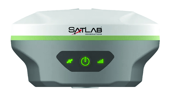
The SatLab SL8 Laser RTK GNSS receiver combines dual cameras, GNSS, an IMU and visible laser technology to make surveying faster and easier. With non-contact measurement, image-assisted targeting, CAD live-view stakeout, and a built-in LoRa radio. It ensures smooth, reliable work even in complex or GNSS-limited environments. The SL8 achieves 2 cm accuracy within 10 meters and enables efficient data collection across bridges, tunnels, riverbanks, and other sites where traditional GNSS methods are restricted. It features image-assisted targeting through SatSurv software, displaying laser points directly on real-time images for quick and precise aiming. Its automotive-grade IMU requires no manual calibration or initialization and enhances measurement accuracy by up to 40% in GNSS-challenged areas. A built-in multi-protocol LoRa transceiver provides stable transmission beyond 15 km and compatibility with multiple RTK brands. The integrated CAD and visual stakeout functions combine live imagery with CAD data, allowing users to visualize target points on site and increase layout efficiency by up to 50%.
A complete precision mapping solution for the utility and critical infrastructure industries worldwide is the goal of a partnership between ProStar Holdings and Tersus GNSS. The partnership will integrate Tersus’s survey-grade GNSS receivers with ProStar’s PointMan Underground Utility Mapping Software, providing an affordable, field-ready solution. The partnership will use ProStar’s LinQD open API integration platform, which is designed to enable seamless interoperability between emerging technologies and legacy systems, creating a robust global ecosystem for geospatial intelligence, uniting equipment manufacturers and service providers under the initiative.
The MVP S1 RTK-SLAM handheld 3D laser scanner uses GNSS through an AI-driven RTK-SLAM workflow, as well as lidar data with imagery from dual 48-megapixel panoramic cameras. The combination provides survey-grade results in both GNSS-denied and open environments. The system achieves centimeter-level accuracy outdoors and maintains performance indoors or underground through SLAM processing. TimeSync 3.0 synchronizes the hardware, aligning sensor data at the microsecond level and supporting consistent datasets and reliable post-processing. A mobile application provides users with real-time feedback, including previews of colorized point clouds while scanning, as well as basic scan reports on site. This feature helps operators verify data completeness and quality before leaving the field, reducing the need for repeat visits. The MVP S1 supports 3D gaussian splatting (3DGS), enabling creation of textured, photorealistic 3D models. This capability is useful for building information modeling, construction progress monitoring, underground surveys, forestry analysis and industrial site documentation.
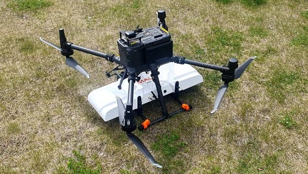
The MALÅ GeoDrone 600 and Zond Aero 600 NG are two new high-resolution ground-penetrating radar (GPR) systems for UAVs. They significantly enhance high-resolution subsurface investigations with drones, supporting applications in engineering surveys, utility mapping, archaeology, environmental studies and geophysical research. They enable surveyors to capture consistent, high-quality subsurface data in areas difficult, slow or unsafe to access with traditional ground instruments. Operating at 600 MHz, the antennas offer a balance between penetration depth and fine near-surface resolution. Typical penetration from the drone is up to 2 meters, depending on surface conditions, while SPH Engineering’s True Terrain Following ensures stable antenna height to maintain data quality and repeatability.
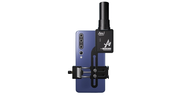
For high-precision surveying, photo surveys and 3D modeling
Image: Aurora Navigation
The Astra1 Mobile Visual RTK is a professional-grade GNSS receiver engineered to redefine high-precision mobile data acquisition. It is built to meet the demand for highly portable, reliable, high-precision tools that simplify complex field operations. At 60 grams, the Astra1 is an ultra-compact solution designed to deliver reliable, centimeter-level positioning and advanced 3D mapping capabilities through seamless integration with a smartphone and the proprietary Anypos App. Accuracy is RTK 8mm+1PPM horizontally, 15mm+1PPM vertically, photo survey <4 cm (2-15 m distance). The Astra1 allows users to capture photos with precise RTK coordinates, enabling the creation of accurate 3D models for detailed construction verification and digital twinning applications.
The AR588MA is a 5G-advanced (5G-A) automotive-grade cellular module that integrates dual-band GNSS supporting both L1 and L5 bands with up to 30 Hz output. Based on MediaTek’s latest-generation MT2739 platform, the AR588MA supports 5G-A communication technology and complies with the 3GPP R18 standard protocol. It features both NB-NTN and NR-NTN satellite communication capabilities and supports dual-SIM dual-active (DSDA) technology, offering improved stability and reliability on cellular connections. It also includes intelligent driving scenario recognition. Designed in compliance with the AEC-Q104 Grade 2 automotive standard, it delivers fast, stable connectivity and reliable security for in-vehicle communication and benefits on-roof applications, such as smart antennas for automotive, with higher-temperature support.
A firmware upgrade to the Xsens Sirius and Xsens Avior IMUs delivers centimeter-level vertical displacement measurements for marine stabilization and control systems. The new Heave feature enables real-time stabilization and wave compensation in a wide range of marine applications. Marine engineers can access comprehensive motion data — roll, pitch, yaw and heave — from a single compact sensor, eliminating the need for external processing or oversized tactical-grade systems while maintaining the precision required for offshore platforms, vessels, docking systems, marine robots, buoys and surveying equipment.
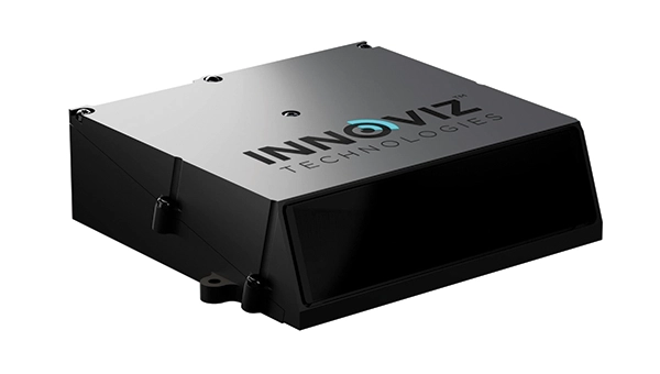
The InnovizThree is fully colored long-range lidar with camera that creates a compact sensor-fusion module designed to reduce OEM integration complexity. The solution combines lidar and RGB sensing in a single compact perception module, purpose-built for behind-the-windshield installations, drones, micro-robotics and humanoids. The consolidation of an RGB camera inside InnovizThree reinforces Innoviz’s commitment to scalable, OEM-friendly sensor-fusion perception solutions designed for series production and long-term deployment, with the potential to enable faster deployment and cost savings. The RGB sensing capabilities are factory-aligned with the lidar, enabling precise and consistent visual-to-lidar geometry across production units. This alignment, combined with hardware-synchronized capture, will enable reliable multi-modal sensor-fusion data correlation while reducing calibration effort during vehicle integration.
High-integrity GNSS integration for autonomous driving
Image: Getty Images / iStock / FlashMovie
Swift Navigation is collaborating with Nvidia to enable a scalable, cost-effective approach to autonomous driving by integrating the Nvidia Drive AGX platform with Swift’s globally referenced, centimeter-accurate GNSS positioning. Swift Navigation offloads absolute localization to the GNSS sensor stack using its Swift Automotive Suite. The suite is a complete, modular software solution for safe, high-integrity precise vehicle localization that combines the centimeter-level Skylark Precise Positioning Service with the Starling positioning engine, software that fuses raw GNSS data and corrections with IMU and wheel odometry to deliver high-integrity, centimeter-accurate positioning (PVT). By using Swift’s high-precision stack for lane-level positioning, the vehicle’s optical sensors focus on obstacle detection and safety, lowering system cost and complexity.
Sinclair’s new SM 5G Family Tier features the SM714 and SM2601 series antennas. The multi-band, multi-port antennas are engineered to deliver superior connectivity, reliability and versatility for GNSS and other mission-critical wireless transportation applications. The SM714 is a 4-in-1 low-profile customizable transit antenna that combines 5G/LTE, Wi-Fi and tri-band GNSS coverage in a single compact form. Supporting 617–5925 MHz, it enables seamless operation across all major 5G and LTE bands. It is suitable for vehicles, fleet systems and connected mobility applications requiring a discreet, high-performance solution. The SM2601D is a 5-in-1 low-profile customizable antenna that features five independent ports: one for PTC (219–223 MHz), one for Wi-Fi (2400–6000 MHz), one for GNSS, and two full-band cellular ports (694–2700 MHz) that support diversity and MIMO operation for multi-radio systems. This dual-cell configuration offers greater throughput, flexibility, and redundancy in complex communication environments.
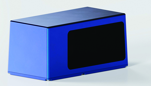
High-precision depth sensing and real-time velocity measurement
Image: Voyant Photonics
New versions of the Carbon lidar platform add 32-line and 64-line variants for compact, cost-sensitive and compute-limited systems. The new models complement existing 128-line configurations and are optimized for industrial autonomy, robotics, drones and smart infrastructure applications. They offer lower data rates and simplified integration while maintaining core FMCW advantages including velocity measurement, interference immunity and high dynamic range. With line resolutions spanning 32, 64 and 128, original equipment manufacturers and system integrators can tailor performance, bandwidth and compute load to specific use cases, from robotics and automated guided vehicles to drones and embedded edge platforms. The Carbon family’s silicon-photonics architecture integrates beam steering and coherent detection on a single photonic chip. The new variants include high-precision depth sensing and real-time velocity measurement, exceptional ambient light immunity and compact design for industrial and mobile environments.
For automotive track and varied environment testing
Image: VBOX
The NTRIP Base Station from VBOX Automotive combines a multi-constellation, multi-frequency GNSS engine with a built-in networked transport of RTCM via internet protocol (NTRIP) server. The equipment transmits real-time kinematic corrections over radio and cellular or Wi-Fi networks, supporting accurate real-time positioning across wider areas in varied environments compared to traditional radio-only systems. The base station launches in three models, with specifications designed to fit users’ needs. All systems combine quad-constellation, dual-frequency GNSS technology with built-in cellular and Wi-Fi connectivity. Compatible with VBOX 4, VBOX 3iS and external GNSS rovers, the new NTRIP Base Station supports both MSM4 and MSM7 RTCM formats, has up to 24 hours of battery life and is rated to IP67 to handle the demands of long outdoor test sessions. Models include Internal GNSS antenna and 2.4 GHz radio (quick to deploy for short-range applications, for temporary or mobile testing); Internal GNSS antenna, no radio (compact and simple, suitable for NTRIP or semi-permanent installations with external high-power radio masts); and External GNSS antenna, no radio (optimized for permanent installations with tripod-mounted antennas for maximum satellite visibility, supporting NTRIP or external radio).
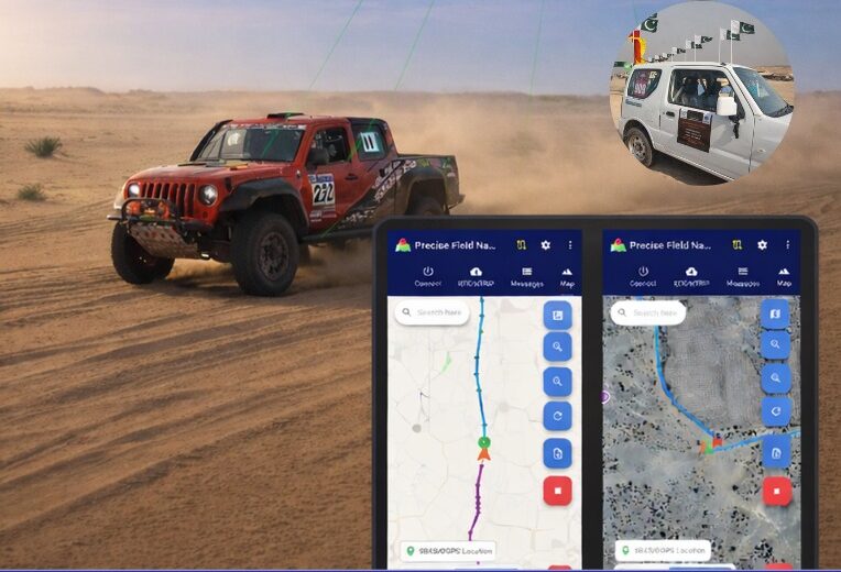
Pakistan’s national space agency SUPARCO (Space and Upper Atmosphere Research Commission) has achieved a major milestone in navigation technology with the successful launch of its Pak-SBAS satellite-based augmentation system (SBAS) device and service.
The Pak-SBAS navigation service was rigorously tested in the extreme desert conditions of Cholistan during Cholistan Desert Rally 2026. The Cholistan desert experinces high speeds, unpredictable routes, and the absence of visual landmarks that demand exceptional positioning accuracy and signal reliability for autos and motorcycles.
Throughout the rally, Pak-SBAS demonstrated remarkable performance by delivering highly precise location data, stable signal continuity, and integrated route tracking.
By applying SBAS corrections, the system significantly reduced positioning errors compared to conventional GNSS technologies, offering rally drivers and navigation teams a new level of confidence essential for competitive desert racing.
According to a SUPARCO spokesperson, the Pak-SBAS technology holds vast potential beyond motorsports. It is expected to enhance disaster response operations through accurate tracking of rescue teams and affected areas, improve transport efficiency via real-time vehicle positioning, and strengthen aviation safety with more reliable navigation support.
The system also will benefit the surveying and mapping sectors by minimizing positional inaccuracies and reducing project costs.
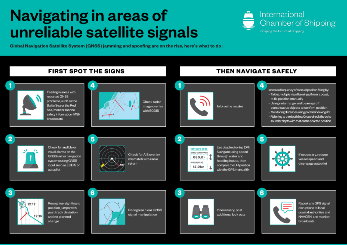
The International Chamber of Shipping (ICS) and its members have produced an informational poster for ship crews that highlights strategies when GNSS signals are jammed or denied.
The Navigating in Areas of Unreliable Satellite Signals poster is available for free on the ICS website. Crews are welcome to download and print it for display near the conning position on board navigation bridges.
Modern maritime operations depend heavily on GNSS. From open-ocean routing to precise harbour maneuvers, satellite-based positioning data is deeply embedded in ship systems, port logistics, traffic monitoring and safety infrastructure.
This reliance, however, has created a growing vulnerability. Incidents of GPS jamming and spoofing, once a military concern, now increasingly affect merchant ships at sea and near ports. Without proactive preparation and mitigation, interference with satellite navigation threatens vessel safety, global trade efficiency, port operations and maritime security.
To support crews facing these incidents, the poster helps bridge officers identify the signs of compromised satellite signals and recommends best practices to maintain safe navigation.
“The safety of our seafarers, ships, and the environment is critical,” said Gregor Stevens, ICS Nautical Director. “With ever-increasing frequency of jamming and spoofing of GPS, this new free resource helps seafarers recognize the warning signs and provides guidance on navigating these waters safely.”
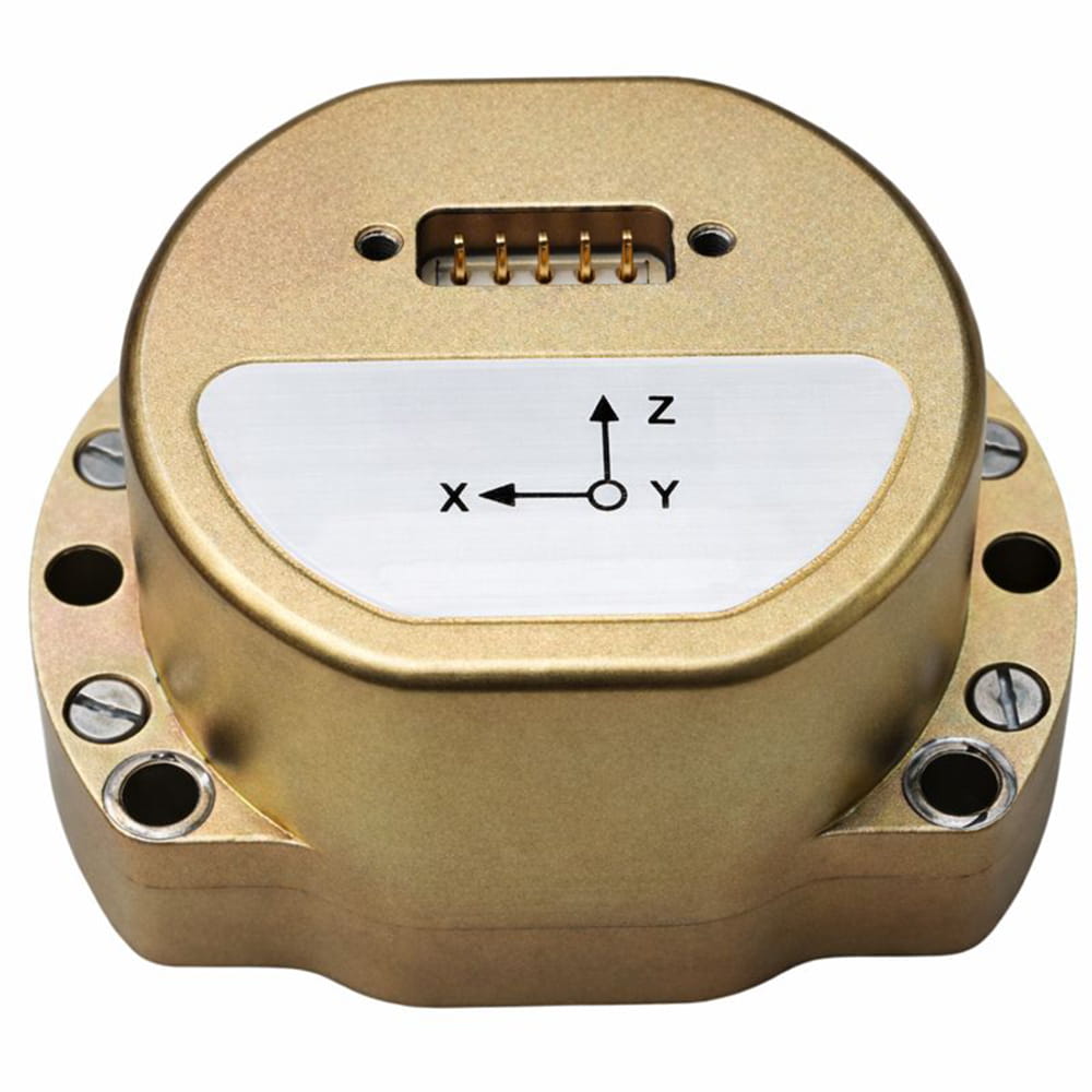
Micro-Magic has released the U4930 series, a reliable and cost-effective six-axis MEMS inertial measurement module that can be widely used in navigation, control and measurement fields for vehicles, ships and drones.
Typical applications include vehicle/ship attitude measurement, UAV attitude reference and trajectory control, mobile mapping, track inspection, underwater high-precision navigation, and Satcom-on-the-Move.
The U4930 series integrates high-performance MEMS gyroscopes and MEMS accelerometers within an independent structure. The three-axis MEMS gyroscopes sense the angular motion of the carrier, and the three-axis MEMS accelerometers sense the linear acceleration of the carrier.
The system internally performs compensation for zero bias, scale factor, non-orthogonal error, and acceleration-related terms across all temperature parameters, maintaining high measurement accuracy over a long period of time.
The module supports custom communication protocols and provides synchronization for GPS/GNSS time data and pulse per second (PPS) signals.
The U4930A series inertial measurement module can be configured with various hardware and software to meet user needs.
Project establishes innovative test framework to help UK operators, providers and suppliers adopt best practice and benchmark success
Spirent Communications, now part of Keysight Technologies, has partnered with the European Space Agency (ESA) to lead an initiative aimed at increasing the resilience of positioning, navigation and timing (PNT) systems used in critical national infrastructure. Under the initiative, Spirent and partners will deliver a comprehensive test framework to drive measurable resilience in PNT systems for users, operators and providers of critical infrastructure in the United Kingdom.
Supported by Element 2 of ESA’s Navigation Innovation and Support Program (NAVISP), the initiative is designed to raise awareness and improve resilient PNT test and assessment by providing a pathway to assess, validate and rate PNT equipment and services used in critical national infrastructure. The 2023 UK government report The Economic Impact on the UK of a Disruption to GNSS estimates a seven-day GNSS outage could cost the UK economy £7.6 billion. Critical infrastructure is heavily dependent on satellite-based PNT systems and data.
“For years, organizations have been wrestling with a fundamental challenge: they know PNT resilience matters, but they do not have a clear way to measure it or benchmark their progress,” explained Mark Holbrow, vice president of Engineering and Product Development at Spirent Positioning. “This new initiative changes that by building the tools and frameworks that let critical national infrastructure operators quantify resilience, track it, and improve it over time, and we’re proud that ESA has entrusted Spirent to lead this exciting three-year project.”
The Resiliency in Critical National Infrastructure will support the UK government’s resilient PNT strategy by enabling access to rigorous, quantitative test evidence and operational insights that help evaluate and validate PNT systems across essential sectors. It will comprise three core components:
Spirent PNT Alliance brings together companies, academic research partners, and PNT professional and government bodies to identify, develop and cater resilience services for critical infrastructure. It will include the Royal Institute of Navigation and other strategic partners to complement their activities and help build a resilient PNT ecosystem in the UK by commercializing best practices and connecting infrastructure operators with new technologies and test approaches.
PNT Shopfront showcases solutions that aid the adoption of resilient PNT and help to assure regulatory compliance for critical PNT dependencies.
PNT Resiliency Health Check will enable independent appraisal of GNSS equipment capability against general performance, resilience and security criteria. Annual health check assessments will help organizations understand their dependencies, identify vulnerabilities, and track improvements over time, with a technical framework that scores resilience against standard benchmarks to create a pathway toward industry-wide test methodologies.
“Intentional and malicious disruptions to GNSS are now a daily occurrence, and are pervasive in the aviation and maritime sector,” said Ramsey Faragher, director of the institute. “The Royal Institute of Navigation is focused on raising awareness to these issues and in promoting the needs for improved resilience against such disruptions, especially within Critical National Infrastructure. Our Best Practice Guidelines emphasize the criticality of thorough testing in order to verify resilience and to help protect against both existing and future attack vectors. The UK is well placed to take a lead in this area, and well placed to inspire other nations to follow suit. We are really pleased to see initiatives like these from our corporate partners, and we look forward to supporting them.”
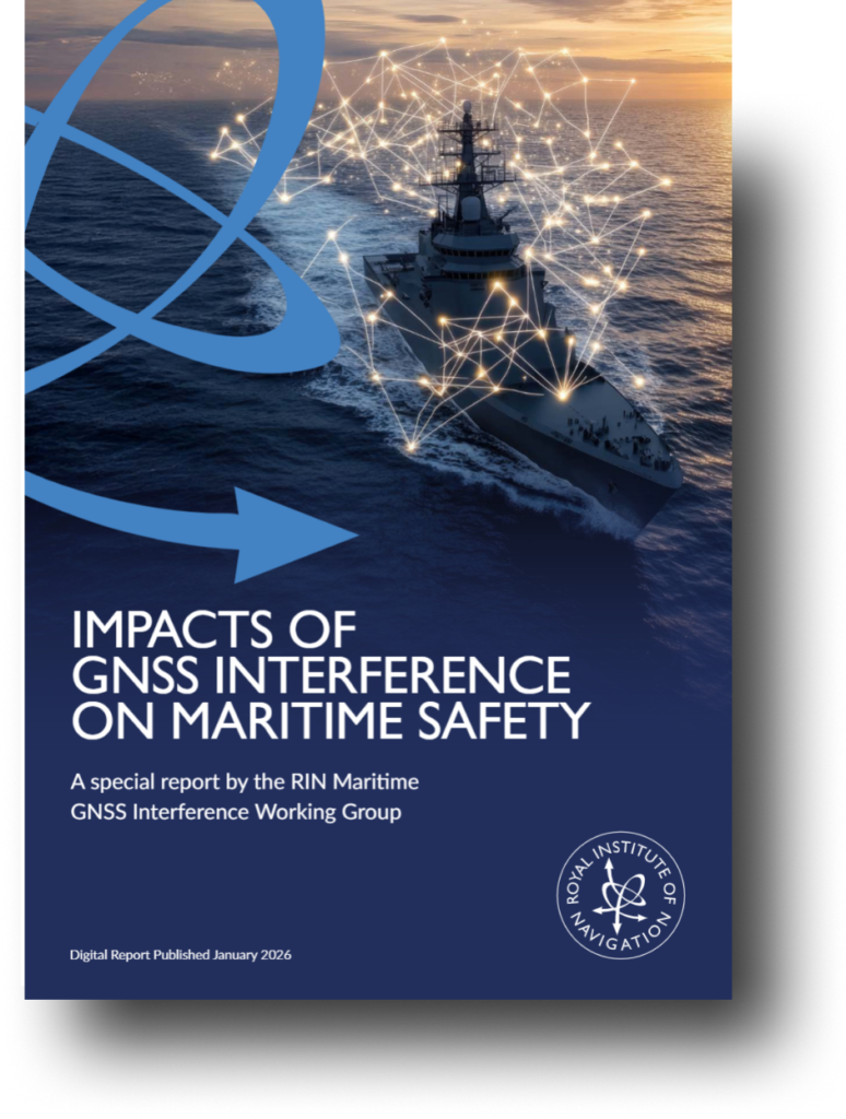
The UK Royal Institute of Navigation has released a special report on GNSS-interference and its impact on the maritime sector.
Impacts of GNSS Interference on Maritime Safety is a special report by the RIN Maritime GNSS Interference Working Group on the impacts of GNSS Interference. Survey data was compiled from more than 100 sector experts and 300 vessel captains, supported by interviews with dozens of people involved in the operations and supply chain of vessels that regularly encounter GNSS interference.
GNSS interference refers to anything that disrupts a ship’s satellite-based positioning signals, usually caused by jamming and spoofing.
In 2025, at least two collisions and groundings were reported in mainstream media linked to GNSS interference in regions such as the Baltics, Straits of Hormuz and the Red Sea. With hundreds of vessels being affected daily, the RIN report details for the first time the scale of the problem on modern digital vessels, where GNSS jamming and spoofing present a significant cybersecurity vulnerability and urgent risks to maritime safety.
Survey data exposes the vulnerability of critically important systems such as Global Maritime Distress and Safety Systems (GMDSS) and other SOLAS-mandated equipment that rely on satellite positioning and timing.
“The report has highlighted serious safety concerns and has underlined the fact that these issues are rooted in significant cybersecurity vulnerabilities, and are not just disruptions to navigation,” said Ramsey Faragher, director of the RIN.
Operating within regions of known GNSS interference carries serious safety-of-life and liability implications, as key systems are expected to fail or malfunction with high probability in these conditions. The report also highlights unnecessary dependencies between GNSS receivers and a range of onboard electronics — including radar, radios (VHF/MF/HF), Navtex, speed logs, ship clocks and satellite communications — many of which do not require GNSS data for their primary function, creating avoidable points of failure and compounding operational risk.
“The issue of GNSS interference must be taken seriously. It cannot be overcome by traditional navigation techniques when GNSS receivers are ‘baked in’ to modern ships’ critical systems, including safety systems,” said Ivana-Maria Carrioni-Burnett, maritime captain and chair of the RIN Maritime Navigation Group. “These are no longer isolated incidents and pose a real risk to life: people, property and the environment. We must do more to safeguard our seas today and the shipping of tomorrow.”
“Despite measures to improve resistance to jamming, spoofing and other harassment measures, the threat is real and growing,” said Retired Commodore James Taylor OBE and fellow of the RIN advises. “And this threat is not only to positioning and navigation; it is to every part of every transport and navigation means and to every part of national infrastructure where timing is derived from space-based timing signals.”
The Royal Institute of Navigation will continue to work with report partners (GLA, IALA, Nautical Institute and others) and regulatory bodies to provide expert guidance to mitigate these issues, and to establish industry-wide adoption of solutions to this problem. RIN thanks National PNT Office for its support.