Category: Transportation

  • Septentrio GNSS receivers to guide train systems for Wabtec

    Septentrio is providing GPS/GNSS receivers to Wabtec, a global company specializing in equipment, digital solutions and services for freight and transit rail systems.

    Wabtec is implementing Septentrio GNSS receivers in its GoLINC Edge platform, providing positioning, connectivity, data storage and enhancing positive train control (PTC) with the adoption of higher precision positioning technology.

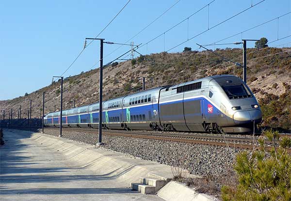
    The enhanced navigational reference capability can benefit U.S. railroad operations as Septentrio GNSS receivers are installed on Wabtec’s latest GoLINC mobile data center platform operating onboard freight locomotives. Two GNSS receivers are being installed on each locomotive to provide precise positioning information as part of the GoLINC system.

    Septentrio receivers are also being installed as position reference modules along 30,000 miles of track. They will provide GNSS corrections to the rover receivers aboard the locomotives for reliable and accurate positioning, even in difficult environments such as when tracks run alongside mountains, around cliffs or under foliage.

    “The Septentrio GNSS receiver was chosen based upon its superior performance and has proven to have the technology advantage that our customers are looking for,” said Michael Miner, GoLINC product manager at Wabtec.

    Wabtec’s GoLINC system — comprising networking, communications and applications management platforms — makes trains smarter by collecting numerous parameters about the train and its route.

    GoLINC is integrated with Wabtec’s PTC solution, which functions as a safety overlay and is designed to enforce existing railroad signal indications and other operating rules. Moreover, PTC provides critical information about proximity of work zones, movement authorization, switch positions and other operational data.

    “For two decades, Septentrio has been delivering GNSS receivers to customers requiring accuracy, reliability and safety,” said Neil Vancans, Septentrio vice president of global sales. “We have pioneered and fine-tuned capabilities such as position reliability and interference robustness driven by our customers in markets such as offshore energy, mining and construction.

    “Over the last several years, we have been working closely with the transportation and logistics sector as well,” Vancans said. “Cooperation with Wabtec offers an excellent opportunity to further deploy our high-precision positioning technology in the rail industry, where the unique capabilities of our GNSS hardware and software match perfectly with the accuracy and safety demands of positive train control.”

    Beyond PTC, the high-precision GPS infrastructure along the track will enable other applications such as drone flights for rail inspection.

    Septentrio will be exhibiting its latest GNSS receivers at the Railway Interchange exhibition and technical conference, which runs Sept. 22-25 in Minneapolis, Minn., USA.


    Feature photo: Septentrio

  • Seen & Heard: Bats, buses and cows

    “Seen & Heard” is a monthly feature of GPS World magazine, traveling the world to capture interesting and unusual news stories involving the GNSS/PNT industry.


    Batman only wishes he had one

    New miniature GPS “backpacks” are making it possible to track tiny desert bats, providing insight into their lives. Tiny 1-g GPS tags showed University of Helsinki researchers that Africa’s yellow-winged bats struggle during dry periods. The species is one of the few desert bats large enough to carry the tag. Researchers placed GPS trackers on 29 bats, 15 in the rainy season and 14 in the dry season, for one week each, and recorded their positions every 30 to 60 minutes each night.


    Photo: iStock/ MBPROJEKT_Maciej_Bledowski
    Photo: iStock/ MBPROJEKT_Maciej_Bledowski

    The wheels on the bus need GPS

    All New York City public school buses will provide GPS tracking by the first day of class this fall. The city has teamed up with Via to install the equipment and provide an app for real-time tracking of the nearly 10,000 buses. The city council approved the tracking program after a sudden snowstorm in November 2018 left buses stranded in traffic for hours, and parents couldn’t reach their kids.


    Keep on truckin’

    Shipping company UPS is investing in autonomous deliveries, specifically in TuSimple, a robot-trucking startup. UPS is testing self-driving tractor trailers on a route between Phoenix and Tucson, Arizona, to help it understand requirements for Level 4 autonomous trucking. TuSimple completed a two-week pilot with the U.S. Postal Service in May, hauling mail between Phoenix and Dallas. All TuSimple trucks operate with two technicians in the cab, with the aim to operate without drivers within two years.


    A+ for GPS Cows

    High-school students interested in agricultural professions can now learn about the use of GPS for monitoring livestock, and even make their own GPS collars. The collaborative GPS Cows program brings together industry researchers, professionals and educators from the U.S. and Australia. GPS Cows is fighting the misperception that ag-focused students don’t need digital literacy, and is engaging them in agri-tech, specifically tools and systems that provide animal location and behavior data.

  • Autonomous vehicles can reduce road fatalities

    Autonomous vehicles can reduce road fatalities

    Mothers Against Drunk Driving (MADD) has partnered with Velodyne Lidar, a provider of real-time 3D perception systems for a range of commercial applications, including autonomous vehicles. The initiative includes a website on the safety benefits of autonomous vehicle technology (see velodynelidar.com/madd-partnership.html) and an October conference on autonomous safety.

    “We have learned that technology is essential to getting us to our goal of zero deaths caused by drunk driving,” said MADD President Helen Witty. “Autonomous vehicle technology holds the incredible promise of helping us eliminate drunk driving.”


    World Safety Summit on Autonomous Technology
    Levi’s Stadium in Santa Clara, California | October 2, 2019

    The summit is designed to advance understanding of the safety benefits that can be achieved with autonomous vehicle technology. It is designed for business, government, public safety and community leaders. Attendees will have the opportunity to ride in autonomous vehicles.


    Marta Hall, Velodyne Lidar’s president and chief business development officer, added, “Our goal is to design, develop and mass-produce lower cost lidar sold for every model of car and truck.”

    The two organizations partnered in 2018 to create the website with information on how autonomous vehicles can help prevent roadway collisions. The site explains the basics of autonomous driving in easy-to-understand language for all audiences. Content modules include “Lidar 101,” explaining how lidar sensor technology is an essential component of self-driving vehicles.

    A 3D lidar sensor such as the Velodyne Alpha Puck can deliver information to help enable vehicle autonomy and advanced driver-assistance systems. (Image: Velodyne)
    A 3D lidar sensor such as the Velodyne Alpha Puck can deliver information to help enable vehicle autonomy and advanced driver-assistance systems. (Image: Velodyne)

    “The promise of safe, self-driving cars is very exciting, particularly for those of us who have seen the devastation that impaired driving and human error can bring,” said former MADD President Colleen Sheehey-Church.

    Puck Sensor.
    The Velodyne Alpha Puck is a lidar sensor specifically made for autonomous driving and advanced vehicle safety at highway speeds. In a session at July’s Automated Vehicle Symposium, company speakers presented “High-Definition 3D Lidars: An Integral Part of Future Autonomous Driving,” including use cases that have proven elusive for solutions based on camera and radar; and “State of Solid-State 3D Lidar,” a technical presentation on application-specific integrated circuits (ASICs).

    “Core lidar electronics are moving from a printed circuit board to an ASIC, which provides advantages such as higher density, lower cost and improved reliability,” said UAV and Robotics Business Manager Frank Bertini. “The trend roughly follows Moore’s Law, leading to dramatic decreases in size, weight and cost over relatively short time periods.”

  • Arm to offer Swift Navigation positioning for autonomous vehicles

    Arm to offer Swift Navigation positioning for autonomous vehicles

    The Swift/Arm partnership means Arm will offer Swift Navigation’s high-integrity, high-accuracy GNSS positioning solutions as an option on Arm-based platforms to developers of autonomous and connected vehicles. (Image: Swift Navigation)
    The Swift/Arm partnership means Arm will offer Swift Navigation’s high-integrity, high-accuracy GNSS positioning solutions as an option on Arm-based platforms to developers of autonomous and connected vehicles. (Image: Swift Navigation)

    Swift Navigation is partnering with Arm, a global leader in semiconductor IP.

    The partnership means Arm will offer Swift Navigation’s high-integrity, high-accuracy GNSS positioning solutions as an option on Arm-based platforms to developers of autonomous and connected vehicles.

    Swift Navigation is a San Francisco-based tech firm redefining GNSS positioning technology for autonomous vehicles.

    Standard GNSS positioning is three to five meters in depth which is not suitable for safety-critical systems requiring lane-level accuracy. For higher levels of autonomous capability, a vehicle needs to be able to determine its absolute location. To achieve this, high-precision localization is needed to get to accuracy down to the centimeter.

    Swift’s partnership with Arm will deliver a high-integrity, high-accuracy GNSS positioning solution for silicon makers and Tier 1 and 2 auto suppliers to integrate precise positioning into the sensor suite.

    Swift Navigation’s Starling is a GNSS positioning engine designed for just such automotive and autonomous vehicle applications. Starling’s software enhances the measurements for commercially available GNSS receivers to provide true precision and integrity capabilities. Starling is receiver-agnostic, so it is ideal for Arm customers as it works with a variety of automotive grade chipsets and inertial sensors.

    Swift’s partnership with Arm will deliver a high-integrity, high-accuracy GNSS positioning solution for silicon makers and Tier 1 and 2 auto suppliers to integrate precise positioning into the sensor suite. (Image: Swift Navigation)
    Swift’s partnership with Arm will deliver a high-integrity, high-accuracy GNSS positioning solution for silicon makers and Tier 1 and 2 auto suppliers to integrate precise positioning into the sensor suite. (Image: Swift Navigation)

    Swift and Arm are working together to provide developers of autonomous and connected vehicles a cost-effective, scalable and high-integrity positioning solution. Starling is designed to be compatible with industry leading silicon makers who build their solutions on Arm.

    Starling works with a variety of GNSS measurements engines and is a hardware proven, end-to-end solution, tunable for the specific requirements of a customer’s platform. This partnership elevates the capabilities of the connected car and simplifies the integration of high-precision GNSS into Tier 1 and 2, Silicon and Platform and Automotive OEM vendors.

    “We are pleased to join the ecosystem of Arm technology partners to deliver precise positioning solutions to its automotive and autonomous vehicle customers,” said Timothy Harris, chief executive officer of Swift Navigation. “This partnership opens up a broader audience of customers who can benefit from Swift’s positioning technology and builds on our mission to enable a future of autonomous vehicles.”

    “As we strive toward an autonomous future, the requirements of the automotive market are changing, and a more solution-based approach is needed,” said Dipti Vachani, senior vice president and general Manager, automotive and IoT line of business, Arm. “The combination of Arm IP uniquely designed for automotive and Swift’s GNSS solution gives our partners another key component on the road to the effective deployment of autonomous vehicles at scale.”

    Available for purchase today for Arm-based processors, the Starling positioning engine provides a rapid deployment, low total cost of ownership solution to enable widespread adoption of ADAS, connected car, C-V2X and autonomous solutions.

    Interested parties should visit this website to get more information on using the Starling positioning engine on Arm-based devices.

    The joint solution will be also be showcased at the IAA New Mobility World 2019 event from Sept. 10-15 at the Arm booth, Hall 5.0, stand A10, Frankfurt Messegelände.

  • GMV to develop autonomous vehicle positioning for BMW

    GMV to develop autonomous vehicle positioning for BMW

    GMV has been awarded a contract for development of a precise GNSS positioning system with integrity for the new generation of autonomous vehicles of the German carmaker BMW Group.

    The Spanish multi-national’s technology solution is going to be developed for the first time in BMW Group’s autonomous vehicles. GMV’s positioning software calculates the vehicle’s position and other magnitudes, using advanced GMV-developed algorithms, including components that have already been patented. These algorithms have been especially modified and adapted to meet BMW Group’s performance and safety requirements.

    Photo: BMW Group
    Photo: BMW Group

    The developed software will abide by the most demanding automotive standards and the highest quality levels of safety-critical software, GMV said.

    Another key component provided by GMV is a GNSS correction service to be run in a secure infrastructure using data from a global network of monitoring stations to be set up by GMV under this contract.

    This new project cements GMV’s position as a supplier of GNSS-based autonomous-car positioning solutions, the company said.

    “GMV has been investing for many years in the key GNSS technologies that are essential for autonomous driving systems,” said Miguel Ángel Martínez Olagüe, GMV’s general manager of Intelligent Transportation Systems. “For our company this contract represents a unique opportunity to capitalize on all that effort, providing a product of outstanding performance for the automotive industry.”

  • French railways embrace Galileo to boost customer service

    French railways embrace Galileo to boost customer service

    More than 70 million TGV passengers will benefit from Galileo’s improved accuracy and positioning in 2019. (Photo: GSA)
    More than 70 million TGV passengers will benefit from Galileo’s improved accuracy and positioning in 2019. (Photo: GSA)

    News from the European GNSS Agency (GSA)

    The French national rail company SNCF is adopting Galileo technology to boost customer services, in particular in its high-speed TGV network. TGV is France’s intercity high-speed rail service, and is operated by the SNCF.

    With almost 50% of TGV trains already equipped with Galileo receivers, European GNSS is enabling improved customer information and traffic management.

    Galileo is a technology building block that can precisely and safely locate trains and contribute to the future evolution of the European Rail Traffic Management System (ERTMS). ERTMS aims to harmonize signaling systems across Europe, and European GNSS can help reduce its costs.

    SNCF is already embracing GNSS-based systems, in particular for passenger information, and fleet and traffic management.

    “At the beginning of 2019, some 250 high-speed trains were already equipped with Galileo-ready receivers,” said Antoine Barre, head of SNCF train localization projects. “This represents nearly 50% of SNCF’s TGV fleet. Some 320 trains are expected to be Galileo-ready by the end of 2019.”

    70 million passengers to benefit

    The aim is to deliver Galileo-enabled services along the entire train journey and customer experience. During 2019, more than 70 million passengers will benefit from the improved accuracy and positioning availability delivered to French TGV trains by Galileo.

    SNCF aims to equip its entire train fleet with Galileo receivers to assist non-safety relevant train localization. It also plans to further investigate the future contribution of European GNSS within ERTMS.

    “Having Galileo on the iconic TGV trains is a major milestone for us, confirming that European GNSS is delivering a clear value added to one of the main EU Railway undertakings,” said Daniel Lopour, GSA market development officer.

    “It is also good to see that SNCF is further progressing towards GNSS adoption on the regional fleet on the basis of the GSA position paper delivered earlier to the Community of European Railways (CER), explaining the benefits of Galileo for such applications,” Louper said.

    Currently, signaling is enabled by equipment installed along rail tracks that requires regular inspection and maintenance. Accurate and reliable geolocation using GNSS will enable rail networks to reduce the cost related to the infrastructure.

    Receivers installed in the train and connected via wireless networks should considerably reduce the costs of operation, maintenance and renewal of the network.

    SNCF has identified three main themes of work for future rail technologies: geolocation, telecommunication and the use of satellite images for infrastructure monitoring.

    Technology forward

    Speaking at the Space for Innovation in Rail event, held in Vienna, Austria, March 18-19, Corinne Talotte described SNCF’s Technology Forward programme. Talotte is director of Innovative Technologies at SNCF. Talotte explain that the SNCF program is looking to build the “Railway for the Future” — a railway that is “autonomous, connected and zero emission.”

    This spirit of innovation at SNCF aims to accelerate the implementation of new technologies. “First, this involves keeping an open mind on innovation and learning from other transport sectors,” Talotte said. “And our second important principle is to move to demonstrate innovative technologies as soon as possible in real operational situations to prepare the future deployment of innovations.”

    Highly precise geolocation is a key element to enable autonomy in all modes of transport and future mobility systems. For trains, autonomous operation can increase the density of trains operating in the network while at the same time improving safety and reliability of customer services.

    Space4Rail: From innovation to implementation

    “We need to know accurately the position, velocity and attitude in real time to enable autonomous train systems,” explained Talotte. “We are developing a multi-sensor system for localisation based on GNSS but combined with other inertial sensors.

    “This hybrid approach is inspired by the approach already adopted in the aviation sector. SNCF is undertaking a number of demonstrations with several partners, including the ERTMS user group and the Shift2Rail Joint Undertaking.”

    Hybrid architecture

    At the Space for Innovation in Rail event, Corinne Talotte said that SNCF was working on the remote operation of trains for use cases like shunting yards and the development of fully autonomous train prototypes.

    The hybrid architecture makes it possible to take advantage of the benefits offered by both technologies: GNSS corrects the natural drift of the inertial unit, and when GNSS is not available, for example in tunnels or in dense urban environments, the inertial unit can take over to ensure continuity of location data. The inertial unit also protects the system from any possible disturbances in the GNSS signal, such as jamming or spoofing, as well as environmental factors.

    The use of autonomous trains with innovative network control systems should enable SNCF to increase throughput on its lines. The objective is to carry more people and more goods, with greater regularity, improved energy efficiency and better economic performance, while ensuring continuing high levels of safety.

    SNCF believes that the autonomous train is no longer science fiction, but the immediate future. A first prototype remote-controlled freight train should be tested some time this year, and the first prototypes of freight and passenger trains with autonomous driving capability are predicted beginning in 2023, with gradual implementation.

  • U.S. Navy to conduct GPS interference tests off Savannah

    U.S. Navy to conduct GPS interference tests off Savannah

    Photo:
    CSG4 19-03 GPS interference testing. (Image: FAA)

    A U.S. Navy exercise in the southeastern United States will involve GPS interference testing that could make aircraft navigation unreliable or unavailable on Aug. 30 and Sept. 5.

    The Federal Aviation Administration issued an advisory about the testing, which will be centered in the Atlantic off the coast of Savannah, Georgia, on the SAV VOR 139-degree radial at 84 nautical miles.

    It could affect GPS reliability — including WAAS, GBAS and ADS-B — centered at 311230N 0795830W (SAV139084):

    • within a 352-nautical-mile radius at Flight Level 400
    • within 307 nautical miles at Flight Level 250
    • within 242 nautical miles at 10,000 feet
    • within 197 nautical miles at 4,000 feet above ground level
    • within a 127-nautical-mile radius at 50 feet above ground level.

    The tests are scheduled for 1800 Zulu to 2200 Zulu on Aug. 30, and 1600 Zulu to 2000 Zulu on Sept. 5.

    The FAA advisory states that GPS interference notices to airmen may change with little or no notice, and encourages pilots to check regularly for updates. NOTAMs will be published at least 24 hours in advance of any GPS tests.

  • Garmin launches GNC 355 GPS/comm radio with LPV approaches

    Garmin launches GNC 355 GPS/comm radio with LPV approaches

    The GNC 355 is a GPS navigator with localizer performance with vertical (LPV) approach guidance and a built-in communications radio. (Photo: Garmin)
    The GNC 355 is a GPS navigator with localizer performance with vertical (LPV) approach guidance and a built-in communications radio. (Photo: Garmin)

    Garmin International Inc. has launched the GNC 355 — a GPS navigator with Localizer Performance with Vertical (LPV) approach guidance and built-in communications radio.

    With the GNC 355, pilots can take advantage of the benefits of WAAS/SBAS GPS guidance, while also incorporating a modern comm radio into their existing avionics stack.

    Intended for Class I/II aircraft that weigh 6,000 lbs./2,721 kg. or less, as well as experimental/amateur-built (EAB) aircraft, the GNC 355 Supplemental Type Certification (STC) is imminent and will be available in August for more than 700 aircraft makes/models.

    “Based on the popularity of legacy products like the GX 60 and the GNC 250/300XL, as well as customer excitement for our new GPS 175 and GNX 375, we’re pleased to bring the GNC 355 to market,” said Carl Wolf, Garmin vice president of aviation sales and marketing. “The GNC 355 gives value-minded customers a simple upgrade path to a GPS navigator with a number of capabilities including WAAS/LPV approach guidance, wireless connectivity, a modern Comm radio, and with its standard mark-width form factor, pilots can easily add the GNC 355 without overhauling the panel of their aircraft.”

    Aircraft owners can incorporate the GNC 355 into an existing avionics stack because of its standard 6.25-inch wide by 2-inch tall design. A vibrant, colorful and responsive touchscreen display boasts a familiar Garmin user experience, while a dual concentric knob and home button offer added versatility when interfacing with the touchscreen.

    The user interface has been optimized for the screen size of the display, while also retaining a familiar menu structure similar to other Garmin products. Pilots can quickly access direct-to functionality, moving map, flight plan, nearest, procedures, waypoint and terrain pages, as well as frequency information using the touchscreen, and create customizable data fields and shortcuts for quick, one-touch access to important information.

    Fully WAAS/SBAS IFR-approach-capable, the GNC 355 gives pilots the benefit of flying LPV, as well as Area Navigation (RNAV) approaches. Many approaches offer vertical approach guidance as low as 200-feet above ground level (AGL).

    Pilots can also leverage the touchscreen and moving map to generate customized holding patterns over an existing fix in the navigation database or over a user-defined waypoint and easily insert it into a flight plan. Visual approaches are also available within the GNC 355 and provide lateral and vertical approach guidance in visual flight conditions.

    Two versions, the GNC 355 and GNC 355A, are available with 25 kHz and 8.33 kHz frequency channel spacing respectively. Using the internal frequency database, airport, weather, Air Route Traffic Control Center (ARTCC) and Flight Service Station (FSS) frequencies are easy to find and can be loaded to the standby position by selecting the frequency from the airport information page. Recent, nearby and saved frequencies also offer easy access to frequency information. For example, with built-in standby frequency monitoring, pilots can listen to ATIS while monitoring tower frequency simultaneously. The airport identifier and frequency type are also displayed below the frequency so pilots can communicate with confidence.

    An array of interface options includes the G3X Touch flight display for experimental and certificated aircraft, the G5 electronic flight instrument, the GFC 500 and GFC 600 autopilots, as well as select third-party autopilots. Course deviation and roll steering outputs can also be coupled to the GFC 500/GFC 600 autopilots and select third-party autopilots so procedures such as holds, radius-to-fix (RF) legs and missed approaches may be flown using the autopilot. Aircraft owners can also retain many of their existing flight instruments, audio panels and many legacy CDI/EHSI indicators such as the KI 208/209 products.

    Additional interface options include pairing the GNC 355 with a dual-link Garmin Automatic Dependent Surveillance-Broadcast (ADS-B) solution, such as the GTX 345 or GDL 88. When paired with these products, the GNC 355 is capable of displaying subscription-free Flight Information Service-Broadcast (FIS-B) weather and ADS-B traffic targets, which includes patented TargetTrend and TerminalTraffic.

    Wireless Connext devices running the Garmin Pilot and FltPlan Go applications. Pilots can also use the Flight Stream 510 to access the wireless benefits of Garmin’s Database Concierge, which uploads aviation database information from the Garmin Pilot app to the GNC 355 in minutes.

    The GNC 355 provides a number of additional benefits, including graphical flight plan editing, allowing pilots to more easily edit their flight plan based on an ATC amendment or weather. Features such as FastFind simplify flight plan entry by applying predictive logic to suggest airports and waypoints using current GPS location, while Smart Airspace makes it easier to identify pertinent airspace on the moving map.

    The addition of SafeTaxi airport diagrams displays runways, taxiways, Fixed Based Operators (FBOs), hangars and more relative to the aircraft’s location on the airport surface.

    The GNC 355 and GNC 355A can be purchased through the Garmin Authorized Dealer network at that time starting at a list price of $6,9951 and $7,6951 respectively.

    European Union Aviation Safety Agency (EASA) validation is expected at a later date.

    A free GNC 355 trainer app is also available for download on Apple mobile devices, which allows customers to explore the feature set.

  • Iran jams GPS on ships in Strait of Hormuz

    Iran jams GPS on ships in Strait of Hormuz

    Ships sailing through the Strait of Hormuz and the Persian Gulf have been experiencing GPS interference that U.S. officials suspect is the work of the Iranians, according to CNN.

    The U.S. Department of Transportation’s Maritime Administration issued an advisory on Aug. 7 to ships traveling in the Persian Gulf, Strait of Hormuz, Gulf of Oman, Arabian Sea and Red Sea. Ships have reported GPS interference, bridge-to-bridge communications spoofing and jamming, and other problems.

    Iran’s goal is for ships and aircraft to wander into Iranian waters or airspace, justifying a seizure, a U.S. defense official told CNN. He said Iran has placed GPS jammers on Iran-controlled Abu Musa Island, which lies in the Persian Gulf close to the entrance of the Strait of Hormuz.

    “Heightened military activity and increased political tensions in this region continue to pose serious threats to commercial vessels,” reads the advisory. “Associated with these threats is a potential for miscalculation or misidentification that could lead to aggressive actions. Vessels operating in the Persian Gulf, Strait of Hormuz, and Gulf of Oman may also encounter GPS interference, bridge-to-bridge communications spoofing, and/or other communications jamming with little to no warning.”

    In at least two incidents, vessels reported GPS interference. One vessel reportedly shut off its Automatic Identification System (AIS) before it was seized, complicating response efforts.

    Vessels have also reported spoofed bridge-to-bridge communications from unknown entities falsely claiming to be U.S. or coalition warships.

    Since May 2019, the following maritime incidents have occurred in this region:

    • Six attacks against commercial vessels.
    • Shoot-down of U.S. Navy remotely piloted aircraft over international waters
    • Attempted at-sea interdiction of Isle of Man-flagged M/V British Heritage (oil tanker)
    • Seizure of ex-Panama-flagged M/V Riah (oil tanker)
    • Seizure of U.K.-flagged M/V Stena Impero (oil/chemical tanker)
    • Detention and subsequent release of Liberian-flagged M/V Mesdar (oil tanker).
    Photo: Igor Grochev/Shutterstock.com
    Photo: Igor Grochev/Shutterstock.com
  • Drotek releases Sirius RTK GNSS rover F9P

    Drotek releases Sirius RTK GNSS rover F9P

    Image: Drotek
    Image: Drotek

    Drotek Electronics is now offering the F9P Sirius RTK GNSS Rover, which is designed to be mounted on a moving vehicle. The u-blox ZED-F9P module inside provides 1-cm position accuracy, a convergence time under 10 seconds and a navigation update rate up to 20 Hz.

    The new Sirius RTK GNSS Rover F9P has a built-in active antenna patch. It receives GPS, Galileo, Beidou and GLONASS signals, providing additional accuracy. The F9 Sirius Rover is designed to fit most setup designs as well as integrate easily into a vehicle. Its six-pin JST-GH connector makes it plug-and-play with the Pixhawk Pro 3 autopilot.


  • Swift Navigation expands Skylark precise positioning for autonomous vehicles

    Swift Navigation expands Skylark precise positioning for autonomous vehicles

    Image: Swift Navigation
    Image: Swift Navigation

    Skylark is now available across the contiguous United States, enabling safe and lane-level accurate positioning.

    Swift ​​Navigation’s network-connected Skylark precise positioning service is now available throughout the United States. Full contiguous U.S. (CONUS) coverage reduces initialization times to seconds, ensuring high-accuracy, high-integrity positioning is available when customers need it.

    Swift ​​Navigation is ​​a San Francisco-based tech firm providing centimeter-accurate GNSS positioning technology for autonomous vehicles, and the maker of the Piksi Multi and Duro GNSS receivers.

    Skylark is built for autonomy at scale and delivers lane-level precision, with safety-of-life integrity, required by mass-market automotive and autonomous applications. Skylark is a scalable network delivering a continuous stream via the cloud of robust, reliable, multi-constellation, multi-frequency corrections, with the latency, security, precision and reliability required for safety and autonomy.

    “Since Skylark was introduced last year, the Swift network team has been hard at work deploying infrastructure across the country,” said Rob Hranac, COO of Swift Navigation. “This extensive network helps remove hurdles in precise positioning for our customers and we look forward to partnering with those customers as we expand Skylark internationally.”

    Skylark is designed to address the needs of automotive original equipment manufacturers (OEMs) by supporting ASIL-rated (Automotive Safety Integrity Level) systems and Ntrip2 (Networked Transport of RTCM via Internet Protocol) connections in cloud reference station (CRS) mode. It is state space representation (SSR) ready — an emerging industry format.

    Skylark is hardware-independent, giving customers a choice in today’s rapidly improving and commodifying the GNSS sensor ecosystem. OEMs are able to benefit from the lane-level positioning Skylark delivers using a host of third-party receivers in addition to Swift’s Piksi Multi and Duro receivers.

    Unlike legacy real-time-kinematic (RTK) services designed for smaller regions and precise point positioning (PPP) services that suffer from slow convergence times, Skylark is a high-performance hybrid nationwide U.S. network that delivers initialization times in seconds, better than 10 centimeters of accuracy and integrity required by the most demanding safety-of-life critical applications.

    When used with Swift’s Starling positioning engine, Skylark is capable of delivering protection levels (PL) down to 1 meter and target integrity risk (TIR) down to 10-7/hour. Engineered for automotive functional safety standard ISO 26262 (ASIL B), Skylark is designed and built from the ground up to support next-generation GNSS applications, connected car, V2X and advanced driver assistance systems (ADAS).

    Skylark packages GNSS precise positioning as an affordable subscription service for ease in deployment for large-scale autonomous vehicle fleets.

  • Volkswagen, Ford join on self-driving cars

    Photo: Argo AI
    Photo: Argo AI

    In July, Volkswagen AG and Ford Motor Co. provided updates on their development alliance announced in January.

    The automakers plan to collaborate on autonomous vehicles, among other programs. Together, they are investing $2.6 billion in Pittsburgh startup Argo AI, which is developing a self-driving technology platform. Ford first invested in Argo two years ago.

    The investment includes the resources of VW’s Autonomous Intelligent Driving Group (AID), valued at $1.6 billion. AID will become Argo AI’s European operation.

    Volkswagen and Ford hope to achieve a self-driving platform that can be scaled comparatively quickly. Argo AI’s objectives are to

    • build for scale.
    • architect the software to be production quality.
    • have automotive-grade sensors and computers.
    • fully integrate their product with OEMs and automakers.

    A benefit to having the Argo AI system on more vehicles means the AI will obtain data through daily operation, enabling it to grow smarter and better.

    Argo AI has successfully tested its driverless vehicles in five U.S. cities: Pittsburgh, Palo Alto, Detroit, Miami and Washington, D.C.