Fleet management company Omnitracs LLC has partnered with Peloton Technology, a developer of connected and automated vehicle systems for U.S. and global freight carriers. Omnitracs and Peloton will collaborate to bring Peloton’s truck platooning technology to Omnitracs customers.
The partners will also develop joint solutions that combine each company’s safety, efficiency and fleet management capabilities.
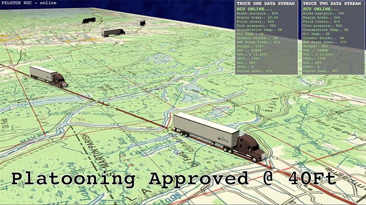
Peloton will begin filling pre-orders of its flagship platooning product for Class 8 trucks in 2017. The technology synchronizes braking and acceleration between pairs of trucks through the integration of vehicle-to-vehicle (V2V) communications with radar-based collision avoidance systems, enabling the trucks to travel safely at aerodynamic following distances.
The Peloton system generates 4.5 percent fuel savings for the lead truck and 10 percent for the follow truck in a two-truck platoon, according to independent testing by the North American Council for Freight Efficiency.
Image: Omnitracs
For the driver of the follow truck, the Peloton system works similarly to adaptive cruise control with the added safety feature of V2V communications to enable automated braking within 0.1 second of braking by the lead truck. The driver of each truck controls steering while the platooning system coordinates speed and distance between the trucks, meeting the definition of SAE Level 1 automated driving.
Platoons are managed continuously by a cloud-based Network Operations Center that connects to trucks through cellular and Wi-Fi communications. Cloud-based supervision limits operation of platoons to specified roads in safe driving conditions.
Here is a video explaining Peloton platooning.
Peloton will help to roll out practical, cost-saving automated vehicle technology featuring leading-edge cybersecurity to Omnitracs customers, beginning with two-truck platooning. Omnitracs has a large customer base in the long-haul trucking segment which stands to benefit significantly from platooning.
“Peloton has developed technology that is on the cutting edge of advanced driver assistance systems and the automated vehicle movement,” said John Graham, CEO of Omnitracs. “Its emphasis on spatial awareness is a crucial and foundational component of improving truck safety and fuel efficiency.”
“We are excited to be part of the first partnership of a commercial platooning system supplier with a leading fleet management provider,” said Joshua Switkes, founder and CEO of Peloton Technology. “We will offer expanded opportunities for platooning across the broad customer base that Omnitracs has attracted by focusing on cost advantages for fleets.”
A key operational benefit of the partnership for fleet customers will be optimized matching opportunities for inter-fleet platooning, leveraging Omnitracs’ routing and dynamic dispatch applications to provide navigation assistance and clear savings calculations for scheduled and ad-hoc platoons of trucks from different fleets.
“This partnership will offer benefits to fleets of all sizes,” said Butch Winters, Peloton’s vice president of products, sales and business development. “In addition to helping fleets find more opportunities for platooning, we’re working with Omnitracs on new product features to enhance safety and efficiency for fleets and drivers.”
Co-developed solutions from the partnership may include integrated cloud-based fleet management services and hardware.
General Motors (GM) is using Trimble RTX (real-time eXtended) technology as the high-accuracy GNSS/GPS correction source to deliver absolute positioning to vehicles equipped with GM’s Super Cruise hands-free highway driving system, now available on the 2018 Cadillac CT6.
GM customers using Super Cruise featuring Trimble RTX technology can have peace of mind on the road knowing that RTX plays an important role in maintaining lane position for hands-free driving on divided highways.
https://youtu.be/_rxW68ADldI
Super Cruise also uses precision lidar mapping data, a state-of-the-art driver attention system, and a network of camera and radar sensors.
Trimble RTX technology provides real-time, multi-constellation GNSS positioning capable of achieving better than 1.5 inches accuracy. Standard GPS signals can drift up to 25 feet, which could cause incorrect lane identification.
The 2018 Cadillac CT6 features Super Cruise hands-free driving technology for the highway. (Photo: GM)
Lane-level accuracy is a critical enabler in advanced driver assistance systems increasingly being used on highways. When used in conjunction with high-definition maps, cameras, radar and inertial sensors, Trimble RTX improves lane-level positioning performance for semi-autonomous and autonomous vehicles.
Trimble has a long history of pioneering automation and vehicle autonomy to improve productivity — from providing positioning solutions for some of the earliest robotic applications in the 1990s to delivering automated steering for farm tractors, automated blade control for earthmoving equipment and providing advanced positioning technology for fully autonomous trucks.
Trimble is now enabling semi-autonomous operations for passenger vehicles with Trimble RTX technology, delivering high-accuracy GNSS corrections via a global network to support absolute vehicle positioning in combination with other sensors and inertial dead-reckoning.
Trimble’s RTX technology uses signals captured by more than 100 Trimble GNSS reference stations around the globe. Trimble RTX corrects the signals for atmospheric conditions, satellite orbit and time synchronization errors and then sends those signals to GM vehicles with Super Cruise via OnStar 4G LTE cellular.
The Trimble network is supported by redundant servers that are monitored 24/7 by a team of network engineers and IT specialists ensuring optimal signal performance and reliability for drivers who will depend on it.
“Through our collaboration, the combined technologies of GM and Trimble will transform the way the world drives,” said Patricia Boothe, vice president of Trimble’s Advanced Positioning Division. “Trimble RTX is now influencing how we interact with our vehicles and the environment around them — helping to minimize driver fatigue and improve the assisted driving experience.”
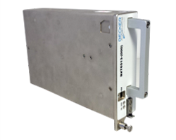
Becker Avionics Diversity Mode S Transponder with ADS-B certified.
Avionics technology provider Becker Avionics has received certification for the company’s BXT6500 family Mode S transponder, designed for the rigorous flying environment characteristic of helicopter operations.
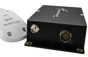
Paired with a FreeFlight Systems’ 1203C SBAS/GNSS sensor, the remote-mounted solutions provide helicopter operators a complete and cost-effective way to equip with ADS-B Out for the upcoming Jan. 1, 2020, mandate.
The Becker BXT6500 family Mode S transponder is diversity-capable and available for installation on non-TCAS equipped aircraft. A non-diversity option is also available.
The FreeFlight SBAS/GNSS (WAAS/GPS) 1203C sensor.
In addition to providing clients with ADS-B compliance, the system features enhanced privacy settings that can disable both ADS-B and Mode S transmissions — a feature unique to the BXT6500 family.
“We are pleased to announce this new milestone in our transponder product line,” said Forrest Colliver, managing director. “This new system showcases how we tailor our compact, robust and durable avionics to our clients’ requirements in order to provide the best solution for where and how they fly.”
The system is a part of the company’s robust BXT6500 line of ADS-B Mode S transponders. Manufactured with a standard ARINC 429/743 output, this transponder easily integrates with the FreeFlight Systems Model 1203C SBAS/GNSS sensor for complete ADS-B Out compliance, and can be installed either as dual installation for primary transponder interrogations or as single install for a dedicated ADS-B transmission.
For more information, visit with Becker Avionics at booth C4935 and FreeFlight Systems at booth C1137 during HAI’s Heli-Expo happening this week in Las Vegas, Nevada.
Assisting safer autonomous driving, STMicroelectronics has introduced a multi-frequency GNSS receiver chipset suitable for safety-critical automotive applications and high-accuracy positioning at the decimeter and centimeter-level for precise point positioning (PPP) and real-time kinematic (RTK) applications.
Traditional in-car navigation systems help drivers reach their destinations using receivers and commercial satellite services that allow positioning accurate to within a few meters.
With increasing use of autonomous systems such as lane-departure warning (LDW), adaptive cruise control (ACC), valet parking and auto-pilot, greater accuracy is needed to ensure safety and reliability, in combination with proximity sensors such as cameras, radar, lidar and others, to monitor the driving environment automatically. Fully self-driving vehicles of the future will also demand high-accuracy positioning.
By tracking satellites of all GNSS constellations simultaneously on at least two of the frequencies used by each system, ST’s automotive-quality Teseo APP (automotive precise positioning) receiver provides high-quality raw GNSS data for PPP and RTK algorithms, which allows accurate positioning and rapid convergence time worldwide.
In addition to its high accuracy, the receiver monitors the integrity of the satellite data to alert the system if accuracy is degraded for any reason. This permits Tier-1 manufacturers to certify safety-critical systems in accordance with the automotive industry functional-safety standard, ISO 26262, up to the highest Automotive Safety Integrity Level (ASIL).
Teseo APP also integrates a secure microcontroller for secure system boot and data-output authentication to keep sensitive data safe from attack.
Launched alongside Teseo APP, ST’s Teseo V chip provides equivalent multi-frequency precise positioning in a simplified device for non-safety-critical applications where integrity assurance is not required.
“High-accuracy satellite positioning makes autonomous driving safer, smoother, and more reliable,” said Antonio Radaelli, director, Infotainment Business Unit, STMicroelectronics. “Our newest Teseo APP GNSS chip combines extreme accuracy and precision with industry-unique integrity assurance for use in safety-critical applications.”
Teseo APP eliminates errors by tracking all available GNSS signals in multiple frequency bands, such as the GPS and GLONASS, Galielo, BeiDou, QZSS, and IRNSS L1, L2, and L5 frequency bands, and the Galileo E6 signal that contains PPP correction data to allow worldwide decimeter-level accuracy.
Other techniques for enhancing accuracy have included differential systems reliant on a combination of ground base-station signals as well as satellite signals, or techniques such as RTK, which generally require a denser reference station network.
The new Teseo chips make high-accuracy affordable for autonomous driving through a combination of tracking up to three constellations simultaneously over two frequency domains. These multi-frequency combinations bring reliable GNSS ionospheric and multipath modeling in most environments, allowing accurate positioning with faster convergence time for automotive applications, where timing is critical.
ST is now supplying product samples to lead customers who are developing autonomous-driving systems expected to appear first in high-end vehicles launched in 2020/2021.
Visitors to Mobile World Congress 2018 in Barcelona, Feb. 26 to March 1, can see Teseo APP at the ST booth, Hall 7, Stand 7A61.
Fugro has won a long-term contract to provide GNSS-based rig positioning services to Statoil Petroleum AS.
The contract includes positioning of all the Statoil operated rigs on the Norwegian continental shelf and associated Statoil vessels.
Fugro’s specialized satellite positioning systems, utilizing all available navigation satellites (GPS, GLONASS, Beidou and Galileo), will be permanently installed on the Statoil-operated rigs and vessels.
The robustness and accuracy (better than 3 centimeters) of these satellite systems, in conjunction with Fugro’s latest navigation software and technology developments, will ensure the best possible service for Statoil, Fugro said.
Developments in technology will bring two significant benefits to Statoil: by remotely configuring the offshore systems from Fugro’s onshore bases, mobilization time will be reduced and fast-track operations will be enabled.
Fugro will providing GNSS positioning services to Statoil Petroleum’s oil rigs and vessels. (Photo: Fugro)
Berit Sagatun, commercial manager for Fugro, cited the company’s track record in the delivery of innovative rig positioning systems.
“For decades Fugro has been at the forefront of the rig positioning market in Norway,” Sagatun said. “Our knowledgeable and responsive project management team, combined with our highly skilled and experienced offshore personnel, ensures safe and efficient operations for Statoil.”
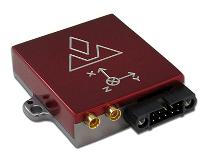
Red Bull Air Race has selected the VectorNav VN-300 dual-antenna GNSS-aided inertial navigation system (INS) as its primary source of aircraft telemetry data for Master Class raceplanes participating in the Red Bull Air Race World Championship.
Weighing less than 30 grams, the VectorNav VN-300 is a tiny dual-antenna GNSS-aided INS. It is used in applications ranging from autonomous vehicles to antenna pointing for satellite communication and aerial surveillance applications.
The inaugural event of the 2018 season in Abu Dhabi saw the VN-300, manufactured by VectorNav Technologies, used for the first time in all 14 aircraft to provide real-time telemetry data used for judging, in-race simulation and virtual reality applications.
Created in 2003, the world championship has held more than 80 races around the globe. The motorsport competition combines speed, precision and skill.
U.S. pilot Michael Goulian performs during the finals at the first round of the Red Bull Air Race World Championship in Abu Dhabi on Feb. 3.(Photo: Andreas Langreiter, Red Bull Content Pool)
Using the fastest, most agile, lightweight racing planes, pilots hit speeds of 370 km/h while enduring forces of up to 10 G as they navigate a low-level slalom track marked by 25-meter-high, air-filled pylons. Pilots incur time penalties for hitting pylons, incorrectly passing through air gates or only exceeding 10 G for more than 0.6 seconds, among others.
Being an individual sport, spectators need a reference to see the difference between the pilots’ lines and speed through the racetrack. Red Bull Air Race Live TV uses an augmented reality (AR) solution known as the Ghost Plane to display the trajectory of the pilots’ runs for real-time comparison in the head-to-head rounds and the Final 4 that decides the winner of the race by time.
The Ghost Plane is driven by the position, velocity and attitude data gathered during flight from the onboard INS.
Critical to the success of the Ghost Plane is the accuracy of the telemetry data, which, given the high dynamics experienced during flight, is extremely difficult to obtain.
For example, as a plane races through a chicane and into a vertical turn maneuver, GPS signals are lost and the INS needs to rely solely on the inertial sensors to accurately estimate the position and velocity until GPS is fixed again in level flight.
The VectorNav VN-300. (Photo: VectorNav)
“We evaluated several different inertial navigation systems and struggled to find one that was able to perform in our dynamics,” said Alvaro Navas, sport technical manager for the Red Bull Air Race. “VectorNav’s VN-300 was the only product able to deliver the attitude, position and velocity data accuracy we require, and it did this out of the box, no customization was required. The sensor is really amazing.”
“We are really excited to be working with Red Bull Air Race,” said Gordon Hain, VectorNav product manager. “Not only are we able to provide accurate data for the race judges and spectators, but we are also able to provide valuable information to pilots and tacticians. With the VectorNav data in hand, they are able to compare actual flight trajectories with their simulations to find areas for improvement. We are looking forward to continued work with Red Bull Air Race in the 2018 season and beyond.”
u‑blox has rolled out the u-blox F9 technology platform, which was designed to deliver high-precision positioning solutions for mass market industrial and automotive applications.
The platform combines multi-band GNSS technology with dead-reckoning, high-precision algorithms, and compatibility with a variety of GNSS correction data services, to achieve precision down to the centimeter level.
u‑blox F9 paves the way for the next generation of high precision navigation, augmented reality, and unmanned vehicles, the company said.
The u-blox F9 platform will underpin the next wave of u‑blox positioning modules targeting mass market industrial and automotive applications. It uses GNSS signals in multiple frequency bands (L1/L2/L5) to correct positioning errors caused by the ionosphere and deliver fast time to first fix (Fast TTFF).
Its ability to receive signals from all GNSS constellations (GPS, GLONASS, Galileo, Beidou) further improves performance by increasing the number of satellites visible at any given time. Stand-alone u‑blox F9 solutions robustly achieve meter-level accuracy.
To achieve centimeter-level accuracy, u‑blox F9 offers optional on-chip real-time knematic (RTK) technology. In addition to offering an open interface to legacy GNSS correction service providers, it supports the main GNSS correction services, bringing RTK high-precision positioning to the mass market.
“High precision is the next frontier in positioning for mass markets, with countless applications in need of a robust and scalable high precision positioning solution. u‑blox F9 provides the hardware and integrated software components to address these needs,” said Daniel Ammann, executive director of positioning product development at u-blox.
Optimized for low power consumption, the u‑blox F9 platform sets a high standard for security with built-in jamming and spoofing detection systems that protect against intentional and unintentional interference. Dead-reckoning technology based on inertial sensors extends high-precision performance to otherwise challenging urban environments.
Automotive applications of the technology include lane-level navigation for head-up displays and vehicular infotainment systems as well as for vehicle-to-everything (V2X) communication, a prerequisite for highly automated and fully autonomous vehicles.
In the industrial realm, u‑blox F9 will enable mass adoption of commercial unmanned vehicle applications including drones and ground vehicles such as heavy trucks or robotic lawnmowers.
The u‑blox F9 platform’s technology will be showcased at Embedded World in Nuremberg, Germany from Feb. 27-March 1 at Booth #3-139. Product samples will be available later in the year.
Helix Technologies Ltd. has been awarded a significant contract by the European Space Agency (ESA) to develop its next-generation GNSS antenna — a multi-frequency antenna optimized for the advanced Galileo E1 Alt-BOC and wide-band E5 Alt-BOC waveforms for use in driverless cars.
The antenna, to be developed under the ESA’s Navigation Innovation and Support Programme (NAVISP), will provide enhanced performance due to its dielectric, multi-filar construction. It will also be optimized to take maximum advantage of the Galileo E5 Alt-BOC waveform, which enables significantly improved measurement accuracy, precision and multipath suppression over conventional GNSS signals.
Learn more about the Helix Technologies antenna in our February issue article here.
“In order to achieve the 10-centimeter accuracy that is required for autonomous vehicle lane-level positioning within challenging urban multi-path propagation conditions, there is a need both for a significant improvement in current GNSS antenna performance and to fully exploit the advanced Alt-BOC waveforms transmitted by Galileo,” said John Yates, managing director of Helix Technologies.
The GNSS antenna, which will also be capable of optimized operation with the GPS L1 and L5 M BOC signals, is aimed at the automotive and consumer markets, and the company is targeting the third quarter of this year for the manufacture of prototypes.
Independent testing and evaluation of the vehicle-mounted antenna performance will be conducted in the challenging multipath environments of the high-rise financial districts of the cities of London and Shanghai.
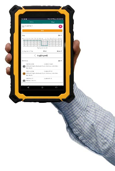
FleetUp Trace is a ruggedized tablet designed for fleet drivers required to display Records of Duty Status (RODS) upon request instead of printing out hard copies with the new Electronic Logging Device (ELD) mandate. Tim provides thoughts on the product hardware, ease-of-use and various app features.
Photo: FleetUp-Trace
By Tim Spence
Sometimes, there is great anticipation when buying a new electronic gadget. The look, the feel and the flashy presentation is what many products on the market rely on to make their product the best. With ELDs though, drivers and fleets managers are thinking about these products a bit differently. Thoughts like:
Will this satisfy our need for compliance?
How much training will this take?
How many drivers am I going to lose?
Is this even going to work?
When powering up the FleetUp Trace tablet for the first time and opening the Hours of Service (HOS) app, it was evident that a lot of thought went into fulfilling these needs. Here is a first look at FleetUp Trace, a ruggedized tablet designed for fleet drivers required to display Records of Duty Status (RODS), as part of the FMCSA ELD mandate.
Unboxing
When removing the FleetUp Trace case from the box, you will notice that it is quite unique and will not easily be lost among other items because of that. The case was durable and tough but soft as well. When unzipped it revealed the Android tablet, a couple of short manuals and various accessories for charging and memory.
The Tablet
Safety orange is the key color with this tablet and since it is a popular color in our industry, it definitely catches the eye. In addition, the protective case fits the tablet so well, it looks to be a part of the product (if you have ever purchased a tablet and tried to find a durable hard case that fits well, you know).
Booting the tablet, a brilliant orange screen for FleetUp appears and then four preloaded apps on the home screen: FleetUp’s HOS app, FleetUp’s CamVue app, Camscanner (a very reliable document scanner) and a preset version of Teamviewer QuickSupport, which provides an ID and easy instructions to show the FleetUp screen to another device.
HOS app tutorial
Starting the app and logging in, the Voice Over HOS greets you by name, gives you the current date, tells your current duty status, how many hours you have left in the 70-hour cycle, and how many on-duty hours you have before you are required to take a break. It then tells you to select a vehicle. After selecting a vehicle and confirming, you are told to tap the HOS button.
The app automatically uses a tutorial showing each feature. One button at a time, the app guides you to the next feature prompted by your action of pressing the “GOT IT” button. This tutorial is available on each section of the device and can be turned off on the main menu that slides over from the left. That is a great feature not only because you wouldn’t want to go through the tutorial EVERY SINGLE TIME but just in case you forget how to use a certain section, like driver vehicle inspection report (DVIR), you can manually slide open the main menu and turn it back on to REINFORCE YOUR LEARNING. After going through the tutorial for each section, you will find a lot of reasons (mainly regulatory) why this is valuable.
Using the HOS app
After going through the tutorial once, even if you have years of experience on paper logs, you will find that many of the basics of logging are easy to find or figure out. It is very comfortable operating without the Voice Over HOS or Tutorial features. On the “Status” tab, you can see your current status and log graph, as well as change your status and check your available hours. On the “LOGS” tab, you can fill out a pre-trip or post-trip inspection and edit your time (except for driving time, of course). This section also allows you to enter shipping document information, edit any equipment information and certify your logs by signing with your finger (no special pen needed).
Features that make the difference
Tutorial mode. While this feature may sound simplistic, it has the capability to answer a driver’s question with the flip of a switch. Just the fact that you can turn it on whenever you need to be reminded is so valuable. It is beneficial to know that this feature does work best in the portrait or vertical mode.
Voice over HOS. This feature reminds you of the actions that many drivers forget. If you have ever used ELDs in the past as a driver or fleet manager, you understand. Along with the text prompts, it reminds the driver to do things such as certifying the log at the end of the day, sign the DVIR, release the vehicle, etc. All the voice and text prompts work hard to keep the driver in compliance. Even when you want to LOG OUT, the app asks you if you still need to complete unfinished actions.
Easy-to-read availability. Many electronic logging devices make it very challenging to understand what hours are left for a driver. With FleetUp, there is no confusion at all because it is stated in text and graph.
Big buttons to change status. No more calibrating screens or needing a stylus just to change your status. Just touch a big button with your finger, enter the note under the GPS-enabled address entry, and tap “Yes.” It is that easy.
On top of everything else, FleetUp Trace and the HOS app are extremely user-friendly. This should be the key to it all because if the device and app are not user-friendly and easy to operate, there is no reason for it to exist.
FleetUp has accomplished a great feat by making the transition to E-Logs painless and smooth while complying with a multitude of regulations. Whether you’re looking for a simple way to track internal records of duty status (RODS) or to ensure HOS compliance and DVIR with a simple, hands-free gadget, FleetUp is one provider that clearly committed a lot of thought into what drivers are going to go through on the road, and offers plenty of features for an all-encompassing solution to the ELD mandate.
Tim Spence, creator of Apps4truckers, is an app consultant, writer and safety manager in Birmingham, Alabama.
By Oliver Leisten Technical Director, Helix Technologies Ltd.
To attain the 10-centimeter accuracy required for autonomous vehicle positioning within urban multipath propagation conditions, there is a need for a significant upgrade in GNSS antenna performance. The autonomous vehicle application demands excellent antenna performance together with exploitation of the full set of GNSS multi-frequency and multi-constellation system advances to deliver this performance paradigm in the most severe of real-world use scenarios.
Given that an antenna necessarily operates in open fields, it follows that field resonance must be managed to provide predicable performance in diverse use-scenarios. A new antenna developed by Helix Technologies (Figure 1) deploys balanced fields across a cylindrical ceramic dielectric core to constrain the outreach of resonance fields and thereby minimize the interaction with nearby objects. The antenna feed is designed to provide enforcement of balanced operation, which ensures that the antenna resonates predictably and independently of the platform (i.e., the vehicle in the case of autonomous driving). Thus, the operation is not significantly influenced by the mechanical or material properties of the platform or housing. This architecture provides isolation from common-mode signals and protects the GNSS signals from conducted interference.
Figure 1. Features of the hexafilar-turnstile solution for multi-frequency GNSS.
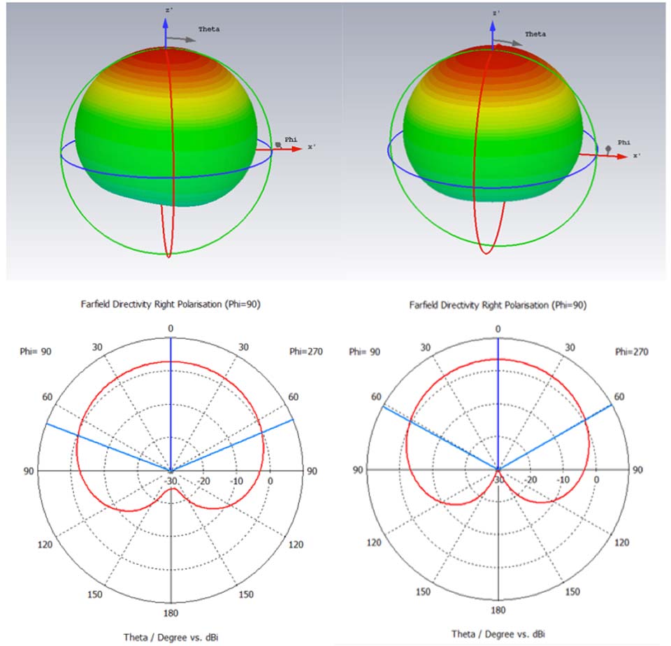
It is challenging to configure a GNSS antenna operating at many frequencies in which the performance at any one frequency is not impaired by mode interactions. Such impairments can have serious consequences for the position accuracy in an urban environment because they adversely affect the cross-polar discrimination: a parameter which is most important for eliminating multipath positioning errors. The architecture of the hexafilar-turnstile antenna has overcome this problem and delivers the circular polarization pattern characteristics illustrated (simulated data) in Figure 2.
Figure 2. Simulated RH circular polarized patterns at GPS L1 (left) and GPS L2 (right).
The figure demonstrates that the antenna is forming cardioid patterns at two frequencies. The 3D graphic is intended to show the omni-directionality and the 2D elevation cuts exhibit the signature cardioid shape which characterize a “spinning-dipole” circular polarization antenna.
It is often suggested that patterns of wide beam-width such as these would not be particularly suitable for positioning in urban canyons where the sky can only be seen in a relatively small solid angle. In fact, the ratio of front-to-back gain is strongly associated with the cross-polar discrimination that is important for position accuracy in urban environments. Patterns of this quality can deliver as much as 30-dB of signal-to-interference advantage in favor of the direct-path satellite signals against signals whose polarization has reversed due to multipath reflection.
Helix Technologies is developing antennas which have two-pole frequency responses that provide two frequencies of optimum cross-polar discrimination that are aligned to the two frequencies of maximum spectral density of an M-BOC or Alt-BOC coded signal, as transmitted by the modern GPS and Galileo satellites respectively. These antennas should be available for test and evaluation in Q2 of 2018.
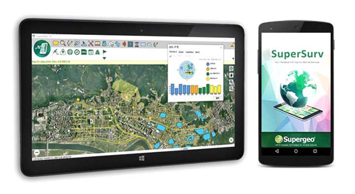
SuperSurv’s NTRIP solution is being enhanced to adopt more RTCM versions and provide a better GNSS positioning service. NTRIP (Networked Transport of RTCM via internet protocol) is a protocol to send GNSS-related data through the internet, which enables users of differential GPS or network real-time kinematic (RTK) to get correction parameters after connecting to the internet. The correction parameters can be used to calculate a more accurate GNSS location. Supergeo’s product team is developing the support for RTCM 3.1, including Types 1021 and 1023.
The scalable A222 GNSS smart antenna is designed for both agriculture and basic indicate systems markets, as well as other markets requiring flexible positioning. The smart antenna has the flexibility to scale and grow as business expands and can be configured from L1-only to multi-GNSS, multi-frequency and real-time kinematic (RTK). It adds a system component so that tractor and farm equipment manufacturers can deliver their own guidance and control solutions to their customers. Designed to excel in challenging environments, the A222 uses Hemisphere’s Athena RTK engine and is Atlas L-band capable. It is easy to mount and customizable. Its dual-serial, CAN and pulse output options are compatible with almost any industry-standard interface. Because the A222 is Atlas-capable, it has the ability to use the new Atlas AutoSeed technology. Atlas AutoSeed allows users to suspend Atlas use for any period, and upon returning to their last location, AutoSeed rapidly re-converges to a high-accuracy converged position. A222 comes pre-configured with Atlas Basic activated.
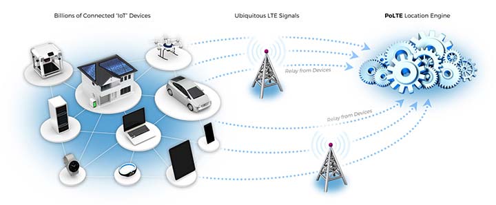
Locates mobile devices moving indoors and outdoors
Leveraging ubiquitous LTE signals, the Lite-Touch Architecture calculates positioning in the cloud to efficiently locate devices between indoor and outdoor environments. By offloading computation-heavy location calculations from the device to the cloud, the PoLTE positioning solution makes location positioning available to a wider variety of devices, including those constrained by battery life, memory, processing power, size and cost. This includes IoT-based applications that historically relied on GPS, with its high rate of power consumption, as well as Wi-Fi and Bluetooth with their added size, cost and network complexity.
Enhancements to the SyncServer S600 series of time servers and instruments improve time synchronization over enterprise Ethernet networks and supply timing signals for improved military radar operations and satellite uplink communications. The SyncServer S600 series also meets the timing and synchronization needs of the rapidly evolving networks of enterprise and financial customers, particularly for compliance purposes such as the European MiFID II directive, which specifies highly stringent time accuracy requirements for stock trading systems. The latest release includes support for the IEEE 1588 multiport, multi-profile Precision Time Protocol (PTP), which allows the S600 to operate as an independent grandmaster clock on each Ethernet port — delivering cost savings and network deployment flexibility to customers. This is coupled with a new 10-GbE interface to easily interoperate with a wider variety of network and stock trading topologies.
The HG4930 inertial measurement unit (IMU) is tailored for “straight-out-of-the-factory” integration and use in various non-defense and non-aerospace industrial applications including surveying and mapping, autonomous vehicles and gimbal stabilization. The HG4930 IMU is not classified under an International Traffic in Arms Regulation category; it is free from the burden of an export license for all but a few military-related use cases. The micro-electro-mechanical system (MEMS)-based IMU has been tailored to provide significantly improved gyroscope and accelerometer performance for the environments and use cases experienced by non-aerospace and non-defense users.
The HX-DU2017D is a frequency-hopping OEM modem designed to provide strong anti-jamming and signal receiving capability for complex data-intensive applications. HX-DU2017D is a miniature, dual-frequency, software-selectable 840-MHz and 900-MHz data link modem. It provides power switching of 0.5 W, 1 W and 2 W; 20 ms/30 ms/40 ms/50 ms/ frequency-hopping intervals; and supports point-to-point, point-to-multipoint network. Its full duplex mode ensures secure data transferring and stable long-range communication. The HX-DU2017D also provides short latency of data transmission and communication recovery in millisecond level. It allows fast and secure simultaneous data communication for mission-critical applications, especially in the fields of precision agriculture and UAVs, including unmanned plant surveys, UAV plant protection and automatic mowers. It could be placed on a UAV with its extremely small footprint for tight OEM integration and design flexibility. Meanwhile, its frequency-hopping transmission ensures UAV data security and flight stability.
For small construction, thermal inspections and public safety
The Parrot Bebop-Pro Thermal is a compact quadcopter with two embedded cameras: a stabilized 14-megapixel high-definition front-facing video camera and a FLIR ONE Pro thermal camera. The thermal-imaging camera is positioned in a dedicated module at the back of the drone. Three thermal-imaging setting modes are available: Standard, Dynamic and Hotspot. The Parrot FreeFlight Thermal app innovatively transmits and analyzes images captured by the quadcopter’s cameras. Included is a long-range Parrot Skycontroller 2 remote control.
Pergam gas sensor integrated with carbon-fiber UAV
Pergam gas sensor aboard the Microdrones md4-1000 UAV.
The aerial methane detector mdTector1000 CH4 detects methane gas via a fully integrated aerial package. It has a Pergam gas sensor, mounted and integrated with the Microdrones md4-1000 UAV. In real time users can see aerial shots of detection with the laser sensor. The carbon-fiber-built UAV goes into dangerous areas unsuitable for workers. The mdTector1000 CH4 can be used for natural gas line surveys, tank inspections, gas well testing, plant safety and landfill emission monitoring. The mdCockpit Android app allows users to maintain visualization in flight. A special mdTector app allows users to visualize and present all post-flight data on one map.
Microdrones, www.microdrones.com
UAV tracking antenna
Portable antenna for unmanned or manned aircraft
The Octopus UAV portable tracking antenna enables long-range data transmission and is suitable for unmanned and manned aircraft applications. It has a range of more than 100 kilometers and an integrated pointing algorithm. The GPS location of the aircraft is sent over the Airlink IP datalink and received directly by the tracking antenna, making it operational with any existing unmanned aircraft autopilot system. For a manned aircraft, an existing GPS receiver or dedicated GPS receiver can be used.
Brings high-precision positioning and attitude to small UAVs
AsteRx-m2 UAS receiver.
The AsteRx-m2a UAS GNSS OEM engines provides precise and reliable multi-frequency, all-in-view real-time kinematic (RTK) positioning and heading — along with interference technology — with low power consumption. It features Septentrio’s AIM+ interference mitigation and monitoring system, which can suppress a wide variety of interferers. It is designed to bring high-precision positioning and attitude to any space-constrained application, offering a high update rate and low latency output. The AsteRx-m2a UAS provides plug-and-play compatibility for autopilot systems such as ArduPilot and Pixhawk. Event markers accurately synchronize camera shutter events with GNSS time. The board can be powered directly from the vehicle power bus via its wide-range input. It works seamlessly with GeoTagZ software, providing offline re-processed RTK accuracy without the need for either ground control points or a real-time datalink.
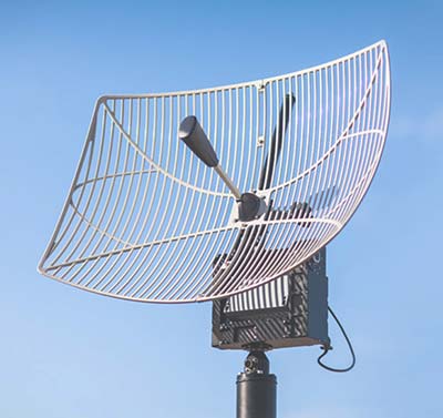
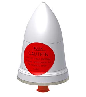
The GPS-TMG-HR timing antennas are designed for Positive Train Control and railroad management, among other markets. They are equipped with high-rejection narrowband filtering to mitigate interference and provide 65-dB rejection of frequencies adjacent to L1 GPS. The GPS-TMG-HR maintains all features of PCTEL’s GPS timing reference platform. The antennas feature a 26-dB amplifier (GPS-TMG-HR-26N) and 40-dB amplifier (GPS-TMG-HR-40N ) and narrowband high rejection filtering to support long-lasting, trouble-free deployments in congested cell-site applications with severe interference around the GPS L1 frequency. The proprietary quadrifilar helix design, coupled with multi-stage filtering, provides superior out-of-band rejection and lower elevation pattern performance than traditional patch antennas.
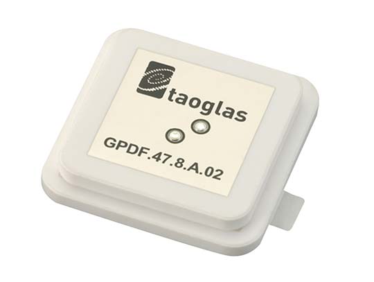
The GPDF.47.8.A.02 is a ceramic GPS L1/L2 / Galileo low-profile, low-axial ratio, embedded stacked passive patch antenna. It is 47.5 x 47.5 millimeters wide and 8 millimeters thick. It is designed for the highest accuracy centimeter-level tracking in telematics applications for positioning technologies. Typical applicable industries are transportation, defense, marine, agriculture and navigation.
The Autonomy Development Platform provides automakers, truck makers and Tier 1 vehicle suppliers the hardware, software, engineering and integration services they need to accelerate development programs for on-road and off-road autonomous vehicles. By combining customized integration and engineering services with GNSS-inertial positioning technologies, the Autonomy Development Platform advances driverless vehicle development projects at every stage of development and commercialization. The platform delivers a navigation solution that is fully customizable and includes integration and engineering services, field-tested hardware and proprietary software for highly accurate positioning. The solution is capable of working with all sensors, including multiple cameras, lidar, radar and ultrasonic sensors, and with all vehicle types at all stages in the development and commercialization cycle. Also, the technology enables highly accurate assessments of the full 360-degree environment around a vehicle to produce a robust representation, including static and dynamic objects, which is critical for successful vehicle autonomy.
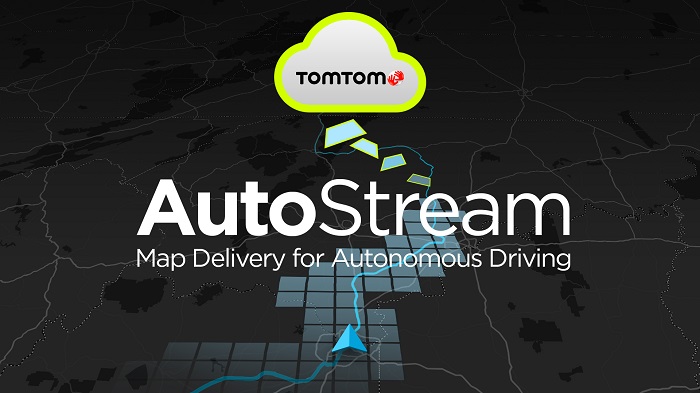
TomTom AutoStream is a map delivery service for autonomous driving and advanced driver assistance systems. The service enables vehicles to build a horizon for the road ahead by streaming the latest map data from the TomTom cloud. TomTom AutoStream ensures that the TomTom map data used to power advanced driving functions is the latest, most accurate available, enabling a safer and more comfortable experience. The map-data stream can be customized based on criteria such as sensor configuration and horizon length. It can stream a wide variety of map data including advanced driver assistance systems (ADAS), attributes such as gradient and curvature, and the TomTom HD Map with RoadDNA. This flexibility allows customers to use AutoStream to power a wide range of driving automation functions.
A new company, hoopo, has launched to supply an innovative, accurate geolocation solution for low-power wide area (LPWA) networks. The solution would improve precision for low-power Internet of Things (IoT) asset tracking.
Hoopo’s geolocation enables companies to locate their valuable assets without the significant cost or battery consumption that can be associated with GPS. hoopo’s IoT solutions help companies precisely track specific assets in areas such as shipping ports, airports, car dealer lots, cattle ranches and other asset-dense areas.
Hoopo has received $1.5 million in funding to further grow its business from a group of investors, including the initial investors in Mobileye; Israeli investor Zohar Gilon; and Ben Marcus, CEO of AirMap.
The need to understand and quantify asset location is quickly becoming a requirement for the enterprise and industrial IoT. However, the accuracy of today’s low-power geolocation isn’t precise enough to deliver on the full promise of the IoT.
LPWA networks are becoming the driving force behind smart city and other IoT applications because of their low-cost, low-power consumption, and high-coverage capabilities in rural and urban environments. The long battery life of LPWA devices allows businesses to deploy a maintenance-free device in the field for several years.
“Hoopo is addressing a real business need of companies around the world: cost-effective, yet precise, tracking of their valuable assets with longevity of battery life up to 10 years in the field,” said Ittay Hayut, CEO of hoopo. “LPWA checks off all of the boxes companies need in terms of cost and coverage, and hoopo’s solutions work alongside these LPWA networks to help businesses keep their assets safe, anytime and anywhere.”
Hoopo’s solutions are based on a patent-pending triangulation method that uses LPWA data transmissions to generate a precise location. The solutions suite includes low-cost LPWA gateways and devices, as well as a platform for management and real-time notifications. Companies can receive on-demand geolocation, establish geofences, receive movement alerts, and more, ensuring the protection of their valuable assets.
“Hoopo’s geolocation technology reveals new business verticals that were limited or impossible when using existing technologies because of their high-cost and significant power consumption,” said Menashe Terem, CEO at Tri-logical, a provider of tracking and management solutions.
“Early applications such as asset tracking are just the beginning of what advances in geolocation will enable,” said Eli Fogel, former CTO at Intel and hoopo investor. “Just as the advent of GPS launched a wealth of applications that no one ever thought of before, such as location-based advertising, there are future applications that this next generation of geolocation technology will enable. We’re excited to see what new applications emerge as customers embrace these new precision location capabilities.”
Hoopo is displaying at Mobile World Congress in Barcelona Feb. 26-March 1 in Hall 5, Stand 5D81.