Category: Transportation

  • BlackBerry and Baidu partner on connected car technology

    BlackBerry Limited and Baidu Inc. are collaborating to accelerate the deployment of connected and autonomous vehicle technology for automotive OEMs and suppliers worldwide.

    The companies have signed a statement of intent to make BlackBerry QNX‘s ISO26262 ASIL-D certified safety operating system (OS) the foundation for Baidu’s Apollo autonomous driving open platform.

    Also, BlackBerry and Baidu will work together to integrate Baidu’s CarLife, the leading smartphone integration software for connected cars in China, as well as its conversational artificial intelligence system DuerOS, and high-definition maps to run on the BlackBerry QNX Car (Infotainment) Platform.

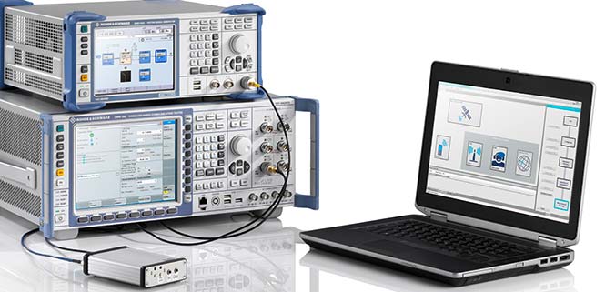
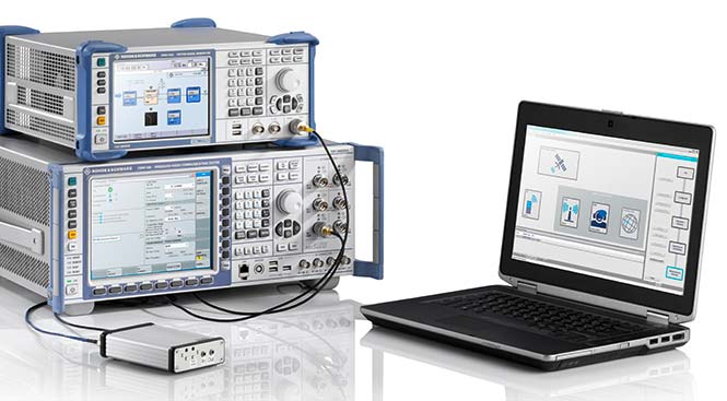
    Blackberry QNX will host demonstrations of its foundational software for autonomous and connected vehicles at the Consumer Electronics Show (CES) 2018, at North Hall Booth 7523. The show takes place Jan. 9-12 in Las Vegas.

    “BlackBerry QNX has established itself as the OS platform for safety-certified production-based systems,” said Li Zhenyu, general manager of Intelligent Driving Group, Baidu. “We aim to provide automakers with a clear and fast path to fully autonomous vehicle production, with safety and security as top priorities. By integrating the BlackBerry QNX OS with the Apollo platform, we will enable carmakers to leap from prototype to production systems. Together, we will work toward a technological and commercial ecosystem for autonomous driving, intelligent connectivity and intelligent traffic systems.”

    “Joining forces with Baidu will enable us to explore integration opportunities for multiple vehicle subsystems including ADAS, infotainment, gateways and cloud services,” said John Wall, senior vice president and GM of BlackBerry QNX. “Baidu has made tremendous strides in artificial intelligence and deep learning. These advancements paired with their high-definition maps and BlackBerry’s safety-critical embedded software and expertise in security will be crucial ingredients for autonomous vehicles.”

    Announced by Baidu in April 2017, Apollo is an open platform that provides a comprehensive, secure, and reliable solution that consists of cloud services, an open software stack and reference hardware and vehicle platforms. It supports all major features and functions of an autonomous vehicle.

    More than 70 global partners are involved with Apollo, including OEMs, Tier 1 suppliers, developer platforms and technology start-ups. The project was named after the historic lunar landing program to illustrate its scale and complexity. BlackBerry provides OEMs with cybersecurity technology to protect and mitigate, including hardware, software, applications and end-to-end systems from cyberattacks.

    BlackBerry’s pedigree in security and continued innovation has led to recent automotive design wins with Delphi, Denso, Qualcomm, Visteon and others.

  • Rohde & Schwarz offers certified eCall test solution

    Rohde & Schwarz offers certified eCall test solution

    From April 1 onward, car manufacturers are required to equip new vehicles for sale in the European Union with an eCall module. In the event of a serious accident, this emergency call system automatically sends data to the uniform European emergency phone number 112 to facilitate faster response by emergency services.

    The independent test house CETECOM has now certified the eCall test solution from Rohde & Schwarz, which can be used to simulate a public-safety answering point, in accordance with the EN standard. This puts manufacturers and suppliers in a very good position for acceptance tests of their installed emergency call systems, and the Russian emergency call counterpart ERA-Glonass can also be tested with an extension.

    The Rohde & Schwarz eCall test solution is the first of its kind to be certified by an independent test body, according to the company. CETECOM has examined the implementation of the eCall test public safety answering point (PSAP) in the Rohde & Schwarz solution for the pan-European emergency call system and certified it as compliant with the CEN EN 16454:2015 standard. This is a prerequisite for tests compliant with Commission Delegated Regulation (EU) 2017/79.

    CETECOM has been officially designated as a technical service for eCall by the German Federal Motor Transport Authority. After March 31, manufacturers must equip new vehicles for sale in the EU with an eCall module. The R&S CMW-KA094 test solution is the first independently certified test PSAP system based on a wireless communications test platform.

    Rohde & Schwarz thus offers a compact solution for reproducible end-to-end functional tests and standard-compliant conformance tests of eCall and ERA-Glonass modules. The prescribed conformance tests can be performed with the test solution.

    Manufacturers and suppliers use these tests to check whether the installed modem properly initiates an emergency call in the event of a motor vehicle accident, correctly acquires the relevant data and sends it via the mobile network, and is able to establish a voice connection to the PSAP.

    Test houses and vehicle manufacturers use this solution for type approvals and for other tests requiring the emulation of mobile networks, such as location-independent testing of a car telephone.

    The certification of an eCall test solution by an independent body demonstrates that Rohde & Schwarz is a reliable partner for the automobile industry — the majority of global OEMs use the R&S CMW500 wideband radio communication tester and rely on the field-proven Rohde & Schwarz test solution.

    The company is also developing test features for the next-generation eCall over LTE system and making the corresponding solution fit for the future and for testing new vehicle telematics units.

    Along with eCall, Rohde & Schwarz supports the automobile industry with test solutions for V2X communications (from a vehicle to other users).

    The eCall test solution based on the R&S CMW500 platform in combination with the R&S SMBV100A GNSS simulator is the first to be certified by CETECOM. (Photo: Rohde & Schwarz)

    Technical basis. The R&S CMW-KA094 application software specifically developed for eCall is based on the R&S CMW500 platform in combination with the R&S SMBV100A GNSS simulator.

    The software simulates a PSAP and controls the R&S CMW500, which emulates a mobile network in the lab. It also controls the GNSS simulator, which provides the position data of the accident location.

    The R&S SMBV100A additionally supports the GNSS receiver performance tests in accordance with Commission Delegated Regulation (EU) 2017/79 Annex VI.

    The eCall test solution can be fully automated with the R&S CMWrun sequencer software for further conformance tests, enabling users to directly utilize ready-made test sequences for eCall and ERA-Glonass modules compliant with ETSI TS 103 412, CEN EN 16454 or GOST 33467. This additionally facilitates demonstration of the functional capability of the overall system in accordance with Commission Delegated Regulation (EU) 2017/79. For more information on how to test eCall and ERA-Glonass system modules, visit www.rohde-schwarz.com/ad/press/ecall-cetecom.

  • Expert Opinions: How will autonomous traffic safety issues affect the GNSS industry?

    Expert Opinions: How will autonomous traffic safety issues affect the GNSS industry?

    Q: How will safety issues raised by increasing autonomous traffic — in the air and on roads — affect the GNSS industry?


    Sanchit Agarwal, VP, Field Operations, Nearmap

    A: Due to increasing autonomous traffic, the GNSS industry will have to adopt the concepts of collective tracking mechanisms in the shared ecosystem. Inherently, all the cars/drones (rovers) will have the sensors to track the traffic “on-the-fly” and make intelligent navigation decisions, but in case of any system malfunction, the collective tracking of devices can facilitate “social” interactions between the rovers. This will serve as an added layer of security in case an autonomous social member goes rogue!


    Zak M. Kassas, Assistant Professor, University of California, Riverside

    A: Future autonomous vehicles will demand full situational awareness and extremely reliable, accurate and secure navigation systems. GNSS will not meet the stringent demands of these autonomous vehicles. To address the inevitable situations where GNSS signals become unusable (due to attenuation or interference) or untrustworthy (due to spoofing), receivers should be coupled with sensors such as IMUs, lidar and cameras, and exploit the plenitude of ambient signals of opportunity such as cellular, digital TV and Wi-Fi.


    Jonathan Auld, VP of Engineering and Safety Critical Systems, Novatel

    A: Safety issues raised by increasing autonomous automotive and airborne traffic will escalate the product development standards and performance requirements of GNSS software, hardware, and correction services used. The GNSS industry is challenged to increase accuracy on lower cost platforms by utilizing multi-frequency, multi-constellation, sensor fusion and precise point positioning. To be able to rely on GNSS in auto-guidance applications, the industry also needs to incorporate GNSS integrity functionalities into our products.

  • No positive train control on train that derailed over Interstate 5

    No positive train control on train that derailed over Interstate 5

    Photo: NTSB
    Photo: National Transportation Safety Board

    Multiple injuries and fatalities have been reported after an Amtrak train derailed Dec. 18 on the inaugural run of a new high-speed service linking Seattle and Portland.

    Train 501 was going south when it derailed while crossing a bridge over Interstate 5 (I-5) near DuPont, Washington, around 7:40 a.m. Pacific Time, causing at least one car to fall onto the freeway below. At least six are dead, none of them motorists on the freeway.

    Amtrak Cascades Train 501 was making a southbound run from Seattle to Portland. The Interstate northbound route is closed.

    The Amtrak/Cascade trains are pulled by new Charger locomotive. While equipped with positive train control systems that automatically stop trains when trouble is detected, the PTC system isn’t due to be activated until 2018.

    The last serious train accident in the United States took place May 12, 2015, when the Amtrak 188 connecting Washington to New York with 243 people on board derailed at the entrance of a curve while the train was launched at 100 miles per hour, more than twice the speed allowed. The accident killed eight people and injured more than 200.

    PTC makes it possible to monitor the location of the train and the speed at which it travels, by using GPS and sensors placed both in the trains and along the tracks.

    A computer system centralises the data and prevents any excess speed, any red light or collision with another convoy by acting on the locomotive instead of the driver, to curb if it goes too fast, or stop it completely if an obstacle has been detected on the tracks for example.

    The accident comes just a week after the mayor of Lakewood, a nearby town, warned that high speeds on this segment of track could causes accidents.

    According to John F. Banzhaf, the accident could have been avoided with an inexpensive GPS-based speed control system. Banzhaf is an MIT-trained professor who is also an inventor with two U.S. patents.

    Banzhaf argues that trains should be using a simple GPS-based system to prevent excessive speeds, and not waiting for the delayed and expensive PTC.

    “Rather than waiting for so-called positive train control [PTC] systems which may not be operational soon, there is a much simpler and much less expensive GPS-only speed control system for trains which could be put into operation much more quickly, and at only a fraction of the cost of PTC,” Banzhaf said.

    “It is also so simple that its basic principle is already in use in millions of automobiles and trucks now on the roads.

    The new routing of the trains, which began Monday, uses Sound Transit tracks that go through Lakewood and along I-5 in the area. In all, the new routing was meant to shave about 10 minutes on the travel time and make for more on-time trips, as the Amtrak trains would no longer have to share single-track tunnels with BNSF trains near Point Defiance and along southern Puget Sound.

    “One reason that PTC is so expensive, time-consuming to establish, and difficult to install is that it is designed to do far more than the simplest but most vital task of keeping trains from exceeding the speed limit — e.g., also dealing with switches left in the wrong position, hijackings, natural disasters, etc.

    “It is therefore a very complex system which requires not just GPS units in each locomotive, but also many thousands of signaling devices along sections of about 140,000 miles of track which transmit cab codes to antennas on railroad cars.

    “Unfortunately, for PTC to work properly, there must be close cooperation and coordination between the many different entities which own the different tracks to which the devices are attached, and the owners of over 500 different railroad companies which may run on these many different tracks.

    “All of the devices must also be able to communicate seamlessly with each other, and much of the delay in installing the system has been caused by the need to unify dozens of different systems, obtain permission to use the radio frequencies necessary for the devices to flawlessly exchange information, and related coordination problems…

    “Since automobile GPS units can show not only the car’s speed, but also the speed limit on that section of the road, they could also be mounted on each locomotive and prevent the posted speed from being exceeded — completely independent of the tracks on which they are traveling, and without the need for any other sensing devices, cooperation with other companies, communication between devices, etc.”

    Read Banzhaf’s full blog at ValueWalk.com.

  • Speaker details announced for Autonomous Safety-Critical Workshop

    Speaker details announced for Autonomous Safety-Critical Workshop

    A free Cognizant Autonomous Systems for Safety Critical Applications (CASSCA) Workshop will be held 8:30 a.m.-5:30 p.m. on Jan. 29 at the Hyatt Regency Reston in Reston, Virginia. This is scheduled to take place the day before and at the same location as the Institute of Navigation’s International Technical Meeting and Precise Time & Time Interval Systems and Applications (ION ITM/PTTI) 2018 conference.

    The workshop is complimentary but registration is required to attend.

    The workshop consists of a full day of presentations and discussions on the opportunities and challenges associated with developing fully autonomous systems that are cognizant and trustworthy for safety-critical applications by leading experts in the field. Speakers include:

    • David Corman, Program Manager, Cyber-Physical Systems Program; National Science Foundation (NSF). Dr. Corman’s current research interests are in the field of Cyber Physical Systems (CPS), security for CPS, unmanned systems, manufacturing, and technologies supporting Smart and Connected Communities.
    • Paul DeBitetto, Vice President, Software Engineering; Top Flight Technologies. Dr.  DeBitetto leads all Top Flight’s Software and Embedded Systems Development. That includes product-related flight control, simulation, computing, sensing, data communications, security-related controls and software solutions.
    • Finch Fulton, Deputy Assistant Secretary for Transportation Policy; Department of Transportation (DOT)
    • Joao Hespanha, Professor and Chair of Department of Electrical and Computer Engineering; University of California, Santa Barbara. His current research interests include hybrid and switched systems; multi-agent control systems; distributed control over communication networks (also known as networked control systems); the use of vision in feedback control; stochastic modeling in biology; and network security.
    • Robert Peterson, Professor and Director of Center for Insurance Law and Regulation; Santa Clara University.
      Mr. Peterson teaches torts, insurance law and regulation, evidence and products liability, and other courses. He is a past chair of the California State Bar Standing Committee on Insurance Law, and is director of the Law School’s Center for Insurance Law and Regulation.
    • Signe Redfield, Roboticist and Mission Manager; Naval Research Laboratory (NRL). Dr. Redfield’s primary interests include performance evaluation of autonomous systems, foundations of robotics, and cooperative behaviors for autonomous underwater vehicles.
    • Giorgio Rizzoni, Professor and Director of Center for Automotive Research (CAR); The Ohio State University. The CAR is an interdisciplinary university research center that conducts research on advanced automotive and transportation technologies and systems engineering, focusing on sustainable mobility, advanced propulsion systems, human safety and the environment.
    • Steven Rogers, Senior Scientist for Automatic Target Recognition and Sensor Fusion; Air Force Research Laboratory (AFRL). Dr. Rogers serves as the principal scientific authority and independent researcher in the field of multi-sensor automatic target recognition and sensor fusion.

    The workshop is organized by Zaher (Zak) M. Kassas, an assistant professor at the University of California, Riverside and director of the Autonomous Systems Perception, Intelligence & Navigation (ASPIN) Laboratory.  His research focuses on cyber-physical systems, autonomous vehicles, intelligent transportation systems, navigation systems, and software-defined radio. He has co-authored two cover stories in GPS World magazine, “LTE cellular steers UAV: Signals of opportunity work in challenged environments” and “Opportunity for Accuracy: Terrestrial SOPs attractive supplement to GNSS.”

    To register for the CASSCA Workshop, go to www.ion.org/cassca.

    Registration is also now open for the ION International Technical Meeting (ITM) and Precise Time and Time Interval Systems Applications Meeting (PTTI), which begin the next day (January 30-February 1) at the same location. See www.ion.org/itm for more information.

  • Rolls-Royce, ESA collaborate on autonomous shipping

    Rolls-Royce and the European Space Agency (ESA) have signed a cooperation agreement aimed at pursuing space activities in support of autonomous, remote-controlled shipping and promoting innovation in European digital logistics.

    The collaboration with Rolls-Royce aims to study the applications of various space assets to autonomous shipping, such as satellite-based positioning, better situational awareness using Earth observation data, and satcom services for improved onboard connectivity. It aims to develop and validate new solutions for communication between vessel systems and shore-based systems in addition to ship-to-ship communication.

    This will pave the way for the operation of commercial remote and autonomous shipping, innovative cargo logistics, smart ports and future commercial marine vessels.

    The partnership will enable satellites to serve navigation, ship intelligence, marine operations, cargo logistics, maritime safety, healthcare, passenger and crew communications.

    The next generation of 5G communications will rely on seamless integration of telecom networks and services, and ESA’s Satellite for 5G Initiative supports the technical and supply chain progress required, and will support development of 5G commercial services.

    The Memorandum of Intent (MOI) forms part of ESA’s wider strategy. In its new navigation research and technology programme, called the Navigation Innovation and Support Programme (NAVISP), ESA is studying and testing technologies for smart ships.

    NAVISP is investigating the integration of satellite navigation with non-space technologies and complementary positioning and communication techniques. NAVISP will apply ESA’s expertise from Galileo and EGNOS to new satellite navigation and, more widely, positioning, navigation and timing (PNT) challenges.

    ESA already serves the maritime community with many satellite capabilities. SAT-AIS (Satellite Automatic Identification System) permits identification and global tracking of ships using cutting-edge space and ground technology, using low Earth orbiting satellites to act as information relays to serve the whole globe. This results in more efficient use of existing infrastructures, a tangible reduction in cost and a decrease in the environmental impact.

    The ESA developed Sentinel-1 satellite, part of the European Union’s Copernicus programme, is establishing a pivotal role in the sector. Last August, Sentinel-1 Earth observation data helped the U.S. Coast Guard vessel Maple navigate through the legendary Northwest Passage, showcasing the enormous potential that satellite earth observation can have across the industry, particularly in ship-to-ship data transmission.

    Rolls-Royce and ESA also plan to cooperate in harnessing the power of big data. Data analytics, Machine Learning and Artificial Intelligence (AI) can improve operational efficiency, reliability and safety.

    Sensor data will inform augmented and virtual realities, or “digital twins.” A digital twin is an AI copy of a ship, including its systems, that synthesises the information available about the ship in a hologram.

    “It allows any aspect of an asset to be explored through a digital interface, creating a virtual test bench to assess the safety and performance of a vessel and its systems, both before its construction and through its lifecycle,”  said Karno Tenovuo, SVP ship intelligence at Rolls-Royce. “By creating ships and ship technology in a virtual environment, new ideas and technology can be realized and tested in a shorter time frame.”

  • Honeywell offers new IMU for easy integration

    Long established as a key component within defense applications, navigation technology from Honeywell is now available to a wide range of new industries that can benefit from the advanced precision and performance of reliable, rugged and easy-to-install inertial measurement units (IMUs).

    Honeywell’s newest IMU offering — the HG4930 — applies the principles of reliability, dependability and performance from aerospace and defense. It’s tailored for “straight out of the factory” integration and use in various non-defense and non-aerospace industrial applications, the company said.

    Applications include autonomous vehicles, surveying and mapping, ground and underwater robotics, unmanned aerial vehicles and gimbal stabilization.

    IMUs help people, vehicles and machines measure motion and calculate changes in position, anywhere in the world, even where GPS signals are intermittent. In industries where automation is taking hold and working conditions where GPS may be out of touch, an IMU can help fill in the moments of disconnect and keep things like an autonomous underwater vehicle or a robot in a factory informed about how they are moving relative to their surroundings.

    “For more than a decade, we’ve designed our IMUs to perform in the extremely harsh and demanding environments for our aerospace and defense customers,” said Chris Lund, senior director, industrial IMUs, Honeywell Aerospace. “But there is no shortage of possibilities for how that same IMU technology can support a wealth of markets hungry for the next level of enhanced navigation and control. The HG4930 tactical grade IMU is a highly competitive and cost-efficient variant of our industry-leading navigation technology. Whether helping your industry evolve toward autonomy or augmenting a platform or solution’s precision in domains where GPS is unreliable, the HG4930 delivers the needed performance.”

    In addition to the HG4930 IMU being an extremely small, lightweight and low-power product for spearheading new uses or bolstering current navigation capabilities, Honeywell’s HG4930 IMU is not classified under an International Traffic in Arms Regulation category, but instead is free from the burden of an export license for all but a few military-related use cases. This means a broader availability for customers around the world.

    With more than 500,000 tactical-grade IMUs produced to date, the HG4930 builds on a proven Honeywell legacy of reliable inertial technologies. According to Honeywell, it is the highest-performing microelectromechanical system (MEMS)-based IMU of its size and price, and benefits from world-class inertial sensor development, calibration and compensation.

    The HG4930 has been tailored to provide significantly improved gyroscope and accelerometer performance for the environments and use cases experienced by non-aerospace and non-defense users.

    For industries that depend on less reliable MEMS or large, power hungry and expensive fiber-optic gyroscopes for navigation and control capabilities, the HG4930 offers three off-the-shelf performance grades for easy replacement and new capability.


  • Lear to acquire EXO Technologies for connected car tech

    Lear Corporation, a global supplier of automotive seating and electrical systems, has entered into a definitive agreement to acquire Israel-based EXO Technologies, a developer of GPS technology providing high-accuracy solutions for autonomous and connected vehicle applications.

    EXO Technologies has operations in San Mateo, California, and Tel Aviv, Israel. Financial terms of the transaction were not disclosed.

    EXO Technologies has developed core technology that addresses the need for high-accuracy positioning in a vehicle. Its proprietary technology works with existing GPS receivers to provide centimeter-level accuracy anywhere on the globe without the need for terrestrial base-station networks.

    EXO Technologies offers a software-based GPS approach — PICO pinpoint positioning software — that enhances GNSS receivers. By correcting satellite orbit error and clock error, it eliminates the inherent error sources within navigation messages. Its algorithms reduce complementary errors and construct a full positioning solution.

    The integration of EXO’s technology with Lear’s vehicle and connectivity expertise will enable a superior vehicle positioning solution, the companies say.

    “EXO has developed technology that is essential for the future of connected and autonomous vehicles,” said Nuri Golan, EXO co-founder and CEO. “We are extremely excited to join the Lear family where we will provide unparalleled solutions for vehicle-to-vehicle, autonomous driving and other applications.”

    “Lear is a leader in automotive connectivity solutions including Vehicle-to-Vehicle and Vehicle-to-Infrastructure communications,” said Matt Simoncini, Lear’s president and chief executive officer. “The acquisition of EXO Technologies will provide Lear with a differentiated technology to significantly improve GPS accuracy and reliability, thereby enhancing vehicle safety and enabling autonomous driving.

    “The combination of EXO Technologies with Lear’s existing resources further strengthens our connectivity capabilities,” Simoncini said. “We see excellent growth opportunities for our E-Systems business as the proliferation of connected and autonomous vehicles will drive increased demand for improved accuracy and reliability in vehicle positioning.”


  • Tampa demonstrates connected vehicle technology

    Tampa, Florida, took a big step toward its goal of becoming a smart city on Nov. 13, when the Tampa Hillsborough Expressway Authority (THEA) hosted its first public demonstration of connected car technology.

    THEA plans to equip 1,600 privately owned automobiles with connected vehicle technology by mid-2018 as part of the Tampa Connected Vehicle Pilot.

    In the project, volunteers’ automobiles will be equipped to communicate with downtown traffic and pedestrian signals to enhance safety, improve traffic flow and reduce emissions of greenhouse gases. Ten buses and 10 streetcars will also be equipped.

    Tampa is one of three sites deploying the technology as part of the U.S. Department of Transportation’s Connected Vehicle Pilot Deployment Program. The other two sites are New York City and the Interstate 80 corridor in the state of Wyoming. Tampa’s project is the only one that involves local residents driving their own cars.

    THEA is now recruiting volunteer drivers and pedestrians for the Tampa Connected Vehicle Pilot. Participating drivers commuting on the equipped expressway will receive a warning when traffic backs up, or when approaching a curve at an unsafe speed. Drivers who near pedestrians in certain crosswalks also will receive alerts.

    Pedestrians will be able to participate in the pilot by installing an app on their smartphones that will enable them to request a “walk” signal at certain intersections, and issue audible alerts if a bus or streetcar is moving nearby.

  • Fast forward: Developing future autonomous driving now

    Fast forward: Developing future autonomous driving now

    Enabling the future of autonomous transportation by significantly reducing product development time is the shared goal of three presentations to be made on Thursday, Nov. 30 in a free webinar, “High Accuracy for Autonomous Driving.”

    The speakers will show how they employ post-processing software to generate accurate and reliable ground reference solutions in vehicle testing. The software enables evaluating potential sensor suites, benchmarking solutions, and generating high-definition maps.

    Post-processing the data from autonomous vehicle tests under varying environmental conditions that mirror real-world situations can mitigate GNSS error sources (satellite clock & orbital error, and ionospheric & tropospheric delay); establish an ultra-precise ground truth reference for testing; compare and contrast different sensor packages tested onboard the vehicle; produce customized data formats for exporting information; compare real-time and post-processed quality; transform and translate data between different locations and reference frames; and revisit tests through export to Google Earth. The speakers will show how post-processing forward and back can lead to as much as 40 percent data accuracy improvement.

    The software package, Inertial Explorer, offers this capability, whether lower-grade or high-end inertial sensors are employed.

    Speakers in the free webinar are:

    Steven Waslander, associate professor at the University of Waterloo, heads a project collecting 1,000 km of data in all-weather conditions for a new public road driving dataset focused on autonomous driving challenges. He directs the Waterloo Autonomous Vehicle Laboratory (WAVELab), extending the state of the art in autonomous drones and autonomous driving through advances in localization and mapping, object detection and tracking, integrated planning and control methods and multi-robot coordination.

    Terry Lamprecht, director of products at AutonomouStuff, a supplier of components, services and software that enable autonomy, will discuss verifying proper installation, and creating a baseline data set to benchmark against data collected on autonomous vehicles in real-time.

    Natasha Wong Ken, product manager at Waypoint, will give a high-level technical overview of post-processing techniques and settings, including forward and reverse processing, tightly vs. loosely coupled, PPP vs. differential, and more.

    Registration for the November 30 webinar is free. For those not able to attend the live broadcast, all audio and presentation slide components can be downloaded after air date for viewing at convenience.

  • Trimble expands CenterPoint RTX FAST in North America and Europe

    Trimble has expanded its CenterPoint RTX Fast correction service in North America and Europe.

    RTX Fast reduces the convergence time — the duration needed to reach full precision accuracy — by up to 98 percent faster than other satellite-delivered correction services, Trimble said.

    The service allows customers to realize horizontal positioning accuracy of better than 4 centimeters (1.5 inches) in as fast as one minute. With RTX Fast, farmers, surveyors, geographic information system (GIS) professionals and construction contractors can work faster, improve productivity, minimize input costs and reduce worker fatigue, Trimble added.

    New RTX Fast services have recently launched in Switzerland, Slovakia, Northern Italy, Eastern Poland and the Southern regions of Saskatchewan and Manitoba.

    In addition, Trimble has a 60 percent larger footprint in the Central U.S., including new coverage in Kentucky and Tennessee.

    As the requirement for real-time, absolute positioning grows, Trimble is expanding its RTX Fast coverage to meet the demand both geographically and for the markets it serves, including new emerging applications in vehicle autonomy and location-based services.

    The demand for real-time absolute positioning in driving applications continues to rise as Advanced Driver Assistance Systems mature and accuracy requirements become more stringent. RTX Fast provides the network enhancement necessary to deliver fast, high-accuracy RTX corrections for real-time positioning while on the road.

    “Trimble RTX technology has been adding value to our core markets since its introduction in 2011. And, now we are demonstrating its capability in new applications such as autonomous driving solutions,” said Patricia Boothe, vice president of Trimble’s Advanced Positioning Division. “We are committed to expanding the reach, use and accessibility of Trimble RTX technology, reinforcing its position as a leading solution for improving GNSS performance.”

  • NovAtel partners with Esterline on aviation GNSS receiver

    NovAtel partners with Esterline on aviation GNSS receiver

    Esterline CMC Electronics and NovAtel Inc. have entered a new strategic partnership, extending their collaboration in GNSS positioning technology that started in the late 1990s.

    The partnership will see NovAtel’s GNSS measurement technology integrated into a new Esterline CMC-designed multi-constellation, multi-frequency chipset for certified aviation use.

    The DO-254 Level A certified chipset will allow both companies to develop new GNSS receiver solutions for use in a variety of safety critical applications, including DO-178C Level A certified products designed for commercial aviation, military and unmanned aerial systems (UAS).

    Combining the capabilities of NovAtel’s GNSS expertise with Esterline CMC’s aviation and certification experience will allow the companies to bring innovative solutions to the market, meeting the requirements of new and evolving industry standards as the modern age of multi-constellation, multi-frequency GNSS positioning in aviation is ushered in, the companies said.

    NovAtel and Esterline CMC plan to combine their resources to deliver competitive solutions with a new standard for excellence in this application space.

    “Esterline CMC and NovAtel have a highly successful and growing relationship built on the strengths of both companies often described as ‘1+1 yields 3,’” said John Studenny, director, aviation GPS products at Esterline CMC. “While Esterline CMC Electronics is an acknowledged industry leader with its reliable, dependable, DAL-A certified CMA-5024 and CMA-6024 landing system receivers, our company will usher in a new generation of high-performance Multi-Constellation-Multi-Frequency (MCMF) GNSS products certified to the highest levels, supporting current and new aircraft GNSS precision approach.”

    “We are proud to extend our long-standing and successful collaboration with Esterline CMC Electronics,” said Jonathan Auld, vice president of engineering and safety critical systems at NovAtel. “We believe that this partnership will strengthen the technology portfolio of both companies. NovAtel is a major supplier of precise GNSS technology to mission-critical military and civilian UAS, for example, and with this new, certified chipset we will extend our solution portfolio with assured positioning solutions to meet the emerging industry standards.”