By Sashidharan Manickam and Kyle O’Keefe PLAN Group, Department of Geomatics Engineering, University of Calgary
This paper analyzes the GNSS signal authentication limits in using different grades of IMU (Tactical and MEMS) to detect errors in combination with different grades of GNSS receiver (Geodetic grade and Automotive). To test these combinations, a tightly-coupled 23 state navigation Kalman Filter is implemented with a constant velocity dynamics model for the position, velocity, attitude and clock states and first-order Gauss-Markov processes to model the 12 sensor errors.
NVIDIA and TomTom announced they are partnering to develop artificial intelligence to create a cloud-to-car mapping system for self-driving cars.
The work combines TomTom’s HD map coverage, which spans more than 120,000 kilometers of highways and freeways, with the NVIDIA DRIVE PX 2 computing platform. Together, the solution accelerates support for real-time in-vehicle localization and mapping for driving on the highway.
“Self-driving cars require a highly accurate HD mapping system that can generate an always up-to-date HD map in the cloud,” says Rob Csongor, vice president and general manager of Automotive at NVIDIA. “DRIVE PX 2 for AutoCruise provides TomTom with a real-time, in-vehicle source for HD map updates.”
The NVIDIA DriveWorks software development kit now integrates support for TomTom’s HD mapping environment. The open solution is available for all automakers and tier 1 suppliers developing autonomous vehicles.
Low-cost, precision GNSS receivers will become a reality in the driverless car, drone and even smartphone markets by 2021, finds ABI Research. The automotive industry will be the main driver behind precision GNSS receiver adoption, in which centimeter-level accuracy is essential to complete driver safety systems with the redundancy necessary for autonomous vehicles.
“There is a variety of competing technologies currently under investigation by the automotive industry, but ABI Research forecasts it will move to a hybridized approach, combining LIDAR, HD maps, sensor fusion, machine vision and precision GNSS,” says Patrick Connolly, principal analyst. “As the receivers’ average selling price drops below $50, we expect to see a more immediate market for location technology services, such as AR Heads Up Displays (HUDs), in high-end vehicles. Vehicle-to-Vehicle, or V2V, communication might constitute another use case for high-precision GNSS.”
In addition to autonomous vehicles, the report also identifies opportunities for low-cost, precision GNSS receivers in autonomous unmanned vehicles (AUVs), as well as commercial and consumer devices. Though the average selling prices of such GNSS receivers is $1,000 and higher, ABI Research finds the cost to be one of the most addressable inhibitors to market growth today.
“Precision GNSS achieves sub-meter accuracy through a variety of methods, including a network of reference stations,” Connolly says. “The biggest question mark today is not cost-related, but instead how to achieve reliable, worldwide satellite navigation coverage to support correction techniques, such as real time kinematic, or RTK, and precise point positioning, or PPP. This is an extremely expensive undertaking, with currently no guarantee of a return on investment.”
Competition in the location technologies market ranges from crowdfunded startups to Internet giants, reflecting the scale of the opportunity. Traditional precision GNSS receiver vendors like NovAtel have the intellectual property, engineering experience and ownership of correction networks.
In the consumer GNSS receiver market, u-Blox and Skytraq lead the way, according to the report. Each developed low-cost single frequency PPP and RTK receivers, with a clear roadmap toward dual-frequency. Other consumer GNSS providers, like ST Microelectronics, Broadcom and Qualcomm, also appear active in this space.
Start-ups like North Surveying, NVS Technologies, REACH, and Swift Navigation continue to disrupt the industry, bringing low-cost precision receivers to market, said ABI Research. Their goal is to hit an ASP below $100 in the near future. And Radiosense is a startup that received a lot of attention for its previous work concerning precision GNSS on smartphones. It is now working on automotive solutions in a pilot in Austin, Texas.
Locata has the potential to be the wildcard in the deck, working on a powerful synchronization and location technology that may find its way into consumer technologies by 2021.
“Most interesting in the location technology competitive landscape is the involvement of Internet giants Google and Alibaba,” concludes Connolly. “Google recently announced it will make GPS pseudoranges available to developers, which, although extremely nascent, could open up the door for a lot of innovation. And in China, Alibaba is a major partner in the roll-out of Continuous Operating Reference Stations, or CORS, networks in the region.”
To assist drivers losing their navigation assistance in tunnels such as those in New York, Baltimore, Boston and Pittsburgh, app maker Waze has begun pilot projects installing electronic beacons. Each about the size of an E-ZPass, the beacons are installed within tunnels to guide the way via Bluetooth. No GPS signal in the tunnel means no directions upon emerging into daylight. That can cause a missed exit — or worse.
Waze spokesperson Meghan Kelleher said one beacon is placed every 40 feet or so to provide seamless smartphone navigation throughout the tube and to allow people to note traffic troubles on the crowdsourcing app. But even non-Waze users can benefit.
“It’s actually an open technology,” Kelleher says. “We’re making it available free of charge to other navigation services.”
Each mile of beacons costs about $300 per year. The hardware is made by Bluvision with batteries are designed to last about six years.
Waze has just switched them on in the Fort Pitt and Liberty tunnels in Pittsburgh with an eye on getting governments and other agencies to foot the bill in the rest of the world’s tunnels.
Photo: the justified sinner via Foter.com / CC BY-NC-SA
The United States Federal Aviation Administration (FAA) is incentivizing general aviation aircraft owners to equip their aircraft with required NextGen avionics technology before the Jan. 1, 2020, deadline.
On Sept. 19, the FAA’s Automatic Dependent Surveillance-Broadcast (ADS-B) rebate website will go live, and general aviation aircraft owners will have the opportunity to apply for a $500 rebate to help offset the cost to equip eligible aircraft in a timely manner, rather than waiting to meet the mandatory equipage date.
“NextGen has played and will continue to play an important role in ensuring that our airspace is safe and efficient for the American people, and we are focused on achieving its full potential,” said U.S. Transportation Secretary Anthony Foxx. “This incentive program is an innovative solution that addresses stakeholder concerns about meeting the 2020 deadline, and will make a huge difference in helping the general aviation community equip.”
ADS-B is a foundational NextGen technology that transforms aircraft surveillance using satellite-based positioning. ADS-B Out, which is required by Jan. 1, 2020, transmits information about a plane’s altitude, speed, and location to air traffic control and other nearby aircraft.
ADS-B In allows aircraft to receive traffic and weather information from ground stations and to see nearby aircraft that are broadcasting their positions through ADS-B Out. Owners can choose to install only ADS-B Out equipment to meet the 2020 requirement, or they can purchase an integrated system that also includes ADS-B In.
On June 6, Secretary Foxx and FAA Administrator Michael Huerta announced that the rebates would be available starting this fall, and that only installations performed after the program launched would be eligible for the rebate. Previously equipped aircraft will not be eligible.
The $500 rebate will help offset the cost of purchasing required avionics equipment, which is available for prices as low as $2,000.
Beginning this month, the FAA will issue 20,000 rebates on a first-come, first-served basis for one year or until all 20,000 rebates are claimed — whichever comes first. The rebate is available only to owners of U.S.-registered, fixed-wing, single-engine piston aircraft that were first registered before Jan. 1, 2016.
The FAA will not provide rebates for software upgrades on already equipped aircraft, or for aircraft for which the FAA has paid or committed to upgrade. The FAA estimates that 160,000 aircraft need to be equipped by the deadline.
“We promised that we would help aircraft owners equip with ADS-B, and I am pleased to say that today we are honoring that commitment and we are delivering on our target date,” said Huerta. “We are encouraging aircraft owners to start equipping now. Do not wait until the last minute, because you may not be able to get an appointment with a certified installer.”
Aircraft owners who have a standard airworthiness aircraft may have a repair station or an appropriately-licensed A&P mechanic install the ADS-B equipment. Owners of aircraft certificated as experimental or light sport must adhere to applicable regulations and established standards when installing ADS-B equipment.
Owners are only eligible for the rebate if they install the avionics after September 19, 2016 and within 90 days of the rebate reservation date. Aircraft owners will have 60 days after the scheduled installation date to validate their equipage by flying their aircraft, and will then be able to claim the rebate.
The reservation system will require an N number, installation date, and the planned ADS-B equipment being installed. The reservation system will be available at the ADS-B Rebate website.
The FAA published a final rule in May 2010 mandating that aircraft flying in certain controlled airspace be equipped with ADS-B Out by January 1, 2020. That airspace is generally the same busy airspace where transponders are required today. Aircraft that fly only in uncontrolled airspace where no transponders are required, and aircraft without electrical systems, such as balloons and gliders, are exempt from the mandate.
The FAA has been working with stakeholders, including the Aircraft Electronics Association, the Aircraft Owners and Pilots Association, the Experimental Aircraft Association, the General Aviation Manufacturers Association, and others to inform and educate the aviation community about the ADS-B requirements.
CalAmp — a provider of wireless products, services and solutions — has launched the MDT-7P Android-based tablet designed to integrate with CalAmp’s family of aftermarket telematics devices.
It features wired, Wi-Fi and Bluetooth connectivity, a rugged 7-inch touchscreen display, and is suited to deliver and support applications for industries such as long-haul trucking, fleet management, asset delivery and mobile workforce management.
“The MDT-7P is designed at its core to support the development and deployment of telematics applications for the mobile workforce,” said Justin Schmid, senior vice president and general manager of the Telematics Systems business at CalAmp. “Seamlessly integrated with CalAmp’s leading telematics devices, the MDT-7P provides a powerful platform to support, monitor and maintain applications such as those designed to support compliance mandates for hours of service, rests, vehicle inspections and other state and federal regulations.”
The MDT-7P leverages CalAmp’s management and maintenance system, PULS (Provisioning/Programming, Update and Logistical System) for autonomous over-the-air installation of applications and firmware directly to the tablet from trusted sources such as CalAmp’s Appstore while in service.
In addition, the CalAmp Mobile Framework (CMF) software provides the interface to CalAmp’s programmable event generator (PEG). PEG enables the MDT-7P to communicate with an installed telematics device to continuously monitor the operating environment and respond instantly to pre-defined and configurable threshold conditions such as time, date, motion, location, geo-zone crossings and other parameters.
The MDT-7P offers a comprehensive and versatile set of features and capabilities including:
Easy-to-use Android Lollipop OS for application development
Support for CalAmp’s Appstore providing a secure environment to manage and distribute applications content and services
High quality built-in front and rear facing cameras to support streaming video applications
Integrated GPS receiver for high precision mapping, navigation, dispatch and routing
Secure 802.11 b/g/n protocols for persistent Wi-Fi connectivity
Cargo that comes into the Rotterdam, The Netherlands, shipping port could very well be guided by a new GPS system.
APM Terminals Rotterdam operates at the important European gateway with a fleet of more than 70 straddle carriers. The straddle carriers have been equipped with GPS Lite, made by U.K.-based International Terminal Solutions (ITS).
GPS Lite tracks the straddle carriers.(Photo: ITS)
GPS Lite, the latest version of ITS’s G-POS GPS tracking system, provides real-time visibility so that valuable resources aren’t wasted hunting for or handling misplaced containers.
Testing. To ensure the new system was rolled out smoothly and provided the required reliability and accuracy, extensive tests were done on two straddle carriers.
Following the success of these tests, the system was rolled out in phases to the rest of the fleet.
APM Terminals Rotterdam uses the COSMOS Terminal Operating System. For COSMOS users, G-POS connects to the radio data terminal on each straddle carrier in the same way as the legacy system it replaced.
It is fully compliant with COSMOS interface specifications and uses the same cable connections to make the system swap compatible.
Rotterdam port: A straddle carrier is in the foreground. (Photo: APM Terminals Rotterdam)
ITS can provide a range of GPS accuracy options wih G-POS, depending on customer needs. Accuracy can range from 2 centimeters up to 0.7 meters, with various types of differential GPS correction methods used.
G-POS provides automated, real-time, error-free data, enabling a live accurate database to improve storage and retrieval decisions, and to optimize equipment use.
Everyone talks about the weather, but nobody does anything about it — right?
Our lead authors this month are doing something about it.
The July cover story of GPS World magazine was titled “See into the Smoke with Inertial.” This month’s feature could have been called “See into the Fog with CDGNSS,” but we just didn’t have room in the already extensive article to go into that angle. So here it is.
Precise carrier-phase differential GNSS positioning will in the near future become a must-have complement to cameras and lidar for all-weather automated driving. Positioning will be furnished, as the article explains, by a dense reference network broadcasting to low-cost antennas for precise (10 centimeter) performance.
Here’s the kicker, not included in your cover-story package, although hinted at by the orange and green trapezoids on the cover, and replicated in the fog-bound version above.
Such vehicle positioning would enable new driver-assistance systems. With precise knowledge of a vehicle’s position and orientation, intuitive driving directions can be rendered on the windshield in luminous paths that appear to be painted on the roadway. These paths will guide the driver along the fastest route to destination. Other symbols will suggest lane changes for safety or efficiency, and highlight the presence of vehicles dangerously close ahead. Because satellite navigation signals are not affected by rain, snow or fog, they can be combined with radar sensors to safely guide a driver or an automated vehicle in all weather.
As author Todd Humphreys explains it, “Imagine how relaxing it would be to follow a yellow brick road safely home! I envisioned this augmented-reality heads-up display during a recent road trip. Driving on unfamiliar roads, I was trying to interpret various route options on my wife’s smartphone while simultaneously fielding questions (in Spanish!) from my in-laws, and more questions from my nine-year old son. It was too much to ask of one driver!”
Not any more. That is, soon, in our brave new future, no longer.
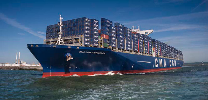
The container shipping industry uses between 20–25 million containers, only a small number of which are tracked. A company called Traxens is on the verge of changing that.
In July, the Switzerland-based Mediterranean Shipping Company (MSC) joined worldwide container shipping company CMA CGM to invest in the French start-up. Under the deal, both CMA CGM and MSC will be represented on the board of directors of Traxens.
Traxens cargo tracker. (Photo: Traxens)
CMA CGM and MSC transport about 25 percent of the world’s shipping containers.
Established in 2012, Traxens has been developing solutions for the cargo logistics sector and has created a new multi-modal container monitoring and coordination system to provide real data for logistics.
By the last quarter of 2016, CMA CGM and MSC will have installed Traxens devices across their fleets.
“We see container monitoring as an important innovation in providing our customers with a high quality of service, while also being able to monitor our outputs accurately,” said MSC CEO Diego Aponte. “We believe that shipping lines should naturally compete on service, but should cooperate in the area of technology and innovation.”
“This should be the start of deployment on a massive scale,” said Tim Baker, Traxens director of marketing and communications.
CMA CGM, which has been backing Traxens since 2012, said that the investment is a part of its global digital strategy. Its 536 vessels call on more than 420 world ports. MSC operates an integrated network of road, rail and sea on more than 200 trade routes.
Each Traxens device has GPS on board, but other methods can be used to save battery life, which affects the overall cost of ownership of the solution. “For instance, once we have determined that a container is on board a ship, we can use the AIS ship-positioning data rather than the GPS on the device — especially as the device may be under deck with no view of the sky,” Baker said.
Also to save power, critical decisions on location are made by the devices locally rather than transmitting position up to the cloud and making decisions there. “It is much less power hungry to evaluate GPS position on the device, compare location with expected location, and then decide whether the information is worth transmitting than to send each position to the cloud just in case it happens to be interesting,” Baker explained.
A dense reference network facilitates low-cost carrier-phase differential GNSS positioning with rapid integer-ambiguity resolution. This could enable precise lane-keeping for automated vehicles in all weather conditions.
Strong demand for low-cost precise positioning exists in the mass market. Carrier-phase differential GNSS (CDGNSS) positioning, accurate to within a few centimeters even on a moving platform, would satisfy this demand were its cost significantly reduced. Low-cost CDGNSS would be a key enabler for many demanding consumer applications.
Centimeter-accurate positioning by CDGNSS has been perfected over the past two decades for applications in geodesy, precision agriculture, surveying and machine control. But mass-market adoption of this technology will demand much lower user cost — by a factor of 10 to 100 — yet still require rapid and accurate position fixing. To reduce cost, mass-market CDGNSS-capable receivers will have to make do with inexpensive, low-quality antennas whose multipath rejection and phase center stability are inferior to those of antennas typically used for CDGNSS.
Moreover, there will be a strong incentive to use single-frequency receivers, whereas almost all receivers used for CDGNSS in surveying and similar applications are multi-frequency. Despite these user-side disadvantages, mass-market precise positioning will be expected to demonstrate convergence and accuracy performance rivaling that of the most demanding current precise positioning applications: Users will be dissatisfied with techniques requiring more than a few tens of seconds to converge to a reliable sub-decimeter solution.
Meeting this challenge calls for innovation targeting both the rover (user) equipment and the reference network. Here we examine the challenge from the point of view of the reference network and offer demonstration results for a low-cost end-to-end system.
The recent trend in precise satellite-based positioning has been toward precise point positioning (PPP), whose primary virtue is the sparsity of its reference network. But standard PPP requires several tens of minutes or more to converge to a sub-10-centimeter 95 percent horizontal accuracy. Faster convergence can be achieved by recasting the PPP problem as one of relative positioning, thereby exposing integer ambiguities to the end user.
This technique, known as PPP-RTK or PPP-AR, is mathematically similar to traditional network real-time kinematic (NRTK) positioning. As the network density is increased, sub-minute or even instantaneous convergence is possible with dual-frequency high-quality receivers. Even single-frequency PPP-RTK is possible, with convergence times of approximately 5 minutes for a 40-kilometer network spacing.
For PPP-RTK and NRTK, convergence time is synonymous with the time required to resolve the integer ambiguities that arise in double-difference (DD) carrier-phase measurements, referred to here as time to ambiguity resolution, or TAR. As reference networks become denser, they can better compensate for spatially-correlated variations in signal delay introduced by irregularities in the ionosphere and, to a lesser extent, in the neutral atmosphere. Improvement is manifest as reduced uncertainty in the atmospheric corrections that the network sends to the user. Reduced uncertainty in the atmospheric corrections is key to reducing TAR.
Prior work has established an analytical connection between uncertainty in the ionospheric corrections (denoted σi ) and TAR. The existing literature does not, however, offer a satisfactory model for the dependence of σι on network density.
The prevailing model is based on single-baseline CDGNSS, which is inapt for PPP-RTK and NRTK. Moreover, prior work does not address the effect of network-side multipath on the accuracy of the corrections data, which becomes increasingly important as low-cost and poorly-sited reference stations are used to densify the network.
Here, we examine the relationship between ionospheric uncertainty and probability of correct ambiguity resolution, and present the results of an empirical investigation of the relationship between network density and the total uncertainty in network correction data. We developed a simple analytical model relating error variance in network corrections to network density. Our analysis and experiments indicate that for rapid TAR in challenging urban environments with low-cost receivers, network density must be significantly increased. We report on the design and deployment of a dense network in Austin, Texas, and demonstrate a new system that taps into the network to provide reliable vehicle lane-departure warning.
AMBIGUITY RESOLUTION
Reducing the ionospheric uncertainty σι allows a strong prior constraint to be applied in the ionosphere-weighted model, thereby increasing P( = z), the probability that the estimated and true integer ambiguity vectors are equivalent. It is instructive to consider single-epoch ambiguity resolution (AR), for two reasons.
First, for stationary users with low-cost equipment, multipath errors dominate in the carrier-phase measurement and are strongly correlated over 100 seconds or more. Thus, if single-epoch AR fails then a static user may have to wait an unacceptably long time for multipath errors to decorrelate enough to permit AR. In any case, singe-epoch performance is a strong predictor of multi-epoch performance over an interval short enough (a few tens of seconds) to satisfy impatient mass-market users.
Second, a convenient and accurate analytical model (by Dennis Odijk and PJG Teunissen) for single-epoch AR reveals the dependency of P( = z) on scenario parameters of practical interest: the standard deviation of ionospheric correction errors, the number of visible satellites, the standard deviation of undifferenced carrier- and code-phase measurement errors (including multipath-induced errors), a satellite geometry factor, the number p of free parameters to be estimated (p=3 for negligible tropospheric error, p=4 to estimate a single additional tropospheric parameter), and the number of carrier frequencies broadcast by each of the satellites (1, 2 or 3) along with each carrier’s wavelength.
The model is highly accurate for single-epoch AR, but only approximate for multiple epochs, with accuracy degrading as the data interval lengthens. The model’s inaccuracy results from its assumption that overhead satellites remain static from epoch to epoch, which yields pessimistic results for even fairly short data capture intervals (for example, 30 seconds). Fully accounting for satellite motion in an analytical model for P( = z) is an open problem, which is why studies that wish to account for satellite motion resort to simulation.
Figures 1 and 2 show single-epoch, single-frequency results from the analytical P( = z) model for parameters approximately reflecting the mass-market use case. The most important conclusion to draw from these figures is that for single-epoch, single-frequency AR to be even moderately reliable (PT⩾0.9) over the next few years, the ionospheric uncertainty σι must be held under 2 millimeters. This will relax somewhat as more Galileo and MEO BeiDou satellites come online, but signal blockage in built-up areas will raise the effective elevation mask angle significantly above the 15 degrees assumed here, reducing the number of available satellites. Thus, sub-2-mm ionospheric uncertainty remains desirable for urban environments even as GNSS constellations become fully populated.
Figure 1. Single-epoch single-frequency ambiguity fixing. Blue traces (left axis) indicate the probability P(z^=z) of correctly resolving all integer ambiguities with a single epoch of data as a function of the number of satellites m. Each trace represents P(z^=z) for a different value of ionospheric uncertainty σι. Green bars (right axis) represent the probability mass function P(m) for the number of satellites above an elevation mask angle of 15 degrees, assuming 31 GPS, 14 Galileo, and 3 WAAS satellites (projected mid 2017). Each blue trace is marked with the total probability of correct integer resolution PT, a function of both the trace itself and P(m). Other parameters of the scenario: geometry factor fg=2.5, standard deviation of undifferenced phase measurements σϕ=3mm, standard deviation of undifferenced pseudorange measurements σρ=50cm, and number of estimated parameters p=3.Figure 2 . Total probability of a correct fix for the scenario of Figure 1 as a function of ionospheric uncertainty σι.
Figures 3 and 4 offer results for a dual-frequency (L1-L2) single-epoch scenario. All other scenario parameters are held as for the single-frequency scenario except that, in an attempt to be somewhat more pessimistic, P(m) is based only on GPS satellites. It is assumed that from each satellite the user can extract dual-frequency measurements. As with the single-frequency case, it is evident that dual-frequency PT is strongly dependent on σι. The dual-frequency case is more forgiving, but substantial performance improvement can still be had by reducing σι to under 2 mm.
Figure 3. As Figure 1 except for dual-frequency (L1-L2) measurements and the probability mass function P(m) corresponds only to a constellation of 31 GPS satellites. The elevation mask angle is again taken to be 15 degrees. It is assumed that dual-frequency measurements can be obtained from every GPS satellite.Figure 4. Total probability of a correct fix for the scenario of Figure 3 as a function of ionospheric uncertainty σι.
Corrections Uncertainty and Network Density. A key question arises in connection with σi: How is related to reference network density? One expects to decrease with increased network density, but what is the exact relationship?
Dennis Odijk’s work adopts a linear relationship between σi and the distance l between the user and the nearest reference station:
σi = βl, 0.3 ≤ β ≤ 3 mm/km
Parameter β depends on ionospheric activity; Odijk recommends determining β empirically. Similarly, his other work adopts a linear relation, with β = mm/km. But there appears to be no justification for applying this linear model to ionospheric corrections provided to a user by a network of reference receivers. The linear trend corresponds to individual single-baseline solutions involving a single master reference station without network aiding; it is not representative of how σi varies for a rover within a reference network.
Instead of determining how σi varies throughout a reference network, it will be more useful to consider the spatial variation in the variance of aggregate error in network-provided corrections. The aggregate error variance, denoted , can be modeled as the sum of variances associated with (1) residual ionospheric delay error, (2) residual neutral atmospheric (hereafter tropospheric) error, and (3) error due to carrier-phase multipath at the reference network stations:
This model assumes that precise orbital ephemerides are used to eliminate spatially-correlated errors due to satellite ephemeris errors and that the contribution to from reference station carrier-phase thermal noise is negligible compared to reference station carrier-phase multipath error.
Focusing therefore on σv , consider its relationship to reference network density γ, expressed in stations per unit area. This relationship depends on the assumed model for the DD ionospheric and tropospheric delays. Let a denote the master reference station and let S = {s1, s2, …, sN} denote the set of all secondary stations available in the network. Then, for pivot satellite i and alternate satellite j , suppose that the true combined DD atmospheric delay at secondary station s∈S can be accurately modeled as follows, where xs, ys, and zs represent the secondary station’s east, north, and up displacement from the master: (1)
Dai et al. refer to this model as a linear interpolation model or first-order surface model. The quantities and are the model parameters for the satellite pair i, j.
Map showing trends in σv across a simulated reference network assuming a linear model for combined DD ionospheric and tropospheric delays and independent errors due to multipath at each station. The master station is marked in black; secondary reference stations are marked in white. Blue denotes low σv. Red denotes high σv.
For the linear model in (1), one can show that if stations are sufficiently uniformly distributed (i.e., no station clumping), then the average value of σv across a network, denoted , is approximately related to the network density γ by (3)
where q is a parameter related to the variance of the uncorrelated errors , s∈S. This approximation becomes highly accurate as γ increases. [See full paper for details.]
It is clear from (3) that, for the linear model (1),can be driven to an arbitrarily small value by increasing the network density γ, and this is true despite the presence of multipath in the reference station carrier-phase measurements. Whether (3) applies in practice depends on whether (1) can be considered an accurate model for , at least over a compact region. The following section examines this question empirically. It further seeks to identify, for an example dense reference network, the density γ beyond which further reduction inno longer matters (would no longer improve ) because rover multipath dominates.
ANALYSIS OF A DENSE REFERENCE NETWORK
We examined σι as a function of network density using data from several organizations providing GNSS reference station observations: National Geodetic Survey Continuously Operating Reference Stations, UNAVCO, and the California Real Time Network. This combination allowed analysis of a hypothetical reference network of 23 high-quality GNSS receivers with an overall network density of approximately 8 nodes/1,000 km2, or an average inter-station spacing of 14 km. The relative positions of the sites selected to comprise this reference network, located between Los Angeles and Pomona, California, are depicted graphically below.
Depiction of the placement of the 23 GNSS reference stations. Horizontal positions are relative to the master station, LONG of CRTN, in kilometers. The color map indicates the height of each station above the WGS 84 geoid in meters.
DD carrier-phase observations from GPS L1 C/A signals spanning GPS weeks 1850 through 1859 were used for the analysis. A minimum satellite elevation mask was enforced at 20 degrees. Any satellite not above the elevation mask and providing carrier-phase observations at both the beginning and end of each processing window was excluded. A step size of 10 minutes was used. The longest available sub-window, meeting the above requirements and providing a minimum of 6 satellite vehicles (1 pivot satellite and 5 others), was selected for processing.
To facilitate batch processing, integer ambiguities were assumed to be resolved correctly when the mean standard deviation of carrier-phase residuals for that solution was less than one quarter wavelength of the GPS L1 frequency. In application, this constraint resulted in rejecting only 0.6 percent of all solutions.
Network Corrections Estimation. Estimation of network corrections made use of least-squares estimation applied to carrier-phase residuals measured between master station LONG, denoted a hereafter, and secondary reference stations s∈S, where S is now taken to be the set of all stations other than LONG. Consider the following model for the DD carrier-phase measurement, expressed in meters, between master station a, secondary station s∈S, pivot satellite i, and alternate satellite j:
(4)
Here, λ is the carrier wavelength; is the DD carrier-phase measurement, in cycles; is the DD range; is the DD integer ambiguity; is the DD combined atmospheric delay, which includes tropospheric and ionospheric delays; and is the DD carrier-phase measurement error, which is dominated by carrier-phase multipath error at a and s.
Experimental analysis ofas a function of network density proceeded as follows. A subset of secondary stations Sk ⊂S was chosen, together with a, to act as the kth test network. A large number K of subsets Sk of various geographic size and density were analyzed. Let {S\Sk} denote the set of secondary stations not in the kth test network. For each Sk, k = 1, 2,…, K, all secondary stations in {S\Sk} were designated, one at a time, to act as a test station, or rover. Atmospheric delays estimated by the kth network for test station s∈{S\Sk} were then differenced from actual delays measured by s to evaluate the quality of the atmospheric delay estimates.
Details of the atmospheric delay estimation procedure for the kth test network are as follows. For each s∈Sk, a DD measurement residual was formed for each pivot satellite i and alternate satellite j as
(5)
where was assumed known to sub-millimeter accuracy and was assumed to have been resolved correctly. The true DD atmospheric error contributing to (5) was assumed to vary linearly with geometry over sufficiently short baselines as modeled in (2). The DD multipath error term was assumed to be zero mean, and the component due solely to s was assumed to be uncorrelated with all corresponding components .
Under these assumptions, can readily be estimated via least squares. Let be the vector containing the residuals for |Sk|x1. This residuals vector can be modeled as
(6)
where H is an |Sk|x4 matrix whose rows are of the form [xs ys zs1]. The 4 x 1 vector contains the parameters of the hyper-plane to be estimated at each epoch. The |Sk|x1 vector wijcontains DD measurement errors.
An estimate from a least-squares solution of (6) was used to produce a network correction for a test secondary station s∈{S\Sk}, acting as rover, at location xs, ys, zs :
(7)
The subscript l on the atmospheric correction indicates that the correction is based on a linear model for DD atmospheric errors; it is used to distinguish the correction from those produced by a quadratic model later on. The correction was applied at test station s∈{S\Sk} to produce a corrected DD phase measurement
This procedure was repeated at each epoch for each satellite pair i, j visible to each test station s∈{S\Sk} of the kth test network, k = 1, 2,…K.
If the assumed models hold, then in the limit as the network density increases, can be modeled as
(8)
where is DD phase measurement error due only to multipath at s. In other words, as network density increases, application of the network correction eliminates not onlybut also , the component of the DD phase measurement error due to multipath at the master.
Linear least-squares compared to quadratic-least squares estimation. To evaluate the assumption that DD tropospheric and ionospheric errors vary proportional to relative position, c1 was estimated with the full set of secondary stations S for single epochs at 300 second intervals. The probability distributions of the contributions of those parameters (e.g., cxlxs and not simply cxl) are shown below. For comparison, equivalent values are calculated for a quadratic least-squares estimate of the following form:
(9)
Here, the subscript q of denotes a quadratic model for DD atmospheric delays. The distributions of comparable terms from (9) are also shown in the next two figures. These data represent the collection of all satellites above the elevation mask angle. It is noted that when all satellites are considered together, the expected value of these terms is very near zero.
Probability densities of the terms estimated at the station location for SPMS of UNAVCO. As indicated by the legend, the linear components are shown for a linear least-squares estimation as well as the linear components for a quadratic least-squares estimation. These data represent the probability densities for all GPS satellites combined.
Probability densities of the terms calculated at the station location for SPMS of UNAVCO.
The next two figures show the same data as the two above, but with each GPS satellite plotted separately. It is noted that the linear parameters, when considering only a particular satellite, are not necessarily zero-mean. This is hypothesized to be a manifestation of the satellite orbit reflected in the tropospheric and ionospheric errors. It is interesting to note that the quadratic terms shown in the second figure below largely exhibit zero mean behavior despite non-zero mean for the associated linear terms.
Probability densities of the terms for every GPS satellite observed, calculated at the station location for SPMS of UNAVCO, where each plot line represents a different GPS satellite. This figure is intended to qualitatively illustrate the non-zero mean nature of these linear terms when considered for individual satellites.
Probability densities of the terms for every GPS satellite observed, calculated at the station location for SPMS of UNAVCO, where each plot line represents a different GPS satellite. This figure is included to qualitatively illustrate the largely zero mean nature of these quadratic terms when considered for individual satellites.Probability densities of the difference between linear least-squares and quadratic least-squares network correction estimates for representative reference stations. The red vertical lines denote boundaries between which 68.27% of the probability distribution is contained; displayed as a comparative proxy to lσ of the Gaussian-distribution (these distributions are non-Gaussian). Recall that CGDM has a distance to the master station of 15.1km, BGIS is at 21.6km, and LORS is at 23.1km.
The figure above shows the probability distributions of the difference between (7) and (9) (i.e., ) at three representative reference station positions. It can be noticed that despite the increasing baseline distance of LORS and BGIS as compared to CGDM, there is no apparent correlation in these estimation errors. Notice that CGDM and LORS have very similar distributions despite their difference in baselines. BGIS and LORS, with similar baselines, exhibit very different distributions. There is no apparent correlation found between reference station positions and these error terms. Additionally, these distributions are zero-mean for all s∈S (to within 0.5 mm in each case) with 68.27% boundaries positioned between 1.5-5.5 mm. Because these errors appear indistinguishable from multipath, it is concluded, for this specific network and time period, that linear least-squares estimation is sufficient for estimating tropospheric and ionospheric errors. This is fortunate, because the linear model for atmospheric DD delays provides an averaging effect on multipath present at the reference stations which minimizes the introduction of multipath errors into the estimates produced.
Uncorrected carrier-phase residuals. The figure below shows the expected values for DD carrier-phase residual standard deviations for all s∈S through use of uncorrected observations. These data were produced by averaging the standard deviation of the DD carrier-phase residuals calculated at each epoch across all satellites present in the solution. The fitted curve indicates a linear growth of DD carrier-phase residuals with β = 0.62 mm/km. Additionally, the mm-level scatter of these data points suggest that position biases of the resolved reference station positions are also mm-level. If the linear fit is shifted down by approximately 4 mm (e.g., taking the minimum data points as those with very little position bias) and extrapolated to 0 km, one can consider this as providing a rough estimate of DD multipath at the reference stations; 4.7 mm (DD) or 3.3 mm (single-difference equivalent).
Standard deviation of uncorrected DD carrier-phase residuals versus baseline distance between each of the 22 reference stations and the master reference station.
Uncorrected Carrier-Phase Residuals. Figure 5 shows the expected values for DD carrier-phase residual standard deviations for all secondary stations, based on observations that were not corrected for atmospheric delay. These data were produced by averaging the standard deviation of the DD carrier-phase residuals calculated at each epoch across all satellites present in the solution. The fitted curve indicates a linear growth of DD carrier-phase residuals with distance to the master. The mm-level scatter of these data points suggest that biases of the resolved reference station positions are also mm-level.
Figure 5. Standard deviation of uncorrected DD carrier-phase residuals versus baseline distance between each of the 22 reference stations and the master reference station.
Network-Corrected Residuals. Figure 6 displays similar data to Figure 5, except that the carrier-phase residuals are those that remain after network corrections are applied. Each data point corresponds to a particular subset of secondary stations together with the master, and a particular rover selected at random from the remaining stations. Both the size and specific selection of secondary stations comprising each subset were randomly selected. In all, 70 different network configurations and more than 3.67 million NRTK solutions were analyzed.
Figure 6. Standard deviation of carrier-phase residual remainders (the carrier-phase residuals which remain after application of network corrections) versus average network density. The fitted curve is simply a polynomial fit of these data; it is not based on any theoretically anticipated behavior.
Figure 6 shows that carrier-phase residuals after application of network corrections are considerably reduced compared to those original magnitudes seen in Figure 5. With increasing network density, the DD residuals’ deviation asymptotically approaches a minimum value of about 4 mm, which corresponds to an undifferenced deviation of 2 mm. This floor is due to multipath at the rover. Deviations in excess of this floor are caused by residual ionospheric errors and, to a lesser extent, neutral atmospheric errors.Attributing the excess deviation entirely to residual ionospheric errors, and assuming these are uncorrelated with multipath, one can estimate from Figure 6 the undifferenced ionospheric uncertainty. For example, for a 50-km inter-station distance, σι=(℘(142 – 42))/2=6.7mm. To achieve the σι<2 mm recommended earlier for fast and reliable AR, station separation should be no more than 22 km, which we round down to a recommended value of 20 km to provide a margin of station redundancy.
NETWORK DEPLOYMENT
We have developed and deployed a low-cost reference network testbed in Austin, Texas, with site hosting courtesy of the Texas Department of Transportation. The Longhorn Reference Network boasts a dozen stations, with plans for 20 (Figure 7). The network’s average inter-station spacing is far shorter than the 20-km spacing recommended earlier. The tighter spacing provides redundancy and flexibility of experimentation. The low-cost reference stations are deployed in environments with greater multipath and signal blockage than those of the high-quality stations studied earlier. Such non-ideal signal environments are to be expected in a dense low-cost reference network, for which choice of station siting is driven largely by opportunity.
Figure 7. Overview of the planned Austin area reference network (Google Maps).
The reference station design, pictured in Figure 8 and diagrammed in Figure 9, is novel. Each station is a self-contained, solar-powered node supporting a software-defined dual-frequency, dual-antenna GNSS receiver with an always-on cellular connection to university servers for data collection and software maintenance.
Figure 8. Low-cost reference station in the Longhorn Reference Network.Figure 9. Reference station components.
Live Vehicle Demonstration. In partnership with Radiosense, an Austin-based precise positioning startup, we have developed and demonstrated a low-cost vehicle lane departure warning system that receives corrections from our dense reference network. The system takes in lane widths from an external database and infers a safe driving corridor within each lane by analyzing the behavior of human drivers on the same road. A vehicle’s proximity to the lane boundary is displayed in real time to the driver and passengers.
For robustness against cycle slips and to provide a baseline against which to compare future improvements, the system currently employs single-epoch CDGNSS positioning without aiding from additional sensors. In choosing a single-epoch approach, the system naively discards information regarding the underlying integer ambiguities at the beginning of each measurement epoch. Still, the system performs well with the typical number of overhead signals in a light urban environment: correct and internally-validated solutions were available in over 92 percent of measurement epochs. When a second rover antenna is included to combat multipath with spatial diversity, this percentage improves to 96. Such good single-epoch performance suggests that, when armed with additional sensor aiding and proper integer ambiguity persistence, reliable and accurate vehicle positioning can be maintained in more challenging environments.
Demonstration setup. The live demonstration followed a predetermined route in the vicinity of the University of Texas campus. The 1-mile route (Figure 10) passed through both open-sky and partially-blocked environments.
Figure 10. Demonstration route.
Prior to the demonstration, the vehicle was driven several times on the same route collecting GNSS measurements to precisely map typical driving trajectories on the route. The ensemble of trajectories was used to build a centimeter-accurate model of the lane center along the route. The sensing equipment employed during this mapping phase is no different than that used during the demonstration, making feasible eventual crowd-sourcing, wherein end-user vehicles generate and update the centerline models.
The demonstration vehicle was outfitted with two dual-frequency GNSS antennas mounted with magnetic bases onto the roof. The first antenna, designated primary, operated as the rover in a single-baseline CDGNSS solution against the master reference station of the Longhorn Reference Network, as illustrated in Figure 11. This baseline provided the geo-referenced, centimeter-accurate vehicle position. The other antenna, designated secondary, was paired with the primary antenna to produce a constrained-baseline CDGNSS solution providing sub-degree-accurate vehicle heading. The secondary antenna also served as a backup when the primary antenna produced a result that did not pass the precise positioning engine’s internal validity testing.
Figure 11. GNSS antenna configuration. A single-baseline precise position solution between the primary antenna and the master reference station provides precise vehicle position. A constrained-baseline 2D attitude solution between the primary and secondary antennas provides heading.
The GNSS antennas were connected to a low-cost, dual-frequency front-end in the trunk of the vehicle (FIGURE 12)which downconverted and digitized the incoming signals and subsequently fed them to a low-cost single-board computer running the precise positioning engine. A cellular modem received real-time measurements from the master reference station, while a WiFi router streamed real-time solutions to several Android devices in the vehicle for real-time visualization of precise within-lane position.
Figure 12. Low-cost, dual-frequency rover system in the trunk of the vehicle.
Demonstration Results. Figures 13, 14 and 15 show snapshots of the Android application and a still frame of the side of the vehicle in three different scenarios. The large rectangle indicates vehicle position with respect to the modeled lane center, changing color from green, when the vehicle is within the safe driving corridor, to yellow as the vehicle nears the edge of the lane, and finally to red if the vehicle breaks the lane boundary. One could imagine wrapping a control loop around these signals to enable last-moment lane-keeping.
Figure 13. Vehicle position relative to lane edge (left) synchronized in time with video still frame (right), centered safely within the lane, as depicted by green rectangle.Figure 14. Vehicle nearing lane edge, as depicted by yellow rectangle.Figure 15. Vehicle crossing lane edge, as depicted by red rectangle.
Figure 16 reveals the precision with which the positioning engine was able to locate the vehicle’s driver-side antenna in four repeated passes along the test route. The variation between the four yellow traces is primarily due to driver non-repeatability; actual measurement precision is at the centimeter scale. A small bias in the traces’ registration to the picture is present because Google Earth imagery is only registered to the International Terrestrial Reference Frame with meter-level accuracy.
Figure 16. Four repeated traces of driver’s side antenna as vehicle made a turn.
Figure 17 shows a time history of the vertical deviation from the route mean, in meters. The zoomed view of the vertical deviation shown in Figure 18 allows one to appreciate the precision of the positioning engine: the vertical trajectory is smooth at the centimeter level. Figure 19 shows the DD residuals in carrier phase and pseudorange for GPS PRN 30 during the four loops in Figure 17. One-sigma undifferenced phase and pseudorange deviations are 3.4 mm and 42 cm, respectively.
Figure 17. Time history of the vertical deviation from the route mean, in meters.Figure 18. Zoomed view of the time history of the vertical deviation from the route mean, showing the centimeter-level precision in the 3.3 Hz positioning data.Figure 19. Double-difference carrier phase (top) and pseudorange (bottom) residuals for GPS satellite 30 at frequency L1 over the full time interval shown in Figure 17.
The figures demonstrate that the precise positioning engine fed by reference data from the Longhorn Reference Network maintained centimeter-accurate knowledge of the vehicle’s position during almost the entire trajectory, despite passing between a large football stadium and parking garage, each of which introduced significant signal blockage and multipath.
For the data shown in Figure 17, 96 percent of the 3.3-Hz measurement epochs resulted in a correct and internally-validated positioning solution. The majority of the remaining solutions were correct but did not pass internal validation. For only 0.6 percent of solutions were the carrier-phase integer ambiguities resolved incorrectly, but all of these incorrect solutions were caught and excluded by the validation algorithm.
Furthermore, the number of overhead signals during the time in which this particular dataset (set A) was taken was average, as seen in the upper plot of Figure 20. 16 signals above 15 degrees elevation were available during this time. In contrast, the number of overhead signals for a second dataset taken 8 days prior (set B) was much worse, with only 12 signals above 15 degrees elevation, as seen in the lower plot.
Figure 20. The number of signals above a 15-degree elevation mask. Each plot spans an entire day. The black arrows denote the time of day in which two different datasets, A and B, were taken. The dashed red line represents the mean number of signals above the mask over both days. Dataset A was taken during a nominal time when 16 signals were available, while dataset B was taken during a worst-case time when only 12 signals were available.
For insight into the performance of the positioning engine as a function of the number of overhead satellites, Table 1 details the performance of these two datasets (as well as a third dataset) in terms of the percentage of epochs that passed the positioning engine’s internal validation testing, based on a ratio test with a fixed threshold of 2.0. Results are shown for single- and dual-antenna positioning solutions and for dual-antenna vehicle heading solutions.
Table 1. The performance of each dataset in terms of the percentage of solutions that passed validation testing.
A large drop-off in positioning performance occurs when the number of overhead signals is reduced below 16, while the constrained-baseline heading determination performance remains good throughout. Fortunately, it will not be long until even more signals are available. Within the next 8 months, the Galileo constellation will add six fully operational satellites. These will bring the number of GPS L1, GPS L2C, Galileo E1, and SBAS signals that are above 15 degrees elevation to 16 or more 95 percent of the time, enabling high-reliability single-epoch CDGNSS positioning.
CONCLUSIONS
For a sufficiently dense reference network, linear least squares estimation can be applied to the task of reducing uncertainties due to tropospheric and ionospheric delays for the purposes of providing improved positioning accuracy as well as faster time to ambiguity resolution for carrier-phase differential positioning. High network density allows use of a strong linear model for atmospheric delays, which has the virtue of suppressing network-side multipath errors in the provided corrections.
A network of 23 high-quality reference stations in the vicinity of Los Angeles, California, was studied to determine what network density is sufficient to make all network-side error sources negligible compared to rover receiver multipath. A density of three stations per 1,000km2, or an average inter-station spacing of 20 km, was found to drive network-side ionospheric, tropospheric, and multipath errors well below rover receiver multipath.
These findings motivate a significant densification of permanent reference networks, at least in built-up areas where signal blockage and multipath are common, to support mass-market applications for which low user (rover receiver) cost and rapid convergence to a reliable sub-decimeter position are a priority. In a light urban setting, and with the kind of satellite coverage that will soon become the norm, we demonstrated vehicle lane departure warning in a field test that produced highly reliable instantaneous sub-decimeter positioning.
ACKNOWLEDGMENTS
This work was supported in part by Samsung Research America, by the Data-Supported Transportation Operations and Planning Center (D-STOP), a Tier 1 USDOT University Transportation Center, and by the Texas Department of Transportation under the Connected Vehicle Problems, Challenges and Major Technologies project.
Harxon has released a utility beacon antenna — HX-CS7615A — to professionally solve marine satellite positioning challenges.
The HX-CS7615A supports GPS L1/L2, GLONASS L1/L2 BDS B1/B2/B3 and beacon frequencies (282.6 to 326 KHz), which greatly overcomes the defects of long-distance transmission limits, the company said. In addition, combining wide frequencies in one antenna makes the new device more cost effective.
Inside, a multipath rejection board significantly eliminates measurement error, Harxon said. The phase center of the antenna remains constant as the azimuth and elevation angle of the satellites change.
The HX-CS7615A Harxon marine antenna.
The HX-CS7615A is designed with high gain and wide beam width. It is test approved — even in some severe blocking situations, its reception remains stable.
A specialized antenna made for rugged environments, the HX-CS7615A beacon antenna is sealed against water and dust, is salt and fog resistant, and operates in extreme weather conditions.
A status update released this month by the Federal Railroad Administration (FRA) underscores the need for railroads to implement Positive Train Control (PTC) as quickly and safely as possible. The update also highlights the Administration’s repeated calls for Congress to provide more significant funding to assist commuter railroads in implementing PTC.
“Positive Train Control should be installed as quickly as possible,” said U.S. Transportation Secretary Anthony Foxx. “This is lifesaving technology available now, and railroads should continue to aggressively work to beat the deadlines Congress has put in place.”
PTC prevents certain train-to-train collisions, over-speed derailments, incursions into established work zone limits and trains going to the wrong tracks because a switch was left in the wrong position.
The status update includes railroad-by-railroad quarterly data as of June 30 on track segments completed, employees trained, radio towers installed, route miles in PTC operation and other key implementation data. Some of this information is also displayed in infographics below. In March, FRA announced that it intended to require railroads to submit quarterly reports to FRA on their progress toward completing PTC implementation.
In 2008, Congress mandated PTC implementation on certain railroad main lines where railroads transport poisonous-by-inhalation hazardous or toxic-by-inhalation hazardous materials or any line where a railroad provides regularly scheduled passenger service. Following a derailment in May 2015 in the Northeast Corridor, in October Congress extended the original deadline from December 31, 2015, to at least December 31, 2018.
“The official deadline for Positive Train Control may be years away, but the urgency for railroads to activate it is now,” said FRA Administrator Sarah E. Feinberg. “Every day that passes without PTC, we risk adding another preventable accident to a list that is already too long. FRA will continue to push railroads to stay focused on implementation and urge Congress to fund this life-saving technology.”
Earlier this week, FRA awarded nearly $25 million in grants to help railroads complete full PTC implementation. Many of the awards will help railroads achieve interoperability among the different PTC systems that railroads are deploying. This follows DOT’s announcement in July that commuter railroads and states can apply for approximately $199 million in PTC grants.
President Obama has consistently made funding and assistance for commuter railroads to implement PTC a priority. In his Fiscal Year (FY) 2017 budget request, the president requested $1.25 billion. This follows requests of $825 million in both FY 2015 and FY 2016.
Since 2008, FRA has provided significant assistance to support railroads’ PTC implementation. Those efforts include:
Approving more than $650 million in grants to passenger railroads, including nearly $400 million in American Recovery and Reinvestment Act of 2009 funding
Issuing a nearly $1 billion loan to the New York Metropolitan Transportation Authority to implement PTC on the Long Island Rail Road and Metro-North Railroad
Building a PTC testbed at the Transportation Technology Center in Pueblo, Colorado
Working directly with the Federal Communications Commission and the Advisory Council on Historic
Preservation to resolve issues related to spectrum use and improve the approval process for PTC communication towers
Dedicating staff to work on PTC implementation, including establishing a PTC task force.