The European Union Aviation Safety Agency (EASA) and EuroControl have published a joint action plan designed to strengthen the safety and resilience of European aviation operations amid the growing challenge of GNSS interference.
GNSS provides aircraft with precise positioning, navigation and timing information that is essential for a wide range of functions. Interference with the signals has become a regular occurrence, in particular on the edge of conflict zones, and poses a threat to safety. The action plan focuses on maintaining safety in the near term while limiting impacts on airspace capacity and containing the threat of GNSS interference. It sets out short, mid- and long-term measures to mitigate the threat with harmonized operational procedures and to strengthen the robustness of GNSS‑based operations by clearly defining who needs to act, and by when.
“While the potential threat to aviation safety from GNSS interference has so far been mitigated by short-term actions such as raising pilot awareness, it is clear that more needs to be done,” said Florian Guillermet, EASA executive director. “This action plan lays out and prioritizes short, mid and longer-term actions and, importantly, also assigns roles to the various aviation actors. By working together with EuroControl and pooling our expertise, we have been able to create a strong plan that will enable the wider sector to come together to counter this threat.”
“GNSS interference remains a significant and evolving challenge for European aviation, making today’s action plan an important step forward in our collective response,” said Raúl Medina, director-general, EuroControl. “The action plan concretely supports our Member States and aviation partners as we work together to ensure the evolution and resilience of aviation’s critical infrastructure — one of the core goals of EuroControl’s Trajectory 2030 strategy. I welcome the strong cooperation and close coordination with EASA and all our partners across the aviation sector on this plan, which demonstrates our shared commitment to safety, and aims at delivering tangible benefits for the network, operators and passengers by making GNSS‑based operations more robust.”
Key elements of the joint action plan The action plan is built on several core pillars designed to strengthen Europe’s ability to detect, manage and mitigate GNSS interference.
Through joint monitoring and data-sharing, EASA and EuroControl aim to establish a common, validated operational picture of GNSS interference events across Europe, enabling more accurate detection, reporting and situational awareness. By pooling expertise and operational data, the two organisations will deepen their understanding of interference patterns, operational impacts and associated safety risks, with the aim of delivering consistent and harmonized guidance to air navigation service providers (ANSPs), airlines, and national authorities to ensure rapid and aligned responses to interference incidents.
In close partnership, EASA and EuroControl will develop updated operational guidance for flight crews and air traffic controllers to help them manage disruptions effectively and maintain safe operations in degraded navigation environments and join forces and expertise for investigations into ongoing GNSS interference. The two organisations will also promote improved mechanisms for timely information exchange through Member States, ensuring that events with both civil and military dimensions are addressed in a coordinated and transparent manner to minimize disruption and preserve airspace capacity.
The action plan envisages close collaboration with A/C manufacturer and avionics industry to support the development of more robust, interference‑resilient avionics solutions over the longer term. It addresses the concerns expressed in a letter sent on June 6, 2025, by 13 EU Member States to the European Commission that called for immediate and coordinated European action to address the growing number of Radio Frequency Interference (RFI) events affecting GNSS‑based systems. The action plan also integrates proposals and guidance from international partners including the International Civil Aviation Organization (ICAO), and the International Air Transport Association (IATA).
Background GNSS enables more efficient flight paths, reduces fuel consumption, and supports the implementation of Performance-Based Navigation (PBN), which allows aircraft to fly more direct routes and operate safely in areas with limited ground-based infrastructure.
However, the growing challenge of RFI — whether intentional (jamming or spoofing) or unintentional — poses a threat to the resilience of these systems. The most severe interference typically occurs near conflict zones, but GNSS performance may be affected well beyond these areas. Although aircraft can operate safely without GNSS, disruptions can reduce resilience and the continuity of operations.
As GPS World readers know, the growing prevalence of GPS/GNSS jamming and spoofing outside of conflict zones interrupts vital aviation safety technologies and presents challenges to maritime commerce and the global economy. An alarming example is playing out along the Baltic Sea and the North Sea, prompting 13 coastal European nations and Iceland to highlight in January 2026 “growing GNSS interference” and collectively reinforce requirements to comply with existing regulations and international law designed to ensure the safety of all maritime vessels engaged in shipping.
As commercial aircraft report navigation anomalies and maritime operators experience false position data in congested waterways, global authorities are sounding alarms that GNSS interference will continue to rise without immediate action. In March 2025, the International Civil Aviation Organization (ICAO), International Telecommunication Union (ITU), and International Maritime Organization (IMO) issued a joint warning expressing “grave concern” that disruptions from GNSS jamming and spoofing constitute an urgent threat to public safety, telecommunications networks and international commerce.
Compounding harmful interference incidents led the GPS Innovation Alliance (GPSIA) to act. Defeating illegal and harmful interference outside of combat zones requires a coordinated, whole-of-government strategy that focuses on stopping bad actors through deterrence and enforcement, and directing resources toward preventing and sanctioning those violating international commitments and laws prohibiting jamming and spoofing. Investing in GPS modernization and integrating innovative signals from complementary PNT satellite systems into devices and receivers will deliver PNT that surpasses today’s technologies to the global community.
Roadmap for Action
In September 2025, GPSIA led a coalition of leading industry groups in sending a letter to the Departments of Defense and Transportation that called for urgent action to address GPS jamming and spoofing. We noted the United States has the technology and expertise to solve this issue, and the administration has the power to act. GPSIA followed the letter with a whole-of-government strategy providing a clear roadmap for the administration. While some recommendations have been implemented, other opportunities remain.
Focus on the Real Culprits
The culprits in each of these scenarios are bad actors putting public safety and global commerce at risk with harmful interference outside conflict zones. The global community relies on several unique technologies that can be impacted by harmful interference, such as cellular and Wi-Fi signals, radars and automated information systems. The misplaced focus on faint GNSS signals or dependencies on GNSS derail collective efforts to immediately regain interference-free global commerce and bolster public safety.
Governments and international organizations mandate certain industries integrate safety-of-life technologies into their operations — and they do, at great cost. Officials should in turn be given the political support and resources to stop bad actors from intentionally interfering with them.
What to Do Next
Public and continued diplomatic engagement are critical. By amplifying European counterparts, condemnations from senior U.S. officials can raise the reputational costs for bad actors and reaffirm international norms that protect GNSS signals and other technologies from harmful interference.
Engaging with the ICAO is important. The U.S. should reinforce its commitment to providing modern civil GPS signals that support navigation in international airspace and encourage ICAO to prioritize the enforcement of global GNSS protections.
GPSIA also recommends Executive agencies establish an interagency task force that rapidly identifies and disseminates information about interference events with civil operators, including sanitized intelligence information on intentional jamming and spoofing of commercial aircraft and ships.
Civil operators also should be invited to participate in interference coordination calls and reporting. Sharing radio-frequency interference data, incident reports and threat assessments among military and civil agencies and operators is essential to preserving public safety. The Performance-based Operations Aviation Rulemaking Committee’s recommendations for continuity of operations during GPS disruption events should continue to be implemented with urgency.
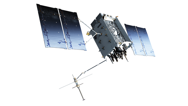
The GPS III satellite has additional anti-interference features. (Image: Lockheed Martin)
Deterrence and information sharing must be coupled with sustained enforcement. Federal agencies have taken welcome action to interdict illegal jamming equipment, reporting an 830% increase in seizures since 2021. We applaud the U.S. government for prioritizing resources to stop the illegal import and sale of these devices.
GPSIA commends the Kingdom of Norway’s annual Jammertest, which allows receiver and device manufacturers to test interference detection and counter jamming and spoofing. These realistic test scenarios, together with strengthened enforcement and prioritized intelligence collection and analysis, will enhance public safety.
Modernize GPS
While GPS satellites continue operating with an extraordinary 99.99% availability and no outages on record, the health of the constellation and jamming and spoofing incidents affecting receivers and devices, demand action. The final GPS III satellite is scheduled to launch this spring. Next-generation GPS IIIF satellites are being built. Their launches should be prioritized to reduce the number of satellites on orbit that are one system or subsystem away from failure. GPSIA welcomed the passage of the FY2026 Defense Appropriations Bill, which bolstered national and economic security by investing needed funding for modernized GPS IIIF satellites and long-term PNT leadership.
Notably, the current GPS program plan does not include counter-spoofing technologies. Implementing counter-spoofing authentication capabilities for Wide Area Augmentation System (WAAS) signals would further strengthen aviation resilience.
Ground infrastructure modernization is equally important. The GPS ground station must be able to command and monitor GPS III and IIIF satellites and the modern L5 aviation signal.
Streamline Regulatory Activities
Regulatory modernization represents another area of progress. In September 2025, the State Department removed jam-and spoof-resistant Controlled Reception Pattern Antennas (CRPAs) from the International Traffic in Arms Regulations (ITAR), fulfilling one recommendation from GPSIA’s strategy.
Certification processes also must evolve, and integration of CRPAs into aircraft should be accelerated. The modern L5 signal and counter spoofing signal authentication signals must be incorporated into FAA-certified and other receivers as soon as possible.
Recommendations for the FCC
President Trump’s December 2025 Executive Order (EO), “Ensuring American Space Superiority,” directs U.S. departments and agencies to detect and counter threats to U.S. space infrastructure. It also states that his administration will enable industry to develop and deploy advanced space capabilities, including terrestrial and cislunar PNT applications. This EO should serve as a “North Star” for the FCC, resulting in increased enforcement resources to address illegal jamming and spoofing, and a regulatory environment prioritizing innovative, advanced commercial satellite PNT systems that complement GPS. Demonstrating American leadership in space demands that we step forward, not backwards, in our PNT capabilities.
The FCC is evaluating the record developed in its Notice of Inquiry, Promoting the Development of PNT Technologies and Solutions, and is reportedly considering future rulemaking. The FCC’s task is not to replace GPS, but to ensure that the regulatory environment protects its spectrum, increases enforcement actions against those perpetuating harmful interference and enables innovation that complements this foundational system. This balanced approach will fulfill President Trump’s mandate, preserving public safety and economic security, and ensure continued American leadership in PNT.
Global Safety and Commerce
Baltic and North Sea shipping lanes have become a flashpoint for GPS jamming and spoofing, prompting 13 European nations and Iceland to issue a joint warning in January 2026 over interference threatening maritime safety and global commerce. (Photo: Dmitri Toms / iStock / Getty Images Plus / Getty Images)
The FCC’s Notice of Inquiry uncovered dozens of PNT technologies, ranging from those in the marketing stage, to hyper-localized solutions, to proposals to exploit “signals of opportunity.” Creativity and ingenuity abound in the commission’s record, but the docket’s many filings lacked technical details to evaluate whether the systems advance the nation’s PNT leadership.
The hallmarks of GPS are its worldwide coverage, and the continuity, availability, integrity and accuracy of its signals. Our modern global community deserves complementary PNT systems and signals that meet or exceed GPS capabilities. A few satellite-based solutions stood out as holding promise to do so.
Systems operating in low-Earth orbit (LEO) can transmit stronger signal power due to their proximity to Earth, improving performance in urban environments and contested spectrum conditions. Systems operating in different frequency bands, such as TrustPoint’s C-band system, add spectral diversity, making it far more difficult for an adversary to disrupt all PNT services simultaneously. When combined with modernized GPS signals and authentication capabilities, this layered approach can deliver robust services while complementing the foundational role of GPS.
Terrestrial systems cannot replicate global coverage of satellite constellations. They are also vulnerable to wildfires, hurricanes and other disasters.Building parallel terrestrial networks would require significant investment while delivering a fraction of modernized satellite systems’ capabilities. Nor do terrestrial signals provide the continuity, availability, integrity and accuracy of satellite systems.
The Progress is Real
GPSIA is pleased to report that progress is being made in several areas outlined in its “whole-of-government” strategy. It’s time to accelerate that progress. In May 2026, GPSIA members will convene to evaluate this strategy and outline what more the PNT industry can do to play a part in defeating harmful interference. Our members also will meet with government officials to underpin that government-led enforcement and solutions to jamming and spoofing can further illustrate the importance of PNT to U.S. leadership in space, and national security, public safety and the global economy.
The U.S. Air Force has opened market research for a GPS Increment 2 GNSS M-code receiver for the Joint Air-to-Surface Standoff Missile (JASSM) program.
The Air Force’s Materiel Command Lifecycle Management Center at Eglin Air Force Base published a Request for Information on March 17 to identify qualified vendors capable of developing and producing the receiver.
Key requirements include:
demonstrating a point-of-departure design at or above Technology Readiness Level/Manufacturing Readiness Level 5 applicable to U.S. Department of Defense tactical missiles
identifying existing programs leveraged
providing current TRL and MRL status
presenting a funded development plan to achieve required maturity.
Respondents must also
describe their technical approach for the GPS receiver
identify the status of Increment 2 M-code Application Specific Integrated Circuit certification with the GPS Directorate Security Team
demonstrate an active production line delivering DoD M-code receivers where possible
provide a notional low-risk development and integration schedule from contract award.
The government is using the market research phase to assess vendor capability before proceeding to formal solicitation. The opportunity is open to qualified commercial vendors without foreign participation. The government is seeking established manufacturers with demonstrated capability in DoD M-code receiver production.
Respondents must submit white paper responses of 10 pages or less by May 29. Administrative information including company credentials, facility security clearance, and executed Non-Disclosure Agreements must be submitted separately and do not count toward the 10-page limit.
SBG Systems has expanded its product line with the launch of the Stellar-40, a modular and scalable inertial navigation system (INS) designed for demanding environments and mission-critical applications.
Designed for land, air and marine platforms, the Stellar-40 integrates a tactical-grade IMU, a GNSS receiver and advanced sensor fusion algorithms within a compact and rugged enclosure. The system is designed to provide reliable navigation performance in high-vibration, high-dynamics and electronically challenging environments.
The development of the Stellar-40 focused on two main objectives: increasing resilience in harsh operational conditions and improving production scalability. To overcome the vibration sensitivity commonly encountered in defense and industrial applications, SBG Systems implemented an innovative three-level mitigation approach:
Sensor-level isolation: Dampers integrated directly at the IMU sensor level reduce vibrations at the source.
Resonance-free enclosure: A specialized housing engineered to drastically minimize resonance and internally induced vibrations.
Structural isolation: Custom external dampers designed to isolate the unit from harsh vehicle dynamics.
This architecture supports stable system behavior in dynamic environments.
Beyond mechanical robustness, the Stellar-40 addresses modern electronic warfare challenges. The system incorporates a high-performance GNSS receiver designed to actively mitigate advanced jamming and spoofing threats. When GNSS signals are degraded or unavailable, the system relies on multi-sensor fusion and dead-reckoning capabilities to maintain navigation continuity.
Positioned as the heavy-duty counterpart to the Ekinox Micro, the Stellar-40 introduces a revised mechanical and electronic design intended to simplify integration and manufacturing processes. The system is suited for defense programs, robotics platforms, UAVs and autonomous systems requiring compact, scalable navigation solutions.
“Stellar-40 was developed with scalability and integration flexibility as key priorities,” said Kaoutar, product manager at SBG Systems. “The design aims to support a broad range of platforms while keeping large-scale production in mind. This product brings high-end resilience against vibrations, jamming and spoofing into a box that teams can completely trust in real-world operations.”
With the introduction of the Stellar-40, SBG Systems continues to expand its range of inertial navigation solutions for professional and industrial applications.
The Stellar-40 is designed for a wide range of applications across defense and autonomous systems. It supports platforms such as UAVs, robotics and other autonomous vehicles that require compact and scalable navigation solutions. Its revised mechanical and electronic design simplifies integration and manufacturing, making it well-suited for both large-scale production programs and demanding operational environments.
Advanced Navigation has raised $110 million in a Series C funding round aimed at expanding its positioning, navigation and timing (PNT) technology portfolio.
Airtree Ventures led the round, with participation from Quadrant Private Equity and the National Reconstruction Fund Corporation (NRFC). Existing investors — including Main Sequence, KKR, In-Q-Tel, Alpha Intelligence Capital, Malcolm Turnbull and OIF Ventures — also participated.
The Sydney-based company develops alternative positioning, navigation and timing, or PNT, systems designed to function when GPS signals are degraded or unavailable. Its products are used across defense, energy, maritime and space applications.
Chris Shaw, CEO and co-founder of Advanced Navigation
Chris Shaw, chief executive and co-founder, said demand for GPS-independent navigation has grown as threats such as signal jamming, spoofing and infrastructure-denied environments have become more common.
“As autonomous vehicles scale into contested and high-stakes frontiers, the world’s reliance on any single navigation technology has evolved from a technical limitation into a systemic vulnerability,” Shaw said.
The company’s customers include Anduril, the National Oceanic and Atmospheric Administration, Hanwha, BHP, Rheinmetall and Intuitive Machines. Advanced Navigation reported triple-digit revenue growth over the past year, with more than 80% of revenue generated in the United States and Europe.
The company said it plans to use the funds to establish what it calls PNT Centers of Excellence in the U.S. and European markets, embedding engineering teams in key regions to support local operations and supply chains. The investment will also support technology acquisitions in robotics, photonics, computer vision, artificial intelligence and quantum sensing.
At the center of Advanced Navigation’s product architecture is a software fusion engine called AdNav Intelligence, which combines data from multiple sensors in real time to maintain navigation accuracy when GPS is unavailable.
The company has deployed more than 100,000 systems across multiple countries.
Modernized GPS is strengthening operational assurance and signaling a new era of assured positioning, navigation and timing (PNT) for U.S. and allied forces
L3 Harris has reached a milestone with the delivery of the 100,000th next-generation military-code (M-code) GPS receiver to the United States and allied partners through the Modernized GPS User Equipment (MGUE) Increment 1 program.
M-code receivers are designed to deliver secure, jam-resistant PNT capabilities that are essential as military operations grow more distributed, joint and technologically complex. Unlike legacy systems, M-code-enabled receivers provide enhanced security features and increased resistance to interference, allowing forces to maintain trusted GPS access when signals may otherwise be degraded or denied.
“As the global threat environment continues to evolve, secure and resilient PNT has never been more critical to ensuring operational advantage,” said Quinlan Lyte, president, Advanced Effects, Missile Solutions, L3Harris. “Reaching this delivery milestone reflects our team’s sustained commitment to equipping the warfighter with reliable technology designed to perform in the most contested environments.”
Beyond the milestone itself, the scale of fielded MGUE Increment 1 receivers underscores a broader shift toward modernized, mission-ready GPS capability across U.S. and allied platforms. From air and ground systems to maritime and joint operations, M-code technology is helping commanders operate with greater confidence in environments where GPS reliability can no longer be assumed.
Onto the next phase
L3Harris is building on the momentum from MGUE Increment 1 as the company advances the next phase of GPS modernization through MGUE Increment 2. Ongoing development includes a new M-code-enabled application-specific integrated circuit and the TruTrak-M Type II receiver, technologies designed to further improve size, weight, power and cost efficiencies while maintaining robust security and performance. These advancements will enable greater integration and flexibility, as well as broader adoption across future platforms.
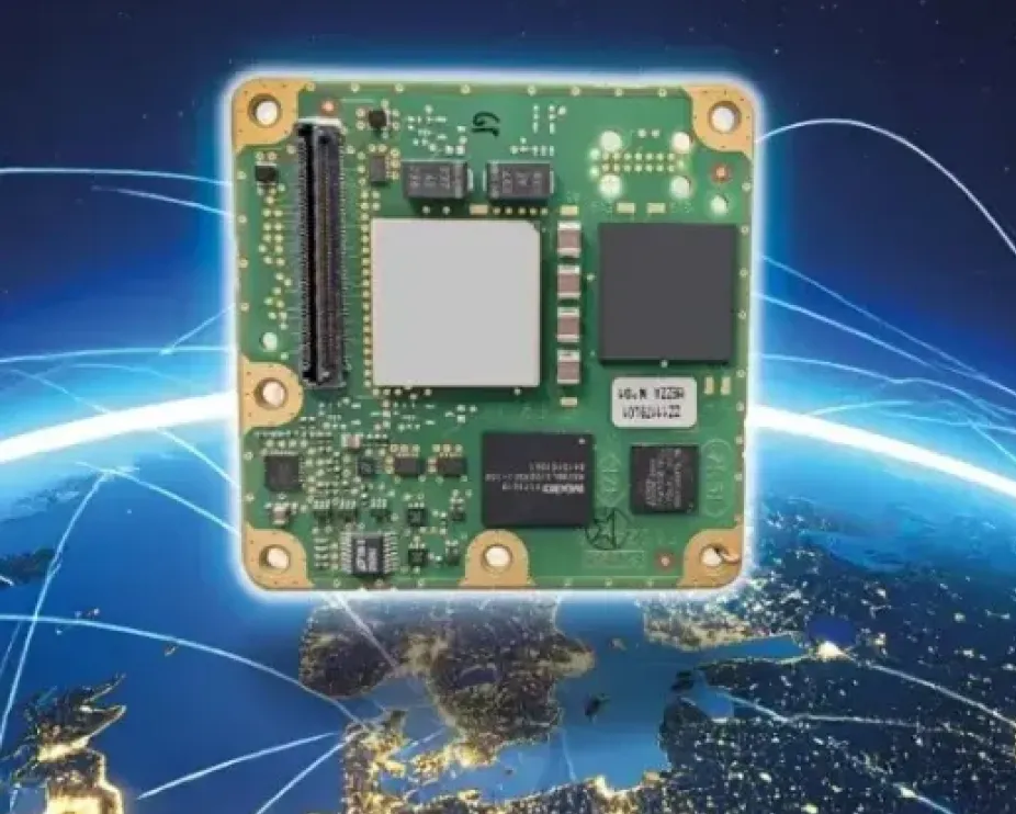
The small-form-factor Galileo OS (Open Service) or PRS (Public Regulated Service) sensors are designed to enhanced GNSS receivers and resilient multi-sensor navigation systems, ensuring safer and more reliable satellite-based navigation.
The Galileo PRS core module integrates a certified, single-chip, application-specific integrated circuit (ASIC) security module that incorporates all the necessary Galileo PRS security and navigation functions. It provides dual-frequency (E1/E6) iono-free Galileo PRS positioning, velocity and timing services. It also provides pseudorange and delta pseudorange raw data, along with GPS C/A (coarse acquisition).
The low-SWaP (size, weight and power) digital solution has been designed to work with any European GNSS receiver manufacturer seeking a standardized, easy-to-integrate Galileo module with which to develop their own GNSS receivers.
Credit: Thales
The modules can meet the requirements of a wide range of applications for manned or unmanned vehicles, combat aircraft, helicopters, high-dynamic missiles, and the navy. Their small form factor also makes them suitable for platforms with size constraints, such as ground vehicles, small drones and guided munitions.
The modules feature standardized interfaces, enabling the Galileo PRS function to be easily integrated into the host system. Furthermore, the TopStar Galileo core module can be embedded with minimum impact by using the analog RF front end of the host receiver.
The Galileo OS core module version enables the early integration of Galileo functionalities into the host system, as well as export to countries not authorized to use PRS. The PRS core module version provides an easy upgrade to Public Regulated Service capability, offering greater resilience against jamming and crucial protection against spoofing.
The war between Israel, the United States and Iran has dominated headlines since it began with surprise attacks launched by Israel and the U.S. on the last day of February. Significant damage has since been inflicted on Iran as the allies seek to end the country’s nuclear capabilities and bring about regime change — removing those responsible for worldwide terrorism through its proxy groups, including Hezbollah, the Houthi movement in Yemen, various Iraqi Shiite militias, Hamas and Islamic Jihad, all of which have targeted Western countries and Israel.
Iran maintains a formidable military with more than 600,000 active-duty personnel, an estimated 2,000 to 3,000 ballistic and shorter-range missiles, and a significant offensive drone capability. The Shahed series and Mohajer-6 drones have emerged as low-cost kamikaze weapons central to Iran’s arsenal. The Shahed-136 in particular has been supplied in large quantities to Russia for use in its ongoing war against Ukraine and is now also manufactured by Russia, or a version of it is. The Shahed drone has several variants, including the jet-powered, long-range Shahed-238.
Iranian Shahed-136 attack drones, read for launch. (Photo: IMA Media)
With a range of 800 miles to 1550 miles, the Shahed-136 carries an 88-pound warhead which can punch very large holes in buildings, disable oil tankers or warships, destroy equipment on the ground, and kill and injure lots of personnel. It’s possible that those six US servicemen killed and others injured during the early hours of the conflict in Port Shuaiba, Kuwait, were victims of a Shahed kamikaze drone attack.
This is not all bad news: the U.S. has analyzed captured downed Shahed-136 drones and has quickly replicated its own version, the Low-cost Unmanned Combat Attack System (LUCAS), admittedly with a shorter range but just as deadly. It’s reported that the Iranians can build and mass-produce thousands of drones for between $20 and $50,000 each. Nevertheless, the U.S. has now been producing large volumes of LUCAS, and has them to fight in Iran.
LUCAS is already in US volume production. (Photo: US Central Command)
Spektraworks, based in Phoenix, was awarded a $30 million contract, and within 18 months, a redesigned, hardened and autonomously coordinated attack drone — manufactured in the U.S. at a cost of approximately $43,000 per unit — became available in significant quantities and was fielded to U.S. Central Command’s newly formed drone task force, Task Force Scorpion Strike.
The unit was responsible for the Shahed-like drones seen flying over Baghdad in early television coverage as the U.S. offensive got underway.
It marks a notable achievement — delivering similarly designed attack drones, and the destruction they carry, back to Iran, a country that has exported terror to numerous nations for more than 50 years.
Meanwhile, the 2026 RoboBoat Competition took place at Nathan Benderson Park near Sarasota, Florida, drawing 37 high school and university teams. The event challenges students to demonstrate progress in developing autonomously operating marine systems installed on model boats. Benderson Park features a large rowing lake that has hosted Olympic rowing and canoe trials, making it a fitting venue for RoboBoat competitors and spectators.
Teams arrived with a wide variety of model boat designs and technical approaches, navigating through a series of in-water obstacle courses while gaining hands-on experience relevant to future careers. Volunteer support was plentiful, and each team brought cheering crews and technical assistance. Typical tasks included restoring simulated harbor operations, assessing underwater infrastructure and supporting exploration scenarios.
After watching more than 2 hours of posted videos, it is clear that the competition is run by a volunteer student organization. The final-round objectives were not clearly defined, and without commentary, it was difficult to determine whether any team successfully completed the obstacle course — though several boats did navigate between narrow red and green buoys after avoiding a series of posts in the water.
RoboBoat 2026
Nevertheless, it was great to see the whole gathering, many from overseas, and the level of enthusiasm. One guy told the story of how the team’s heavy equipment had survived a long-distance shipment from overseas and arrived almost intact. But during the competition, the quite heavy demo boat sank; it was just a minor setback for him — we’ll learn something and keep going! — was his mantra. As everyone in the industry knows, having your tested, verified, and 100% reliable set-up actually function at a trade show is a major hurdle we’ve all had to overcome. So, it’s good to see these young men and women learn firsthand what it takes to get a prototype to work when it becomes absolutely essential – and of course, to actually make progress and extend their reach towards autonomous robotics.
The U.S. military has been throwing Shahed-like kamikaze weaponized drones back at the country that had not only invented them, but also spread the technology to and through other antagonists, yet now feeling their impact on their own capital city — a significant success for the initial U.S. attack on Iran. And growing and supporting the latest wave of students and their autonomous aspirations at RoboBoat 2026 in Florida. One aspect of UAVs is warlike and deadly, while another is encouraging young engineering candidates towards their dreams of maritime robotic autonomy.
InfiniDome is set to debut its Aura GNSS protection system at XPONENTIAL Europe in Düsseldorf, Germany, March 24-26.
Aura supports two to four antennas and protects two GNSS frequency bands while passing two additional bands. The system can generate up to three nulls per protected band, allowing it to suppress multiple interference sources at once. The product is offered in two configurations: an enclosed version weighing 500 grams and an OEM version at 375 grams, the latter designed for integration into platforms where size and weight are constraints.
The company will also present IroNav, a navigation solution developed jointly with Wonder Robotics that combines InfiniDome’s anti-jamming technology with Wonder Robotics’ visual navigation and autonomy software. The layered architecture is intended to keep autonomous systems navigating when GNSS signals are degraded or unavailable entirely. IroNav is also making its European debut at the show.
InfiniDome recently entered the Indian market through a partnership with Globaz Technologies, which will serve as the company’s official partner in the country. The agreement is aimed at addressing demand for navigation resilience technology in India’s defense and unmanned systems sectors.
XPONENTIAL Europe is scheduled to take place this month in Düsseldorf, Germany.
Austria is breaking new ground in space. BeaconSat is the largest satellite ever developed in Austria and also the country’s first military satellite. The project is being led by Austrian start-up GATE Space, based in Schwechat. Launch is planned for February 2027 aboard a SpaceX Falcon 9 rocket.
BeaconSat is designed to detect and analyze jamming and spoofing attacks on GNSS — targeted attempts to interfere with and manipulate navigation signals such as GPS or Galileo. Austria is responding to a security policy development that has real implications for aviation, transport, energy supply, and military operations.
Attacks on critical infrastructure
Jamming and spoofing incidents are frequent in geopolitically tense regions. In aviation, repeated disruptions have affected civilian aircraft.
“Space is now a central component of Europe’s and Austria’s security and defense strategy,” said Major General Friedrich Teichmann, head of the ICT and Cybersecurity Center. Navigation signals have long been part of critical infrastructure, and securing them is therefore of great strategic importance.
However, many of these attacks remain invisible. Countries often do not know where the interference is coming from, how systematic it is, or what pattern lies behind it. This is where BeaconSat comes in.
Technology demonstrator with strategic dimension
BeaconSat will systematically detect and analyze GNSS interference signals from orbit for the first time. The aim is to obtain data on when and where navigation systems are being deliberately disrupted. The mission is designed as a multi-year research and development project.
“It is important that we are able to act independently in terms of communication and navigation when necessary. This is a question of resilience and military capabilities,” emphasized Defense Minister Klaudia Tanner. “Space is an essential part of military capability.”
The satellite is not intended to be an isolated military project, but rather a demonstrator. Civil space technologies are being further developed for security-related applications and tested under real-world conditions. The findings will be incorporated into the operational processes of the Federal Ministry of Defense (BMVL).
Austrian industry at the center
GATE Space has overall responsibility for the project. Founded in 2022, the spin-off from TU Wien develops chemical propulsion systems for satellites and currently employs around 27 people. For BeaconSat, the company is supplying the propulsion system, the satellite structure, and the thermal management system, among other things.
“With BeaconSat, we are making a direct contribution to Europe’s security. The market for such capabilities is huge,” said Managing Director Moritz Novak.
The engines were tested in more than 8,000 hot runs at the site near Vienna Airport, both under atmospheric conditions and in one of Europe’s most powerful vacuum chambers.
GATE Space was supported by the Federal Ministry for Innovation, Mobility, and Infrastructure (BMIMI) through Austria Wirtschaftsservice (aws) with funding of around 750,000 euros.
Jamming and spoofing detection
A central contribution to the payload comes from the Graz-based company IGASPIN, which develops systems for the precise detection and analysis of GNSS interference. Additional components, including the on-board computer, are supplied by the Danish company Space Inventor.
At the European level, the mission is supported and co-financed as a technology demonstration via the European Space Agency’s ESA Marketplace. Off-the-shelf systems are specifically used to test commercially available technologies under security-relevant conditions.
New space chapter in the Ministry of Defense
BeaconSat also marks a turning point institutionally. The BMLV is currently setting up its own organizational unit for space services. The focus is on three areas: satellite communication, satellite navigation, and satellite-based reconnaissance.
“These space services are key to cross-domain operations and make a substantial contribution to the Austrian Armed Forces’ modern reconnaissance, command, and control network,” Teichmann said.
BeaconSat will provide data that will be directly integrated into military decision-making processes. At the same time, the project contributes to European resilience: those who recognize threats early on can respond diplomatically, politically, or technically.
Space as a growth area
The strategic importance of space technologies is growing both in terms of security policy and economics. Austria has recently increased its contribution to the ESA from 260 to 340 million despite budgetary constraints. Space and aviation technologies are anchored in the government’s industrial strategy as one of nine key technology fields.
Satellites have long been considered critical infrastructure. They enable navigation, communication, Earth observation, climate monitoring, and security applications. At the same time, new markets are emerging in the areas of propulsion systems, data analysis, and dual-use technologies.
With BeaconSat, Austria is repositioning itself in terms of security policy and industry. The project is an example of how startups, established technology companies, ministries, and European partners can and must work together successfully.
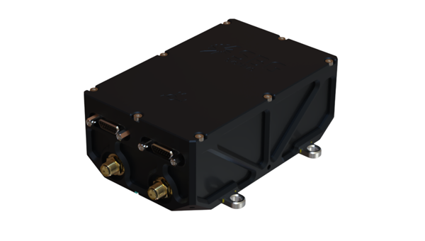
With full multi-constellation, multi-frequency GNSS signal protection, the GAJT-AE3 provides assured positioning, navigation and timing (PNT)
Hexagon | NovAtel has launched the latest addition to its battle-proven GNSS Anti-jam Antenna Technology (GAJT) lineup: GAJT-AE3. The GAJT-AE3 emerges in response to the escalating power and sophistication of jamming techniques that disrupt satellite-based navigation systems, a concern highlighted by current worldwide geopolitical conflicts.
As jammers become more powerful and low cost, with the capability of targeting a wider range of GNSS frequencies, there is a critical need for next-generation functionality and reliability.
To address this, the GAJT-AE3 protects all major GNSS constellations with full multi-constellation, multi-frequency coverage. This significant advancement in jamming protection — in a compact format — ensures reliable PNT in demanding airborne environments.
“This is a revolutionary expansion in our battle-proven anti-jam solutions designed specifically for space-constrained platforms,” said Stig Pedersen, president, Aerospace & Defence Division, Hexagon. “The GAJT-AE3 offers unparalleled signal coverage and multi-jammer direction finding for superior protection and heightened situational awareness.”
The GAJT-AE3’s antenna electronics mitigate interference by creating up to seven nulls per band in the direction of jammers, providing significant anti-jam protection even in dynamic multi-jammer scenarios. The output is a protected radio frequency signal, free from jamming and suitable for input to modern and legacy GNSS receivers.
Protecting and supporting all GNSS frequencies, including L-band corrections and Iridium PNT, the GAJT-AE3 is an easy-to-integrate, compact unit suitable for use on a variety of platforms, from UAVs to complex weapons. It can be paired with a range of antennas from the Hexagon | Antcom portfolio, including custom options.
Hexagon | NovAtel’s GAJT-AE3 is now commercially available.
CGI, one of the largest independent IT and business consulting services firms in the world, has entered an alliance partnership agreement with Vantor, provider of unified spatial intelligence from space to ground. The companies have signed a Letter of Intent outlining their plans to collaborate on developing next-generation solutions that combine CGI’s advanced artificial intelligence (AI), edge computing and visual analytics expertise with Vantor’s Spatial Intelligence platform Tensorglobe and its Raptor product for navigation and geolocation in GNSS-denied environments.
The collaboration will enhance mission effectiveness and real-time situational awareness across defense, national security and environmental domains. CGI and Vantor will deliver integrated intelligence solutions that combine AI, spatial intelligence, space-based sensing and digital platforms, enabling faster, more informed decision-making in increasingly complex operational environments.
The partnership reflects growing demand for interoperable, sovereign and commercial solutions that strengthen operational resilience in a changing geopolitical and environmental landscape.
“We are bringing together complementary strengths in AI-driven analytics and secure, scalable access to satellite data through this collaboration with Vantor. As governments and industry organisations look to improve resilience and responsiveness, integrating near-real-time space-based intelligence into digital command and control networks will be key to achieving decision advantage,” said John Hanley, Secure Mission Critical Solutions, CGI.
“Collaborating with CGI allows us to extend the reach of Vantor’s technology and apply it to new use cases that demand both agility and precision. Our combined capabilities will help defense and civil government customers derive actionable intelligence faster and more securely, supporting safer operations and smarter use of global data assets,” said Anders Linder, general manager, Vantor International.
The companies seek to develop solutions that fuse CGI Machine Vision and CGI SignalSense platforms with Vantor’s Tensorglobe services to enhance high-precision geo-positioning and imagery analytics. Integration with Vantor’s Raptor products will support users operating in GNSS denied or degraded environments to navigate and position coordinates. The collaboration will pursue opportunities across the UK, Europe, and allied markets for AI-enabled edge computing and space-based situational awareness capabilities.