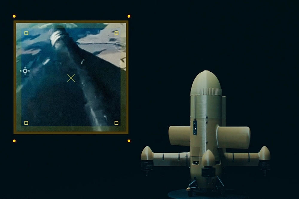
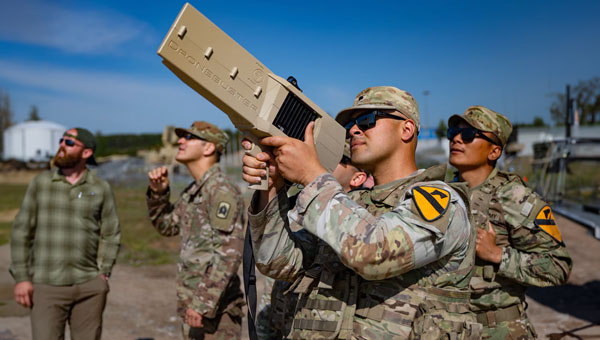
The U.S. Air Force has awarded Trust Automation a $490-million indefinite delivery, indefinite quantity (IDIQ) contract for the rapid research, development, prototyping, demonstration, evaluation, production and transition of unmanned and counterunmanned aircraft system (CUAS) capabilities.
As Trust Automation looks ahead to 2026 and beyond, this program represents a pivotal step in addressing the evolving challenges of modern warfare. Work will be performed at Trust’s facility in San Luis Obispo, California, and is expected to be completed by Aug. 20, 2030.
Image: Trust Automation
“We’re incredibly proud to have been selected for this critical C-UAS project,” said Ty Safreno, Trust’s chief executive officer. “This contract underscores our commitment to developing cutting-edge anti-drone technologies that address our most pressing security challenges, protect our armed forces and contribute to the safety of our nation.”
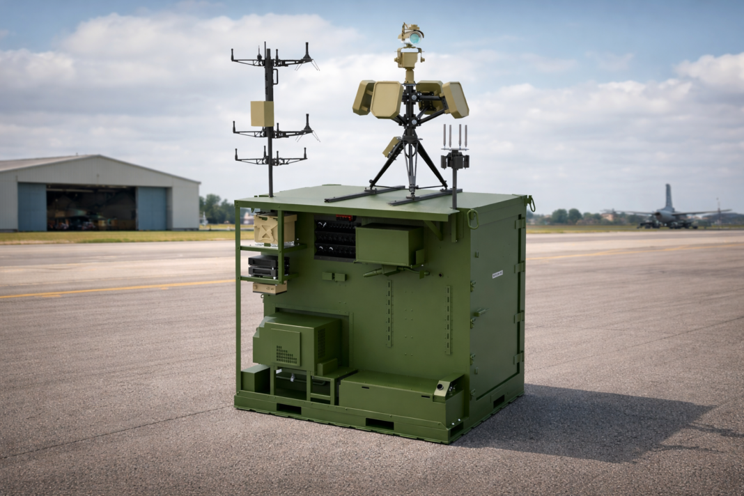
Trust is a field-proven leader in defense and counter-small unmanned aircraft system (C-SUAS) technologies to directly counter UAS activity in C2 and GNSS bands. At the core of its product suite is the Small-Unmanned Air Defense System (SUADS), which delivers fixed-site, such as Air Force base defense operations centers (BDOC), and rapidly deployable protection for key facilities and units in combat zones. These systems provide layered defense with adaptable modular solutions to detect, track and defeat Group 1, 2 and 2+ aircraft threats.
Complementing SUADS is the weapons-mountable GAT UAS Jammer, which enables personnel to directly counter UAS activity in GNSS bands. Together with a broader suite of radio frequency products, Trust equipes warfighters with scalable options to secure critical operations against evolving UAS threats.
As Trust Automation rolls into 2026, the company remains dedicated to its mission to deliver innovative, reliable and mission-critical technologies that empower the U.S. Air Force and other defense partners to stay ahead of emerging threats.
As the news subsides on the U.S. operation in Venezuela to capture Nicolás Maduro and his wife, attention is now turning to the legal aspects of the prosecution. Nevertheless, this military undertaking was apparently extremely complex and involved very discreet initial persistent surveillance of not only Maduro’s location but also of a large number of military installations and facilities.
Venezuela has acquired an extensive arsenal of sophisticated Russian air defense capabilities beginning in 2011 and which were apparently recently upgraded in 2024. Heavy damage during the U.S. operation at La Carlota Air Base in Caracas, Fort Tiuna Military Complex, La Guaira Port and El Higuerote Airport appears to have overcome not only surface-to-air anti-aircraft missile systems but also Su-30 Sukhoi Flanker fighter aircraft armed with air-to-air missiles.
And how was this accomplished? Well, likely with the help of legendary Lockheed RQ-170 Sentinel Stealth Drones. Nothing in the classified operation has been positively confirmed, but it is known that one or two of these surveillance drones were videoed returning to Naval Station Roosevelt Roads in Puerto Rico in the early morning of Jan. 3 following the U.S. attack. And piecing together earlier photos of U.S. Latin American command with an RQ-170 operations operative, pundits now believe confirm RQ-170 involvement.
The 30th and 44th Reconnaissance Squadrons at Wing at Creech Air Force Base in Nevada are the only units the Air Force has confirmed to be operating RQ-170s Wraith low-observable stealth drones.
It’s therefore quite possible that when President Trump said, “I was able to watch it in real time, and I watched every aspect of it,” that the video link may have been supplied by one or more of the RQ-170 Wraith drones circling over the action on the ground.
Another aspect of the Venezuelan operation comes from people on the ground in Caracas who reported a number of instances of “flying bombs” which fell on targets during the U.S. operation. Video clips and numerous personal accounts apparently supported the reports that prop-powered attack drones were being crashed into ground targets, followed by big explosions.
And previously on Dec. 16, the U.S. had a “first” for the U.S. Navy to have launched a one-way attack drone from the deck of the USS Santa Barbara in the Arabian Gulf. These earlier reports indicated that these attack drones could be launched by catapult, using rocket assist and from mobile ground vehicles.
Therefore, it is not much of a leap to say it’s very likely that other marine and ground launch facilities in and around Venezuela dispatched many one-way, likely semi-autonomous attack-drones to take out targets prior to Delta Force being helicoptered in to capture Madura.
Meanwhile back in the U.S., well away from military action, the Federal Communications Commission has effectively banned the sale of any new UAS or parts for UAS being imported into the U.S. The ruling was developed after the White House initiated a review aimed at protecting American security which decided “that UAS and UAS critical component parts that are produced in foreign countries pose unacceptable risks to the national security of the United States and to the safety and security of U.S. persons.”
To somewhat clarify the situation, the FCC just added exemptions for Pentagon-approved “Blue List” drone models and parts thereof from EagleNXT, Parrot, Teledyne FLIR, Neros Technologies, Wingtra, Auterion, ModalAI, Zepher Flight Labs and AeroVironment — imports from these suppliers will be allowed through the end of 2026.
So with new models of foreign drones being prevented from entering the U.S., the U.S. drone industry has been granted, at least for the moment, an opportunity to develop leading UAS models which will eventually outpace existing foreign drones operating in the U.S. It’s predicted that the FIFA soccer World Cup this summer will need a lot of drone coverage for security purposes — possibly a new U.S. drone home market.
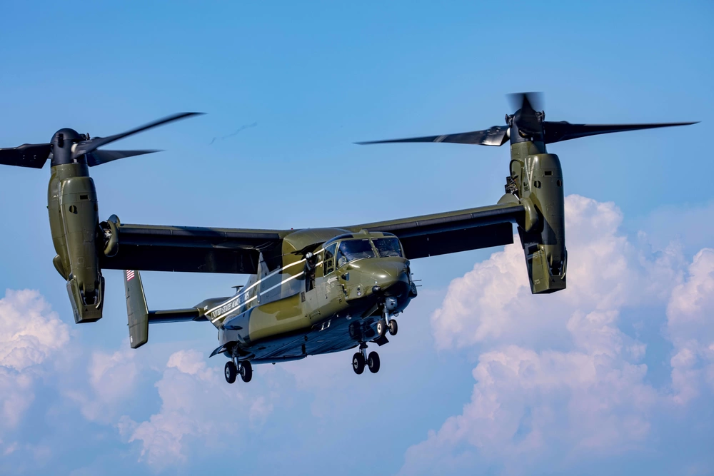
The Bell-Boeing V-22 Osprey is a complex military tilt-rotor aircraft which overcame many hurdles in its development and initial operations phase, even having some incidents during its mature field operations.
Nevertheless, the Chinese appear to have adopted a similar design approach for the Lanying R-6000 manned/unmanned tilt-rotor 6-12 passenger eVTOL and a 2-ton-cargo transport version. The promotional video for the Chinese United Aircraft R-6000 seems to interchange shots of the V-22 in hover mode with recent R-6000 prototype system in hover flight. However, Bell-Boeing web statements disclaim any linkage with the Chinese company or its R-6000 development.
If the name “United Aircraft” seems familiar, it’s because there was such a company in the U.S. in the 1930s, changing its name to United Technologies (Pratt & Whitney) in 1975, now RTX Corp.
United Aircraft in China has apparently been around since 2012 and has produced a number of vertical lift aircraft, including the TD220 twin-coaxial helicopter (without tail boom). As with most large industrial companies in China, this one also seems heavily engaged with the Chinese military and is now making inroads into the civilian marketplace with a number of UAVs for various applications, leading up to the projected 550 mph Lanying R-6000, which has been depicted in low-level flight mode.
Promotional image of eVTOL Lanying R-6000. (Photo: United Aircraft)
So, a mixed bag of unmanned aircraft reports this month, ranging from drones likely used in the recent U.S. action in Venezuela, FCC rulemaking to restrict imports of foreign UAVs into the U.S., and all the way to a new potential Chinese tilt-rotor eVTOL entrant.
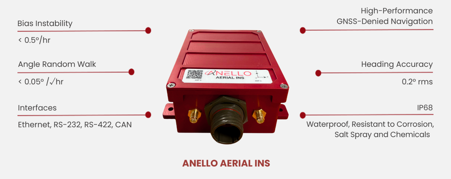
Anello Photonics has launched the Anello Aerial inertial navigation system (INS), a compact, high-performance inertial navigation system built around the company’s Silicon Photonics Optical Gyroscope technology and integrated with multi-band GNSS receivers.
Anello made the announcement at CES 2026, taking place this week in Las Vegas.
The Anello Aerial INS is built for demanding aerial platforms — including BVLOS UAS, maritime/shipborne VTOL UAS, ISR/special-mission aircraft, heavy-lift and cargo drones, and other autonomous aerial vehicles. The system is powered by an advanced EKF-based sensor fusion engine and ANELLO flight-profile-tuned algorithms, consistently delivering >98% navigation accuracy without the need for cameras or fiber-optic cables.
The Anello Aerial INS delivers <0.5 deg/hr unaided heading drift, maintaining accurate navigation and control through high-dynamics and GNSS jamming, spoofing, or occlusion. Anello’s navigation solutions are built to deliver assured performance in fully GNSS-denied environments — whether operating over water or desert corridors, in night or low-light missions, or through fog and cloud cover — maintaining precise guidance without GPS and enhancing warfighters’ effectiveness and survivability.
“Customers flying real missions need resilient navigation when GPS isn’t reliable,” said Mario Paniccia, co-founder and CEO of Anello Photonics. “By combining our SiPhOGs with our airborne-optimized sensor-fusion algorithms and integrated multi-band GNSS, the Anello Aerial INS delivers accurate navigation solutions in a cost-effective SWaP-friendly package. This allows UAVs to hold course through GPS jamming, multipath, spoofing, or outages using only Anello without the need for cameras or fiber-optic cables and allows the warfighter to complete their mission safely and successfully.”
ANELLO’s full product portfolio has been developed in close collaboration with customers and verified through comprehensive integration and mission-platform testing.
The Anello Aerial INS is available for evaluation today with production shipments beginning in the second quarter of this year. Evaluation kits include the Anello Aerial INS, cabling, drivers for PX4/ArduPilot, and a quick-start integration guide.
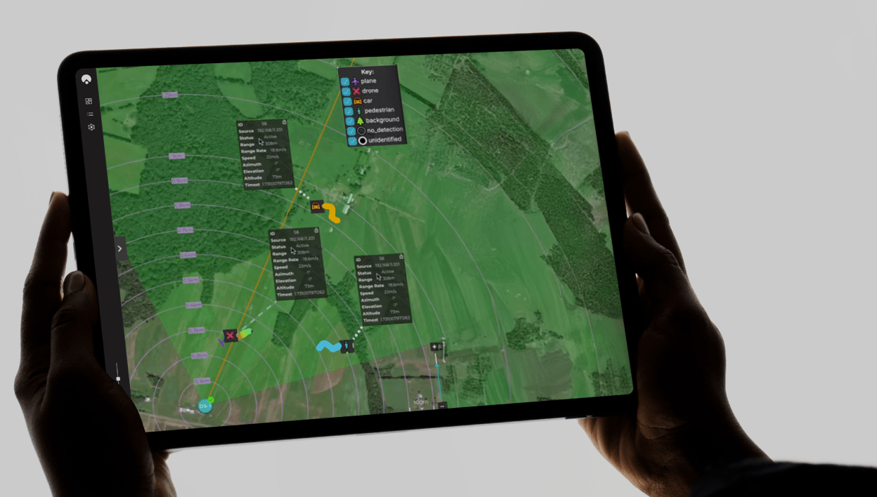
Winners of the U.S. defense Counter-small Unmanned Aircraft System (C-sUAS) Low-Cost Sensing (LCS) challenge have been announced.
MatrixSpace Inc. was selected as the overall winner and will receive the top award of $500,000. Following the overall winner, the top three performers — Guardian RF, Hidden Level and Teledyne FLIR Defense — will each receive award amounts of $100,000.
The selected systems secured a place among the 10 finalists who advanced to live testing during USNORTHCOM’s Falcon Peak 25.2 exercise, outperforming 115 submissions. The system demonstrated capability in detection, classification, localization, scalability, cost and integration readiness.
Sponsors of the award include Defense Innovation Unit (DIU), U.S. Northern Command (USNORTHCOM), Joint Interagency Task Force 401 (JIATF-401), U.S. Army, U.S. Navy, U.S. Marine Corps and U.S. Indo-Pacific Command.
“Small UAS threats are evolving faster than traditional acquisition cycles, and meeting that challenge requires capabilities that can be deployed at speed and scale,” said David Payne, acting director of DIU’s Autonomy Portfolio. “The selected solutions show how commercial innovation can strengthen our layered defense — delivering affordable sensing that we can field widely, adapt quickly, and keep the warfighter ahead of the threat.”
The MatrixSpace platform combines ultra-low SWaP-C radar, AI-driven edge intelligence, and distributed networked CUAS powered by AiCloud. During the evaluation, it successfully detected, tracked and classified every sortie flown —including RF-dark fiber FPVs, commercial drones, and custom-built UAVs.
A scalable, distributed approach to counter-UAS sensing
The LCS challenge, launched in May 2025, was designed to complement existing sensor systems by identifying emerging technologies that enable broad, distributed, and resilient sensing architectures. During FP 25.2, the 10 selected finalists demonstrated solutions spanning radio frequency passive detection, active radar, acoustic sensing, optical and infrared modalities, and hybrid systems.
These technologies collectively showed potential cost savings of 50–80 percent in total cost of ownership, while still meeting key coverage and performance requirements for C-sUAS defense.
During live testing, vendors were evaluated against a variety of small UAS flown both individually and in coordinated multiples, employing diverse communication protocols. Finalists were not informed which platforms or profiles they would be tested against, ensuring performance was measured under realistic, un-scripted, and operationally relevant conditions.
Evaluated by experts and end-users, against a rigorous selection criteria,challenge winners differentiated themselves by demonstrating tailored technical strengths, high performance against threat-representative UAS targets and demonstrating a cost-effective architecture enabling deployment at scale across fixed, mobile, and austere environments.
About the LCS Challenge
The Counter-sUAS Low-Cost Sensing (LCS) challenge sought to identify emerging sensor solutions that could:
expand detection coverage
reduce total lifecycle cost
integrate seamlessly into joint C2 architectures
provide the resilience and redundancy required to counter small UAS threats.
Launched in May 2025, the challenge drew participation from traditional and nontraditional vendors across the country, representing the full spectrum of sensing modalities. The Falcon Peak 25.2 exercise provided a realistic environment to evaluate these capabilities under operationally relevant conditions.
For more information about DIU’s work accelerating commercial technology into the Department of Defense, visit www.diu.mil.
The latest generation of Safe Pro’s AI technology will be presented at U.S. Army exercise at Fort Hood, Texas
Safe Pro Group, a developer of artificial intelligence (AI)-enabled defense and security solutions, has deployed upgraded AI algorithms to its patented Safe Pro Object Threat Detection (SPOTD) technology for drone operations in GPS-denied environments.
The newly enhanced SPOTD capabilities will be prominently featured at the upcoming U.S. Army 2026 Concept Focused Warfighter Experiment (CFWE) technology demonstration taking place at Fort Hood, Texas.
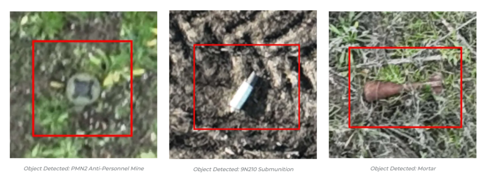
Operating on the Amazon Web Services (AWS) Cloud or at the Edge, SPOTD is Safe Pro’s patented rapid battlefield image analysis platform designed to identify and map small explosive threats such as landmines and ambush drones detected in videos collected from virtually any drone.
The ability for SPOTD to rapidly detect threats and create 2D/3D models from drones flying in GPS-denied environments was developed after real-world exercises in Ukraine at the request of end users. The integration of these new algorithms further enhances the value of SPOTD as a situational awareness tool for use in a wide array of military reconnaissance and planning operations.
SPOTD enhancements include:
Ability to process any drone video data: Turning video clips into 2D and 3D models with AI-trained explosive threat detections
Enhanced operational robustness: Operating capability in GPS and GPS/GNSS denied environments
Terrain modeling: Threat and terrain mapping in support of unmanned ground vehicles (UGVs) route planning
Rapid mapping-only mode: Mapping for intelligence, surveillance and reconnaissance (ISR) and missions that do not require AI-powered threat detections
Accelerated processing: Up to 10x reduction in processing time powered by Safe Pro’s proprietary geospatial AI algorithms.
Powering the company’s SPOTD technology is Safe Pro’s unique real-world datasets, which include high-resolution drone imagery and GPS-tagged geospatial data encompassing more than 2.2 million drone images analyzed to date, and 41,400+ threats identified across 11,400 hectares (28,000+ acres).
It’s always good news when we hear about NASA’s “out-of-this-world” next steps toward building a replacement for Ingenuity, the small Mars helicopter-drone. With 72 flights over 1,004 days, Ingenuity outlived NASA’s expectation of just 30 operational days on Mars. It ended up serving as a trailblazer for the SUV-sized Perseverance rover as it worked its way around Jezero Crater. Built with a large number of smartphone components, it’s actually amazing that this thing survived for so long, given the radiation environment on the surface of Mars, along with the harsh temperature extremes of daytime 32°F to nighttime minus 130°F. How a Samsung S5 phone battery survived, operating so far outside its design temperature range, is hard to fathom.
NASA’s 20-year plan for future Mars exploration now looks to take advantage of the huge expansion of the envelope for exploration that the small 30-day Mars helicopter brought to the Perseverance mission: “Enhanced mobility systems will enable exploration of challenging terrains and increased operational range. Aerial mobility technologies will facilitate access to previously unreachable areas on Mars.”
NASA drone flies over Mars Hill in Death Valley during recent navigation tests. (Photo: NASA/JPL)
So now NASA is working on the next Mars rover mission and on improvements for its accompanying airborne support. A team recently took three commercial drones into Death Valley to work on overcoming navigation problems that Ingenuity encountered on Mars flying over “bland” terrain with few visual features for its optical navigation system. Sand dunes without features on Mars messed with Ingenuity’s navigation solution, including on its 72nd flight.
Death Valley and Mesquite Flats Sand Dunes were two places the NASA team visited to test improved navigation algorithms installed on existing commercial drones, and they found some improvements by adding camera filters. The new software helped find landing spots in cluttered terrain.
But now new initiatives are seeking ways to get crewed flights to Mars in the next couple of years, well ahead of NASA’s timetable, which doesn’t move to anything crewed until around 2030. NASA still seems to prefer to pursue landers to gather much more data on Mars before risking crewed flights. Robotic dogs are also being investigated that can traverse rugged uphill areas that landers cannot access, as well as a winged glider the size of a small school bus.
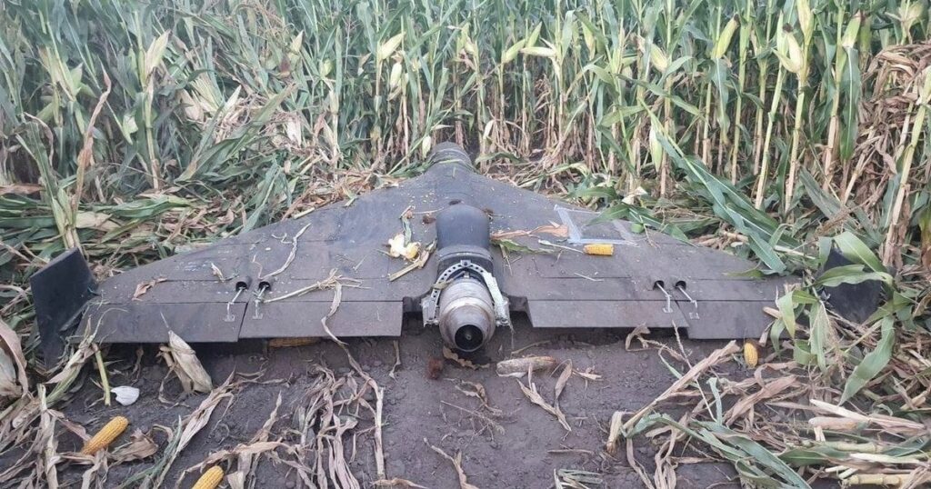
Meanwhile, the never-ending Russia-Ukraine war rages on, dominated by drone attacks from both sides. Russia is increasingly using Iranian Shahed or the equivalent Russian-produced Geran-2 one-way drones, while Ukraine intercepts them with low-end modified commercial drones. This stalemate has $20,000 Geran-2 drones being brought down by high-speed interceptor drones built for $2,000 to $6,000 — in other words, the cost of attrition might determine the victor.
Russian Geran-3 jet-powered drone downed by Ukraine. (Photo: DIU)
However, Russia has now introduced a jet-powered Geran-3 model that flies at up to 230 mph, which Ukraine has apparently been able to bring down.
As we well know, Ukraine not only regularly receives Western military equipment but also civilian drones in large numbers. But an industrial capability has also been created in Ukraine to design, develop and build high volumes of drones. So it’s not surprising that Ukraine has revealed its own interceptor drone known as Sting.
STING interceptor drone and imagery striking a Shahed drone. (Photo: Wild Hornets Group)
Nevertheless, Sting has four rotor props and should be no match for a Geran-3 flying at top speed, even though Sting is claimed to be capable of 215 mph. The Russian jet-powered drone also apparently comes with anti-jam capabilities and a satellite navigation system, but Russia has yet to field these new drones in large numbers. Of course, Ukraine says it has already developed jet-powered interceptor drones — so the step up to the next level of technology should happen for both sides, but of course, costs increase for both sides, which neither can really afford.
Defense has always affected the speed of development for any technology — government funding and oversight are major incentives for new companies to emerge and for new technologies to be developed. Anduril Industries has recently emerged as a new entrant to the U.S. industrial defense complex, specializing in autonomous systems. Anduril’s products include unmanned aircraft systems and counter-UAS, and they have made big strides in both areas.
Anduril is a relatively new company, initially founded in 2017, so its products are fresh off the drawing board and its product improvement experience is at best eight years. The big U.S. defense contractors have fielded and corrected decades of problems in their high-tech systems, so new generations come with hard-learned design and build understanding. The advantage for Anduril is that they are not bound by the restrictions of a long-established industrial heritage, but this can also mean they may still have a way to go in learned experience.
Nevertheless, in high technology, much is new technology and new software and new approaches to build. So it takes effort to not only make this stuff work but also to make it work reliably.
Anduril builds lots of test articles and rapidly evolves the design through rigorous internal and real-world testing. So it’s not uncommon to see test failures — this is how improvements are developed.
Recent U.S. defense tests that saw crashes at Eglin Air Force Base in Florida drew a lot of bad press, given that the Altius drone had already been battle-tested in Ukraine. However, if the approach of lower cost, high volume and attritable drones is the one we have chosen, it may take a little more time to get maturity into the beast.
Navigation testing for NASA’s next Mars drone, jet-powered attack drones, and evolving interceptor defenses and drones from a new player on the U.S. defense scene — a pretty wide range of unmanned aircraft applications.
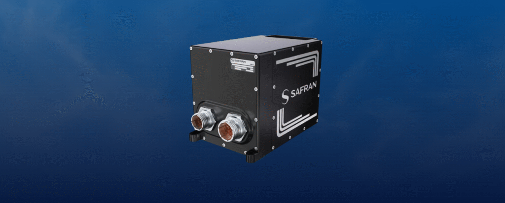
Skynaute is a hybrid inertial/GNSS navigation system based on HRG Crystal technology. It will serve as a critical component of the Hercules avionics suite designed and integrated by Moog.
The Skynaute navigation unit by Safran. (Photo: Safran Federal Systems)
Under this agreement, Safran Federal Systems will supply Skynaute units to support enhanced navigation performance in demanding operational environments.
“Being selected by Moog underscores the reliability, innovation, and mission readiness of our Skynaute solution,” said Tony Full, senior director of Business Development, Navigation Systems, Safran Federal Systems. “This collaboration continues our tradition of delivering precise, resilient navigation technologies to meet the evolving needs of military aviation.”
Skynaute is engineered to meet the needs of both legacy and next-generation military aircraft, providing superior accuracy and robustness with minimal size, weight, and power consumption. The system is suited for retrofit and modernization programs, particularly for platforms like the Hercules that remain integral to global air mobility and tactical transport operations.
Safran Federal Systems supports Safran Defense & Space Inc. (Safran DSI) by providing APNT technologies across a range of defense and aerospace applications.
The United Kingdom has issued a summary of input it requested on positioning, navigation and timing (PNT) technologies. The UK deems PNT resilience critical for the UK’s economy.
After a call for evidence, the UK Department for Science, Innovation & Technology received 128 responses from business, industry, academics and the public. These views on opportunities and challenges for the UK’s PNT industry are gathered in a document available online.
Key themes identified
A viable market exists for GNSS-independent PNT, with respondents citing applications in defense and critical infrastructure.
Awareness of GNSS vulnerabilities in end users and critical infrastructure sectors is low.
Potential opportunities in GNSS-independent PNT and other technologies include eLoran, LEO-PNT, 5G, quantum PNT, inertial systems, and applications for GNSS-denied environments.
Short-term challenges include funding constraints and a lack of legislation and standards.
Long-term challenges include scalability, lack of sovereign manufacturing capability, and insufficient planning .
The industry is experiencing a skills shortage, especially in engineering, with a limited talent pipeline and lack of dedicated training opportunities.
In all, 128 responses were received from businesses (sellers and users of PNT), academics, industry bodies and the public. Respondents could select multiple sectors when describing their background; the defense sector was selected most frequently (39 responses), followed by space (35 responses), aviation and drones (28 responses), maritime (28 responses) and communications (27 responses).
Responses will be used, along with wider research, to inform future government policy interventions to support the UK PNT sector.
The U.S. Army is starting market research for possible sources of an optical tracking solution for its test ranges to use in GNSS-denied environments.
The Army Contracting Command – Orlando issued a Sources Sought Notice Dec. 11 on behalf of the Test Resource Management Center Test and Evaluation/Science and Technology (T&E/S&T) Program.
The Army wants to identify potential sources in the market having the interest, skills and ability to complete a thorough technology study and trade space analysis related to the viability of Time-Space-Position Optical Tracking (T-SPOT) for use on test ranges. The technology would be used as a time-space-position information (TSPI) truth sensor in GNSS-denied environments.
Required capabilities
The primary objective of a T-SPOT prototype effort would be to develop the system architecture, concept of operations, and comprehensive trade space analysis based on the results of modeling and simulation of the future-state system. The intent of the effort would not be to deliver the fieldable system itself but rather to answer whether/how such a system would achieve its performance goals.
A future T-SPOT system should
achieve 3D TSPI accuracy comparable to the accuracy of real-time kinematic positioning (RTK) GNSS navigation systems.
be generated in a near-continuous manner, notionally at an update rate comparable to GNSS navigation systems.
achieve full performance during daylight and in good visibility conditions, with the goal of operating at day and at night and in all-weather conditions.
support temporary and modular integration with airborne systems being tested, operating at altitudes typical for the operation of U.S. Air Force cargo and single-engine training aircraft, with the goal of supporting aircraft closer to or on the ground.
minimize its size, weight and power (SWaP) budget for integration with crewed aircraft, with the goal of supporting integration with small uncrewed aerial systems.
In addition to the sensor hardware hosted on the SUT, a future T-SPOT system should rely on terrestrial features solely comprised of passive landmarks (no active emissions; no required power). The system may employ synthetic landmarks (e.g., purposely installed fiducials) and/or pre-existing landmarks (of either natural or human origin). While the system must operate independently of GNSS, GNSS may be used pre- and post-test (i.e., for landmark surveying).
More details are on the announcement page. The deadline for responses is Jan. 30.
The 5G PNT network in Santa Clara County will mark the first real-world demonstration of a 5G-powered backup to GPS
NextNav Inc., a leader in next-generation terrestrial positioning, navigation, and timing (PNT) and 3D geolocation solutions, will commence operations of a 5G PNT network in Santa Clara County, California, as early as Dec. 11.
Network operations of positioning, navigation and timing applications represent the next milestone toward commercial readiness and the mission to deliver a resilient complement to GPS.
The 5G PNT network will consist of multiple fixed base station locations using a standards-compliant 5G signal with a positioning reference signal (PRS) enabled, a standalone 5G core, and NextNav’s 3D PNT architecture. The network’s authorized technical parameters will align with those in NextNav’s proposal to optimize the lower 900 MHz band to enable a terrestrial, widescale backup to GPS that is broadly available to critical infrastructure, public safety and American consumers.
“We’re incredibly pleased to continue demonstrating our technology in a real-world operational environment,” said Mariam Sorond, CEO of NextNav. “Activating this network is a critical step in our commercialization process, proving that robust 5G broadband service and high-integrity PNT can be delivered together, at scale, using standard 5G equipment.”
The 5G PNT network will validate NextNav’s 5G PRS-based PNT end-to-end architecture under real-world conditions.
“This is the first public demonstration of a full-scale and operational 5G-based PNT in live deployment, delivering both resilient PNT and broadband service simultaneously,” said Arun Raghupathy, NextNav Co-Founder and CTO. “Through this commercialization deployment, we’re validating our 5G-based network can deliver accurate 3D location, improved timing synchronization, and enhanced resilience. This real-world deployment is critical to establishing U.S. leadership in next-generation PNT technologies.”
The 5G PNT network will support the broader adoption of 5G-based terrestrial PNT with 5G broadband capabilities for operators, enterprises and ecosystem partners. This deployment will also prove that NextNav’s software solution is ready to scale and deliver commercial PNT while serving the critical national security and public safety needs of the United States.
AeroVironment has integrated its visual navigation system (VNS) kit with the Puma Long Endurance (LE) small unmanned aircraft system, delivering GNSS-denied navigation capability to ensure mission success.
First introduced in 2022 for the Puma 2 AE and Puma 3 AE, the VNS kit uses advanced computer vision and onboard processing to deliver precise, GNSS-independent navigation. Its integration into Puma LE now extends this capability across the full Puma family for greater flexibility and resilience in degraded or denied environments.
“Assured navigation is critical to the mission, especially as GNSS becomes an increasingly vulnerable resource,” said Jason Hendrix, Vice President of Small Uncrewed Systems for AV. “By fusing visual and inertial data in real time, the system enables uninterrupted flight paths, accurate geolocation, and mission continuity in unreliable GNSS regions.”
Using a suite of downward-facing sensors, cameras and onboard computing, the VNS kit performs visual inertial odometry (VIO) to capture and analyze terrain imagery, estimating true aircraft position in real time. The system fuses continuous visual data from the cameras with motion inputs from onboard inertial sensors to calculate precise position, velocity, and orientation — allowing the aircraft to know where it is and where it is going when GNSS is not available. It automatically transitions between GNSS-enabled and GNSS-denied modes with zero pilot input, ensuring uninterrupted mission continuity in contested environments.
In September, AV announced several upgrades to the Puma LE platform that include the integration of a Laser Target Designator and the release of the Universal Gimbal Kit, enhancements that evolve Puma LE beyond ISR into a cutting-edge precision-engagement system.
“Every upgrade to Puma LE, including the addition of the VNS kit and our new laser designator and gimbal capabilities, is driven by one goal: giving the warfighter greater confidence, flexibility, and capability,” said Trace Stevenson, president of Autonomous Systems at AV. “These recent releases are a great example of AV constantly evolving our platforms to ensure they are at the forefront of technology and providing best in class capability to the warfighter.”
The VNS Kit is designed as an add-on option for new Puma 3 AE or Puma LE system orders and as a retrofit kit allowing existing Puma 2 AE, Puma 3 AE, and Puma LE customers to upgrade fielded systems. The compact two-piece add-on installs into existing Pumas with minimal impact on performance and fits within the standard Puma cases for efficient mission packout. The standard Puma LE system weighs 23.8 pounds and offers 6.5 hours of endurance, a 60-kilometer range, is inaudible at 500 feet and features tool-free payload swaps for seamless transitions between intelligence, surveillance and reconnaissance (ISR), targeting, and other mission sets.
Shipborne Measurements Near the Kaliningrad Border
A major new report by GPSPATRON gathered data between June 23 and Oct. 14, aboard a vessel routinely leaving the Port of Gdańsk and performing extended maneuvers in open water.
The vessel conducted multiple offshore measurement campaigns, resulting in a shipborne dataset that provides a far more accurate representation of the true GNSS environment experienced by maritime operators in the Gulf of Gdańsk. It also reveals a level of interference complexity and intensity not visible in a previous coastal study.
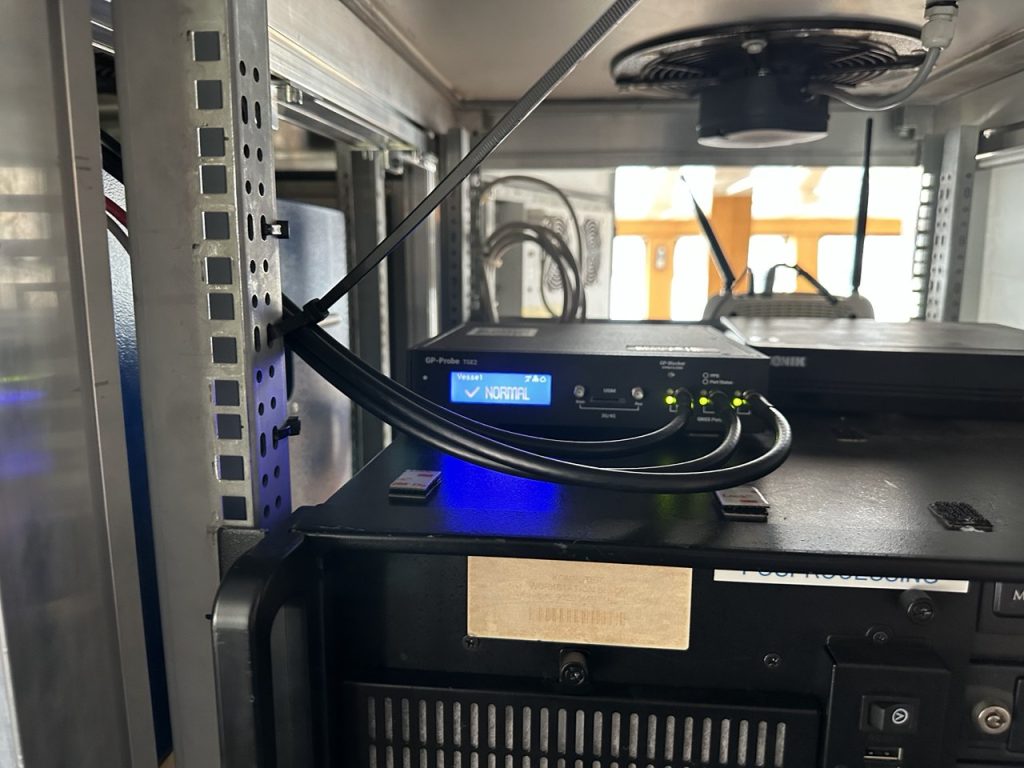
In the present phase of research, the GPSPatron team moved beyond land-based monitoring and installed itsGP-Probe TGE2 interference sensor directly on board a research vessel. The ship operated throughout the southern Baltic Sea, including regular approaches toward the maritime boundary of the Kaliningrad region.
By placing the sensor on a moving platform rather than a coastal location, they were able to record GNSS interference exactly as it affects real vessels — capturing signal conditions that cannot be observed from shore due to differences in radio horizon, antenna orientation, multipath environment, and proximity to potential interference sources.
The GPSPATRON probe TGE2 instaslled within the vessel’s equipment. (Photo: GPSPATRON)
Transition from classical jamming to combined spoofing-jamming interference
In contrast to the previous six-month coastal study, where all recorded GNSS interference consisted exclusively of multi-constellation jamming, the current shipborne campaign reveals a fundamentally different interference landscape.
All major events now present a dual-layer structure composed of:
GPS L1 spoofing, generating forged satellite-like signals, and
Simultaneous jamming of GLONASS, Galileo, and BeiDou.
This combined architecture forces GNSS receivers to rely solely on spoofed GPS signals while denying access to independent ranging sources. The practice is consistent with commonly used operational strategies: spoofing only one constellation (GPS) drastically reduces system complexity and cost, whereas spoofing all GNSS systems would require multiple parallel RF chains, SDR-based generators, algorithms for signal simulations and amplifiers.
Highest recorded levels of GNSS disruption
The most severe interference period occurred from late June through July, during which:
GNSS availability dropped to 83.5%,
4 days, 5 hours and 24 minutes of spoofing were recorded — by far the highest cumulative spoofing activity of the entire campaign.
The single most extreme incident took place between 1 and 3 July, with nearly 30 consecutive hours of spoofing within a 48-hour interval, posing a severe risk for maritime navigation.
In subsequent months the interference intensity gradually decreased, yet low-power and short-duration events continued to be observed.
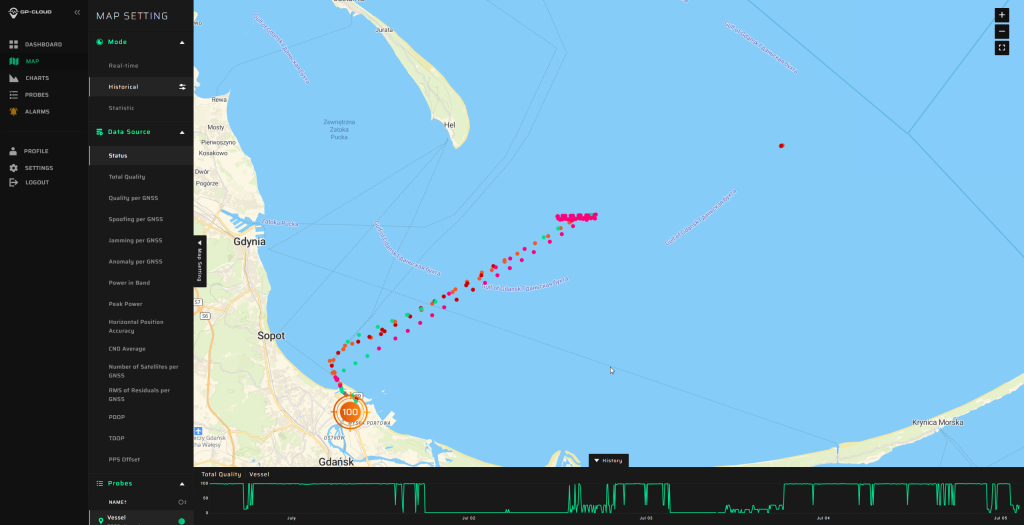
The area of the Baltic Sea the vessel patroled for GNSS interference. (Image: GPSPATRON)
A multi-emitter, synchronously operating interference network
Spectrogram analysis reveals that the interference does not originate from a single source but from four distinct, technologically different emitters operating in coordination:
The synchronous activation and termination of all four components indicate a centrally coordinated system, yet their differing spectral signatures, bandwidths, and stability levels confirm multiple spatially separated stations rather than a single unified installation.
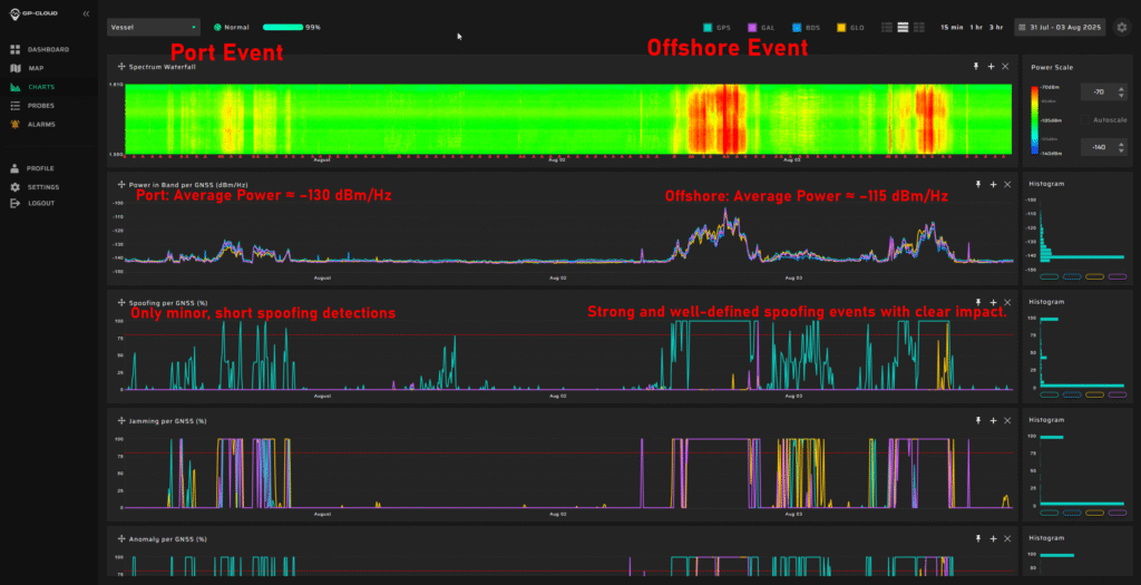
This GNSS interference analysis shows interference intensity increases away from port. (Image: GPSPATRON)
Evolution of interference modulation techniques
A clear shift is observed compared to the previous study :
Previously, the dominant interference source consisted of a high-quality, purpose-engineered wideband signal with three clean constellation-matched components — an indication of modern, precisely designed jamming equipment.
In the current campaign, the prevailing interference is simpler wideband chirp jamming, a less advanced technique but deployed at significantly higher power levels.
The wideband analog-like component further shows pronounced parasitic frequency fluctuations, characteristic of older low-stability RF hardware.
This indicates a shift from high-precision jamming to a mixed environment of legacy high-power systems combined with newer spoofing capabilities.
Interference strongly intensifies offshore
A distinct spatial gradient was recorded:
In the Port of Gdańsk, interference appears weak or barely detectable.
As the vessel moves into open water, the same signals become up to 15 dB stronger.
The interference power consistently increases when approaching the waters facing Kaliningrad.
This pattern shows that — intentionally or not — the interference system affects maritime traffic far more than coastal infrastructure, with the operational impact being greatest in offshore navigational zones.
Download the full report using the form on this page.