Category: Defense

  • DT Research’s new military-grade tablet has RTK GNSS

    DT Research’s new military-grade tablet has RTK GNSS

    DT Research has released the DT301T rugged RTK tablet (DT301T-RTK), a lightweight military-grade tablet purpose-built for GIS mapping applications. It features real-time kinematic (RTK) satellite navigation to enhance the precision of GNSS position data.

    The tablet enables 3D point cloud creation with centimeter-level accuracy, meeting the high standards required for scientific-grade evidence in court.

    The DT301T-RTK is a rugged tablet with scientific-grade GNSS. (Photo: DT Research)

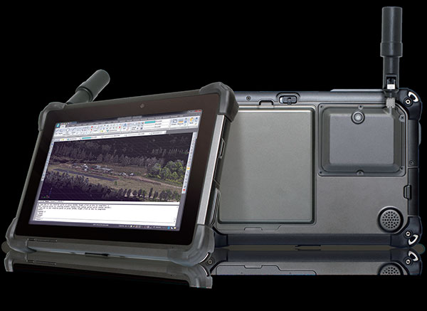
    The DT301T Rugged RTK tablet is military-grade with an IP65 rating. Because it’s lightweight, the DT301T can be used in the field, office and vehicles, the company said.

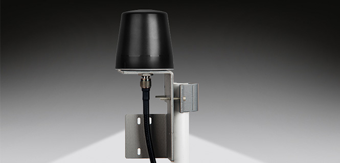
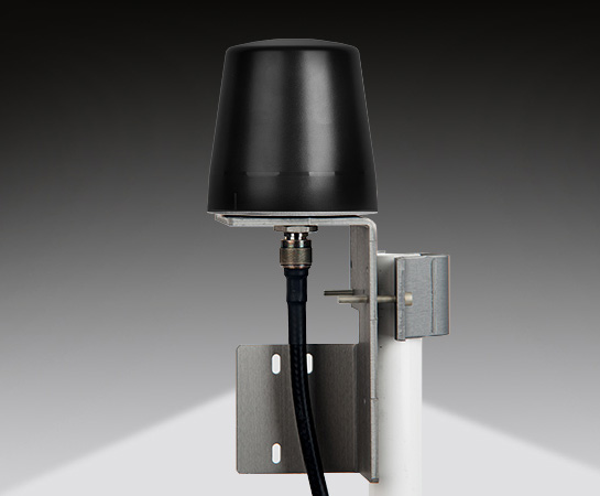
    A dual-frequency GNSS module is built into the tablet, which uses real-time reference points within 1–2-centimeter accuracy to position 3D point clouds created from aerial photogrammetry, using GPS, GLONASS and Galileo receivers. Users can measure with the RTK GNSS positioning directly using a foldable antenna or connect to an external antenna for more robust receiving and survey-grade precision.

    “We’ve seen a dramatic uptick in the need for rugged tablets to be purpose-built for a range of mapping uses across industries,” said Daw Tsai Sc.D., president of DT Research. “In designing the DT301T with RTK satellite navigation, we also took into consideration the other features and capabilities necessary within a rugged tablet to quickly and easily conduct forensic mapping, land surveying, e-construction, building information modeling (BIM) and other mapping scenarios.”

    The DT301T is compatible with existing GIS software for mapping applications and brings together the advanced workflow for GIS data capture, accurate positioning and data transmitting.

    Uses

    According to DT Research, the tablet can be used in a variety of scenarios.

    Forensic mapping. Public safety teams, investigators and crash reconstructionists can use the DT301T Rugged RTK tablet to accurately collect measurements that are scientifically defensible by using the real-time centimeter reference points to position 3D point clouds created from aerial photogrammetry or take stand-alone measurements.

    DT301T-RTK tablet during forensic mapping training. (Photo: DT Research)

    The results will have the precision necessary to stand up as evidence in court, said Andrew S. Klane, a former Massachusetts State Police Lieutenant who teaches Forensic Mapping and is now the chief operating officer at Forensic Mapping Solutions Inc.

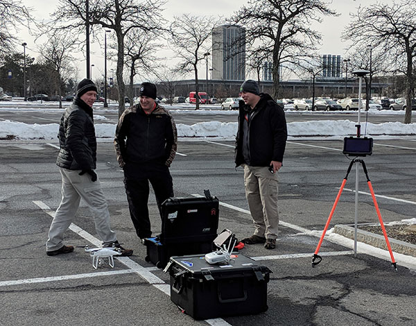
    “As more drones are being used for mapping, there is a growing need for ground-control positioning devices,” Klane said. “By using a DT301T Rugged RTK Tablet in combination with a drone, users can more quickly and cost-effectively create a 3D model to deliver an accurate representation of the scene with scientific-grade tolerance that will hold up in a court of law.”

    It could also help clear crash scenes faster, restoring the normal flow of traffic on congested roadways, reducing secondary crashes and lowering the chance of first responders and other workers getting hurt while clearing the scene.

    Land surveying. Surveyors can use the DT301T tablet to measure the altitudes, angles and distances on the land surface so that they can be accurately plotted on a map to determine property boundaries, construction layout and mapmaking.

    E-construction. Construction workers can manage the collection, review, approval and distribution of highway construction contract documents in a paperless environment using the DT301 tablet.

    Building information modeling (BIM).  Architecture, engineering, and construction (AEC) professionals can use the tablet to create 3D models to efficiently plan, design, construct and manage buildings and infrastructure.

    FEATURES

    The DT301T Rugged RTK tablet has been purpose-built for precision mapping in a variety of environments and includes the following features and capabilities:

    • Dual-frequency GNSS module: GNSS L1 and L2 RTK that receives GPS, GLONASS and Galileo signals up to 372 channels with RMS 10 mm + 1 ppm accuracy.
    • High-performance CPU and Windows OS: Intel 6th-generation core i5 or i7 processor with Microsoft Windows 7 Professional or Windows 10 IoT Enterprise. Units come with either 8 GB or 16 GB of RAM.
    • Sunlight-readable display: A 10.1 inch LED-backlight, sunlight-readable screen with capacitive touch and 1920 x 1200 resolution.
    • Wireless connectivity: Long-range Class 1 Bluetooth powers connectivity up to 1,000 feet and 4G mobile broadband for LTE, HESPA+, GMS/GPRS/EDGE, EV-DO, Rev A and 1xRTT.
    • Storage: For field data collecting, the tablet can store up to 1 terabyte of data.
    • Military standards: The tablet is fully ruggedized to meet the highest durability standards with an IP65 rating, MIL-STD-810G for vibration and shock resistance, and MIL-STD-461F for EMI and EMC tolerance.
    • Battery pack: High-capacity hot-swappable battery pack delivers 60 or 90 watts for up to 15 hours of continuous mobile communications.
    • Accessories: Those available include external antennas, pole mount cradles, detachable keyboards, battery charging kits and digital pens.
  • Movement grows against killer robots

    The miniature UAV, smaller than a human palm, zips right to its human target — identified through facial recognition technology — and pierces the forehead with a projectile, for an instant kill.

    That harrowing scene takes place in a seven-minute viral video issued by autonomousweapons.org, a non-profit sounding warning bells over potential automation of weapons. Its Campaign to Stop Killer Robots (#BANKILLEROBOTS) seeks a preemptive international ban on “fully autonomous weapons which enable strikes to be carried out without human intervention.”

    “Allowing machines to choose to kill humans will be devastating our security and freedom,” warns Stuart Russel, professor of computer science at the University of California at Berkeley, on the video.

    What feels like science fiction to those of us raised on the Terminator franchise could be closer than we think. Because of this, a new U.S. Army report emphasizes the need to develop countermeasures against swarming drones and other unmanned weapons.

    The Army and U.S. Department of Defense have invested significantly in technologies in response to these threats, often focusing on detecting radio frequency transmissions of the UAVs or their operators.

    However, as the report points out, today’s consumer and customized UAS increasingly can operate without radio frequency command-and-control links by using automated target recognition and tracking, obstacle avoidance, and other capabilities enabled by software.

    The U.S. Army discusses the pros and cons of autonomous weapons in a June 2017 article in Military Review, saying an international ban should be considered on “fully autonomous weapons with missions that cannot be aborted and that cannot be recalled once they are launched. If they malfunction and target civilian centers, there is no way to stop them.”

    Sobering thoughts about a future that may not be too distant.

  • Orolia to acquire Talen-X to enhance Assured PNT offerings

    Orolia to acquire Talen-X to enhance Assured PNT offerings

    Orolia, a resilient positioning, navigation and timing (PNT) company, has entered into a definitive agreement to acquire Talen-X.

    Talen-X is a U.S. technology innovator with the ability to characterize, enhance and implement advanced techniques and products to solve real-world GNSS vulnerability problems. It has expertise in GPS/GNSS performance, requirements, testing, integration and threat mitigation.

    Orolia has completed 10 acquisitions since 2007, including Spectracom, Spectratime and McMurdo brands. The transaction is subject to customary closing conditions and approvals required by the U.S. Defense Security Service (DSS) and the Committee on Foreign Investment in the United States (CFIUS).

    Through this acquisition, Orolia said it will significantly enhance Assured PNT capabilities across the global company’s portfolio to support mission-critical applications. The additional resources also strengthen Orolia’s commitment to serving the U.S. government, with further expansion of domestic capabilities and a greater U.S. footprint. Toward that end, the companies will reinforce their commercial cooperation to maximize market awareness and access.

    “Military personnel know that accurate and trusted time and position information is a critical enabler for almost all warfighting functions and systems,” said Orolia CEO Jean-Yves Courtois. “Reliable PNT data are critical for communications, sensors, network synchronization, situational awareness, command and control or search and rescue missions. This acquisition reinforces Orolia’s position as a major supplier of Assured PNT technology and enhances our ability to offer unique end-to-end solutions.”

    Talen-X has extensive technology integration and PNT engineering resources that will enable Orolia to rapidly develop and offer new, superior products and services to the U.S. market.

    “Our culture of innovation, together with our demonstrated testing capabilities, will complement Orolia’s global technology expertise and significantly enhance the reliability, performance and safety of military operations,” said Tim Erbes, CTO of Talen-X.

    Key terms of the transaction were not disclosed.

  • High-power microwaves and lasers defeat drones in U.S. Army exercise

    High-power microwaves and lasers defeat drones in U.S. Army exercise

    Forty-five unmanned aerial vehicles and drones fell out of the sky during a U.S. Army exercise after Raytheon’s advanced high-power microwave and laser dune buggy engaged and destroyed them.

    These common threats were knocked down during a Maneuver Fires Integrated Experiment (MFIX), held in December at the Fires Center of Excellence at Fort Sill, Oklahoma.

    The directed energy system emits an adjustable energy beam that renders drones unable to fly. (Photo: U.S. Army)

    The directed energy system emits an adjustable energy beam that, when aimed at airborne targets such as drones, renders them unable to fly.

    The MFIX event brought military and industry leaders together to demonstrate ways to bridge the Army’s capability gaps in long-range fires and maneuver short-range air defense.

    Raytheon’s high-power microwave system engaged multiple UAV swarms, downing 33 drones, two and three at a time.

    Raytheon’s high-energy laser, or HEL, system identified, tracked, engaged and killed 12 airborne, maneuvering Class I and II UAVs, and destroyed six stationary mortar projectiles.

    The vehicle-mounted laser is installed on an all-terrain Polaris militarized vehicle. (Photo: U.S. Army)

    The vehicle-mounted laser combined a solid state laser with an advanced variant of the company’’s Multi-Spectral Targeting System™ and installed them on a small, all-terrain Polaris militarized vehicle.

    The system delivers 300 seconds of invisible, precise and instantaneous energy and five hours of intelligence, surveillance and reconnaissance from a single charge, Raytheon said.

    Coupled with a generator, the HEL weapon system provides military members with counter-UAV capabilities and a virtually unlimited magazine.

    “The speed and low cost per engagement of directed energy is revolutionary in protecting our troops against drones,” said Thomas Bussing, Raytheon Advanced Missile Systems vice president. “We have spent decades perfecting the high-power microwave system, which may soon give our military a significant advantage against this proliferating threat.”

    Raytheon and the U.S. Air Force Research Laboratory worked together under a $2 million contract to test and demonstrate high-power microwave, counter-UAV capabilities.

    “Our customer needed a solution, and they needed it fast,” said Ben Allison, director of Raytheon’s HEL product line. “So, we took what we’ve learned and combined it with combat-proven components to rapidly deliver a small, self-contained and easily deployed counter-UAV system.”

  • New report predicts small drone threats to infantry units

    The emergence of inexpensive small unmanned aircraft systems (sUASs) has led to adversarial groups threatening deployed U.S. forces, especially infantry units, according to a new report.

    Although the U.S. Army and the U.S. Department of Defense (DOD) are developing tactics and systems to counter single sUASs, the report by the National Academies of Sciences, Engineering and Medicine emphasizes the need for developing countermeasures against multiple sUASs — organized in coordinated groups, swarms, and collaborative groups — that could be used much sooner than the Army anticipates.

    The committee that conducted the study developed a classified report that details its findings and recommendations, along with an unclassified public version that discusses key background issues.

    “Hobby drones are easy to buy, their performance is improving dramatically, and their cost has dropped significantly; now with millions of them around the world, they pose a growing threat to the U.S. warfighting forces if used for nefarious intents,” said Albert Sciarretta, president of CNS Technologies and chair of the committee. “The threats could be consumer items like hobby drones, modified consumer items such as could be assembled with online components, and customized ones, like built-from-scratch aircraft.”

    The committee that authored the report was asked by the U.S. Army to assess the threat from sUASs, especially when massed and operating collaboratively, examine the current capabilities of military units to counter them, assess related human performance issues, and identify technologies appropriate for short- and long-term science and technology investments by the Army.

    Readily available, high-performance, sUASs can be easily modified to carry lethal weapons, identify targets at long ranges, and conduct electronic warfare attacks. As the capabilities of hobby drones improve at a rapid pace, the added threat from coordinated groups, swarms and collaborative groups of sUASs will pose a substantial challenge to U.S. armed forces, the report says.

    “Modified hobby drones can be used to support conventional and unconventional attacks. For example, they can be fitted with external or embedded explosives designed to explode on contact,” added Sciarretta. “In addition, they can be used by adversaries to jam our radio frequency signals and to support their information operations. When these sUASs are combined in groups or swarms, their threat is significantly enhanced.”

    Countering sUASs first requires detection and identification, which is difficult because they are small, fly at low altitudes, can have highly irregular flight paths, and travel at a range of speeds, the report says. Moreover, a sUAS can also take advantage of the surrounding environment, for example, by concealing itself among trees or blending in with a flock of birds.

    Even after threats are identified, countering sUASs can be challenging, the report says. The Army and DOD have invested significantly in technologies in response to these threats, often focusing on detecting radio frequency transmissions of the sUASs or their operators.

    However, the report highlights that today’s consumer and customized sUASs increasingly can operate without radio frequency command-and-control links by using automated target recognition and tracking, obstacle avoidance, and other capabilities enabled by software.

    The study was sponsored by the U.S. Army.

    Copies of Counter-Unmanned Aircraft System (CUAS) Capability for Battalion-and-Below Operations are available from the National Academies Press or by calling 202-334-3313 or 1-800-624-6242.

  • Lockheed Martin’s JASSM-ER declared operational on F-15E Strike Eagle

    Lockheed Martin’s JASSM-ER declared operational on F-15E Strike Eagle

    Lockheed Martin’s Joint Air-to-Surface Standoff Missile (JASSM) – Extended Range (ER) achieved full operational capability on the F-15E Strike Eagle, flown by the U.S. and allied nations’ air forces.

    With completion of integration and the fielding of JASSM-ER’s Suite 8 Operational Flight Program, the F-15E Strike Eagle becomes the first Universal Armament Interface (UAI)-compliant platform to field JASSM-ER. UAI-compliant aircraft feature standardized interfaces to support future weapon integration.

    Like the JASSM, the JASSM-ER cruise missile employs an infrared seeker and enhanced digital anti-jam GPS to dial into specific points on targets.

    JASSM employs an enhanced digital anti-jam GPS receiver and infrared seeker to dial into specific points on targets. (Photo: Lockheed Martin, courtesy of the U.S. Air Force)

    “Fielding on the F-15E Strike Eagle expands JASSM-ER’s mission flexibility,” said Jeffrey Foley, program director of Long-Range Strike Systems at Lockheed Martin Missiles and Fire Control. “With its greater than 500 nautical-mile standoff range and planned block upgrades currently in work, JASSM-ER provides an impressive tactical advantage for U.S. and allied warfighters.”

    Baseline JASSM was the first missile ever to be integrated onto a UAI platform. The U.S. Air Force Seek Eagle Office led the F-15E Strike Eagle JASSM-ER and JASSM integration.

    Armed with a penetrating blast-fragmentation warhead, JASSM-ER and JASSM can be used in all weather conditions. They share the same powerful capabilities and stealth characteristics, though JASSM-ER has more than two-and-a-half times the range of JASSM for greater standoff distance.

    Effective against high-value, well-fortified, fixed and relocatable targets, JASSM-ER is integrated on the B1-B and in the process of integration on the F-16C/D and the internal bay and wings of the B-52H. JASSM is integrated on the U.S. Air Force’s B-1B, B-2, B-52, F-16 and F-15E.

    Internationally, JASSM is carried on the F/A-18A/B, F-18C/D and F-16 Block 52 aircraft.

    Produced at the company’s manufacturing facility in Troy, Alabama, more than 2,150 JASSMs have been delivered.

  • Orolia GPS/GNSS passive anti-jam antenna offers horizon blocking

    Orolia GPS/GNSS passive anti-jam antenna offers horizon blocking

    Model 8230AJ antenna from Spectracom

    Designed primarily for applications such as homeland security, Spectracom’s 8230AJ antenna provides protection in high-interference environments where additional resilience is needed, such as communications networks, financial systems and power grids, the company said.

    Orolia, through its Spectracom brand, said the antenna, Model 8230AJ, is a drop-in replacement for the company’s Model 8230. Its conical antenna pattern rejects interference from the horizon and is simple to mount using the same pipe supports, without new cabling. All that is required is a new bracket.

    “Model 8230AJ is a high gain (40 dB) GNSS outdoor antenna covering GPS L1, GLONASS L1, BeiDou B1, Galileo E1, and QZSS L1,” said David Sohn, product manager at Spectracom. “It uses a three-stage low noise amplifier, a mid-section SAW, and a tight pre-filter to protect against saturation by high level sub-harmonics and L-band signals. It is designed especially for harsh environments, is IP67 rated, and improves resilience and protects against jamming and spoofing.”

    According to the company, the AJ antenna rejects signals for the lower elevation angles – where most interference comes from – and only receives signals from the higher elevation angles where the satellites are. While this reduces the number of satellites the receiver will see, for timing applications only a few satellites are needed. Moreover, with multi-constellation receivers, an increasing number of satellites are available.

    With the increasing prevalence of jamming and spoofing, industries with critical infrastructure must take measures against interference.  GPS and GNSS in general have well-known vulnerabilities and limitations that require protection and mitigation: the signals are easily disrupted by unintentional interference from radio transmitters, they are extremely weak, cannot penetrate buildings and can easily be jammed, and civilian signals are not encrypted and can easily be spoofed.

    The new anti-jam outdoor antenna is appropriate for anyone who uses a time server, including Spectracom customers who own a SecureSync, VersaSync or Netclock, according to the company.

    Image: Spectracom
    Image: Spectracom
  • Esri acquires ClearTerra location data extraction technology

    Esri acquires ClearTerra location data extraction technology

    Spatial analytics company Esri has acquired technology from ClearTerra, a company that offers geospatial and activity-based intelligence tools.

    The acquisition will provide ArcGIS platform users the ability to easily discover and extract geographic coordinates from unstructured textual data like emails, briefings and reports, instantly generating intelligent map-based information.

    This capability will make mapping this elusive information easier across many industries. Defense, intelligence and public safety organizations tend to have massive volumes of unstructured data, as do other fields, such as petroleum, utilities and maritime, where locating information on the Earth is not as easy as searching for a street address.

    Esri’s acquisition of ClearTerra technology brings workflow-enhancing software technologies into the ArcGIS platform.

    “We have been close partners with Esri for a number of years,” said Jeff Wilson, former vice president of sales for ClearTerra, now an executive for defense and intelligence with Esri. “Esri has the platform and resources to provide a solid path going forward for our technology, allowing us to expand this capability to the global market.”

    ClearTerra LocateXT technology allows analysts to rapidly scan through documents without having to spend hours reading, copying, pasting and running spreadsheet formulas, placing the results instantly into geospatial features.

    Additionally, ClearTerra FindFZ technology provides enhanced search capabilities for the ArcGIS platform, incorporating the powerful techniques found in internet search engines, including a tolerance for misspelled words, as well as wildcard and Boolean logic searches.

    The LocateXT extension for ArcMap is used to extract locations from unstructured data (messages, reports, briefings) into a geodatabase feature class. (Image: ClearTerra)
    The LocateXT extension for ArcMap is used to extract locations from unstructured data (messages, reports, briefings) into a geodatabase feature class. (Image: ClearTerra)

    “We are excited to bring ClearTerra technology into the Esri family,” said Jeff Peters, Esri director of national government. “The unstructured data tools are powerful not only for those who have made use of this technology for a number of years, such as in the military, but it also has useful applications for so many more Esri users.”

    ClearTerra has been an active member of the Esri partner program, providing their software to ArcGIS users via desktop, server, and the cloud. Support and maintenance for the software will continue via Esri with no interruption of service, and is readily available for licensing.

    ClearTerra specializes in geospatial and activity based intelligence software products, custom solutions, technical services, consulting and training. ClearTerra is a business unit of ClearShark.

  • Signals of opportunity: Holy Grail or a waste of time?

    The military is always looking at new techniques and technology for deriving position and, it seems, every few years signals of opportunity (SOOP) becomes fashionable again.

    In broad terms, SOOP refers to the use of any signals for navigation, which are not normally intended for navigation. This might mean TV or radio broadcast signals, cellular network signals, or anything else you can receive.

    Figure 1. Navigating using opportunistic signals, such as phone, TV and radio transmissions. (Image: Michael Jones)

    The promise of SOOP

    In the quest for resilient positioning and navigation, SOOP certainly sounds attractive. When GPS goes down, why not simply continue to navigate by receiving digital TV signals instead? Why not receive a whole pile of different signals, and make yourself virtually immune to jamming?

    You can even turn jamming from a problem to a solution. If someone does decide to turn on a bunch of jammers, why not use the jammers themselves as signals of opportunity, and position yourself using those? With so many possibilities, it’s no wonder SOOP excites people. Certainly it’s of great interest to the military of many countries.

    Let’s dip our toes into the world of opportunistic navigation.

    What signals might we use?

    The figure below shows what we get if you use a spectrum analyzer to quickly sample what’s on the airwaves in the UK, in this case looking fairly coarsely from 10 MHz to 3 GHz. A number of candidate signals immediately present themselves, which are labeled 1 to 11 and identified in the table.

    Figure 2. Plenty of opportunistic signals are out there. (Image: Michael Jones)

    There are, of course, many more signals-of-opportunity out there, but this illustrates a few of the more visible ones. How do we go about using these signals for positioning ourselves?

    Bringing in defense techniques

    For decades, one of the principle requirements in electronic warfare (EW) has been to geolocate enemy transmissions. This has given rise to a plethora of techniques for determining location, such as received signal strength (RSS), angle-of-arrival (AOA), time-of-arrival (TOA), time difference of arrival (TDOA), frequency difference of arrival (FDOA), and so on.

    In a positioning application, we have the reciprocal problem: instead of trying to geolocate a transmitter relative to ourselves, we are trying to geolocate ourselves relative to a set of transmitters. But of course we use the same techniques: GPS is an excellent example of a TOA system.

    Let’s look at the basics of TDOA. A signal s arriving at location 1 can be expressed as

    where A1 is an amplitude scaling to account for attenuation over the path, n1 is additional noise, and d1 is the signal delay time. We can repeat the equation for further locations:

    Usually we designate one location as the reference, in which case we can rewrite the above equations as:

    The first problem is to determine D, the time difference of arrival. There are many ways to do this, but a popular method is to perform generalized cross-correlation:

    Or, in a realizable digital form:

    Finding the peak of this function gives us our estimate of the time difference D. It’s a little bit more involved in practice, as we would normally apply filtering functions to improve the TDOA resolution, but you get the idea. Each TDOA measurement gives a set of possible locations that form a hyperboloid. With three stations, we will have two hyperboloids, the intersection of which gives a set of possible locations along a hyperbola. The addition of a fourth signal allows us to plot three hyperboloids, from which we can then determine position.

    Figure 3. Positioning using TDOA involves solving for the intersection of hyperboloids. (Image: Michael Jones)

    There are various ways to solve for the hyperbolic intersections. With only four measurements it is possible to compute the solution analytically, but with many measurements an iterative approach or minimum mean squared error technique is often used.

    TDOA, when used properly, can form the basis of a highly accurate positioning system. A number of navigation systems utilize TDOA technology, such as LORAN and its variants.

    Now let’s consider angle-of-arrival. AOA techniques generally make use of an antenna array to provide spatial diversity, allowing the direction of a source transmission to be determined. Measured angles to multiple transmitters then allows triangulation to be performed and the position computed. There are some advantages to AOA techniques, when compared to TDOA: position can be computed with as few as three signals, there is no requirement for time synchronization in any form, and narrowband signals can be used without loss of accuracy. Disadvantages include larger physical size due to the use of an array of antennas, and potentially more susceptible to environmental effects such as multipath.

    Classical AOA methods include Capon’s method, but since the 1980s the preferred techniques have often been signal subspace methods such as Multiple Signal Classification (MUSIC), Estimation of Signal Parameters by Rotational Invariance Techniques (ESPRIT), and variants of these techniques. The most well known of the subspace methods, MUSIC, performs an eigendecomposition of the sample covariance matrix given by:

    Once the signal and noise eigenvectors have been separated the array manifold is projected into the appropriate subspace to yield the MUSIC surface:

    The peaks of the function P, give us the direction-of-arrival of any signals. From these multiple lines of bearing we can perform triangulation, and derive our position.

    We’ve looked at TDOA and AOA methods, which are just two of many techniques that can be used to process signals-of-opportunity to derive position. But there are some perceived drawbacks to navigation by SOOP. By definition, SOOP makes use of transmitters that are uncooperative, and not generally designed with navigation in mind.

    For TDOA you are dependent on signals that are transmitted synchronously (or else you need a separate source of reference), which may or may not be the case. You also need to know the locations of the various transmitters, for example the coordinates of any GSM base stations, digital TV transmitters, and so on. It may be difficult to obtain this information, especially in some parts of the world. But whilst it certainly helps to have this information, it isn’t entirely necessary. It is possible to both position yourself, and build up a map of the transmitter locations, without a-priori information.

    SLAM

    Simultaneous localization and mapping (SLAM) is a field popular in the autonomous vehicle and robotics communities. It’s often described as a machine-learning concept, which aims to solve the problem of positioning oneself within a map, whilst simultaneously constructing and updating that map. There are a pile of techniques and algorithms that have been applied to the problem, including the good old Kalman filter, and the particle filter.

    In basic SLAM, you use a state vector to store an estimate of your position (and often orientation as well), just as you would in a typical GPS receiver. However, in SLAM, we also store estimates of the transmitter positions (called “features” in SLAM terminology). If we want to localize ourselves in a global coordinate frame it does mean we need an initial estimate of our position from some other means, like GPS. Otherwise we can only localize ourselves within the map we are generating.

    From our initial position estimate, we then move in some way. We then estimate our position again, perhaps using some form of dead reckoning technique, like inertial or visual odometry. Together with our motion model, this forms the prediction phase of the Kalman filter. We perform the measurement phase by re-measuring any features (our transmitters of opportunity), along with any new ones.

    Figure 4. Basic SLAM concept: simultaneously estimate the locations of both the vehicle and the transmitters of opportunity. (Image: Michael Jones)

    If you know about Kalman filters, you might spot one of the problems with SLAM: As the number of features increases, the size of the state vector becomes larger, until you end up with huge matrices that are very time-consuming to solve. The solution time is a quadratic function of the number of state variables. For this reason, it is often necessary to constrain the problem in some way: perhaps by limiting the number of transmitters we keep track of.

    But when done properly, SLAM is a powerful technique for signals-of-opportunity navigation.

    Is SOOP worth it?

    We’ve seen that, by using a variety of techniques, almost any radio signal can be used for opportunistic navigation purposes.

    One disadvantage of SOOP is that it can require complex hardware to do it well. If you truly want to use all the opportunistic signals out there, then you need a receiver that can handle a very wide range of frequencies. You also need an antenna or set of antennas that can do the same.

    When resilient PNT is a critical military requirement, you cannot afford to rely on signals that you don’t control. SOOP is also highly dependent on where you are. There aren’t many opportunistic signals at sea or in the desert, compared to in the urban environment (perhaps the odd satellite signal, or HF signal).

    So SOOP is unlikely to become a primary technology for the military. But it does have the potential to be a powerful augmentation to GNSS, and it certainly deserves a place in the PNT kit bag.


    Figures: Michael Jones

  • U.S. Air Force seeks builder for 22 more GPS III satellites

    U.S. Air Force seeks builder for 22 more GPS III satellites

    Photo: LMCO

    The U.S. Air Force Space Command (AFSC) has released its request for proposals (RFP) to build 22 new GPS III satellites, called the GPS III Follow-On Phase 2 contract.

    The contract will be awarded to a single bidder, the Air Force Space Command stated in the announcement posted on FedBizOpps.gov. The estimated dollar value of the acquisition is $10 billion including all options.

    Phase 2 is planned as a single, predominantly fixed-price incentive-type contract awarded via full and open competition for production of 22 GPS III satellites. Deadline for proposals is April 16. Construction is to begin in fiscal year 2019 (Oct. 1, 2018), with delivery of the first satellite in 2026.

    For Phase 1,  AFSC awarded in May 2016 three fixed-price contracts to Boeing Network and Space Systems, Northrop Grumman Aerospace Systems and Lockheed Martin Space Systems Company, which is building the first 10 GPS III satellites. According to the Air Force, “Phase 1 has determined that viable, low-risk, high-confidence sources exist to conduct a full and open competition for Phase 2, the production of 22 GPS III SVs starting in the FY19 timeframe.”

  • Satelles shows improved PNT accuracy from LEO constellation

    Satelles had demonstrated in 2016 sub-microsecond timing using its Satellite Time & Location (STL) service with a stand-alone TCXO-based receiver. The service uses a signal from the Iridium low-Earth orbit (LEO) constellation.

    Now the company has released from new tests using configurations with a differential source and with a more accurate OCXO clock, producing timing accuracy of 160 nanoseconds.

    Gregory Gutt, president and chief technical officer of Satelles, made the presentation at the recent Institute of Navigation International Technical Meeting.

    The 66-satellite Iridium LEO constellation transmits overlapping spot beams, which provide location-specific data that changes every few seconds. The featured image on this article (above) shows spot beam pattern for 2 of 66 satellites.

    Overview of Satelles test configurations. (Chart: Satelles)
    Overview of Satelles test configurations. (Chart: Satelles)

    The testing employed three different configurations of equipment, services, and environment, as shown in the adjacent figure. Equipment employed in the tests included a Stanford Research Systems (SRS) rubidium vapor frequency reference, based on the PRS10 module, and a Satelles Evaluation Kit (EVK2) STL receiver, comprising a Maxim RF chip, Xylinx Spartan-3 FPGA , TI dual core DSP chip, and internal OCXO or external clock.

    Parameters and equipment for the three test configurations:

    Configuration #1 – Optimal. Outdoor antenna, Rubidium clock powered on for months prior to data collection, receiver configured in static mode with a known location, and high-quality antenna

    Configuration #2 – Sub-optimal. Indoor antenna, Rubidium clock powered on 6 hours prior to data collection, receiver configured in static mode with an unknown location, and low quality antenna

    Results from the first two tests are shown here:

    Test results, configurations 1 and 2. (Chart: Satelles)
    Test results, configurations 1 and 2. (Chart: Satelles)

    Configuration #3. Three independent receivers collecting data, receiver on-board OCXO, indoor antenna, receiver configured in static mode with an unknown location, low-quality antenna. Tests performed:

    • 10 days with no local reference station running
    • 10 days with local reference station, 20km away from test receivers, providing timing corrections to STL ground segment.

    Results from these tests shown here:

    Results from OCXO tests. (Table: Satelles)
    Results from OCXO tests. (Table: Satelles)

    With this individual test result:

    OCXO timing result with base station. (Chart: Satelles)
    OCXO timing result with base station. (Chart: Satelles)

    Some of the commercially available products and evaluation kits that incorporate the STL service are shown here:

    STL user equipment implementations. (Image: Satelles)
    STL user equipment implementations. (Image: Satelles)
  • U.S. Air Force plans to release GPS III Follow-On RFP next week

    The U.S. Air Force plans to release a request for proposal (RFP) for the second phase of GPS III Follow-On satellite production “on or about” Feb. 13, according to a report by Inside Defense.

    The RFP was expected in December 2017, but was held up as officials worked to solidify requirements.

    The solicitation is expected to result in a contract for up to 22 GPS III Follow-On satellites in the 2019 time frame.

    Lockheed Martin is on contract to build the initial 10 GPS III satellites, the first of which is expected to launch this year. Besides Lockheed, Boeing and Northrop Grumman  have both expressed interest in competing to produce the next batch of satellites.