Category: Defense

  • New DoD policy prohibits personal GPS tracking in deployed settings

    News by Jim Garamone, U.S. Department of Defense

    Deployed service members may have to ditch their fitness trackers in response to a new memo from Deputy Defense Secretary Patrick M. Shanahan prohibiting the use of GPS functions in deployed locations.

    This includes physical fitness aids, applications in phones that track locations, and other devices and apps that pinpoint and track the location of individuals.

    Pentagon spokesman Army Col. Robert Manning III announces the policy on geolocation devices at the Pentagon, Aug. 6, 2018. (Photo: DoD/Jim Garamone)
    Pentagon spokesman Army Col. Robert Manning III announces the policy on geolocation devices at the Pentagon, Aug. 6, 2018. (Photo: DoD/Jim Garamone)

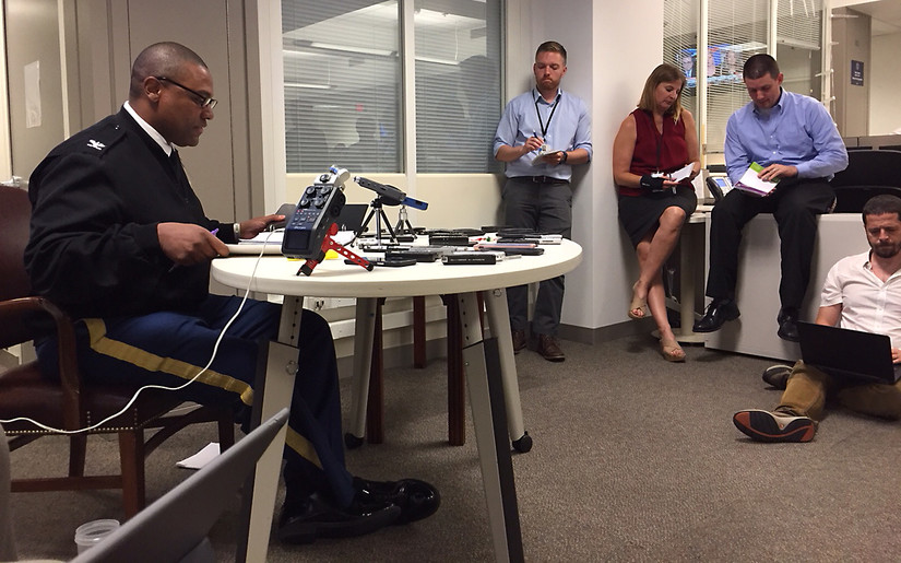
    “Effective immediately, Defense Department personnel are prohibited from using geolocation features and functionality on government and nongovernment-issued devices, applications and services while in locations designated as operational areas,” Pentagon spokesman Army Col. Robert Manning III told Pentagon reporters on Aug. 6.

    Deployed personnel are in “operational areas,” and commanders will make a determination on other areas where this policy may apply.

    The market for these devices has exploded over the past few years, with many service members incorporating them into their workout routines. They use the devices and applications to track their pace, running routes, calories burned and more. These devices then store the information and upload it to central servers where it can be shared with third parties. That information can present enemies with information on military operations.

    Using GPS Devices Pose Risk

    Photo: Fitbit
    Photo: Fitbit

    “The rapidly evolving market of devices, applications and services with geolocation capabilities presents a significant risk to the Department of Defense personnel on and off duty, and to our military operations globally,” Manning said.

    The GPS capabilities can expose personal information, locations, routines and numbers of DoD personnel. Their use in overseas locations “potentially create unintended security consequences and increased risk to the joint force and mission,” Manning said.

    Personal phones and other portable devices also contain apps that rely on GPS technology, and they will be affected. Commanders will be responsible for implementing the policy, and they will be allowed to make exceptions only after conducting a thorough risk assessment.

    Security is at the heart of this guidance. DoD seeking a balanced way that allows for legitimate official and personal uses of geolocation technology that does not impact security.

    Manning said the department will continue to study the risk associated with these devices and change the policy as needed.

  • The current state of the Defense, Security and Government PNT sector

    The current state of the Defense, Security and Government PNT sector

    GPS World magazine recently conducted the 2018 State of the Industry survey, an online polling of the GNSS community. It has become an annual feature, probing for the technical and business challenges that are drawing attention this year, how executives, managers and product developers are driving business in today’s economy, what issues they are concerned about, and — always — what solutions hold the most promise for positioning, navigation and timing (PNT) in challenged and indoor environments, regardless of which technology provides them?

    This column reports on the answers provided by those who identified themselves as working in the Defense, Security and Government (DSG) sector of the GNSS/PNT industry, and speculates on the insights that can be drawn from the answers.

    Among all who took the survey, 18 percent said they worked in Defense, Security and Government, the second largest group among eight industry sectors, following only Survey and High Precision in size. Of the DSG group members, 82 percent were based in the United States, 6 percent each in Europe and Asia-other-than-Russia-China-and-Japan, and 4 percent from Latin America. Slightly more than half of them worked in companies of more than 500 people.

    Queried as to job title, they answered as follows:

    Owner/president/co-owner/CEO: 8 percent

    Vice president, CTO, COO, CFO or similar: 6 percent

    General Manager: 2 percent

    Product or program manager: 10 percent

    Researcher: 12 percent

    Engineer: 44 percent, the largest group

    and Other: 18percent, with this last category encompassing consultants, cartographers, a security architect systems engineer, and more.

    Each sector group taking the survey answered two questions specific to their sector, while also responding to a variety of economic and systemic questions for the industry as a whole. In the DSG group, the specific questions were:

    How vulnerable is GPS/GNSS in defense/security/critical government applications, that is, M-code or similar, to disruption by jamming, whether intentional or unintentional?

    And:

    What is the greatest threat to GNSS over the next three years?

    The answers to vulnerability appear here:

    Source: <em>GPS World</em> 2018 State of the Industry survey
    Source: GPS World 2018 State of the Industry survey


    And the answers to threat here:

    Source: <em>GPS World</em> 2018 State of the Industry survey
    Source: GPS World 2018 State of the Industry survey

    Perhaps we erred in offering an “All of the above” answer, as nearly half of respondents selcted that option. This shows a generalized awareness (and fear) of threats, but lacks the capability to then prioritize those threats.


    Delving a little further into the responses from the DSG sector, when asked “What technology will win fully enable seamless outdoor/indoor navigation, in combination with GNSS,” they answered:

    Assisted GNSS           8.57 percent

    Assisted GNSS plus any ONE of the six other answers (Cell-tower triangulation, Proximity beacons, Radio frequency pattern-matching, Sensor-based dead reckoning, Terrestrial ranging system,Wi-Fi   22.86 percent

    And the winner: Assisted GNSS plus MORE THAN ONE of the six alternatives  34.29 percent

    With Don’t Know, 17.14 percent, and Other, 8.57 percent.

    More than any other solution an integration of at least three sensors, in the opinion of the plurality, will be necessary for ubiquitous positioning and navigation.

    First choice for a GNSS back-up? The leading answer was eLoran, at 25.71 percent, followed by Low-Earth orbit satellite constellations, 22.86 percent, and Sensor-based dead reckoning, 17.14 percent.

    How much effort are you devoting to mitigation of GNSS jamming and/or spoofing?

    This is the leading concern of out research and development effort   40 percent

    This is an important concern for our R&D, but not the dominant one          20 percent

    This is one among many factors we consider; no particular importance above others 17.14 percent

    And very surprisingly: We are not focusing on jamming/spoofing mitigation at all at this time        22.86 percent

    Finally, describe the market for GNSS products/services in the Defense, Security and Government PNT industry sector as of today.

    Very healthy; strong growth   25.71 percent

    Relatively healthy; moderate growth  48.57 percent

    Flat      22.86 percent

    Slightly down  2.86 percent


    For more results from the 2018 State of the GNSS Industry, see this page.

  • PCTEL announces Trooper II antenna for public safety

    PCTEL announces Trooper II antenna for public safety

    PCTEL Inc. has announced the next generation of its Trooper antenna, the company’s flagship multi-band platform for public safety fleets.

    The new Trooper II provides optimal wireless communications performance through the antenna’s 4-port 4G LTE connections and 4×4 802.11ac Wi-Fi MIMO capability, the company said. It also incorporates PCTEL’s newest high rejection multi-GNSS technology for high precision tracking and asset management.

    The Trooper II antenna. (Photo: PCTEL)
    The Trooper II antenna. (Photo: PCTEL)

    “The Trooper II antenna enhances PCTEL’s successful Trooper platform, with expanded multi-band RF and GNSS capability in a robust, aerodynamic housing,” said Rishi Bharadwaj, senior vice president and general manager of PCTEL’s Connected Solutions group. “Its slender new design with a single cable exit accommodates installation restrictions often encountered on modern public safety vehicles.”

    “Our Trooper antennas have been broadly deployed on public safety fleets, notably in support of  the leading FirstNet public safety broadband network systems. The Trooper II is also ideal for many Industrial IoT deployments,” Bharadwaj added.

    The rugged Trooper II (part #GL9X1AX-TRB) features PCTEL’s new proprietary high rejection multi-band technology, which supports GPS L1, GLONASS and Galileo for high precision tracking.

    In addition to public safety applications, the antenna is suitable for tracking and communications support for industrial internet of things (IoT) and other fleet management applications, including farming tractors for precision agriculture, utility service fleets and railway positive train control systems.

    PCTEL will display the Trooper II antenna Aug. 6-7 at APCO 2018, Booth 1719, along with its portfolio of antennas for the public safety industry and grid testing solution for in-building public safety networks.

    The Trooper II antenna is available for pre-order now. First shipments are expected in early fall.

  • Venezuelan assassination attempt highlights need for UAV security

    Two drones armed with explosives detonated near Venezuelan President Nicolas Maduro on Aug. 4 in an apparent assassination attempt that took place while he was delivering a speech to hundreds of soldiers, while the speech was being broadcast live on television, according to press reports.

    The footage of this apparent assassination attempt can be viewed below.

    Drone security solutions company DroneShield issued a statement about the incident. 

    “The history of commercial drone incidents involving heads of state goes back to September 2013 when the German Chancellor Angela Merkel’s public appearance was disrupted by a drone, which was apparently a publicity stunt by a competing political party,” said Oleg Vornik, DroneShield’s CEO.

    “Yesterday’s apparent drone assassination attempt on Venezuelan President Maduro is the first known drone attack on a head of state. An attempted drone assassination of a sitting sovereign leader demonstrates that, sadly, the era of drone terrorism has well and truly arrived,” Vornik said.

    “Technological progress cannot be reversed, and going forward, the security of any asset whose perimeter is protected two-dimensionally on the ground will need to be also protected in the third dimension — from attacks from the air,” Vornik added.

    DroneShield supplies counterdrone (counter unmanned aerial system/counter unmanned aerial vehicle/c-UAS) products, which have been successfully deployed in a variety of situations by third parties.

    The company’s products have been deployed for counterdrone security at, among others:

    • an ASEAN meeting of heads of state,
    • several Boston Marathon events over the years,
    • the PyeongChang 2018 Olympics and
    • the 2018 XXI Commonwealth Games.

    Also, a Middle Eastern ministry of defense recently placed a multi-million dollar order for DroneShield’s anti-drone equipment.

    The company expect that this latest incident involving a head of state will result in governments around the world accelerating their implementation of anti-drone mitigation measures.

  • 58th CGSIC meeting agenda features address by Brig. Gen. Shaw

    58th CGSIC meeting agenda features address by Brig. Gen. Shaw

    Brig. Gen. John E. Shaw is Director of Strategic Plans, Programs, Requirements and Analysis, Headquarters Air Force Space Command, Peterson Air Force Base, Colorado. (Photo: USAF)
    Brig. Gen. John E. Shaw is Director of Strategic Plans, Programs, Requirements and Analysis, Headquarters Air Force Space Command, Peterson Air Force Base, Colorado. (Photo: USAF)

    The U.S. Department of Transportation and the Coast Guard Navigation Center are preparing for the 58th annual Civil GPS Service Interface Committee (CGSIC) meeting.

    The meeting will be conducted Sept. 24-25 at the Hyatt Regency Miami in Miami, Florida, in conjunction with the Institute of Navigation’s ION GNSS+ 2018 conference.

    CGSIC meetings are free and open to the public.

    Subcommittees of the CGSIC for Timing, International Information, and Survey, Mapping, and Geosciences will hold meetings Sept. 24, and a summary of these meetings will be presented to the CGSIC plenary session Sept. 25.

    The meeting includes important briefings on the status of ongoing GPS programs and a keynote address by Brig. Gen. John Shaw, director of strategic plans, programs, requirements and analysis for the Air Force Space Command.

    The CGSIC agenda in development can be found at gps.gov.

  • Swarming USVs ready for range of missions

    Swarming USVs ready for range of missions

    Photo: Aquabotix
    Photo: Aquabotix

    SwarmDivers by Aquabotix are micro swarming unmanned surface vehicles (USVs) capable of diving to 50 meters and swarming in groups of 40 or more.

    Multiple SwarmDivers can function simultaneously as a single coordinated entity, be easily controlled via one operator on the surface and perform dives on command to collect valuable intelligence.

    Their design delivers rugged reliability and accuracy for applications requiring specialized sensor payloads in defense, oceanography, aquaculture, research and hydrographic survey, the company said. The units also operate collectively to quickly gather data and report back in near real time.

    This screenshot from an Aquabotix video shows the swarm returning to base. (Image: Aquabotix)
    This screenshot from an Aquabotix video shows the swarm returning to base. (Image: Aquabotix)

    The swarming algorithm allows vehicles to communicate with each other to make decisions as a group. This allows SwarmDiver to quickly and accurately self-arrange in various swarm formations as well as dive simultaneously to collect synoptic data sets.

    With the ability to be outfitted with customized payloads and sensors, SwarmDiver can meet a wide range of mission profiles, Aquabotix said.

    For the defense community, SwarmDiver could provide surf-break-zone operations support, enhanced navigational capabilities, explosive ordnance disposal and mine countermeasures.

  • FreeFlight SBAS/GNSS receiver chosen for USAF helicopter fleet

    FreeFlight SBAS/GNSS receiver chosen for USAF helicopter fleet

    A FreeFlight Systems SBAS/GNSS receiver has been selected to provide ADS-B position source information as a part of an upcoming ADS-B modification and compliance program for the United States Air Force HH-60G helicopter fleet.

    Strategic Enterprise Solutions Corp. (SESC) of Warner Robins, Georgia, was awarded the modification program, which includes installation of the 1203C SBAS/GNSS receiver and the AN/APX-119 Mode S Extended Squitter transponder with Mode 5 capability to provide a complete ADS-B Out solution for more than 100 helicopters.

    An HH-60 Pave Hawk helicopter lands in Afghanistan; a UH-60 Blackhawk is in the background. (Photo: (U.S. Air Force photo/Senior Airman Brian Ferguson)
    An HH-60 Pave Hawk helicopter lands in Afghanistan; a UH-60 Blackhawk is in the background. (Photo: U.S. Air Force photo/Senior Airman Brian Ferguson)

    The FreeFlight Systems 1203C SBAS/GNSS receiver is a certified, high-integrity position source in a compact, lightweight package that was designed to be modular and able to be integrated with various other avionics.

    The 1203C pairs seamlessly with certified Mode S Extended Squitter transponders for a fully rule-compliant ADS-B Out system, FreeFlight said.

    More than a war hawk. The primary mission of the HH-60G Pave Hawk helicopter is to conduct day or night personnel recovery operations into hostile environments to recover isolated personnel during war.

    The HH-60G is also tasked to perform military operations other than war, including civil search and rescue, medical evacuation, disaster response, humanitarian assistance, security cooperation/aviation advisory, NASA space flight support, and rescue command and control.

    The 1203C in service. With several hundred 1203Cs in service across airline transport, military, business aviation and rotorcraft platforms, these receivers are known for their high performance, ease of installation, operational reliability and longevity, FreeFlight said.

    The 1203C SBAS/GNSS receiver and antenna (Photo: FreeFlight Systems)
    The 1203C SBAS/GNSS receiver and antenna (Photo: FreeFlight Systems)

    The 1203C can also serve as the approved position source for select manufacturers of TAWS/FMS, RNP and other NextGen applications, and allows customers to take advantage of the operational and safety benefits provided by the NextGen airspace transformation without the need for extensive and costly avionics upgrades.

    With the ADS-B mandate now only 17 months away, aircraft operators need to prioritize ADS-B installations.

    Significant portions of today’s airline, business, and military aircraft fleet will remain in service long after 2020, and in many cases an STC’d retrofit solution comprising of a transponder upgrade and the addition of a dedicated SBAS/GNSS receiver like the 1203C is the simplest and most cost-effective way to achieve mandate compliance, FreeFlight said.

  • USS Wasp first carrier to use GPS-based JPALS on deployment

    USS Wasp first carrier to use GPS-based JPALS on deployment

    F-35Bs can use JPALS for precision landings in zero visibility conditions.

    Early in 2018, U.S. Marine Corps F-35B Lightning II fighters deployed to the Pacific aboard the USS Wasp amphibious assault ship, and used Raytheon Company’s  Intelligence, Information and Services business’ Joint Precision Approach and Landing System (JPALS) to guide them onto the ship’s deck.

    An F-35B Lightning II prepares to land on the flight deck of the USS Wasp while underway in the Philippine Sea, March 23, 2018. (Photo: U.S. Marine Corps/Lance Cpl. Amy Phan)
    An F-35B Lightning II prepares to land on the flight deck of the USS Wasp while underway in the Philippine Sea, March 23, 2018. (Photo: U.S. Marine Corps/Lance Cpl. Amy Phan)

    JPALS is a differential, GPS-based precision landing system that guides aircraft onto carriers and amphibious assault ships in all weather and surface conditions, including rough waters.

    It uses an encrypted, jam-proof datalink, connecting to software and receiver hardware on the aircraft and an array of GPS sensors, mast-mounted antennas and shipboard equipment, the company said.

    “We’re asking our pilots to land in some of the most difficult conditions on Earth,” said U.S. Navy Captain B. Joseph Hornbuckle III, program manager, Naval Air Traffic Management Systems Program Office. “JPALS goes a long way toward ensuring the safety of our aircrews and the success of our missions.”

    JPAL’s precision navigation is equally effective ashore. A land-based version of the system can be small enough to be either dropped into an austere environment via parachute or driven in on a trailer.

    “Deploying with the F-35 is a good start, but it’s just the beginning,” said Matt Gilligan, Raytheon vice president of Navigation, Weather and Services. “There are many fixed and rotary wing aircraft around the world and across the services that deploy to harsh, low-visibility environments where JPALS would be extremely valuable.”

    The system is slated to go into production in 2019 and will be outfitted on the U.S. Navy’s newest fighter — the F-35 Lightning II — allowing pilots to land with accuracy.

  • Persistent Systems provides drone tracking for battlefields

    Persistent Systems LLC has introduced the Auto-Tracking Antenna System, a new portable ground-to-air antenna that operates on the Wave Relay mobile ad hoc network (MANET).

    Designed to incorporate aircraft into the MANET, the Auto-Tracking Antenna System is a complete portable ground-to-air system for tracking aircraft, including drones. Army, Navy and foreign customers can use it for better airborne communications relay and full-motion video camera/sensor data transmission, Persistent said.

    Photo: Persistent Systems
    Photo: Persistent Systems

    “The Auto-Tracking Antenna System represents a major step towards achieving the vision of a truly networked battlefield,” said Herb Rubens, CEO of Persistent Systems. “The tracking antenna rotates to follow air assets, keeping them connected to the MANET. “The air platforms orbit over our users on the ground, extending the MANET bubble and keeping soldiers connected to the enterprise. High throughput, low latency connectivity empowers the warfighter and decreases the dependence on SATCOM, which both reduces cost and increases network availability.”

    Designed for ease-of-use, quick assembly and portability, the Auto-Tracking Antenna System can be assembled and deployed in less than 15 minutes, the company added.

    The portable and lightweight design is completely collapsible, with the main five-foot parabolic dish breaking down into eight individual petals.

    The entire system fits into most standard-sized SUVs for easy transport and compact storage.

    Photo: Persistent Systems

    Mimicking the MPU5’s modular RF structure, the Auto-Tracking Antenna System has interchangeable S-band, L-band and C-band MIMO feeds that allow it to cover all frequencies where Persistent’s five radio modules operate.

    The antenna feeds twist-lock into place for quick and simple installation. An Automatic Heading System enables the tracking antenna to self-calibrate prior to operation for greater precision and less than one-degree pointing accuracy.

    “Our customers require a system that is simple to put together, turn on, and works,” said Louis Sutherland, vice president of business development at Persistent Systems. “They want to extend the Wave Relay MANET out to aircraft and achieve high data-rates and reliable HD video transmission. The Auto-Tracking Antenna System truly delivers.”

    The large parabolic dish enables video streaming out to distances of 130 miles (over 200 kilometers) while maintaining high throughput and strong signal strength.

    Photo: Persistent Systems
    Photo: Persistent Systems

    Combining the precisely aimed tracking system with the MPU5 radio and Wave Relay MANET achieves optimal connectivity and reliable communications for manned and unmanned aircraft to communicate further than ever before.

    The antenna is IP67 rated and built to endure harsh environments and weather, so it can be setup and left out for as long as the mission requires.

  • Harris wins three 10-year NGA geospatial data contracts

    Harris wins three 10-year NGA geospatial data contracts

    Earth's western hemisphere, 2002. (Photo: NASA)
    Earth’s western hemisphere, 2002. (Photo: NASA)

    Harris Corporation has been awarded three multi-award indefinite delivery/indefinite quantity (IDIQ) contracts with ceilings totaling $1.5 billion to provide the National Geospatial-Intelligence Agency (NGA) with geospatial data services for up to 10 years.

    Harris will create, manage and disseminate high-quality geospatial-intelligence (GEOINT) information for use by the U.S. intelligence community and military worldwide under contracts that cover all three areas of NGA’s JANUS program — geography, imagery and elevation.

    The JANUS program will contribute to and maintain comprehensive, geospatially accurate databases of the world that can be accessed quickly as intelligence, operational and crisis needs arise.

    Harris will use its predictive analytics technology to continuously evaluate the health of NGA databases and to guide the acquisition, creation and integration of all forms of geospatial data. Harris’ cloud-based tools will validate and correct the data — pinpointing locations that require updates.

    “Winning JANUS continues our long-standing legacy of providing high-quality, responsive GEOINT and analytics to the intelligence and military communities,” said Bill Gattle, president, Harris Space and Intelligence Systems. “Our analytics technology provides NGA with fit-for-purpose data, reduced production costs and cloud-based access to geospatial products and content.”

    Harris is investing in new technologies that improve the speed and accuracy of providing GEOINT products. The company has partnered with the NGA for almost 20 years to provide automated geospatial data processing, data management, and geospatial systems design and development. Harris provides high resolution geospatial data content and products under NGA’s Foundation GEOINT Content Management program, and previously supported the Global Geospatial-Intelligence program.

    Hexagon US Federal Also Contracted

    The NGA also has selected Hexagon US Federal as a prime contractor on two multiple award, indefinite delivery/indefinite quantity contracts for amounts totaling $1.17 billion for the JANUS Geography and JANUS Elevation contracts.

    JANUS Geography. Hexagon’s tasks for the JANUS Geography program will support the creation, conflation, integration and enrichment of Foundation GEOINT data used to produce a comprehensive and seamless dataset for NGA partners and customers.

    The creation of this dataset will ensure more accurate and readily available geospatial data for military and intelligence operations as well as disaster relief missions saving time and lives.

    JANUS Elevation. As a prime contractor on the JANUS Elevation contract, Hexagon will support NGA’s Office of Geomatics with maintenance to an existing worldwide library of digital elevation models. The effort includes products generated, modified or assessed by the office that are a digital representation of the terrain surface of the Earth.

  • DroneShield takes down threatening UAVs

    A news story from Australia’s “Today Tonight Adelaide” television show highlights how the DroneShield system can bring down drones that enter restricted airspace or threaten safety. DroneShield countermeasures allow for the controlled management of drone payloads such as explosives, with no damage to common drone models or the surrounding environment.

  • CTSi flight tests navigation prototype to replace GPS for Navy

    CTSi flight tests navigation prototype to replace GPS for Navy

    An F/A-18F Super Hornet assigned to Strike Fighter Squadron (VFA) 102 launches from the flight deck of the aircraft carrier USS Ronald Reagan on July 10, 2018. (Photo: U.S. Navy/ Mass Communication Specialist 2nd Class Kenneth Abbate/Released)

    Along with partner L3 Technologies, the Enhanced Link Navigation System (ELNS) offers new solution to defeat enemy countermeasures to detect and disrupt allied signals.

    CTSi and partner L3 Technologies this month completed flight-testing of a newly developed integrated communication and navigation system for use in highly contested and GPS-denied environments.

    Designated the Enhanced Link Navigation System (ELNS), the prototype was built under a U.S. Navy $8.7 million Small Business Innovative Research (SBIR) Phase III contract and flight tested at the St. Mary’s County Regional Airport near Patuxent River, Maryland.

    “Our team put ELNS in the air in less than 18 months. It worked the first time and every time during 15 flights, which included 152 approaches,” said Ian Gallimore, CTSi chief technology officer. He went on to say that ELNS provided area navigation to replace GPS at ranges in excess of 50 nautical miles all the way through landing.

    Pilots from Airtec, who provided turn-key flight test support, said during test events, “These needles are… money,” and “ELNS is as good as any instrument landing system I’ve flown, I’d fly it in the weather.”

    “ELNS is scalable for unmanned aircraft in all groups, from those needing high integrity like MQ-25, to small unmanned aircraft on tight weight budgets,” said Martin King, Navy project manager. “ELNS is the first system to bring GPS-denied navigation capability to small UAS. By combining significant investments in related fields to create a whole new capability like this, ELNS takes position, navigation and timing (PNT) for air vehicles in a compelling new direction.”

    ELNS utilizes L3 Technologies’ waveforms that defeat adversary strategies to detect and disrupt allied signals, using waveforms that are essential in communications-denied and GPS-denied environments.

    “There is a strong fit between what ELNS brings and the threats that our forces are facing today,” said Tom Sanders, CTSi chief executive officer.

    To learn more about ELNS, contact [email protected].