The latest variant of the Excalibur precision-guided projectile will be used by armies and be available for naval ships.
The Netherlands Ministry of Defense is adding Raytheon Company’s Excalibur Ib artillery rounds to its arsenal under a previously announced foreign military sales agreement, underscoring growing international interest in the precision-guided projectile.
The Netherlands is the second Excalibur lb customer in Europe after Sweden, the U.S. government’s development partner for the 155-mm round. Deliveries are expected to begin later this year.
“The Netherlands joins a growing list of nations acquiring this highly sophisticated artillery munition, which uses GPS guidance to provide accurate, first-round effects capability at extended ranges,” said Mark Hokeness, Raytheon’s Excalibur program director. “When fired from the Dutch PzH 2000 artillery system, Excalibur can fly up to 50 kilometers, score a direct hit and deliver lethal effects in all types of weather and battlefield conditions.”
A Dutch Panzerhaubitze 2000 (PzH 2000) fires a round in Afghanistan. (Image courtesy Dutch Ministry of Defense)
The U.S. Army has determined Excalibur Ib is fully compatible with the PzH 2000, a self-propelled howitzer produced in Germany and fielded by several nations.
The Excalibur precision-guided, extended-range projectile uses GPS guidance to provide accurate, first-round-effects capability in any environment. Excalibur’s level of precision delivers a major reduction in the time, cost and logistical burden associated with using other artillery munitions. Excalibur has been fielded by the U.S. Army, Marines and several international military forces.
Excalibur Facts
Combat-proven: Nearly 770 Excalibur rounds have been fired in combat with exceptional accuracy and lethality.
Precise: Excalibur consistently strikes less than two meters from a precisely-located target, Raytheon said.
Safe: Excalibur’s precision avoids collateral damage and has been employed within 75 meters of supported troops.
Affordable: With its first round effects, Excalibur reduces total mission cost and time and the user’s logistics burden, according to Raytheon.
Evolving: Raytheon has demonstrated a dual-mode GPS/semi-active laser seeker Excalibur variant to compensate for target location error, maintain precision in GPS denied or degraded environments, and enable engagement of relocated or moving targets.
Navies: With Excalibur N5, navies will be able to deliver extended range, precision naval surface fires from existing 5-inch/127-mm guns.
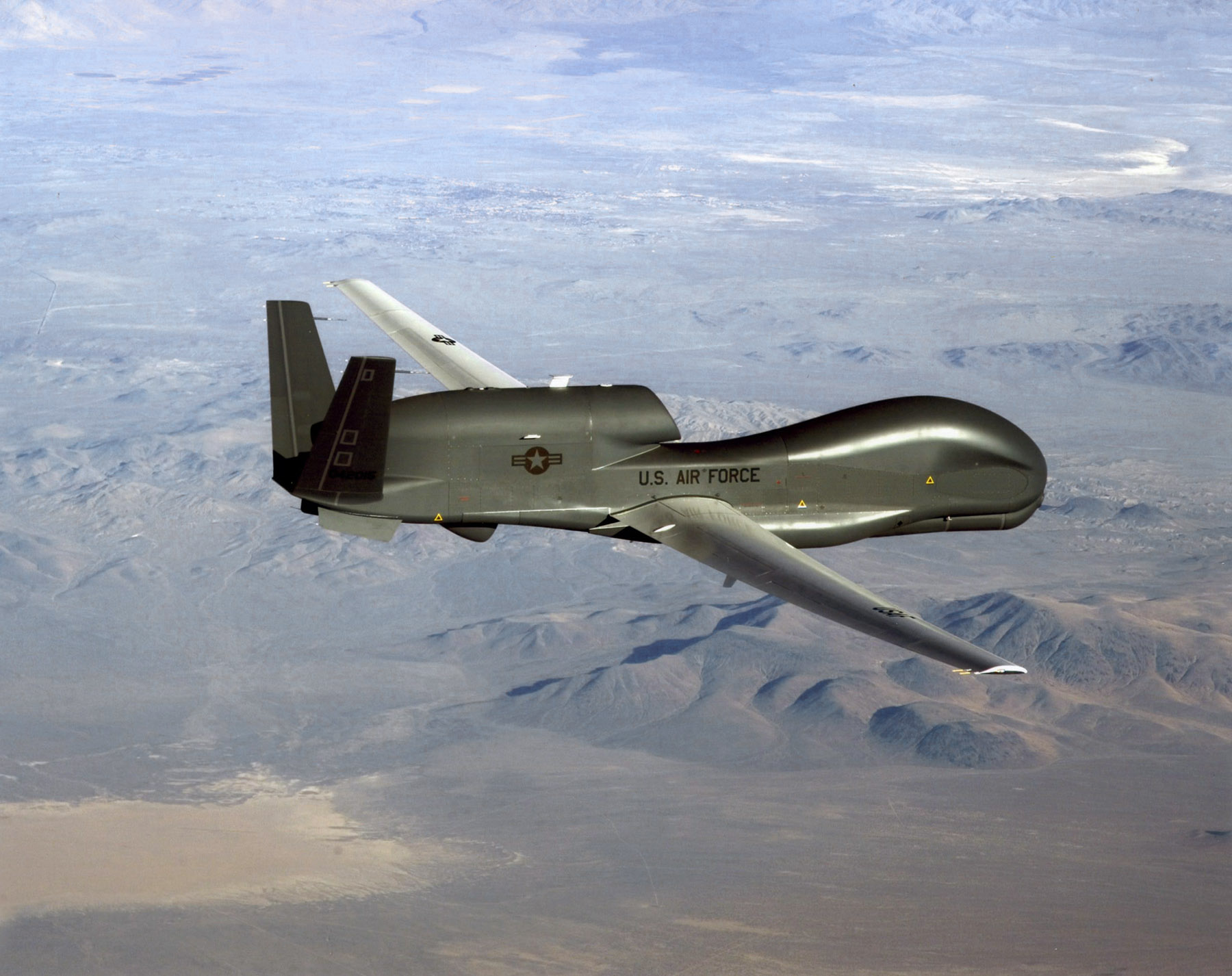
An RQ-4 Global Hawk soars through the sky to record intelligence, surveillence and reconnaissance data. (Courtesy USAF)
Curtiss-Wright Corporation’s Defense Solutions division was honored by Northrop Grumman for its role as a supplier in support of the RQ-4 Global Hawk unmanned aircraft system (UAS).
Global Hawk has flown 150,000 total flight hours supporting diverse global missions. Carrying a variety of intelligence, surveillance and reconnaissance sensor payloads, Global Hawk supports anti-terrorism, humanitarian assistance, disaster relief, airborne communications and information-sharing missions.
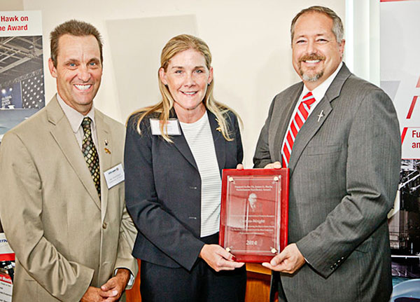
A ceremony was held Aug. 19 at Curtiss-Wright’s Integrated Systems facility in Santa Clarita, Calif., for the program to receive the James G. Roche Sustainment Excellence Award for a third year in a row. During the ceremony, an award was presented by Mick Jaggers, Global Hawk UAS vice president and program manager, Northrop Grumman Aerospace Sector, and accepted by Lynn Bamford, senior vice president and general manager, Defense Solutions division. The event was also attended by Rep. Steve Knight, U.S. Congressman for California’s 25th District.
(From left) Knight, Bamford and Jaggers with the award.
“We extend our sincerest congratulations to the US Air Force on this award and Northrop Grumman for their stellar job as the prime contractor on the milestone setting RQ-4 Global Hawk UAS,” said Ms. Bamford. “We take great pride in Curtiss-Wright’s role as an industry leader in providing advanced rugged electronics that help lower this important aircraft’s cost through the use of commercial-off-the-shelf technologies.”
During the ceremony, Jaggers remarked, “An aircraft as sophisticated as the Global Hawk comes together with the help of many partners, and one of the most crucial sustainment partners on the Global Hawk is Curtiss-Wright.”
The Sustainment Excellence Award is granted by Headquarters U.S. Air Force Logistics, Installations and Mission Support. It is named for Dr. James G. Roche, the 20th Secretary of the Air Force, a position he held from 2001 to 2005.
Technology Advancement Group (TAG) will be showcasing precision, navigation and timing technology integration solutions at the ION GNSS+ conference, which will be held Sept. 14-15 in Tampa, Fla.
In particular, TAG will display a custom-designed military GNSS survey system that is the U.S. Army program of record for geodetic, construction and airfield surveying.
TAG’s Precise Positioning Service Global Positioning System Survey (PPS GPS-S) system was designed specifically for use by survey teams to have access to centimeter-level GPS survey accuracy with the added benefits of a fully-certified military GPS receiver that is supplemented with a GNSS receiver for real-time kinematic surveying with multi-constellation operations.
The PPS GPS-S system has been specifically designed to address the stringent requirements of military survey missions including geodetic, construction, airfield, and field artillery survey. It gives the military surveyor the tools they need to complete their missions with minimum time-on-station even in the face of GPS signal interference, attempted spoofing, or electronic warfare, the company said.
TAG was recently awarded a $24 million contract by the U.S. Army Geospatial Center for its AN/GSN-16 military survey system.
Core components of the PPS GPS-S system include a base station and two rovers, each integrated with a GNSS antenna with protection against jamming or spoofing, a custom-designed rugged tablet with an internal RF radio that has a 20-km range, and GPS-S accessories for additional functionality. Designed for continuous operation, the PPS GPS-S system includes multiple power options such as dual hot-swappable Li-Ion batteries, 12V battery, DC/DC converter, NATO adapter, and 4-slot Li-Ion charging station.
Powered by Carlson Surv-PC, TAG’s PPS GPS-S system is tailored for military environments that require tactical computer-aided design (CAD) operations. With an intuitive graphical user interface, surveying operations can be conducted in the field allowing for work to be completed in real-time. Accurate geospatial information system (GIS) data capture and a full suite of CAD functions allows survey teams to remain in the field to complete the drawings without the need to return to base.
For ION GNSS+, TAG will be in booth #102 of the exhibit hall in the Tampa Convention Center.
On Aug. 24, David W. Madden joined Lockheed Martin’s Military Space Line of Business, where he will be responsible for international military satellite communications (MILSATCOM), based in Denver.
Madden served as the GPS Wing Commander at the Space & Missile Systems Center (SMC) in Los Angeles, Calif., before retiring from the U.S. Air Force in May 2010. From June 2010 until his new appointment, Madden served as director of the Military Satellite Communications Systems Directorate at SMC.
In his new role, Madden will oversee Lockheed Martin’s efforts to further enhance the company’s relationships with international allies and customers, and to grow the MILSATCOM portfolio.
At the Military Satellite Communications Systems Directorate at SMC, Madden was responsible for acquiring, deploying and sustaining the $42 billion MILSATCOM portfolio of programs which consists of ACAT I and II programs including the Defense Satellite Communications System, Milstar, Global Broadcast Service (GBS), the Wideband Global SATCOM, the Advanced EHF program, the Enhanced Polar System, the Command and Control System-Consolidated and associated Terminals programs.
Madden entered the Air Force in 1980 after graduating from the Virginia Military Institute. He gained experience in systems engineering, technical intelligence, and command and control and space systems requirements, development, fielding and operations. In addition, he has commanded a Space Operations Squadron and a Material Acquisition Group before the GPS Wing.
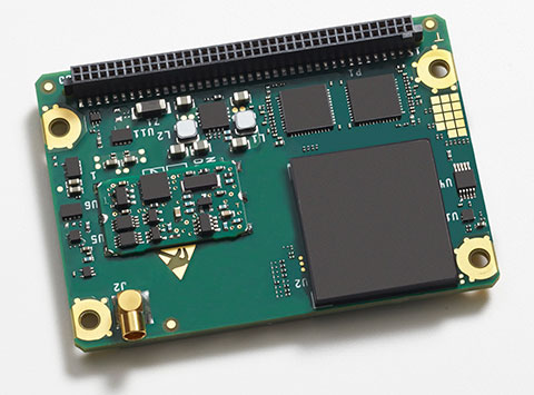
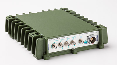
The Rockwell Collins GB-GRAM-M (pictured here) is the product of one of the MUE card development contracts, awarded by the U.S. Air Force Space and Missile Systems Center. The program is developing the next generation of GPS user equipment to include a new military signal and enhanced security architecture
GPS Source and Rockwell Collins have successfully demonstrated the ability of the Military-Code Ground-Based GPS Receiver Application Module (GB-GRAM-M) receiver card to fit within the Defense Advanced GPS Receiver (DAGR) Distributed Device (D3).
GPS Source and Rockwell Collins are the first to provide this capability for the M-code signal, which is one of the key elements in the modernization of military GPS capabilities.
The initial fit checks confirm that the Rockwell Collins GB-GRAM-M Type II receiver fits within the volume of the D3 and is able to acquire, track and navigate using C/A, Y and M-code while enclosed in the unit. Initial testing also validated backwards compatibility of the IS-GPS-153 serial port interface of the GB-GRAM-M receiver.
“These outstanding initial results confirm our confidence that the MGUE integration with the D3, when authorized to proceed, will be achieved in short order and with a very high probability of success,” said GPS Source CEO Robert Horton.
Mike Jones, vice president and general manager of Communication and Navigation Products for Rockwell Collins, added, “This demonstration paves the way for the D3 to incorporate the next-generation GPS capability that our GB-GRAM-M provides.”
GPS Source’s D3 supports new or retrofit programs integrating radio or communications equipment. It removes the burden of multiple SAASM GPS receivers or antennas. As a Selective Availability Anti-Spoofing Module GPS router, it is designed to meet the U.S. Army’s DAGR Distributed Device (D3) performance requirements, mounted into an existing DAGR vehicle mount, utilizing standard DAGR accessories.
The Rockwell Collins GB-GRAM-M is the product of one of the MUE card development contracts, awarded by the U.S. Air Force Space and Missile Systems Center. The program is developing the next generation of GPS user equipment to include a new military signal and enhanced security architecture.
Are you using a legacy-model PNT (position, navigation and timing) receiver or a smart PNT receiver, and why does it matter? Don’t have a clue? Read on! Hint — L2C and CNAV (civilian navigation message format) are the major reason it matters. Yes, it’s all because of L2C, the controversial GPS civilian signal that seems to always be in the news and just keeps getting better the more we learn about it.
A couple of weeks ago, Alan Cameron, our esteemed editor in chief — penned a follow-on editorial comprised of excerpts from techies, subject-matter experts and editors, including yours truly, exchanging opinions about the flexibility, sustainability and capability of the GPS L2C signal and all that signal enables.
I won’t bother to go into the details or history of the L2C signal here, as I did that in excruciating detail 30 months ago. However, let’s consider L2C 30 months on and determine if the landscape has changed.
What is L2C?
According to the official U.S. government PNT website, “L2C is the second civilian GPS signal, designed specifically to meet commercial needs.” As it turns out, the military needs L2C as much as the civilian world, but that is a story for another time. When combined with L1 C/A (coarse acquisition signal) in a dual-frequency GNSS receiver, L2C enables ionospheric corrections, a technique that boosts accuracy. Civilians with dual-frequency GPS receivers typically enjoy the same or better accuracy as the military.
For professional and high-precision users with existing dual-frequency receivers, L2C delivers faster signal acquisition, enhanced reliability and greater operating range. L2C broadcasts at a higher effective power than the legacy L1 C/A signal, making it more jam and interference resistant, plus it’s easier to receive signals under trees and indoors. The U.S. Commerce Department estimates L2C will generate about $6 billion in economic productivity benefits through the year 2030. Considering there are more than four billion GPS users around the world today, the DOC economic benefits number seems rather low.
L2C Status
The first GPS IIR-M (R= Replenishment, M= Modernized with M-code and L2C) satellite featuring L2C launched on Sept. 26, 2005, and is still operational today. Every GPS satellite fielded since then (18 SVs, including SVN 49) has included an L2C transmitter. This equates to 16 operational L2C satellites on orbit and transmitting, with GPS IIF-10 being number 17 when it is fully commissioned. With 17 SVs (GPS satellite vehicles) on orbit, the L2C system is officially near Initial Operating Capability (IOC). With the requisite ground system upgrades, which are in the works, this means that on any given day most users will have at least one or more L2C signals in view. You can be sure manufacturers will be quick to take advantage of the geometry.
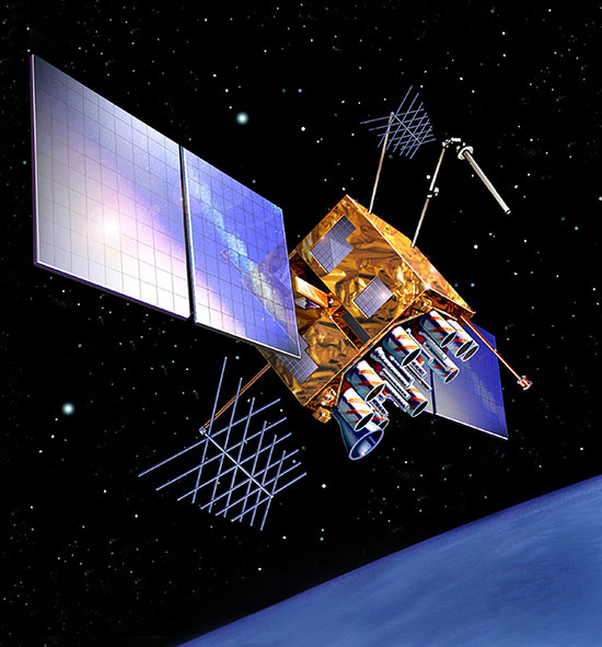
LMCO GPS IIRM Satellite Vehicle On Orbit. (Artist’s rendering courtesy of Lockheed Martin)
Legal Caveats
“In April 2014, the U.S. Air Force began broadcasting civil navigation (CNAV) messages on the L2C and L5C signals. Prior to that time, L2C and L5C provided a default message or Message Type Zero, containing no data. Adding additional CNAV message types required upgrades to the GPS control segment. On Dec. 31, 2014, the Air Force began transmitting CNAV uploads on a daily basis. L2C should continue to be considered pre-operational and should be employed at the user’s own risk.”
Now the lawyers are happy.
So What?
What does this mean for the average user? You might be surprised at the answer. Depending on how technical you are and exactly how you use GPS, it could mean that all your “legacy” GPS receivers are about to become obsolete. Or, depending on the company that builds your receivers and the amount of foresight they built in, it could just mean a few firmware upgrades and new applications.
Regardless, with the full implementation of L2C GPS signals and navigation messages, GPS will never be the same again. This is not to say your legacy receiver will not work just as efficiently as it does today, and in fact you will probably be able to use it quite effectively for years. But it will not be able to take full advantage of all the capabilities L2C enables without an upgrade, if indeed it is upgradeable.
Legacy versus Smart
No matter how much or how little you paid for your GPS/GNSS/PNT receiver, it is essentially — except for a few notable exceptions — a legacy receiver. For example Trimble is ahead of the game as they began producing L2C capable receivers as early as 2003 and are just waiting for the additional L2C messages to be defined. Again, those receivers that are not L2C-ready or capable are what I will classify as a legacy receiver, simply because of all the future capabilities that are missing. Your current PNT receiver may have the potential to be a smart receiver — it may have the technical capability to process far more than it does today. But, unfortunately, essentially almost every receiver, again with a few exceptions, on the market today falls into the “legacy ” category.
Is My Legacy Device Considered Obsolete?
Now that I have your attention and have probably riled more than a few GPS device manufacturers, please allow me to explain. In the past, your GNSS/PNT device (for brevity’s sake, I will default to PNT for the rest of the column) has basically performed a simple function. It displayed your position, and perhaps maps and other ancillary data (targets or destinations) after it received, decoded, verified and applied timing signals and a very small number of navigation messages.
It accomplished this feat typically from a cold start in under 120 seconds. Maybe much less. Recently, I was privileged to view a demonstration of a receiver from a major manufacturer that performed a warm restart in less-than-ideal conditions and displayed a useful position in 1/20th of a second. As amazing as that may be, it is still today classified as a legacy receiver. It accomplished its task; it supplied a useful position both in human and machine language that could be utilized by both. In the past, this was the task your receiver accomplished routinely. With the full implementation of L2C, all that changes and changes drastically. I call it a revolution for PNT, but alas I am frequently given to hyperbole. However, give me a moment and see if you don’t agree.
I was attracted to a Wall Street Journal headline recently by a company that I know well, since they have an abundance of well-known and multi-talented former military leaders. That company, Accenture, puts it this way: “Change is good. Transformation is even better.” That is exactly where I believe we stand today with L2C. It is a game changer.
For example, just this week in the WSJ, which I read cover to cover six days a week, I saw stories about Audi vehicles driving autonomously from coast to coast, over 3,000 miles without driver intervention. Contrary to many manufacturers, Audi is quick to credit GPS with a large portion of the proprietary Audi (VW) technology and the capability it enables. There was a story about commercial vehicles, over-the-road diesel trucks that may have even more capabilities than the Audi. Again, with GPS as the prime contributor. The same WSJ story mentioned that, “Some of the features being added to trucks are similar to those in cars, but generally the move to autonomy in commercial and industrial vehicles is far ahead of the autonomous systems offered on most passenger vehicles. Already, mining vehicles and military forklifts are operated without drivers.”
Amazingly, these capabilities depend greatly on GPS, but exist without the full implementation of the revolution that L2C, CNAV and multiple nav messages will bring.
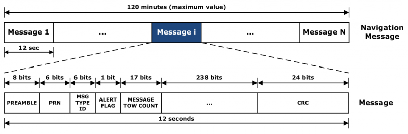
L2C CNAV Message Structure.
L2C Ready
I have over the past year seen advertisements for PNT devices that proclaim they are L2C ready. I beg to differ, but only because my definition of L2C ready probably varies greatly from that of the devices’ marketing department. Beyond its signal structure, L2C has a new messaging capability.
As stated earlier, the L2C signal is heads and shoulders above most other GNSS signals in strength, code structure and security. L2C delivers faster signal acquisition, enhanced reliability, and greater operating range. L2C broadcasts at a higher effective power than the legacy L1 C/A signal, making it interference and jam resistant and easier to receive under trees and indoors. These attributes make it a great signal and when you consider the carrier-phase and RTK (real time kinematic) capabilities, which really are real-time today. It is a very appealing signal indeed.
For precision and timing users, the carrier phase of the L2C signal, non-coded carrier, is 1,000 times more stable than the fully coded L2C signal. The L2C carrier-phase stability will remain unchanged until the semi-codeless transition date of Dec. 31, 2024, per the FRP or Federal Radio Navigation Plan of 2014. Then officially all bets are off, but who knows? That date could be extended.
However, the real and future strength of the L2C signal structure is hiding in one or more (accurately 255 more, for a total of 256) messages that can be utilized in a myriad of ways and applications. These are messages, nav-messages if you will, that your new or updated PNT device will be able to utilize for who knows how many functions. Just use your imagination. Here are some ideas I have for using the additional L2C messaging capability.
Send 250+ other navigation messages, to be defined.
Send continuous atmospheric corrections (such as ionospheric) for each two degrees of longitude around the globe or in one degree increments if you consider land mass applications only.
John Deere and Trimble as the leading commercial and civil providers of navigation data could appropriate a small fragment of the messages for their global navigation and timing corrections to their agricultural and precision users/customers around the globe.
Companies or governments could send nominal navigation or even text-based navigation-related messages to users anywhere an L2C signal can be received.
Companies could shut down and render useless receivers from users that have not paid their bills or were abusing the system.
Companies could send small firmware updates or notices of larger updates directly to users. Data could include active hyperlinks.
Precision, scientific and premium users might have the capability to receive constant correction updates that make their PNT receiver a centimeter or potentially a millimeter level device.
Receivers with communications — four billion plus smartphones and other devices with PNT capabilities and built-in communications — could become sensors capable of being sampled at will. These devices have the potential to be considered remote monitoring stations both for PNT and communications purposes. They could report both communications and PNT jamming or interference. They could also help track intentional jammers.
If you think about it hard enough, you will see that this modest list of capabilities with the proper security either make spoofing an impossibility or without proper security a malicious nightmare.
I hope by now you catch my drift and have come up with some ideas of your own concerning how the additional 250+ L2C messages could be utilized. We’re unsure how many messages will actually be available or how the messages will be used. The government will, out of operational necessity, require a small number, so right now your guess is as good as mine.
Keep in mind that L5C and M-code will have the same capabilities on differing frequencies, and different governing bodies will decide how the signals and 750-plus multiple-messaging capabilities are allocated and utilized. That is all hopefully in the near future. How that process unfolds, technically and operationally, will have a great deal to do with how successful and ubiquitous L2C becomes. The process alone will undoubtedly spawn thousands of articles; however, right now we are primarily discussing the necessity for smart receivers to fully utilize the additional L2C messages. For along with all the potential capabilities comes a processing and communications tail that does not exist today, except in a few instances that we can’t go into in this venue.
Relative
This is probably a good time to further qualify what I mean by legacy versus smart receivers. Were the appellation “legacy” not already in our vernacular concerning today’s highly functioning devices, it would not be one I would have chosen. However, it is and we are stuck with it. Consider that there are static high-end (read premium quality) single GNSS receivers that “see” more than 50-60 separate GNSS satellite vehicles and processes more than 150 GNSS signals. This does not take into consideration all the augmented and companion signals some of these devices are capable of processing. Many of these devices are very difficult to jam and literally cannot be spoofed, and still today they are legacy receivers in relationship to L2C capabilities.
However, I am told such high-end receivers are absolutely L2C ready, which may mean the additional L2C messages are ready to be processed and applied, received or rejected, whenever they are properly and officially defined. This brings us to the future definition or next generation smart L2C receiver.
Smart L2C PNT Receiver
For the first time a smart PNT L2C capable receiver will have the ability to:
Select between GPS only, GPS + GLONASS, or full GNSS mode with ancillary corrections such as WAAS and EGNOS, and work with, process or reject messages, making a decision about some or all the signals it has in view. While there are receivers that accomplish some of these functions today, they do not typically have the option of accepting or rejecting a GPS navigation message if it is properly formatted and verified. L2C smart receivers will — indeed must — at a minimum possess and correctly utilize that capability.
Alert users concerning new navigation message(s) and determine automatically or with user input whether the navigation message should be applied immediately, in the near future, put on hold or totally rejected.
Alert users to the effect that applying new or multiple navigation messages will have on the current PNT display and possibly the current mission or operation. For example, if you are a precision user, think millimeters for level of accuracy, utilizing PNT to measure tectonic plate movement — you are very interested in relative displacement over time and you may have no desire to apply a multiple nanosecond correction that could move your current measured position several inches or feet. If you are a geocacher, you do not want the coordinates of your latest buried treasure to dynamically change.
Determine if the latest valid navigation message(s) apply to your geographic area or, for mobile receivers, your destination, and what effect incorporating the messages will have on your displayed position or ETA.
Display a text-based navigation message if it is addressed to your device.
Require password(s) for certain actions — be they sensitive, proprietary, classified or of a “cannot undo” nature. Passwords could also be required in the message format before it could be unlocked and applied.
Determine and alert users if multiple navigation or device-control messages conflict with organizational or user-defined parameters.
Alert users to malicious messages or spoofing attempts.
Alert users to GNSS assets that are no longer available or go offline, such as during the two total GLONASS constellation shutdowns when GLONASS signals were not available for several hours. In the case of Apple iPhones, the GLONASS constellation-wide shutdown meant these devices went from multiple GNSS devices to “GPS plus PNT augmentation (WAAS) and other onboard sensors” devices. This is something many users may not care about, but is definitely worth a user-defined parameter for a warning message.
The ability to permanently reject a certain type of message by type, source, timeframe, etc.
By now, I hope you see the trend. You can probably think of many more possibilities for future GNSS or PNT receivers and the necessity for them to be loaded with computing and communications capabilities, especially where L2C is concerned — indeed, where all the CNAV signals and messages are concerned.
Bottom Line
The bottom line is L2C is a potentially revolutionary signal for GPS/PNT; it opens incredible opportunities for entrepreneurs, manufacturers and users at a minimum. We now all have some hard and important questions to consider before we purchase our next-generation PNT device or upgrade our legacy device.
Until next time, happy navigating, and I hope to see everyone at ION GNSS+ in September in Tampa, Fla. Remember, GPS is brought to you courtesy of the United States Air Force.
Wearable fitness trackers such as FitBit could help military patients recover quicker, according to Col. Deydre Teyhen, an official with from the Defense Health Headquarter’s Office of the Surgeon General. The trackers could help patients with musculoskeletal conditions gauge how much physical activity they can handle without exacerbating their injuries, Teyhen told an audience at a conference hosted by tech association, AFCEA and reported by NextGov.
Device-agnostic software is needed to allow soldiers to use the devices they already own, she said. “The question becomes, is it a one-size-fits-all solution?”
For instance, some patients begin to feel better before their soft tissue heals fully, and start walking around more, which could inhibit their recovery process, she explained. An effective system might send that patient a notification on their fitness tracker to say, “‘You’ve done great, at 1,000 to 2,000 steps a day,’ and it gives you a warning … ‘You might actually be doing too much and you might cause a setback.’ If you give them that warning in real time, then they can change their behaviors.”
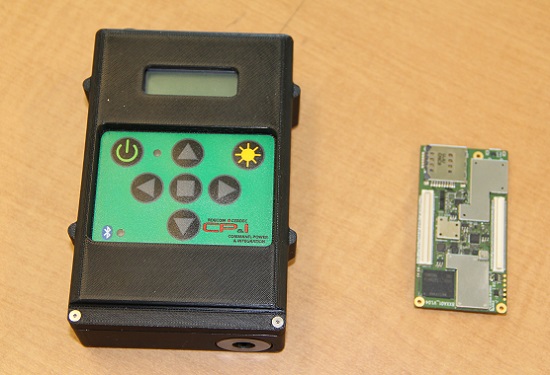
The current WINS form factor (left) sits beside a prototype for the future incarnation.
The Evolution of the Warfighter Integrated Navigation System
A new device is being developed to enable foot soldiers to find their exact location in GPS-denied situations. If satellite signals are blocked by heavy jungle canopy, or because of enemy interference, soldiers — and Headquarters — will still know where they are with the Warfighter Integrated Navigation System (WINS).
WINS will be a compact, wearable navigation device capable of operating either as a standalone system or networked to distribute position location information to other soldier platforms. WINS will extend positioning capability for soldiers in environments where GPS is not available, reducing the effect of GPS interference and enabling integrity monitoring for trusted position reporting.
The technology behind WINS is being developed at the U.S. Army’s Communications Electronics Research Development and Engineering Center (CERDEC) labs. “WINS will be not just one technology; it’s a soldier-worn multi-sensor source incorporating information from GPS, inertials, vision-aided navigation, RF ranging, etc.,” explained John DelColliano, chief for CERDEC’s PNT Branch, which falls under CERDEC’s Command, Power and Integration Directorate (CP&I).
“All these will tie in to making a more robust navigation system, so if you’re in a situation where GPS fails, you can have other things to back you up.” For instance, inertial sensors will calculate an offset from the last-known GPS location using footsteps taken, speed, acceleration and time.
“The bottom line is that the soldier, without having to do any extra work on his own, will have a navigation system on his person that will provide him with a solution that he can count on when he needs it,” DelColliano said.
WINS is expected to help eliminate dependence on vulnerable commercial receivers. It will improve positioning in GPS-degraded environments, enduring some jamming and providing positioning indoors and in urban areas. It will enable soldier-based cooperative engagements and provide trusted dismounted soldier position through integration with Selective Availability Anti-Spoofing Module (SAASM) GPS receivers and redundant navigation sensors.
“CP&I’s PNT branch has worked on these individual technologies for many years, but we’ve always had the vision of an integrated solution,” DelColliano said. “That’s where we are today. It makes the most sense for what the soldier is going to need in the battlefield.” With a WINS-equipped solder, DelColliano said, “We’ll be able to know where he is and at what time, and we’ll be able to track if something happened to him. This capability will also enable our forces to be more mobile and maneuverable. It allows the commander and HQ to see where each squad is.”
As part of a technology demonstration program at Fort Dix, N.J., WINS is being developed under an incremental build process as researchers consider what functionality should be incorporated. The engineering specifications for WINS are expected to be transferred to Program Executive Office, Intelligence and Electronic Warfare & Sensors by 2017, and from there eventually be made available to soldiers.
Future WINS capabilities
The final version of the WINS will have the following capabilities:
Military GPS for a protected signal and anti-jam capability on the soldier.
Inertial measurement unit for soldiers to track their location.
RF ranging using a radio or radio-like device to communicate between soldier-worn nodes and determine the range between soldiers, computing positions through triangulation relative to GPS.
Vision-aided navigation using the same kind of camera as in a cell phone, which is ideal for SWaP-C (size, weight and power compliance), to help navigate by tracking the soldier’s motion through an environment.
In late June, I had the honor and privilege of attending and participating in the Institute of Navigation’s Joint Navigation Conference (ION-JNC) in Orlando, Fla. This year attendance was up by 20 percent. The entire event was FOUO (For Official Use Only) with a classified (SECRET) day on Thursday held at, as improbable as it seems, a joint military and Walt Disney location known as Shades of Green. It gives Mickey Mouse and the military a whole new meaning!
The classified day included a remarkable War Fighter Panel, which, full disclosure, I have had the honor along with my colleague Jim Doherty at IDA (Institute For Defense Analyses) of co-chairing for the last several years. It is always heart-warming and invariably enlightening to hear our warfighters discuss capabilities that GPS enables for them in times of peace and war. You could even say this was the theme of the conference: “The capabilities that GPS technology enables.”
You might assume an FOUO- and SECRET-level conference would be slim pickings for a journalist. If that is all that transpired, then you would be correct; however, all the conversations outside the official sessions, especially around the displays and exhibitors’ booths, make it more than worthwhile. Not to mention all the tidbits you pick up at breakfast, lunch, dinner and evening socials. One of the most common phrases I heard all week was, “Now don’t quote me on this, but…” or the one I like to hear, “OK, this is on the record” or “You are recording this, right?” Everyone has a message!
ION-JNC in Dayton, Ohio
For the next two years (2016-17) ION-JNC will be held in beautiful downtown Dayton, Ohio, at the Dayton Convention Center. Dayton is home to the famous Wright Brothers Cycle Shop and the Wright Flyer.
Take-off of the 1903 Wright Flyer, the world’s first powered, sustained and controlled heavier-than-air flight on Dec. 17, 1903.
Dayton also hosts the world-famous National Museum of the USAF (United States Air Force) located on Wright-Patterson Air Force Base (WPAFB). The classified day will be held at the prestigious USAF Institute of Technology (AFIT), also on WPAFB, where many an Air Force officer has earned a master’s and or Ph.D. The papers and sessions should be outstanding in view of the venue and the presence of the Air Force Research Laboratory (AFRL) at WPAFB, which is known as the Air Force’s only organization wholly dedicated to leading the discovery, development and integration of warfighting technologies for air, space and cyberspace forces.
Register early and send your clearance if you have one; it just gets better every year.
SpaceX and Falcon 9
Elon Musk,CEO Space Exploration Technology Corp. (Photo Courtesy of Tesla Motors)
I arrived in Orlando on Sunday, June 21 (yes, I traveled on Father’s Day) because events start bright and early Monday morning, to hear about the Falcon 9 launch failure, the first for that family of launchers. Even though it occurred 130+ seconds into the launch segment, if the rocket fails to deliver the payload or supplies to orbit or their destination, it is generally referred to as a launch failure. Technicians and subject-matter experts will be debating for some time exactly what caused the failure, but there can be no doubt this is a big blow to the Space Exploration Technology Corporation — better known as SpaceX.
I have known Elon Musk and experienced his outsize ego casually for more than 20 years, and I am constantly amazed at his accomplishments and would never bet against him. I do not mean the ego remark in a negative way, because history proves that if Elon says he will accomplish the seemingly impossible, then he will do just that. Can you say Tesla Motors? Setbacks just make him and his team more determined.
“It is difficult to say what is impossible, for the dream of yesterday is the hope of today and the reality of tomorrow.” — Dr. Robert Goddard
Gwynne Shotwell, COO Space Exploration Technology Corp. (Photo Courtesy of SpaceX)
However, launch setbacks are played out on a national stage where lives may well be at stake. SpaceX President and COO (Chief Operating Officer) Gwynne Shotwell, the brains of the outfit, who is as alluring as she is brilliant, said following the launch failure, “I’m sure we will find the cause rapidly and resume normal launch operations within a year.”
Reportedly, SpaceX is already a bit tardy in scheduled launches with an enviable backlog totaling approximately $7B, many of which are government payloads. In the end, this merely highlights that the launch business is a tough nut to crack, and attention to detail is paramount. Every little detail must be scrutinized numerous times.
BAR
In the mid 1990s, Dr. John Darrah and I (then AFSPC Chief Scientist and Deputy respectively) under the auspices of Air Force Space Command and the Institute For Defense Analyses (IDA) formed a high-level group of subject matter experts (SMEs) to review why the U.S. government, in the matter of a few months, put several billion dollars worth of space hardware into saltwater instead of the vacuum of space. The group was labeled the BAR, or Broad Area Review, and its task was to euphemistically “bar” this type of abnormal launch activity from ever happening again. I can honestly say the BAR has been wildly successful.
There have been five separate BARs to date, and there has not been a military or national security space launch failure since the BAR’s inception. There have begen more than 120 successful launches by Lockheed Martin, Boeing and the combined organization known as ULA or United Launch Alliance. I am not at liberty to reveal the findings of the various BARs, but obviously attention to detail is key to any successful endeavor.
SpaceX vaulted from an upstart small company with a few employees to a certified government space launch contractor with more than $7 billion in contracts and 3,000+ personnel on the payroll in only 13 years. SpaceX previously successfully launched two cargo resupply missions to the space station. To date, it is the only predominantly commercial space company to accomplish that task.
Therefore, I am sanguine without a doubt (now I sound like Elon) that SpaceX will quickly discover the malfunction that caused the launch failure and correct it immediately. This is not to say that anyone at SpaceX has been intentionally careless, but the successful space launch business today is by necessity an OCD (obsessive compulsive disorder) culture of attention to detail where items are checked not once or twice but 20 times to make sure nothing has been overlooked or assumed. However, for SpaceX the critical task, for the success of the company and future astronauts’ lives, depends on SpaceX’s assurance there will be no more failures for any reason. The U.S. military has proven for the last 16 years — 16 years without a single national security space launch failure — that it is an achievable goal. Note: Currently SpaceX launches do not fall under the purview of the BAR, a situation easily rectified.
Assured Access to Space
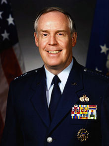
General (USAF, Ret) Thomas S. Moorman Jr. (Photo Courtesy of the USAF)
Lest we forget, behind all the technological arguments and/or failures is the crux of the matter, which is nothing less than assured access to space and all that capability enables, which of course includes GPS. In 2006, General (USAF Retired) Thomas S. Moorman Jr., former AFSPC commander and VCSAF, wrote in the highly esteemed AFSPC publication High Frontier regarding a Senior Leader’s Perspective on Assured Access to Space. He stated clearly that
“Assured access [to space] is a requirement for critical national security, homeland security and civil missions, and is defined as a sufficiently robust, responsive and resilient capability to allow continued space operations, consistent with risk management and affordability.”
In referring to his now famous and eponymous study, he stated that,
“The study found that most people wanted to describe assured access in terms of reliability. As the study team progressed in our analysis, it became apparent that often what people were describing was the need for resiliency rather than reliability. Reliability describes the dependability of a specific booster while resiliency considers the collective ability of all available launch systems to meet national security need.
“While our recent launch record…is indeed impressive, we should not rest on our laurels. Assured access is not a destination, but rather a journey. As a nation, we need to continue to adequately fund space launch operations and develop the next-generation technologies that will increase responsiveness, improve reliability, and reduce costs. Through these actions, we can ensure the nation will have continuous, uninterrupted access to space for decades to come.”
In that light it is possible — even probable — that SpaceX will help us strive, reach and continue with that vaunted goal; contrarily, you may remember a few months ago SpaceX sued the U.S. government because the government was not moving quickly enough for Space X with certifications and validations for SpaceX launch vehicles. The U.S. government knows first hand how difficult the space launch business can be, and it wanted to ensure that not only was SpaceX ready but that their family of vehicles were reliable. The government’s caution has unfortunately been validated, as this was the second SpaceX launch failure, although the first and hopefully the last in the Falcon 9 family of vehicles. All is not lost, and the future actually looks bright for SpaceX if it will just put egos aside, listen to the launch subject matter experts and pay attention to every little detail.
Competition may well be viewed as a “good thing” in the space launch business. However, it is always trumped by assured access to space, which is a critical national security requirement. Competition and national security needs must be balanced with the emphasis on what is gained by assured access to the high ground of space. Elon Musk, Gwynne Shotwell and the SpaceX team may well be capable of showing the rest of us “how it is done,” but first they must demonstrate unerring dependability, reliability and resiliency. I wish SpaceX the best of luck and every success.
Nascent Leadership Paradigm — People on the Move
For some unfathomable reason, at least intellectually, all the USAF Leadership Schools, or at least the majority, are located in Montgomery, Ala. Now personally I happen to like Montgomery and its laid-back southern charm. It was also once the capitol of the Confederacy, which is apropos nothing except it seems to be a hot topic or trigger word these days. Be that as it may, Montgomery and Air University are not exactly Oxford, Cambridge or Eton, and yet the university in its many incarnations has produced outstanding military leaders in its 95-year history. And yet in my numerous tenures at this prestigious institution, it has been made clear by the staff that this is an institution with bipolar tendencies.
On the one hand, it is made clear to every officer and student that the national military establishment thrives on rules and regulations, and those wishing to abuse or ignore them can readily and rapidly be replaced. Some instructors I encountered (not all certainly, and probably not the cream of the crop) would have you believe that individualism has its place — just not in the U.S. military. Then, in the next class or session, you hear stories about visionaries such as Claire Chennault, Jimmy Doolittle and William “Billy” Mitchell, who never colored within the lines. Not to disparage Air University, but I have always had a problem with this school tenet, as it tends to disregard personality, relationships and leadership. I often think of General Dwight Eisenhower’s comments concerning his rebellious, unorthodox and rule-breaking friend U.S. Army General George Patton. Eisenhower made numerous famous comments about Patton’s rebellious nature, his inability to follow orders and his swashbuckling uniforms that once paraded 24 general’s stars at one time on one non-standard uniform, and yet in official comments written after Patton’s untimely death Eisenhower wrote:
“He [Patton] was one of those men born to be a soldier, an ideal combat leader whose gallantry and dramatic personality inspired all he commanded to great deeds of valor. His presence gave me the certainty that the boldest plan would be even more daringly executed. It is no exaggeration to say that Patton’s name struck terror at the heart of the enemy.”
In other words personality, individualism, reputation and leadership do make a difference, and in times of war, leaders bearing those qualities are difficult if not impossible to replace. But in times of peace, those qualities still matter, and we should never take those leaders for granted. I mention this because in the past several months, several Air Force leaders considered key to the GPS program have either retired, been promoted or left government service for personal reasons.
USAF General Ellen Pawlikowski is only the third female four-star general in USAF history, and she recently left SMC (Space and Missile Systems Center) for a job at the Pentagon, where she worked space and GPS acquisition and policy issues. From there she was promoted to four stars and now sits as just the ninth commander of Air Force Materiel Command. Gen. Pawlikowski was replaced at SMC by Lt. Gen. Samuel Greaves (USAF).
Brigadier General William Cooley (USAF) recently pinned on his first star while serving as the director of the GPS Directorate at SMC. He was recently selected for reassignment as program executive, Programs and Integration, Office of the Under Secretary of Defense for Acquisition, Technology and Logistics, Missile Defense Agency (MDA), Redstone Arsenal, Alabama —an organization where Lt. Gen. Sam Greaves once served as the deputy commander. Can you say career broadening? Brig. Gen. “Wild Bill” Cooley is being replaced by USAF Colonel Steve Whitney, who has distinguished himself with yeoman service at the directorate as the GPS Military User Equipment (MUE) guru.
David W. Madden serves as a member of the Defense Intelligence Senior Executive Service and functions as the executive director, Space and Missile Systems Center, Air Force Space Command, Los Angeles Air Force Base, Calif. He is the senior civilian executive and the deputy program executive officer for Space. His responsibilities include managing the research, design, development, acquisition and sustainment of satellites and the associated ground command and control systems and user terminals. In his military career, Dave served as the GPS Wing Commander at SMC. For personal and professional reasons, Dave has decided to leave government service soon, and my sources tell me he will take up a position in Denver, Colo. Unfortunately, I am not currently at liberty to say where. I have been told the name of Dave’s replacement, but it was in an FOUO session and therefore not currently releasable. Suffice it to say, the individual is eminently qualified.
Each of the individuals mentioned has a very strong personality and a certain way of doing business. I have known them all for years and can honestly say their personalities and personal leadership styles dominated their successful careers to date. Frankly, I don’t see that changing. So, when you hear that military personnel are interchangeable and personalities don’t matter, as I unfortunately heard a very senior official say publicly recently, please take that with a huge grain of salt and skepticism. People, personalities and leadership styles do matter, especially outside-the-box thinkers and leaders. Let’s wish everyone the best in their new endeavors.
Until next time, Happy Navigating, and remember: GPS is brought to you courtesy of the United States Air Force.
Public Works and Government Services Canada (PWGSC) has selected NovAtel’s GAJT-AE antenna electronics for testing on Canadian Army platforms. The GAJT-AE, developed in Calgary at NovAtel’s global headquarters, is a GPS anti-jam solution suitable for small and weight constrained applications. The testing is being conducted through PWGSC’s Build in Canada Innovation Program (BCIP).
PWGSC will procure a number of GAJT-AE’s on behalf of the Department of National Defence (DND). The Director Land Requirements (DLR), with the assistance of the Quality Engineering Test Establishment (QETE), will oversee all testing on DND’s behalf. Field testing is expected to take place in the latter half of 2015 at 4th Canadian Division Support Garrison Petawawa.
The testing will analyze the performance of GAJT-AE on Canadian Army equipment in operational conditions to confirm the suitability and robustness of the NovAtel technology for this role. The process is expected to be completed by the end of March 2016.
GAJT is a null-forming technology that negates jammers, ensuring the satellite signals necessary to compute position and time are always available. Three categories of GAJT are manufactured by NovAtel:
GAJT-710ML: for use with military land vehicles, networks and timing infrastructure
GAJT-710MS: for marine vessels, from small boats to capital ships
GAJT-AE: for use with an external antenna in size and weight constrained applications
“NovAtel has had great success working closely with the Canadian Army on the previous round of BCIP,” said Jason Hamilton, NovAtel’s vice president of marketing. “It is essential to have military users test our products in operational scenarios. We look forward to the valuable feedback that the Canadian Army testing of GAJT-AE GPS anti-jam antenna electronics will provide. NovAtel will use this feedback to continue developing products in support of Canada and its Allied partners.”
The BCIP was created by the Government of Canada to strengthen Canadian innovation. The program offers procurement and testing of pre-commercialized products and services, at a late stage of development. The BCIP:
Bridges the “pre-commercialization gap”
Supports Canadian suppliers by connecting innovators and government users and by testing innovations
Provides real-world evaluation of pre-commercial goods and services
Improves the efficiency and effectiveness of government operations.
NovAtel’s SPAN GNSS/INS technology is now available on the company’s OEM625S dual-frequency SAASM GPS plus civil RTK receiver. The addition of SPAN offers system developers with SAASM requirements the benefit of continuously available 3D positioning, velocity and attitude (roll, pitch, yaw) for their U.S. Department of Defense (DOD) applications.
Authorized defense customers need access to the Precise Positioning Service (PPS) for DOD applications. When keyed, the existing OEM625S board level receiver provides an RTK PPS solution by taking the raw measurements from an L-3 XFACTOR SAASM and applying them to NovAtel’s industry leading RTK algorithm. SPAN technology couples NovAtel’s precision GNSS receivers with robust IMUs to provide a more reliable, stable solution, even during short periods of time when satellite signals are blocked or unavailable. The company offers a range of IMU options to meet the accuracy and size requirements for nearly any defense application.
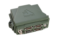
NovAtel’s FlexPak-S enclosure.
SPAN technology is also available on NovAtel’s FlexPak-S enclosure, with multiple RS-232/RS422 serial ports for ease of integration.
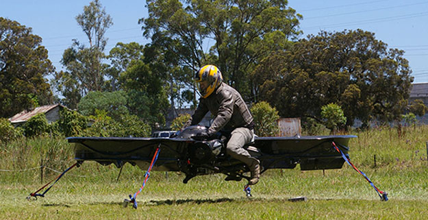
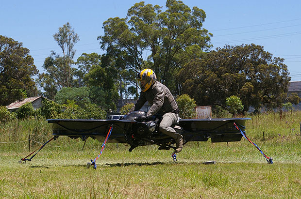
The hoverbike, shown tethered for safety reasons, supports nearly 600 pounds, enough for soldiers and their heavy gear. (Photo: Malloy Aeronautics)
Hover technology has long been depicted in movies like Star Wars and Back to the Future. Now the U.S. Army is teaming up with two companies to develop hoverbike technology — a cross between a motorcycle and a drone.
SURVICE Engineering Co., a Belcamp, Md.-based defense firm, and U.K.-based Malloy Aeronautics, an aeronautical engineering firm, are developing the Hoverbike technology for the U.S. Department of Defense as part of an ongoing research and development contract with the U.S. Army Research Laboratory. The Hoverbike is being developed to operate as a new class of Tactical Reconnaissance Vehicle (TRV).
The makers, Malloy Aeronautics, have a vision for the hoverbike beyond defense. “Its low cost and practical size lends itself to search and rescue, precision farming and cattle mustering, first-responder emergency services and cargo insertion of up to 120 kg (265 lbs) into confined spaces. We believe it would be ideal for ski and mountain rescue, airborne logistics and time-sensitive personnel insertion/extraction during major disasters,” the website says.
As part of this strategic alliance, UK-based Malloy Aeronautics has established a U.S. office in Belcamp adjacent to Aberdeen Proving Ground to complete work on the Hoverbike. A model of the Hoverbike is on display at the Paris Air Show, which runs through June 21.
Malloy’s Drone3, a prototype of the hoverbike, was funded through a kickstarter campaign and is now being sold. According to Malloy’s website, “A Californian customer of ours (Steve Mandel) received his Kickstarter Drone3 in February this year and emailed us yesterday with a photo of his new Drone3 in flight — with a new test pilot.” (Photo courtesy of Steve Mandel)
With about 400 employees, SURVICE is a specialty engineering firm that has been providing R&D support for the U.S. Department of Defense and other industry sectors for more than 30 years.
Formed in 2012, Malloy Aeronautics is an entrepreneurial aerospace company that develops, markets, and sells drones and Hoverbike technology to commercial and military markets.
The video below shows the second-generation Hoverbike in a unmanned static hover. While makers say it’s capable of lifting a person of at least 100 kg, for safety and legal reasons the vehicle is being tested as a drone.
“Establishing an office in Maryland was a clear business decision,” said Chris Malloy, managing director of Malloy Aeronautics. “The proximity to the Army Research Laboratory and U.S. defense decision makers, access to the world-class facilities through the laboratory’s Open Campus initiative, and the co-location with our strategic business partner, SURVICE Engineering, were all factors in favor of Maryland as the best choice for Malloy Aeronautics.”
“Maryland companies do a tremendous amount of research and development (R&D) for the U.S. military,” said Jeff Foulk, SURVICE chief executive officer. “If there is a new military technology being developed, there’s a good chance that some aspect was designed, built or tested in Maryland.”
The U.S. Army Research Laboratory is the nation’s premier laboratory for land forces and is part of the U.S. Army Research, Development and Engineering Command, which has the mission to develop technology and engineering solutions for America’s Soldiers. RDECOM is a major subordinate command of the U.S. Army Materiel Command.