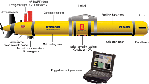
The Remus 600 Unmanned Underwater Vehicle, made by Kongsberg Maritime, a Norwegian company.
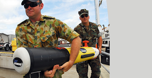
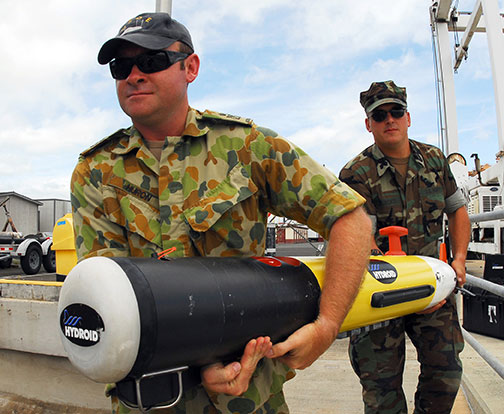
The U.S. Navy plans to deploy its first underwater drones from submarines later this year, according to a report by Military.com.
The website quoted Rear Adm. Joseph Tofalo, the Navy’s director of undersea warfare, who said the deployment will include the use of the Remus 600 Unmanned Underwater Vehicles (UUVs) to perform undersea missions around the globe.
Sailors carry a Remote Environmental Measuring Unit (REMUS) 100. (Credit: U.S. Navy)
“Now you are talking about a submarine CO who can essentially be in two places at the same time — with a UUV out deployed which can do dull, dirty and dangerous type missions. This allows the submarine to be doing something else at the same time,” Tofalo said. “UUVs can help us better meet our combatant command demand signal. Right now, we only meet about two-thirds of our combatant commanders’ demand signals, and having unmanned systems is a huge force multiplier.”
The Remus 600 is a 500-pound, 3.25-meter-long UUV equipped with GPS, as well as dual-frequency side-scanning sonar technology, synthetic aperture sonar, acoustic imaging, and video cameras manufactured by Hyrdoid, a subsidiary of Kongsberg Maritime. The Remus 600 is similar to Bluefin Robotics UUVs, which were used to search for wreckage of missing Malaysia Airlines flight MH370. Other applications include hydrographic surveys, harbor security, and environmental monitoring.
In this video, Explosive Ordnance Disposal Mobile Unit One (EODMU-1) tests the Remus 600 to locate mines using autonomous guidance and advanced sonar.
The Association for Unmanned Vehicle Systems International (AUVSI) will host Unmanned Systems 2015, which will run from May 4-7 at the Georgia World Congress Center Atlanta. With 8,000 attendees from around the world, Unmanned Systems 2015 is the largest expo and trade show in the industry, according to AUVSI.
The event will include three days of interactive exhibits and exciting demonstrations of air and ground vehicles spread throughout 350,000 square feet of exhibit space. The 150-plus educational sessions, workshops, and panel presentations will focus on the future of commercial, humanitarian, environmental, governmental, and military applications for robotics and unmanned systems. For more information on the sessions, see AUVSI’s Program Planner.
This year’s conference will feature keynote addresses and panel discussions by:
Colin Guinn, chief robotics officer, 3D Robotics
Dave Vos, project lead, Project Wing @ GoogleX
David Vigilante, senior vice president, legal, CNN
Helen Greiner, CEO, CyPhy Works
Hugh Herr, MIT professor and head of biomechatroinics at the MIT Media Lab
Rep. Frank Lobiondo, New Jersey House of Representatives
Henrik I. Christensen, distinguished professor, KUKA chair of Robotics, and director of the Robotics & Intelligent Machines Center, Georgia Tech
For more information and a full agenda of events, visit www.auvsishow.org.
COLORADO SPRINGS, Colo. — I had the pleasure of having an early breakfast on this beautiful Colorado morning with Mark Stewart, VP and program manager at Lockheed Martin in Denver for the GPS III program. Mark was very upbeat, a normal state for him actually, and stated that GPS III SV1 was fully integrated — payload, bus and propulsion segments — on April 7, and “all is proceeding according to plan.”
“SV1 is ready to begin environmental testing at the vehicle level and there are no liens going forward,” Mark said. “There are no current issues or concerns.”
Currently, the schedule calls for SV1, per Space and Missile Systems Center (SMC) mandate (read that as Lt. Gen. Sam Greaves) to process through acoustic testing to simulate the acoustics of launch and early orbit maneuvers. Then the complete vehicle will endure a rigorous thermal vacuum testing procedure that should be completed by this summer (2015).
Barring any major anomalies, I am still predicting that SV1 will be through tests by the end of this calendar year. That is not a LMCO prediction as much as it is mine. With that schedule intact, SV1 should be ready for launch by the first quarter of the calendar year 2016. Great news. I will have photos of the mated segments, which make up GPS III SV1, as soon as they are cleared for release. More later.
DARPA is looking for technology communities that can team to provide expertise and innovation for small sensors, expendable and small unmanned systems, and distributed communications and navigation technology.
The Defense Advanced Research Projects Agency (DARPA) is researching a drone that can hibernate on the ocean floor for years at a time before being launched to the surface and into the air.
The “Upward Falling Payload” (UFP) concept centers on developing deployable, unmanned, nonlethal distributed systems that lie on the deep-ocean floor in special containers for years at a time. These deep-sea nodes could be remotely activated when needed and recalled to the surface. As DARPA terms it, they “fall upward.”
The new drones are part of a new focus by the U.S. military to develop and improve technology for emerging threats. “Today, cost and complexity limit the Navy to fewer weapons systems and platforms, causing strain on resources that must operate over vast maritime areas. Unmanned systems and sensors are commonly envisioned to fill coverage gaps and take action at a distance. However, power and logistics to deliver these systems over vast ocean areas limit their utility. The Upward Falling Payload (UFP) program intends to overcome these barriers,” DARPA said on its website.
DARPA’s statement continues: “Nearly 50 percent of the world’s oceans are deeper than 4 km, which provides vast areas for concealment and storage. As a consequence, the cost to retrieve UFP nodes is asymmetric with the likely cost to produce and distribute them to the seafloor. Concealment provided by the sea also provides the opportunity to quickly engage remote assets that may have been dormant and undetected for long periods of time, while its vastness allows simultaneous operation across great distances. Getting close to objects without warning, and instantiating distributed systems without delay, are key attributes of UFP capability.”
The UFP system would have three key subsystems:
The payload, which executes waterborne or airborne applications after being deployed to the surface
The UFP riser, which provides pressure tolerant encapsulation and launch of the payload
The UFP communications, which trigger the UFP riser to launch.
The program would need to demonstrate a system that can:
survive for years under extreme pressure
be triggered reliably from standoff commands
rapidly rise through a water column and deploy its payload.
The drones wouldn’t require fuel, as they would be powered with energy generated by ocean currents. Ocean drones would be difficult to manufacture, however, because researchers would need to figure out how to activate the drone, how to help the drone breach the surface, and make sure the drone is protected in salt water for long periods.
This artist’s concept shows a potential communications application of an upward falling payload. (Credit: DARPA)
Phase 2. The program is completing its first phase and is about to enter its second. During Phase 1, DARPA supported more than 10 study and design efforts to figure out approaches for long-range communications, deep-ocean high-pressure containment, and payload launch. The study teams also addressed a variety of missions for the payloads.
“In this first phase, we really learned about how the pieces come together, and built a community of developers to think differently about unmanned distributed solutions for the maritime domain,” said Andy Coon, DARPA Program Manager for the effort. “The trick is to show how these systems offer lower-cost alternatives to traditional approaches, and that they scale well to large open-ocean areas.”
In the next Phase, DARPA intends to learn from the studies, and develop and demonstrate prototype systems. DARPA is seeking teams to develop UFP nodes that combine expertise in both deep-ocean engineering and advanced payload development.
“We’re also looking for the communications technologies for these nodes. As long as you can command the nodes remotely and quickly, and don’t have to send a ship out to launch it, you’re in good shape. Some Phase 1 approaches were more exotic than others, but we were pleased by the range of challenging options,” said Coon.
In today’s fiscally constrained environment, such a system of pre-positioned, deep-sea nodes could provide a full range of maritime mission sets that are more cost-effective than existing manned or long-range unmanned naval assets.
For Phase 2, DARPA is particularly looking for technology communities that can team to provide expertise and innovation for small sensors, expendable and small unmanned systems, distributed communications and navigation technology, novel long-range underwater communications, and long-endurance mechanical and electrical systems that can survive for years in dormant states.
As I write this, the 31st Space Symposium (SS) will kickoff in just 5 days, on April 13 at the incomparable Broadmoor Resort in Colorado Springs, Colo., at the foothills of the beautiful Rocky Mountains.
Neil deGrasse Tyson (courtesy of PBS)
If you haven’t figured it out already, the 31st SS is not a WWII German unit designation, but the 31st Space Symposium, which Dr. Neil deGrasse Tyson, famed astrophysicist, bestselling author, director of the Hayden Planetarium and host of the hugely successful television series Cosmos: A Spacetime Odyssey, simply calls “the most awesome symposium in the world.” Very high praise indeed, and a sentiment with which I totally agree.
Breaking Records
This year’s Space Symposium, which is sponsored by the Space Foundation, will be the largest ever held in terms of venue, size (number of exhibitors and speakers) and attendance. Approximately 10,000 space enthusiasts are expected to attend, and I hope you are one of them. My sources tell me the classified sessions (Cyber 1.5 and classified space sessions) are filled to overflowing — no new registrations allowed there. The exhibitor space at the Ball Aerospace Exhibit Center and Pavilion is bursting at the seams. The organizers are turning exhibitors away, so better luck next year. But if you just want to attend the greatest space symposium in the world, bar none, there is still time to register.
By the way, if you haven’t figured it out already, this is a truly international event. My sources at the Space Foundation stated that the 31st Space Symposium will have more international participation than ever, including more than 150 exhibits of the world’s latest space technology, products and services. The Ball Aerospace Exhibit Center will host more than 30 first-time exhibitors with more than a dozen countries represented, including: Austria, Canada, Denmark, France, Germany, Japan, New Zealand, Norway, Scotland, Sweden, Turkey, the UK and the U.S. The symposium is expected to attract space leaders from more than 25 countries, representing all sectors of the global space community.
Everyone who is anyone in the space world will probably be there or be represented. Consequently, the networking capabilities are unparalleled. Not to mention just being able to avail yourself of the world-famous Broadmoor Resort hospitality, plus the crisp, clean and cool mountain air at 6,000 feet.
Event Preparation
For many years, the event was known as the National Space Symposium. It outgrew that moniker many years ago, and is now simply known as the Space Symposium.
Every year before I attend the Space Symposium, I make a “ToDoToDay” list of topics I want to explore, both as a journalist and in my senior space analyst profession. Plus, of course, I make a list of people I definitely want to talk with or interview. This year, I thought I would share some of those to-dos with you, because you may indeed have some of the same interests.
GPS III
Mark Stewart, Lockheed Martin GPS III program manager (courtesy of Lockheed Martin)
Wearing my subject matter expert (SME) hat, so to speak, I recently had the honor of touring the Lockheed Martin (LMCO) Space Systems facility in Waterton Canyon (far West Denver), Colorado, where the GPS III satellites are built, integrated and otherwise readied for launch. I took the opportunity to chat with Mark Stewart and his crew. Mark is vice president for manufacturing and space systems and program manager for GPS III.
I learned that the first GPS III space vehicles (SVs) is much farther along than most everyone thinks. The problematic MDU (Mission Data Unit — the heart of the system) from Exelis has been fully tested and integrated into the payload. GPS III SV1 was only three days from being totally integrated or mated, as they say, with the on-orbit propulsion portion of the payload (the remainder of the LMCO A2100 bus) and beginning its months-long testing, certification and verification process. According to Mark, GPS III SV-01 — which powered on initially in February 2013 — now is in integration and test flow leading up to final delivery to the Air Force.
While it was thrilling to see everything finally coming together, I will also tell you candidly that the next milestone everyone is asking about, the first GPS III launch date, is probably as fluid as the Snake River in Spring. So, while I do not feel comfortable quoting a first launch date, and LMCO would not give me a firm date for delivery of the first GPS III SV, I do feel comfortable making this prediction: Barring any unforeseen major issues during testing, LMCO will be ready to deliver to the U.S. government the first ready-to-launch GPS III satellite by the end of this calendar year. That’s right, in my humble opinion the first GPS III SV will be ready to deliver to the Air Force by December 2015. When it will actually be launched is anybody’s guess; obviously, the sooner the better. Apropos of the Boeing IIF initial launches and critical on-orbit anomalies, the sooner the LMCO GPS III is put into orbit for full-scale operational and mission analysis tests the better.
LADO and OCX
The critical question of course is: Will the U.S. Air Force (USAF) have a ground control system that can successfully and reliably launch and support a full-up GPS III SV by the end of 2015? Certainly not if they stay the course with OCX, but there are alternatives, and you know who you are! Can you say LADO, Launch/Early Orbit, Anomaly Resolution, Disposal and Operations System?
Consider that LADO has been utilized to launch GPS satellites as far back as the GPS IIR-M family of satellites, also produced by LMCO, one of which was successfully launched on October 17, 2007, using the then-new LADO system. That milestone ensured the GPS program continued to provide superior space-based navigation for billions of users, military, civilian and commercial, around the globe using industry-leading highly modified (Aces Premier) commercial launch technology. This significant achievement was the culmination of outstanding teamwork between the USAF, Braxton Technologies, the engineering firm and the prime contractor.
The LADO system formed and is still the backbone of the new GPS Command and Control (C2) functionality implemented by the prime contractor. It known today as the Advanced Architecture Evolution Plan (AEP). Subsequently, LADO is now the primary launch system for all current and future (IIR-M, IIF and possibly GPS III) satellites, which should allow the U.S. Air Force to retire some outdated legacy GPS ground support and command and control systems.
The first successful 2007 LADO launch and control of an operational GPS IIR-M satellite, and the 1SOPS and 2SOPS operators’ acceptance of the GPS LADO system, was proof that commercial software can be deployed effectively even in a militarily critical mission system, saving the government both cost and schedule without sacrificing mission-unique capabilities.
In my humble opinion, that is where we need to go today. Let’s return to the tried-and-true LADO and prime contractor partnership and launch the first GPS III SV by the end of this year, or certainly by early 2016. Please notice I have not made any statements concerning scrapping the hugely expensive, 100-percent-over-budget-and-schedule (years behind) OCX program of record. Under Secretary of Defense for Acquisition, Technology and Logistics (USDATL) Frank Kendall recently announced the controversial decision that OCX as the program of record would go forward under strict scrutiny with definite milestones that must be met. Scrutiny is a fickle mistress, and historically on the OCX program, milestones are there to be missed. Meanwhile, the USAF requires a tried, proven and utterly reliable capability to launch GPS III SVs as soon as the first few become available. The USAF must place several GPS IIIs on orbit for a full checkout to ensure there are no major anomalies. Currently, LADO had an eight-year proven track record with no failures, and it remains the only program that can initiate, control and dispose of residual GPS satellites — including the IIAs, which are the longest lived GPS satellites on orbit today.
Beware, there will be many naysayers in government circles, and you may meet some of them at the symposium, that will tell you it is just not possible. But just stop by and talk candidly with LMCO Space Systems and Braxton Technologies personnel, and see what they have to say. You may be surprised by what you hear.
Then stop by the Raytheon booth and check on the status of OCX.
Lynn Dugle (courtesy of Raytheon)
Female Executives in the News
Speaking of OCX and Raytheon, Lynn Dugle retired from Raytheon on March 2, 2015. Historically, Lynn has been a very capable executive. She is the former president of Raytheon’s Intelligence, Information and Services (IIS) business, which handles several key U.S. Air Force space contracts, including OCX, the current program of record for the next-generation ground system for GPS III. Dugle served as president of the division beginning in 2009.
David Wajsgras (your guess is as good as mine), Raytheon’s former senior vice president (SVP) and chief financial officer (CFO), has replaced Dugle. Wajsgras served as SVP and CFO of Raytheon Company from March 2006 to March 2015.
David Wajsgras (courtesy of Raytheon)
As a member of Raytheon’s senior leadership team, he directed Raytheon’s overall financial strategy. In my humble opinion, he has his work cut out for him. He will need all of his financial expertise and acumen to make OCX a success — financially and, hopefully, operationally. The program is grossly over budget, several years behind schedule, and reportedly, my sources tell me, far less capable than originally planned. Good luck, David.
As long as we are still speaking primarily of female executives with great track records, USAF Lieutenant General Ellen Pawlikowski, who I have had the honor of knowing and working with for the past 25 years, was recently nominated for her fourth star. General Pawlikowski successfully commanded the SMC (Space and Missile Systems Center) and served as Program Executive Officer (PEO) for Space for three years at Los Angeles Air Force Base in California. Among her many successful space acquisition programs, she was responsible for GPS procurement during her tenure.
Lt. Gen. Ellen Pawlikowski, USAF (courtesy of the USAF)
Currently, General Pawlikowski serves on the East Coast in the Pentagon as the military deputy to William LaPlante, Ph.D., the assistant secretary of the Air Force for acquisition. In other words, LaPlante is the Air Force’s Service Acquisition Executive, responsible for all Air Force research, development and acquisition activities. Previously, just to add to her mystique, General Pawlikowski spent more than one tour at the super secret National Reconnaissance Office.
When confirmed, General Pawlikowski will be only the third female four-star general in U.S. Air Force history. A well-deserved honor and one that certainly merits acknowledgement. General Pawlikowski is scheduled to speak several times at the Space Symposium, so when you see her, congratulate her on a job well done and on being nominated for her fourth star, and wish her luck in her new assignment as the head (four-star commander) of Air Force Materiel Command.
Before we leave the female leader category, my sources tell me that USAF Colonel DeAnna Burt, commander of the 2nd Space Operations Squadron (2 SOPS, the GPS squadron) from 2008 to 2010, will in June 2015 become only the third female commander of the 50th Space Wing at Schriever AFB, Colorado — home to 2 SOPS. She follows in the very capable footsteps of then-Colonel Suzanne (Zan) Vautrinot, who was the first female wing commander at the50th Space Wing followed by then-Colonel Teresa (Terry) Djuric. Note that both Suzanne and Terry, who are now retired from active duty, went on to become general officers in the USAF.
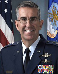
Commander AFSPC – Gen. John Hyten (courtesy of the USAF)
Currently, Colonel Burt serves as director of the Air Force Space Command (AFSPC) Commander’s Action Group for General John Hyten. General Hyten, the current commander of AFSPC, is himself a former 50th Space Wing commander, and he will also be speaking several times at the space symposium. Here’s a big hint: As a four-star general, General Hyten has morphed into quite a forceful, informative, entertaining and engaging speaker. You won’t want to miss any of his presentations.
If you see Colonel Burt at the Space Symposium, please congratulate her on her new assignment, and you might offer her your prayers for the incredible amount of responsibility she is about to assume. I’m betting she can handle it.
GPS Directorate
Another USAF general officer you are sure to run into at the Space Symposium is a newly minted brigadier general known by some as Wild Bill Cooley. General Cooley, who is currently the director of the GPS Directorate at SMC, was pinned on just a few weeks ago and will be speaking several times at the symposium. Wild Bill also deserves your congratulations. By all accounts, he is doing a great job and has more stars in his future.
The Place to Be
So, while there are several points to be made, a key one appears to be that if you are heavily involved with the GPS program inside and outside the USAF and you do a good job, it can work wonders for your career. If you want to hear from those who have been successful, the 31st Space Symposium is the place to be.
I hope to see you at the Broadmoor April 13-16. Come early and wear your walking shoes. Please stop by the GPS World booth and say hello to everyone. I will be there for sure.
As I wind up this to-do list, I will tell you about another Space Symposium event where it is important, even critical, to be seen. Everyone who is anyone will be attending the Connecting Colorado private function on Wednesday evening, April 15. The event is hosted by the Braxton Science and Technology Group; this is the third year for the coveted event. As I have stated before, I have attended 26 of the 31 Space Symposiums, and I have never been to an after-hours function during that time that even approaches the quality and class that Connecting Colorado exudes. It is a first-class event in a visually stunning venue, where private access passes are required to enter and guards are serious about keeping out gatecrashers. If history is any guide, it promises to be an amazing evening of fine wines, sumptuous food, quality cigars, roaring fireplaces and professional camaraderie that can’t be beat. Plus, the networking opportunities are endless. In other words, the Connecting Colorado event is what all the other after-hours Space Symposium events long to be or wish they could emulate. I can’t wait. I hope to see you there, and at the 31st Space Symposium. By the way, April in the Rocky Mountains means dress appropriately — warmly works for me.
Until next time, Happy Navigating, and remember: GPS is brought to you courtesy of the United States Air Force.
Two dual-feed GPS/GLONASS antennas from Tallysman’s GNSS antenna range are now available in Australia and New Zealand through M2M Connectivity. Tallysman is a Canada-based developer of high-performance GNSS antennas focused on the requirements for precision and multi-constellation GNSS receivers.
Featuring a dual-feed wide-band patch element, Tallysman’s TW2410 and TW4421 antennas cover the GPS L1, GLONASS G1 and SBAS (WAAS, EGNOS and MSAS) frequency band (1574 to 1606 MHz). The dual-feed patch provides excellent circular polarized signal reception, multipath rejection and out-of-band signal rejection, according to Tallysman.
Offering tight phase center variation (PCV), the antennas are suitable for high-accuracy applications and for use in precise point positioning (PPP) systems that require only a single frequency such as single-frequency RTK solutions, GNSS compasses and machine control.
Suitable for precision industrial, agricultural and military applications, the dual-feed GPS/GLONASS antennas feature Tallysman’s Accutenna technology that provides superior or multipath signal rejection and precision. The TW2410 and TW4421 antennas are housed in IP67 industrial-grade weather-proof, magnet mount enclosures and come with a wide range of connector options and cable lengths.
Tallysman is a manufacturer of high-performance, high-quality products for a wide range of GNSS applications.
A bi-partisan group of legislators led by Congressman John Garamendi (D-Calif.) has introduced a bill that would require the U.S. Secretary of Defense to establish a backup for GPS within three years using eLoran.
The National Positioning, Navigation, and Timing Resilience and Security Act of 2015, H.R. 1678, was co-sponsored by Congressmen Duncan Hunter (R-Calif.), Peter DeFazio (D-Ore.), and Frank LoBiondo (R-N.J). Garamendi is the ranking member of the House Transportation and uInfrastructure Subcommittee on the Coast Guard and Maritime Transportation.
H.R. 1678 would require the secretary of defense, in coordination with the commandant of the Coast Guard and the secretary of transportation, to establish and sustain a reliable, land-based positioning and navigation system that will complement and backup America’s GPS for military and civilian uses by using eLoran.
eLoran is the government’s existing and underused long-range navigation system infrastructure. The backup system would step in when GPS signals are corrupted, degraded, unreliable, or otherwise unavailable. A terrestrial-based system, eLoran wouldn’t be affected by atmospheric interruptions such as solar storms, or jamming or spoofing aimed at GPS.
The bill directs the secretary of defense to incorporate the expertise and contributions of the private sector to quickly establish system architecture, as well as build and operate the system.
“GPS is much more than a LCD screen on your dashboard. It’s a technology used for much of our nation’s critical infrastructure and by almost every major industry in America, as well as the military, law enforcement, and first responders,” Garamendi said in a press release. “We are increasingly reliant on the precision, navigation, and timing services that GPS provides. From land navigation on cell phones to a timing source for our national infrastructure, we need a reliable backup system to GPS.”
Garamendi said the bill would make the nation’s geopositioning infrastructure more resilient to “threats both natural and nefarious.” “A backup system could also reach places that GPS currently cannot, such as inside many buildings. This would help first responders and law enforcement more effectively protect the public,” he added.
Other members of Congress are expected to sign on as co-sponsors after Congress returns from its spring recess, according to Dana A. Goward, president and executive director, Resilient Navigation and Timing Foundation.
The eLoran PNT system would use enhanced long-range signals (eLoran) from 19 towers around the country, each with approximately a 1,000-mile range providing overlapping fields from which a device can derive its location. The back-up system would use the remaining Loran infrastructure and provide a secure and reliable cybersecurity insurance policy, said the press release.
The U.S. atomic clock, accurate to one second in 300 million years, also serves as the base timing source for this backup GPS capability. This exceeds the timing needs of modern cell phones, creating an infrastructure backbone that is prepared to handle the evolution of consumer and industry electronic communications in the years ahead, the press release said.
The bill sets out numerous requirements for the system, saying that it shall:
Be wireless, terrestrial, and wide area
Provide a precise, high-power 100 kilohertz signal
Be resilient and extremely difficult to disrupt or degrade
Be able to penetrate underground and inside buildings
Take full advantage of existing, unused Loran infrastructure
Work in concert with and complement any other similar positioning, navigation and timing systems, including eLoran.
Since 2004, the federal government has recognized that the absence of a reliable backup system for GPS is a glaring economic and security threat to the United States, and has reaffirmed its interest in developing an eLoran as a reliable, land-based backup for GPS signals, the press release said.
In January, the United States Army began soliciting information for eLoran receivers for the warfighter, either stand-alone or integrated with GPS, for use in Army and other Department of Defense maritime, aviation, or vehicular platforms, and for position and timing.
The United Kingdom began using eLoran in October 2014 to protect its shipping lanes, which carry 95 percent of UK trade, in case of GPS signal loss.
UPDATE: The GPS satellite has been deployed by the Delta IV rocket, completing today’s launch. The deployment occcurred as scheduled about 3 hours after launch.
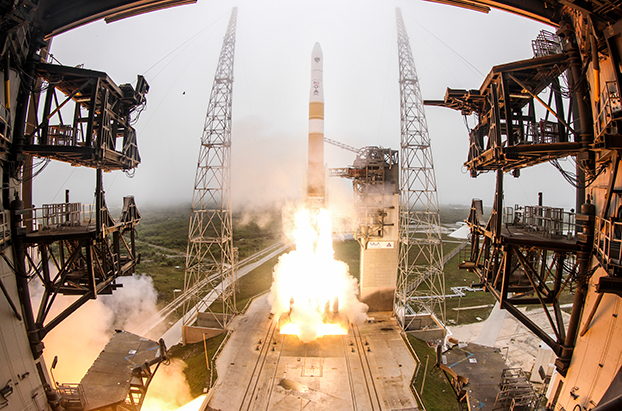
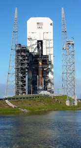
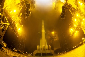
The U.S. Air Force’s ninth GPS Block IIF satellite (GPS IIF-9) launched on time Wednesday at 2:36 p.m. EDT (1836 GMT) from Space Launch Complex 37 at Cape Canaveral Air Force Station, Fla.
The GPS IIF-9 rode aboard a United Launch Alliance (ULA) Delta IV rocket, which has been the workhorse of the GPS fleet for successful launches.
GPS IIF-9 is one of the next-generation GPS satellites, incorporating various improvements to provide greater accuracy, increased signals, and enhanced performance for users.
The Air Force and the 45th Space Wing supported the successful launch of the ULA rocket. This launch is the fourth ULA launch this year and the 95th launch since the company was formed in December 2006.
GPS IIF-9 launched aboard a Delta IV Medium-plus (4,2) Evolved Expendable Launch Vehicle, using a single ULA common booster core powered by an Aerojet Rocketdyne RS-68 main engine, along with two ATK GEM 60 solid rocket motors. The upper stage was powered by an Aerojet Rocketdyne RL10B-2 engine with the satellite encapsulated in a four-meter diameter composite payload fairing.
GPS Launch Workhorse. The launch marks the 29th Delta IV launch and the 57th operational GPS satellite to launch on a ULA or heritage launch vehicle. Delta IV has delivered numerous satellites for the National Reconnaissance Office (NRO), as well as GPS satellites for the Air Force and weather satellites for NASA, according to a ULA media release.
“Many thought the Delta IV and GPS days were long gone, but the recent questions concerning reliable and proven launch vehicles have brought them back online, so to speak, for GPS,” said GPS World Defense Editor Don Jewell. The upcoming (April 27) 20-year milestone for GPS space vehicles on orbit translates to approximately 500 orbital years just for the IIR and IIF constellations alone,” Jewell said. “The IIAs may account for that many orbital hours as well. Quite a record, and something of which the U.S. Air Force (USAF) and all the companies involved should be very proud.”
Yet Another USAF Success. Jewell points out that this is another successful government launch in a long string of successive launches, without a failure. “It is by far the most successful launch record ever put together by any nation or government. No other space-faring nation even comes close. The U.S. Air Force and all the players should be proud of all these records and more, plus we have one more GPS asset on orbit, providing GPS signals to the world and all they enable, courtesy of the USAF.”
“I’m elated with today’s successful launch, the GPS constellation remains healthy, strong and robust and in over 20 years since initial operational capability, GPS has never failed to deliver on its global positioning, navigation, and timing commitments,” said Brig. Gen. Cooley, director of Space and Missile Systems Center’s Global Positioning Systems Directorate.
“Each new generation of GPS satellites provides enhanced capability over the prior generations, and has delivered reliable performance demonstrating our commitment that GPS remain the Gold Standard space-based positioning, navigation, and timing service for the future,” Cooley said. “Thanks to the men and women of SMC, the 45th, 50th 310th Space Wings, Boeing, United Launch Alliance, the Aerospace Corporation, GPS IIF and Delta IV launch teams, the GPS IIF program continues to meet GPS enterprise needs.”
45th Space Wing. Once again, the 45th Space Wing team of military personnel, government civilians, and contractors provided support to the ULA launch of the Air Force Space Command mission, including weather forecasts, launch and range operations, security, safety, and public affairs.
The 45th Space Wing commander was both proud and pleased with the team she works with on the Eastern Range. “First, let me offer my heartiest congratulations to ULA, Boeing, Space and Missile Systems Center, the Launch Systems Directorate, the Global Positioning Systems Directorate, and all the mission partners who made this happen,” said Brig. Gen. Nina Armagno, 45th Space Wing commander, who also served as the Launch Decision Authority.
“What a treat — and an honor — it is to know that we have played such a significant part in something that we will celebrate two decades of helping people all around the world,” Armagno said. “Every GPS satellite since the program’s inception has been launched right here from Cape Canaveral Air Force Station safely and reliably by members of the 45th Space Wing.
“And that’s because we continue to take a ‘one launch at a time’ mentality and focus on our number one priority — 100 percent Mission Success. I am so very proud to be part of Team Patrick-Cape.”
Constellation Changes. The Air Force Second Space Operations Squadron (2 SOPS) indicates that IIF-9, SVN-71/PRN-26, will replace SVN-35 (currently being operated in Launch, Anomaly Resolution and Disposal Operations [LADO]) in the B plane slot 1F. SVN-35 is a GPS 2A-22 satellite originally launched aboard Delta 222 on August 30, 1993. It was decommissioned from active service in 2009, remained in orbit as a spare, then was set usable again in 2011. The satellite was declared unusable in 2013 and decommissioned a second time, reports Spaceflight Now. It was tested again in 2014.
SVN-38/PRN-08 will be taken out of the operational constellation prior to SVN-71 payload initialization and sent to LADO. PRN-08 will be assigned to SVN-49 in May and set to test, but is tentatively scheduled for assignment to IIF-10 to launch June 16.
SVN-35, launched on August 30, 1993, has been in a residual status since March 2013 in an expanded node slot in the B plane and successfully served 21.5 years, 14.0 years beyond its designed service life, due to the diligent efforts of the men and women of the U.S. Air Force.
SVN-51 is still in a re-phase journey from E1 (GLAN=146 °) to an auxiliary node at E7 (GLAN=60.7 °) scheduled to arrive sometime this summer.
Courtesy photo/John Studwell, provided by 45th Space Wing Public Affairs.
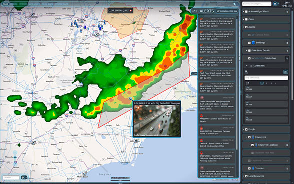
IDV Solutions’ Visual Command Center is a physical security and risk visualization (PSRV) software that unites data from external sources, enterprise systems and internal devices into a real-time, common operating picture of risk and security. Photo: IDV Solutions
IDV Solutions, a corporation that specializes in business intelligence, physical security and risk visualization software, has formed a technical partnership with Geofeedia, producer of a cloud-based social media monitoring platform. Through the partnership, Geofeedia’s location-based social media monitoring data will now be integrated into IDV Solutions’ Visual Command Center Enterprise Risk Visualization (ERV) software.
The companies say the combination of the two technologies enables security, supply chain and business continuity teams to gain instant intelligence from multiple social media networks for a myriad of risk events — from a political demonstration to a natural disaster. The location-based visualization filters out excess noise to show important social media posts in the context of locations of interest, such as facilities, employee locations, supply routes or traveling executives.
“Companies are looking for ways to efficiently gain actionable intelligence from social media,” said Ian Clemens, chief technology officer and co-founder of IDV Solutions. “The immediacy of social media combined with the alerting and locational context offered by Visual Command Center enables organizations to make more effective use of social media to protect employees, facilities and business continuity.”
The Visual Command Center provides a real-time, common operating picture of assets, personnel and operations in relation to potential threats to those assets. It unites information on global sources of risk — such as weather, terrorism and natural disasters — with data from internal data stores and physical security systems on an interactive map and timeline. When a risk is detected near an asset or employee location, the Visual Command Center automatically generates an alert and provides tools to assess whether the risk is a threat and take immediate action to mitigate the impact of the threat.
The Geofeedia integration complements the Visual Command Center’s Twitter Visualization and Alerting Module by providing information from more social media networks and visualizing all posts within a selected area.
Geofeedia enables organizations to filter and analyze social media content by location in real time across multiple sources. Users search for a city, address or location name, draw a virtual perimeter around the specific area of interest,and access geo-tagged social media content from within those boundaries.
“Location resolves the challenge of monitoring the massive amounts of cluttered data to identify meaningful, real-time on-the-ground intelligence when and where it matters most,” said Phil Harris, CEO and co-founder of Geofeedia. “We are thrilled to be able to help more organizations take advantage of our real-time, geotagged social media data to prevent, protect and respond to valuable intelligence.”
Rockwell Collins has signed a contract to provide its MicroGRAM GPS receivers (pictured here) for Harris Corporation’s tactical radios, bringing secure, jam-resistant GPS capability to products such as the Falcon III AN/PRC-158 and AN/PRC-117G.
Rockwell Collins has signed a contract to provide its MicroGRAM GPS receivers for Harris Corporation’s tactical radios, bringing secure, jam-resistant GPS capability to products such as the Falcon III AN/PRC-158 and AN/PRC-117G.
The contract, which represents the largest annual purchase of MicroGRAM, calls for Rockwell Collins to provide 5,000 GPS receivers to Harris over the next three years. Deliveries began in January.
“MicroGRAM enables Harris Corporation to meet military customer demands for embedded, secure GPS,” said Mike Jones, vice president and general manager of Communication and Navigation Products for Rockwell Collins. “MicroGRAM protects warfighters from the growing jamming and spoofing threats on the battlefield, while enhancing survivability and mission success.”
With this selection, Jones said Harris is one of the first major original equipment manufacturers to commit to using MicroGRAM to meet the Department of Defense’s (DoD) requirement to use Selective Availability/Anti-Spoofing Module (SAASM) technology in its products.
“Harris is pleased to continue our long relationship with Rockwell Collins as our provider of GRAM SAASM GPS modules. Integrating the MicroGRAM receiver into a number of our new tactical radios allows us to reduce the size and weight while extending the battery life of our products,” said George Helm, president, Department of Defense business, Harris RF Communications. “The end result is delivering reliable situational awareness down to the individual warfighter.”
MicroGRAM is the world’s smallest, lightest, lowest powered SAASM-based GPS receiver. It enables military micro-users who require secure Position, Navigation & Timing (PNT) to comply with U.S. DoD policy that all combat and combat support systems use SAASM-based GPS devices. This capability is critical at a time when threats to commercial GPS are increasing. The use of unprotected commercial non-SAASM GPS devices has inherent vulnerabilities which introduce a false sense of situational awareness on the battlefield.
GPS World will host a webinar this Thursday, March 19, on the merits of using simulated jamming, spoofing and interference scenarios to prepare GNSS receivers for the brave new world of coping with adverse signal effects. It’s clear that users need to still operate commercially and individually, even when they get hit by extraneous interference — intended or otherwise — in a world where cigarette-lighter jammers, engineering “lash-up” spoofers, and badly designed commercial gear can ruin a person’s day.
Recently, I had a conversation with Guy Buesnel, market segment manager, GNSS Vulnerabilities, at Spirent Communications. He wanted to alert me to the concept that jamming and spoofing is at a stage where Internet hacking was many years ago. Hacking has progressed from the typical loan student in his bedsit or studio apartment pounding on a keyboard to break down banking or other institutional firewalls, to nowadays, where focused groups mount hacking attacks on targeted agencies or companies lasting days, weeks, even months. Huge effort is currently being applied to defending against these and future focused attacks.
Buesnel’s point is that organized attacks on GNSS may be coming, and coming soon. Individuals and groups are already self-jamming to prevent detection — organized car and truck thieves wanting to avoid location of stolen assets, or truck drivers wanting to prevent their employers knowing their whereabouts — using easily obtained “personal cigarette lighter” or even professional-looking jammers (see figure below). Jamming GPS L3 at 1381.05MHz might awaken U.S. Department of Defense (DOD) interest as it’s used by the Nuclear Detonation (NUDET) Detection System Payload (NDS), and L4 at 1379.913 MHz is currently only used for studies on additional ionospheric corrections.
But Buesnel warns that organized spoofing could soon start to happen, and happen frequently. And it could be argued that spoofing is more dangerous than jamming, because a user or someone monitoring a user might not know for some time that their position information has been compromised. Long enough, perhaps, for an unwary user to get into potentially serious trouble, especially in a higher speed, fuel-restricted application like an aircraft or a small boat running some distance offshore.
GNSS is already embedded into the critical infrastructure of utility providers, and also telecoms, financial and transport sectors for timing/synchronization or positional data, and the growth in vehicle automation will soon see GNSS being used for even more safety-critical applications. The security of GNSS is already of huge importance and a “GNSS hacking attack,” like those experienced by Internet users, could achieve significant disruption across a host of operational segments. Precise GNSS timing is already essential for time stamping some transactions and used extensively for cell-site synchronization, so significant damage could occur if timing information were to be compromised.
While an intentional spoofing attack has yet to be confirmed — except under conditions such as that drone spoofing demonstration and then the White Rose luxury yacht spoofing trials, both by University of Texas/Cockrell School of Engineering graduate students — unintentional spoofing has indeed been reported. GNSS repeaters radiating at higher power levels than actual GNSS signals can be the source of such spurious signals. The result can be that GNSS receivers may acquire and track the higher power repeater signals, and the receiver position becomes that of the repeater. Use of GPS repeaters in unsuitable locations, such as for production tests in an open workshop, have been reported. The risk is that GNSS signals could extend outside the building and affect users, so GPS receivers could be spoofed and tricked into reporting an incorrect position.
White Rose 213-foot luxury yacht. Photo: Tony Murfin
For more than 20 years, the information security community has debated publishing the methods used by hackers and others to expose and attack vulnerabilities within products. Initially, things were kept hidden and were only shared between groups of hackers or IT administrators. However, online hacker forums quickly distributed knowledge — often including sample code. This allowed everyone from security researchers and IT administrators to hackers to learn about the vulnerabilities of applications and critical systems. It would seem that both researchers and hackers alike have broken the spell, and now it’s easy to spread the word about backdoors and weaknesses in firewalls, critical applications and the like.
Fast forward, and we are now in the age of mass-market access to jammers of all kinds through offshore websites — even if it’s illegal to operate such devices. However, it’s also illegal to hack the Department of Defense, but that has not prevented hackers in the past from assaulting and penetrating all sorts of secure DoD computing facilities. So, let’s just assume that the individuals who get a kick out of creating mayhem may eventually turn to something new — and the age of jamming and spoofing for fun may be upon us.
All is not lost, however. Just as applications for finding and killing viruses have become more robust, and new “antidotes” and warnings are now automatically downloaded to your PC even as they are created, and huge amounts of effort are now being applied to creating the most robust firewalls, so the designers of GNSS receivers are working hard to immunize their systems against anticipated attacks. And simulator/replay manufacturers such as Spirent Communications, IFEN, Spectracom and Racelogic are developing and fielding ready-made spoofing and jamming capabilities and scenarios with which manufacturers can test and qualify their receivers — which you may well hear about during the coming GPS World webinar on March 19.
Nevertheless, some people in the industry are urging members of the GNSS community to act more cooperatively and report spoofing and jamming incidents/attacks for their own good. It seems that the industry only collaborates in the face of a major common threat — take the ultra wideband and LightSquared episodes where the response was virtually unanimous. While most GNSS manufacturers in the meantime tend to maintain a very proprietary cover to their field experience and technological solutions, this still leaves customers exposed to product vulnerabilities. The GNSS community now has the advantage that the information security community has been working through these hurdles for the past two decades. Lessons learned include the following:
Controlled, responsible disclosure and cooperation allows everyone to monitor the threat and how it is being dealt with.
Without restricted disclosure and preventive solutions, attacks will always take advantage of weaknesses.
Eventually, disclosure of product vulnerabilities will result in more respect and confidence in manufacturers by users.
Rapid resolution of issues is essential.
The GNSS community has an opportunity to come together, learn from the information security community, and adopt best practices to secure and protect its customers.
(With grateful thanks to Guy Buesnel and David DeSanto of Spirent Communications!)
Editor’s Note: Don Jewell, GPS World’s Defense PNT newsletter editor, served 30 years in the United States Air Force as an aviator and a space subject-matter expert. The views expressed are his own.
It was a dark and stormy night, followed by an even more challenging predawn in the far North. Clouds and blowing snow mixed with stinging ice crystals scudded over the ocean and the hills of southwest Iceland. I knew from personal experience that the crew inside the Airborne Warning and Control Aircraft (AWAC) E3, especially the cockpit crew, were watching the weather closely as they listened to tiny ice pellets pinging off the aircraft. The winds gusted at 20-30 knots from the east, and the Keflavik tower was in the midst of turning the airport around, which meant that all aircraft would depart to the east over land, versus the normal departure SID (Standard Instrument Departure) to the west over water.
(I must interrupt my tale briefly to tell you that GPS plays no role in the 1978 drama that is about to unfold. At its conclusion, I will describe the differences GPS has made in the operation of strategic military aircraft, and why a recent book is one of the best arguments for GPS/PNT systems I have ever read.)
I was stationed as a permanent party USAF officer in Iceland assigned to Detachment One of the 552d Airborne Warning and Control Wing which flew the latest AWACs out of Iceland to help defend the GI-UK (Greenland, Iceland, United Kingdom) gap. Russian TU-95 four-engine turbo-prop Bear bombers flew non-stop over the GI-UK gap, at jet speeds (550-575 mph) from Murmansk in what was then the Soviet Union, on a regular basis, en route to visually and electronically surveilling and reconnoitering — spying on — the East Coast of the United States, and then landing in communist-controlled Cuba.
Russian TU-95 “Bear” Bomber (courtesy of Wikipedia and RAF).
That memorable morning just before Christmas in 1978, I was the Supervisor of Flying (SOF) for all USAF military aircraft at Keflavik AB, which was both an Icelandic commercial airport and U.S. military installation. As SOF, I double-checked all the flight information for the AWACS aircraft, visually checked that the aircraft were ready for take off and flight, and surveyed the airport and runway environment to make sure there were no hazards to the aircraft or crew. Because the weather was rapidly deteriorating that morning, I also checked all the alternates for the AWACS in England and Scotland.
Supervisor of Flying (SOF)
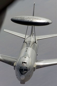
AWACS (Photo courtesy of the USAF).
I was comfortable in my Command Vehicle, a new British Range Rover, vintage 1978, equipped with a plethora of radios that connected me to everyone on the airfield, including the control tower and the U.S. military Command Post. Externally, the vehicle had a constantly flashing yellow light so that I could be easily seen and identified by the tower and the aircraft I inspected. There were external blue and red lights and sirens, which came into play when we launched the alert E3 aircraft or there was an emergency. All in all it was a very comfortable and functional mobile airfield office. But this morning I had a welcome addition. My boss, Major General-selectee John L. (Pete) Piotrowski, the 552nd Wing Commander, had stopped by on his way from Japan, en route the long way home to the AWACS base, Tinker AFB in Oklahoma.
For many officers (I was just a major at the time), having your General Officer boss onboard might have been intimidating, but not for me. General Piotrowski was a valued mentor and friend as well as a true gentleman and professional USAF officer of the highest caliber, and frankly, I welcomed his presence and experience. I was happy he had come to personally check out the very first AWACS detachment. Little did I know how pivotal his presence would be that cold, dark and blustery Icelandic morning.
There were two full crews aboard the AWACS aircraft I had just checked and cleared for departure, a senior crew in the cockpit and two mission crews that would get some much needed training on the way back to Tinker, so they would not go “non-current” over the Christmas holidays. Crews typically deployed to Iceland from Tinker AFB for a 10-day tour and then rotated back to CONUS and then to other disparate operation locations around the globe.
(Courtesy of the USAF).
Weather and planning-wise, Iceland was the most challenging for the E3 aircrews because of the annual snowfall of 311 inches and the siren call of suitable and weather-wise more hospitable alternates, with proper facilities and security arrangements, which were more than a hour away in England and Scotland, so planning was key. However, that morning all the crew was thinking about was getting home and enjoying the holidays (we called it “gethomeitis”) and, unfortunately, it played a key role in that mornings near catastrophe. I, of course, wanted to impress my boss with my thoroughness and professionalism, so I was double- and triple-checking every little detail.
Remember, 1978 was the same year the first fully operational, non-test, GPS satellite was launched into MEO orbit, so there were no GPS receivers on the AWACS aircraft. Instead, at that time the prevailing technology called for precisely surveyed aircraft parking spots on the ramp. The coordinates of these spots were typically entered into the E3’s INSs (inertial navigation systems) before they taxied for takeoff. Because the departing AWACs were nominally always parked in the same spots near the prevailing runway for a quick reaction or alert takeoff, the procedure quickly became routine for the AWACs flight crews. This routine also contributed to the nearly catastrophic incident that blustery and memorable morning.
Even with the deteriorating weather and the gusty winds, there appeared to be no reason why the E3 should not depart on schedule. Then, just five minutes before scheduled take off, the wind shifted dramatically and suddenly to an easterly direction. The tower immediately “turned the airfield around” and cleared the E3 for a takeoff to the east – the only problem was the aircraft was already lined up on the prevailing runway ready for a routine westerly departure. So the Icelandic controllers in the Keflavik tower promptly cleared the E3 for a rapid taxi down the active runway, so they could turn around (180 degrees) on the other end and still make an on-time takeoff. This was actually rather a common occurrence for those of us who were permanent party, so no one was concerned.
The E3 Aircraft Commander (AC) was a senior 06 — an USAF full Colonel. (Note: The subsequent safety investigation proved the AC’s rank and seniority, plus the crew’s reluctance to question his decisions, were a contributing factor in the incident.) The colonel responded to the tower, “Roger, understand, cleared for takeoff” and the aircraft began to roll down the runway in what General Pete, the tower personnel and I all initially assumed would be a fast taxi to the other end of the runway. At the time, I remember thinking, “I wonder why he did not respond correctly with the complete clearance, which was to taxi to the other end of the runway and then be cleared for takeoff to the East?” However, since it was 0500 and no other aircraft were in the area, no one was too concerned — until we saw that the E3 aircraft was continuing to accelerate to the point that the spray caused by the tires and the blowing snow thrown up by the four big jet engines nearly obliterated the aircraft from our vantage point.
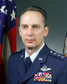
General Piotrowski (Photo Courtesy of the USAF).
I think General Pete and I realized at the same moment that the EA was making a dangerous downwind departure. However, we realized it too late, as did the tower. General Pete and I simultaneously reached for the radio microphone, connecting us to the departing E3 aircraft at the same moment, but then neither of us made the radio call to the aircraft because we realized the pilot in command would have his hands full. At this point, the aircraft was going much too fast to stop on the wet and icy runway available, plus the AC did not need the distraction of a radio call in the middle of what was rapidly becoming a possible emergency situation. I do vaguely remember turning on my red and blue lights and my siren and accelerating down the active runway, in pursuit of the E3, and making the radio call “SOF on the Active” to the tower, as I wanted to be as close to the aircraft as possible if it stopped with hot brakes, or crashed into the barrier or the water. E3 (707 320B) aircraft are notoriously susceptible to control and start issues with tailwinds, and I must admit that I did not think for a moment the aircraft stood a chance of actually getting airborne. Miraculously, the E3 managed to lift off in the overrun at the far end of the runway and grudgingly managed what appeared to be about a five to ten feet per minute positive climb rate out over the water, before it rapidly disappeared into the lowering cloud deck.
General Pete and I sat there in shock and disbelief for a full five minutes before we heard the tower give the aircraft a new departure heading and frequency. We waited to be sure the aircraft replied, and since no emergency was declared, we knew they were finally safely on their way home.
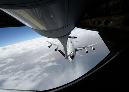
Needless to say, incident and safety reports were filed, audiotapes from the tower were copied and forwarded to the 552nd Wing Safety Office, and I filed my SOF report. Normally, I would have called the 552d Wing Commander as well, but of course he was seated right there beside me. Long story short, the rest of the flight went without a hitch, and the crew landed safely at Tinker AFB 14 hours later after a successful mission that included two aerial refuelings. The flight crew was immediately suspended pending an investigation and the aircraft was impounded and inspected.
AWACS refueling (Photo courtesy of the USAF).
Two months later, I attended the safety inquiry at Tinker AFB into the incident in question. At the time of the incident, only the Keflavik tower, General Pete, myself and the cockpit crew knew what had happened. The 20+ mission crew members had no idea their lives had been in peril. There were reportedly comments among the mission crew about an extremely long takeoff run, but beyond that, there were no crew concerns.
During the hearing, the AC admitted that once he realized his mistake and calculated he could not stop the aircraft on the wet and slippery runway, he asked for full military power (military-rated thrust) on all four engines, which means the throttles were pushed to the stops and every ounce of power the engines had was engaged. It was a matter of life and death, and yet at the inquiry, when General Piotrowski fired most of the flight crew and told them to find jobs elsewhere, there were no raised voices or angry words, no shouting or swearing. General Piotrowski handled it like the true gentlemen he still is today. Later that same day over lunch, I asked him how he could remain so calm. He replied, “Don, always remember, when you are in the right and you have the power to make the right decision, there is never a need for shouting or cursing or loud voices. Do what is right and do it quickly and firmly but calmly. Emotions have no place in these types of decisions.”
This was merely one of the leadership lessons I learned from this great man, wonderful leader, mentor and friend. I have known General “P” for over 38 years now, and have never seen him lose his cool. He is the consummate professional and, frankly, I could tell General Pete stories all day long, but fortunately I don’t have to because he wrote a wonderful can’t-put-it-down book — The Secret War and Other Conflicts — about his life and the lessons he learned during his almost 40-year career in the USAF. There are many more stories like the one you just read, and at the end of each chapter in his book are the lessons he learned and that he hopes we all learn as well.
GPS Connection
There is, of course, a definite GPS/PNT connection, even though I am reasonably sanguine General Piotrowski did not have that in mind when he penned this 715-page tome of military life and knowledge. Every scenario in this very educational book that relates to military operations and/or training has the same theme for aviators everywhere.
There I was trying to figure out where I was, where the target or destination was, and how I could get there, and once there how I could deliver my ordnance, my passenger(s) and/or just get the aircraft safely back on terra firma.
In this regard, and so many others, General Pete is right on the money, and he should know. Like many of us, including General Curtis LeMay, he trained as a navigator and an aviator.
Take the AWAC E3 aircraft and the whole support system that surrounds it. How did the introduction and integration of GPS change those operations and procedures? To say the least, the changes GPS enabled were drastic — revolutionary versus evolutionary — to those of us who have experienced pre- and post-GPS AWAC flights.
The most obvious change both to the AWAC organization and to the USAF, as it pertains to the rated career field, is that the navigator position was eliminated on the E3 and several other large flight-crew-type aircraft. The navigator planned all the missions for the aircrew, including the flight route (on the ground and inflight), planned and ran the rendezvous for the air refuelings (typical AWAC sorties average 14 hours), and trained with and used a sextant (sun, moon and stars) for navigation in case in war time the electronic navigation aids were unavailable. The navigation system supplied the position, time and velocity references to the mission end of the operation. That crew position and all the manual functions associated with it were eliminated when GPS was installed on the aircraft. The operations still had to be performed and the mission successfully completed, but GPS proved to be so accurate and provided such reliable information that the navigator position was no longer necessary. The position and timing accuracy sent from the navigation hardware and software to the mission computers improved to the point it was accurate to the centimeter level — versus thousands of feet with the old system.
In the old, pre-GPS days, the navigator or pilot would initialize a time hack for all crew members and members of a flight so that everyone had the same time reference as the lead pilot or aircraft. That timing was — five, four, three, two, one hack! — accurate to a whole second and no more. Today, GPS provides continuous atomic-clock-level global timing for everyone. All systems onboard the aircraft, as well as the ground interfaces and communications systems, are accurate to over a millionth of a second and no time hacks are necessary.
Additionally, in the pre-GPS days, aircraft — even the versatile E3, which is capable of and has historically fulfilled the functions of an FAA Control facility for aircraft — mostly flew airways over CONUS and used Federal Aviation Administration radio-based navigation aides such as TACAN (Tactical Air Navigation), VORs (VHF-Very High Frequency Omni Directional Radio Range systems), VORTACS and DMEs (Distance Measuring Equipment) to determine their position while the navigator practiced his craft. However, go feet wet — that is, strike out over water where none of those navigation aides exist, en route to Hickam AFB, Hawaii, for instance — and all of a sudden the navigator became the most important member of the crew. Today’s AWAC aircraft and most modern GPS-equipped military aircraft are able to fly direct to any point in CONUS or anywhere on the globe, saving thousands of hours of flying time, wear and tear on the aircraft and crew, and of course fuel and money. The savings are practically incalculable, but certainly run into the hundreds of millions if not billions of dollars a year. Plus, from a military point of view, the safety factor of putting bombs on target the very first time, day or night, from any location on the Earth cannot be accurately calculated, especially when you consider the number of lives saved.
In WW II, in Vietnam and even in Korea the U.S. Army Air Corps and USAF would fly hundreds and then tens of sorties, endangering thousands of lives, just to take out a single bridge that a single JDAM (Joint Direct Attack Munition) or any GPS-guided weapon today can take out from such a distance that the aircrew may never actually see the bridge, but be certain to a high degree that it was destroyed with a single weapon and a single sortie.
Ask any pre-GPS navigator or aviator, and they will tell you that the biggest error in any bombing mission was always target error. This error extended to exactly where the target was located, how it was defended and how it could be destroyed. With modern GPS weapons, all those variable target errors are greatly minimized. Human lives may not be involved as GPS is capable of providing the PNT information necessary for a UAV (unmanned aerial vehicle) to perform the mission, sans any threat to the pilot or weapons systems officer, who may well be thousands of miles away from the fight.
So, back to General Pete’s book. As you read this wonderful compendium of Air Force lore and knowledge and become involved in the scenarios of just getting to and from the targets in war time, to airfields in bad weather and home again through the clouds, think from time to time about how GPS has greatly simplified all those tasks and made them infinitely doable. Indeed, this 715-page aeronautical volume is one of the best arguments for GPS/PNT systems I have ever read.
Basic Airman to General: The Secret War and Other Conflicts – Lessons in Leadership and Life
This remarkable manuscript is so much more than the biography of a two-striper airman that retired as a four-star general. Amazing as that accomplishment is, the true value of the book is in the journey it took to get there — the life lived and lessons learned.
True to form, General Pete pulls no punches in his biography – in print as in life what you see with General Pete is what you get. He is honest to a fault, and is as critical of himself as he is the United States Air Force he loves and served in uniform for almost 40 years. I recommend this book as an Air Force primer to anyone thinking of joining the military and to members of Congress who never served in the military, and unfortunately that number stands at 80% today, because truly they (Congress) don’t have a clue what putting your life on the line to defend your country means. They have no idea what flying, fighting and dying for your country means. They have no idea of the sacrifices made by USAF military forces on a daily basis.
Treachery
Unfortunately, during the Vietnam War there was a very revealing event that highlights a major failing of civilian leadership that cannot be reconciled or apologized for but is still a major lesson that must be learned by everyone in the U.S. military and in the U.S. government. General Piotrowski reveals treacherous acts by the Kennedy and Johnson administrations that literally took my breath away. It made me physically ill. I have to admit I was gasping for breath after I read it and I had to sit down. I was so shocked that I read it several times and still had trouble believing what was revealed. Don’t get me wrong, I certainly never doubted General Piotrowski’s veracity concerning the politician’s confession; I was and am still just amazed that anyone in the U.S. government in any position of power could be so ignorant and criminally naive. General Piotrowski reveals stunning facts about the Vietnam War on pages 246-247 of his 715 page-turner of a book that shook me to my core. General Piotrowski writes:
“Nearly twenty years later, [ed. after the Vietnam War ended] I saw former Secretary of State Dean Rusk being interviewed by Peter Arnett on a CBS [ed. CBC] documentary called “The Ten Thousand Day War.” Mr. Arnett asked, “It has been rumored that the United States provided the North Vietnamese government the names of the targets that would be bombed the following day. Is there any truth to that allegation?”
To my astonishment and absolute disgust, the former Secretary responded, “Yes. We didn’t want to harm the North Vietnamese people, so we passed the targets to the Swiss embassy in Washington with instructions to pass them to the NVN government through their embassy in Hanoi.” As I watched in horror, Secretary Rusk went on to say, “All we wanted to do is demonstrate to the North Vietnamese leadership that we could strike targets at will, but we didn’t want to kill innocent people. By giving the North Vietnamese advanced warning of the targets to be attacked, we thought they would tell the workers to stay home.”
No wonder all the targets were so heavily defended day after day! The NVN obviously moved as many guns as they could overnight to better defend each target they knew was going to be attacked. Clearly, many brave American Air Force and Navy fliers died or spent years in NVN prison camps as a direct result of being intentionally betrayed by Secretary Rusk and Secretary McNamara, and perhaps, President Johnson himself. I cannot think of a more duplicitous and treacherous act of American government officials. Dean Rusk served as Secretary of State from January 21, 1961, through to January 20, 1969, under President John F. Kennedy and Lyndon B. Johnson. Perhaps Senator John McCain, POW for five years and presidential candidate in 2008, was one of the many victims of this utter stupidity and flawed policy flowing from President Lyndon B. Johnson. Mr. Peter Arnett opined that this would be a treasonous act by anyone else.”
After reading this horrendous revelation, I was so shocked I couldn’t function properly for the rest of the day. I am still aghast and incredulous that government officials could be so deceitful. I lost so many friends, aviator comrades and loved ones in that terrible war, including my father who was literally eaten from the inside out by parasites and the drugs and alcohol he used to try and dull the physical and mental pain and anguish. There are still tens of thousands of veterans suffering today from the effects (such as PTSD – post traumatic stress disorder) of that war, and to think that our government leaders at the highest levels told our enemy what our targets would be on a daily basis because they cared about Vietnamese civilian casualties. Seriously, we were at war. Obviously the administrations, especially the SECDEFs and Secretary’s of State, did not care about American lives, especially American fliers. You can never hope to win a war when all of your targeting information is being treacherously given to the enemy on a daily basis. I am still incredulous they could be so treacherous.
Lessons Learned
Yes, this is sensational and revealing, and there are obviously lessons to be learned — indeed, lessons that the current administration could, should and indeed must learn — such as allowing military professionals to do what they do best and stop micromanaging the Defense Department. But this represents merely a handful of lessons, and this book, this wonderful tome concerning life and leadership at all levels from basic airman to four-star general, is such an educational tool for today’s leaders that it needs to be required reading at all the service academies, certainly the United States Air Force Academy (USAFA). But you don’t have to be in the government or the military to enjoy and learn from the life lessons presented here. General Piotrowski is incredibly honest about his triumphs, his failures, his family life, and his service. He is brutally honest and self-effacing concerning the effects of time spent away from his family defending his nation. Not only in wartime, but during the Cold War as well. For example, remember AWAC aircraft at the time had no CONUS (Contiguous United States) mission, so all the missions were flown overseas. I flew AWAC missions for nine years, average sortie length 12-14 hours, including four years flying NATO AWAC aircraft from Geilenkirchen, Germany, and one year in Iceland. The other four years I was TDY (temporary duty) overseas an average of 220 days per year. General Piotrowski did the same and more, and believe me, it is a huge sacrifice for the service member and their families.
So, there is a lot of good fatherly advice in this book, and I only wish someone like General Pete could have written this book 40 years ago when I was a young lieutenant.
The bottom line is the title says it all: Basic Airman to General; The Secret War and Other Conflicts — Lessons in Leadership and Life. Get a copy today, you won’t be disappointed.
Until next time, happy navigating, and remember: GPS is brought to you courtesy of the United States Air Force.