Category: BeiDou

  • The System: OCX, GPS III Show Launch Readiness

    Illustration: Lockheed Martin
    GPS III SATELLITE, artist’s rendering, courtesy Lockheed Martin.

    Raytheon Company and Lockheed Martin successfully completed the first launch readiness exercise for the U.S. Air Force’s next-generation GPS III satellites. The exercise is a key milestone demonstrating the team remains on schedule to achieve launch availability in 2014, the companies said.

    The Lockheed Martin-built GPS III satellites and the Raytheon-developed next generation GPS operational control system, known as OCX, are critical elements of the U.S. Air Force’s effort to affordably replace aging GPS satellites while improving capability to meet the evolving demands of military, commercial and civilian users worldwide. This is the first space and ground enterprise successfully building the ground control and space vehicles by two independent prime contractors.

    The launch readiness exercise, completed over a three-day period by mission operations personnel, validated the basic satellite command and control functions, tested the software and hardware interfaces and demonstrated basic on-console procedures required for space vehicle contacts during the launch and early orbit mission.  The event sets the stage for the first GPS III satellite’s mission readiness timeline, which includes five short-duration exercises and six, five-day mission rehearsals leading up tolaunch.

    To achieve first launch availability in the 2014 timeframe, the U.S. Air Force awarded Lockheed Martin and Raytheon contracts in January of this year to provide a Launch and Checkout Capability (LCC) for launch and early on-orbit testing of all GPS III satellites.  At the heart of the LCC is Raytheon’s Launch and Checkout System that will provide satellite command and control capability, an integral part of OCX’s  support of the first GPS III launch.

    Rockets on the Pad

    As this magazine goes to press on September 17, several GNSS satellite launches are pending, and may have already occurred by the time you read this. Launch dates this fall for GNSS satellites in the coming season are as follows, according to various, not always official, sources. Compilation courtesy of CANSPACE.

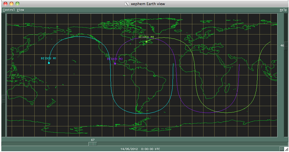
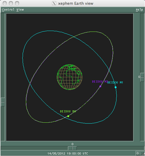
    Compass M2 and M5. September 18, 18:12 UTC (speculative).

    GSAT-10. Carrying a satellite-based augmentation system (SBAS) transponder for  the  GPS-aided geo-augmented navigation system (GAGAN), a planned implementation of a regional SBAS by the Indian government: September 21.

    Compass G6. No earlier than October 1.

    GPS IIF-3. October 4. Launch window: 12:10-12:29 UTC.

    Galileo IOV FM3 and FM4. October 10, 18:31 UTC.

    Luch-5B. For the Russian SBAS. Originally scheduled for October 15, launch has slipped to no earlier than November 1 due to an issue with the Briz-M upper stage, which caused the loss of the Telkom-3 and Ekspress-MD2 communication satellites during their launch on August 6.

    GLONASS-K1 (block K2s). November 14.

    Photo: Raoul Kieffer
    The fourth Galileo flight model satellite is unloaded at Cayenne Airport in French Guiana August 17. (ESA/EADS Astrium, Raoul Kieffer)

    JAVAD: Filters Protect GPS L1, L2, L5; GLONASS L1, L2; Galileo L1, L5

    Javad Ashjaee, founder and CEO of JAVAD GNSS, filed a September 7 letter with the U.S. Federal Communications Commission (FCC) concerning his company’s development of technical possibilities in GNSS filter designs and components. He stated “I hope this will be helpful in establishing realistic guidelines for the characteristics of high-precision GNSS receivers that will be used in critical applications.”

    The letter reads, in part:

    “We have improved our previous L1 filter and have extended the design to include all commercial GNSS bands.”

    “Our filter . . . protects GPS L1, Galileo L1 and GLONASS L1 bands. It brings in all the useful signals intact and rejects out of band signals with the slope of about 12 dB/Mhz. Similarly . . . our filter . . . . protects GPS L2, GPS L5, GLONASS L2 and Galileo L5 and has slope of about 9 dB/Mhz.

    “These filters not only protect GNSS signals against all LightSquared signals (10L, 10H and 10R handsets) but also from all similar signals that may appear near all commercial GNSS bands in the future. We are proud that our filters help allow better usage of these precious bands, in particular for broadband wireless communication that our country desperately needs.

    “These filters apply to wideband high precision GNSS receivers and the cost is even less than earlier conventional filters. The case of narrow-band low precision receivers (e.g. Garmin) is much simpler, as has been demonstrated by GPS receivers in more than 300 million cell phones and mobile devices which are not affected by LightSquared signals. The low precision receivers (L1 C/A code only) require filter slopes 10 times less steep than those presented here and do not necessitate additional costs.”

    Galileo Headquarters Moves to Prague

    On September 6, the European GNSS Agency (GSA) inaugurated its new premises in Prague, Czech Republic. Previously headquartered in Brussels, the headquarters of the Galileo program moved its seat to Prague this summer, as agreed by the EU heads of state and government in December 2010.
    Galileo is expected to be partly operational by the end of 2014. Two in-orbit validation (IOV) satellites will be launched in October, bringing the total in space to four, sufficient for initial check-outs.  Beginning in 2013, four more Galileo satellites will be launched every six months until the network of 30 is completed in 2020.

    GSA ensures security of satellites and prepares ground for new GNSS products. The agency is responsible for a number of implementation tasks for the European Satellite Navigation programmes Galileo and  the European Geostationary Navigation Overlay Service (EGNOS), which are managed by the European Commission. Its two main tasks are:

    • Security accreditation of satellites, launchers, and sites, and the operation of the Galileo Security Monitoring Centre, and
    • Market development for the European satellite navigation systems, such as new products and services possible using Internet access to satellite navigation data, among others.

    Future Role. A European Commission (EC) proposal for revising the GNSS Regulation foresees that operational responsibility for the GNSS programmes will be gradually transferred from the EC to the GSA over the next multi-annual financial framework (2014-2020). This represents a reversal of an earlier move, or a restoration of a previous state; after delays and budget disputes with manufacturers during the tentative public-private partnership (PPP) phase, the European Commission took direct control of the Galileo program, effectively sidelining the GSA.

    The transfer of responsibility will start with EGNOS in 2014, and already a number of preparatory tasks have been allocated to the GSA, including the procurement for the future operations of EGNOS.

    To carry out these new functions, the GSA’s staff is expected to increase from about 60 today to more than 180 by the end of next financial framework in 2020.

    Budget. The GSA has an annual budget of about €12.75 million ($16.75 million) in 2012, plus €34.4 million ($45 million) for exploitation activities.
    According to European Commission calculations, a total budget of € 7 billion ($9.2 billion) is necessary to complete the deployment phase of the Galileo programmes and finance the exploitation phase of the GNSS programmes over the 2014-2020 period.

    Compass Energizes China’s Economy

    China’s Beidou/Compass system will spur the country’s economic development in the satellite-navigation industry, geoinformation, and location-based services, according to an article in China Daily. China’s civil navigation providers are likely to experience rapid growth during the 12th Five-Year Plan (2011-15) period.

    The deputy director-general of the National Administration of Surveying, Mapping and Geoinformation said the government is likely to introduce policies to help the geoinformation industry grow.

    “In addition, the nation’s self-developed satellite navigation network, the Beidou Navigation System, will come into commercial use by the end of this year, a move that may stimulate the development of the geoinformation industry in China.”

    Aviation NextGen May Show Slow ROI

    An inspector from the U.S. Department of Transportation testified in Congress that benefits from the GPS-based air traffic control system Next Gen may take longer to realize than had been expected. Although the Federal Aviation Administration (FAA) has improved its management of the modernization program, years of delays and cost over-runs have left airlines dragging their feet in turn over multibillion-dollar equipment upgrades needed for the new system to work.

    The inspector stated the investment will be worth the taxpayer cost in the long run, and will produce significant safety and scheduling benefits. U.S. air travel is expected to nearly double over the next two decades, bringing an unbearable burden onto the current air traffic control system, if not significantly upgraded.

    By 2020, the new system is expected to reduce delays by 38 percent compared with the current system; airlines, passengers, and taxpayers are estimated tosave $24 billion.

    The FAA plans to spend $2.4 billion over the next five years on a collection of six programs evolving from an outdated, radar-based system to one that uses GPS and telecommunications advances for precision tracking, making routes more direct, eliminating many weather delays, and enabling planes to fly safely at closer distances. Once fully in place, the modernization program will save 1.4 billion gallons of fuel and reduce carbon dioxide emissions by 14 million metric tons, the FAA says.

    However, planes must be equipped with new equipment at a cost of hundreds of thousands of dollars per aircraft. NextGen doesn’t start yielding full benefits until a critical mass of planes have the new technology.

  • Two Compass Satellites Launched

    News courtesy of CANSPACE Listserv.


    China successfully launched two BeiDou-2/Compass MEO satellites Tuesday at 19:10:04 UTC. The satellites are designated Compass-M5 and Compass-M6. They are also referred to BeiDou-14 and BeiDou-15.

    UPDATE: More details have emerged on yesterday’s BeiDou-2/Compass satellite launch. According to Web sources, the new satellites will occupy slots 7 and 8 in Plane A of the Compass MEO orbit design. The existing operational Compass MEO satellites, MEO-3 and MEO-4 occupy slots 3 and 4 in Plane B, 120 degrees to the west of Plane A. The Compass MEO constellation will eventually consist of 24 primary satellites, eight in each of three equally spaced planes. It is reported that the satellites now use Chinese-made atomic clocks.

    The exact time of yesterday’s launch was 19:10:04.179 UTC. NORAD/JSpOC is tracking four objects from the launch: the satellites, the adapter, and the third stage of the launch vehicle. They are all in elliptical transfer orbits at the present time and the satellites will likely transfer to their MEO orbits within the next few days.

    According to a Compass official, the current generation of Compass navigation satellites has a predicted lifetime of eight years. This will be increased to 11-12 years for future models.

    Compass managers now claim that the 5 GEO + 5 IGSO +4 MEO initial configuration will have good robustness and economic efficiency for such a regional navigation system. They state that “[T]he four MEO satellites increases the repeat coverage for users: the probability for position dilution of precision being less than three is now at 74.89 percent for more than 23 hours per day, up from 38.55 percent earlier this year.”

    The final Compass GEO satellite for the initial constellation deployment, GEO-6, is scheduled for launch in October of this year.

    CCTV-13 video report of the launch:
    http://www.youtube.com/watch?v=brzO8UtnXEM

  • China Satellite Navigation Conference (CSNC 2013)

    The fourth China Satellite Navigation Conference (CSNC 2013) has issued a call for papers for the May 15–17, 2013, event in Wuhan, China.

    The theme of CSNC 2013 is “BeiDou Application — Opportunities and Challenges.” The event will include an academic exchange and a commercial exhibition and technical forum.

    The deadline for submitting abstracts is October 31, 2012. Full papers are due December 20. Authors whose papers have been accepted will be notified by the end of February 2013. A template for the papers and additional information on the event are available on the  CSNC conference website.

  • Upcoming Navigation Satellite Launches Scheduled

    News courtesy of CANSPACE listserv.


    Launch dates this fall for GNSS satellites are as follows, according to various sources:

    Compass M2 and M5: September 18, 18:12 UTC (speculative); Compass G6: No earlier than October 1.

    GSAT-10 (includes a GAGAN SBAS transponder): September 21.

    GPS IIF-3: October 4, 2012. Launch window: 12:10-12:29 UTC.

    Galileo IOV FM3 and FM4: October 10, 18:31 UTC.

    Luch-5B: Originally scheduled for October 15, launch has slipped to no earlier than November 1 due to an issue with the “Briz-M” upper stage, which caused the loss of the Telkom-3 and Ekspress-MD2 communication satellites during their launch on August 6.

    GLONASS-K1 (block K2s): November 14.

  • The System: Next GPS IIF in October

    Next GPS IIF in October

    The next GPS satellite, Block IIF-3 (SVN65), scheduled to be launched on October 4, will be positioned in orbital slot 1, which is in plane A. This slot is currently occupied by a Block IIA satellite, SVN39, operating as PRN09. SVN39 is one of the oldest operating satellites in the GPS fleet, dating from June 1993. SVN65 will the the third of a projected 12 IIF satellites to attain orbit.

    Galileo IOV Tandem in October, Too

    The previously announced September 28 launch date for the second set of Galileo IOV satellites has reportedly been pushed back to October 10.

    Meanwhile, after more than four years of service as a Galileo testbed satellite, GIOVE-B was retired on July 23. Its navigation transmitters were switched off, according to an announcement from the European Space Agency, and the satellite’s height was raised in a series of steps to a graveyard orbit where there will be no danger of it interfering with the operational Galileo satellites or other spacecraft.

    The SES-5 geostationary communications satellite (also known as Sirius 5 and Astra 4B), launched in July, arrived at its orbital slot of 5 degrees east longitude late that month. The current position is actually about 5.2 degrees. The satellite carries L1 and L5 transponders for the European Geostationary Navigation Overlay Service (EGNOS) satellite-based augmentation system. The GPS Directorate has assigned C/A PRN code 136 and L5 PRN code 136 for use by the satellite.

    GAGAN in September

    India’s GSAT-10 telecommunications satellite — one of two passengers for Arianespace’s upcoming Ariane 5 mission on September 21 — has completed pre-flight preparations at the Spaceport in French Guiana. Aboard GSAT-10 is the GAGAN (GPS and GEO augmented navigation) payload, which will support the Indian government’s implementation of a satellite-based regional capability to assist aircraft navigation over Indian airspace and in adjoining areas. GSAT-10 is expected to be positioned at 83 degrees east longitude and use PRN code 128. It will join the first GAGAN-equipped satellite, GSAT-8, launched in May 2011, and now at 55 degrees east longitude and transmitting test signals on the L1 frequency using C/A PRN code 127. Although GSAT-8 reportedly carries a dual-frequency transponder, no L5 signals from this satellite have yet been detected by International GNSS Service tracking stations.

    GLONASS SBAS in September as Well

    Luch-5B, the second of three geostationary satellites to reactivate Roscosmos’s Luch Multifunctional Space Relay System, is scheduled for launch no earlier than November 1, 2012, to be positioned at 16 degrees west longitude. The system’s multi-functional satellites carry transponders for the System for Differential Correction and Monitoring (SDCM), Russia’s satellite-based augmentation system. The transponders will broadcast GNSS corrections on the standard GPS L1 frequency using C/A PRN codes assigned by DoD’s GPS Directorate.

    Luch-5A, launched in December 2011, has been placed in an orbital slot at 95 degrees east longitude. It began transmitting corrections on July 12, using PRN code 140.

    SVN49 Back on the Air, Unhealthy

    The GPS Block IIR-M satellite, SVN49, briefly resumed transmissions as PRN24 on August 9. The signals were marked unhealthy and the satellite was not included in broadcast almanacs. SVN49 was launched in March 2009, but remains out of service until an L1/L2 satellite multipath issue is resolved. Although not in the almanacs, a number of stations of the International GNSS Service tracked SVN49. See http://gge.unb.ca/test/IGS_stns_tracking_G24_223.pdf. SVN49 stopped transmitting signals as PRN24 on August 22. SVN49 previously operated between March 28, 2009, and May 6, 2011, as PRN01, and between February 2 and March 14, 2012, as PRN24.

    Beidou Begins Testing Network

    China will build a Beidou testing and certification network over the next three years to sharpen the system’s global competitiveness, according to a statement from China’s Certification and Accreditation Administration. By 2015, a national testing center will be set up in Beijing, while seven local sub-centers will be established across the nation, it said. The centers will test the safety and accuracy of products designed for use with Beidou and qualify them for civilian use. China plans to launch 30 satellites to complete the system by 2020.

    The launch of next two Beidou-2/Compass medium-Earth-orbit satellites, M2 and M5, did not occur in August as was previously speculated. A knowledgable source states: “All three active Chinese tracking ships have retreated to their home base Jiangyin, north of Shanghai. (Two ships are required for tracking down-range for a typical Chinese beyond-low-Earth-orbit launch.) The launch was put off for the remaining part of August and at least the first couple of weeks in September. The most recently speculated launch date is September 18.”


  • China’s Beidou/Compass System Expected to Spur Growth in Nav Industry

    China’s Beidou/Compass system will spur the country’s economic development in the satellite-navigation industry, geoinformation, and location-based services, according to an article in China Daily. China’s civil navigation providers are likely to experience rapid growth during the 12th Five-Year Plan (2011-15) period.

    According to the article, “Earlier this month, Wang Chunfeng, deputy director-general of the National Administration of Surveying, Mapping and Geoinformation, said the government is likely to introduce policies to help the geoinformation industry grow.

    “In addition, the nation’s self-developed satellite navigation network, the Beidou Navigation System, will come into commercial use by the end of this year, a move that may stimulate the development of the geoinformation industry in China.”

    Read more at China Daily.

  • China Begins Work on Beidou Navigation System Test Network

    China will build a testing and certification network for its Beidou satellite navigation system over the next three years to sharpen the system’s global competitiveness, according to a Friday statement from the Certification and Accreditation Administration, as reported by the Xinhua news service.

    An authoritative testing and certification system with uniform standards and legal support will secure the Beidou system’s safe operation and accelerate its industrialization, said the statement. By 2015, a national testing center will be set up in Beijing, while another seven local sub-centers will be established across the nation, it said. The centers will test the safety and accuracy of products designed for use with the system and qualify them for civilian use.

    China began to construct the Beidou system in 2000 with a goal of breaking its dependence on GPS by 2020. Authorities plan to launch a total of 30 satellites to complete the system. The 12th and 13th satellites will be launched at the end of April.

    The Beidou system has been used by 120,000 civilian and military users to date, according to the statement.

  • New u-blox 7 GNSS Chip Supports GLONASS, Galileo, Compass

    u-blox is launching the u-blox 7, its next-generation core positioning technology platform. Supporting all deployed as well as soon-to-be deployed GNSS, the platform is based on the UBX-G7020 multi-GNSS receiver integrated chip with low power consumption.
     
    With 7 mW power consumption during continuous navigation, u‑blox’ UBX-G7020 is designed for small portable and power-sensitive devices requiring long battery life, high sensitivity, small size, and fast positioning. GPS, GLONASS, Compass, Russian, QZSS, and Galileo satellite positioning systems plus all satellite-based augmentation systems (SBAS) are supported.
     
    “As the satellite systems expand beyond GPS, u-blox 7 is an important step for our customers to design systems that work with all available global navigation standards, particularly GLONASS which is now fully operational. Our multi-GNSS UBX-G7020 integrated circuit does exactly that while achieving two of the most important features that our customers demand: minimum power consumption and small size,” said Andreas Thiel, executive vice president of R&D Hardware and co-founder of u-blox.
     
    The chip has been designed to support the lowest cost stand-alone solution via minimum eBOM; only eight external components are required resulting in a receiver occupying only 30 mm2 on a two-layer PCB. Standard crystal and TCXO are supported. The chip also provides low-power, autonomous log data output of position, velocity, and time. Support for A-GPS and u-blox’ CellLocate hybrid GNSS/cellular positioning technology is embedded to facilitate advanced telematics applications including indoor positioning. Standard and automotive grade are supported.
     
    First samples of the multi-GNSS receiver chip UBX-G7020 are available for customer evaluation. Shortly afterwards, module customers can migrate to the MAX, NEO, and LEA form factors, u-blox’ module series which will all be upgraded to the new u-blox 7 platform.
     
    u-blox 7 maintains software compatibility with u-blox 5 and u-blox 6, and modules provide drop-in compatibility. Both previous generation platforms remain fully supported, the company said. u-blox’ capability of delivering GNSS technology in both integrated circuit and module form provides maximum design flexibility for a wide variety of applications. To evaluate the performance of the u-blox 7 multi-GNSS platform, evaluation kits supporting all u-blox 7 based chips and modules can be ordered.

  • Three More BeiDou-2/Compass Satellites to Be Launched This Year

    News courtesy of CANSPACE Listserv.


    China will launch three more satellites for its Beidou GNSS, reports CRIenglish.com and People’s Daily Online. Two satellites will be launched in June, and another in October.

    The system is expected to be adopted by some of China’s neighboring countries in the next year or two such as Pakistan and Mongolia, said Ran Chengqi, director of the China Satellite Navigation Office. He spoke at the third China Satellite Navigation Conference in the southern city of Guangzhou.

  • BeiDou/Compass Satellites Launched April 29 Now Being Tracked

    BeiDou/Compass Satellites Launched April 29 Now Being Tracked

    News courtesy of CANSPACE listserv.


    The two BeiDou-2/Compass satellites launched on April 29 became active on May 6. Several tracking stations in the Asia/Pacific area began tracking the satellites at about 08:00 UTC.

    The medium Earth orbit (MEO) satellites, identified by their international designators 2012-018A and 2012-018B and by Chinese officials as M3 and M4, are using pseudorandom noise codes 11 and 12. M3 and M4 are in the same orbit plane,  a different one than that of M1, the first BeiDou-2/Compass MEO satellite launched.

    A view of the three MEO satellites in their orbit planes is pictured here:

    cmpass-1

    The one-orbit ground tracks of the satellites are pictured here (click to enlarge):

    Compass-2


    Tracking of the satellites by NORAD/JSpOC appears to have been interrupted when the satellites fired their apogee kick motors to circularize the orbits. The last days the satellites were tracked in their transfer orbits were 30 April and 1 May. They were recovered by NORAD/JSpOC on 9/10 May. Likely the orbit circularizations occurred around April 30 / May 1.

    Recent two-line element sets for the three MEO satellites are given below:

    BEIDOU M1
    1 31115U 07011A   12134.10254588 -.00000105  00000-0  10000-3 0  5834
    2 31115 056.7122 028.7463 0003954 199.1314 301.1397 01.86191632 34665

    BEIDOU M3
    1 38250U 12018A   12132.52529875 +.00000052 +00000-0 +10000-3 0 00275
    2 38250 055.1626 116.9959 0024183 186.6025 335.0953 01.86239286000385

    BEIDOU M4
    1 38251U 12018B   12133.86489950  .00000061  00000-0  10000-3 0   262
    2 38251 055.0887 116.4855 0024672 179.1060 208.4713 01.86163690   419

  • The System: GPS III Endures Bad Press, IIAs an OCX Concern

    GPS III Endures Bad Press, IIAs an OCX Concern

    Reports in daily news media such as the Washington Post and Denver Post that “Lockheed Martin will lose its entire fee of about $70 million to defray an 18 percent cost overrun” on GPS III satellites misconstrue the facts.

    Don Jewell, contributing editor for GPS World, said after informal talks with key Lockheed executives, “This is a good story, but it has been sensationalized.”

    Lockheed Martin’s fee is 5 percent of the target cost, which includes one-time engineering tasks, test equipment, and satellite assembly, according to the Air Force.

    The first GPS III satellite remains on schedule to be available for launch in 2014, Lockheed Martin spokesman Michael Friedman said via email.

    “While we have encountered challenges associated with higher standards for parts testing and first-time technical issues, the program is on firm footing and our cost estimate remains within the original Air Force budget,” Friedman stated, adding that the company doesn’t discuss specifics of fees.

    “In their defense,” Jewell reports, “the program was initially identified as stable with no government change request allowed, to keep it on schedule and budget. The recent budget furor has introduced chaos into the requirements process and contributed significantly to the increased costs.”

    Lockheed Martin is using a full-sized prototype to identify and solve many assembly issues “that would have cost more and presented more risk if they had been discovered later in production,” Lockheed’s Friedman said.

    “We have identified tens of millions of dollars in cost savings for the production satellites and in some cases we are seeing 50 to 80 percent reductions in labor costs,” he added.

    Ground Control to Aged Birds

    By Don Jewell

    One of the long-standing issues for support of IIA vehicles after the future GPS Operational Ground Control Segment’s (OCX’s) ready-to-operate (RTO) date, which should fall in December 2016 at the latest, is what ground command-and-control (C2)system will steer GPS IIA satellites, do navigation uploads, and so on. The issue is that AEP, the current C2 system, will no longer be available once the transition to OCX takes place, and OCX has no requirement to control IIA satellites.

    The OCX program, which struggled early, is now under new program leadership within Raytheon Space Systems, and while Ray Kolibaba, the new OCX program manager, is making great progress, OCX does not need to be burdened with additional requirements at this stage of the program.

    Just how big an issue is GPS IIA C2? Initially the Aerospace projections were that there would only be one or two GPS IIAs left on orbit in 2017, and it was not worth the costs to include the C2 software for the legacy system in the new software code. However, I have long maintained that Aerospace and Space Missile Systems Command (SMC) neglected to count the residual satellites, maintained by Launch, Anomaly, and Disposal Operations (LADO), which might very well actually amount to 3–4 additional IIAs. Added to the two IIAs on orbit, this could amount to six IIA SVs that need to be maintained.

    The solution announced during the week at the National Space Symposium (NSS, April 16–19) by General William Shelton, the four-star chief of Air Force Space Command, is to fund the current LADO operator, Braxton Technologies, to build in this support for the IIAs. This is significant for several reasons: One, of course, is that it solves the IIA C2 issues, it does it now, and at a relatively modest cost, and it utilizes more of the capabilities of the Braxton Technologies’ LADO software. Additionally it provides a true backup capability for assets on orbit that become increasingly valuable as the number of available launch slots for GPS decreases.

    Braxton Technologies initially demonstrated this capability years ago in a lifeboat drill during the transition to AEP, but the navigation upload capability was never maintained for LADO after the successful transition. This is certainly a step in the right direction and provides a simple solution to a vexing problem that has plagued the GPS program for the last several years.

    Dual Launch. I asked General Shelton if he would support an approach that would allow the United States to go to dual launch of GPS III on vehicles 5–6 instead of waiting until 8–9 as planned today. He said the Air Force would certainly support that, and is looking at making it possible with vehicle 7 currently. That will come even sooner if the program advances with glitches.

    I also asked him about the gap between GPS III launch and OCX RTO. The gap seems to be getting wider, not narrower, and he agreed that OCX could probably not move to the left, and GPS III has moved significantly to the left, so this is still an issue that needs to be addressed. There are plans in place, but the recent budget activity has caused some uncertainty.

    Sequestration. On the subject of sequestration — a highly charged Congressional effort to force another $500 billion-plus in additional defense cuts — General Shelton said it would come on top of the approximately $487 billion already cut from programs, and that many space programs might be unsustainable in their current mode if that occurs.

    However, the U.S. Armed Services have been informed by the White House Office of Management and Budget not to make plans for sequestration. So right now, the services and other agencies of the U.S. government have been forbidden to make programmatic decisions based on a possible sequestration. Interesting.

    By the way, attendance at NSS this year surpassed 9,000.


    Galileo Launches Accelerated, First Payload Shipped

    Javier Benedicto, head of the Galileo Project Office for the European Space Agency (ESA), set an aggressive schedule for launching some Galileo satellites as many as four at a time in 2014 and 2015, to meet a target provision date of Galileo initial services in 2014 and full services in 2015. The announcement came at the Munich Summit, March 14.

    The hurry-up to carry 22 satellites into orbit proceeds with dual-satellite launches aboard Russian Soyuz rockets, as was the case for the most recent in-orbit validation (IOV) launch in October 2011. There will be three Soyuz launches in 2013, for a total of six new satellites in orbit, and two Soyuz launches in 2014, adding four more. Then the burden will shift to European rockets from Arianespace, according to a contract signed in February of this year. One Ariane 5 rocket is slated to carry four Galileo satellites aloft in 2014, bringing the projected total of IOV and eventually operational Galileo satellites in space to 16 by the end of 2014. ESA had ealier aired plans for further Soyuz IOV launches in 2012, but the Munich statement did not mention these.

    In 2015, two more Ariane 5 launches will add eight satellites, for a total on orbit of 24, estimated to be sufficient for Galileo full operational capability (FOC).

    In subsequent talks with European satellite manufacturers OHB Systems and Astrium, GPS World contributing editor Don Jewell was told that the future launch schedule is “subject to change.”

    ESA headquarters has made no official announcement of a detailed launch schedule; inquiries regarding the Benedicto remarks were referred to the February contract statement, cited above.

    Payloads. Meanwhile, Surrey Satellite Technology Ltd. (SSTL) delivered the first of 14 FOC satellite payloads to prime contractor OHB System AG, for mechanical integration of the payload with the satellite platform and the beginning of overall vehicle assembly, integration, and testing for what will eventually become the fifth satellite in the Galileo constellation.


    Compass on the Grow

    Discussions in Internet forums indicate that the next BeiDou-2/Compass launch will take place on or about April 28, after this magazine goes to press. The launch purportedly will place two mid-Earth orbit satellites into space: BeiDou M3 and BeiDou M4. Sometime in June, plans call for BeiDou M2 and BeiDou M5 to be launched.

  • Beidou Launch Completes Regional Nav System

    The Beidou-2/Compass IGSO-5 (fifth inclined geosynchonous orbit) satellite was launched on December 1 from Xichang, China. Exact launch time was 21:07:04.189 UTC. The third stage of the CZ-3A rocket with the satellite attached achieved a geosynchronous transfer orbit and the satellite subsequently separated according to NORAD/JSpOC. As of December 7, the satellite is still in geosynchronous transfer orbit (GTO), orbiting the Earth about twice a day with a highly eliptic orbit. To get to geosynchronous orbit, the satellite's apogee kick motor will have to be fired. The satellite is not drifting to its intended orbit, for example, like a GLONASS satellite might.

    According to an announcement on the official government Beidou/Compass website, this launch completes the construction of the basic regional navigation system for service to China and will be operational by the end of the year. However, completion of the Phase II development, to provide service to the Asia/Pacific region, will require further satellite launches in 2012. Phase III global coverage, with a 30-satellite system, will be achieved by 2020 according to the website.

    The GNSS community outside China still awaits a Compass interface control document (ICD), which has been promised by the end of 2012.