Category: Mobile

  • Qualcomm and Trimble join on meter-level location for smartphones

    Qualcomm and Trimble join on meter-level location for smartphones

    Photo: simon2579/iStock/Getty Images Plus/Getty Images
    Photo: simon2579/ iStock/Getty Images Plus/Getty Images

    The Trimble RTX GNSS correction  service will soon be available for Snapdragon 8 Gen 1 and Snapdragon 888 Mobile Platforms from Qualcomm Technologies Inc.

    Expected to be available in the second quarter of this year, Trimble’s RTX service will enable superior location capabilities in premium Android smartphones worldwide.

    The integration of Trimble RTX GNSS technology, a correction services platform, with Snapdragon contributes to a higher quality, more accurate location-based user experiences such as car navigation with lane-level guidance.

    Coupling the Trimble RTX technology with premium Snapdragon Mobile Platforms will enable smartphone manufacturers, service providers and application developers using Snapdragon to provide mobile users with robust meter-level accuracy (or about 3 feet) when used with a Trimble RTX-based correction service. This represents a five times improvement in location accuracy compared to typical accuracy.

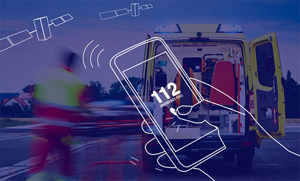
    Location information accuracy can significantly improve the smartphone’s user experience when using mapping, driving or other mobile applications. For example, with more accurate positioning for a ridesharing app, both driver and rider can have a better experience when the pick-up destination is more precisely displayed. In addition, lane-level accuracy enables drivers to gain greater map detail and more accurate directions when using real-time navigation applications.

    The new collaboration expands Trimble’s existing relationship with Qualcomm Technologies to provide high-accuracy positioning solutions for connected vehicles, advanced driver-assistance systems (ADAS) and autonomous driving solutions to automotive OEMs and Tier 1 suppliers.

    “Trimble and Qualcomm Technologies have a history of innovation in mobile location technologies, both separately and collaboratively,” said Lisa Wetherbee, general manager of Trimble Advanced Positioning. “Together, we are boosting premium Android phone functionality, helping mobile applications provide better information about the user’s immediate surroundings.”

    “Precise positioning, where accuracies are down to a meter or less, is a necessary capability in next-gen premium Android phones, providing better mapping, more accurate navigation and new exciting services to consumers,” said Francesco Grilli, vice president, product management, Qualcomm Technologies. “Snapdragon is again taking location-based experiences to a new level through this collaboration with Trimble.”

  • EU requires Galileo for smartphone emergency calls

    EU requires Galileo for smartphone emergency calls

    Galileo-supported E112 will result in faster response times and more lives saved. (Image: EUSPA)
    Galileo-supported E112 will result in faster response times and more lives saved. (Image: EUSPA)

    As of March 17, all smartphones sold in the European Union must be leveraging Galileo signals in addition to other GNSS for calls to the European 112 (E112) emergency number.

    Using Galileo enhances pinpointing locations of 112 calls in Europe, resulting in faster response times and more lives saved, according to the EU Agency for the Space Programme (EUSPA).

    The 112 emergency number is operational in nearly all EU Member States, as well as other countries. People in danger can call it 24/7 to reach the fire brigade, medical assistance and the police.

    Most calls to the 112 emergency number are placed from mobile phones. These calls already support the sending of location information to emergency services. However, this information was not based on GNSS capabilities until recently.

    Three years ago, the Commission Delegated Regulation anticipated measures to take advantage of GNSS and Wi-Fi location capabilities in smartphones placed on the European Union market, starting March 17.

    GNSS versus cell-ID

    Until now, the 112 caller’s location information was established through identification technology based on the coverage area of a cellular network tower (cell-ID). The average accuracy of this information varies from two to 10 kilometers, which can lead to significant search errors following emergency calls.

    By contrast, GNSS location information pinpoints the call within a few meters. This level of accuracy will have a major impact in terms of response times, ultimately allowing for quicker intervention in emergency situations.

    Galileo 112 rollout

    The ability for 112 to communicate a caller’s location to emergency services automatically is already being rolled out. The protocol — Advanced Mobile Location (AML) — is being deployed across the European Union. When a caller dials 112 from their smartphone, AML uses the phone’s integrated functionalities and data from Galileo to accurately pinpoint the caller’s location and transmit it to a dedicated endpoint, usually a Public Safety Answering Point (PSAP), which makes the caller location available to emergency responders in real time.

    According to the European Emergency Number Association (EENA), at least 18 EU Member States have already completed AML deployment, while others are in the process of doing so. This implementation is because of EU initiatives and projects such as the Help 112 project, which was set up to evaluate the merits of handset-based technologies in improving the location of emergency callers.

  • Swift Navigation and Taoglas partner on precision GNSS solutions

    Swift Navigation and Taoglas partner on precision GNSS solutions

    Partnership to bring integrated precision GNSS solutions to automotive and industrial customers

    Swift Navigation, a San Francisco-based GNSS firm, and Taoglas, a provider of internet of things (IoT) solutions, have announced a strategic partnership to integrate their technologies to deliver pre-tested, low-risk, high-precision GNSS solutions to a broad customer base.

    The Taoglas EDGE RTK Starter Kit has high-precision GNSS with U.S. 4G/3G cellular connectivity. (Photo: Taoglas)
    The Taoglas EDGE RTK Starter Kit has high-precision GNSS with U.S. 4G/3G cellular connectivity. (Photo: Taoglas)

    The partnership will provide positioning solutions for automotive, micromobility, delivery, robotic and industrial customers. Specifically, the Taoglas EDGE Locate IoT platform and EDGE RTK Starter Kit now come pre-integrated with Swift’s Skylark precise positioning service.

    Bringing pre-integrated, high-accuracy positioning products to these industries in an easy-to-implement solution will greatly improve the accuracy of the positioning data delivered, the companies state.

    Together, Swift and Taoglas deliver high-precision GNSS solutions to customers around the globe by utilizing Taoglas’ IoT platforms and Swift’s Skylark seamless, cloud-based corrections — available in advanced SSR (state space representation) or industry-standard formats. The pre-integration allows customers to bypass module-level validation, integration and engineering efforts with an out-of-the-box solution.

    “Swift Navigation is excited to begin this partnership with Taoglas and align our visions of making accurate positioning easily accessible across industries,” said Swift CEO Timothy Harris. “We look forward to offering our products as an integrated solution to make it easier for customers across the globe to benefit from affordable and accurate positioning.”

    “We are delighted to be partnering with Swift Navigation to enable companies to overcome the challenges of delivering their high-precision positioning-based IoT solutions.,” said Ronan Quinlan, co-founder and joint CEO of Taoglas. “Our worldwide team of design, development, test and manufacturing engineers is dedicated to delivering IoT software and hardware solutions on time, the first time, for leading technology enterprises.”

    Additional products will soon be available from Swift, Taoglas and their channel partners. Customers have the ability to pre-order now by contacting [email protected] or [email protected].

  • Taoglas launches small 9-in-1 GNSS+5G antenna at MWC

    Taoglas launches small 9-in-1 GNSS+5G antenna at MWC

    The MA990 Guardian GNSS antenna. (Photo: Taoglas)
    The MA990 Guardian GNSS antenna. (Photo: Taoglas)

    Taoglas announced its smallest 9-in-1 combination antenna with dual-band GNSS and high-performance 5G/4G, the Taoglas MA990 Guardian.

    Taoglas made the announcement at Mobile World Congress (MWC) Barcelona 2022, which takes place  Feb. 28–March 3; Taoglas is exhibiting at booth #5E32.

    The Taoglas MA990 Guardian antenna is a small 9-in-1 combination antenna with dual-band GNSS (L1/L2) and globally supported cellular (5G/4G). It has been designed to support emerging market demand for modules that cover specific 5G/4G bands.

    For example, two of its eight cellular MIMO antennas cover from 600 to 6,000 MHz, while another two are optimized for 3,000 to 6,000 MHz to cover high-band 5G and C-band/CBRS applications. The product is designed to operate on all carrier networks globally and is future-proofed to work with latest 5G routers in the market.

    Housed in a low-profile, robust, IP67-rated waterproof, adhesive-mount external enclosure, the MA990 is designed for space-constrained, mission-critical applications, including asset and vehicle tracking, first- responder vehicles and high-definition video sources such as surveillance cameras.

    The Taoglas MA990 also is highly customizable, including for any variation of antennas below 9-in-1 and the addition of Wi-Fi/single-band GNSS.

  • Synzen antennas and Next Big Thing join on IoT GNSS platform

    Synzen antennas and Next Big Thing join on IoT GNSS platform

    Antenna company Synzen Precision Technology has teamed up with Next Big Thing AG (NBT) to produce the sensor-based LTE-M/NB-IoT development platform Prometheus, which promises fast cellular internet of things (IoT) prototyping.

    The PROXIMA GNSS antenna will be part of the Prometheus platform. (Photo: Synzen Precision Technology)
    The PROXIMA GNSS antenna will be part of the Prometheus platform. (Photo: Synzen Precision Technology)

    Prometheus is an IoT sensor-based development platform designed to simplify prototyping and speed time to market for developers of IoT and cloud-based solutions. The latest platform showcases Synzen’s expertise in GNSS and LTE 4G antenna solutions when combined with the Nordic nRF9160 module.

    The building blocks enabling the mobility and IoT revolution are “always-on” connected 4G cellular and accurate and reliable GNSS solutions, regardless of the operating environment, Synzen said. Prometheus provides 4G connectivity combined with high-performance GNSS positioning solutions.

    For the Prometheus platform, NBT chose the low-power FR4 active GNSS solution. “The selection of our latest PROXIMA low-power active solution in an FR4 package helped enable a fully certified solution optimized for low power consumption over the full industrial temperature range of –40 to +85 degrees centigrade,” said Chris Tomlin, Synzen technical director.

    The PROXIMA GNSS SMD active antenna includes an amplifying front end to boost the signal as well as provide out-of-band filtering to prevent receiver saturation.

  • Europe’s Project NAV-SSHE to demo GNSS + 5G for critical applications

    Europe’s Project NAV-SSHE to demo GNSS + 5G for critical applications

    NAV-SSHE logoThe Navigation Sensor Switching in Hostile Environments (NAV-SSHE) project aims to design, prototype and demonstrate new solutions for positioning, navigation and timing using 5G plus GNSS for critical applications in hostile environments. NAV-SSHE is supported by the European Space Agency (ESA).

    Geolocation company M3 Systems Belgium is taking part in the project in collaboration with Telespazio Belgium. The project began in September 2021 and will last until January 2023.

    In the context of NAV-SSHE, M3 Systems Belgium will implement both a GNSS and a 5G signal based on positioning engines. The output of both engines will be fused to provide a unique solution with increased robustness.

    The complete system will be demonstrated on two real-use cases:

    • autonomous vehicles on an airport platform (specifically autonomous lawn mowers)
    • autonomous docking of vessels in port

    The demonstrations will also be used to test potential use of these technologies for drone applications — specifically for the navigation system of the autonomous remotely piloted aircraft Boreal.

  • Rohde & Schwarz provides testing to meet Europe’s E112 requirements

    Rohde & Schwarz provides testing to meet Europe’s E112 requirements

    Rohde & Schwarz adds an extension to its R&S TS-LBS location-based services test system to meet 112 emergency-call regulations for smartphones

    E112 emergency caller location tests are now available on the R&S TS-LBS test system. (Photo: Rohde & Schwarz)
    E112 emergency caller location tests are now available on the R&S TS-LBS test system. (Photo: Rohde & Schwarz)

    A new regulation requires all smartphones sold in the European Union from March 2022 onwards to support caller location for 112 emergency calls. To ensure this feature, the devices must be compliant with several positioning systems as outlined by the European Commission.

    In response, Rohde & Schwarz has added an extension to its R&S TS-LBS location-based services test system. Certification service provider CETECOM has already started E112 testing using these test sequences.

    All smartphones sold in the European Union have to be compliant as of March 17 with the Delegated Regulation (EU) 2019/320. A supplement to Radio Equipment Directive (RED) 2014/53/EU, it defines that 112 emergency calls provide caller location information to emergency services in a fast and accurate way, to make sure first responders can arrive at the site of an accident quickly.

    Instead of a harmonized standard, a guideline document from the European Commission recommends the testing procedures for Notified Bodies, who support the smartphone vendors in the conformance assessment procedure. Compliance with Galileo, advanced mobile location (AML) and Wi-Fi positioning will be mandatory.

    The software-based extension to the R&S TS-LBS location-based services test system makes it a tailored solution in line with the European Commission’s guideline document and the upcoming ETSI standard TS 103 825 for AML protocol testing.

    In the Rohde & Schwarz solution, the cellular network is emulated by the R&S CMW500 wideband radio communication tester, while the dual-frequency E1+E5 GNSS Galileo signal is generated by an R&S SMBV100B vector signal generator. Thanks to the automation software of the test setup, all the test cases described in the EC guideline can be executed automatically to ensure unified, fast and repeatable results.

  • U-blox adds LENA-R8 GNSS receiver to LTE Cat 1 portfolio

    U-blox adds LENA-R8 GNSS receiver to LTE Cat 1 portfolio

    Photo: U-blox
    Photo: U-blox

    U‑blox has added a GNSS receiver module to its cellular LTE Cat 1 portfolio. The GNSS receiver in the LENA-R8 is based on the u‑blox M10 platform.

    U-blox also introduced the LARA-R6, its smallest LTE Cat 1 module with global coverage. Together, the modules comprise five certified global, multi-regional and regional product variants, simplifying logistics for product developers and increasing design flexibility.

    Both modules offer device makers facing imminent 2G and 3G network sunsets a future-proof migration path to 4G technology for data-streaming applications.

    Additionally, they offer MQTT Anywhere and MQTT Flex connectivity via u‑blox’s Thingstream platform out of the box, thereby enabling low-power, low-cost connectivity with globally ubiquitous, seamless roaming.

    Tracking and Telematics

    The LENA-R8 standard-grade module series targets customers in the tracking and telematics markets seeking to minimize costs associated to their bill of material and data charges. The compact module balances cost and performance with single Rx antenna and primarily targets customer deployments in the Europe, Middle East, Africa, Asia, and South America regions.

    The LENA-R8 supports a broad range of frequency bands with 2G fallback, providing maximum roaming coverage for global tracking applications using a single stock keeping unit (SKU).

    A variant of the LENA-R8 series comes with an ultra-low power u‑blox M10 GNSS receiver for high performance asset tracking applications, reducing integration effort and time to market. Making no compromises in terms of GNSS performance, the module can concurrently receive up to four GNSS constellations for maximum position availability.

    CellLocate Support

    All variants of the LARA-R6 and LENA-R8 family support CellLocate, u‑blox’s cellular network-based location service, for coarse positioning data even in the absence of GNSS signals.

    Engineering samples will be available in February.

  • NextNav to deliver high-precision vertical location for 911

    NextNav to deliver high-precision vertical location for 911

    NextNav’s Pinnacle 911 will deliver Z-axis capabilities with floor-level accuracy for wireless 911 calls in more than 4,400 cities and towns across the United States.

    Photo: vichie81/iStock/Getty Images Plus/Getty Images
    Photo: vichie81/iStock/Getty Images Plus/Getty Images

    NextNav has entered into an agreement with one of the nation’s largest wireless carriers, not yet named, to deliver vertical location for Enhanced 911 (E911), using NextNav’s Pinnacle 911.

    Pinnacle 911 leverages the barometric sensors already available in phones, tablets and other devices to deliver “floor-level” altitude measurements that exceed the FCC mandate for 3-meter accuracy. The Pinnacle service compares device data to local conditions, subtracting the weather and other factors to leave behind a highly accurate altitude measurement.

    NextNav altitude stations create a hyperlocal model of environmental conditions. The precisely surveyed, high-density network delivers “floor level” real-time altitude data nationwide.

    NextNav’s dedicated, managed network makes Pinnacle available throughout metropolitan areas, providing comprehensive coverage that scales to meet a variety of use cases.

    The delivery of vertical location to public safety answering points (PSAPs) nationwide will improve emergency response in the United States. It enables first responders to accurately locate wireless 911 callers in multi-story buildings, enhancing both safety and response times, and helping to save lives.

    With NextNav’s Pinnacle 911 reaching more than 4,400 cities and towns in the United States, including 90% of buildings above three stories, implementation of the service will exceed the Federal Communication Commission’s (FCC) Z-axis requirement for nationwide E911.

    “For over two decades, one of public safety’s key needs has been 3D geolocation information — especially floor-level vertical location,” said Ganesh Pattabiraman, CEO of NextNav. “Partnering with one of the nation’s largest wireless carriers to deliver precise, Z-axis information will not only improve geolocation information for PSAPs, but save lives by reducing emergency response times by more than 80%. This adoption of our Pinnacle technology for 911 marks a historic step forward for communities around the nation, and public safety as a whole.”

    In an independent evaluation by the Cellular Telecommunications and Internet Association commissioned by the FCC, Pinnacle was able to deliver floor-level accuracy (defined as ±3 m) 94% of the time, consistently exceeding the 80% benchmark set by the FCC.

    NextNav’s Pinnacle service enables applications and technologies that rely on precise altitude data across industries, including public safety, mobile apps and gaming, lone worker tracking as well as out-of-home retail experiences.

    NextNav’s extensive list of existing partners and customers includes AT&T FirstNet, Intrepid Networks, 3am, TRX Systems, Qualcomm, Bosch, Unity and Unreal Engine.

  • NBT’s Prometheus employs Nordic’s nRF9160 SiP for IoT and GNSS

    NBT’s Prometheus employs Nordic’s nRF9160 SiP for IoT and GNSS

    Photo: Next Big Thing
    Photo: Next Big Thing

    German venture studio Next Big Thing AG (NBT) has launched the Prometheus internet of things (IoT) sensor-based development platform designed to simplify prototyping and speed time-to-market for developers of cellular IoT- and cloud-based solutions.

    The Prometheus platform is powered by Nordic Semiconductor’s nRF9160 low-power system-in-package (SiP) with integrated LTE-M/NB-IoT modem and GNSS. The platform supports development across a wide range of industrial applications including the manufacturing, pharmaceutical and logistics sectors.

    The nRF9160 SiP’s 64-MHz Arm Cortex-M33 dedicated application processor provides sufficient computational power to not only supervise the LTE-M/NB-IoT modem’s cellular connectivity, but also all other product functionality. The SiP’s 1MB Flash and 256kB RAM supports fast response and complex application software.

    In addition to the Nordic SiP, the CE-certified development platform features a wide range of sensors and interfaces, a stable embedded software stack, fully encrypted communication, mesh connectivity for short-range communication, automatic switching between NB-IoT and LTE-M cellular IoT connectivity, and advanced provisioning tools. The solution is optimized for low power consumption and provides an industrial temperature range of –40 to +85° C.

    NBT’s IoT development platform comprises two main components:

    • the hardware and embedded software platform (Prometheus)
    • the cloud-based software platform (NBT software platform).

    The standard configuration of Prometheus consists of a range of sensors, for example a temperature sensor (analog and digital), accelerometer, magnetometer, gyroscope, air quality sensor, ambient light sensor and humidity sensor.

    The extended version of Prometheus also includes Nordic’s nRF52832 Bluetooth 5.2/Bluetooth Low Energy (Bluetooth LE) general purpose multiprotocol system-on-chip (SoC) to provide support for Bluetooth LE connectivity, as well as USB, GPS, radar, an adjustable antenna tuner and extended temperature range.

  • Infineon and Deeyook collaborate on low-power Wi-Fi location

    Infineon and Deeyook collaborate on low-power Wi-Fi location

    Infineon logoInfineon Technologies AG and Deeyook are collaborating on location solutions. Deeyook, a location-as-a-service (LaaS) company, has patented a tracking solution to determine indoor and outdoor locations of items, assets and employees.

    Deeyook logoThe companies fused Deeyook’s ultra-precise algorithms into Infineon’s low-power AIROC Wi-Fi portfolio to enable an accurate, passive, ubiquitous and efficient location solution.

    Deeyook specializes in wireless signal processing applicable to incumbent Wi-Fi/4G/5G modem firmware versions. The firmware extracts angles of wireless transmissions (direction finding, or DF), for commercial wireless tracking. Deeyook’s tracking capabilities are ultra-precise, providing location information within 10 cm/4 in, passively exploiting the install base of 1.7 billion wireless access points worldwide.

    “There are many challenges when companies implement real-time location systems, primarily because tracking solutions, such as RFID, are not really ubiquitous. This is particularly acute with GPS, which has many shortcomings,” said Gideon Rottem, CEO and co-founder of Deeyook. “We created Deeyook to address these challenges — technology that is ubiquitous and can track things with the utmost precision indoors, outdoors and in bad weather. We are excited to work with Infineon because its AIROC Wi-Fi portfolio is reliable and power efficient.”

    “Infineon’s mission is to make the world an easier, safer and greener place with our technologies through smart, connected devices,” said Sivaram Trikutam, senior director, IoT Compute and Wireless, Infineon Technologies. “These new IoT solutions support multiple location tracking technologies. Previously, Wi-Fi was not considered a viable option due to its power demands, while additionally, real-time locating system (RTLS) deployments required businesses to utilize custom solutions with costly infrastructure, engineering and labor-intensive installation.”

  • Hexagon and Dayou partner to bring high-accuracy GNSS corrections to China

    Hexagon and Dayou partner to bring high-accuracy GNSS corrections to China

    TerraStar X corrections technology enables lane-level accuracy with under one-minute convergence for consumer and automotive-grade GNSS receivers

    Hexagon’s Autonomy & Positioning division has partnered with Chinese positioning company Dayou to bring TerraStar X technology to the Chinese market. TerraStar X provides fast precise point positioning (PPP) corrections for autonomous vehicles and has mass-market use such as in smartphones.

    The partnership enables Hexagon and Dayou to provide consistent positioning solutions globally, including North America, Europe and China, so original equipment manufacturers (OEMs) can deploy the same design worldwide.

    The GNSS corrections generated from TerraStar X technology enable lane-level accuracy with convergence in under a minute for consumer and automotive-grade GNSS receivers, supporting advanced driver-assistance systems (ADAS), autonomous applications, safety-critical applications, mobile-phone applications and more.

    TerraStar X technology delivers corrections using industry-standard formats compatible with mobile networks and enabling efficient delivery of corrections to millions of end-user devices. Through the partnership with Dayou, OEMs can now deploy the same high-accuracy solution across China as in North America and Europe, while having access to local sales, support and technical resources.

    “This partnership provides a way for global companies to leverage TerraStar X technology to bring consistent lane-level positioning around the globe,” said Sara Masterson, director of positioning services at Hexagon’s Autonomy & Positioning division. “With its hardware-agnostic design, industry-standard format and delivery of corrections, this technology opens up the possibility of precise positioning for a multitude of new mass-market applications for customers to use one software positioning solution on all platforms worldwide.”

    “Dayou is excited to be working with Hexagon in China to bring this next level of positioning technology to market,” said Han Jianxin, chief executive officer at Dayou. “High accuracy positioning used to be limited to expensive equipment and niche markets like survey and mapping. With TerraStar X technology, everyone can have the benefit of more accurate positioning, opening up new applications ranging from autonomous driving and freight to regular smartphone users moving from point A to B.”

    Test Regions Expand to China

    Using Dayou’s local infrastructure to calculate ionosphere corrections, TerraStar X technology ensures that fast convergence to lane-level and sub-meter accuracy is available when needed.

    Engineering development test areas are available around the world to support large-scale programs with functional safety requirements. With these test regions now expanded to China, the partnership with Dayou marks a significant milestone to bring Hexagon’s TerraStar X technology to a global scale.

    China Dayou PI is a Chinese company invested in by China Intelligent and Connected Vehicles (Beijing) Research Institute Co. Ltd. for high-precision positioning service and solutions based on GNSS, INS and HD map technology.

    Image: imaginima/iStock/Getty Images Plus/Getty Images
    Image: imaginima/iStock/Getty Images Plus/Getty Images