Category: Mobile

  • Broadcom launches its lowest power GNSS receiver for mobile, wearables

    Broadcom launches its lowest power GNSS receiver for mobile, wearables

    The BCM4778’s third-generation dual-frequency GNSS receiver features advanced multipath mitigation, L5 acquisition capability, LTE filtering and jamming protection

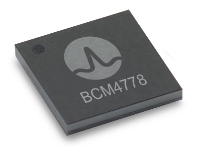
    Broadcom Inc. has launched the BCM4778, its lowest power L1/L5 GNSS receiver chip optimized for mobile and wearable applications. Equipped with the latest GNSS innovations, the third-generation chip is 35% smaller and consumes five times less power than the previous generation.


    Broadcom will be presenting further information on the chip in the Session B5, Panel: GNSS Chipset Technology – Trends, Opportunities and Challenges panel at the ION GNSS+ 2021 on Sept. 24.


    Dual-frequency GNSS continues to be an important location feature for modern mobile and wearable devices, providing greater positioning accuracy for location-based applications. The advanced L5 signal enables sidewalk-level accuracy for pedestrian navigation in urban environments, as well as lane-level accuracy for vehicle navigation.

    Reduction in GNSS power consumption is crucial to extending the battery life of a mobile or wearable device. Compared to GNSS receivers used in integrated platforms, Broadcom’s single-chip BCM4778 delivers significantly lower power consumption and higher performance while offering more advanced GNSS features, such as the next-generation Grid Tracking urban multipath mitigation technology.


    “We are excited to see this impressive power reduction, combined with the L5 Grid Tracking technology in the new Broadcom GNSS chip. This will increase the impact of Google’s 3DMA ray-tracing for urban multipath mitigation,” said Frank van Diggelen, principal software engineer at Google.


    Longer battery life. The BCM4778 increases the GNSS always-on battery life on a smartwatch by 30 hours compared to the previous generation chip operating on a 300-mAh battery. The extended battery life helps drive new experiences in smartwatches and phones, including keeping the GNSS always-on for fitness applications for multiple days on a single battery charge.

    In addition, the BCM4778 features fully integrated LNAs for L1 and L5 bands, which reduces RF front-end BOM costs and footprint requirements, suitable for space-constrained applications. The chip offers increased flexibility to smartwatch and phone designers with its small size. Having the ability to place the BCM4778 closer to the antenna helps improve signal reception and enhances overall GNSS performance.

    The BCM4778 dual-frequency chip is designed for small mobile and wearables. (Photo: Broadcom)
    The BCM4778 dual-frequency chip is designed for small mobile and wearables. (Photo: Broadcom)

    Product Highlights

    • 7nm CMOS technology
    • Typical power consumption
    • 4mW L1 band only
    • 6mW L1+L5 simultaneous
    • FCBGA package
    • New Grid Tracking technology
    • Advanced multipath mitigation
    • Continuously tracks the full L5 channel
    • Capable of L5 acquisition
    • Increased processing capability and throughput
    • Advanced LTE filtering and jamming mitigation
    • Enhanced LTE Band 13 and Band 14 filtering
    • Spoofing and jamming detector
    • Jamming mitigation through multiband and multi constellation
    • Reduced BOM cost and footprint
    • Flexibility in using internal LNAs
    • Optional operation without interstage SAW filters
    • Integrated switching regulator with direct connect to battery

    “With the launch of this third generation dual-frequency GNSS receiver chip, Broadcom continues the tradition of raising the bar for mobile GNSS,” said Vijay Nagarajan, vice president of marketing for the Wireless Communications and Connectivity Division at Broadcom. “Always-on dual frequency GNSS is a key request from mobile and wearable OEMs, and we are thrilled to deliver it.”

    “Consumer electronic companies have been faced with the challenge of managing power consumption versus performance, often having to choose one over the other. Broadcom’s innovative approach to the BCM4778 allows their customers to realize improvements on both fronts,” said Ramon T. Llamas, research director for mobile devices at IDC. “The result: device manufacturers can enable new experiences and run applications over a sustained period of time. In addition, by reducing its BOM cost and its physical footprint, Broadcom is enabling further benefits from cost savings and design configurability.”

    Broadcom is currently sampling the BCM4778 to its early access partners and customers. Please contact your local Broadcom sales representative for samples and pricing.

  • Orolia joins with Keysight on advanced 5G GNSS testing

    Orolia joins with Keysight on advanced 5G GNSS testing

    Integrated solutions address GNSS test requirements defined by 3GPP and major U.S. carriers

    Orolia and Keysight Technologies Inc. have joined forces to advance 5G services by addressing GNSS test requirements defined by 3GPP and major U.S. carriers.

    Working with Orolia allows Keysight to extend its 5G device test solution portfolio with advanced GNSS simulation capabilities. As a result, existing users of Keysight’s 5G device test solutions can easily address GNSS-related 3GPP protocol conformance and carrier acceptance test requirements by upgrading the software in Keysight’s E7515B UXM 5G Wireless Test Platform and combining it with Orolia’s GSG-8 simulator.

    Skydel GSG-8 (Photo: Orolia)
    Skydel GSG-8 (Photo: Orolia)

    The efforts of Keysight and Orolia will enable chipset and device makers to verify functionality to accurately position mobile phone users within a geographic area.

    “Working with Orolia has enabled Keysight to deliver GNSS-based LBS test solutions for 5G protocol conformance and carrier acceptance validation,” said Muthu Kumaran, general manager of Keysight’s device validation solutions business. “Keysight’s LBS solutions also support assisted GNSS test functionality, enabling users to comprehensively address 5G new radio conformance requirements mandated by both the Global Certification Forum (GCF) and PTCRB.”

    Accurate positioning is important in a wide range of sectors including healthcare, road and aerial transportation, entertainment and homeland security.

    Future applications, such as drones and autonomous vehicles, will depend on highly precise positioning services for reliable navigation and safe transportation of people and goods. Mobile operators use GNSS technologies and non-GNSS technologies, such as beamforming, angle-based positioning and round-trip time to deliver personalized services and support emergency calls.

    Keysight's UXM 5G Wireless Test Platform. (Photo: Keysight Technologies)
    Keysight’s UXM 5G Wireless Test Platform. (Photo: Keysight Technologies)

    The GSG-8 simulator, powered by the Skydel Simulation Engine, offers high performance, flexibility and an easy-to-use software-defined platform to deliver superior jamming and spoofing options that can help ensure accurate, continuous operations for critical applications during interference or signal loss. Automated and scalable, the simulator supports GPS, Galileo GLONASS and BeiDou, with upgrade paths for future constellations.

    Keysight offers in-built positioning capabilities in the UXM 5G wireless test platform for non-GNSS positioning test requirements.

    “We are pleased to collaborate with Keysight on developing solutions that improve PNT testing for 5G communication networks and devices,” said Lisa Perdue, Orolia’s Simulation Product Line director. “Our GSG-8 simulator, powered by Orolia’s Skydel Simulation Engine, offers ultra-high performance and unmatched flexibility. The easy-to-use software-defined platform also delivers superior jamming and spoofing options that can help ensure accurate, continuous operations for critical applications during interference or signal loss.”

  • TRX awarded NIST funding for NEON Personnel Tracker

    TRX awarded NIST funding for NEON Personnel Tracker

    TRX Systems was awarded funding through the National Institute of Standards and Technology (NIST) Public Safety Innovation Accelerator Program (PSIAP) to test, validate and harden the TRX NEON Personnel Tracker solution to support wide-scale public safety deployment. TRX is partnering with the Arlington County Fire Department (ACFD) to conduct extended testing during which the TRX 3D location technology will be used by all personnel at Station 5, serving Pentagon City and Crystal City, to validate usability and performance and to better align the solution with first responder needs.

    Through a previous NIST PSIAP award, TRX improved the accuracy and capabilities of its NEON Personnel Tracker solution. With this subsequent Technical and Business Assistance (TABA) award, TRX will take the next steps toward wide-scale deployment by validating and tuning the NEON solution in a challenging live environment. Combined, these projects aim to accelerate the availability of improved 3D location accuracy, easy to use 3D map data tools, and actionable 3D visualizations for first responder use cases.

    Over the course of this program, TRX will partner with ACFD to conduct an 8-month field trial that exercises the TRX NEON Personnel Tracker solution 24 hours a day, 7 days a week in a fully operational environment. The key objectives of this extended deployment are to identify and close any gaps that could inhibit widescale deployment, validate usability and tracking accuracy, and demonstrate the operational feasibility and value of the solution.

    First responders typically operate in environments that are indoors, underground, or in other areas where reliable access to GPS signals is impeded. TRX’s NEON Personnel Tracker system delivers reliable and real-time 3D location in these GPS-denied environments by using patented mapping and tracking algorithms that fuse inertial sensor data to compute the user’s path and position. This solution lets on-scene and remote commanders track the real-time location of personnel during an incident, helping them to ensure the safety of their teams and improve the efficiency of their response.

  • Editorial Advisory Board Q&A: The benefits of 5G for GPS

    Editorial Advisory Board Q&A: The benefits of 5G for GPS

    How will widespread deployment of 5G most benefit GNSS?

    Greg Turetsky, oneNav Inc.
    Greg Turetsky

    “The connectivity options that widespread 5G offer will accelerate multiple GNSS benefits. The high bandwidth is starting to encourage many into the RTK domain, but I think the bigger opportunity may come from the low power versions that enable IoT applications. The combination of the ubiquity of cellular connectivity with the low power of NB-IoT could truly accelerate the real time asset management sector all the way down to the package/pallet level.”
    — Greg Turetzky


    Allison Brown
    Allison Brown

    “Widespread deployment and adoption of 5G is likely to continue to increase the demand for spectrum as broadband access continues to expand. The recent FCC decision allowing Ligado to operate terrestrial networks in bands near GPS is likely not the last decision that will result from this increasing demand. It is not clear to me that 5G deployment will ‘benefit’ GNSS and chipset vendors may need to prioritize developing products that have improved robustness in the presence of nearby interference.”
    — Alison Brown


    Headshot: Miguel Amor
    Miguel Amor

    “The benefit of 5G will be seen in the long term, when 5G ranging capability is available. Hybrid positioning algorithms using both 5G and GNSS observations will provide significant positioning benefits in challenging urban environments and seamless navigation between indoor and outdoor environments. Applications across markets will see the benefits of hybrid 5G and GNSS navigation, but the real advantage lies in how this hybrid will enable the future of autonomous mobility. We will see both technologies working closer together to deliver a seamless and ubiquitous positioning solution.”
    — Miguel Amor


    Photo: Mitch Narins headshot
    Mitch Narins

    “Like communications, the ability to precisely and securely position and navigate is an essential part of 21st century life. Together they must support both critical and non-critical operations. This requires finding a common understanding of spectrum needs and how to have the best of both. In the long run, end runs by either side may achieve myopic goals but will damage society. The problem is crying out for an enterprise-level systems engineering leadership that can plot our future spectrum course. Else, the push for spectrum will continue, fueled by ‘entrepreneurial spirit’ and often a lack of understanding of the importance of other spectrum uses.”
    — Mitch Narins


    Image: KENGKAT/iStock/Getty Images Plus/Getty Images
    Image:
    KENGKAT/iStock/Getty Images Plus/Getty Images
  • GNSS devices help Olympic athletes bring home medals

    GNSS devices help Olympic athletes bring home medals

    Photo: Catapult
    Photo: Catapult

    Catapult, a sports performance technology company, says that it helped athletes at the 2020 Olympic Games in Tokyo win 24 medals. Catapult athletes took part in rugby, football and rowing, representing various countries. Among athletes using Catapult were members of the Canadian women’s football team, who helped Canada win gold for the first time in the sport.

    “We strive every day to find the improvements that unleash the full potential of all our athletes and teams, and we’re proud to see our customers’ hard work pay off on the world stage,” said Will Lopes, CEO of Catapult. “Following an unprecedented year of delayed and disrupted training, athletes were able to use our technology to continue to compete at the highest level and perform at their best.”

    The athletes were wearing the Vector system, which provides data to aid decisions on performance, risk and return to play. The Vector GNSS/LPS device combines advanced GNSS capability with Catapult’s ClearSky LPS to deliver tracking data both indoors and outdoors.

  • Samsung Introduces 5-nm processor with GNSS for wearables

    Samsung Introduces 5-nm processor with GNSS for wearables

    The Exynos W920 offers high performance, efficiency and LTE connectivity in tiny form factor

    Image: Samsung
    Image: Samsung

    Samsung Electronics is offering a new processor for wearables, the Exynos W920. The new processor integrates an LTE modem and is built with an advanced 5-nanometer (nm) extreme ultraviolet process node, offering powerful yet efficient performance demanded by next-generation wearable devices.

    The Exynos W920 is embedded with a GNSS L1 receiver (GPS, GLONASS, Beidou, Galileo) for tracking speed, distance and elevation during outdoor activities. It also has a 4G LTE Cat. 4 modem.

    “Wearables like smartwatches are no longer just a cool gadget to have. They’re now a growing part of our lifestyles to keep you fit, safe and alert,” said Harry Cho, vice president of System LSI marketing at Samsung Electronics. “With the Exynos W920, future wearables will be able to run applications with visually appealing user interfaces and more responsive user experiences while keeping you connected on the go with fast LTE.”

    The Exynos W920 has two Arm Cortex-A55 cores for high-performing, power-efficient processing and an Arm Mali-G68 GPU with CPU performance improved by 20 percent and 10 times better graphics performance than its predecessor. With upgraded cores and improved performance, the Exynos W920 enables faster application launches and more interactive, eye-catching 3D graphical user interface (GUI) on a device’s qHD (960×540) display.

    The Exynos W920 comes in a tiny package with Fan-Out Panel Level Packaging (FO-PLP). The technology incorporates the Exynos W920, power management IC and embedded multimedia card. The processor’s compact size allows smartwatches to house larger batteries or have sleeker designs.

    Always-on-display (AOD) for wearables, especially for smartwatches, is a widely adopted feature as it makes it effortless to take a quick look at the time, notifications, missed calls and more without the need to wake the watch up from sleep mode. Rather than powering up the main CPU, the W920 activates a dedicated low-power display processor, the Cortex-M55, reducing display power consumption under AOD mode compared to its previous Exynos model.

    The Exynos W920 supports a new unified wearable platform Samsung built jointly with Google, and will be first applied to the upcoming Galaxy Watch model.

  • Swift Navigation and KDDI partner to expand precise positioning

    Swift Navigation and KDDI partner to expand precise positioning

    Swift Navigation logoSwift Navigation is partnering with Tokyo-based KDDI Corporation, an international telecommunications company, to help bring Swift’s precise positioning technology to the Japan market. KDDI will also be a key partner in the global expansion of Skylark precise positioning service, which is now available across the continental United States and Europe in partnership with Deutsche Telekom.

    Traditionally, precision GNSS corrections were provided using real-time kinematic (RTK) techniques, requiring a high density of reference stations and with limited fault tolerance. By partnering with Swift, KDDI is able to utilize Swift’s patented wide-area corrections solution, a hybrid of precise point positioning (PPP) and RTK. The solution delivers wide-area corrections with a low density of reference stations, fast convergence and centimeter-level accuracy from a reliable service delivered via the cloud.

    The accuracy of the Skylark precise positioning service enables lane-level positioning at fast convergence times to achieve the levels of safety, reliability, integrity and availability required by autonomous, mass-market and mobile applications.

    Skylark is GNSS hardware agnostic, giving customers a choice of which GNSS sensor they use and enabling users across industries to benefit from higher accuracy by subscribing to Skylark. With the service, automotive manufacturers can achieve lane-level accuracy in the sensor suite with high levels of integrity. Delivery companies can improve operational efficiencies and cost savings with route optimization. Mobile app companies can improve analytics using accurate data to create better maps and higher performing apps. Industrial applications can automate equipment and improve efficiency with reliably accurate positioning.

    “Swift Navigation is delighted to be partnering with KDDI to expand Skylark’s precise positioning in Japan and benefit customers around the globe,” said Timothy Harris, co-founder and CEO at Swift Navigation. “KDDI has always been at the forefront of bringing innovative technological solutions to its customers, and Swift is pleased to add value to their businesses through the reliable accuracy delivered from Skylark.”

    “We believe that Swift’s high-precision positioning solution further empowers our business capabilities in mobility space and contributes to the expansion of business coverage into smart vehicles,” said Hiromichi Matsuda, executive officer, Business Exploration & Development at KDDI Corp. “The accuracy afforded from precise positioning unlocks opportunities for a multitude of businesses and industries and adds value to our customers in Japan.”

  • Rx Networks adds StarCourse extended ephemeris services

    Rx Networks adds StarCourse extended ephemeris services

    Rx Networks has added a new extended ephemeris service called StarCourse.

    According to the company, real-time ephemeris services provide GNSS chipsets in connected mobile devices a headstart in determining position accurately and quickly. For devices with limited connectivity, typical extended ephemeris solutions have provided a headstart with 7-14 days of ephemeris data.

    With the evolution of the internet of things (IoT), low power consumption and a limiting of connection time are essential for extending the usable life of a device. This creates a challenge for IoT vendors seeking an extended ephemeris offering that can minimize onboard resource usage without compromising accuracy.

    The new StarCourse service provides a 50% reduction in RAM requirements, 90% reduction in CPU cycles, and ephemeris accuracy exceeding that of previous market offerings. This empowers Rx Networks customers to extend the usable life of their products while delivering an excellent positioning experience, the company said. Full data customization is offered to StarCourse subscribers, allowing them to create optimal solutions for their needs.

    StarCourse enables autonomous positioning on a wide array of connected GNSS IoT devices, including asset tracking, wearables, in-dash navigation and mobile devices. For situations where accuracy is paramount, StarCourse Premium provides ultra-precise predicted ephemeris for the first 24 hours.

    “GNSS assistance services are essential to solving the spatial intelligence requirements of the booming IoT world,” said Chris Perriam, product owner at Rx Networks. “StarCourse endeavours to quickly enlighten all connected devices with location.”

    Rx Networks provides location information to strengthen the connection between people, devices and businesses by improving the GNSS experience and creating enhanced opportunities for next-generation products and services.

    Image: Rx Networks
    Image: Rx Networks
  • Skyward and FAA to test cellular-connected drones

    Skyward and FAA to test cellular-connected drones

    A Censys Technologies Sentaero equipped with a Verizon 4G/LTE link. (Photo: Skyward)
    A Censys Technologies Sentaero equipped with a Verizon 4G/LTE link. (Photo: Skyward)

    Skyward, A Verizon company, has signed a Memorandum of Agreement (MOA) with the U.S. Federal Aviation Administration (FAA) to test cellular-connected drones. Cellular-connected drones could unlock complex operations like beyond visual line of sight (BVLOS), universal traffic management (UTM) and one-to-many operations.

    Titled “Unmanned Aircraft Systems (UAS) — Cellular Technologies to Support UAS Activities,” the MOA enables Skyward and the FAA to mutually research the capabilities of cellular communication networks for command and control (C2) within the National Airspace System.

    Partially focused on safety-critical C2 data, the three-year MOA also allows the two groups to propose standards for operations, including BVLOS and over commercial wireless spectrum. Skyward and Verizon will also be using the data and information collected in the course of the MOA to inform its discussions on C2 and BVLOS operations in the FAA’s BVLOS Advisory and Rulemaking Committee.

    Today, most commercial drones use unlicensed spectrum, which is restricted in range and subject to interference, limiting its use for complex operations. Verizon’s 4G LTE nationwide coverage, provided over spectrum protected from interference, presents an enormous opportunity for drone operations.

    The MOA will inform regulations regarding spectrum used in the C2 link between the drone operator and drone. The MOA will also facilitate information sharing between the FAA and Skyward as the parties continue to explore how wireless networks can support drone operations.

    The MOA is inspired by the previous industry collaborations with the FAA, but is intended to address complex UAS operations through joint data collection and analysis.

    The agreement also follows Skyward’s announced emergency waiver to inspect critical communications infrastructure near the Big Hollow wildfire in Washington in September 2020. The industry’s first known fully remote BVLOS operation with no pilot or visual observer on site demonstrated low-risk operation as well as a need for analyzing and sharing fully remote data with standard bodies and the FAA.

    “Cellular-connected drones play a critical role in enabling tomorrow’s safe, reliable and secure drone operations,” said Matt Fanelli, Director of Strategy and Operations at Skyward. “We are thrilled to be laying this foundation with the FAA and are confident that our efforts will help inform technical standards from which industry regulations authorizing low-risk BVLOS and one-to-many operations will flow.”

  • Orolia unveils EdgeSync network timing platform

    Orolia unveils EdgeSync network timing platform

    The new cost-effective small form factor is designed for NTP and PTP functionality

    Photo: EdgeSync
    Photo: EdgeSync

    Orolia has introduced EdgeSync, a new cost-effective network timing platform that provides Network Time Protocol (NTP) and Precision Time Protocol (PTP) Grandmaster and Boundary Clock functionality for real-time edge applications.

    High performance, scalability, ease of use and manageability make EdgeSync particularly suitable for a wide range of applications, including data centers, finance, mobile edge computing, enterprise, smart grid, industrial internet of things (IoT), process control or telecommunications.

    “EdgeSync is a great addition to Orolia’s timing product line because it’s ideally suited to meet the demanding requirements of today’s modern networks, including 5G infrastructure,” said Jeremy Onyan, director of Time Sensitive Networks at Orolia. “It delivers NTP and PTP capability to industries like process control, broadcast and telecom in a cost-efficient form factor that doesn’t sacrifice performance while taking advantage of the growing demand for edge applications.”

    EdgeSync uses a multi-GNSS receiver (GPS, Galileo, GLONASS, Beidou and QZSS), PTP and Synchronous Ethernet (SyncE) as input references and generates PTP, SyncE, NTP and timing signals (10 MHz, 1 PPS and Time of Day message) as outputs. It features dual 1 GbE ports for both copper RJ45 and optical network timing connections.

    EdgeSync also can provide IEEE 1588-2008 (PTP) Grandmaster and Boundary Clock functionality. The device leverages unique PTP algorithms to deliver stringent timing for demanding, precise applications and supports multiple industry PTP profiles for interoperability. An enhanced oscillator and PTP slave capacity option allow users to choose the EdgeSync performance level to meet their specific needs.

    EdgeSync is available both in the Orolia Online Store (shipping to U.S. addresses only) and directly from Orolia technical sales representatives.

  • U-blox launches PointPerfect GNSS corrections for mass market

    U-blox launches PointPerfect GNSS corrections for mass market

    The GNSS augmentation service provides real-time, verified and scalable high-precision positioning to consumer, industrial and automotive applications.

    logoU-blox has launched its new PointPerfect location service. PointPerfect delivers an advanced GNSS augmentation data service designed from the ground up to be ultra-accurate, ultra-reliable and immediately available.

    The service enables the fast-growing demand for high-precision GNSS solutions including autonomous vehicles such as unmanned aerial vehicles (UAV), service robots, machinery automation, micro-mobility and other advanced navigation applications.

    Emerging automotive applications include automated driving (AD) and advanced driver assistance systems (ADAS), lane-accurate navigation and telematics.

    Delivered via mobile internet or L-band satellite signals, PointPerfect broadcasts on a continental scale with homogeneous coverage in Europe and the contiguous United States, up to 12 nautical miles off coastlines to any number of end-devices, delivering sub-10-centimeter positioning accuracy and convergence of seconds. It uses the SPARTN messaging format with the lightweight, secure MQTT internet of things (IoT) delivery protocol for a real-time, bandwidth-optimized, cost-efficient solution for mass-market applications.

    PointPerfect cooperates smoothly with u-blox positioning and connectivity hardware, providing a one-stop-shop solution from silicon to cloud. Because it is based on the open SPARTN GNSS correction data format, its use is not restricted to a single hardware provider, allowing customers the flexibility to optimize solutions.

    PointPerfect is delivered via the Thingstream IoT service delivery platform, an enterprise-grade cloud platform that supports billions of messages. Thingstream provides a self-serve environment where users can manage their device fleet, optimizing cost and performance through flexible and predictable pricing plans.

    The service is backed by a full warranty, 99.9% uptime availability and 24/7 reliability. In-house development of all the technological building blocks ensures expert technical support while eliminating any external dependencies that could otherwise lead to delays.

    “PointPerfect seamlessly integrates our advanced high accuracy GNSS augmentation service with industry-leading positioning and connectivity hardware,” said Franco de Lorenzo, principal product manager services, u-blox. “Designed for increased flexibility, PointPerfect lowers barriers to adoption and supports scaled-up high precision positioning solutions, even in segments where such solutions would previously have been considered impractical. Moreover, innovative delivery options fully integrated into our easy-to-use Thingstream IoT service delivery platform eliminate complexities and allow users to engage more efficiently, reducing time-to-market.”

  • U-blox releases explorer kits for high-precision indoor positioning

    U-blox releases explorer kits for high-precision indoor positioning

    Leveraging Bluetooth direction finding technology, the solutions demonstrate sub-meter level position accuracy for a variety of industrial and consumer applications

    Photo: U-blox
    Photo: U-blox

    U-blox has released two explorer kits for product developers to evaluate the potential of Bluetooth direction finding and high-precision indoor positioning. Designed for low power consumption, simple deployment, and low cost of ownership, the u-blox XPLR-AOA-1 and XPLR-AOA-2 explorer kits will test the technology’s capabilities to enable a variety of applications including access control, collision detection, smart appliances, indoor positioning and asset tracking.

    Recognizing the growing demand for more accurate indoor positioning solutions, the Bluetooth special interest group (SIG) released Bluetooth direction finding, offering a major improvement over previous receiver signal strength indicator (RSSI)-based solutions.

    Bluetooth direction finding makes it possible to determine the direction that radio signals travel from a mobile tag to one or several fixed anchor points. Using angle-of-arrival (AoA) technology, anchor points comprising antenna arrays connected to Bluetooth receivers can detect the direction, or angle, to the mobile tag, which transmits a Bluetooth signal. When a constellation of such multi-antenna anchors is deployed, AoA technology can be used to triangulate the precise location of a mobile device or tag.

    The u-blox XPLR-AOA-1 and XPLR-AOA-2 explorer kits showcase one of the first complete Bluetooth-based tracking solutions – from the tag to the cloud – to reliably offer sub-meter-level accuracy in indoor environments.