Woolpert has received the 2019 Google Cloud Specialization Partner of the Year award for location-based services.
Woolpert was recognized for the company’s achievements in the Google Cloud ecosystem, helping joint customers deploy and optimize their location-based services, developing an online customer assistance system and cloud information portal, more than doubling its staff to support customer needs and supporting all location-based data efforts with its extended geospatial team.
The firm, which has been a Google Cloud Partner since 2015, was awarded this honor and the Google Cloud Partner Award for Customer Success in Google Maps Platform in 2018. Woolpert Vice President and Chief Innovation Officer Jon Downey said Woolpert is honored to work with Google Cloud and provide a heightened level of products and services to the teams’ joint customers.
“We thought this would be a natural partnership, joining the world leader in customer-facing location-based services with one of the first global geospatial mapping firms, but it has far exceeded our expectations,” Downey said. “It has given us the ability to create products and provide support specific to our clients’ location-based needs, which has led to a greater than 98% retention rate and more than 100 additional customers in 2019. We look forward to what this partnership will yield in the future.”
“We’re proud to recognize Woolpert’s work on behalf of customers,” said Carolee Gearhart, vice president, Worldwide Channel Sales at Google Cloud. “Woolpert has demonstrated strong expertise and results in providing location-based services for customers over the past year, and we look forward to continuing our partnership to help customers succeed.”
Indoor location platform provides municipalities with emergency response and public safety solutions on existing Wi-Fi networks
InnerSpace, a Toronto-based company, is offering its Wi-Fi-based indoor location intelligence platform to support all levels of government. The platform analyzes patterns and movement in public spaces using existing Wi-Fi networks.
The platform is suitable for understanding the movement of people inside public spaces and can support emergency response strategies, social distancing programs and help smart cities implement effective security and public safety measures.
“In response to the global COVID-19 pandemic, we have accelerated the delivery of our public safety solution inFORCE,” said James Wu, CEO, InnerSpace. “Our platform processes RSSI [received signal strength indication] data in real time and returns the industry’s most accurate location data available today. By using public Wi-Fi access points, municipalities have a way to quickly roll out new solutions at city-wide scale.”
InnerSpace inFORCE was selected in a competitive process by the U.S. Department of Homeland Security, for its ability to use Wi-Fi to locate citizens and track emergency responders in an active shooter scenario.
The same platform can be used in a wide variety of emergency situations such as the current COVID-19 pandemic. In addition to the company’s tracking capabilities, it’s analytics dashboard gives public safety offices an unprecedented view into how people leverage public spaces.
“In times of emergency, it is reasonable to prioritize safety and public health to minimize the loss of human life,” said Cerys Goodall, president and COO, InnerSpace. “By providing municipalities with a system that can deliver line-of-sight into how people move in public spaces, we can inform response strategies, improve rescue efforts, and create an infrastructure to support better outcomes.”
InnerSpace inFORCE ingests RSSI data and returns accurate anonymous indoor locations. The information can be connected directly into emergency response communications systems, building management and security systems, or analyzed by InnerSpace to identify critical patterns and trends in people’s movements.
Sewio — a UWB-based, real-time location system (RTLS) company — is offering companies free consulting and software licenses to help them install employee tracking technology.
Current quarantining and other enforced measures are designed to save lives by containing the spread of the virus. Once these restrictions are lifted, the pressure to restart manufacturing operations will increase.
Nevertheless, this brings the risk of a COVID-19-positive employee introducing the virus to the workplace, increasing the risk of infecting colleagues, endangering lives and placing the factory under quarantine again.
With its precise accuracy, ultra-wideband RTLS enables employee tracking and monitoring of any employee who has come into contact with a newly identified infected person. According to Sewio, it can help make sure exposed staff members are tested and receive the treatment they need as quickly as possible.
“UWB-RTLS-powered smarter, faster and selective quarantining helps save lives and keep mission-critical operations running at all times,” said Milan Simek, CEO at Sewio Networks.
A team of medical researchers and bioethicists at Oxford University published results in Science that offer further understanding of coronavirus transmission.
The evidence is enabling several international partners to assess the feasibility of developing mobile apps for instant contact tracing in record time.
If rapidly and widely developed, the mobile apps could help to significantly slow transmission rates and support countries emerging from lockdowns as restrictions are gradually eased.
Partners include the Norwegian Institute of Public Health (FHI) and NHSX, a joint unit comprised of teams from NHS England and the UK’s Department of Health & Social Care.
Critically, the researchers suggest a mobile app can help slow the spread of infection until vaccines and antiviral treatments become widely available.
“We need a mobile contact tracing app to urgently support health services to control coronavirus transmission, target interventions and keep people safe,” explained Christophe Fraser, Oxford University’s Big Data Institute, Nuffield Department of Medicine, an a lead author on the Science paper.
“Our analysis suggests that about half of transmissions occur in the early phase of the infection, before you show any symptoms of infection,” Fraser said. “Our mathematical models also highlight that traditional public-health contact tracing approaches provide incomplete data and cannot keep up with the pace of this pandemic.”
The project is co-led by David Bonsall, senior researcher at Oxford University’s Nuffield Department of Medicine and clinician at Oxford’s John Radcliffe Hospital. “The mobile app concept we’ve mathematically modeled is simple and doesn’t need to track your location,” Bonsall said.
Anonymous alerts
“It uses a low-energy version of Bluetooth to log a memory of all the app users with whom you have come into close proximity over the last few days,” Bonsall said. “If you then become infected, these people are alerted instantly and anonymously, and advised to go home and self-isolate.
“If app users decide to share additional data, they could support health services to identify trends and target interventions to reach those most in need,” Bonsall said.
The authors argue that a mobile app can reduce transmission at any stage of the epidemic: in countries or regions where the epidemic is just emerging, at the peak of the epidemic, or to support a safe transition out of restricted movement or lockdown.
It could also help to reduce the serious social, psychological and economic impacts caused by widespread lockdowns. Critically, the researchers suggest a mobile app can help slow the spread of infection until vaccines and antiviral treatments become widely available.
Good citizenship
“A contact tracing app can foster good citizenship by alerting people at risk,” Fraser explained. “It can also help ease us out of confinement if we know we’ve not been in contact with anyone infected we can leave home safely, whilst still protecting our loved ones and avoiding a broader resurgence of coronavirus in our community.”
Given the level of infection across much of Europe, the team believe ongoing development of a mobile app partnership across the union would massively reduce transmission and avoid a resurgence in the number of cases, providing an opportunity for all citizens using mobile contact tracing apps to contribute towards ending the epidemic. An app strategy could also be used by low- and middle-income countries, earlier in the epidemic, to rapidly control transmission and get ahead of the epidemic now.
The Oxford team highlight that the mobile contact tracing app should still be combined with isolation of cases, tracing and quarantine of contacts, physical distancing, scaled-up diagnostic testing, decontamination and hygiene measures.
As Bonsall explains “If the mobile app is widely adopted in any country, and combined with other critical interventions such as physical distancing and widespread testing, our models suggest the epidemic could be brought under control. This app is a tool for each and every person affected to contribute towards protecting their health services, supporting vulnerable people and simultaneously gradually releasing communities out of extended quarantine.”
Rigorous ethical standards
Today’s Science study highlights the importance of rigorous ethical standards underpinning the successful and appropriate use of mobile phone technology in addressing the coronavirus pandemic, including a number of ethical requirements needed to foster well-founded public trust and confidence.
“With transparent and inclusive ethical oversight to ensure genuine public trust, it is possible to both save lives and protect civil liberties,” said Michael Parker, director of the Wellcome Centre for Ethics & Humanities and one of the paper’s authors.
“The app should be opt-in, provide secure data storage and privacy protection, and be informed by public and user engagement at every stage of implementation. With these guarantees and, if widely installed by users across a country or regional bloc, a mobile app could even help to end the epidemic,” Parker said.
Official apps only
As mobile apps launch over the coming weeks and months, the Oxford research team urges people to support official apps, developed by trusted institutions, and their partners, such as the mobile contact tracing apps under advanced assessment in several European countries.
Fraser concludes, “Our hope is to support communities with life-saving information as the pandemic worsens and help to release countries from large-scale isolation. The maths is clear: the more people that use a contract tracing app the better chance we have of getting ahead of this epidemic and eventually stopping it in its tracks. If a country reduces the epidemic growth rate to below zero, the epidemic will rapidly decline and eventually stop. Together we can make this possible.”
Download results
Results of a mobile-app-focused survey from a large representative sample of the UK population (1,055 respondents) conducted March 20-22 are available here. Other country surveys are also available for Italy, Germany and France, currently in each language.
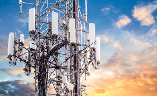
PCCW and Unistrong will collaborate on developing GNSS technologies and services for the telecommunications and aviation industries.
PCCW Global is the international operating division of HKT, a Hong Kong telecommunications service provider. Beijing UniStrong Science and Technology Corporation Limited is a navigation and positioning company.
The collaboration intends to link satellite positioning to 5G mobile networks to provide positioning data accurate to within centimeters. The link will unlock new services for telecommunications providers rolling out new networks to support the internet of things (IoT), smart cities and the aviation industry.
UniStrong’s experience in developing high-precision products, solutions and services will enable PCCW Global to integrate new services with 5G mobile infrastructure, providing high-precision positioning (HPP) accurate down to centimeter levels.
This integration of precision positioning expertise and technologies has the potential to revolutionize industries such as commercial drone operations, autonomous vehicles and transportation, logistics, construction, agriculture and others.
New Airport Technology
The integration of technologies will also enable the provision of smart aviation solutions for airport authorities. Based on high-precision positioning and navigation technology, new airports will be able to leverage smart civil construction works that will facilitate safer and more efficient airport operations.
These aviation technologies will also be able to integrate with a wide variety of IoT sensors, edge-computing capabilities, machine vision and other artificial intelligence (AI) technologies to create intelligent surveillance platforms capable of managing and enhancing many aspects of airport safety and efficiency.
The installed base of GNSS devices in use globally is forecast to increase from 6.4 billion in 2019 to 9.6 billion in 2029, with Asia-Pacific continuing to account for more than half of the global GNSS market.
In terms of global annual GNSS receiver shipments, the market is forecast to grow from 1.8 billion units in 2019 to 2.8 billion units in 2029, according to the 2019 GNSS Market Report by the European Global Navigation Satellite Systems Agency (GSA).
“As a global ICT service provider with extensive high speed fiber networks and cloud services coverage worldwide, we are delighted to cooperate with UniStrong with the aim to offer unique, game-changing solutions in Satellite High Precision Positioning (SHPP) and Continuous Operating Reference Station (CORS) solutions ideally suited to the new era of 5G, IoT and smart cities,” said Benney Cheng, head of Strategic Project and Development, PCCW Global.
“The cooperation between UniStrong and PCCW Global will further promote the development of professional solutions and applications that are oriented towards global users’ needs,” said Jun Shen, corporate vice president and chief scientist of UniStrong. “Based on GNSS technologies, and deeply integrated with communication technologies, Big Data, Industry 4.0, IoT, artificial intelligence and other technologies, these solutions will empower and influence more industries and countries, and promote BDS/GNSS global applications and international services worldwide.”
Photo: Bill Oxford / iStock / Getty Images Plus / Getty Images
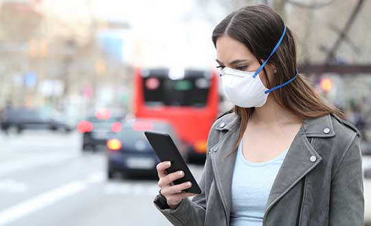
In moves sure to concern privacy advocates, 19 countries are now accessing citizens’ mobile location data in an effort to fight the coronavirus outbreak.
A COVID-19 Digital Rights Tracker by Top10VPN lists countries that are using mobile data for the pandemic. Uses range from anonymous aggregated data to monitor the general movement of people, to tracking the phones of individual coronavirus patients, to tracking suspected patients and their contacts, known as “contact tracing.”
“In the past week we have witnessed a 90% growth in the number of countries implementing digital tracking measures and a 100% increase in reports of censorship,” reported Top10VPN on March 26.
In the United States, the Senate’s $2 trillion economic stimulus bill includes $500 million for the Centers for Disease Control (CDC) to launch a new “surveillance and data-collection system” to monitor the spread of COVID-19, reports Business Insider.
Europe’s telecom companies are sharing location data with health authorities in Italy, Germany and Austria, according to Reuters, to check whether people are remaining at home. The data is aggregated and anonymous, mapping concentrations rather than individuals to respect Europe’s privacy laws.
In South Korea, the government created a map of cellphone data provided by telecom and credit card companies. The map was made public so everyone could track whether they’d been exposed, according to The Verge.
According to reports, Iran used the COVID-19 epidemic to gather private data from its citizens “to boost Tehran’s surveillance capabilities,” reports Vice. The country sent a link to download the AC19 app with government endorsement, touting it as a way to determine whether users have the virus, but usage required sending back location data.
In Taiwan, a mobile phone-based geo-fence uses location-tracking to ensure people who are quarantined stay in their homes, reports the New York Times. If the patient leaves their home address or turns off their smartphone, the police will visit within 15 minutes.
SafePaths app
The new Private Kit: SafePaths app, developed by Massachusetts Institute of Technology (MIT) researchers, is now available, though it is still under development. The downloadable app (for IOS and Android 8.0 and above) informs users if they’ve crossed paths with coronavirus patients, known through published data.
“The solution is a ‘pull’ model where users can download encrypted location information about carriers so the users can self-determine their likely exposure to COVID-19 and coordinate their response with their doctor using their symptoms and personal health history,” according to a white paper about the contact-tracing app.
The app takes privacy into consideration — COVID-19 patients consent to provide health officials with an accurate location trail once they are diagnosed. “Governments are equipped with a tool to redact location trails and thus broadcast location information with privacy protection for diagnosed carriers and local businesses,” the white paper reads.
“Since the outbreak of COVID-19, governments around the world have implemented a range of digital tracking, physical surveillance and censorship measures in a bid to slow the spread of the virus,” warns Top10VPN. “Some of these may well be proportionate, necessary and legitimate during these unprecedented times. However, others have been rushed through legislative bodies and implemented without adequate scrutiny.”
Garmin International Inc., a unit of Garmin Ltd., has chosen SiTime’s micro-electromechanical system (MEMS) timing solutions for several of Garmin’s automotive, aviation, marine, fitness and outdoor products.
“Garmin makes products that are engineered on the inside for life on the outside,” said Patrick Desbois, Garmin executive vice president of operations. “Our innovation focuses on developing technologies that enable our customers to enrich their experiences as they pursue their passions. SiTime’s MEMS timing solutions help extend battery life across several of our product lines.”
SiTime timing solutions are the heartbeat of customers’ electronic systems. With the deployment of 5G, internet of things (IoT) and automotive electronics in challenging outdoor environments, manufacturers will need timing solutions that enable environmental robustness and solve difficult challenges, such as power, size, and reliability. With the proliferation of electronic devices, the timing market is expected to grow to $10.1 billion by 2024.
“Garmin creates products for active people,” said Piyush Sevalia, executive vice president of marketing at SiTime. “Precise time is at the heart of every GPS receiver and impacts the speed of signal acquisition as well as position accuracy.
“Garmin’s outdoor products encounter many environmental stresses such as shock, vibration, rapid temperature changes and extreme temperatures. SiTime’s MEMS timing solutions are engineered to provide the highest level of robustness to such stressors and provide a powerful value-add to Garmin’s high-performing, robust and reliable products.”
Analytics provider Teoco has been selected by Telstra — a mobile network in Australia — to assist with the development of its UAV strategy.
Telstra will use Teoco’s AirborneRF solution to assess the readiness of its radio access network for future UAV applications, including communications, navigation, surveillance, safety and identity.
Teoco is a provider of analytics, assurance and optimization solutions to more than 300 communication service providers (CSPs) and OEMs worldwide.
Already deployed by several tier-one operators globally, AirborneRF ensures effective, mission-critical connectivity to enable effective traffic management and control for UAVs in the lower airspace. Telstra will use the solution to develop a platform for enabling a multitude of mission-critical services, vital in supporting successful UAV operations.
The platform provides a link between cellular networks and aviation systems, such as air traffic management (ATM), unmanned traffic management (UTM) and flight information management systems (FIMS).
TEOCO’s AirborneRF solution will play an important role in assisting Telstra enable a safe, equitable, secure and reliable urban air space platform. This has become all the more important to Telstra following Uber’s decision in 2019 to use Melbourne as one of three pilot cities to test out its “flying taxis” — the pilot is expected to begin this year, with commercial operations planned for 2023.
Telecommunications companies can provide needed UAV services via their mobile networks. For the internet of things (IOT), they can provide drone registration, activation and identification. For 5G, they can provide super low-latency remote command and control and high-resolution video carriage.
“We have been running a number of drone-related technology assessments with various industry customers, within law enforcement, humanitarian aid, post disaster, first responders and city councils, over the past 12 months,” said Thomas Neubauer, vice president of Business Development, TEOCO.
“Commercial UAVs present a huge opportunity for [[telecommunications]] operators, but only if supporting mobile networks deliver the required connectivity to keep them airborne,” Neubauer said. “Mobile networks were not designed to meet the needs of the aviation industry, so tight focus is needed to guarantee the quality of service needed to safeguard the additional revenue that connected skies promise. Our Airborne RF solution offers this guarantee to a growing number of major operators around the world.”
No, I’m not talking about the line at the grocery store to buy toilet paper and hand sanitizer. Or the line at the doctor’s office. I’m talking about that gray privacy line invisible to the naked eye, but all too accessible on our mobile devices.
On March 16, Israeli Prime Minister Benjamin Netanyahu and his cabinet approved using citizens’ smartphones to track the locations of people infected with the novel coronavirus (COVID-19), as well as anyone they might have had contact with.
Such a strategy might work — some citizens reported receiving smartphone alerts when they were near an infected person. However, it does raise the ubiquitous privacy concerns of allowing your government to know your every move.
Some may think this an acceptable use of tracking, except that the Israeli Knesset — the citizenry’s representative legislature — was not involved in the decision. The tracking didn’t require a court order, and records were to be kept until the new regulation expired.
A few days later, Israel’s top court put a stop to the program, saying there would be no tracking of Israelis by the Shin Bet without Knesset oversight.
Of course, Israel is a democracy, and Netanyahu’s move is nowhere near the draconian measures undertaken by the Chinese government in response to the virus. Those actions included forcibly removing people from their homes and placing them in quarantine.
Yet China’s actions worked. As of press time, the outbreak there is under control, with no new cases reported on March 19. That’s impressive, if one can trust the state news. After all, this is the same country that warned the doctor who discovered the virus not to talk about it. Dr. Li Wenliang died in February of the disease.
Privacy versus public health: Something to think about while social distancing at home.
The World Health Organization (WHO) has launched a messaging service with partners WhatsApp and Facebook to keep people safe from coronavirus.
The messaging service has the potential to reach 2 billion people and enables WHO to get information directly into the hands of the people that need it.
From government leaders to health workers and family and friends, this messaging service will provide the latest news and information on coronavirus including details on symptoms and how people can protect themselves and others. It also provides the latest situation reports and numbers in real time to help government decision-makers protect the health of their populations.
The service can be accessed through a link that opens a conversation on WhatsApp. Users can type “hi” to activate the conversation, prompting a menu of options that can help answer their questions about COVID-19.
The WHO Health Alert was developed in collaboration with Praekelt.Org, using Turn machine learning technology.
UPDATE: Israel’s High Court of Justice put a stop to the tracking on Thursday, March 19. The court declared that the Shin Bet security service may not track confirmed and suspected coronavirus patients if a Knesset panel to oversee this practice isn’t set up by noon Tuesday, according to Israel news agency Haaretz.
Israel’s internal security agency Shin Bet is using citizens’ smartphones to track the locations of people infected with the novel coronavirus (COVID-19) as well as anyone they might have had contact with, news agencies are reporting. Some citizens report receiving smartphone alerts when they have been near an infected person.
Privacy concerns. The tracking doesn’t require a court order and records will be kept until the regulations expire, according to Israeli news source Haaretz. The regulation can be renewed, and the country’s Health Ministry can keep the location records for 60 days after the regulation expires.
Israeli Prime Minister Benjamin Netanyahu told The New York Times that the government would approve the plan Monay night. “We have to maintain the balance between the rights of the individual and needs of general society, and we are doing that,” he told the newspaper.
No legislature involved. The plan was reportedly approved by cabinet members without approval of the Knesset, the Israeli legislature, which has just been sworn into office and has not yet convened.
Microsoft Azure customers now have access to HERE Location Services within its self-hosted Azure environments. HERE is providing a new set of application programming interfaces (APIs) for developers to build location-aware applications.
Microsoft Azure is a cloud computing service for building, testing, deploying and managing applications and services through Microsoft-managed data centers.
According to HERE, HERE Location Services such as Routing, Geocoding and Map Tiles APIs offer developers useful tools while ensuring high performance for an application’s most critical processes.
Software developers rely on the accuracy and scale of HERE Location Services to incorporate core location-oriented components into the enterprise-grade applications they build and manage, the company said.
The HERE Location Services available for self-hosting in Azure Virtual Machine environments are:
Routing – provides access to and use of global, real-time and historical traffic information.
Forward Geocoder and Reverse Geocoder – provides comprehensive coverage in 196 countries and several territories with a high-precision mapping of geo-coordinates or addresses.
Map Tiles– shows fresh day-time map tiles in multiple styles (for example, base and aerial) including rendered live-traffic tiles for flow overlay.
Applications for HERE Location Services include the following.
Fleet management and emergency services
Create safe and efficient routing solutions for multiple vehicle types
Provide the most efficient routing options based on real-time traffic conditions
Seamless mobility
Provide routing options for pedestrians and public transportation
Help cities run more smoothly with improved traffic flow and transportation network usage
Business intelligence:
Understand trends and behavior of citizens in relation to their location and mobility patterns
Understand shifting market dynamics to inform real-estate investments
Verify insurance claims and authenticate transactions
HERE Location Services are available to Azure customers who want to manage and deliver highly available location-based services. The self-hosted architecture ensures maximum availability and resiliency for Azure customers running critical business applications that rely on “always-on” location services.
“Location anchors our connected world and HERE Location Services enable industries to solve complex challenges while delivering valuable new products and experiences,” said Mithun Dhar, General Manager, Developer Relations at HERE Technologies. “Demands on business require flexibility in software architecture, and HERE is proud to offer robust and high-quality location services to customers operating across public cloud, self-hosted or hybrid environments.”
HERE Location Services are also available as Serverless Functions on the Azure Marketplace. For the latest Azure developer content, go to HERE | Azure Marketplace.