EGNOS Embraces Ground Users
The European Geostationary Navigation Overlay Service (EGNOS) is Europe’s version of the U.S. Wide Area Augmentation System (WAAS) with essentially the same mission. It offers GPS users in Europe more accurate and reliably GPS positioning. Like WAAS, EGNOS focuses on improving the integrity and accuracy of autonomous GPS positioning primarily by modeling refraction caused by the ionosphere. Also, EGNOS was designed to be compatible with WAAS so your WAAS-enabled receiver will work with EGNOS just fine.
The system is similar to WAAS in that it’s an augmentation to GPS. It primarily consists of a network of ground reference stations (RIMS) and three broadcasting satellites.
This is done via the network of ground stations spread out over Europe as follows:
RIMS = Ranging and Integrity Monitoring Stations
MCC = Master Control Stations
NLES = Navigation Land Earth Station
PAFC = Performance and Assessment Check-out Platform
ASQF = Application Specific Qualification Facility
In a quick sentence, the MCCs process the data collected by the RIMSs and the NLESs send the processed data to the three geostationary satellites that rebroadcast to the users. Got that?
As I mentioned, there are currently three EGNOS broadcasting satellites:
-PRN 120 (Inmarsat 3 F2) located at 15.5 West Longitude.
-PRN 126 (Inmarsat 3 F5) located at 25.0 East Longitude.
-PRN 124 (Artemis) located at 21.5 East Longitude.
PRN 120 and PRN 126 are to be used by the general public.
PRN 124 is available to the public but designed for use by companies to “perform various tests on the system” according to the European Space Agency (ESA).
Generally speaking, the user needs line-of-sight visibility to either PRN 120 or PRN 126 in order to use EGNOS (there are a couple of exceptions I’ll mention later). There is a nice online tool at http://www.lyngsat.com you can use to determine approximately how far above the horizon PRN 120 and PRN 126 are in your area:
PRN 120 – http://www.lyngsat.com/tracker/inmar3f2.html
PRN 126 – http://www.lyngsat.com/tracker/inmar3f5.html
One major exception to the line-of-sight rule is something that significantly differentiates EGNOS from WAAS. The line-of-sight rule has been the major inhibitor for WAAS ground users. Some companies have used innovative methods to overcome this limitation, but EGNOS has taken it to another level.
EGNOS has embraced the ground users — something that WAAS has done poorly.
To address the needs of the ground users (engineering and scientific community), EGNOS developed Signal-in-Space through Internet (SISNeT). SISNeT is a method of distributing EGNOS corrections over the Internet instead of requiring line-of-sight visibility to PRN 120 or PRN 126.
What a great idea! WAAS really missed the boat on this one.
All users need is a mobile phone with a data plan (like network RTK) to connect to their GPS receiver and they don’t have to worry about EGNOS satellite visibility. Granted, if you’re using a consumer-grade receiver, this doesn’t make much sense. But if you’re using high performance receivers (1-2 meters) for mapping and you’re in an area where you won’t have consistent visibility to PRN 120 or PRN 126, this makes a lot of sense.
Like WAAS, EGNOS accuracy claims (1-2 meters) are a little ambiguous and generally on the conservative side.
Like WAAS, you need to be working inside the EGNOS IGP (Ionospheric Grid Point) area to take full advantage of EGNOS accuracy. Note that some receivers are designed to exploit EGNOS outside of the IGP area with some accuracy degradation, but your average consumer GPS unit won’t do this. The following graphic defines that area:
A year ago, the ESA declared that EGNOS was declared “fully-deployed” for “non-safety of life” applications such as mapping. This is the so-called Initial Operations phase of EGNOS.
Safety-of-life applications using EGNOS such as aviation navigation aren’t approved yet, but the news seems to be good. On June 28, 2007, the African aviation safety agency (ASECNA) signed up to cooperate with ESA to improve aviation traffic safety over the African continent.
The ESA has done a really good job of publishing detailed information on EGNOS. There is even a website referred to as EGNOS for Professionals that gets as technical as most people would like.
EGNOS web site – http://www.esa.int/esaNA/egnos.html
EGNOS For Professionals web site – http://www.egnos-pro.esa.int/
EGNOS SISNeT web site – http://www.egnos-pro.esa.int/sisnet/index.html
Lastly, I’ll leave you with some data collected last month. It’s always good to get a real field perspective. Through my grapevine, I was able to obtain data collected in Italy (June 2007) using EGNOS corrections. Enjoy.
Here is the graphic plot:
It’s been about a year since I’ve touched on WAAS (Wide Area Augmentation System) with any depth, and a lot of things are happening on that front so I’d thought I’d give an update. Also, look for a column on EGNOS (Europe’s version of WAAS) in the next month or two.
WAAS is finally going to settle down, in terms of the WAAS broadcasting satellites; the final one is scheduled to become operational (for aviation users) in mid-July. Although it should never have been a headache for ground users like us (many of us have been using the satellite for mapping for more than a year), it was — mainly because several manufacturers of mapping receivers insisted on allowing their receivers to use only WAAS in aviation mode, which didn’t make any sense.
Anyway, two significant events will happen next month. One is mentioned above, which means that users in the eastern/northeastern US and eastern Canada who are using mapping receivers that require WAAS to be operational for aviation users will now be able to use WAAS more reliably.
The other event happening next month is that the two legacy WAAS broadcasting satellites, POR (PRN 122) and AOR-W (PRN 134), will stop broadcasting WAAS information. This has been the FAA’s plan all along. It will leave two WAAS broadcasting satellites (PRN 135 and PRN 138) that provide dual coverage throughout the US. Alas, WAAS satellite visibility will never be as good as it was for northeastern US and northeastern Canadian users when AOR-W was at 54W longitude.
After the two legacy WAAS satellites stop broadcasting, the coverage footprint will look like this:
This will put the nearly 18-month WAAS satellite reconfiguration confusion to bed.
Another major milestone for WAAS later this summer is an upgrade that will add four new reference stations in Canada and five in Mexico. Also, new reference stations in Alaska will be added to the Iono grid.
What this means is that WAAS coverage will expand to the north (Canada) and south (Mexico). Users will also see improved performance on the fringes of the current WAAS service area (southern Texas, southern California, New England states, etc.).
Following is a map of the Iono Grid Points (IGPs) for the current WAAS service area:
And here’s a map of the IGPs for the expanded WAAS service area:
WAAS Accuracy
Even though the expanded IGPs have yet to be implemented, WAAS accuracy is impressive. The National Satellite Test Bed (NSTB) produces a WAAS Performance Report on a quarterly basis. Each GPS receiver collects about 7,000,000 each quarter, and the NSTB compiles and publishes the test results.
Following are the results of Q1 2007:
For a system that was originally specified to provide 7-meter accuracy, the performance is impressive. At the 95% confidence level, horizontal accuracy for all test sites across the CONUS and some in Alaska are all under a meter. Also, remember that these figures will improve with the addition of the new reference stations later this summer.
Whether you live in London, Lagos, Lisbon, or Los Angeles, when you are looking to buy a survey instrument, most likely you have a “preferred” instrument distributor in mind. Maybe it’s the local Topcon dealer. Perhaps your Leica dealer has served you well. Or you might prefer the Trimble dealer in your area. All of the manufacturers have distributors signed up around the world. Some operate on a regional basis, serving several countries, while others serve one specific country.
I raise this point because of recent, significant changes in the U.S. distribution of survey instruments. These include:
Topcon’s intent to acquire Sokkia (still subject to Japanese Fair Trade Commission approval).
Leica’s purchase of Allen Precision Equipment, Inc. (APE, Atlanta, Georgia), the largest nationwide catalog distributor of survey instruments in the United States and the largest Topcon distributor in the country.
Topcon’s purchase of Hayes Instrument Co., a regional and online distributor of Topcon, Magellan, TDS (Trimble), Sokkia, Nikon, and Carlson instruments.
A little history. Generally, instrument distributors are independent companies that have distribution agreements with particular manufacturers. Sometimes, a distributor like APE will have agreements with several manufacturers. APE had (prior to being purchased by Leica Geosystems) distribution agreements with Topcon, Sokkia, and Magellan for GPS equipment.
Another type of manufacturer/distributor arrangement is one like what Leica Geosystems has traditionally maintained in the U.S. They have one distributor that operates exclusively in a region, and no other distributor is permitted to sell in that region. In essence, the distributor is somewhat “protected” by Leica. In return for this protection, the distributor is not allowed to have a distribution agreement with a competing manufacturer.
Outside of the U.S., there may be several distributors in a country, or there may be only one distributor for an entire country, or, in some cases, a distributor’s responsibility may include more than one country.
Lastly, in other countries or regions outside of the U.S. where a suitable distributor does not exist or the country is very large, a manufacturer may set up its own regional office.
The distributor is a very important part of the sales channel for the instrument manufacturer because, for the most part, the local distributor is the one that makes the sale and supports the customer. If the distributor does a good job of supporting the customer and building trust, the customer may be very loyal to the distributor. On the other hand, especially with GPS/GNSS equipment, the customer makes a significant investment training to learn a specific system. So are customers more loyal to the distributor or to the manufacturer?
At the end of the day, I think they are more loyal to the manufacturer. Even though the customer may well prefer to work with a specific distributor, the significant investment in equipment and training in the manufacturer’s hardware/software trumps the relationship with the distributor. Not many customers are willing to retool their equipment, training, and procedures to stay loyal to a particular distributor.
Back to current events. It’s been nearly two months since Topcon announced its intent to acquire Sokkia. There was some significance to the announcement in terms of brand differentiation and reconciling the Topcon and Sokkia distribution channels, but the synergy was plausible (refer to my March column for further details) and it didn’t upset the instrument distributor applecart in a significant way.
Then along came Leica, who announced last week that it had acquired APE — a discount, nationwide, mail-order survey equipment supplier. APE is (was) Topcon’s largest U.S. distributor. In response to the purchase, Topcon announced it had severed its relationship with APE. In one fell swoop, a decades-long relationship was ended.
On its website, APE stated that it “wished to continue representing all current product lines, including Topcon.” But the site goes on to say, “However, Topcon has chosen not to support our mission…” It doesn’t take a brain surgeon to understand why Topcon cut off the relationship.
With its largest U.S. distributor cast away, Topcon was left with a big hole to fill. Within days of the Leica announcement, Topcon announced it had purchased Hayes Instrument Co. of Shelbyville, Tennessee. Hayes is a regional and online distributor of survey instruments which has garnered a reasonable reputation of providing quality technical support. Hayes is also a distributor of Magellan, Sokkia, TDS, Nikon, and Carlson. Topcon also announced Hayes will be opening an Atlanta, Georgia, office by the end of June. Clearly Hayes gives Topcon the springboard to expand their distribution quickly in the southeastern U.S. — where APE is the most dominant. This is damage control at its best and actually is a better long-term solution for Topcon, in my opinion.
What I don’t get is how Leica is going to reconcile the APE purchase with its U.S. distributors. Leica has traditionally protected its distributor network fairly well, so on the surface the APE purchase seems really out of character. Perhaps APE was purchased to “fill in the blanks” where good Leica distributor coverage is lacking. Rumor has it there was a Leica distributor meeting last Monday (May 14th). It will be interesting to hear the fallout from that meeting.
One thing is for sure: the dust hasn’t settled yet.
Ok, this column is supposed to be about high-precision GNSS, right? Well, who would have ever thought I’d be inclined to write about consumer GPS receivers? Certainly not me. Sometimes, I even speak rather condescendingly about those “Wal-Mart GPS units” because they seem to be mis-used so often in the survey/construction business.
But with the explosive growth of Personal Navigation Devices (PNDs) and being the GPS technology-aholic I am, I had to give some of these a try. Surprisingly, I became addicted to them in short order. Mind you, I already have an in-dash GPS navigation system in my car so this isn’t a new concept to me. So why the big fuss?
First of all, let’s define a PND so everyone’s on the same page.
The newer PNDs are roughly the size of a slice of French bread with a 3”-4” LCD touch screen. Its primary function is to guide you from Point A to Point B by providing you turn-by-turn instructions on the map screen and via voice instructions. Seriously — it talks to you. It typically comes with a street/address map database of the region where you bought it such as North America, Europe, etc. It runs on batteries or vehicle power and comes with some sort of windshield or dashboard mount.
Whereas legacy PNDs were bulky and ran a short time on batteries and were really designed to stay mounted in your car, the newer PNDs are slim. They are designed to be truly portable with features that support “grab and go” functionality like ruggedness and extended battery operations.
The PND did its job of getting me to where I needed to go. But the great part about it was that when I needed to alter plans, like a last-minute dinner meeting, it was perfect. With my old Mapquest method, I would have scrambled to find directions.
But, secondly, perhaps what surprised me most and what prompted me to focus this month’s column on PNDs is the response I’ve been receiving from people who see me using the PND. I’m not talking about soccer Mom’s or Joe consumer. I’m talking about architects, construction superintendents, engineers: professional types. I’ve been on project sites where these types of people see me using the PND and they start asking questions.
Most see it as a really productive business tool because they spend a lot of time traveling from one project site to another and aren’t necessarily familiar with the local hotels, restaurants, reprographic vendors, construction material vendors, and so on.
Some have even exclaimed they can’t believe there’s not a monthly subscription fee. There’s not. Although after a couple of years of ownership, you’d probably want to purchase an updated map database.
So the pessimist in me asked what happens if I become too dependent on the thing. After three days in San Francisco, I’d used the PND exclusively to navigate my way around the different suburbs. At the end of my trip, I dialed up the rental car location on the PND and let her take me home. Sure enough, about 10 min. from the airport, the screen went blank. No warning, no nothing. Dead battery. After a few seconds of “uh oh, what am I’m going to do now?” I remember I packed the car charger. I pulled over, plugged it in and off I went. But, it made me think about what I would have done otherwise. My conclusion was that, worst case, I pull over and ask for directions.
The attractive feature of the “grab and go” functionality with new generation PNDs is that they aren’t tied to a specific vehicle. I found myself throwing it on the seat of rental cars and not using the windshield mount at all. To me, there was not enough value in hooking it up all that mounting hardware. I’d rather stuff it in my laptop bag and pull it out when I need it. I can imagine a small survey outfit having one unit in the office that folks check out for the day no matter which rig they are taking in the field.
Another attractive feature for survey/construction professionals is that some of the new generation PNDs allow you to load topo maps in addition to having turn-by-turn directions, points of interest, etc.
Time is money and it doesn’t take an MBA to figure out that if the PND saves time getting folks to each project site faster, it’s a no brainer at the ~$500 price tag.
L1 RTK follow-up
I promised I wouldn’t visit this subject again until products starting hitting the streets. It’s starting to happen. read more >>
Why are the two GPS Transmitter frequencies (1575.42 and 1227.6 MHz) coherently selected integer multiples of 10.23 MHz master clock?
Question posted on CANSPACE on October 30, 2006, by Sivaraman Ranganathan.
The document defining the GPS signal, IS-GPS-200, states that “The carrier frequencies for the L1 and L2 signals shall be coherently derived from a common frequency source within the SV.” This makes the L1 and L2 multiples of the common frequency source 10.23MHz. (Section 3.3.1.1). Why is this? I believe this is done for simplicity of system design and operation. All components of the signal (code, carrier, and navigation data) are derived from the atomic frequency standards on board the satellite. If this were not done and separate frequency sources were used, then biases between the different components would occur, which would have to be calculated and removed.
IS-GPS-200 furthermore states in Section 3.3.1.8 that the C/A and P(Y) digital codes are as well derived from the same frequency standard. “All transmitted signals for a particular SV shall be coherently derived from the same on-board frequency standard; all digital signals shall be clocked in coincidence with the PRN transitions for the P-signal and occur at the P-signal transition speed. On the L1 channel the data transitions of the two modulating signals (i.e., that containing the P(Y)-code and that containing the C/A-code), L1 P(Y) and L1 C/A, shall be such that the average time difference between the transitions does not exceed 10 nanoseconds (two sigma)”.
Despite the coherence of the two carriers, it is understood there is a difference between the radiated L1 and L2 signals due in part to the different paths the signals take within the on-board electronics. This is called the differential group delay and an estimate of this difference is broadcast to users in the navigation message. The difference between L1 P(Y) and L2 P(Y) is designated Tgd (reference paragraph 20.3.3.3.3.2). The difference between L1 P(Y) and L2C is called the Inter-Signal Correction (ISC) (reference paragraph 30.3.3.3.1.1).
For further technical discussion of this topic, see the book Global Positioning System, Signals Measurements, and Performance by Pratap Misra and Per Enge (section 2.3.1).
Why are GLONASS satellites launched on Christmas Day? Question posted on CANSPACE on December 10, 2006, by Kerry Matthews
The latest triple-satellite GLONASS launch occurred on December 25th at 23:18 Moscow Time. This launch is the sixth GLONASS December launch in a row. In fact, all 9 launches since December 1995 have occurred in the last month of the year with the exception of the launch on October 13th, 2000 (see a list of GLONASS launches going back to 1990).
Including this month’s launch, three of the recent launches have occurred on December 25th and one originally scheduled for the 25th, occurred on the 26th. Why the preponderance of December launches and launches on Christmas Day in particular?
First of all, we should realize that for most people in the Russian Federation, there is nothing special about December 25th. Most Christians in Russia belong to the Russian Orthodox Church which celebrates Christmas according to the Julian calendar — on January 7th. And in modern Russia, January 7th is a state-wide holiday. So, GLONASS launches don’t occur around December 25th because it’s a special day on the Russian calendar. So why do they occur then?
I posed this question to Col. (ret.) Nikolai Shienok, the former chief of the Information Department of the Coordination and Scientific Information Center of the Russian Ministry of Defense. After conferring with officials from Roscosmos (the Russian space agency) responsible for the GLONASS program, Col. Shienok confirmed that it is only for financial or organizational reasons that there is a preponderance of launches in December. “It is the last month of the year and it is impossible to postpone a planned launch further” Col. Shienok said.
Nevertheless, there may be some operational calendar constraints on GLONASS satellite launches as there are for launches of other satellites. Satellite operators typically try to avoid launching satellites when the Sun-orbit-plane or beta angle for the intended orbit is unfavorable. The beta angle is the angle between the geocentric position vector to the Sun and the satellite’s orbital plane. This angle determines if and for how long a satellite will be in the Earth’s shadow during its orbit. For a given orbit (altitude, inclination, and initial right ascension of the ascending node), the beta angle will vary over the year. Operators try to avoid a launch date when the satellite would be in eclipse for a significant fraction of its orbit so that during the crucial satellite deployment and commissioning phase, the satellite’s solar panels receive as much sunlight as possible to keep the satellite’s batteries fully charged. The recent GLONASS launch put the satellites into Plane 2 which is actually in one of its eclipse seasons right now. However, the satellites will be out of eclipse by early January.
In your August 2006 issue, you raised the question: Who was first with GPS? And you concluded that a debate may not be useful. You may be right. In spite of Richard Easton’s Internet claim that his father, Roger Easton, invented GPS by filing an enabling U.S. patent number 378 9409 in 1974, he must have had his doubt. For he preceded his article with a quote by Alexander von Humboldt, who had observed that the third stage of scientific discovery “finally credits the wrong person.”
From its very beginning, the invention of GPS was teamwork. First and foremost among them were the rivaling research teams of the U.S. Air Force and the U.S. Navy.
In the 1940s, the navigation system LORAN, still in use by ships today, was developed by an MIT research team while Ivan A. Getting was a researcher at MIT’s Radiation Laboratory. In 1951, Getting became the head of research and engineering at Raytheon Corp. in Waltham, Massachusetts. They developed a mobile ballistic missile guidance system, called MOSAIC. In 1960, Getting was asked by the Air Force to create a nonprofit military systems development organization and became president of Aerospace Corp. While planning new ballistic missile systems, space-launch systems and high powered chemical lasers, he focused on and became an evangelist for Navstar. “GPS was incubated in the mind of Ivan Getting,” noted the National Inventors Hall of Fame when it inducted him and Colonel Bradford Parkinson.
Everybody agreed, however, that many others were part of the several inventor teams and deserve credit as well.
Back in 1991, as president of ACSM, I had the opportunity to speak to Col. Bradford Parkinson’s GPS expert, Col. Gaylord Green. He told me that their small team of six or seven scientists had built the GPS architecture in 1972, in less than a month. Air Force team members included Mel Birnbaum, Bob Rennard, and Jim Spilker. The GPS concept and theory had been established earlier as a Transit system, and has always been an “institutional endeavor,” said Green.
Richard Easton also mentioned James Buisson, Thomas McCaskill, Don Lynch, Charles Bartholomew, Randolph Zirn and “an important outsider,” Robert Kern, as talented team members of his father, Roger, at the Naval Research Lab (NRL). It turns out that the important outsider, Robert Kern, became the founder of Frequency & Time Systems, Inc. (FTS), a manufacturer of atomic clocks for GPS satellites, in Beverly, Massachusetts, in 1971.
He may or may not be a descendant of the famous Swiss instrument manufacturer Kern A.G., which is related to Wild Heerbrugg of Switzerland, now Leica. In its website, Milestones of Technology, it describes that it had conducted the first feasibility study for the GPS program 621B of the U.S. Air Force in 1967. Likewise, in 1971, it defined, designed, and built early prototype receivers for the Navy’s GPS program Timation. As Gaylord Green pointed out, GPS has always been an institutional endeavor.
To sum it up, the diverse teams of GPS inventors and designers were led by at least three outstanding American scientists. They are Ivan A. Getting of Raytheon and Aerospace Corporation, who in the 1950s “incubated GPS in his mind;” Bradford Parkinson of the U.S. Air Force, who helped create GPS in 1972; and Roger Easton, of the U.S. Navy Research Laboratory, who filed the enabling patent in 1974.
Thanks to their joint effort, simultaneously or in succession, we can today look at GPS applications, both military and commercial, where the sky is truly the limit.
– Gunther Greulich, PLS, PE, Former president ACSM
The magazine has not carried much GLONASS news in recent months, yet we continue to cover Galileo with some assiduousness and we devoted several pages to Beidou in December. In all three cases, we find an absence of real news in the sense of verifiable happenings, satellite launches, new applications by users, or releases of products you can wrap your hands around.
No, in all three systems we have pronouncements, prognostications, and promises of satellites future. Ongoing deliberations, budget wrangling, internal disputes, delays, cost overruns, turf squabbles, and discussions postponed until the next round of meetings. Hmmm. These young upstarts sound remarkably akin to their older cousin, GPS.
Aha — but! GPS launched a satellite in November, and declared it operational for users on December 13. Not only a new satellite, a new kind of satellite, with new codes. That may not be news on the order of "man bites dog," but it is undeniably authentic, progressive, practical, and actually useful news you can use.
Why cover Galileo and Beidou, while devoting scant attention to GLONASS?
Well, Beidou is new, only very recently and suddenly being talked about as a truly global NSS. It is all talk at this point, but it’s fascinating talk, and comes from a region that has long held itself mysterious, aloof. Hard information is extremely difficult to come by. We’re reduced to scrutinizing the inscrutable, reading the tea leaves of government releases and newspaper stories within China, where the government controls the press. Even the analysts whom we canvass haven’t much better sources. So, play hard to get, you Beidou designers . . .
Galileo is completely another story. Or six or seven other stories. A soap opera, it keeps unfolding, plot-twisting, introducing new characters and controversies, and leaving you cliffhanging from one episode to the next. Politics play a very overt role, as 151 constituencies try to resolve issues to everyone’s satisfaction. While continuing — here’s the real trick — to move forward. That keeps us tuning in.
Meanwhile, Russia bravely carries on its own tradition, promising three new, longer-lived satellites by Christmas and 18 or 24 by 2008, an upgraded service freely available anywhere in the country and soon (or later) the world, a new Five-Year Plan better than the old Five-Year Plan, which went unattained. Not through lack of trying, but through lack of money, and a crumbling infrastructure. This may be lamentable and the new optimism estimable, but is it news? Can I use it?
The Kremlin has no lock on inflated goals and blue-sky promises. This desk receives plenty of that from industry. Yes! In this country! And others. Our intent is to filter that out, to deliver only that which may truly affect our readers.
News doesn’t exist in a vacuum. It requires people, and a demonstrable effect on those people, to become news.
Momentum is a powerful phenomenon. When thought of in terms of a moving object, its mass and velocity can be measured. In other respects, it’s immeasurable. Feelings of confidence, trust, and faith can’t be hard-coded — but can make the difference between winning and losing. Whether in the context of a football game, the stock market, or a presidential election, positive momentum builds confidence, and confidence feeds the momentum. The Big Mo.
In 2006, GPS constellation health has declined, but a well-timed presentation by Brad Parkinson at the ION GNSS 2006 conference has injected renewed enthusiasm into the GPS program. Parkinson’s call for a 30-plus satellite constellation may constitute a boon for GPS survey/mapping users in 2007. More satellite signals and healthier satellites mean increased productivity. While 2006 saw two IIR-M satellite launches, look for double that in 2007. Even if new launches don’t improve the PDOP spikes, we’ll have more reliable hardware in orbit. The Big Mo is rolling.
The short-term benefit of the IIR-M launches is a healthier constellation. Another, longer-term benefit comes from the addition of the second civil frequency. L2C may bring some value to L1/L2 users in 2007, but with only eight IIR-Ms even potentially operational by year’s end (assuming five are launched in 2007), plus the requirement to have an L2C-capable reference station, the bennies will be limited.
GLONASS is still a crapshoot and may likely continue that way into 2007, but it doesn’t matter because its value is augmenting GPS. Up until a few months ago, it had The Big Mo on its side. Then GLONASS headed south in a hurry in September, when nearly a half dozen satellites were declared unusable “due to maintenance.” This continued for 30-plus days. The good news is that the Russians are launching GLONASS satellites at a pretty good clip, and GPS/GLONASS users don’t need a full GLONASS constellation for it to be useful. Three more are scheduled to launch this month and six are scheduled for launch in 2007.
Even if only half of those become operational, GPS/GLONASS users will feel the love in 2007. Worldwide GLONASS usage will increase significantly in 2007 now that all major survey instrument manufacturers have introduced and will begin rolling out their GPS/GLONASS-capable products. The Big Mo will return.
Galileo won’t do anything for the survey/mapping user in 2007, but that doesn’t mean you don’t keep tabs on it. Galileo has the potential to deliver Huge Mo for survey/mapping — just not in 2007. The business model will continue to receive scrutiny, and the discussion of military use will spin things around a bit, but development and testing will continue. The key news to look for in 2007 will be any significant delays. 2008 should be a Big Mo year for Galileo if the program can stay on target, and if tight GPS interoperability is realized.
Satellite-based augmentation systems (SBASs) like the United States’ WAAS, Europe’s EGNOS, Japan’s MSAS, and India’s GAGAN also have Big Mo on their side. Virtually every GPS receiver shipped today is SBAS-capable. WAAS will finally stabilize with respect to the communication satellite adjustments made in 2006, and EGNOS should be declared operational. The worldwide SBAS user base will continue to show strong double-digit if not triple-digit growth.
NDGPS (National Differential GPS), another GPS augmentation system, will encounter the most significant crossroad in its decade-long history of service in 2007. Lack of support threatens the program’s existence. The worst-case scenario is that NDGPS will shut down as early as October 2007, leaving the U.S. Coast Guard to operate only 40 or so maritime DGPS broadcast stations along coastlines and major waterways. Big Mo left some time ago, and No Mo has moved in.
Reshaping the Marketplace. The most interesting GPS survey/mapping innovation for 2007?
L1 RTK.
While not the most innovative technology because it’s been possible for many years, it holds great interest because of its potential to reshape the survey/mapping marketplace. It will fill a gap between L1 static systems and high-end L1/L2 RTK systems. Those L1 static users who could not overcome the financial jump to an L1/L2 RTK system costing several tens of thousands of dollars will now have the productivity of RTK within reach.
Why now, and not five years ago? Follow the money to find the answer. L1/L2 RTK systems still run in the US$25-45,000 range. Competition among high-end GPS manufacturers is heating up, so they’re looking for opportunity. L1 RTK systems will be half that price — maybe even one third. Yes, baseline lengths will be limited to a few kilometers, and initialization times will be measured in terms of minutes rather than seconds, but the accuracy will be the just as good as high-end L1/L2 RTK systems.
Satellite constellation health will be the wildcard for L1 RTK. 2006 was not a good year for the GPS constellation. With L1 RTK and a weak constellation, productivity would be an issue, especially if you aren’t operating in a really clear open-sky environment. However, the good news is that it seems GPS Wing of the U.S. Air Force is in giddy-up mode again. If they share Parkinson’s vision of a 30-plus satellite constellation, L1 RTK could end up being a very productive tool — with Big Mo on its side.
Well done on the editorial this month (“Skies Cloudy All Day,” October). I totally agree with you regarding the lack of clear vision for our GPS future. And I’m not saying there is not vision at the Air Force, but the GPS programs must be backed by the full Congress and its funding. We must put government funding behind that vision to make it a reality. When we as U.S. citizens say GPS is critical to our national security, and even our livelihood more and more each day, we must back that with the bucks to keep it healthy and strong as the utility that it has become.
– Ellen Hall
President, Spirent Federal Systems Inc.
NDGPS Killer App
This is in response to the October 2006 letter “NDGPS Budget” by Tim Smith and the reply by Erik Gakstatter. There will be a killer application for NDGPS, for ground vehicles to know their position precisely to the meter, especially in the urban canyon setting where satellite reception can be very poor. This effort is spearheaded by the Department of Transportation (DOT) for the Intelligent Transportation System (ITS). In addition, the Vehicle Infrastructure Integration (VII) consortium consists of several state agencies, automobile manufacturers, and vendors to implement vehicle-to-vehicle-to-roadside communications via Dedicated Short Range Communications (DSRC). The primary purpose is to enhance vehicle safety using communications for collision avoidance, signal violation warning, near instantaneous traffic information, and road hazard warnings. In this case accurate GPS positioning is very important and where NDGPS can fill the need. Secondary purposes are to provide a wide range of applications starting with local electronic signage, navigation aids, traveler information, electronic payments (fuel, parking, tollway), ramp metering, and a wide variety of potential consumer applications in the vehicle.
The article “Safe in Traffic” in the very same issue of GPS World describes the whole project and the use of GPS for ground vehicle transportation, but not the need for accurate GPS positioning which could be provided by NDGPS.
– Neal W. Probert
President, ProbeStar Technical Systems
WAAS in the East
Could you please tell me when WAAS will be up and running in Eastern Canada?
We recently discovered that in a 5-day period three GPS satellites were taken off line indefinitely with no explanation as to possible return to service. This is significant in that the constellation that remains is “non-optimal” in terms of providing more than four satellites at all locations and so on. Specifically we have concerns about RNP Aviation operations that rely on excellent satellite availability to achieve the lower RNP, less than 0.2 capability for final approaches. This seriously impacts airline operations as our calculations indicate that RNP 0.18 operations have been reduced (worldwide) to an availability of about 86 percent. This is a very significant loss of availability. This potentially also impacts LPV and other FAA certified GPS approaches as well.
Do you have any information as to what has happened to these satellites and whether or not they may be returned to service? May the constellation be “rebalanced” — with satellites being moved to new orbits to make the remaining 26 satellites provide a more optimal configuration that would also substantially improve RNP and other aviation operations availability?
Any insights or references as to where I may go to learn more about this situation would be greatly appreciated.
Editor’s reply: As of September 4, three on-orbit GPS satellites had been taken out of service. PRN 15 was taken off line on 21 August; PRN 3 off on 24 August, and PRN 29 off on 26 August. PRNs 15 and 3 were reportedly undergoing clock swaps. PRN 3 had a previous clock swap in June. See “Clipped Birds” in The System news coverage for constellation status as of press time, September 22.
NDGPS Budget
Eric Gakstatter’s on line article on NDGPS (Nationwide Differential GPS) is a very poor framing of the issues. I have two main problems with GPS World’s on-line and hardcopy reporting of this issue.
One, the print article relegates an issue that is one of the most important in more than five years for GPS to a “down-at-the-bottom-of-page-20-issue.”
Secondly, it allows a pro-WAAS policy wonk such as Mr. Gakstatter to report on it. Very disappointing. This issue should not be framed as an NDGPS vs. WAAS issue as Gakstatter continually tries to make it. This is not the reason that NDGPS funding is an issue. It is much more complicated than that. Additionally, Mr. Gakstatter undermines his own credibility by making light of the user community that requires NDGPS for real-time, 1–5 meter, differential corrections and cannot use WAAS reliably.
Both of these points illustrate the lack of understanding by him and GPS World of real-world problems that face the GPS user community and policy issues in Washington.
In an article titled “Managing the GPS Constellation for Today’s Needs” in this month’s GPS World publication (September 2006), Mr. Lavrakas states that “Accuracy is the thing, and real-time accuracy is the most important thing.” I wholeheartedly agree. The NDGPS funding issue concerns a fantastically reliable augmentation system that is both efficient and fiscally responsible. My hope is that some sanity will return to this debate and the right path will be taken for the betterment of the GPS user community and the U.S. taxpayer (“Let’s not forget whose money makes all of this possible,” A. Cameron, Editor, same issue of the magazine).
Please, GPS World is a great publication, let’s have some accurate and complete reporting rather than opinion being floated as fact.
—Tim Smith
GPS Program Coordinator, National Park Service
Eric Gakstatter replies: Clearly when valuable programs are threatened, emotions run high.
For the record, I did not claim there were no unique applications for NDGPS. I wrote that the primary threat to NDGPS is the lack of a “killer app” and that WAAS is a key technology that is putting pressure on NDGPS. I think it would be difficult to argue that it is not.
GPS World’s editor and I invite you to write a more substantive, detailed essay to make “The Case for NDGPS.” I think it would be in the best interest of the GPS user community to hear it.
Finally, I am neither pro-WAAS nor anti-NDGPS. I am pro-user community. I have used — and own — both WAAS and NDGPS equipment extensively in the field and am very familiar with the capabilities and limitations of both technologies.
Air Traffic
It was gratifying to read about the result of so many years of hard work to make the vision of GBAS a reality. As Honeywell’s former partner [Pelorus Navigation Systems] in the development of the current systems at SEA-TAC and Moses Lake [Bremen, Malaga, Spain and other locations] I was delighted to read the results of what I knew would be found. My congratulations to Tim and the others at Boeing that had the courage to support LAAS/GBAS/ GRAS from the beginning. It has been a road far too long but the proverbial ILS light at the end of the tunnel will soon be replaced with GBAS.
I so much enjoyed the August news story “Next Generation Air Traffic Controlled by GPS.” As I wrote in my October 1991 GPS World article titled “GPS, Aviation, and Airport; The Integrated Solution,” this was the future. The 1991 article includes then-revolutionary concepts of seamless airport operations, Automatic Dependent Surveillance in the terminal area, computer automated safety logic, and precise digital maps used for navigation and air traffic control. ADS-B is an integral part of the 21st century aviation infrastructure modernization.
The recent Comair, Louisville, Kentucky, disaster could certainly have been prevented with a moving map display showing the right travel path or even a set of navigational waypoints used during the departure taxi and take off. As experienced in the FAA’s Safe Flight 21 and Capstone programs, this technology saves lives, reduces delays, hence lowering airline operating costs, and reduces fuel consumption, thereby reducing pollution, while providing superior cost-effective performance for the air traffic controller and pilot over legacy systems of yesterday.
There are still hurdles to fully realize the aviation infrastructure of the 21st century and an FAA request for ADS-B funding is certainly a major step. A change in FAA management or a change in the U.S. administration could impact or delay vital enhancements to the country’s aviation infrastructure.
—Bob Pilley
Race FX
Just wondered why your article “IndyCar Series Supplements Broadcast with GPS Data” concerns an open wheel racing series, but your photos are from the NASCAR Nextel Cup series. Probably both series use the same technology, but Dale Jarrett, Bobby Labonte and Dale Earnhardt, Jr., drive stockcars, not IndyCars.
—John Webster
Selma, Alabama
Editor’s reply: Good catch. Photos from the IndyCar Series weren’t available, but as you state, both series use the same technology, which was the focus of the article.
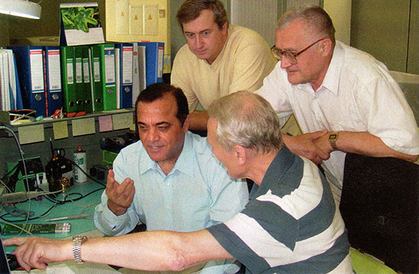
Javad Ashjaee, front left, with colleagues in his Moscow office.
Javad Ashjaee (JA) is president and CEO, Javad Navigation Systems. Alan Cameron (AC) interviewed him by phone at his Moscow office.
AC: What details can you give us about the “new beginning” you mentioned in your May profile?
JA: Things have changed a lot during the past six years. ASICs, microprocessors, and electronic technology in general have progressed significantly. These advances give us much better fundamental tools to implement new signal processing innovations and to design better and smaller products, while at the same time reducing their cost. With new GPS signals, improved GLONASS, and Galileo on the horizon, there are lots of opportunities and challenges to get me going for many years again. I phrased it as a “new beginning” because in the past six years I was not as productive as I wanted to be, due to situations beyond my control.
AC: How do you see your “complete independence” playing out in the marketplace?
JA: Now I can start working on GNSS technology again and hope to make a difference in this field again. The last six years were the darkest years of my professional life. The partnership that I had hoped would be a complementary force in pursuing the most innovative technologies turned out mostly frustrating, and it put stumbling blocks in the way of what I wanted to accomplish. By “complete independence” I mean the contractual limitations have expired, and I am free to pursue new technologies on my own and bring innovations to the marketplace that my team and I feel proud of.
We have just started this new round of technical development and we are trying to define the technical directions. I hope to bring a completely new generation of GNSS products to the market in the second half of 2007. What keeps me motivated and as excited as my first attempts of 25 years ago is the level of support and encouragement that I receive from all my colleagues, friends, and even some of my competitors.
AC: What technology challenges are you and your team tackling?
JA: One of my technology challenges is to bring high-end Galileo into the GPS/GLONASS picture. My first decade of GNSS involved GPS, the second decade GPS+GLONASS, and in the third decade I hope for GPS+GLONASS+Galileo. Of course there are also innovations in signal processing in every one of these navigation systems. As I said earlier, enhancements in the electronic industry, as always, keep pushing us to come up with new products, similar to what you see in the computer and mobile communications industries. The life of any product cannot be longer than two years.
I’m waiting for the Europeans to tell us what is really their plan for Galileo. I want to focus a lot on Galileo but I should admit that with Galileo I’m partially hopeful, but partially disappointed, too.
AC: Why are you disappointed about Galileo?
JA: I basically do not know, or I should say do not understand, the current plan of Galileo as presented; and I could not find anyone who could give reasonable answers to my questions. It is not obvious who the forces behind the Galileo project are, who is going to fund it, and who needs it to the extent that they are willing to pay for it. On several occasions, in different forums I tried to raise such questions and subsequently became convinced that unfortunately my worries and questions regarding Galileo were valid. Let me raise these questions once again here with you. I hope all my worries and suspicions regarding Galileo prove to be false and sincerely hope that Galileo to become a reality soon.
Despite all the questions and uncertainties about Galileo, but due to good publicity, in many communities Galileo has received much more attention than GLONASS, which already has about 20–25 years of on-orbit history and currently about 16 operational satellites on orbit — and recently, with current oil prices, a solid plan to complete the system soon. Until recently many companies were trying to fight or ignore GLONASS, believing that it was not likely that Russia would complete the system. Now Trimble, NovAtel, and Leica have recently announced that they have GLONASS in their receivers, too.
The attention given to Galileo, even before they have a first real satellite, is because of the credibility that the Europeans have earned. I hope this credibility continues to grow by providing open information to the public. Unfortunately, in my belief, so far they have not done so.
One of the issues confronting Galileo is the explanation of its funding and management. It has been said that Galileo will be funded as a private business, but no one has ever provided a business model. When I try to guess about the structure of any business plan based on the information I have received, I conclude that it is very unlikely that it can be funded as such. The fate of Iridium — which did have a detailed business plan but overestimated its number of subscriptions — makes us more worried about Galileo, which does not even have a business plan. Iridium had the support of large, experienced industrial names like Motorola.
Any company whose stock is being traded publicly will suffer a lot as soon as they announce involvement in any project that does not have a solid business plan. The larger the company, the more vulnerable they are to close scrutiny by stock-market analysts.
Funding in Doubt
In providing details on Galileo funding, it was said that most of the Galileo funding will come from bank loans. This makes the issue of a business plan much more urgent and critical for Galileo, especially given the fate of Iridium. Alternatively, the money could come from specific governments. This would easily put an end to the discussion of private funding and give much hope to all of us. I hope this will happen soon.
There are several other flaws in Galileo’s private financial planning. First, GPS tried to make itself a self-funded program but quickly concluded that it was not feasible. Second, if GPS authorities were wrong, and it could have been done as a self-funded project, now with GPS being offered for free, Galileo has a much tougher time to make it as a private enterprise. Note that GLONASS is also there for free. Can you start a pizza business, when you know the guy next door is giving away pizza for free?
Third, it is extremely unlikely that anyone will buy Galileo-only receivers, which means Galileo wants to piggy-back itself on GPS and receive money from the operational GPS. In our pizza example, imagine that your pizza shop can sell its pizza only if it can add slices of pizza from the free shop next door! Clearly the shop next door will stop providing you free pizza if it sees you are making money — or it will at least want its share of the profit.
The progress in GLONASS, also offered free of charge, makes it even harder for Galileo’s private plan to succeed. With 30 GPS and 24 GLONASS satellites, at any given instance we have more than 14 visible satellites. The critical number to have reliable and robust RTK is something like 10 satellites. The additional Galileo satellites are a plus, but the European system cannot survive if it bases its financial plan on riding on the shoulders of GPS (or GPS+GLONASS).
It short, the Galileo private funding scheme assumes free support from GPS — which means Galileo assumes that U.S. tax payers will continue to fund Galileo.
I am certain that even if GPS authorities do not object, the U.S. taxpayers will. U.S. citizens and organizations like the U.S. GPS Industry Council will take the issue to the proper authorities.
By collecting the first license fee from users or manufacturers, Galileo authorities open the door for large international disputes that put the fate of Galileo in question and raise the issue of customer liability, if it is going to be modeled financially as I mentioned earlier.
In the private business model of sharing profit with GPS, Galileo will be at a disadvantage for many years until they have operational satellites comparable to GPS.
The current situation of Galileo, as I see it, is that some independent and mostly research-oriented organizations have been able to collect enough money to define signals. We have seen some published information, such as Günter Hein’s article in GPS World (“Galileo Signal and Frequency Design,” June 2003) on the signal structure. But now when the ICD is published, the signal structure is drastically different.
The Military Question
Similar to GPS and GLONASS, the need for Galileo mostly comes from military establishments and markets. The two recent wars showed that the benefits of satellite navigation systems are no longer a luxury, but a necessity for any country that possesses a certain level of modernized military. The French government needs its own navigation system to independently market its Exocet missiles and Mirage 2000, for example. The Chinese government also has need for such systems, and this could be the reason that they push to fund and participate in the Galileo project.
Does this mean France will break from NATO and join forces with China? This brings us to the very difficult question of international alliances, much more serious than the financial and funding issues that I raised earlier. I find it unlikely that the United Kingdom may want an independent navigation system separate from the United States. France may be the only major country that is willing and can afford to fund such system. This is an extremely difficult issue. I cannot think of any country in Western Europe that is pushing for the breakup of NATO.
This is an order of magnitude more difficulty than money. This is an issue of East-West alignment, and the breakup of NATO, which has many more consequences.
It is very simple-minded if we think Paris taxi drivers are pushing to have their own system because they do not trust the United States!
Although the European military should be most concerned about the future of Galileo, they have been absent from all the Galileo conferences that I have attended. The only European military uniforms I have seen were those of a German Air Force brass band that played Mozart songs at the Munich ENC-GNSS conference.
At best, it seems that some large European companies have teamed up to lead the Galileo project and keep space, control, and user segments under their management and control, and then try to attract money from military sources. This scenario also does not seem to have much chance of success. It is unlikely that military organizations will allow leadership and control of their vital navigation systems to remain in private-sector hands. Under any circumstances, the military organizations will be the real force behind the Galileo even though they may hide it publicly, at least for a while.
Galileo’s best chance of success is for the French government to pay all or at least most of the costs, and not depend on support from other countries who do not have much vital interest and dependence on a new navigation system. I hope this will happen sooner rather than later.
Galileo is not going to delay because of technical issues. There is no problem for the Europeans to have a good signal structure, or to launch good satellites. There is enough intelligence in Europe, they can solve those quickly. Financial and, more important, political issues will determine the future of Galileo.
Will Galileo happen or not? I have no answer. I had a chance to share my thoughts with several prominent authorities. They mostly agreed with my concerns but they said it was politically incorrect for them to even discuss these sensitive issues.
To go forward, I will work on Galileo and will assume that the Galileo authorities will work with the GPS authorities and will make a playing field such that U.S. GPS manufacturers can have the same benefits from Galileo that Europeans have from GPS. Previously we followed the information that was released unofficially by Galileo (by semi-official authorities) and we made chips to track those signals. Next we will follow the new ICD and we will make receivers based on it.
Meanwhile we will try to tap whatever legal authorities, the GPS authorities in the U.S., to help us make the playing field level, to make the Europeans give us the same prompt access to information that they give to European organizations, without any charge.
The United States has been so generous and so open in providing complete and honest GPS information to all, that the first GPS satellite was actually tracked in the UK. Dr. Brad Parkinson noted this point in his keynote speech at the European Navigation Conference in Manchester.
I was so hopeful and supportive of Galileo in the article I wrote for you some months ago. But as I tried to find information regarding the future of Galileo, I developed serious concerns. I pray for Galileo to become a reality soon.
AC: What percentage of Javad Navigation Systems’ annual budget is devoted to research and development?
JA: We do not have a fixed percentage. Developing technology is our first priority and has always been a priority for me. We spend whatever it takes to have the best technology, even if we have to borrow money — though we have never had to. Probably this has been the reason that in all my history of involvement with GPS, the past 25 years, we were profitable every single quarter, because our focus was spending on technology, and giving priority to it. I don’t think there is any other GPS company in the world that can claim profitability for every quarter for 25 years. Our cumulative annual growth in each company was 45 percent. Currently we have a staff of over 100. Our Advanced Theoretical Design team alone consists of more than twelve professors and scientists with more than 200 person-years of experience.
AC: How can we best navigate the next years of new signals, structures, and so on?
JA: The main thing is that we request all U.S. GPS authorities to help to make this a level playing field.
If the Galileo authorities really intend to combine GPS with Galileo for commercial markets, they’d better be as gracious and open as GPS authorities were to them.
Iridium
Iridium communications service was launched on November 1, 1998, and went into Chapter 11 bankruptcy on August 13, 1999.
The system was originally to have 77 active satellites (later reduced to 66) to enable worldwide voice and data communications using handheld devices. Its financial failure was largely due to insufficient demand for the service. The system is currently being used extensively by the U.S. Department of Defense for its communication purposes.
)

)
)
)


 The newer PNDs are roughly the size of a slice of French bread with a 3”-4” LCD touch screen. Its primary function is to guide you from Point A to Point B by providing you turn-by-turn instructions on the map screen and via voice instructions. Seriously — it talks to you. It typically comes with a street/address map database of the region where you bought it such as North America, Europe, etc. It runs on batteries or vehicle power and comes with some sort of windshield or dashboard mount.