Category: Survey

  • Topcon Announces Haul Truck System, DS-200 Upgrade at CONEXPO

    Topcon Positioning Group has made several product and service announcements at CONEXPO-CON/AGG, being held this week in Las Vegas.

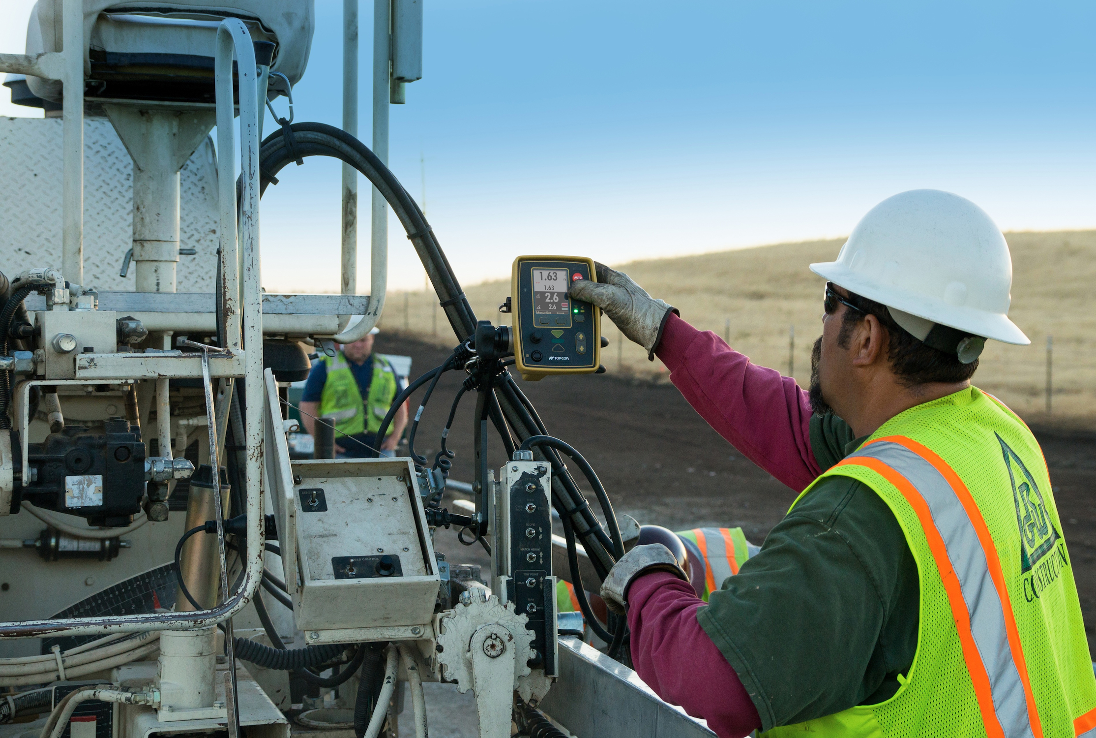
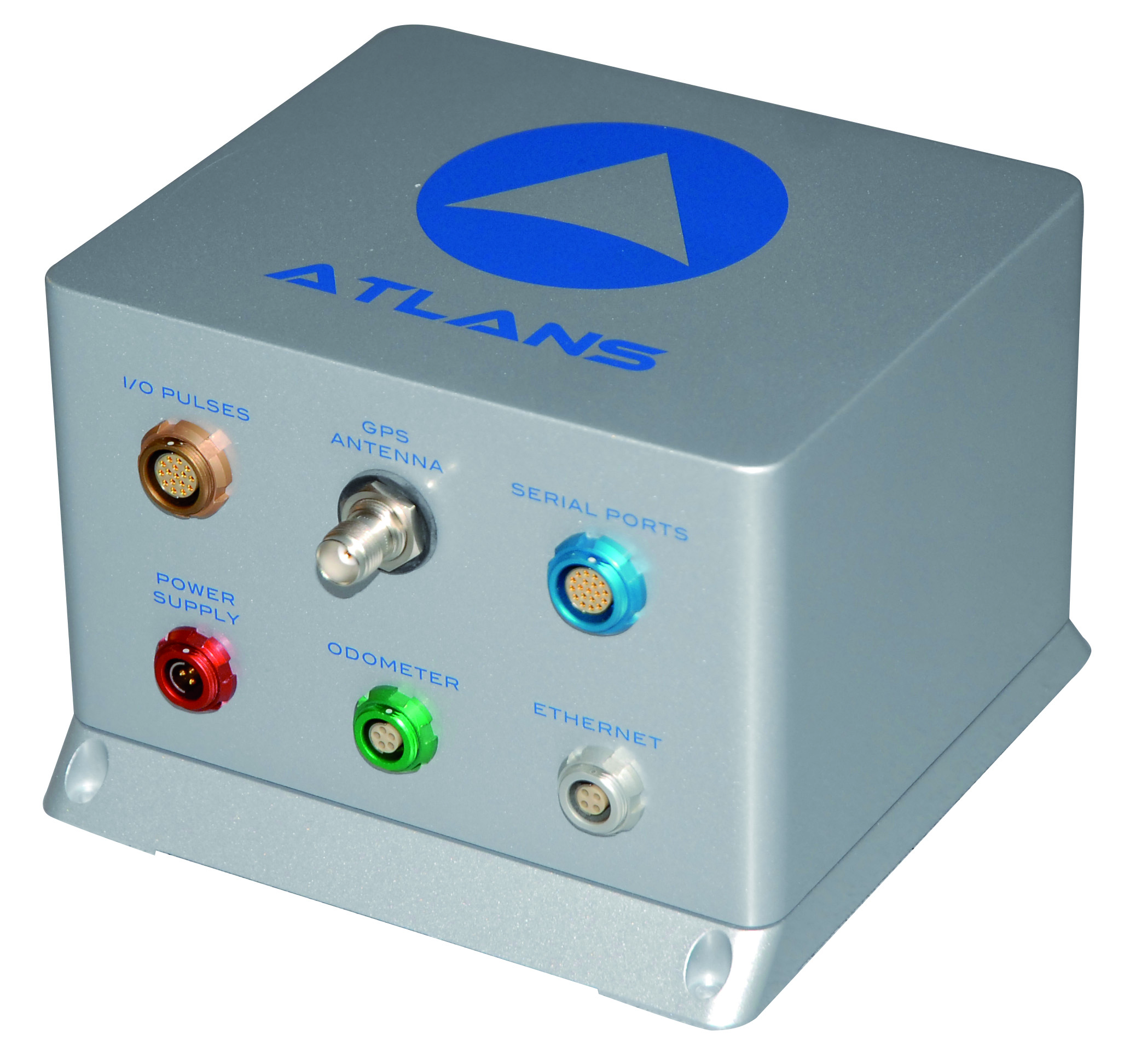
    Haul Truck System. The HT-30 haul truck module for Sitelink3D features a small, portable GPS-enabled control box that mounts into the truck cab. As the truck is loaded, data about the load is input, such as material type, driver, and quantity. The load is then integrated into Sitelink3D and can be tracked for scheduling, rerouted if needed elsewhere, and recorded once delivery is made.

    Whether the material is fill dirt, removal of overburden, select material, base course or even asphalt, HT-30 can be quickly plugged in so management and reporting can be maintained in real-time. For more information on the HT-30 or Sitelink3D, visit topconpositioning.com.

    Topcon DS-200.  Topcon has added the DS-200 with XPointing technology to its DS line of total stations in the North American market. XPointing technology allows the DS-200 to lock on to prisms quickly, even in dim or dark conditions, Topcon said.

    The DS-200 can be configured for interaction with Topcon’s RC5 remote system, which allows users up to 1000 feet (300 meters) away to easily perform a QuickLock with a push of a button, Topcon said.

    As a Hybrid Positioning capable total station, the DS-200 offers the use of both GNSS positioning and optical positioning technology designed to increase field efficiency. The system can become fully robotic with Hybrid Positioning technology, which can allow shots to measured with a GNSS receiver when the line-of-sight is blocked.

    Standard additional features of the DS series include LongLink communications, TSshield security and maintenance technology, MAGNET integrated software onboard, and rugged water-resistant IP65 construction.

    Enterprise Solutions. Topcon Positioning Group also announced a new workflow management system designed to connect all sites, all data, crews and equipment. Topcon Enterprise Solutions offers constant communication, data sharing, scheduling, updating, supporting, and accurate productivity data in real-time, no matter where the job or the office is located.

    Cloud-based Topcon Enterprise Solutions provides seamless connectivity from any office or remote user, to any site, to each enabled machine and field crew, throughout the entire project life cycle, Topcon said.

    Topcon_Enterprise_Solutions
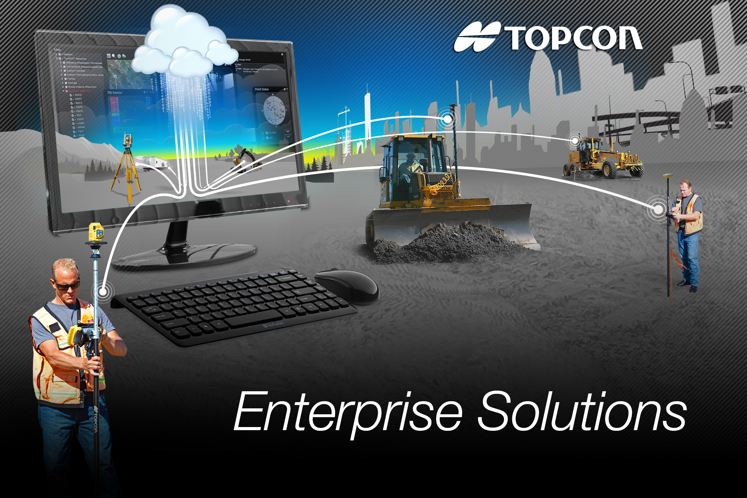
The system is designed to allow users quicker accessibility and management of increasing volumes of data, thereby exponentially increasing a company’s efficiency. Integrating data in a cloud-based environment from Topcon software services like Sitelink3D or MAGNET allows users to make time-sensitive decisions faster.

    The system can also be deployed to key partners of the company, such as engineers and sub-contractors, enabling instant updating of job files, material volumes and equipment schedules instantly with assured accuracy.

    In addition to site and data management, Enterprise Solutions includes the option to activate a corporate Topcon TotalCare account, providing immediate access to online training and technical support for virtually all Topcon products.


  • Topcon Technology Hits the Road in North America


    Topcon Technology Roadshow 2014, by Topcon Positioning Systems, launches in April. The hands-on educational program is focused on advanced positioning technologies and will feature a 5,000 square-foot mobile classroom/theater housed in a custom-designed 18-wheeler.

    The Technology Roadshow will cover North America, traveling more than 23,000 miles in six months. Each of the currently scheduled 23 stops for the free educational program – beginning April 10 in Pleasanton, California, and ending in October at Riverside, California — will include multiple sessions over two days. The events will focus on technology trends in the construction, surveying and GIS, engineering and architecture/engineering/contractor (AEC) professions.

    “With technology advancing so rapidly, many of our customers are telling us that it is difficult for them to keep up,” said Mark Contino, Topcon vice president of global marketing. “The Technology Roadshow is a fresh ‘we’ll-bring-the-technology-to-you’ concept that will provide an educational experience to construction and surveying professionals who want to learn about these exiting new solutions first hand, so they can determine the best fit for their business. Instead of flying half way across the country to attend a trade show or conference, we’re excited for this opportunity to bring tomorrow’s positioning technology to the construction, engineering and surveying backbone of North America — on their timetable, close to home, on a one-on-one basis.”

    “The focus of this unique learning event will demonstrate how the entire breadth of Topcon solutions works seamlessly together,” Contino said. “The real beauty is we’re bringing it directly to decision makers and end-users, allowing every company — big or small — the opportunity to see first-hand how new solutions and technologies can help them to become more productive and profitable.

    “We believe this rolling ‘user conference’ is a proactive way to help make sure the opportunity to learn about new technology is available to anyone who wants to learn.”Topcon industry and application professionals will staff the traveling unit. Topcon dealer personnel from the local area are tour sponsors and will assist them at each stop.

    For more information, go to the official Topcon Technology Roadshow website and register for an event in your area.

  • Topcon Adds Advances to P-32 Asphalt Paving System

    Topcon Adds Advances to P-32 Asphalt Paving System

    Topcon's P-32 asphalt paving system.
    Topcon’s P-32 asphalt paving system.

    Topcon Positioning Group announces advances to its P-32 asphalt paving system with new components including the ST-3 sonic tracker, anti-vibration slope sensor and a firmware update to the full-color, graphical display GC-35 control box.

    “The P-32 paver system was built to improve smoothness, ensure accurate slope and material thickness and provide unmatched operator ease-of-use,” said Kris Maas, machine control product marketing manager.  “Announced in 2013, the P-32 saves time and improves safety by allowing an operator to view elevation and slope values of the screed from a single control box. With these new components, this state-of-the-art 2D control system will continue to improve the speed and quality of asphalt paving.”

    The ST-3 sonic tracker is designed to enhanced position indication on string lines, give a wider range of linear detection and work better in tight areas. “The introduction of the ST-3 sonic tracker will increase productivity for users by providing smoother surface detections,” said Maas. “The smoother it can be, the faster the job will be finished.”

    The new slope sensor to the P-32 system is designed to increase accuracy in the most challenging conditions.  “This new slope sensor is amazingly resistant to vibrations and provides stable operation within dynamic temperature ranges,” said Maas.

    A firmware upgrade to the GC-35 full-color, graphical display control box provides enhanced slope accuracy data. “The cross slope value will be displayed even when the control box is set in elevation control mode on both sides, which takes the guess work out of knowing whether the cross slope is correct. Additionally, block slope calibration protects users from accidentally changing the slope sensor while the P-32 system is in operation,” said Maas.

  • GeoLearn with Geospatial Online Learning Opens Its Doors

    Geo-learn-logoGeoLearn, a start-up devoted to servicing the geospatial industry with online learning and continuing education credits, has launched its website and training portal with an initial catalog of 22 one-hour-long courses taught by industry-leading faculty members. Course topics available at launch include “Unmanned Aerial Vehicles (UAV’s),” “ALTA/ACSM Land Title Surveys,” and “National Flood Plain Insurance.”

    “We want to provide quality professional development to satisfy continuing education requirements that also enables you to deliver services to your clients from a higher quality knowledge base,” said GeoLearn Principal Joe Paiva. “You often have to get continuing education to satisfy licensing requirements; at GeoLearn you will also leave enriched — a plus for any geospatial organization.” While catering to professionals, GeoLearn will begin to build up courses suitable for technicians as well, including a series that supports those pursuing Certified Survey Technician (CST) status.

    GeoLearn faculty members are nationally recognized experts in the geospatial field. Initial faculty include Gary Kent of the Schneider Corporation, Wendy Lathrop of Cadastral Consulting and GeoLearn Principal Joseph Paiva. More courses will come soon from other notable professionals in the geospatial industry.

    “A key motivation to start GeoLearn has been the desire to significantly improve the learning experience for busy professionals and technicians,” said GeoLearn Principal Bob Morris. “With limited time availability and the growing cost of travel associated with more traditional methods of securing continuing education credits, we hope to provide an attractive option using of state-of-the-art multi-media through our online training portal.”

    GeoLearn has invested in a multi-camera video production studio optimized for online learning, and hired Emmy Award-winning marketing and video expert Peter Barrett to head up those efforts.

  • Carlson Software’s MINI2 Offers Land Surveyors Performance in a Compact Size

    Carlson Software’s MINI2 Offers Land Surveyors Performance in a Compact Size

    The rugged, lightweight Carlson MINI2.
    The rugged, lightweight Carlson MINI2.

    Carlson Software’s newest data collector, the Carlson MINI2, packs a punch for its compact size. The new handheld computer is taking the place of its predecessor, the Carlson MINI.

    With an IP68 rating (better than the original MINI), the MINI2 is waterproof and dustproof, and is tested to MIL-STD-810G to meet the environmental demands of the surveying industry. The MINI2 also has several advancements over the MINI, including a bright display, a custom battery that lasts 20+ hours on one charge, and a scratch-resistant capacitive touchscreen with glove-friendly numeric keypad, for faster and more accurate data entry.

    The Carlson MINI2 was designed and manufactured by Juniper Systems, which specializes in building ultra-rugged handheld computers. Juniper Systems also manufactures the Carlson Surveyor handheld computer. Carlson Software packages these rugged handhelds with its own software to provide a total solution for surveying professionals.

    “Carlson Software has been a great partner of Juniper Systems for many years now,” said Debbie Trolson, Geomatics Market Manager at Juniper Systems. “Their high level of service as well as their attention to customer needs has made them not only an excellent company, but also a leader in the surveying market. I believe our cooperation with Carlson in providing the MINI2 to surveying professionals will continue to strengthen our partnership for years to come.”

    “Working with the team at Juniper Systems has allowed Carlson to offer our customers the kind of rugged and reliable hardware they need out in the field,” said Butch Herter, director of Hardware for Carlson Software. “The Juniper-produced MINI2 and Surveyor are the perfect complement to Carlson’s popular and efficient data collection software choices.”

  • GeoLearn with Geospatial Online Learning Opens Its Doors

    GeoLearn with Geospatial Online Learning Opens Its Doors

    Geo-learn-logoGeoLearn, a start-up devoted to servicing the geospatial industry with online learning and continuing education credits, has launched its website and training portal with an initial catalog of 22 one-hour-long courses taught by industry-leading faculty members. Course topics available at launch include “Unmanned Aerial Vehicles (UAV’s),” “ALTA/ACSM Land Title Surveys,” and “National Flood Plain Insurance.”

    “We want to provide quality professional development to satisfy continuing education requirements that also enables you to deliver services to your clients from a higher quality knowledge base,” said GeoLearn Principal Joe Paiva. “You often have to get continuing education to satisfy licensing requirements; at GeoLearn you will also leave enriched — a plus for any geospatial organization.” While catering to professionals, GeoLearn will begin to build up courses suitable for technicians as well, including a series that supports those pursuing Certified Survey Technician (CST) status.

    GeoLearn faculty members are nationally recognized experts in the geospatial field. Initial faculty include Gary Kent of the Schneider Corporation, Wendy Lathrop of Cadastral Consulting and GeoLearn Principal Joseph Paiva. More courses will come soon from other notable professionals in the geospatial industry.

    “A key motivation to start GeoLearn has been the desire to significantly improve the learning experience for busy professionals and technicians,” said GeoLearn Principal Bob Morris. “With limited time availability and the growing cost of travel associated with more traditional methods of securing continuing education credits, we hope to provide an attractive option using of state-of-the-art multi-media through our online training portal.”

    GeoLearn has invested in a multi-camera video production studio optimized for online learning, and hired Emmy Award-winning marketing and video expert Peter Barrett to head up those efforts.

  • Septentrio, Imec Co-Design Antenna for High-Precision GNSS

    Septentrio, Imec Co-Design Antenna for High-Precision GNSS

    antenne copy-W
    photo: Imec and Septentrio

    Imec and Septentrio have collaborated to design multi-frequency GNSS antenna that simultaneously receives all GPS, GLONASS, BeiDou, and Galileo bands. Developed under the European Community’s Seventh Framework Programme project Handheld, the compact antenna can be integrated in multi-frequency handheld GNSS devices for high-precision location applications up to 1 centimeter.

    The announcement came at the Mobile World Congress being held this week in Barcelona, Spain.

    The compact antenna integrates Imec’s GNSS antenna and Septentrio’s GNSS RF front-end. Imec’s antenna design satisfies the requirements for the high-accuracy GNSS market while remaining small enough to fit in a handheld surveyor device, the companies said. The antenna has desired uniform gain and phase coverage over the complete upper hemisphere, with strong suppression of unwanted reflected signals below or in the vicinity of the GNSS receiver.

    The GNSS RF front-end, based on established front-end technology developed by Septentrio, is characterized by a superb out-of-band interference rejection to avoid notably device self-interference with other radiation sources such as Bluetooth and WLAN radios, as well as other ambient intentional and non-intentional interference. The compact multi-frequency antenna is a perfect companion of Septentrio’s compact and low-power AsteRx-m receiver, a credit card-sized dual frequency GNSS receiver that provides centimeter accuracy at less than 500-mW power consumption, by far the lowest power consumption in the professional GNSS market.

    The research leading to these results has received funding from the European Union Framework Programme (FP7/2007-2013) under grant agreement n°287183.

  • iXBlue, Septentrio Create ATLANS-C for Mapping Urban Environments

    iXBlue, Septentrio Create ATLANS-C for Mapping Urban Environments

    The ATLANS-C position and orientation system.
    The ATLANS-C position and orientation system.

    iXBlue, a provider of navigation, positioning, and mapping solutions, has launched its new ATLANS-C position and orientation system, developed in close cooperation with Septentrio Satellite Navigation. The system is designed to provide continuous and accurate positioning in urban environments, where GNSS signals are obscured, intermittent, or possibly distorted by reflective surfaces.

    ATLANS-C benefits from the optimized integration of iXBlue’s fiber-optic gyroscope (FOG) based inertial navigation system (INS) and Septentrio’s multi-constellation GNSS receiver technologies. Experts from iXBlue and Septentrio worked closely to develop a “smart” coupling method that combines the advantages of the two companies’ technologies. The result is an easy-to-use, easy-to-integrate, and highly reliable INS-GNSS mobile mapping solution, the companies said.

    “The ATLANS-C development was a real team effort,” said Jan Van Hees, head of sales and business development at Septentrio. “Technical trials with leading customers have already demonstrated superior accuracy, continuity, and reliability of positioning and attitude data, even in the most challenging urban environment.”

    “The new system’s robustness, compact size, and improved urban-area performance uniquely address more complex mobile mapping market requirements. The ease of use, quick integration, and zero maintenance features are excellent values recognized by original equipment manufacturers (OEM) or mobile mapping system integrators,” explained Xavier Montazel, head of iXBlue inertial products division. “One of ATLANS-C’s many other advantages is its versatility, allowing the same equipment to be used for land and air applications. Configuration of the system is achieved through the use of iXBlue’s innovative web interface, utilized across the complete range of products.”

    ATLANS-C has no ITAR components inside, allowing fast and easy global export. Customers will benefit from the industry exclusive five-year warranty and a 24/7 support line. ATLANS-C is available today with a six-week lead time.

  • Topcon Releases Unmanned Aerial Positioning System

    Topcon Releases Unmanned Aerial Positioning System

    Mavinci_Phase_1Topcon Positioning Group has released and made available in Europe the Topcon SIRIUS PRO powered by MAVinci, an Unmanned Aerial System (UAS) designed to produce the most accurate solutions for automated mapping of construction sites, pipelines, disaster areas, mines, quarries and myriad sites without regard to terrain.

    During October 2013, Topcon Europe Positioning (TEP) entered into a strategic partnership with UAS provider MAVinci GmbH. The result of that partnership is the release of the fixed-wing UAS Topcon SIRIUS PRO powered by MAVinci.

    “We are excited to announce our distribution agreement with Topcon. This partnership is the ideal expansion of our global distribution network,” Johanna Claussen, CEO at MAVinci GmbH said. “The simple operation of our UAS from flight planning to the final orthophoto and DEM (Digital Elevation Model), allows flexible use in highly demanding environments. Its flexible assisted auto-pilot landing mode enables navigation around any unforeseen obstacles.”

    Based in St. Leon Rot, Germany, MAVinci is a aerial surveying company specializing in the development of UAS technology.

    “By adding Topcon’s RTK solutions to the UAS and ground control station, the SIRIUS PRO is the first commercially available UAS that can reach 5-cm accuracy without the need for ground control points,” said Sander Jongeleen, mobile mapping product manager for Topcon Positioning Group. “This leads to an enormous reduction of operational cost and allows mapping of areas that are not easily accessible with high accuracy.”

    The SIRIUS PRO is a fixed-wing UAS capable of producing high quality and pre-positioned aerial photography without the need of extensive ground control that is required by competitive products. Key features include:

    • Work in mountain areas — Flight plan adapts to elevation model
    • Cover areas that require multiple flights — Flight plan automatically splits and rejoins for post processing
    • Simple hand launch
    • Land in areas where automatic landing is impossible with assisted auto-pilot mode
    • Fly in all weather conditions — wind up to 50 km/h, temperature range of -20º C to 45º C and rain.
  • Hexagon Acquires Drone-Maker Aibotix

    Hexagon Acquires Drone-Maker Aibotix

    The Aibotix X6 unmanned aerial vehicle is designed  to deliver up-to-date geospatial information from hard-to-reach areas.
    The Aibotix X6 unmanned aerial vehicle is designed to deliver up-to-date geospatial information from hard-to-reach areas.

    Hexagon, a global provider of design, measurement and visualization solutions, has acquired Aibotix, a manufacturer of intelligent multicopter systems for high-efficiency aerial applications.

    Headquartered in Kassel, Germany, Aibotix is the maker of Aibot X6, a new generation of vertical takeoff and landing unmanned aerial vehicle (UAV). Intelligent, autonomous and safe, the multi-rotor platform is designed to suit the needs of customers in the industrial inspection, aerial mapping, surveying, utility and security markets, Hexagon said.

    UAV-based solutions are ideal for delivering up-to-date geospatial information and aiding in hard to reach areas – such as difficult infrastructure inspections of power lines, bridges and dams to locally focused mapping tasks of buildings or any vertical structure. They are quickly becoming a viable tool for key market segments that require application-specific solutions; where the UAV becomes an integral part of the workflow process, delivering essential pieces of information that drive actionable intelligence.

    “The Aibotix acquisition is an important addition to Hexagon’s photogrammetric and mapping technologies portfolio,” said Hexagon President and CEO Ola Rollén. “The growing number of applications for UAV-based solutions offers huge growth potential, especially in areas that require frequent and local updates such as smart city applications, dynamic GIS, and emergency response.”

  • Handheld Launches Nautiz X4 Rugged Computer for Mobile Workers

    Handheld Launches Nautiz X4 Rugged Computer for Mobile Workers

    Handheld-Nautiz-X4-rugged-IP65-W
    photo: Nautiz X4

    Handheld Group, a manufacturer of rugged mobile computers and smartphones, has launched the Nautiz X4 rugged handheld. The Nautiz X4 is a multipurpose compact handheld computer built for the mobile worker. It enables efficient and reliable data collection in the toughest environments, the company said.

    The Nautiz X4 is a compact and lightweight rugged handheld computer that is optimized for efficient field data collection. It has been designed and developed specifically for mobile workers in tough environments in industries such as warehousing, logistics, transportation, utility, field service, security and public safety.

    The Nautiz X4 rugged handheld computer has an integrated u-blox GPS receiver that provides professional-grade navigation functionality. It also offers multiple connectivity options, such as high-powered 3G and excellent Wi-Fi capability, the company said. It has a high-speed 1-GHz processor, 512 MB of RAM and 1 GB of flash memory. It runs Windows Embedded Handheld 6.5.

    Measuring 156 x 74 x 25.5 millimeters (6.1 x 2.9 x 1.0 inches) and weighing 330 grams (11.6 ounces), the Nautiz X4 is an ergonomic work tool and one of the thinnest and lightest handheld computers in the rugged-device sector, the company said. It features a high-brightness, sunlight-readable resistive touchscreen for reliable computing in challenging worksite environments, and comes with either a high-performance 1D laser scanner or a 2D imager for fast, accurate scanning and barcoding tasks. The device also features a 5-MP camera with auto focus and LED Flash.

    The Nautiz X4 has an IP65 Ingress Protection rating, which means that it is impervious to dust and highly resistant to water — the unit can be used in dusty work environments as well as in heavy rain, and can be rinsed off if dirty. It also meets stringent MIL-STD-810G military test standards for overall durability and resistance to humidity, shock, vibration, drops, salt and extreme temperatures.

    “Mobile data collection is performed in warehouses as well as outdoors, in all kinds of weather and for long work hours. It may be cold and it may rain or snow. So the field worker needs a computing tool that can not only handle adverse weather conditions, but is also ergonomic and user-friendly,” said Jerker Hellström, CEO of Handheld Group. “For this, we are proud to introduce the Nautiz X4, a new rugged handheld computer that merges ultimate mobility with true field functionality in a handy package and at a very attractive price. We are confident that the Nautiz X4 will be the obvious choice for mobile workers in a wide range of industries.”


  • Spectra Precision’s Latest Survey Receiver Uses Six GNSS Systems

    Spectra Precision’s Latest Survey Receiver Uses Six GNSS Systems

    Spectra-Precision-SP80-GNSS-Receiver-River-W

    Spectra Precision introduced today its next-generation Spectra Precision SP80 GNSS receiver. Designed to meet the evolving needs of the survey market, the new SP80 combines GNSS technology and a combination of communication capabilities with an ergonomic design, the company said. The SP80 is specifically designed for mainstream surveying and construction applications such as cadastral, topographic, control, stakeout and network RTK.

    Spectra Precision SP80 features Spectra Precision’s Z-Blade GNSS-centric technology running on a new-generation, 240-channel 6G chipset. The SP80 is capable of fully utilizing all six available GNSS systems (GPS, GLONASS, BeiDou, Galileo, QZSS and SBAS), but can also be configured to use only selected constellations in an RTK solution (GPS-only, GLONASS-only or BeiDou-only).The SP80 is also compliant with the new RTCM 3.2 standard, including the recently approved MSM RTCM messages, which means it supports all available GNSS corrections.

    SP80-GNSS-Front-with-Antenna-Pole-WThe extended communication capabilities of the SP80 receiver provide a combination of a 3.5G GSM/UMTS modem, Wi-Fi and Bluetooth connectivity, and an optional transmit UHF radio. The receiver’s built-in Wi-Fi and 3.5G modem can provide an Internet connection for RTK corrections and also send SMS or e-mails with system alerts. The SP80 features a unique anti-theft technology to safeguard the receiver and can detect if it is has been disturbed while in the field (for example, when operating as a GNSS base). The anti-theft protection feature informs the surveyor via SMS or e-mail if the SP80 receiver is moved and can provide its position to facilitate recovery.

    The Spectra Precision SP80 is rugged and waterproof, yet compact, lightweight and ergonomic for ease of use in the field, Spectra Precision said. When the UHF transmit radio module is used, its UHF antenna remains protected inside the rugged rod, extending the radio range performance. Powered with dual hot-swap batteries for typical all-day operation, the SP80 receiver is an ideal tool for any surveyor.

    “The Spectra Precision SP80 introduces several major enhancements and innovations, including the new 6G GNSS ASIC with enhanced Z-Blade technology, unique SMS and e-mail messaging and patented inside-the-rod mounted UHF antenna,” said Olivier Casabianca, business area director of Trimble’s Spectra Precision Division. “In addition, SP80 was designed as an extremely reliable receiver, making it suitable for a variety of challenging surveying projects.”