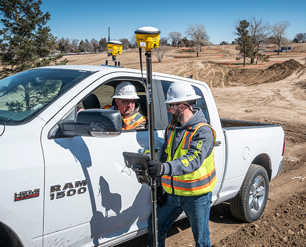
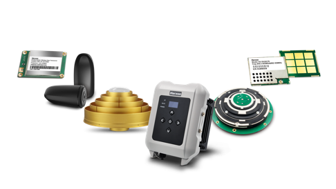
Tersus GNSS Inc. has launched Tersus Oscar, its new generation GNSS real-time kinematic (RTK) system.
Oscar is an all-in-one GNSS receiver that can be used as rover or base system. Paired with a Tersus TC20 controller or A11 mobile terminal, Oscar can more efficiently meet customer application requirements for the optimal surveying solution, according to Xiaohua Wen, founder and CEO of Tersus GNSS.
“Last year, we launched the David GNSS receiver,” Xiaohua said. “This year, we are very excited to introduce an advanced version of David; we named it Oscar.”
Oscar supports calibration-free tilt compensation function, meaning a leveling pole is no longer required. Configuration is made easy with a 1.3-inch interactive screen. With an internal high-performance multi-constellation and multi-frequency GNSS board, the Oscar GNSS receiver can provide high accuracy and stable signal detection, the company said.
The high-performance antenna can speed the time to first fix and improve anti-jamming performance. The built-in large capacity battery can support up to 10 hours of fieldwork.
A radio module in the package supports long-distance communication. With its rugged housing material, Oscar is protected from harsh environments.
A roundup of recent products in the GNSS and inertial positioning industry from the December 2018 issue of GPS World magazine.
OEM
Combination antenna
Long-range connectivity
Photo: Molex
The Molex highly compact 2.4/5-GHz combination GPS/Wi-Fi ceramic antenna is designed to be a cost-competitive solution covering the full GNSS band, 1.561 to 5.85 GHz. The triple-band ceramic antenna has Wi-Fi HaLow compatibility and is interference-resistant, supporting larger but lower (900-MHz) frequency ranges than 2.4/5-GHz connections. It also operates with lower power over longer ranges than 2.4/5-GHz Wi-Fi. Advanced Wi-Fi applications the internet of things, connected cars, smart homes and smart cities.
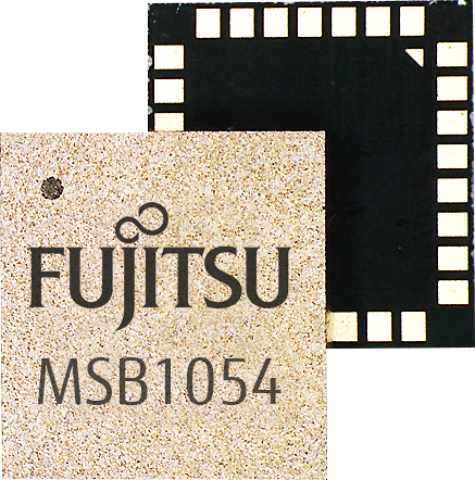
The MSB1054 multi-receiver module requires no external components, meeting needs of smartwatches, fitness trackers, logistics and navigation. Its Flash memory saves navigation data to optimize performance and provide a hot start. The ability to receive signals from several satellite systems significantly reduces the time to first fix. The module provides a built-in RF-front end (SAW filter, low-noise amplifier) as well as a temperature-compensated crystal oscillator (TCXO), so no external component is required other than an antenna. It measures 5.8 × 6.2 × 1 millimeters and uses 3.4 mA current in low-power mode, such as for tracking.
The GE310-GNSS is an internet of things (IoT) module with GSM/GPRS, multi-constellation satellite positioning and Bluetooth functionality in a 270-millimeter-squared form factor. It meets European demand for GSM/GPRS compact form factors and is part of Telit’s migration-support program that helps customers leverage 2G’s low cost and broad coverage while preparing for 4G and 5G. The GE310 enables OEMs and system integrators in asset management, utilities and telematics to meet the strong demand for low-cost, highly compact devices without tradeoffs in performance, reliability and functionality, particularly in regional markets such as Europe, where 2G is forecast to remain in strong growth in number of IoT connections for many years.
With multi-sensor fusion positioning and orientation
Photo: Unicore
The CLAP-B multi-GNSS/MEMS integrated inertial navigation board features a miniaturized high-performance inertial measurement unit (IMU) on a compact high-performance GNSS board. The high-accuracy GNSS positioning coupled with a high-precision gyro and accelerometer provides stable, continuous 3D position, velocity and attitude, as well as original acceleration and angular velocity measurements, even in GNSS-denied environments. CLAP (Concurrent Localization & Attitude Pilot) technology is a high-precision multi-sensor fusion positioning and orientation technology developed by Unicore. The board is compact, light weight and has low power consumption. It is designed for ease of integration and mass production, and is suitable for autonomous driving, smart surveying and UAVs.
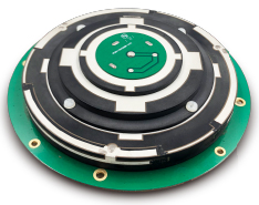
The UNI-GR1 RTK GNSS receiver offers highly accurate heading and positioning output. It can be connected to any device through Wi-Fi, mobile data, radio, USB or serial cable. It simultaneously tracks GPS L1/L2/L5, GLONASS L1/L2, Galileo E1/E5a/E5b and Beidou B1/B2/B3 on 432 channels. The receiver has a built-in level, a LED ring driven by a nine-degrees-of-freedom inertial measurement unit. Users can configure numerous settings such as real-time kinematic, or begin surveying immediately with a smartphone or laptop.
Dynamic tilt functionality has been added to the Trimble SPS986 GNSS smart antenna. The dynamic tilt upgrade allows for faster data collection to enable construction surveyors to create larger digital terrain models faster and with improved accuracy. It can capture higher accuracy measurements on steeper slopes from a moving vehicle and more accurate volume measurements to save time and money on material planning. The dynamic tilt measurement mode also auto-measures antenna height. From inside the vehicle, contractors can set the height of the antenna and quickly interrogate surface models using the real-time 3D surface display in Trimble Siteworks field software.
The Skycatch Edge1 is an on-premise data processing and GNSS base station optimized for the Skycatch Explore1 and DJI Phantom 4 RTK drones. Field teams can fly a drone, process the data and receive centimeter-level data output in 30 minutes or less, directly to a tablet, without the need for internet or cellular connectivity. 2D maps and 3D point clouds can be shared from the tablet. The Edge1 includes built-in WiFi, LTE and reliable sub-5-centimeter accuracy, and delivers high-quality data output. It is also capable of running deep learning algorithms to extract more insights from collected data in near real time.
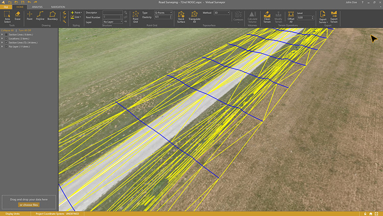
Drone surveying software Virtual Surveyor now eliminates the need for clients to use third-party applications to prepare data for processing. Version 6.1 handles on-the-fly projections that previously required a separate software package to set the data in the proper coordinate system. It bridges the gap between UAV photogrammetric processing applications and engineering computer-aided design (CAD) packages. The software generates an interactive onscreen environment with UAV orthophotos and digital surface models where the surveyor selects survey points and breaklines to define the topography, creating highly accurate topographic products for CAD input up to five times faster than otherwise possible. Surveyors can drag and drop all kinds of files into Virtual Surveyor: points, raster, vectors and point clouds. The point clouds are converted to a DSM for manipulation and processing, dramatically accelerating the time required to generate the CAD model.
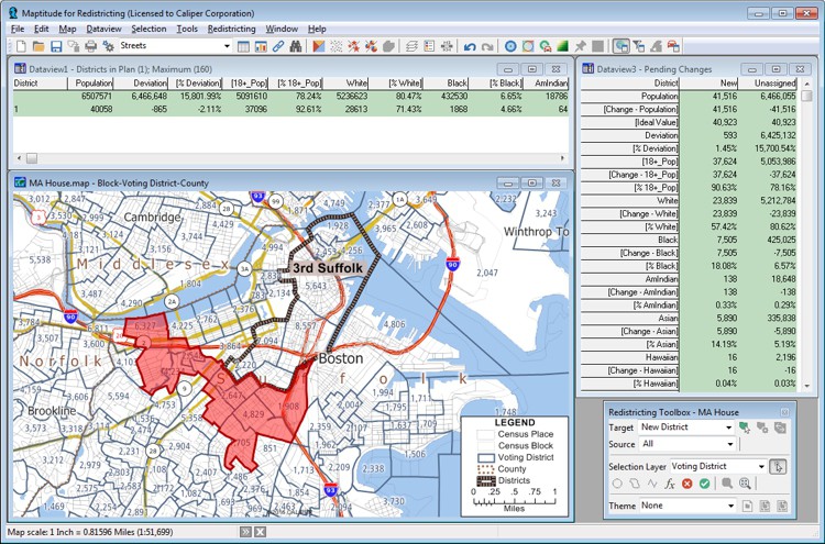
Includes Efficiency Gap Measure to explore redistricting problems
Screenshot: Mapitude
Maptitude for Redistricting is a professional tool for political redistricting. Maptitude provides measures and reports that support the creation of fair and balanced districts, and regularly enhances the software. Maptitude was used to democratize redistricting in California and is used by redistricters from independent commissions, non-profits, and civil rights groups, to the courts and political parties.
Stockpile measurements are up to 80% more accurate
Photo: DJI
The DJI Mavic 2 Pro drone is now part of the Kespry stockpile measurement solution for mining and aggregates companies. Kespry’s stockpile measurement solution produces data up to 80% more accurate than manual measurement. All of the survey data is stored in a central cloud application, accessible for analysis by the entire team. Large aggregates and mining companies can standardize and capture stockpile data across all their sites in the Kespry platform, while using Kespry 2s or DJI Mavic 2 Pro drones.
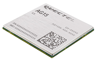
Designed for next-generation automotive applications
Image: Quectel
The automotive-grade C-V2X module AG15 features the Qualcomm 9150 C-V2X chipset paired with Quectel LTE module AG35. It is designed to meet the telematics and vehicle-to-everything (V2X) connectivity requirements of autonomous driving and road safety. It features a built-in multi-constellation high-precision GNSS (GPS/GLONASS/BeiDou/Galileo/QZSS) receiver with additional support from satellite-based augmentation systems (SBAS) and Qualcomm 3D dead-reckoning technology, which improves positioning accuracy and speed while simplifying customer designs. It is designed to allow low-latency, highly reliable and highly dense data exchange between vehicles and their surroundings, enabling effective information sharing among road users to avoid collisions, thus improving automotive safety, automated driving and traffic efficiency.
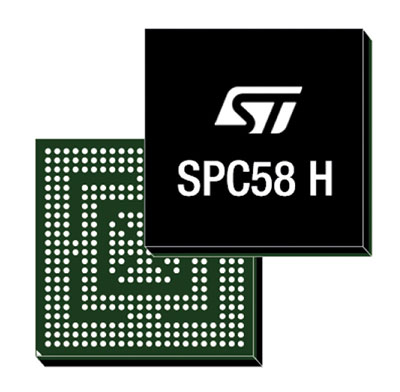
The SPC58 Chorus H microcontroller (MCU) line can run multiple applications concurrently to allow more flexible and cost-effective vehicle electronics architectures. The line is designed for high-end body, networking and security applications such as gateways, body-control modules, battery management and ADAS safety systems. The line has three high-performance processor cores, more than 1.2-MB RAM and powerful on-chip peripherals. The MCU securely delivers updates over the air for vehicle powertrain, body, chassis and infotainment features. With high security and large on-chip code storage, ST’s Chorus automotive microcontroller is a gateway/domain-controller chip capable of handling major OTA updates securely. Two independent Ethernet ports provide high-speed connectivity between multiple Chorus chips throughout the vehicle and enable responsive in-vehicle diagnostics.
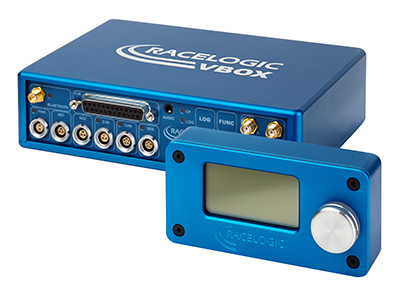
The VBOX 3i RTK is a real-time-kinematic-enabled version of the VBOX 3i dual antenna that can be used in conjunction with an RTK differential base station to obtain ±2-centimeter positional accuracy in real time at 100 Hz. The data logger combines the advantages of a twin antenna GPS setup with GLONASS satellite tracking. It can be used in vehicle tests where positional accuracy and repeatability are of key importance, such as lane departure testing, distance to a fixed object or precise mapping. The VBOX 3i RTK comes with the VBOX manager, a display enabling users to change dynamic modes and filter settings, set up slip angle data and define antenna locations.
The StarLink TrackerWi‑Fi advanced vehicle-tracking device combines u-blox GNSS, 4G and Wi-Fi technology, eliminating the need to equip vehicles with a separate mobile Wi‑Fi hotspot. StartLink is suitable for applications for connected cars, telematics, vehicle diagnostics, fleet management, vehicle security, usage-based insurance, and rental and leasing service companies. With the Wi‑Fi hotspot, users can tap into cellular 4G to transfer telematics data to the fleet manager and send real-time data to the driver’s smart device or infotainment system.
The Notilo Plus team with the iBubble. (Photo: Notilo Plus)
Notilo Plus has launched iBubble, a fully wireless, autonomous and intelligent underwater drone that can be used for search-and-rescue operations, naval or underwater infrastructure maintenance, and subsea patroling. iBubble can accompany divers for up to an hour and down to 197 feet depth, enabling superior underwater imaging. The remotely operated vehicle (ROV) was designed using a patented underwater localization technology, which is mainly based on acoustic signal transmission and image recognition (video tracking). By combining these technologies, iBubble is able to locate precisely its target underwater and shoot stable footage. The iBubble is equipped with an obstacle avoidance system, real-time image recognition, a stabilization system and direct surface control.
Anafi Work is an ultra compact tool for professionals, helping them make informed decisions using the drone’s aerial insights. Anafi Work includes the advanced Anafi drone equipped with an innovative imaging system, a 4K/21MP camera with a 180° vertical orientation, allowing users to capture images of inaccessible areas.The drone operates for 1 hour and 40 minutes with its 4 USB-C smart batteries. It can be transported anywhere in a compact shoulder bag. Professionals can create 3D models of buildings, quickly and easily, using a one-year subscription to Pix4Dmodel.
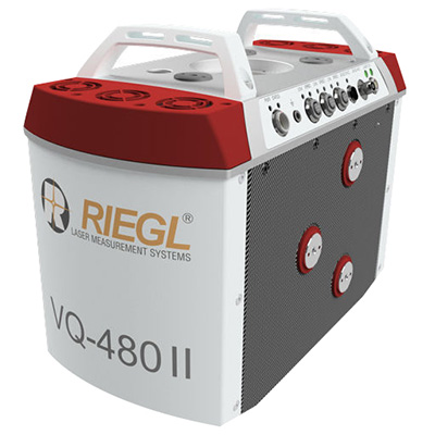
The Riegl VQ-480 II and VQ-580 II are designed for airborne applications at mid-altitudes for use on both manned and unmanned aircraft. The new Mark 2 designs of previous models improve both performance and user-friendliness. Both offer a measurement rate of up to 1,250,000 measurements/second and a 75-degree field of view of suitable for corridor mapping, city modeling and applications in agriculture and forestry. Weighing approximately 10kg, they are ready for integration into helicopters and unmanned UAVs with a higher payload capacity. The VQ-480 II and VQ-580 II are prepared for smooth GNSS/IMU integration, offer interfaces for up to five optional cameras, and are have built-in and removable storage.The VQ-480 II works at a laser wavelength of 1550 nm; the VQ-580 II at the1064 nm wavelength suited to measure on ice and snow.
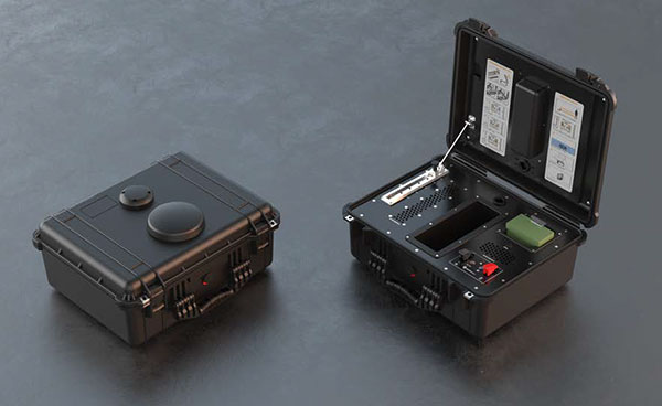
DroneNode is a portable, compact and inconspicuous counter-drone jamming device that law enforcement can use at large outdoor events without raising public concern (it is not yet authorized for use in the U.S.) It can simultaneously jam 2.4 GHz, 5.8 GHz and GNSS L1 and L2 bands up to one kilometer, causing drones to return to their point of origin or land. It is also effective against swarm attacks. Emergency broadcasts, cellphone communication and other dedicated channels are unaffected.
Skydio R1 users now have the ability to follow cars. New modes include Car Follow, improved Lead Mode, and other improvements throughout the system, which is built on top of the Skydio Autonomy Engine. The engine operates 13 cameras, enabling it to map and understand the world in real time, allowing it to be fully autonomous and independently capture video footage. Its Nvidia Jetsonl AI runs neural networks that trained for the Car Follow feature on datasets of automobile images.
The Notilo Plus team with the iBubble. (Photo: Notilo Plus)
Notilo Plus has launched iBubble, a fully wireless, autonomous and intelligent underwater drone. iBubble can accompany divers for up to an hour and down to 197 feet depth, acting as their personal cameraman and enabling superior underwater imaging.
Founded in 2016, Notilo Plus is a Marseille, France-based start-up created to develop intelligent underwater exploration technologies.
The remotely operated vehicle (ROV) was designed using Notilo Plus’ patented underwater localization technology, enabling subaquatic adventures without tethers. It comes with an advanced artificial intelligence system, offering total autonomy and self-learning capabilities.
The localization technology is mainly based on acoustic signal transmission and image recognition (video tracking). By combining these technologies, iBubble is able to locate precisely its target underwater and thus shoot perfectly stable footage.
iBubble is equipped with an obstacle avoidance system, which allows it to smoothly follow a diver, while obtaining images of unparalleled quality for personal or commercial use, the company said. It features real-time image recognition, a stabilization system and direct surface control, bringing outstanding performance to underwater imaging.
The iBubble ROV is an environmentally conscious device — it does not disturb the fragile marine ecosystem thanks to its minimal noise emission levels and its obstacle-avoidance capability.
iBubble can be used for sports and entertainment filming, diving instruction, wildlife protection, search-and-rescue operations, naval or underwater infrastructure maintenance, and subsea patrolling.
“We are excited to introduce to the world the first fully wireless, autonomous underwater drone,” said Nicolas Gambini, CEO of Notilo Plus. “With the countless cutting-edge technologies brought by the iBubble, coupled with its ability to bring exceptional pictures and video footage, this is a remarkable and versatile device for any diving activity.”
The device is now available for order globally. The first batches of iBubble drones will be delivered to the customers, including the Indiegogo crowdfunding campaign supporters, from mid-November 2018.
Regular readers of GPS World are aware of many of the rapidly developing technologies and navigational systems being created around the world, but often the everyday surveyor shows up late to the party.
While smartphones get the most mainstream media coverage, other navigational devices and measurement systems are adapting to evolving technical breakthroughs and new methods of transmitting a variety of data wirelessly.
This month’s article looks at the increase in satellite navigation networks along with the rollout of 5G cellular technology. Both advancements will benefit the surveying community; to start, I’ll explain what this means for accuracy and precision of survey measurements as well as productivity.
Everybody gets a constellation! (with apologies to Oprah)
I’ve been known to wax poetic in this column about my admiration of GNSS technology, and I continue to marvel at the “accidental” civilian use of a military tool. This method of measurement and navigation continues to expand, refine and transcend everyday life, and surveying is no exception.
The satellite constellation is the mainstay of this navigational system. The United States began the charge several decades ago, but other nations are quickly catching up. Let’s look at the current constellations and their status.
Operational Systems
GPS (United States)
GLONASS (Russia)
Galileo (European Union)
Beidou (China)
QZSS (Japan)
IRNSS (India)
Chart: GPS World
There are now more satellites. What’s the big deal?
The addition of these constellations provides large gains for the surveying community in several different ways.
First, the additional satellites mean more signals to help with the mathematical equations necessary for positional determination. While traditional surveying in the general public’s eye is associated with measurements on the ground, our expansion of services into the air and water relies heavily on GNSS determined positions.
No matter what type of remote sensing equipment is being used (lidar, photogrammetric, sonar, etc.), positional determination for most of those sensors are derived from GNSS-based receivers. Add to these measuring methods the ability to perform operations via remote-controlled or autonomous vehicles in both air and water, and the availability of additional satellite signals enhances the reliability of GNSS-derived data and attributes.
Second, by having more satellite signals to utilize, GNSS receiver manufacturers can improve the software for processing the positional information with greater certainty of accuracy.
Before the introduction of additional constellations and receivers with expanded signal reception, GNSS users relied on less sophisticated software to identify potential “bad” signals that would lead to incorrect positions. While the software generally provided reasonable reliability, it was not foolproof and occasionally would allow bad data to be accepted.
Like most everything tech-related, however, the GNSS industry has benefited from increased computing power to go along with the additional satellite constellations. The latest GNSS receivers can accept well over 500+ signals from a variety of sources (including land-based transmitters). The software used to reduce all that data has increased in complexity along with number of those data sets.
Complex computations that were once limited to mini-computers or even mainframes are now being completed on handheld data collectors in minuscule timeframes compared to their predecessors.
The software has also been enhanced to analyze the data in real-time, compute the likely position of the receiver and notify the user of potential incorrect or “spoofed” data from any number of satellites.
Considering that many of the remote-sensing sources now collect millions of points based upon one GNSS-based position, the need for increased positional verification has become a critical issue. By having many more constellations to provide signals for positional data, the percentage of establishing a correct location for each data point has increase significantly.
The improved computing power and verification ability of today’s GNSS software is helping to eliminate errors in positional accuracy and instill more confidence in the surveyor’s data collection activities.
Add to these additional constellations the planned installation of more land-based signal providers to augment or provide a backup plan for satellite systems, and it’s clear that the future is quite bright for GNSS-based receivers and data collection for everyone — especially the surveying community.
The history of wireless communication
While surveyors marvel at the advancements of GNSS-based measurement, it pales in comparison to the rapid growth of modern technology with cellular devices. Notice I didn’t write cellular phones, as the technology has quickly established itself as much more than voice communication. Before we lay out the future of cellular data networks, let’s take a step back and see how this type of communication has revolutionized GNSS-derived data collection for surveyors and others.
Two-way, CB and shortwave ham radio
1947 two-way radio advertisement. (Image: Motorola)
The technology behind wireless communication goes back several decades, but didn’t become a mainstream system until the late 1970s and early 1980s. Motorola is known as the early force behind the two-way radio system, but the base and remote transmitters were not cost effective for small businesses. This type of system was also limited to single-purpose radios with individual crystals wired within that only allowed specific frequencies to be transmitted.
Another type of communication used by some was the citizens band radio, affectionately referred to as CB radio. This radio was limited to 40 channels and didn’t allow for private transmission between two parties. During the 1970s, the use of the CB radio was not limited to long-haul truck drivers — many people used the medium for basic communication.
Vintage CB radio ad from Radio Shack. (radioshackcatalogs.com)
Telephone service during these times was still costly and long-distance calls were not cost-effective, so many found the CB radio as an alternative to conventional phone service. Looking back now, it is not a stretch to classify this type of broadcasting as a primitive social media precursor to today’s methods but limited to live chats and no visuals.
Another method of transmission was short-wave radio. This system was like two-way radios with an established base transmitter, but broadcast on public frequencies over greater distances than CB radios. One of the big drawbacks was the upfront costs, which were much more significant than the other radios. Even more expensive was outfitting a vehicle with a shortwave system, so cost was the biggest limiting factor for this mode of communication.
Pagers of all shapes and sizes
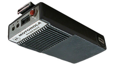
Motorola’s Pageboy pager. (Photo: Motorola)
The popularity of telephone-based pagers didn’t hit its zenith until the early 1990s, but the technology and actual use dates to the early 1960s. The first commercial pager was produced by Motorola in 1964 and called the Pageboy. There was no screen or display; the user was notified by a variety of tones preset for distinct situations or needs. As this technology advanced, variations in screens, message types and even two-way communication became possible.
By 1994, there were more than 60 million pagers in use, but a change was in the technological wind; cellular phones were marching toward the mainstream.
While the concept of wireless telephone communication existed in several laboratories around the world for years, the first big breakthrough was made by researcher Martin Cooper, who developed a prototype cellular device for Motorola in the early 1970s. He famously made the first public cellular phone call on April 3, 1973, to Joel Engel, head of research at Bell Labs, during a walk in New York City. Cooper and Engel were engaged in a rivalry to develop the first commercially available cellular phone with the Motorola DynaTAC prototype being the first to make a successful call.
However, the rush to get cellular phones to market took longer than anticipated. It wasn’t until the introduction of the Motorola DynaTAC 8000 in 1983 (available to the public in March 1984) that the reality of wireless phones came to life. The cost of wireless freedom came at a price: $3,500 for a brick-sized phone that took 10 hours to charge for 30 minutes of use. The cost of the service was also expensive due to the limited cellular infrastructure.
The next decade brought us expanded cellular coverage along with miniaturization of phone; each subsequent model provided more features and longer battery life. From the Nokia “candy bar” to the Motorola Razr, the cellphone era had engulfed the mainstream, but more changes were ahead for mobile communications.
The late 1990s saw the introduction of the cellphone as a computer modem, with limited email connectivity and primitive internet browsers built into the operating systems. But like many electronic technologies that came before, the cellphone would begin a radically different life in the mid-2000s.
Enter the smartphone to help us dummies
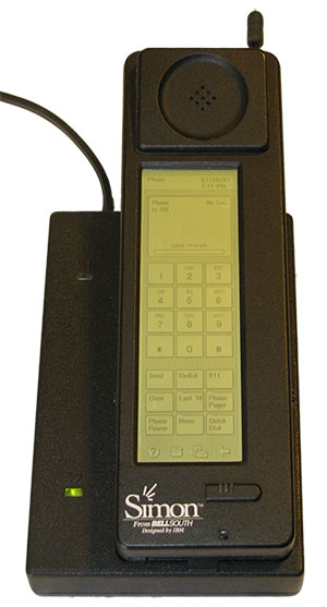
The IBM Simon Personal Communicator and charging base. (Photo: IBM/public domain)
Officially, the smartphone has been in existence since 1992 with the creation of the Simon Personal Communicator from IBM. At a cost of $1,100, with a monochrome screen that was 4 ½ x 1 ½ inches, the Simon allowed the user access to email and faxes (remember those?) along with the phone function — but users had to make it fast; the battery only lasted an hour. IBM sold 50,000 of these units before pulling the plug on the project, but it started the trend toward mobile telephones with a graphical interface and extended uses beyond the standard verbal communications.
Just like the Apple Newton was the failed precursor to the Palm Pilot, various tablets and eventually today’s smartphone platform, the Simon broke ground and established new directions for future communication.
The early 2000s introduced us to the Blackberry personal digital assistant (PDA) and phones from Research in Motion (RIM), a small electronic communications company from Ontario, Canada. RIM started small with a two-way paging system that became popular in Europe and quickly morphed into cellular devices that worked on the DynaTAC network used by Motorola.
A recent model Blackberry PDA. (Photo: Blackberry)
By the mid 2000s, their devices became affectionately known as the “Crackberry” as users became addicted to the functions and capability of this communication tool. These devices were popular with business users as the security encryption was considered more effective than any of the other communication apparatuses of the day.
By 2009, Blackberry had reached the zenith of the mobile device market (second only to the conventional mobile-phone platform dominated by Nokia) but began a rapid decline due to proliferation of the next big thing — the touchscreen smartphone.
After Apple’s introduction of the iPhone in 2007, followed by a crowd of Android-powered phones in 2008 and beyond, Blackberry’s market share has been reduced to a small niche group.
And now, why this relates to the surveyor…
The rollout of Steve Job’s dream of combining Apple’s industry-defining iPod with mobile phone capability revolutionized not only the way we communicate — it has redefined our everyday environment. Many of the tasks we accomplish every day have been incorporated into a smartphone application, which brings us back to the reason this article is directed at surveyors: the device that hangs on your belt or rests in your pocket is revolutionizing the way today’s surveyors work.
Not that long ago, the only navigational devices available were large, expensive and difficult to use. Now, nearly everyone owns a device with GNSS capability. When we combine the ever-expanding number of devices along with the increased coverage of GNSS satellite constellations, the ability to georeference any piece of data to greater precision and accuracy is improving.
Surveyors need to embrace this technology within their smartphones to increase their efficiencies. At the same time, we need to help educate the public on why having better smartphone location capability doesn’t mean the masses can perform their own boundary analyses. For more information on this subject, see the GPS World July 2017 article.
Surveyors should embrace the smartphone as an important tool; the introduction of new survey-grade GNSS receivers that use an app for the user interface will soon become commonplace.
Several GNSS manufacturers have introduced receivers that exclusively use a smartphone and app for data collection, eliminating the need for a dedicated (and usually proprietary) data collector for obtaining centimeter-level location data. I’m not advocating that the surveying community throw their existing systems in the trash in favor of these newer receivers, but the data-collection techniques utilized by smartphones can increase efficiency and reduce equipment costs.
The Mi 8 smartphone offers dual-frequency capability. (Image: Xiaomi)
Another reason to pay attention to the smartphone as a location tool will be the expanded use of dual-frequency chipsets to provide even higher accuracies. One of the fastest growing phone makers worldwide is Xiaomi, based in Beijing, China, which introduced the Mi 8 phone with a dual-frequency GNSS chip. This chip frequency reception (E1/L1+E5/L5) is targeted to embrace the Galileo and GPS constellations for increased accuracies (within a decimeter), well beyond the current norm for smartphones (typically 1-3 meters, plus or minus). For the surveyor, having this capability in their pocket can greatly increase efficiencies, especially when used during reconnaissance efforts. I believe many more phone manufacturers will begin to incorporate dual-frequency chips in their future models to increase location accuracies for users and take advantage of upcoming network enhancements.
Speaking of network enhancements, let’s talk 5G as a gamechanger.
The latest buzz in the general population’s lexicon is 5G and how it will push high-speed internet to all corners of the world. While this is a possibility, it means much more to the surveyor than meets the eye. Yes, there will be increased cellular coverage in places that previously lacked it, or only had limited access, but 5G means much more than that.
Image: NTT DOCOMO Inc. 5G white paper.
Let’s refresh our view of what cellphone coverage currently means to the surveyor. The use of cellular-based RTK receivers has been greatly expanded due to the increased coverage of 4G LTE signals throughout the world, but it’s still scarce is some parts. This is mostly due to the transmission of cellular signals being required from towers and higher placed antennas with powerful transmitters. These transmitters are costly and typically owned and installed by the larger telecom companies, so placement is traditionally in more populated areas.
Enter 5G — while it will provide enhancements for all users, it will be revolutionary for the surveyor. 4G cell coverage was a broad and powerful signal from large transmitters; 5G cellular service consists of smaller cell signals placed in a tight grid of broadcast positions. These transmitters will be more cost effective for many telecom providers and will increase data reception for many users. For surveyors, the additional coverage of 5G will make possible the use of cellular-based RTK GNSS data collection in places not previously possible.
Besides the extended coverage of 5G, the 10-fold speed of the new data transmission protocol compared old 4G LTE creates many possibilities for information collection growth. Soon it will be possible for a field personnel and the office staff to be linked in real time during the data collection process.
From boundary-point recovery to complex topographic surveys, a field crew’s work can be supervised and reviewed while being completed, allowing for instantaneous analysis and guidance from senior staff. This process will allow for more oversight, quality control and mentoring of field staff than is possible for today’s remote crew operations. The new technology will also allow for reduced timeframes when crews are required to provide field data for tight deadline requests and gives us a method of instant feedback on the amount and quality of the data collection.
Some may see this improvement in connectivity as an avenue for office staff to be intrusive on their field activities, but I see this as an opportunity for improved quality control and increased team interaction. More connected teams can lead to improved efficiencies and overall increases in productivity, profitability and morale among team members.
From outside to inside
Another breakthrough created by 5G will be the enhancement of indoor georeferenced location services. By having several transmitters placed throughout a facility, trilateration will be possible to provide more accurate location information for places not typically available to surveyors.
Depending on the accuracy needed and placement of the cell providers, it will possible for surveyors to use devices designed for remote sensing (laser scanners, lidar, SLAM, etc.) and collect georeferenced data with greater accuracy in relation to a known coordinate system. This by-product will also aid rescue and medical providers during emergencies to help pinpoint individuals through their cellphone connection more accurately than before.
5G is more than just bringing YouTube videos to your phone faster; it will improve the data collection process of all shapes and sizes. Surveyors will not get left out, but we will need to be ready to take advantage when it comes online. For more on the 5G revolution, see the GPS World February 2018 article on this topic.
As surveyors, just when we think that technology can’t take us further, we blink and change happens. Moore’s law stated (depending on which revision) that technology would double the number of transistors every one to two years. While some may say that technology is making Moore’s law obsolete, I believe the creativity being used to invent new processes based upon the technology is holding strong.
I, for one, look forward to many more enhancements to follow in the coming years. Surveyors be ready; the future is here.
Trimble introduced several new products at its annual Trimble Dimensions user conference, taking place Nov. 5-7 in Las Vegas.
Photo: Trimble
GNSS Smart Antennas for Civil Construction. The new SPS785 GNSS smart antenna is a fully capable GNSS receiver that features high-quality GNSS accuracy at a lower price point. The SPS785 has full satellite coverage with the combination of GPS and all GNSS constellations. A seamless workflow with the Trimble Siteworks Positioning Systems means that everyone on the jobsite can use the same data and work on the same platform.
For added protection, the SPS785’s radio antenna fits inside the range pole. The lightweight and compact design enables contractors to work longer with less fatigue.
Also, a new dynamic tilt functionality was added to the Trimble SPS986 GNSS smart antenna. The SPS986 is specifically designed for rugged jobsite measurement applications, and is now available with a dynamic tilt upgrade. The dynamic tilt feature allows for faster data collection to enable construction surveyors to create larger digital terrain models faster and with improved accuracy. It is designed to capture higher accuracy measurements on steeper slopes from a moving vehicle and more accurate volume measurements to save time and money on material planning.
The dynamic tilt measurement mode also auto-measures antenna height. From inside the vehicle, contractors can set the height of the antenna and quickly interrogate surface models using the real-time 3D surface display in Trimble Siteworks field software.
The Kestrel seismogeodetic system. (Photo: Trimble)
Kestrel Seismogeodetic System. Trimble RTX technology is now delivered via satellite to the Kestrel seismogeodetic systemfor earthquake, volcano and infrastructure monitoring. Designed for scientists and structural engineers, Trimble’s Kestrel pairs uninterrupted, high-quality GNSS positioning corrections with seismic data — for Earthquake Early Warning (EEW), volcano and infrastructure monitoring of bridges, dams, towers and other civil structures.
In addition to internet-delivered Centerpoint RTX corrections, the Kestrel system also now supports L-band satellite delivered RTX corrections. This ensures corrections are not affected during communication delays or outages that occur during natural disasters. CenterPoint RTX enables centimeter-level absolute positioning, which is critical when analyzing and responding to the movement of a structure.
Field Staking and Design Solution for Electric Utilities. Trimble Field Designer is an innovative mobile staking and design solution that enables electric utilities to quickly design overhead and underground electric utility lines on mobile devices in the field.
Trimble Field Designer leverages mobile technology from Trimble business partner GeoSpatial Innovations, Inc. (GSI). It was developed to add new field staking and design capabilities to Trimble’s Network Information System (NIS), a network asset management solution. At the heart of Trimble NIS is a fully connected “live” network model built on a single database that provides for comprehensive documentation, topology and full life-cycle support of electric utility network assets.
Trimble Field Designer enables electric utilities to:
Capture pole locations efficiently and accurately
Measure distances, angles, elevations, offsets, and bisectors
Assign construction units to locations and spans for material and labor requirements
Capture comments and information about design
Reduce design time
Eliminate redundant data entry in the office.
Earthworks Grade Control Platform version 1.7. The latest version of Earthworks provides support for motor graders and automatic guidance for tiltrotator attachments. Trimble Earthworks for Motor Graders is a GNSS-based, 3D-grade control solution designed to make fine grading more accurate, faster and easier. In addition, Trimble Earthworks now gives excavator operators using tiltrotators the advantage of automatic machine control, which can result in increased productivity.
Skycatch has announced an on-premise data processing and GNSS base station, the Skycatch Edge1, manufactured in partnership with DJI and now available worldwide.
Edge1 base station. (Photo: Skycatch)
Tested and optimized for the Skycatch Explore1 and DJI Phantom 4 RTK drones, the self-positioning Edge1 allows commercial drone users the ability to process and receive data without the need for internet or cellular connectivity, the company said.
Field teams can fly their drone, process the data and receive centimeter-level data outputs in 30 minutes or less, directly to a tablet. 2D maps and 3D point clouds are available for viewing and sharing directly from the tablet.
The Edge1 concept began as a companion to the Skycatch Explore 1 drone. Now, a new generation of the Edge1 will support all DJI drones, including the recently released DJI Phantom 4 RTK, and will process any 2D geotagged images.
In addition to a survey-grade GNSS base station, the Edge1 includes built-in WiFi, LTE, reliable sub-5-centimeter accuracy, and delivers high-quality data outputs, the company added. Built around a state-of-the-art compute module, the Edge1 is also capable of running deep learning algorithms to extract more insights from collected data in near real time.
“It’s truly a revolutionary product that we’re excited to make available to the DJI community, and the construction and mining industry at large,” said Christian Sanz, founder & CEO of Skycatch. “With the partnership and support of DJI, the Edge1 will be assembled with precision execution in their world-class manufacturing facility, and will be available faster to the customer.”
“As the commercial drone industry has grown, the amount of data collected by our enterprise users is unprecedented,” said Jan Gasparic, director of strategic partnerships at DJI. “We are glad to work with Skycatch to manufacture the Skycatch Edge1 GNSS base receiver, enabling enterprise customers, especially those in the construction industry, to process data from their DJI drones on-site and in real-time.”
Skycatch is an industrial data collection and analytics company focused on indexing and extracting critical information from the physical world, using a combination of hardware, software and artificial intelligence. Built for enterprise, its turnkey solutions are deployed across global project sites with largest construction, mining and energy companies.
Kespry and DJI are partnering to offer the DJI Mavic 2 Pro drone as part of the Kespry stockpile measurement solution for mining and aggregates companies.
The solution delivers the Kespry autonomous flight and aerial intelligence experience for stockpile measurement using a DJI drone. It enables large aggregates and mining companies to standardize and capture stockpile data across all their sites in the Kespry platform, while continuing to use Kespry 2s drones to support mine and site planning operations, Kespry said.
Integration of data captured from a DJI drone is the next innovation in the development of the Kespry industrial sensor platform.
Kespry provides inventory management and mine planning data to more than 200 mining and aggregates companies. As these customers scale their use of drone data, they are looking to standardize on a single platform to organize and analyze that data across sites, geographies and product divisions — even when those sites are highly distributed, Kespry said.
The addition of the DJI Mavic 2 Pro to the Kespry lineup is designed to enable even more site data to be centralized in the Kespry cloud. It will be available with a new, cost-effective purchase point designed to support using Kespry across more sites.
“Drone data is now the standard approach for measuring stockpiles at mine sites, however, millions of dollars are wasted through reconciling inconsistent data from different platforms and the time involved getting that data ready for analysis,” said George Mathew, CEO and chairman at Kespry. “Our goal with the addition of the Mavic 2 Pro to our solution is to respond to our customers wishing to use the Kespry aerial intelligence platform across all mine sites to standardize how stockpile data is generated — lowering their costs and helping drive the profitability of every site.”
“DJI is excited to have Kespry offering the Mavic 2 Pro as part of its aerial intelligence platform portfolio,” said Jan Gasparic, director of strategic partnerships, DJI. “Pairing the Mavic 2 Pro with Kespry’s industry leading AI, ML, and analytics capabilities will be of enormous benefit to mining companies that are looking to take advantage of drone technology in a portable and powerful package.”
According to the companies, the integration of DJI’s drone and sensors into the Kespry platform is the latest innovation in the delivery of an industrial sensor network, closely following Kespry’s recently announced high-resolution thermal capabilities for industrial inspection.
This expansion in the range of data that can be explored and analyzed in the Kespry platform further enables customers to protect and maximize their assets across industrial sites.
The Kespry platform is now capable of processing and analyzing a wide range of sensor data, enabling the future creation of industry-specific applications, including those under current development with leaders in the energy sector.
“We have sites in North Carolina, Pennsylvania, Ohio and Maryland, so with the Kespry platform and DJI drone, we’ll be able to fly multiple sites at one time,” said Justin Dermont, accounting manager at Russell Standard. “I could be flying in Erie while my partners fly in North Carolina, but still be able to get the data in real time to the Kespry cloud.”
“Having DJI as part of the Kespry system will help with the flexibility and the timeliness of us being able to take inventory at multiple locations, especially when we have to take inventory at the end of production, or month end, to make sure we have accurate readings,” said Craig Schiebel, controller at Russell Standard. “Being able to take inventory simultaneously at multiple locations is huge.”
“We’re growing our business and recently acquired some new sites,” said Kyla Jungclaus, senior accountant at Brannan Companies. “We need all of our inventory to be done in just a couple days, so introducing the DJI drone to have another pilot surveying at some of our other locations will get inventory done even faster. I know that our measurements will be consistent and accurate even if I don’t do them myself, and I can manage them all in a single account in the Kespry cloud.”
Kespry is offering the Mavic 2 Pro as part of its fully-managed, end-to-end annual subscription model. Kespry customers that choose the Mavic 2 Pro for stockpile measurement will benefit from the full Kespry experience, including its acclaimed support, training, customer success team, and drone up-time guarantee.
The Kespry stockpile measurement solution with DJI will be available Q1 2019.
Propeller Aero, a cloud-based drone analytics company, is partnering with DJI to create the Propeller PPK Solution leveraging the DJI Phantom 4 RTK drone.
The solution provides customers in the civil, mining, aggregates and waste management industries with a reliable and fully integrated drone mapping system, helping them collect highly accurate data from any worksite without the challenges of traditional workflows, the companies said.
The DJI Phantom 4 gathers data at a construction site. (Photo: DJI)
According to Propeller Aero, Propeller PPK Solution is a fully integrated software and hardware system that reliably provides photogrammetric model outputs in geodetic, projected or local coordinate systems.
The solution provides accuracy of 1/10 feet (3 cm) from independent checkpoints across small and large survey areas (checkpoints up to 1 km from GCPs). To capture surveys of this accuracy, all that is needed is one AeroPoint on the ground (over a known point if working in local coordinates).
The Propeller PPK Solution has been shown to reduce the time required to complete a drone survey by 70 percent as compared to a traditional workflow using multiple GCPs across a worksite, Propeller Aero said.
“DJI has led the drone market with their reliable and innovative products, and quickly demonstrated the ability for these machines to become useful tools in the heavy civil and natural resource industries,” said Rory San Miguel, CEO of Propeller Aero. “Globally, these industries are seeing real cost savings and efficiencies through cloud-based analytics and using innovative new technologies like PPK drones combined with AeroPoints. Accurate data is paramount to worksite analytics and Propeller has always been obsessed with helping teams achieve this. We introduced the world’s first smart ground control point, AeroPoints, and now we’ve partnered up with DJI to build an end-to-end PPK solution.”
On today’s construction sites, lack of project data costs businesses more than $177 billion annually. To help solve this problem, Propeller developed a tightly integrated PPK workflow across the DJI Phantom 4 RTK drone, an AeroPoint, and Propeller’s cloud processing platform that visualizes real-time site data. Surveyors and contractors can Propeller PPK solution to gather verifiable, trustworthy data to help make data-driven decisions and prevent costly mistakes, the companies added.
“Propeller’s deep expertise in aerial mapping and analytics coupled with DJI’s industry-leading open-platform drone hardware creates a highly accurate turnkey solution,” said Jan Gasparic, director of strategic partnerships at DJI. “We are excited about this partnership because it broadens the use of DJI drones to deliver accurate data at a cost-efficient price point, helping teams better answer questions about site progress and productivity.”
The complete PPK solution will be distributed through channel partners, including Trimble’s SITECH distribution network. Trimble Stratus, a 3D cloud-based visualization platform developed by Propeller, along with AeroPoints, is already integrated with Trimble Connected Site solutions.
“The advent of drones in the construction industry has improved efficiencies, and Trimble Stratus users are already benefiting from the ease-of-use and scalability of drone-based surveys,” said Scott Crozier, general manager, Trimble Civil Engineering and Construction. “With the new Propeller PPK Solution and Trimble Stratus software, we’ve seen first-hand how surveyors and contractors can collect aerial survey data in a fraction of the time it used to take, and get repeatable and reliable results.”
RealSense 3D camera is fully integrated to capture real-time detailed images
DT301X rugged tablet. (Photo: DT Research)
DT Research has released the DT301X rugged tablet, a lightweight military-grade tablet that is purpose-built to enhance the precision of crime and crash scene reconstruction, bridge and other construction inspections, and 3D surveying.
DT Research made the announcement at Intergeo, being held Oct. 16-18 in Frankfurt, Germany.
The DT301X rugged tablet has MIL spec and IP ratings, yet is lightweight — offering the versatility to be used in the field, office and vehicles, the company said. A high brightness 10.1-inch touchscreen offers flexible viewing in a wide range of lighting, and an Intel eighth-generation Core i5 or i7 processor offers high-performance while still being energy-efficient.
With high-capacity 60- or 90-watt hot-swappable batteries, the DT301X keeps working continuously, complemented with a variety of battery chargers so fully-charged batteries are always available.
The DT301X integrates the Intel RealSense depth camera, which provides real-time 3D imaging to shorten the workflow and create extremely accurate measurements for CAD, engineering, design, utility management and crime-scene forensics.
Scientific grade data, which is important for court evidence as well as building plans, just got easier and is now available to a wider group of workers. With this 3D camera technology, depth perception is integrated to add the most accurate image to make projects stay factual and consistent, DT Research said.
Optional data capture offered on the DT301X besides the 3D camera are a 2D barcode scanner for equipment/location tags, a dual-frequency GNSS module for real-time mapping and positioning, long-range Bluetooth for 1000-foot range, and 4G LTE mobile broadband for the latest in high speed communications.
The rugged tablet gives detailed accuracy combined with the latest 3D camera technology all in one device that is rugged and easy to use in the field.
“DT Research’s high-performance rugged tablet equipped with the RealSense depth camera combined with DotProduct’s Dot3D Scan software allows speedy and efficient field-to-office 3D workflows for a wide range of applications from construction verification to asset management to crime scene mapping,” said Tom Greaves, chief marketing officer at DotProduct.
The DT301X is built to operate in real-world situations, with an IP65 rating for water and dust, MIL-STD-810G for shock and vibration protection, and MIL-STD-461F for EMI and EMC tolerance. The tablet can be paired with a detachable keyboard for ease of use, and Wi-Fi and Bluetooth for smooth networking and constant communications.
The DT301X rugged tablet is compatible with existing applications with Microsoft Windows 10 IoT Enterprise operating systems for flexible integration, and it brings together the advanced workflow for data capture, accurate positioning and data transmitting.
Whether at the electrical substation, at the crash scene, or at the construction site, the DT301X is ideal for accurate measurements as well as other needed tasks, able to travel to wherever the work is.
The DT301X rugged tablet will be available in November 2018 from DT Research’s authorized resellers and partners.
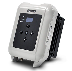
Harxon is showcasing high-precision positioning GNSS antennas and its latest wireless data transmission technologies for surveying applications at Intergeo, Oct. 16-18, in Frankfurt, Germany.
Image: Harxon
X-Survey is an 4-in-1 OEM antenna for both navigation and communication in the real-time kinematic (RTK) surveying applications. It provides standard Wi-Fi, Bluetooth, 4G, and multiple-constellation signal reception for GNSS positioning.
Its 3D design ensures a higher phase center stability and longer communication distance at a 360-degree direction, while lowering the impact of electromagnetic interference (EMI), hence increasing the overall machine efficiency and simplifying the RTK integration, the company said.
Photo: Harxon
The smart eRadio is a long-range and highly efficient radio modem designed to support RTK applications in surveying and precision agriculture. It can automatically identify RTK serial baud rate and provide a plug-and-play form for easy connection between eRadio and RTK.
According to Harxon, the eRadio’s diagnostic reporting software can configure data and update radio status, allowing users to effectively deal with potential issues. In addition, it is equipped with the unique ETALK communication protocol that increases the communication distance by 20 percent.
Other Harxon GNSS products showcased at Intergeo are for UAVs and precision agriculture, as well as surveying.
The D-Helix antenna HX-CHX600A is featured with its patented D-QHA technology.
Both 3D structured and mini-designed choke-ring antennas HX-CGX601A and HX-CGX611A can be used for base-station communication.
The multi-constellation survey antenna GPS 1000, frequency hopping modem HX-DU2017D and external radio modem HX-DU8608D are also popular products for high-precision performance.
The GPS World staff is reporting from Intergeo Oct. 16-18 in Frankfurt, Germany. The massive trade show, dubbed the “global hub of the geospatial community,” brings together more than 17,000 visitors from more than 107 countries and features approximately 640 exhibitors. Check out the latest industry news, as well as photos and videos from the event.
Videos
Choose the video you’d like to watch by clicking the icon in the top left hand corner of the video screen.
The UAV inspection industry continues to grow, as evidenced by these photos of actual end-user application. Unmanned systems follow precise flight paths to gather the data needed for inspection missions in the fields of insurance (home roof inspection), mining, construction and the pulp paper industry.
A free webinar on Thursday, Oct. 25 will show more of these applications and cover the requirements and challenges for positioning technology in commercial applications in urban and remote areas, including those generated by concerns about interference and spoofing.
Latest trends and challenges for drone-based aerial intelligence platforms for insurance and roofing applications
GNSS technology requirements for safe UAV BVLOS operations and a view of the regulatory frameworks
Importance of UAS traffic management systems (UTM)
Use cases in linear infrastructure inspection (railways, roads, power lines and others)
Challenges for GNSS systems in autonomous aerial vehicles and growing concerns about safety
Robustness of multi-GNSS receivers to jamming and spoofing
Latest innovation in GNSS technology concerning inspection applications and real-time accuracy/reliability
Earthworks contractors use this drone technology to perform detailed topographic surveys of project sites throughout all phases of construction. The new survey tool is reducing costs and time, allowing earthworks contractors to increase their profitability and ensure project success. (Photo: Paul Ross/Kespry)
In addition to a tailored application for roof inspections, targeted at insurance companies, UAV manufacturer Kespry provides a complete solution for construction and engineering companies to manage proposed and active earthwork operations. Without using multiple, cumbersome ground control points, survey-grade field data can be collected for an entire site in as little as 30 minutes.
In the webinar, attendees will learn how drone technology is being used to:
Validate proposed earthwork – reduce rework and extra earthmoving costs before the job begins
Safely measure earthwork activity – ensure subcontractor work and delivered material are constantly measured
Further application examples in construction projects will show how drones are providing construction companies with a new method for accurate survey work throughout their entire worksite that can:
Reduce up to 20 percent of total project costs by eliminating rework through regular cut and fill analysis of drone data
Eliminate up to 10 percent of earth moving costs through more accurate volumetric analysis
Perform more frequent surveys in-house with drones, reducing traditional survey equipment and service costs.
Kespry provides a complete solution for construction and engineering companies to better manage proposed and active earthwork operations. Without using multiple, cumbersome ground control points, survey-grade field data can be collected for an entire site in as little as 30 minutes. (Photo: Nathan Stump/Kespry)
In the first example show above, insurance claims for roof damage, the fully-autonomous system improves safety, reduces loss adjustment expenses, and delivers more accurate risk assessments, while reducing overall costs. For commercial property, the UAV solution helps prevent losses and informs underwriting decisions with high-resolution aerial and thermal imagery to identify exposures. Accurate, unbiased reports are easily prepared and shared with all parties. Mobile tools are provided to review inspection quality imagery within minutes of flight; artificial intelligence (AI) technology generates fully-dimensioned wireframes and 3D roof models
Drones for the pulp and paper industry
The drone and analytics platform enables companies to improve profitability through quick, cost-effective, and accurate surveying of chip and roundwood sites.
UAV applications in pulp and paper industry will be demo’d in the Oct 25 webinar (Photo: Jason Nichols/Kespry)
Kespry enables production plant and production managers to analyze stockpile inventories, better manage supply chain activity, and improve site operations — maximizing profitability across production and supply chain operations.
The company also supplies a drone-based AI platform for the aggregates and mining industry supplies accurate inventory management and mine planning. It will be demonstrated in the free October 25 webinar.