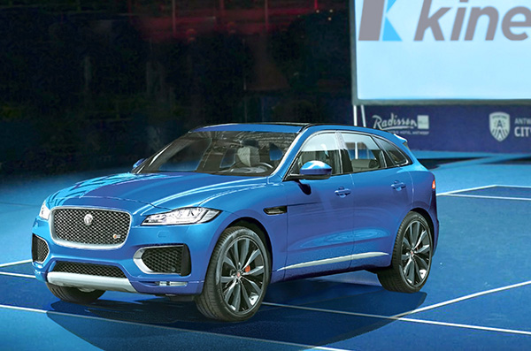
Kinesis is equipping a fleet of luxury vehicles with advanced telematics for the 2019 European Open, held Oct. 13-20 in Antwerp, Belgium.
The European Open has attracted top players including Gael Monfils who is ranked 12th in the world, Belgium player David Goffin and former Wimbledon champion Andy Murray.
Fitted to vehicles supplied by Jaguar, Kinesis vehicle tracking will provide real-time visibility of vehicle movements for logistics, security and safety. Kinesis will fit the fleet with GPS devices that transmitting accurate and up-to-the-minute vehicle locations along with driver assessment data, giving 24/7 visibility of the tournament vehicles from any internet connected device.
Photo: Kinesis
Kinesis is working with Tennium, a global tennis platform company that owns the ATP250 tournaments in Antwerp and Buenos Aires and represents a number of world-class players.
The Jaguar Land Rover-supplied vehicles will include high-end cars, limousines and minibuses and will be used to collect players from the airport and transport them between official hotels and the Lotto Arena. The fleet will also be used to transport ATP officials, invited guests and VIPs.
“Knowing where each vehicle is, where it is headed and at what time it is expected to arrive allows us to meticulously plan the transport of some of biggest names in tennis,” commented Karl Van Parys, logistics and transportation manager at Tennium. “With such high-profile sportsmen it is imperative that they arrive on court in good time and relaxed, and the Kinesis system will help us achieve this.”
The Kinesis telematics intelligence will be used by organisers to plan journeys in accordance with a demanding tournament schedule. With visibility from desktops, tablets and mobile devices, the team can respond, in real time, to changing logistics requirements as play unfolds. Kinesis can also deliver driver performance data, including speeding, harsh braking and accelerating and idling, which can be used to improve driver behaviour for health and safety.
“It is a real honour to be involved in such as prestigious event and work alongside some of the most well-known names in the world of tennis,” added Greville Coe, Group Managing Director of Kinesis. “The use of Kinesis telematics to inform decisions relating to tournament logistics as well as player safety and security, shows just how seriously the organisers take their responsibilities.”
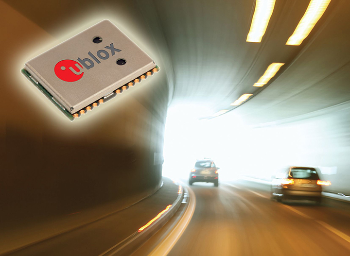
u-blox’ NEO-M8L module with 3D ADR technology and integrated sensors provides accurate vehicle position regardless of satellite visibility. (Image: u-blox)
U-blox has collaborated with Molex on the Modular Automotive Connectivity (MAX) Platform for intelligent vehicles.
The NEO-M8L and TOBY-L4 modules, which are built into the MAX connectivity platform, support the reception and transmission of data over the mobile network to the backend, enabling mobile internet access, in addition to supporting positioning. The solution can determine the position not only via GPS but also via Galileo, Beidou and GLONASS.
Molex is a Tier 1 system integrator and supplier of high-speed networking, datacom, rugged industrial and automotive solutions that enable innovative architecture design and development for the intelligent vehicles.
Molex will demonstrate MAX in booth 151 at ELIV Oct. 16-17 in Bonn, Germany.
The automotive-grade GNSS module NEO-M8L supports positioning, so that the ECU knows exactly where the vehicle is at all times. The solution can determine the position not only via GPS but also via Galileo, Beidou and Glonass. As a result, MAX can be deployed globally and offers a flexible and scalable solution for worldwide mobility providers, OEMs and system suppliers.
TOBY-L4 supports the reception and transmission of data over the mobile network to the backend, enabling mobile internet access.
MAX offers high-quality vehicle networking for both traditional and new mobility providers. MAX is suitable for small series, such as vans or targeted innovative EV projects. As a central node in the vehicle, MAX enables both internal and external networking. The solution is flexible, scalable and is an open software concept, fulfilling important requirements of the dynamic mobility market, Molex said in press release.
“MAX further supports our commitment to providing next-gen connectivity in the car for the entire market, not just a luxury for premium automakers. Molex innovations and expertise are driving solutions that are changing the automotive landscape to allow our customers accessibility,” said Dietmar Schnepp, product director for vehicle communication devices, Molex.
“We are delighted to work with a world leader in the automotive market such as Molex and proud to see two u-blox modules at the core of the new MAX connectivity platform,” said Andreas Thiel, head of Product Centers and co-founder of u-blox. “This collaboration demonstrates u-blox’s dedication to providing automotive customers with best-in-class positioning and wireless communications solutions.”
MAX can be tailored to the customer’s requirements through individual configuration. The platform combines quality of state-of-the-art communication technologies with the necessary degree of standardization for cost control.
In addition, the individual modularization enables a short time-to-market compared to tailor-made solutions. This path is the ideal alternative for telematics service providers who can use MAX as the basis for a backend connection, as well as for the development of various applications.
The new Mobile Mark nine-cable LTMG944 multiband antenna is designed for 5G-ready routers and gateways covering dual-carrier LTE MIMO, Wi-Fi MIMO and GNSS.
The LTM508 antenna. (Photo: Mobile Mark)
The 9-in-1 dual-carrier antenna expands Mobile Mark’s LTM series, used for public transit communications, public safety and vehicle fleet management. It contains nine separate antenna elements housed within a single antenna radome. The antenna has:
four cellular/LTE elements
four Wi-Fi elements
one GNSS element covering GPS, GLONASS and Galileo.
The LTM900 series can also be configured with fewer elements — for example, the LTMG942 contains four LTE, two Wi-Fi and one GNSS element.
The LTMG944 model can be paired with multi-connection 5G-ready routers and gateways already on the market. The cellular/LTE elements are designed to accommodate dual-carrier MIMO coverage (i.e. 2xMIMO on two different cellular carriers) or 4xMIMO for 5G.
Complete cellular coverage is offered from 694-960 and 1710-3700 MHz, with GNSS coverage on GPS and Galileo (1575 MHz) and GLONASS (1612 MHz), and dual-band Wi-Fi coverage on 2.4 and 5 GHz.
“Our new dual-carrier antenna solution series is compatible with the latest fleet management modems and routers offering dual-carrier coverage,” said Michael Berry, Mobile Mark president and CEO. “A single antenna provides MIMO coverage for each carrier.”
The antenna also provides broadband coverage. “We are happy to report that Mobile Mark’s new 9-cable 5G-ready antennas are in production today with efficient, 5 dBi gain on the FCC allocated 5G mid-bands of 3550-3700 MHz as well as being backwards compatible for other cellular frequencies,” Berry said.
The antenna is housed in the attractive, recognizable LTM radome in a choice of black or white. It is sold as a kit with 1-foot pigtails (LMR-100 except RG174 on GPS) and 14-foot jumper cables. The antenna elements fit in a compact radome that measures 5.5-inches in diameter by 2.38 inches high (140 mm x 60 mm). The LTMG944 series antennas are available as surface mounted antennas, but not as mag-mounts.
For high-vibration applications such as mining or large earth-moving equipment, Mobile Mark has developed a proprietary construction technique with superior shock and vibration test results. This option is available for the LTM944 series antennas.
The dual-carrier antenna is made in the USA, in Mobile Mark’s Itasca, Illinois, factory.”
The importance of sensors, whether they be incorporated in cute dog robots or autonomous vehicles, is gaining more traction.
At September’s Custom Electronic Design and Installation Association (CEDIA) Expo, Sony Electronics President and COO Mike Fasulo told GPS World that its foundation sensors are going into autonomous vehicles, drones, agricultural solutions and other platforms.
“A lot of people also don’t know that more than half of the hardware in most smartphones is ours,” Fasulo said. “These sensors we are working on do things you and I can’t do. They can assess sunlight and darkness. They can put a safety cocoon around a vehicle.”
The Aibo robot dog uses artificial intelligence to mimic a real puppy’s behavior. (Photo: Kevin Dennehy)
At the conference, Sony displayed a nearly $3,000 Aibo dog robot, which has many of the same sensors that go into many of the company’s other products, including its venerable camera line. Aibo has facial recognition technology and uses artificial intelligence to mimic a real puppy’s behavior.
Sony sensors seem to be a cornerstone in several new announcements. Less than two months ago, Sony and Yamaha Motor Co. announced the joint development of the SC-1 Sociable Cart, a small autonomous vehicle that will be deployed to golf courses, amusement parks and commercial facilities, the company said.
The SC-1, which is not for sale, features five seats, replaceable batteries, front and rear scope of view thanks to image sensors, an innovative vehicle design, and other improvements over an original prototype vehicle.
In addition to the image sensors, the vehicle has ultrasonic sensors and a two-dimensional laser detection and ranging (lidar) system, the company said. These sensors allow the vehicle to gather cloud travel data for safe-driving analysis.
Sony is working with Japan’s NTT Docomo to test the vehicle’s 5G mobile technologies for remote-controlled functions, the company said.
Geotab leverages sensor data
Sony and Yamaha Motor plan to roll out the SC-1 later this year in Japan. (Photo: Sony/Yamaha Motor)
Canada-based Geotab has made big announcements this year, although the huge one is from the U.S. government to equip more than 200,000 vehicles with its telematics systems.
While that contract itself is massive, the company believes the more than 2 billion data points gathered each day, from millions of Geotab-equipped vehicles on the road, is the real valuable commodity.
The data gathered with the company’s connected-car technology can help companies and governments assess how their fleets are operating, said Mike Branch, Geotab vice president of data and analytics.
Branch, who leads a team of 40 employees, said the company uses the data to help cities assess road impediments — not only road quality. This includes analyzing ABS activation to look at black ice or other hazards. “While weather companies can only estimate conditions, we have sensors in vehicles that can give hyperlocal reports and ground truth,” he said. “People consistently slamming on their brakes in one area is an example [of aggregative data].”
Back in the day, which is less than 10 years ago, all that many companies expected from their fleet management systems was to let them know where their drivers were, by using GNSS and mapping technology. Today, the sensors — and data provided by them — allow managers to assess dangerous driving areas, save on fuel costs by rerouting trucks and compare routes throughout the United States, not just in big cities, Branch said.
In the smart cities space, Branch said that Geotab is working with municipalities for fuel intersection insight mapping. “This means if 20 vehicles, or even just two, are stopped at an intersection, our sensors can detect the wait times,” he said. “The big thing for us is looking at this smart-city deployment to leverage organic data in a private manner.”
Because of the nature of data procurement, privacy is big topic for the company, Branch said. “We treat it with high importance. Our view is that the data is owned by the customer,” he said. “They have full access to it. We will go through it, aggregately, so we can improve our customer’s experience.”
Keeping OBD port secure
The future of open on-board diagnostic (OBD) vehicles — and procuring secured and open data from them — is a concern for Geotab, Branch said.
“We have a full port safety committee with the goal of security and access to the port,” he said. “We believe in open access to this port. This gets to be a concern with mixed-fleet Fords, Mercedes, BMW and others as the data can slow down the port at any time.”
Branch said the company does not want to remove the entrepreneur, who is interested in working with the port in a safe manner. “We work with the OEMs on the future of telematics not just by pulling the data from our device, but pulling it from their feed,” he said.
Branch said that technology may make the port dongle obsolete in five to 10 years, but until then, the company has created an ecosystem to enable the use of the data. “There is going to be an aftermarket as cars are lasting an average of 11 years,” he said.
World View, the stratospheric exploration company, has reached an important milestone representing a key step toward persistent and navigational stratospheric flight.
After achieving the goal of more than 30 days aloft with full navigational control, the Stratollite completed its 32-day mission over the weekend, showcasing its enhanced long-duration flight capability.
Before this mission, the longest Stratollite flight was 16 days, achieved in June 2019. This mission moves World View closer to scaled commercial operations, making the unique data and information sets it can provide available to commercial and government Earth-observation and remote-sensing customers around the world.
Notable accomplishments from the mission:
Executed four continuous days of station-keeping (mission objective) with an average distance of 20 km from the first predetermined target location, followed by an intentional navigation to the second station-keeping target location 1,230 km away.
Achieved 2.5 days of continuous station keeping at the second station-keeping target with an average of 40 km from the second target location.
Averaged an altitude of 19.5 km during both station-keeping exercises.
Traveled more than 11,200 km during the mission, covering Arizona, Utah, Nevada, Colorado, New Mexico, Texas, Oklahoma, Nebraska, Iowa and Kansas.
Demonstrated complete navigational control during the mission from World View’s remote Mission Control in Tucson, Arizona.
The total mission duration was 32 days, 5 hours and 14 minutes
Executed more than 1,000 trajectory-control maneuvers over the entire mission.
“This is another encouraging milestone for the team and our customers that confirms we are on the right track,” said Ryan Hartman, World View president and CEO. “It sets the stage for a challenging set of missions ahead of us as we continue to push the envelope and demonstrate the ability of the Stratollite to meet customer requirements.”
World View’s flight operations team landed the Stratollite at a predetermined landing zone in Iowa on Saturday, Sept. 28, to conclude the mission. The system landed on command, was recovered, and will be refurbished for reuse on future missions.
World View will continue to increase the cadence of its Stratollite flight operations. The company plans to launch multiple missions focused on demonstrating optical imaging and synthetic aperture radar sensing systems with further enhancement of station-keeping and navigational performance.
About the Stratollite. World View’s Stratollite is a long-endurance stratospheric flight vehicle capable of station-keeping over areas of interest for remote sensing and communications.
The craft can travel 95,000 feet above the Earth. World View is already routinely flying payloads to the edge of space for a wide variety of government, commercial, and education customers.
World View’s proprietary altitude-control technology allows it to harness stratospheric winds to steer the Stratollite to and from desired locations and loiter above them for long durations.
Stratollites can carry a wide variety of commercial payloads (sensors, telescopes, communications arrays, etc.), launch rapidly on demand, and safely return payloads back to Earth after mission completion.
Among its wide variety of uses, the Stratollite will help researchers greatly advance knowledge of planet Earth, improve our ability to identify and track severe weather, and assist first responders during natural disasters.
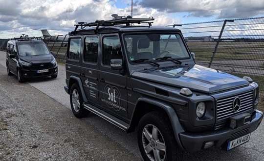
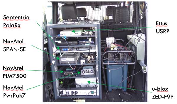
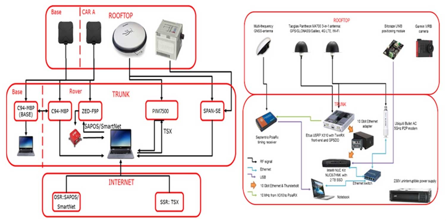
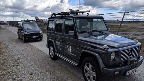
A pair of testbed vehicles went out on the road in Germany to simulate the way we are all likely to be using 5G positioning services in the future. The field test focused on assessing the performance of highly precise hybrid satellite/terrestrial positioning for autonomous vehicles, drones, smart cities and the internet of things (IoT).
The two vehicles were driven for a week around Munich and the surrounding area in a variety of environments, from the open-sky terrain surrounding the German Aerospace Center DLR’s site in Oberpfaffenhofen to the deep urban canyons of the city’s dense Maxverstadt district.
As they drove, they combined a broad range of on-board systems to measure their positions and share them with one another, performing ongoing vehicle-to-vehicle ranging to simulate future 5G operating standards.
The on-board systems included multi-constellation satellite navigation (combining Europe’s Galileo, the U.S. GPS, Russian GLONASS and Chinese BeiDou), incorporating localized high-accuracy correction, and 4G Long-Term Evolution (LTE) and ultra-wideband (UWB) terrestrial wireless broadband communication.
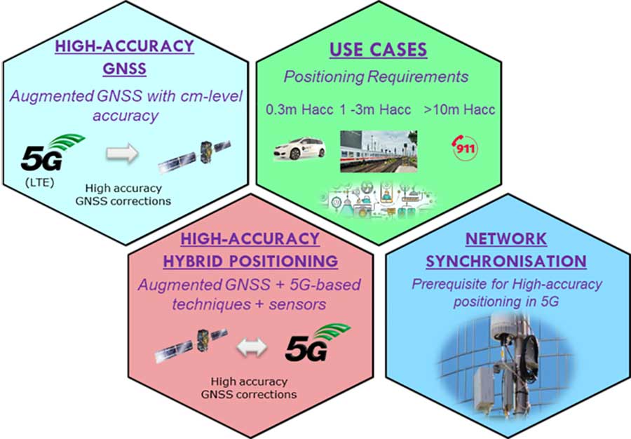
The coming of the next generation of mobile phone networks, 5G, promises much faster, more stable connectivity based on higher bandwidths and frequencies, but the ability to download a full movie in a matter of seconds is only the start. The increased capabilities will also open up a new range of services, many of them based around localization.
From smart traffic management to asset tracking to personalized drone-based delivery, our receivers’ ability to know where they are and share those positions with the wider network will be vital.
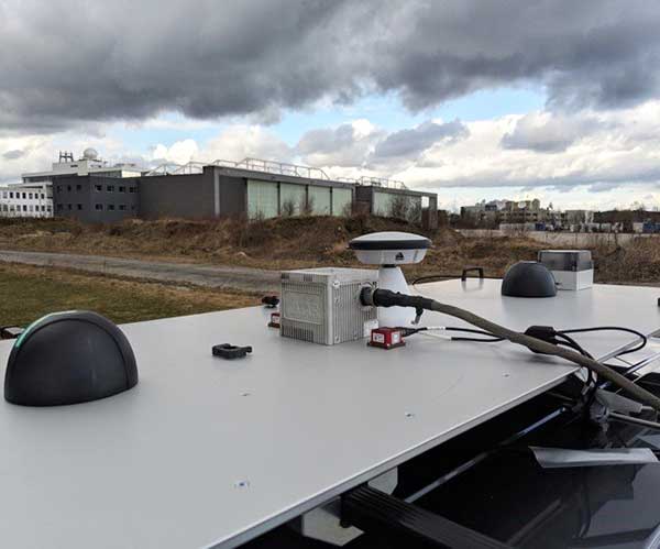
Close-up view of Car A with GNSS and LTE antennas. (Photo: ESA)
“The first step required is understanding what the upcoming disruptive applications are, and to identify the potential requirements associated with them,” said Riccardo de Gaudenzi, who leads ESA’s Electrical Department in its Directorate of Technology, Engineering and Quality.
“For these use cases, positioning and timing are key elements. Therefore positioning, navigation and timing (PNT) aspects, provided via GNSS like Galileo, the terrestrial communication infrastructure and hybridization of technologies, are extremely important.”
The testbed vehicles combined a broad range of on-board systems, including multi-constellation GNSS, incorporating localized high-accuracy correction. (Image: ESA)
Today we rely largely on satellite navigation to determine where we are. But our smartphones quietly blend satnav with other data sources to sharpen the accuracy of their results. That is why, for example, when you turn off your phone’s Wi-Fi receiver, your smartphone will warn you its mapping will become less accurate – it is also using Wi-Fi maps as a reference source.
With 5G, this trend of hybrid positioning will accelerate. Multiple GNSS constellation will be employed to increase accuracy, along with localized correction systems. In addition, the 5G cell network will provide additional corrections to enhance the GNSS localization accuracy and to complement GNSS when satellites are not visible.
This 5G “new radio” positioning accuracy will be enhanced by using steerable antennas on both the base station and the user terminal.
The testbed vehicles combined a broad range of on-board systems, incorporating localized high-accuracy correction and LTE 4G and ultra-wide-band terrestrial wireless broadband communication, to measure their positions and share them with one another and perform ongoing vehicle-to-vehicle ranging to simulate future 5G operating standards. (Image: ESA)
And because positioning performance will have to remain at the same high standard as user receivers move around — whether they be people, cars, shared bikes or drones — additional positioning solutions will also be employed, such as inertial sensors or device-to-device relative positioning.
Areas where ESA is contributing to 3GPP standardisation efforts. (Image: ESA)
Miguel Manteiga Bautista, head of ESA’s GNSS Evolution and Strategy Division in the Agency’s Directorate of Navigation, explains, “For the hybrid positioning field-tests, ESA and its partners set up a collaboration with Deutsche Telecom for use of its 4G network in Munich including relevant information for positioning, and NovAtel, who provided state-of-the-art GNSS equipment and correction services, such as the satellite-based TerraStar-X.”
ESA oversaw this initial field test campaign as part of its 5G GNSS Task Force, coordinated with the European Commission and the European GNSS Agency through the Horizon 2020 Framework Programme for Research and Innovation in Satellite Navigation.
The field test campaign was undertaken by DLR and the GMV company, with contributions by engineers from NovAtel, u-blox and Deutsche Telekom as well as ESA.
In 2016 the 5G GNSS Task Force within H2020 took the initiative to shape the support of high-accuracy positioning services in 4G and 5G networks, to contribute to the 3rd Generation Partnership Project, 3GPP, worldwide standardisation effort.
These field tests are executed within the GNSS Integration into 5G wireless networks or GINTO5G project. Undertaken through ESA’s European GNSS Evolution Programme, this project is being is executed by a consortium composed by GMV, Universitat Autonoma de Barcelona (UAB), DLR, u-blox and Telefonica I+D.
Currently, UAB is involved in the thorough processing of all the data gathered during the field test campaign, leading into models and simulation tools and possibly additional field experiments.
This pair of testbed vehicles went out on the road in Germany to simulate the way we are all likely to be using 5G positioning services in the future. (Photo: ESA)
It’s hard to overstate the importance of inertial sensors in the transportation and machine control markets. For the second year, using inertial navigation systems (INS) to augment positioning was selected by the most respondents (43%) as the best additional solution for positioning in GPS/GNSS-challenged environments.
Inertial measurement units are based on multi-axis combinations of precision gyroscopes, accelerometers and magnetometers using algorithms to determine location, direction and position. Other tech used to increase positioning accuracy includes signals of opportunity (cellular, radio, TV), visual indicators (such as lidar) and ultra-wideband.
Automakers are pushing hard to get autonomous vehicles on our roads and highways. Nissan and Renault (with Microsoft) plan to have 10 vehicles on sale by 2020 with “significant autonomous functionality.”
Ford plans to roll out autonomous vehicles by 2021, and Hyundai is targeting them for the highway by 2020 and urban driving by 2030. While industry experts debate the time frame, it’s clear autonomous vehicles are coming.
Every Tier 1 automaker has an autonomous navigation program, along with heavyweights such as Google, Apple an Amazon. Many automakers are teaming with tech companies on R&D, such as GM with Lyft, and BMW with Intel and Mobileye. Others are teaming with each other —Volkswagen and Ford partnered to acquire AI startup Argo. Daimler has joined Volvo to invest in the platooning concept, connecting trucks through wireless signals.
Stages of Autonomy. The move to autonomous won’t be a sudden jump, but will take place in incremental steps. Formerly only offered on luxury autos such as the Tesla or Mercedes, Honda has introduced semi-autonomous advanced-driver assistance systems (ADAS) options on its entry-level Civic, offering lane-keeping, automatic braking, and adaptive cruise control functionality for the mass market.
Automakers rely on SAE International’s J3016 standard, which defines six levels of automation from Level 0 (no automation) to Level 5 (full vehicle autonomy). The pivotal change occurs between Levels 2 and 3, when responsibility for monitoring the driving environment shifts from the driver to the system.
Chart: GPS World
At Level 1 (driver assistance) is cruise control.
Level 2 (partial automation) includes Audi Traffic Jam Assist, Cadillac Super Cruise, Mercedes-Benz Driver Assistance Systems, Tesla Autopilot and Volvo Pilot Assist.
Level 3 (conditional automation) puts the car in the driver’s seat, but prompts the driver to intervene in a difficult encounter (Audi Traffic Jam Pilot).
At Level 4 (high automation), the car operates without human input, but only under select conditions (road type, geographic area). For instance, the driver might manage all driving duties on surface streets then become a passenger as the car enters a highway.
At Level 5 (full automation), the driverless car can operate on any road and in any conditions a human driver could negotiate. There are no Level 5 autos yet, but Waymo is using a fleet of 600 Chrysler Pacifica hybrids to develop Level 5 tech for production.
Machine Control. Not having to deal as much with traffic, except to navigate to the work site, machines in agriculture and construction are much more autonomous than the family car.
For liability reasons, fully autonomous machines have yet to be approved for field work in the U.S. Nevertheless, manufacturers such as Case IH, New Holland, John Deere and Komatsu are continuing to push the tech, and most tractors sold in the U.S. today include auto-steering systems.
At construction sites, GNSS technology installed in bulldozers, excavators, graders and pavers increase productivity and provide situational awareness to operators. GNSS increases the efficiency and accuracy of these machines, with the input used in task management, data management and theft-detection applications.
Operators rely on GNSS information to position the cutting edge of a bulldozer blade or an excavator bucket. GNSS enables comparison of the position against a 3D digital design to compute cut and fill amounts. Display systems provide the operator with the visual information to manually move the machine’s blade or bucket for highest accuracy.
Starting this year, new-generation GNSS-based landing systems — ground-based augmentation systems or GBAS — will be deployed at airports all around Europe to increase runway capacity by up to 6% in peak traffic periods, according to Indra, a key partner of the European GBAS Alliance.
The GBAS technology allows aircrafts to make steeper approaches, which saves fuel and reduces noise and CO2 emissions. GBAS further improves airport capacity by letting approaching aircraft use different glide slopes to avoid wake turbulence left by precedent aircraft in the runway.
According to research by the European Union’s SESAR initiative supported by Eurocontrol simulations, this can lead to a runway capacity increase between 2% and 6%.
The European GBAS Alliance includes airports, airlines, air navigation service providers and air- and ground-manufacturing industry working for a coordinated and synchronized deployment of ground-based augmentation systems (GBAS).
Photo: Indra
The plan is for deployment preparations to start this year, and ramp up in 2020. The focus is particularly on precision approaches in low-visibility conditions.
The first collaborative meeting took place in Toulouse, France, in June with more than 20 organizations represented.
GBAS is recognized as a supplement and, in the future, the replacement of instrument landing systems (ILS).
A synchronized GBAS implementation for low visibility operations (GBAS GAST D for categories II and III) will lead to environmental, economical, capability and safety benefits for airports, airlines and air navigation service providers.
Indra has been a driver for GBAS development for years, and is one of the initiators behind the European GBAS Alliance. It contributes with one of the technological pillars; the NORMARC GBAS system is an Indra Air Solution capable of guiding aircraft even in low visibility conditions (CAT II and III). The technology is ready, and the focus now is on getting the infrastructure and regulatory framework in place.
“The great response to this initiative is very encouraging,” said Hugo Moen, GBAS general sales manager at Indra. “In spite of the indisputable benefits to everyone, we need a collective effort to get out of a “chicken or egg” situation. Both airlines and airports need to make some investments, but airlines are reluctant to invest in GBAS receivers for aircraft as few airports have the required infrastructure. Likewise, airports or ANSPs are not investing since few aircraft can make use of the system.”
GBAS differs from ILS in being based on GNSS instead of conventional radio signals. Whilst ILS signals can be affected by topography and other physical objects, GBAS has no critical or sensitive areas. This allows for higher capacity during precision approaches, reducing the risk of diversion, cancellation and go-around.
“GBAS enables steeper and shorter approaches. Precision landings can be performed at airports where this has not been possible due to topography or other reasons. In Norway, we have used GNSS-based landing systems at 17 airports for many years, with great results. It is nice to see the industry working together so more countries can benefit from this new technology,” said GBAS Product Manager Linda Lavik from Indra.
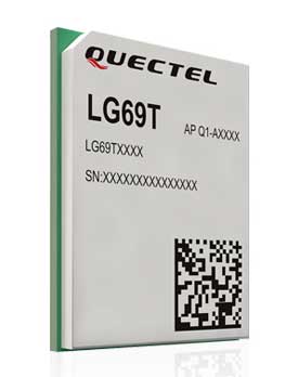
Quectel Wireless Solutions Co. Ltd., in association with STMicroelectronics, has released the LG69T module, an automotive-grade dual-band high-precision GNSS module that integrates dead-reckoning (DR) and real-time kinematic (RTK) technologies.
The new Quectel module, announced at 2019 Apsara Conference in Hangzhou, is designed to facilitate open-sky positioning performance with an accuracy of up to 10 centimeters, which is currently the industry’s most advanced positioning technology for the automotive market. LG69T will support next-generation precision positioning capabilities for smart vehicles and autonomous driving scenarios.
The Quectel LG69T GNSS module is based on ST’s STA8100GA, the latest Automotive-grade dual frequency positioning chip with 80 tracking channels and four rapid-acquisition channels that are compatible with many constellations: GPS, BeiDou, Galileo, NAVIC/IRNSS and QZSS.
It is an AEC-Q100-qualified dual-band (L1 + L5) GNSS module that integrates multi-band RTK technology for centimeter-level accuracy.
The LG69T module’s dead-reckoning capabilities feature an integrated inertial measurement unit (IMU) that provides continuous high-precision positioning. The LG69T supports corrections input for standard Radio Technical Commission for Maritime Services (RTCM) and centimeter-level navigation by using RTCM data from a third — local base stations. The module performs well under the highly challenging conditions of urban canyon environments.
“We are thrilled to collaborate with STMicroelectronics on our newest generation of high-precision positioning module,” said Min Wang, Quectel’s automotive product line general manager. “With this highly-integrated LG69T module, automakers and Tier 1 suppliers will no longer have to spend time selecting components, integrating hardware, adapting interfaces and conducting tests and verifications, which will greatly cut their time-to-market and costs, and help them accelerate the deployment of autonomous driving to seize early opportunities.”
“ST has strong experience and is the Global Automotive High Precise Positioning Technology and Market Leader. We are very proud to cooperate with leading Chinese smart driving high technology company,” said MH TEY, Greater China, South Asia and Korea automotive marketing and application head of department, STMicroelectronics. “Today, there is growing dependency on high-performance GNSS in automotive applications such as navigation, safety and autonomous driving. With this cooperation, we are very confident to become the market leader by providing cost-effective and unique best-in-class solution for autonomous vehicle.”
Engineering samples of Quectel’s LG69T module will be offered to automakers and Tier 1 suppliers by the end of 2019, and the product will be commercially available around mid-2020 and is expected to be deployed in mass produced models as early as 2021.
Companies aim to provide sub-lane-level accuracy to automotive OEMs and Tier 1 suppliers
Image: Trimble
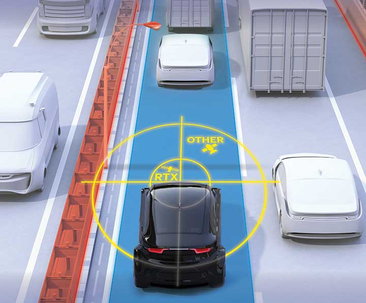
Trimble and Qualcomm Technologies, a subsidiary of Qualcomm Inc., will be working together to produce precise-positioning solutions for select automotive applications.
Trimble will work with Qualcomm Technologies to integrate Trimble’s RTX technology with select Qualcomm Snapdragon Automotive 4G and 5G platforms to deliver a highly accurate positioning solution essential for maintaining absolute in-lane positioning.
The new solution will accelerate the adoption of road-level navigation and emergency services applications, as well as satisfy requirements for developing advanced driver-assistance systems (ADAS) and autonomous driving solutions.
The Snapdragon 4G and 5G automotive platforms feature integrated multi-frequency and multi-constellation high-precision GNSS technology. They also support all major global and regional GNSS satellite constellations including GPS, GLONASS, Galileo, BeiDou, and QZSS, operating concurrently on the L1, L2, and L5 frequency bands, including a precise positioning framework.
The framework ensures consistency in access and use of precise positioning information and incorporates the use of GNSS corrections technology.
Tight integration of GNSS functionality in conjunction with the modem reception of the corrections allows for minimum latencies and optimal performance of the precise-positioning solution from the telematics system and provides automakers with a global location platform to meet the requirements of next-generation vehicles.
Trimble RTX technology provides real-time, multi-constellation GNSS corrections and positioning capable of achieving 2-centimeter horizontal accuracy worldwide, compared to uncorrected GNSS positioning that can be accurate to several meters. The combined solution will provide reliable, consistent, high-accuracy positioning, in a broadcast format, to serve even the most precise requirements of the automotive and transportation industries.
“Trimble’s relationship with Qualcomm Technologies establishes a unique alliance between industry leaders, in which both companies are committed to advancing the development of safer, more capable ADAS,” said John Sprivulis, director of autonomous navigation solutions for Trimble’s advanced positioning division. “Together we will offer a solution to the automotive industry that can help accelerate the adoption of precise GNSS positioning in the connected car and transform the way the world drives.”
“Highly accurate positioning is quickly becoming an important element of connected vehicle solutions to support Vehicle-to-Everything (V2X) and other autonomy applications,” said Lars Boeryd, senior director, product marketing, Qualcomm Technologies. “For this very reason, we are working with Trimble to host the RTX precise positioning software library on our Snapdragon Automotive 4G and 5G platforms to offer a robust end-to-end highly accurate position solution for the automotive industry.”
Evaluation kit. An RTX-enabled Snapdragon evaluation kit (EVK) is expected to be available by early 2020, for use by automotive OEMs, Tier 1 suppliers or other stakeholders considering absolute positioning as part of their autonomy solution.
Trimble has also made Trimble RTX Auto an ASIL and ASPICE compliant RTX software library, available to any OEM or supplier who requires a functional safety certified solution.
High-precision GPS, INS and computer vision come together in a single package called VINS to be demonstrated at the Auto.ai show in Berlin on Sept. 25-27.
Septentrio high-performance GPS/GNSS technology provides reliable absolute positioning inside this innovative computer vision localization system developed by Artisense, a company specializing in vehicle localization and 3D mapping solutions.
Septentrio, a manufacturer of high-accuracy GPS/GNSS technology for demanding applications, is providing positioning technology to Artisense, a supplier of computer vision solutions for automated vehicles.
Artisense incorporates Septentrio GPS/GNSS in their latest visual inertial navigation system (VINS), which will be demonstrated live at Auto.ai show in Berlin, Germany, on Sept. 25-27.
VINS combines computer vision, inertial sensors and GNSS (Global Navigation Satellite System) measurements to deliver highly accurate global 3D positioning and orientation information in any environment, even indoors.
“We are very pleased to work with Artisense on this technology and demonstrate how vehicle localization systems benefit from fusing computer vision with high-precision GNSS,” said Jan Van Hees, business development director at Septentrio. “The result of our cooperation is precise localization in any environment offering positioning reliability and redundancy needed for safety-critical applications such as autonomous vehicles or robotics.”
Multi-constellation, multi-frequency GNSS technology provides reliable centimeter-level global positioning to the VINS system with accuracy required for lane-level maneuvering and V2V warning systems.
Cameras and inertial sensors continue accurate localization as the vehicle moves into tunnels or parking garages with no line-of-sight to GNSS satellites.
Although the system uses a relatively simple MEMs IMU and off-the-shelf cameras, it delivers precision and reliability of a high-end INS system. “Positioning accuracy and reliability are very important to us. Earlier this year we have deployed a large-scale mapping operation in Berlin where we tested a lot of different GNSS receivers. We saw the best results coming from Septentrio consistently,” said Johannes Start, Technical Product Manager at Artisense. “We continue to use Septentrio receivers because they are precise, they acquire RTK (real-time kinematic) fix quickly and reliably and they are easy to integrate.”
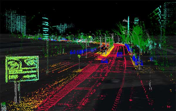
The live demo at Auto.ai will offer a ride around Berlin in a car featuring VINS technology. One screen inside the car will continuously display the car’s location. Unlike the GPS of an average infotainment system, VINS will continue accurate localization anywhere, even in tunnels or in parking garages. The second screen inside the car will feature a real-time 3D point-cloud reconstruction of the car’s surroundings.
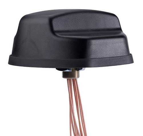
PCTEL Inc. has released an antenna that combines precision multi-constellation GNSS with high-performance LTE, sub-6 GHz 5G, Bluetooth and Wi-Fi connectivity.
The Coach II antenna with GNSS L1/L2/L5 is designed to provide greater precision and reliability for advanced rail communications systems, enabling everything from next-generation positive train control (PTC) to passenger Wi-Fi.
“Precise timing and tracking information is critical not just for rail, but for a variety of fleet, public safety, and industrial IoT [internet of things] applications,” said Rishi Bharadwaj, PCTEL’s chief operating officer. “PCTEL’s antenna technology enables our customers to deploy new technologies with confidence,” added Bharadwaj.
PCTEL is displaying its Coach II antenna with GNSS L1/L2/L5 on Sept. 22-24 at RSSI C&S Exhibition in Minneapolis, Minn. It is available to order now for shipment in early November using part #GL125-DLTEMIMO.