Photo: icholakov/iStock Editorial/Getty Images Plus
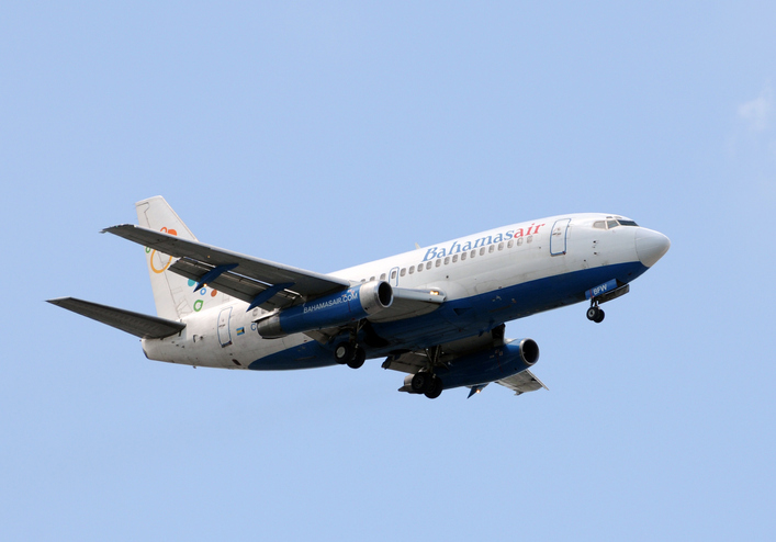
BahamasAir has missed the U.S. deadline for the new ADS-B mandate and is now forbidden from flying certain three of its four jets in United States airspace. The airline said it has adjusted its aircraft deployment accordingly, reports Forbes.
The U.S. Federal Aviation Administration mandated in 2010 that aircraft be equipped with hardware to use NextGen, a satellite-based air traffic control management system, to replace traditional ground radar technology. This step of the transition requires aircraft to have Automatic Dependent Surveillance-Broadcast Out (ADS-B) capability either at time of manufacture or retrofitted with a kit.
BahamasAir was unable to equip three of its Boeing 737-500s with ADS-B before the Jan. 1 deadline, so those aircraft have been taken off the routes it flies to Florida. It has one 737-700 and five ATR regional airliners that have ADS-B, and is using those aircraft for Florida. It also leased some planes to meet holiday season demands.
The airline says it’s maintaining its full schedule with no changes and the old 737s should be fixed in the next few months. Meanwhile, the agency has granted an exemption to the government of Canada for two of its old airframes.
Canadian Changes
The Royal Canadian Air Force operates four Challenger 601 business jets to take government and military officials on shorter flights in the U.S. and Canada. Two of those jets are too old to receive the ADS-B upgrade, so the FAA has said it will be allowed into U.S. airspace but may not get the most convenient routing from air traffic control, according to AVWeb. The FAA does have a process to waive the ADS-B requirement, but it has warned that the exemptions will be issued only under exceptional circumstances.
On Jan. 2, an Air Canada flight leaving Saint John was forced to avoid United States airspace on Thursday and take a longer path to Toronto, avoiding flying over Maine because of the mandate, reports the New Brunswick Telegraph-Journal. The change in flight pattern added roughly 20 minutes to the trip. Air Canada won’t speculate if the longer flight path and extended travel time will happen again.
Quectel Wireless Solutions, a global supplier of cellular and GNSS modules, debuted at CES 2020 a series of communication modules targeting the 5G connected car sector.
CES 2020, the massive annual consumer electronics show, is taking place Jan. 7-10 in Las Vegas. The three new modules are showcased at Quectel’s booth No. 2601.
Quectel’s new automotive-grade modules include the AG550Q, a new 5G New Radio (5G NR) Sub-6GHz module, the AG215S automotive EAP module, dedicated for C-V2X scenarios, and the AF50T Wi-Fi module.
All three modules are based on the Qualcomm Automotive Wireless Solutions from Qualcomm Technologies, Inc., a subsidiary of Qualcomm Incorporated. They are designed to provide multi-gigabit cloud connectivity, improved location services, and enhanced security to support the increasing requirements of connected car and autonomous driving use cases.
Image: Quectel
The AG550Q 5G NR module, supporting both NSA and SA modes, is based on the AEC-Q100 qualified Qualcomm Snapdragon Automotive 5G Platform. The module is compliant with IATF 16949 requirements, and follows automotive quality processes such as APQP and PPAP to address the demanding requirements of automotive devices.
Adopting the 3GPP Rel. 15 technology, the AG550Q supports high speeds and ultra-low latency to facilitate better security and quality-of-service for mission-critical services. The multimode 5G NR module is backward compatible with existing 4G, 3G and 2G technologies. This ensures that cars will remain connected regardless of where they travel within the network.
Supporting optional C-V2X PC5 direct communications, AG550Q provides superior performance in vehicle-to-vehicle (V2V) and vehicle-to-roadside infrastructure (V2I) communications for improved traffic efficiency and safety. Furthermore, the module supports optional Dual SIM Dual Activation (DSDA), which allows car and driver each to choose their own independent network operator subscription in order to support a variety of emerging mobility service models.
Additionally, the highly-integrated AG550Q module supports multi-constellation and multi-frequency GNSS (L1/L2/L5), as well as optional Qualcomm Dead Reckoning (QDR) 3.0 technology which provides quick and highly accurate location positioning. The module will be commonly found in telematics boxes (T-Box), telematics control units (TCU), advanced driver-assistance systems (ADAS), C-V2X (V2V, V2I, V2P) systems, on-board units (OBU), roadside units (RSU), and other automotive/traffic systems.
Quectel AG550Q module offers powerful cyber-security features, which include firmware secure boot, Trusted Execution Environment (TEE), network firewall, SELinux strong access control, TLS/SSL security protocols and more.
“We are proud to deliver global OEMs and Tier 1 suppliers the most advanced wireless connectivity available, which allow them to integrate the latest 5G technology into their next-generation car designs,” said Min Wang, vice general manager of Quectel. “Leveraging our relationship with Qualcomm Technologies and its cutting-edge chipsets, we have been able to offer auto customers secure and reliable connected car solutions. Our complete automotive portfolio ranging from LTE, C-V2X to 5G and Wi-Fi can satisfy the continuity of automakers’ future product planning.”
“As the automotive industry accelerates its adoption of cellular-based communications technology, our priority is to work with innovative partners like Quectel Wireless Solutions to meet the needs of the automotive industry as it delivers on the promises of automated mobility,” said Matt Eichenberger, senior director, business development, Qualcomm Technologies. “The hallmark of our work with partners is to engineer highly scalable cellular technology-based platform that enable automakers to reimagine the speed of innovation. This translates to more connected experiences and improved vehicle safety, as more cars are capable of communicating not only with the cloud but also with other vehicles, pedestrians and transportation infrastructure.”
Besides AG550Q, Quectel also unveiled an automotive EAP module AG215S at the show, which is dedicated to C-V2X applications, and features the Qualcomm Snapdragon 2150 platform. The module integrates powerful application processor to host an ITS stack and applications. Along with having a hardware crypto engine embedded to fulfill powerful ECDSA verification capability (with support for up to 2500 verifications/sec). AG215S supports the global, U.S., EU and China National Security Algorithm, which can greatly boost security in vehicle communications. Quectel will also provide the reference design platform with full functionality (Application Processor + Modem + Connectivity + GNSS + SW SDKs), for customers and application developers.
The Quectel AF50T Wi-Fi module targets the connected car sector and supports Wi-Fi 2.4GHz + 5GHz & BT 5.1, and 802.11a/b/g/n/ac/ax standards.
The AG550Q module is in the engineering sample stage, with the evaluation board available to reduce development time for OEMs and Tier 1 suppliers. The AG215S module will be sampling starting January 2020.
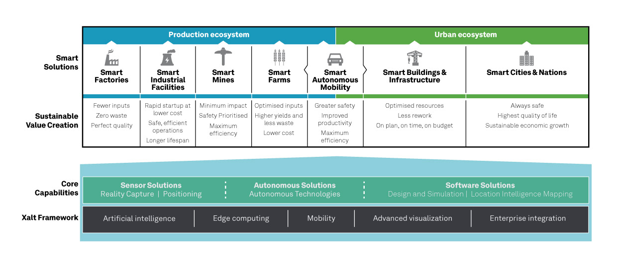
Hexagon AB, a global leader in sensor, software and autonomous solutions, introduced its Smart Autonomous Mobility solutions portfolio today at CES 2020, bringing together all the necessary sensors, software and services to make autonomous driving possible.
CES 2020, the massive annual consumer electronics show, is taking place Jan. 7-10 in Las Vegas. Hexagon’s Smart Autonomous Mobility solutions portfolio will be demonstrated in Hexagon’s pavilion CP-15.
Hexagon said it is on a mission to enable all customers to accelerate and deploy a bold autonomous mobility vision — from research and development to advanced machine learning and simulation, to full integration and production into industry ecosystems.
“Through our Smart Autonomous Mobility solutions portfolio, Hexagon is empowering an autonomous future that can transform ecosystems, protecting millions of lives and dramatically lowering carbon emissions,” said Ola Rollén, Hexagon president and CEO. “We are committed to providing complete technology solutions that enable our customers to build, test and put fully autonomous fleets to work safely.”
The Smart Autonomous Mobility portfolio includes three solution sets: Enable, Accelerate and Deploy.
Enable. Hexagon enables customers to fast-track R&D with hardware, software, and services to quickly enable autonomous driving systems across a variety of vehicle platforms and applications. From providing a turn-key automated driving research vehicle platform for field testing, integrating a customisable and assured positioning engine with reliable correction services, and offering baseline simulation tools and high-accuracy ground truth, Hexagon has already enabled thousands of customers worldwide with these technologies.
Accelerate. Hexagon enables customers to create Smart Digital Realities — seamless workflows between real-world and simulated environments. To drive even 20% better than a human driver requires 11 billion miles of validation, which is equivalent to 500 years of non-stop driving in the real world with a fleet of 100 cars.
With machine learning, simulation and testing for entire system performance and engineering and integration services, and high-definition digital reality capture, visualization and on-demand feature extraction, Hexagon allows customers to optimise, verify and validate the necessary billions of miles of driving required to safely deploy autonomous vehicles to the road.
Deploy. Hexagon allows customers to quickly scale from prototype and R&D phases to production for any autonomous application. The automotive-grade hardware solutions, autonomy software technologies, and functionally safe positioning solutions and services available in Hexagon’s Smart Autonomous Mobility portfolio are ready to deploy at scale for:
Mass production of passenger vehicles
Neighborhood electric vehicles (NEV)
Tractor trailers (class 8)
Off-road vehicles for mining, agriculture and defense
Technology includes vehicle-grade computing platform solution, high-dynamic range camera and ADS synchronization controller
DeepRoute, an international self-driving startup and CES 2020 Innovation Award Honoree, will be debuting three innovative technologies at CES 2020 including a vehicle-grade computing platform solution, DeepRoute-Tite, high-dynamic-range camera and ADS synchronization controller.
CES 2020, the massive annual consumer electronics show, is taking place Jan. 7-10 in Las Vegas. The company will be located at Booth no. 25647 at South Hall 2 LVCC throughout the show.
“It is an honor to be joining international innovators at CES 2020,” said Shuang Gao, Chief Operating Officer of DeepRoute. “We’ve worked hard over the last year to perfect our technologies and reinforce the safety of autonomous vehicles. We are excited to unveil the fruits of our team’s hard work, creativity and talent to the world at the prestigious and highly anticipated global technology show.”
DeepRoute-Tite, the company’s computing platform solution that migrates the algorithm required for L4 level autonomous driving to the vehicle-level computing platform, Nvidia Xavier, significantly reducing the cost, size and power consumption down to 45 watts. DeepRoute’s computing platform solution uses Nvidia’s vehicle-specific computing platform Xavier to process L4 level autonomous driving modules such as perception, prediction, decision-making, planning and control, along with navigation.
Along with the debut of the computing platform, DeepRoute will be launching its first-generation vehicle camera, DeepRoute-Vision. The vehicle camera has a higher dynamic range than other products on the market, allowing optimal performance even under bright sunlight or from within a dark tunnel. Designed to handle LED bulb flicker, the camera can also accurately capture information displayed on LED screens. The vehicle camera will be on display and demonstrated by DeepRoute representatives at the show.
DeepRoute also plans to unveil its second-generation ADS Synchronization Controller, DeepRoute-Syntric. The ADS controller can synchronize information from different types of sensors, enabling the perception algorithm to process sensor data aligned in the same standard. In the event that the sensors malfunction, the ADS controller can take control of the vehicle and perform emergency tasks such as braking.
The company recently announced the availability of DeepRoute Sense, their driving sensing solution technology which will be on display at the show alongside their Level 4 full-stack self-driving technology using a demo vehicle with an independently designed roof box equipped with 8 vehicle cameras, 3 lidars, GNSS and a series of other sensors.
At any given moment, more than 5,000 airplanes are flying over the United States. In a single year, nearly 778 million passengers will take to the skies — more than twice the population of the U.S., and the number increases each year. Aviation is the safest form of transportation. It is 100 times safer than driving. For every 100 traffic deaths, only one aviation related fatality occurs; and the Federal Aviation Administration (FAA) is working hard to make aviation even safer.
Safety is the FAA’s primary focus. The FAA Strategic Plan FY 2019– 2022 states its mission is to provide the safest, most efficient aviation system in the world. To achieve this goal, the FAA is implementing several initiatives. The technical aspects of these efforts fall under a framework called NextGen designed to modernize the nation’s air traffic control system. NextGen began in 2003 in the VISION 100 – Century of Aviation Reauthorization Act. At its core, NextGen is a geospatial framework with satellite navigation as its backbone.
The Geospatial Data Act (GDA) became law when President Trump signed the FAA Reauthorization on Oct. 5, 2018. You might have wondered how the GDA came to be included in the bill. It makes sense in the context of technology advancements towards a smart transportation network, specifically in aviation.
The smart transportation concept integrates all forms of transportation to provide economic and environmental benefits as well as increase safety and reduce wait times and congestion. A large part of smart transportation is based on geographic information technology. The aviation component of this smart transportation initiative falls within the FAA’s authority under the overarching framework named NextGen.
NextGen is an integrated concept improving the efficiency and safety of flight operations both on the ground and in the air. The use of geospatial technology enables precision time-management for controlling air traffic. The system allows each airplane to digitally coordinate with other aircraft in the area, taking into account such things as terrain and other known hazards to safely reroute air traffic as necessary. The FAA refers to this as trajectory-based operations. Those with a knowledge of GIS will recognize it as four dimensional: it calculates direction, speed, distance and time relative to position in x-y-z, and coordinates that information with other known data. Additionally, the system uses historical flight data and predictive analytics to maximize airspace for routing air traffic such as what is experienced during the holidays.
NextGen also uses a system called Optimal Profile Descents (OPD), which allows an airplane to trim its engines and descend along a glide slope from flight level into the airport. The point at which a plane begins its descent is a geospatial calculation to determine the precise point in space for the airplane based upon its altitude, weight, glide slope and distance to the airport. The benefits of OPD are reduced engine noise, fuel savings, less carbon emissions and a positive economic impact. NextGen is an across-the-board win for the airline industry, airline passengers, the economy and the environment.
According to an interview with Michael Whitaker, former deputy administrator of the FAA who was the Chief NextGen Officer, NextGen revolutionizes aviation by enabling digital data communication. It replaces radar-based navigation and tracking with satellite-based air traffic control. The cornerstone of NextGen is the Automated Dependent Surveillance Broadcast (ADS-B) system.
ADS-B is an aviator’s version of Waze, but with a lot more information. ADS-B(out) broadcasts an airplane’s Flight ID, ICAO Code, speed and location in three-dimensional space to air traffic controllers and to everyone who is equipped with ADS-B(in). The combination of ADS-B(out) and ADS-B(in) greatly increases situational awareness for aviators. On Jan. 1, 2020, all airplanes operating in controlled airspace needed to have ADS-B(out) installed. ADS-B transforms the entire National Airspace System into a satellite-based geospatial network. It integrates multiple sources of real-time data, such as weather, pilot reports, aircraft positions, 3D airspace information, and other sources of data, which can be overlaid on top of various basemaps and terrain elevation models, allowing pilots to make more informed and safer decisions.
Switching to ADS-B opens up more capacity in already crowded skies by decreasing the required vertical and horizontal separation distances between aircraft. At Hartsfield-Jackson International Airport, the busiest airport in the world, changing to performance-based operations allowed 8 to 12 more departures per hour; and in Memphis International Airport, one of the busiest airports for cargo operations, arrivals increased by 20%.
Rune Duke, senior director of government affairs, Airspace, Air Traffic and Aviation Security for the Aircraft Owners and Pilots Association (AOPA), said that ADS-B will allow much faster update rates for air traffic controllers on the order of once every second, compared to legacy radar systems that report positions every 8 to 12 seconds. For an airplane traveling at 350 knots, that is about 1 mile. A lot can change in a mile in densely packed airspace.
If you are reading this because of your love of maps and aviation, then I highly recommend the FlightAware and ForeFlight smartphone apps. FlightAware turns the phone into an ADS-B(in) receiver showing the location and flightpath of each aircraft in the immediate area on a basemap. I sit on my back deck and watch airplanes coming and going because I live under the flightpaths for Dulles International Airport, Reagan International Airport, Leesburg Executive Airport, the Montgomery County Airpark and the TERPZ waypoint. On occasion I see helicopters flying to Camp David because I am under that flight path as well.
So, I get to see a variety of aircraft. You can select the airplane icon to see information such as aircraft type, airline, Flight ID, departing and arrival airports, altitude, and groundspeed. Even more information is available by selecting the pop-up window. This is ADS-B information. ForeFlight, on the other hand, is a pilot’s flight bag on a tablet.
In the future, ADS-B will integrate Aircraft Hazardous Areas (AHA): temporary no-fly zones due to commercial space launches. Because of ADS-B, planes will automatically reroute around the AHA, and when the AHA expires, airplanes will be routed back through the area.
ADS-B supports evolving technologies such as remote towers, another significant change to air traffic control. Remote towers allow air traffic controllers to be at a location other than the actual airfield. Remote towers use a suite of sensors mounted at the airfield, including high-definition video, thermal and night vision that can be combined with the digital information provided by ADS-B, all of which is displayed on widescreen panels in a room duplicating the experience of being at the airport and directing aircraft. This allows smaller airports that cannot afford the huge expense of building and staffing an air traffic control tower to be part of a remote tower network. One remote tower center will be able to support several airfields. Leesburg Executive Airpark recently finished successful testing of one of the first remote tower operations in the United States.
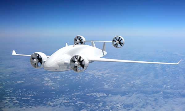
“Over the next 10 years, we are going to see logistics and transportation open up, from being limited by currently rigid road infrastructure to operating on fully flexible and responsive aerial transportation networks,” said Patrick Watson, director of business development for Animal Dynamics.
The envisioned Platform Unmanned Cargo Aircraft. (Photo: PUCA)
ADS-B will also support the integration of unmanned aerial systems (UAS) into the airspace, specifically unmanned cargo aircraft (UCA). In the not too distant future, carrier air fleets without pilots or aircrew will be taking to the skies. UCAs do not require crews, so there will be no need for water, toilets, sewage containment, kitchens or a cockpit (in the traditional sense). Taking those out will allow for more space in the plane to carry cargo and fuel. Plus, without crews on board, there will be no time restrictions on crew hours — planes will be able stay aloft longer and travel further. ADS-B greatly enables the success of this technology.
Septentrio’s GNSS devices are being used for high-accuracy positioning solutions by two companies.
Compact multi-frequency GPS/GNSS receiver module provides robust centimeter-level positioning for advanced driver assistance systems (ADAS) provided by NXP.
Septentrio and Analog Devices collaborate on high-performance GNSS/INS solutions.
Image: Sepentrio
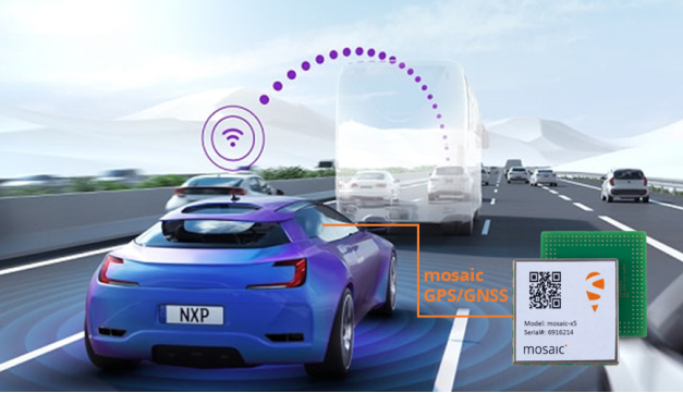
NXP V2X Integration
NXP, a leader in communication technology for embedded applications, is integrating Septentrio GNSS technology into its V2X (vehicle-to-everything) reference design and development boards.
Septentrio, a leading high-accuracy GNSS positioning company, is providing to NXP its mosaic module. Mosaic is a multi-frequency, multi-constellation GNSS receiver that delivers accurate and reliable global localization even in harsh environments.
V2X technology enables cars to communicate with infrastructure as well as other vehicles, making driving safer and more efficient. It enables cars to “see” what’s around the corner or through the dense urban environment warning the driver about road works, traffic congestion and emergency vehicles.
Precise GNSS-assisted localization combined with V2X communication enables a wide array of ADAS functionality such as automatic braking if slowing traffic is detected ahead or truck platooning.
Septentrio’s mosaic is a compact high-accuracy GNSS receiver module which is integrated into NXP’s V2X development boards. True multi-frequency multi-constellation technology gives mosaic access to every possible signal from all available GNSS constellations including the U.S. GPS, European Galileo, Russian GLONASS, Chinese BeiDou and Japanese QZSS satellites.
Septentrio’s advanced, field-proven algorithms exploit this signal diversity to deliver maximum positioning availability even in difficult environments such as under foliage or in urban areas.
“Reliable lane-accurate positioning is vital for many road-safety applications of V2X, such as queue and emergency stop warnings or blind spot warning,” said Andrew Turley, NXP’s senior director of innovation and V2X business development. “Septentrio’s unique easy-to-integrate GNSS module provides field-proven, reliable and robust positioning. Integration of mosaic into our reference design gives our customers a direct solution for developing these and other advanced V2X services.”
”We are excited that NXP selected our GNSS solution for their V2X reference design,” said Jan Van Hees, business development director at Septentrio. “NXP is a world-leader in complete solutions for V2X communications for active safety systems and intelligent transport system (ITS) management. Working with NXP gives us an excellent opportunity to bring the best of V2X and reliable GNSS to our customers.”
Inside a car GPS signals can become “jammed” by nearby electronics or illegal devices called “jammers” which are used by some drivers to avoid road tolling. mosaic uses jamming-resistant signal processing making it robust against interference. Its design is centered around continuous, reliable high-accuracy positioning making mosaic suitable for safety-critical applications such as ADAS and autonomous navigation.
Consumer Electronics Show. The Septentrio mosaic GNSS module will be showcased at CES in Las Vegas, January 7-10. Visitors are welcome to see mosaic and talk to Septentrio GPS experts about V2X, ADAS, INS and other automotive positioning solutions in booth 1135 at the Paradise West Center. A personal meeting can be booked in the Septentrio Suite at the Westgate Las Vegas Resort & Casino.
Combining with Analog Devices on INS
In December, Septentrio announced a collaboration with Analog Devices. The two companies are combining Analog Devices’ high-quality inertial measurement units (IMUs) with Septentrio’s multi-frequency, multi-constellation GNSS receivers.
The resulting high-performance GNSS/inertial navigation systems (GNSS/INS) deliver centimeter-accurate positioning together with 3D orientation (heading, pitch and roll), suitable for applications such as automotive ADAS and industrial automation.
“We are excited to work with Septentrio,” said Tony Zarola, general manager of inertial sensors, Analog Devices. ”Septentrio’s GNSS technology provides a unique combination of accuracy and robustness which is aligned well with the capabilities of our sensors. The company’s deep know-how of GNSS and focus on providing reliable solutions even in harsh environments complements Analog Devices’ focus to solve the toughest engineering challenges for our customers.”
“ADI’s high-end industrial IMU systems are a reference in the industry and we are very pleased to be working together with them,” said Danilo Sabbatini, product manager at Septentrio. “Combining ADI’s IMU experience with our GNSS expertise enables creation of high-performance, easy-to-integrate systems that allow our customers to tackle demanding applications. As a result, customers can expect a faster go-to-market due to the interoperability between the GNSS and INS components.”
Septentrio will incorporate Analog Devices’ advanced industrial-grade IMUs into a selection of its GNSS/INS products. Working directly with Analog Devices allows Septentrio to provide faster and more efficient GNSS/INS integration solutions for high-volume customers. This collaboration promises a solid foundation for design and production of top-performance integrated positioning and inertial solutions, with first products available in spring 2020.
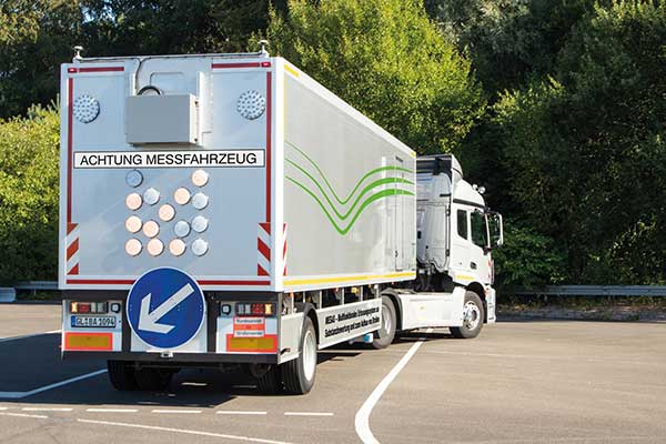
Germany’s Federal Highway Research Institute (BASt) is using a specialized semi-truck to analyze and map road surfaces. The research vehicle uses GNSS, scanner and camera equipment to record the condition of road surfaces and the substance of the asphalt surface, providing the basis for optimum maintenance planning.
The truck is part of the BASt’s MESAS program, which began in 2018. The unique measuring vehicle is a multi-functional assessment tool for fast-moving substance detection, such as for structural evaluation and design of pavements.
For the MESAS program, innovative measurement technology was installed on a single-axle semi-trailer, with all measurement systems synchronized and georeferenced using a GNSS system.
The MESAS measuring vehicle is 14.5 meters long and weighs 22 tons. At speeds of up to 80 km/h, MESAS records road condition parameters with high precision. (Photo: BASt)
The vehicle includes:
the Pavement Profile Scanner PPS-Plus from Fraunhofer IPM
a laser-based Traffic Speed Deflectometer (TSD) that measures short-term reversible deformations of the road surface
a georadar that detects layer thicknesses and inhomogeneity of the road superstructure
ambient cameras that provide images for interpreting the georadar measurements
During test runs, the vehicle system successfully measured more than 11,000 kilometers of the country’s trunk-road network. Now it begins regular operation.
“MESAS is a globally innovative measuring system,” said Dirk Jansen, department head, BASt. “Here we have a really powerful tool at our disposal with which we can make an innovative and significant contribution to the further development of conservation planning.”
Millimeter precision. The Pavement Profile Scanner PPS-Plus records the transverse evenness of the road surface with high precision. The scanner, the size of a shoe box, is mounted on measuring vehicles and scans the road surface with an eye-safe laser beam over a width of about 4 meters. The distance to the road surface is determined with sub-millimeter accuracy using phase-shift technology.
The laser scans the surface with the aid of a rotating polygon mirror perpendicular to the forward movement of the vehicle and generates 800 profiles per second. Each profile consists of up to 900 measuring points, depending on the selected measuring frequency. In this way, the PPS generates a detailed 3D height profile of the road surface.
At traveling speeds of 80 km/h, the measuring point distance in the longitudinal direction is approximately 28 millimeters; in the transverse direction it is 4.5 millimeters. It also provides photorealistic grey-scale images of the road surface that show millimeter-thin structures, such as small repairs and patches.
uAvionix has received U.S. Federal Aviation Administration (FAA) approval for the Vehicle Tracking Unit (VTU-20) Automatic Dependent Surveillance – Broadcast (ADS-B) transmitter for airport surface management.
uAvionix is a designer and manufacturer of communications, navigation and surveillance (CNS) equipment for unmanned and manned aircraft.
Adhering to the performance and design assurance specifications of FAA-E-3032, the externally mounted VTU-20 ensures integration and interoperability with Airport Surface Detection Equipment, Model X (ASDE-X), Airport Surface Surveillance Capability (ASSC) and ADS-B receiver surveillance solutions for airport
surface control and situational awareness.
The VTU-20 can be permanently or magnetically mounted to all airside vehicles, including utility, emergency, snow-removal and maintenance equipment. Each vehicle is clearly and uniquely identified, providing an essential addition to any surface movement guidance and control system.
The VTU-20 implements FAA-approved Squitter Transmission Maps to automatically enable transmission on airport movement areas and disable transmission in low-risk areas or outside airport airside operations.
“Ground vehicle incursions into critical safety and movement areas is on the rise. With this achievement, uAvionix continues to promote safety and common situational awareness not only in the airspace but also on the airport surface,” states Christian Ramsey, uAvionix president.
This recent uAvionix achievement will be made available through an exclusive relationship with L3Harris Technologies, Inc., a leader in surveillance and air traffic management known for the Symphony product line of airport operations and environmental compliance solutions — to promote and sell the VTU-20 in the United States.
University teams will go head-to-head in a two-year autonomous race car competition to test new software and other self-driving technologies at Indianapolis Motor Speedway.
The competition, called the Indy Autonomous Challenge, culminates in a high-speed autonomous vehicle race, scheduled for Oct. 23, 2021, on the speedway’s famed 2.5-mile oval track that is home to the annual Indianapolis 500.
The competition was inspired by the 2005 Defense Advanced Research Projects Agency (DARPA) Grand Challenge, which pitted university teams against each other and spurred commercial development of autonomous vehicles.
“The idea for the Indy Autonomous Challenge originated with DARPA’s winning team captain, [Stanford University’s] Sebastian Thrun. Sebastian joined us at the 2018 Indy 500, where he reflected on the inspiration and excitement that came from participating in the DARPA challenge, and how a high-speed automated vehicle race at the Indianapolis Motor Speedway had the potential to be on par with that experience with today’s teams,” said Matt Peak, Energy Systems Network director of mobility.
Like the DARPA competition, the Indy Autonomous Challenge focuses on university participation. “I can’t speak for DARPA, but our focus on universities is deliberate,” Peak said. “It was advised by not only Thrun, but other original DARPA competitors such as [Aurora CEO] Chris Urmson, all of whom commented on how participation by universities — their students, faculty, departments, alumni — was a key to DARPA’s success.”
The autonomous racing software developed through the competition could assist in developing commercial self-driving vehicles and enhance existing advanced driver-assistance systems (ADAS). Some of the cornerstone technologies include GNSS and digital maps, which provide the accurate location for fully autonomous vehicles.
As was the case with the original DARPA challenge, spurring new innovations and socially beneficial products and services is a goal of the competition, Peak said. “In our case, we see inspiring teams’ creation of software that can solve for edge cases — those problems or situations that occur only at an extreme operating parameter, such as avoiding unanticipated obstacles at high speeds while maintaining vehicular control,” he said. “This applies not only for highly automated vehicles, but also for vehicles equipped with ADAS that aim to help human drivers avoid obstacles altogether. The notion is, if our university innovators can enable cars to outmaneuver others at 200 mph, they certainly can help enable you to avoid that piece of lumber that fell off the pickup in front of you on the 65-mph highway.”
Peak said that a perfect place to demonstrate these technologies is the famous speedway, which for 100 years has tested automotive technology in a demanding environment. “Tackling automation at 200 mph in a race car is a bit more alluring than with a 20-mph people mover,” he said.
In addition to ESN and Indianapolis Motor Speedway, other challenge partners include race-car manufacturer Dallara Automobili and the Clemson University International Center for Automotive Research (CU-ICAR).
$1.45 Million in Prize Money
During the final race at the speedway, teams will compete for $1 million as the first-place prize. Second- and third-place finishers receive $250,000 and $50,000, respectively.
The five-round competition starts with the submission of a white paper to demonstrate vehicle automation with a video of an existing vehicle or participation in Purdue University’s self-driving go-kart competition at the speedway.
During the initial rounds, teams will use sponsor ANSYS’ driving simulator to develop autonomous vehicle software. ANSYS, which will provide $150,000 in prizes to top finishers of a third-round race, will co-host a hackathon to let teams work with the simulator, the company said. The fourth round allows teams to test their vehicles at the speedway in advance of the final race.
So far, five universities have registered:
Korea Advanced Institute of Science & Technology (KAIST)
Texas A&M Transportation Institute (TTI)
University of Florida
University of Illinois
University of Virginia.
Not Everyone Has Championed Autonomous Vehicles…
The new competition is commencing during a time when media reports show that the once-hot autonomous vehicle industry has vocal critics. Recently, Apple pioneer Steve Wozniak, who once headed a GPS-based fleet company called Wheels of Zeus, said he didn’t expect to see a fully autonomous vehicle operating on the streets in his lifetime.
In addition, a few automakers have reined in autonomous vehicle development or have scaled back their technology expectations in recent months.
“Not at all surprising. The traditional OEMs were never going to be disrupters that put driverless mobility-as-a-service cars out there. It isn’t their business model, and it won’t be,” said Alain Kornhauser, Princeton University professor and transportation program director, who was head of the university’s team during the DARPA Challenge, in his Smart Driving Cars weekly newsletter. “Self-driving, I dare say Level 2, is and has always been their sweet spot — it sells cars. Now watch these same companies throw monkey wrenches into those driverless mobility machines to protect their conventional business model.”
Peak says the recent negative press on autonomous vehicles is what happens when any new technology is rolled out. “For any new technology, such as automation, we’re going to see euphoric coverage (automation will solve all of our problems) and pessimistic coverage (automation will never arrive and, if it does, it will make things worse),” he said. “It’s a cycle, it swings back and forth, and we happen to be touching upon the latter, pessimistic end of that cycle.”
Taking a moderate and realistic position about the technology is what the Indy Autonomous Challenge is striving to do, Peak said. “Automated vehicle technologies have a role to play, both in helping humans drive better, and eventually in enabling new markets, such as first/last mile transit solutions. The technologies are light years ahead of where they were a decade ago, and low-level automated technologies are already making a difference and saving lives in today’s vehicles,” he said. “We have a bit of a ways to go before the full potential of automation will be realized, and the Indy Autonomous Challenge will help us address the concerns brought about by the media and others to reach this end goal much sooner than we otherwise would.”
Quectel Wireless Solutions has partnered with SAIC Motor, Shanghai International Port and China Mobile to install its C-V2X modules on trucks to conduct smart truck trials for the shipping industry.
Developed by SAIC Motor, the heavy smart trucks are powered by advanced technologies, including 5G, V2X and AI, to achieve 5G L4-level intelligent driving at the port. Each truck has been equipped with “senses” to detect the external environment and cope with unexpected situations such as crosswinds, obstacles in the road or pedestrian traffic. After arriving at the destination, the vehicles can also dock in target locations.
Photo: Quectel
Quectel C-V2X modules AG15 were integrated in the trucks to help identify and communicate with roadside units such as gates and traffic lights, greatly improving driving safety and efficiency.
According to McKinsey and Company, the automation of ports has proved safer, more cost-effective and efficient than conventional ones. However, the adoption of automation remains slow compared to other sectors. One reason is the high upfront costs associated with automation and difficulties in ensuring effective operations.
The introduction of 5G provides port owners with an unprecedented opportunity to embrace automation to reduce costs by 25-55% and raise productivity by up to 10-35%, according to the same report.
Modules, such as the Quectel C-V2X portfolio, offer even more significant cost-effectiveness and flexibility than conventional forms of investment in automation as they can be custom-installed to meet automakers’ or port authorities’ requirements.
Additionally, Quectel’s AG520R module integrating LTE+C-V2X technologies has supported over 30 automotive customers in product design. The 5G+C-V2X module AG550Q is currently under development and compatible with AG520R in both HW/SW, ensuring a smoother migration from LTE to 5G, which means that the future of automation is now just a module away.
Autonomous vehicle startup announces availability of driving sensing solutions for purchase to OEMs
DeepRoute has released for sale its autonomous vehicle sensing solution, DeepRoute-Sense. DeepRoute is a CES 2020 Innovation Award Honoree.
Photo: DeepRoute
DeepRoute-Sense is an L4-level self-driving full-stalk solution that aims to enable the autonomous vehicle industry to achieve quicker sensor deployment. It includes a sleek, lightweight set-top box and sensor-fusion calibration service.
The roof box consists of GNSS, eight vehicle cameras, three lidars and a series of other sensors to help correspondence and data synchronization between the controllers.
DeepRoute has independently designed the mechanical structure of the roof box, which has outstanding diversion, heat dissipation and sealing functions. The set-top box is lightweight, small and with high impact resistance. With four tripods, the roof box can be easily mounted to the roof of different vehicle models for sensor deployment.
“The team at DeepRoute has worked hard on the development of DeepRoute-Sense and we are excited to finally share our technology with the industry,” said Shuang Gao, COO of DeepRoute. “By bringing this to the market, we are hoping to fuel progress within the industry and bring full vehicle autonomy to be one step closer to the masses.”
The solution uses a DeepRoute-developed in-vehicle camera that features anti-glare, anti-ghosting and highly reliable signal detection. Compared with industrial cameras, the camera comes at a lower cost, but also offers a higher dynamic range.
The roof box has been developed to accommodate different and extreme weather conditions, whether it be during intense sunlight or nighttime high-beam illumination, and can stably handle the exposure and avoid overexposure.
The set-top box includes a sensor data-processing device, the ADS Synchronous Controller. It is pre-processed and fused with the massive data from GNSS, cameras, lidars and other sensors through high-precision time and space synchronization. The ADS Synchronous Controller also supports DNN and SLAM hardware acceleration, which greatly increases computational efficiency.
A roundup of recent products in the GNSS and inertial positioning industry from the November 2019 issue of GPS World magazine.
SURVEYING & MAPPING
IMU-RTK receiver
Increases GNSS availability and reliability
Photo: CHC Navigation
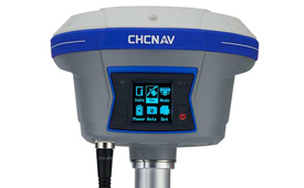
The i90 IMU-RTK GNSS series receiver is designed to dramatically increase GNSS real-time kinematic (RTK) availability and reliability. The i90 is powered by the company’s latest inertial measurement unit (IMU) and RTK technology to provide robust and accurate GNSS positioning in any circumstances. Unlike standard micro-electro-mechanical (MEMS)-based GNSS receivers, the i90 GNSS IMU-RTK combines a high-end calibration and interference-free IMU sensor with a state-of-the-art GNSS RTK engine and advanced GNSS tracking capabilities. The i90 is designed to increase the productivity and reliability of survey projects, with no complicated calibration process, rotation, leveling or accessories are necessary. A few meters’ walk will initialize the i90 internal IMU sensor and enable RTK survey in difficult field environments. The i90 GNSS automatic pole-tilt compensation boosts survey and stakeout speed by up to 20%.
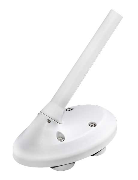
Both accurate and rugged for machine control, logistics
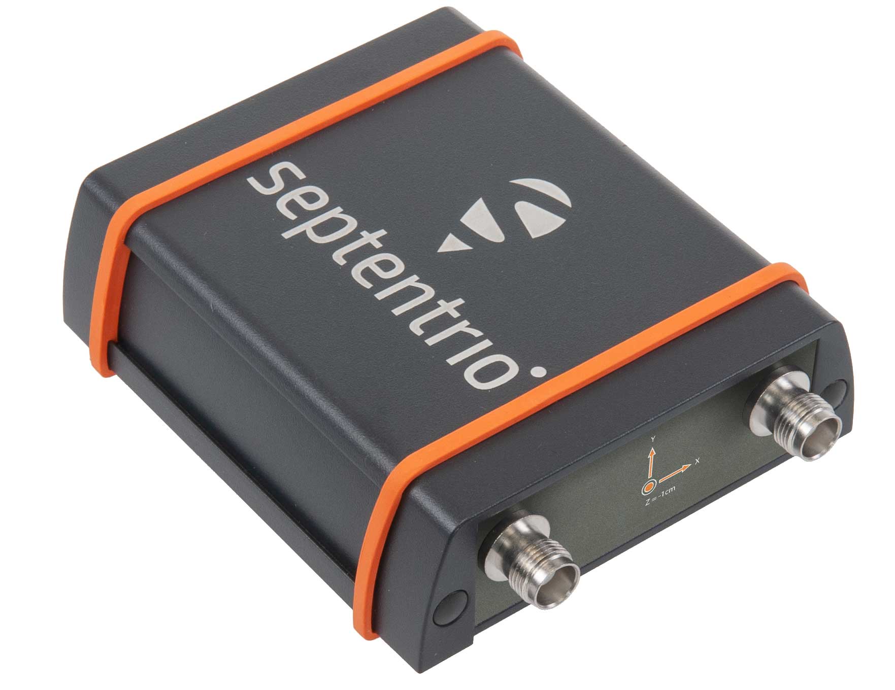
The AsteRX-SBi has a rugged housing, making it suitable for machine control and other outdoor uses. (Photo: Septentrio)
Septentrio has expanded its GNSS/INS portfolio with the AsteRx SBi, a new housed GNSS/INS receiver. The ruggedized AsteRx SBi fuses high-accuracy GPS/GNSS with a high-performance inertial sensor to provide reliable positioning and 3D orientation for machine control and logistic applications. Within its rugged, waterproof enclosure, a high-performance GPS/GNSS is coupled with an industrial-grade inertial sensor to provide high-accuracy, reliable positioning and 3D orientation (heading, pitch, roll). Offering the flexibility of either single or dual antenna, the AsteRx SBi is designed for quick and easy integration into any machine monitoring or control system. Reliable location and 3D orientation data is streamed with a high update rate and constant low latency. Septentrio’s reliable centimeter-level positioning is based on true multi-frequency, multi-constellation GNSS (GPS, GLONASS, Galileo, BeiDou, QZSS) technology.
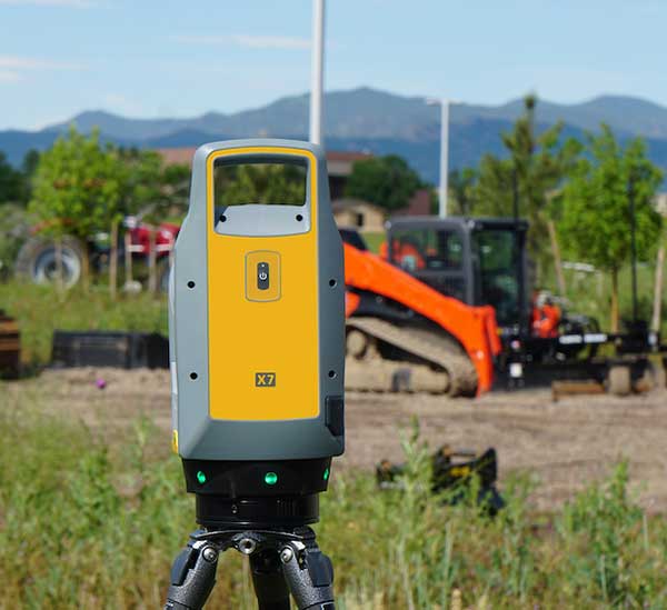
The Trimble X7 laser scanning system is designed for surveying, construction, industrial and forensic applications. It enables professionals to quickly and easily capture precise 3D scanning data to produce high-quality deliverables. The X7 features Trimble X-Drive technology, survey-grade self-leveling and a smart calibration system. It integrates streamlined workflows to provide automatic registration of point-cloud data in the field with Trimble Registration Assist, bringing scans together through self-leveling inertial measurement unit technologies and cloud-based software.
The Bluesky MetroVista range includes high-resolution imagery combined with high-accuracy, wide-scale 3D models. (Image: Bluesky)
The MetroVista city mapping service for Europe incorporates the Leica CityMapper hybrid airborne sensor designed for 3D city modeling and urban mapping. The sensor includes a vertical camera and survey-grade oblique cameras, and incorporates lidar to accurately collect elevation and infrared data. The MetroVista range includes high-resolution imagery combined with high-accuracy, wide-scale 3D models. CityMapper has already been used to capture MetroVista data for cities across the United Kingdom, including London, Manchester, Newcastle and Bristol.
The enhanced GSS9000 series GNSS constellation simulator has been updated to provide significantly improved capability, flexibility and performance to meet the test needs of high-performance navigation systems. It doubles the number of supported channels (320 in a single chassis) while maintaining its full performance specification in key areas such as signal iteration rate and low latency under maximum signal dynamics. These attributes, together with the ability to produce a comprehensive range of emulated multi-GNSS, multi-frequency RF signals, enables full and future-proofed testing of advanced applications. Greater signal flexibility is also built into the enhanced GSS9000 through its open application program interface (API) and flexible architecture. This delivers a highly sophisticated arbitrary waveform generator (AWG) capability.
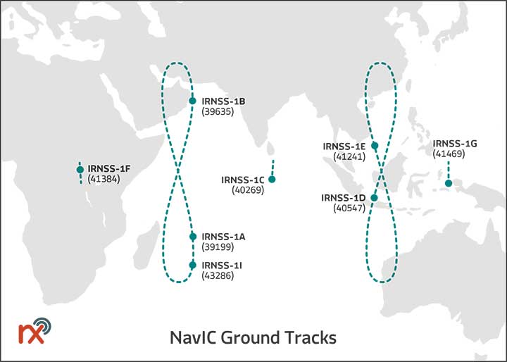
Rx Networks has added NavIC constellation support to its real-time and predicted-assistance data service. The company’s technology partners — semiconductor vendors, mass-market mobile device manufacturers and network operators — now have global support for all satellite navigation systems and L1 satellite-based augmentation systems (SBAS) for any region around the world. Used daily by more than two billion devices, Rx Networks data is delivered via ephemeris in RINEX and via the Location.io interface, with predictions in SP3. Predictions for NavIC via the Location.io platform will be added in the first quarter of 2020.
Endura micro-electro-mechanical system (MEMS) timing solutions are designed for aerospace and defense applications including precision GNSS. They provide high performance in harsh conditions such as severe shock, vibration and extreme temperature. SiTime offers customers 5 million possible part numbers that can be created from 17 programmable products. Solutions accommodate 4 parts per trillion per g force of acceleration (50 times better than quartz); support for –55° C and +125° C operation; timing specifications conforming to MIL-PRF-55310; and Endura Super-TCXOs (temperature compensated oscillators) for use in GNSS applications.
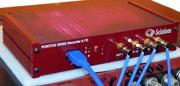
Portos Team paired with the Ninja. (Photo: IP-Solutions)
Portos Team is a new GNSS RF signal record-and-playback system. It can record and play back — or simulate —multi-frequency, multi-system GNSS signals when paired with the company’s Replicator. It can do the same for CRPA signals when paired with the company’s Ninja. The Portos itself can also operate as multi-frequency or CRPA front end for a GNSS software receiver.
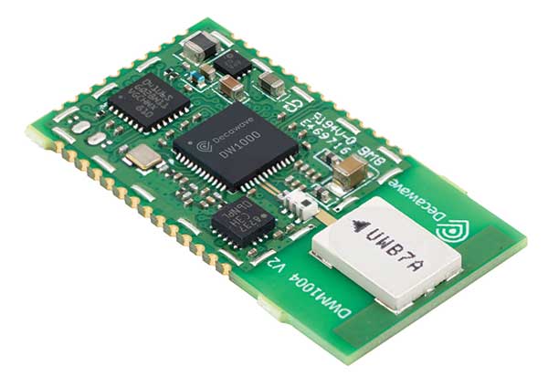
The DWM1004 module targets time difference of arrival (TDoA) tag applications that require years of battery life and a compact design. Based on the DW1000 chipset, the DWM1004C offers high-accuracy, real-time-location capability with a 6.8-Mbps data rate. It delivers more than five years of battery life. Real-time location systems (RTLS) enable managers to have a real-time view of their operations through data collected from connected objects such as tools, pallets, forklifts, badges and collars. The DW1000 is immune to multipath fading, with 2-centimeter precision in indoor environments.
The F9P Sirius RTK GNSS rover is designed to be mounted on a moving vehicle. The u-blox ZED-F9P module inside provides 1-cm position accuracy, a convergence time under 10 seconds and a navigation update rate up to 20 Hz. The rover has a built-in active antenna patch. It receives GPS, Galileo, Beidou and GLONASS signals, providing additional accuracy. It is designed to fit most setup designs as well as integrate easily into a vehicle. Its six-pin JST-GH connector makes it plug-and-play with the Pixhawk Pro 3 autopilot.
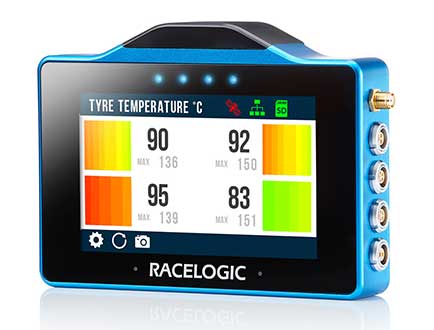
The VBOX Touch is a highly flexible GNSS datalogger with enhanced accuracy. The powerful hardware can be used diverse automotive tests such as acceleration, braking, speed verification, tire temperature monitoring, lap-timing and durability. The VBOX Touch comes preloaded with a sophisticated performance application that covers common use cases; applications can be downloaded from an online library. Racelogic can also write custom Python scripts based on customer requirements.
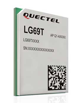
The LG69T GNSS module is an automotive-grade dual-band high-precision GNSS module that integrates dead-reckoning (DR) and real-time kinematic (RTK) technologies. The module facilitates open-sky positioning performance with an accuracy of up to 10 centimeters. It supports next-generation precision positioning capabilities for smart vehicles and autonomous driving scenarios. The LG69T module is based on ST’s STA8100GA, the latest automotive-grade dual-frequency positioning chip with 80 tracking channels and four rapid-acquisition channels compatible with GPS, BeiDou, Galileo, Navic and QZSS. The AEC-Q100-qualified dual-band module integrates multi-band RTK technology for centimeter-level accuracy. The LG69T module’s dead-reckoning capabilities feature an integrated inertial measurement unit (IMU) that provides continuous high-precision positioning.
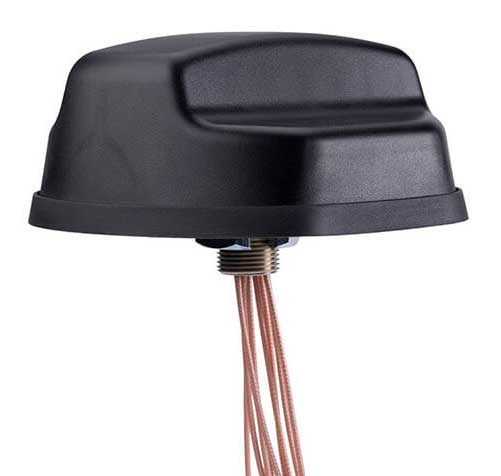
The Coach II antenna with GNSS L1/L2/L5 is designed to provide greater precision and reliability for advanced rail communications systems, enabling next-generation positive train control (PTC) and passenger Wi-Fi. The Coach II features global multi-GNSS compatibility, dual-port 4G LTE / sub-6 GHz 5G NR and 802.11ac Wi-Fi / Bluetooth connectivity. It is AAR compliant for railway applications and is IP67-rated.
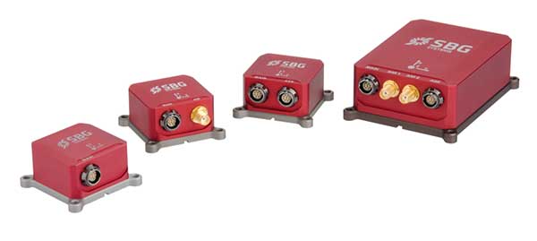
Includes new automotive package for Ellipse GNSS/IMU products
Photo: SBG Systems
New features have been added to the Ellipse product line with firmware update version 1.7. The update better answers needs of the autonomous testing and driving markets such as a CAN odometer. Users now have the choice to connect an external odometer (DMI) with pulses or use their car odometer with velocity information. New outputs include body velocity and slip angle, which calculate the drift angle between the vehicle’s assumed trajectory and its actual trajectory. For precision applications as well as low dynamics and reduced warm-up time, the new firmware allows users to run the Ellipse Kalman filter with no lever-arm estimation. This will ensure centimeter pass-to-pass accuracy for real-time kinematic (RTK) applications and allow operation in lower dynamics while reducing warm-up time. The firmware update also provides new features for advanced marine applications.