SmartDrive Systems, a video-based safety and transportation intelligence company, is collaborating with Geotab to provide fleets with integrated solutions that leverage the SmartDrive platform as a single on-board data collection hub.
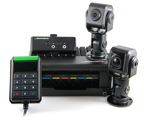
The SmartDrive SR4 video hardware platform. (Photo: SmartDrive Systems)
SmartDrive and Geotab are helping to simplify the on-board technology footprint, providing fleets the freedom to choose solutions that fit their business and their budget, and dramatically lowering the total cost of ownership.
SmartDrive offers a single integrated and aligned understanding of time, location and driver and vehicle performance to third-party applications. Fleets will be able to select solutions without incurring the additional costs associated with managing and maintaining multiple onboard devices.
“The ability to integrate and operate applications from a single data collection platform breaks through significant technology and operational barriers — unlocking efficiency gains for fleets across routes, drivers and risk,” said Steve Mitgang, SmartDrive CEO. “Collaborating with Geotab allows us to make good on the promise of convergence with a company that shares our commitment to providing open, connected and flexible solutions for fleets of every size. We believe this is a transformational shift — and it’s only the beginning of what is possible for our customers.”
With the growth of technology in the cab, fleets are struggling with how to manage the number of devices on the windshield and the connection of those devices in the vehicle.
Video-based safety cameras, electronic logging devices and advanced driver assist system (ADAS) sensors are causing fleets to look for integrated solutions that solve the hardware and data overload problem. Beyond the number of devices on the vehicle, fleets also are contending with the cost to install, maintain and train on each of these technologies. With the migration from 3G cellular networks to 4G, and resulting need to upgrade onboard hardware, fleets have an opportunity to re-think and streamline their technology strategy.
“For too long, traditional telematics systems have saddled fleets like ours with costly hardware that is expensive to maintain and upgrade, and monthly subscription costs that continue to escalate,” said Matt Penland, vice president of safety, Cypress Truck Lines. “There has to be a better way. Fleets should have the same freedom and flexibility to consolidate devices and applications that we all now have on our cell phones. The technology is available to make this possible.”
The SmartDrive platform provides a unified video and telematics data stream that can be leveraged by third parties to power their applications, the companies said. This same data stream powers the SmartDrive video safety program, ADAS and transportation analytics applications.
Through the collaboration, Geotab telematics and compliance offerings take advantage of the SmartDrive single box architecture and unified data stream, eliminating redundancy across hardware, cellular connectivity, GPS modules, connections to the ECU and cabling. It also provides data alignment across the two providers’ applications, unlocking new fleet performance insights and eliminating problematic data discrepancies.
As a result of the collaboration, fleets can benefit from:
The SmartDrive video safety program
SmartDrive SR3 or SR4 video hardware platform
“Single box” architecture enabling the convergence of data, devices and network connectivity
Analytics powered by SmartDrive SmartIQ
Geotab tracking, which delivers real-time and historical visibility to location, speed and geofencing information
Geotab regulatory compliance, including hours of service, driver vehicle inspection reports, International Fuel Tax Agreement (IFTA) recording and tax reports
Access and integration to Geotab Marketplace partners.
“Geotab’s open platform centers on a reliable, scalable and secure approach to data access for business solutions,” said Colin Sutherland, executive vice president of sales, Geotab. “We have always said that our hardware is agnostic. The SmartDrive video hardware integration is a solution that not only leverages Geotab’s platform strength to incorporate data from non-Geotab hardware, but it is a great example of telematics solutions that extend the capital investments across multiple solution providers.”
With more than three billion data points collected daily from over one million vehicles, Geotab helps companies access critical business intelligence and benchmarking data to help increase productivity, reduce fuel consumption, improve driver safety and strengthen compliance.
The integration with Geotab will be generally available early in the first quarter 2019, and the SmartDrive convergence early adopter program is in progress.
Current and prospective customers will be able to take advantage of the integration to Geotab from either the SmartDrive SR3 or SR4 platform.
Released in March 2018, the new SR4 hardware includes unprecedented compute power in a small, flexible footprint; new sensors for advanced risk identification and real-time driver-assist; innovative architecture enabling the convergence of data, devices and network connectivity; new analytics powered by SmartDrive SmartIQ; and a video safety program.
Cohda Wireless has successfully demonstrated its connected autonomous vehicle technology in a live trial on the streets of the city of Adelaide, Australia.
The trial proved the potential for connected self-driven vehicles to make streets safer and that Cohda’s technology is effective even in challenging urban canyons.
In an area covering two city blocks east of Adelaide’s Victoria Square, the demonstration replicated a scenario that is a daily occurrence on the streets of cities all over the world.
In the scenario, two vehicles approach a four-way intersection at right angles to each other. Car 2, driven by a human, fails to adhere to the red-light signal and approaches the intersection at speed, intending to “skip” the red light. Car 1, a connected autonomous vehicle, is approaching the intersection from another direction and intends to proceed through the intersection on the green light.
In a real-life scenario, there would be a risk of a collision as human drivers will invariably approach the intersection when the light is green, fully confident that all other road users will obey the traffic signals. In an instance where Car 2 disobeyed the traffic signal and Car 1 was unable to see the approaching danger, due to visibility being obstructed by buildings or other infrastructure, a collision would be especially likely.
But as Cohda Wireless’s Chief Technical Officer Professor Paul Alexander explained, if the vehicles were connected using Cohda’s V2X (Vehicle-To-Everything) technology, a potential collision situation would be detected and avoided well in advance of it actually happening.
“We demonstrated that when vehicles are connected to each other using our smart V2X technology, Car 1, the connected autonomous vehicle, would detect that Car 2 is approaching the red light at speed and is probably not going to stop. This allows the connected autonomous vehicle to pre-emptively identify and respond to the threat by slowing down and stopping.”
“Cohda’s V2X technology allows vehicles to ‘speak to each other’ to extend their perception horizon,” added Alexander.
“The technology provides the vehicle with an awareness of its environment and risk factors associated with it, consistently and accurately up to ten times per second, enabling it to make decisions that a human being would not be capable of making as the driver of the vehicle.”
Cohda’s Smart Cars Smart City initiative was funded by the South Australian Department of Transport and Infrastructure’s Future Mobility Lab Fund. In June this year, Cohda Wireless took ownership of two specially-modified vehicles from the U.S. that it is using in advanced trials of its V2X (Vehicle-To-Everything) technology.
The two Lincoln MKZ sedans were fitted with the ADAS (Advanced Driver Assistance Systems), ROS (Robot Operating System) various sensors including lidar, radar, cameras, GPS as well as in-vehicle compute platform and Cohda’s GNSS- independent positioning technology.
The fusion and cooperation of the various sensors and Cohda’s V2X technology augment the vehicles’ perception capability and make the autonomous vehicles features more practical, to include threat detection, the dangers associated with blind intersections and vulnerable road users, the company said.
“Our goal today was not only to demonstrate the efficacy of our technology in enabling self-driven vehicles to communicate with each other, but also to do so in a city environment where so-called ‘urban canyons’ significantly affect the ability of systems reliant on Global Navigation Satellite Systems (GNSS) to achieve accurate positioning,” Alexander said.
“The area in the city of Adelaide in which the trial was conducted was one such urban canyon where positioning through GNSS can be off by up to 40 meters, but with our V2X Locate technology positioning accuracy is improved to within a meter.”
Photo: Cohda Wireless
Cohda Wireless demonstrated the efficacy and accuracy of its V2X-Locate system in a 2017 trial in New York City where it repeatedly demonstrated sub-meter accuracy while driving along Sixth Avenue, which has the tallest buildings in the Big Apple. Comparably tested GPS-based systems were as much as tens of meters off-course, at times showing cars driving through buildings.
Cohda’s V2X technology underpins and complements other technology used by autonomous vehicles such as cameras, sensors, radars and lidars by enabling cooperative perception.
“The role of technology in making our roads safer is probably not generally understood but we hope that this demonstration has helped to prove that with the appropriate technology and infrastructure, connected self-driving vehicles are safer to have on our roads than vehicles controlled entirely by human beings,” added Alexander.
Israel-based Autotalks has launched what it calls a global V2X (vehicle-to-everything) chipset.
The chipset supports both dedicated short-range communications (DSRC) and cellular vehicle-to-everything (C-V2X) technology — both allow vehicles to share their location and speed to help prevent accidents and improve the safety of autonomous driving systems, the company said.
The chipset’s processor also could allow customers to switch between the two standards. It minimizes development, testing and certification efforts for a V2X system to be deployed anywhere via a software-defined toggle between the two V2X technologies.
Two competing standards
Automakers have announced intentions to equip their new car models with V2X technology. In recent years, V2X has diverged into two different solutions, DSRC and C-V2X.
While DSRC-based V2X is deployed in the U.S., Europe and Japan, C-V2X is gaining momentum in other regions. Its fundamentally different architectures have made it difficult to harmonize a single global solution.
Autotalks’ response is to equip its second-generation chipsets with C-V2X in addition to native support of DSRC.
Autotalks’ deployment-ready, second-generation V2X chipset supports both DSRC and C-V2X direct communications (PC5 protocol) at the highest security level. According to the company, the chipset supports DSRC based on 802.11p/ITS-G5 standards and C-V2X based on 3GPP specifications.
Autotalks said its chipsets were designed to meet V2X market requirements and standards, including security, environmental, quality, thermal and other requirements.
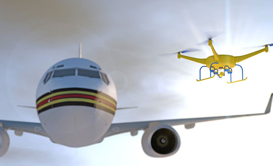
New risk-based “bow-tie” zones will help protect aircraft using PrecisionHawk’s Low Altitude Traffic and Airspace Safety (LATAS) platform.
DJI is improving its geofencing technology to refine the airspace limitations for drone flights near airports, providing smarter protection for airplanes in critical areas.
DJI has updated Geospatial Environment Online (GEO) Version 2.0, and will phase it in starting in November when the revised zones will take effect for airspace around airports in the United States. Upgrades in other regions will follow.
Image: DJI
The new system allows GEO to create detailed three-dimensional “bow-tie” safety zones surrounding runway flight paths, and to use complex polygon shapes around other sensitive facilities, rather than simple circles.
The new restrictions better reflect the actual safety risk posed in those areas, while allowing more flights to the side of runways where risk is substantially lower.
Runway exclusion zones. DJI’s new geofencing also incorporates the principles of Section 384 of the recently enacted U.S. Federal Aviation Administration (FAA) Reauthorization Act designating the final approach corridor to active runways at major airports to be “runway exclusion zones” for unauthorized drones. DJI customers should update their DJI GO 4 flight control app and aircraft firmware to ensure these improvements are implemented.
To obtain reliable geospatial information for the enhanced shapes in GEO 2.0, DJI has chosen a new data provider that can provide highly accurate details such as the exact locations of airport runways and facility boundaries.
PrecisionHawk’s LATAS. In North America, DJI will use data from PrecisionHawk Inc., replacing DJI’s previous geospatial data provider AirMap. Under a partnership agreement, PrecisionHawk’s Low Altitude Traffic and Airspace Safety (LATAS) platform will provide DJI customers with critical airspace information that will position them to fly safely in North America.
DJI will be able to refine airspace limitations for drone flights near airports, providing smarter protection for drones in critical areas and clarifying restrictions, PrecisionHawk said.
“PrecisionHawk has a corporate commitment to safely integrating drones into the airspace and enabling complex operations,” said Diana Cooper, senior vice president of policy and strategy at PrecisionHawk. “Through our work under the FAA Pathfinder Program, we have shown how technology can play a critical role in unlocking advanced operations, including beyond visual line of sight flight.”
GEO 2.0 Development. DJI first created No-Fly Zones for its drones in 2013 and introduced the more refined GEO system three years later, adding live updates and new zones for prisons and nuclear power plants, while providing flexible self-unlocking for professionals.
Both systems recognized that the overwhelming majority of drone pilots want to fly safely and responsibly, and want an easy-to-use guide to help them understand the airspace so they can do so.
Artist’s rendering of a no-drone sign near an airport. Image: PixOne/Shutterstock.com
To develop GEO 2.0, DJI collaborated with general aviation pilots through the Aircraft Owners and Pilots Association (AOPA) and with airports through the American Association of Airport Executives (AAAE) to incorporate their expertise and guidance about air traffic and airports into DJI’s new geofencing methods.
DJI geofencing uses GPS and other navigational satellite signals to automatically help prevent drones from flying near sensitive locations such as airports, prisons, nuclear power plants and high-profile events.
In certain locations, a DJI drone cannot take off or fly in a geofenced area without special authorization. Drone pilots with verified DJI accounts can unlock some areas if they have legitimate reasons and necessary approvals, but the most critical areas require special action from DJI to unlock them.
DJI has streamlined the approval process so professional drone pilots with authorization to fly in sensitive locations can receive unlocking codes within 30 minutes.
The GEO System. The GEO system previously geofenced a 5-mile circle around airports, with enhanced restrictions in a smaller circle encompassing the airport area.
GEO 2.0 applies the strongest restrictions to a 1.2 kilometer- (3/4 mile)-wide rectangle around each runway and the flight paths at either end, where airplanes actually ascend and descend. Less strict restrictions apply to an oval area within 6 kilometers (3.7 miles) of each runway.
This bow-tie shape opens more areas on the sides of runways to beneficial drone uses, as well as low-altitude areas more than 3 kilometers (1.9 miles) from the end of a runway, while increasing protection in the locations where traditional aircraft actually fly.
Artist’s concept of a drone approaching a commercial airliner. Image: PixOne/Shutterstock.com
Aviation Parameters. DJI’s new boundary areas around airport runways are based on the International Civil Aviation Organization’s Annex 14 standard for airspace safety near runways and the FAA’s Part 77 parameters for “imaginary surfaces” and air navigation obstructions.
DJI’s categorization of airports is based on traffic volume principles defined in statutes such as U.S. Title 49 section 47102, and the FAA’s criteria developed in 2012 for categorizing general aviation airports.
Using these aviation parameters, DJI has aligned its geofencing safety feature to broader understandings of airspace and airport risk. This chart demonstrates how GEO 2.0 applies those detailed, risk-based airspace boundaries to the airspace around airports that can be considered to involve relative high, medium, and low risk (see graphic).
LATAS. Through its work under the FAA Pathfinder Program, PrecisionHawk has shown how technology such as LATAS can play a critical role in unlocking advanced operations, including beyond visual line of sight flight. LATAS was tested under the Pathfinder Program to facilitate safe beyond visual line of sight operations.
LATAS brings a combined set of geospatial and software tools to the market. In addition to providing improved geospatial data, the LATAS platform features specialized display elements, including telemetry and access to the Harris real-time manned aircraft feed. Using these elements pilots can easily observe the relative altitude and horizontal separation of intruding aircraft and other mission-critical measures.
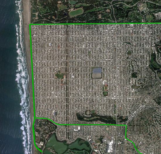
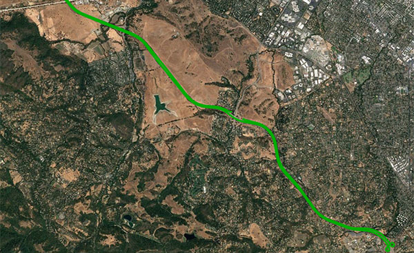
The mixed urban environment in San Francisco, where Starling + the TeseoAPP was tested and data collected and processed in real time. (Image: Swift Navigation)
The Starling modular and portable GNSS high-precision positioning engine leverages Swift’s Skylark Cloud Corrections Service. An advanced GNSS processing engine, Starling enhances measurements from commercially available GNSS receivers to provide true precision and integrity capabilities, the company said.
Starling is GNSS-receiver agnostic and works with a variety of automotive grade GNSS chipsets and inertial sensors, offering automotive companies choices in selecting the best components for their autonomous sensor suite, vehicle-to-vehicle (V2V) applications and automated driving systems.
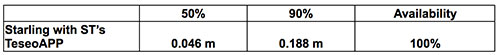
In a test drive in California, Swift showcased the integration of Starling onto ST’s Telemaco3P MPU-based modular telematics platform with on-board TeseoAPP, confirming the accuracy of the combined solution as a compelling offering for safety-critical autonomous-vehicle positioning when ST makes production TeseoAPP chipsets available in 2019.
Dull, dirty and dangerous — those used to be the jobs relegated to autonomous systems. But a decade-plus of improvement in sensor and computing technology has brought autonomy into the mainstream as a defining technology of the future.
At September’s ION GNSS+ conference, I attended a panel titled “Autonomous Cyber-Physical Systems — The Way Ahead.” I came away astounded by how much is changing, and how fast, because of autonomous CPS.
The panel was chaired by John Raquet of the Air Force Institute of Technology and Zak Kassas of the University of California Riverside. It featured presentations covering topics such as the Columbus Smart City Challenge (Dorota Grejner-Brzezinska, The Ohio State University), benefits of precision agriculture (Steve Rounds, John Deere), robotic teammates on the battlefield (Brett Piekarski, U.S. Army), and UAV design and certification (Demoz Gebre-Egziabher, University of Minnesota).
Autonomous cyber-physical systems (CPS) include unmanned aerial vehicles, self-driving cars and unmanned underwater vehicles. The panel addressed the state of autonomous CPS as well as challenges that need to be addressed as we integrate these systems into our environment.
Rather than discuss a specific application, Michael Veth, CEO of Veth Research Associates, tackled a difficult question: Just how much autonomy do we give machines?
“Rigorous risk assessment is the most critical component of machine-controlled autonomous systems,” Veth said. He said the scope of the machine’s autonomous decisions should be limited to the minimum necessary — in other words, avoid the scenario depicted in the movie WarGames.
Another rule: “Don’t put beta software on the street,” he said, recalling the Tesla autosteer system that resulted in a death. Instead, follow DARPA’s example, with its extensive sandbox testing.
Summing up his presentation, Veth provided five guidelines for developing autonomous machines:
Perform rigorous risk assessments;
limit range of action to the minimum required;
use generative models whenever possible;
train and evaluate using maximum available data; and
Mobile app creates new connections for the vehicle finance industry and extends the value of GPS to consumers.
Image: Spireon
Spireon Inc., the vehicle intelligence company, has introduced GoldStar Connect, a full-featured connected car mobile application that gives Buy Here Pay Here (BHPH) dealers and lenders the opportunity to increase customer loyalty and profitability.
As the newest addition to the GoldStar GPS solution suite, GoldStar Connect helps dealers and lenders recoup the cost of GPS, while also increasing value, convenience and safety for consumers, the company said.
The BHPH sector has long used GoldStar GPS to mitigate risk. Dealers and lenders rely on GoldStar to stay connected to their customers in order to facilitate payment collection, monitor default predictors, and streamline recoveries when necessary.
With the new GoldStar Connect mobile app, consumers now have access to all the benefits of connectivity — real-time location access, trip history, vehicle health alerts and recovery solutions for stolen cars — as an add-on at the time of purchase, the company added.
“In marrying the GoldStar solution with a consumer-facing mobile app, our dealer and lender customers not only improve asset management and protection, but also can offer their consumers a significant value add — modern connected car benefits regardless of the vehicle make, model and year,” said Reggie Ponsford, senior vice president of sales at Spireon. “We have had a number of larger BHPH dealers piloting the GoldStar Connect solution in the past few months and seeing up to 90 percent consumer sell-through.”
With GoldStar Connect, consumers gain a host of added benefits with their car purchase, including:
Safety and Security. GPS tracking and geofencing capabilities enable consumers to know the location of the vehicle at all times, helping to ensure the safety of the vehicle and the driver
Trip History. provides visibility to the activity of the vehicle by date, time and duration
Smart Alerts. consumers receive notifications of speeding, geofenced locations and battery condition directly to their mobile devices
Stolen Vehicle Recovery. an in-app recovery guide provides vehicle location data and instructions to assist in reporting and recovery of a stolen car
Insurance Discounts. Many carriers provide discounts of up to 15%
“Consumers want connected vehicle features and benefits, and the app helps dealers and lenders build customer loyalty while also driving additional revenue and margin,” continued Ponsford. “By bundling the purchase into the vehicle loan, it’s seamless and easy for dealers and buyers.”
“We’re excited to help our customers in the vehicle finance industry evolve their thinking about GPS from solely managing risk to now providing an opportunity to increase consumer loyalty and profitability,” said Brian Deeley, director of product management at Spireon. “The GoldStar solution is trusted by more BHPH dealers than all of our competitors combined. The addition of GoldStar Connect creates even more distance between Spireon and the rest, maintaining GoldStar as the GPS gold standard for BHPH.”
GoldStar Connect is now available and will be demonstrated in booth #208 at the National Alliance of Buy Here, Pay Here Dealers (NABD) Buy Here Pay Here Subprime Conference, Oct. 8-10, at the MGM Grand in Las Vegas. To book a demonstration at the conference, see Spireon at NABD.
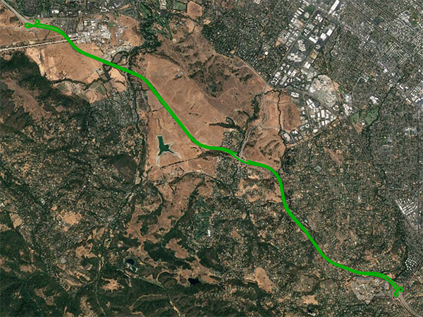
An open-sky freeway environment on Interstate 280 in California where Starling + the BCM47755 were tested and data collected and processed in real time. (Image: Swift Navigation)
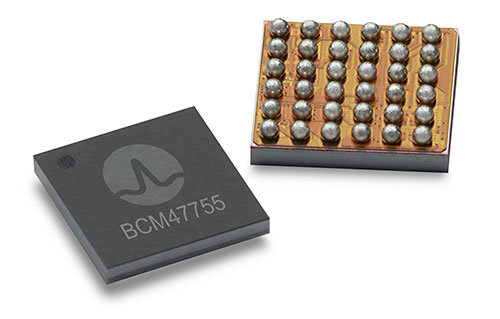
Swift Navigation has announced that its Starling positioning engine is available with Broadcom’s dual-frequency GNSS receiver chip, the BCM47755.
The new solution is capable of delivering centimeter accuracy with minimal power consumption and small footprint for rapidly expanding precise positioning applications, the company said.
The Starling Positioning Engine is a modular and portable GNSS high-precision positioning engine that leverages Swift’s Skylark Cloud Corrections Service. Platform independent, Starling is an advanced GNSS processing engine that enhances the measurements from commercially available GNSS receivers to provide true precision and integrity capabilities.
Swift’s Starling software is GNSS receiver agnostic and works with a variety of GNSS chips and inertial sensors. According to the company, Starling features multi-band, multi-constellation support to provide centimeter-level accuracy and supports the calculation of integrity outputs to provide absolute position, velocity and time (PVT).
Broadcom’s BCM47755 chip now works with Starling. (Image: Broadcom)
Swift showcased the integration of Starling with the Broadcom BCM47755 chip — the latest generation of Broadcom GNSS receiver chip — during a recent test drive in California. The synergistic benefits of integrating Starling with the BCM47755 measurement engine include low system-level power consumption and a smaller PCB (printed circuit board) footprint.
The successful integration illustrated the accuracy of the combined solution and forthcoming offerings for autonomous vehicles including unmanned aerial vehicles, robotics, asset tracking, fleet management and other applications requiring precise positioning.
The BCM47755 simultaneously supports GPS and GLONASS in the L1 frequency band or GPS and Galileo in both the L1/E1 and L5/E5a frequency bands, the company added. Starling combines the GNSS raw observations from the BCM47755 with corrections from Swift’s Skylark Cloud Corrections Service to deliver centimeter-level positioning.
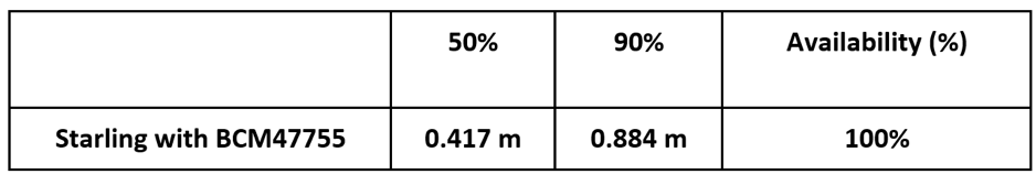
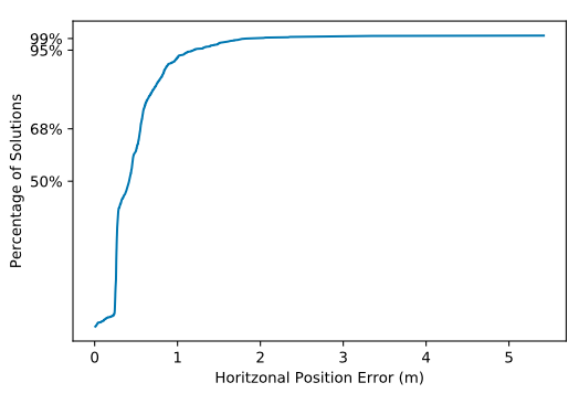
Horizontal Position
Horizontal CDF (Cumulative Distribution Function). (Chart: Swift Navigation)
“Broadcom is delighted to work with Swift in their integration of Starling and Skylark with our BCM47755,” said Vijay Nagarajan, senior director of product marketing for the Wireless Communications and Connectivity Division at Broadcom. “This is an exciting development for Swift and Broadcom, bringing together innovative hardware and software for the precise positioning market.”
“Swift has taken its mature Starling positioning engine that has long been powering Swift’s Piksi Multi and Duro receivers and made it interoperable with other industry leading chipsets to provide customers with a broader selection of precise autonomous navigation solutions,” added Samir Kapoor, executive vice president of engineering and product at Swift Navigation. “We are excited to offer an integrated solution with the Broadcom BCM47755 GNSS receiver chip.”
Evaluation Kit
Swift has developed an out-of-the-box evaluation platform for the combined Swift/Broadcom solution, called the Starling + BCM47755 Evaluation Kit, which will be available to order in the fourth quarter of this year.
The Evaluation Kit includes:
Starling Evaluation Board
Cortex-A7 Processor Running Starling Positioning Engine on Linux
Broadcom BCM47755 Chip
I/O – RS-232, Ethernet, USB, CAN
Supports SBP, NMEA and RTCM3 Protocols
Built in NTRIP Client
Built in Client for Skylark, Swift’s Cloud-Based GNSS Corrections Service
Dual Frequency, Multi-Constellation Antenna
External Cell Modem
Power Supply, Cabling and Accessories
Evaluation Kit Hardware Design Documentation, including Schematics and Layout
Evaluation Kit User Manual, Swift Console PC Application and Firmware Image
Integrity Monitoring of LTE Signals of Opportunity-Based Navigation for Autonomous Ground Vehicles
By Mahdi Maaref, Joe Khalife and Zak M. Kassas/University of California, Riverside
FIGURE 1. RAIM framework for LTE-based navigation without GNSS signals. (Images: Authors)
Proprietary receivers and navigation frameworks for autonomous ground vehicle (AGV) navigation with long-term evolution (LTE) cellular signals demonstrate meter-level accuracy with standalone LTE signals and lane-level accuracy with LTE signals coupled with other sensors (inertial and lidar).
As the number of systems that rely on cellular signals for navigation grows, the need for monitoring the integrity of their navigation solution becomes essential.
This paper proposes a receiver autonomous integrity monitoring (RAIM) framework for AGV navigation with LTE signals of opportunity. Experimental results evaluate the efficacy and accuracy of the proposed RAIM-based fault detection and exclusion technique, demonstrating a reduction of 22% in the position root-mean-squared error (RMSE).
FIGURE 1 demonstrates the RAIM framework: (a) When GNSS signals are unusable, LTE signals are used for navigation and integrity measures are calculated; (b) simulation results of downtown Riverside, California, where the black regions represent areas where multipath is expected to exceed 0.5 meters; (c) experimental setup; (d) environment and location of LTE towers; and (e) experimental results showing severe multipath being autonomously detected and excluded.
The estimation error represents the difference between the ground truth from an RTK GNSS-IMU system and our LTE-IMU system.
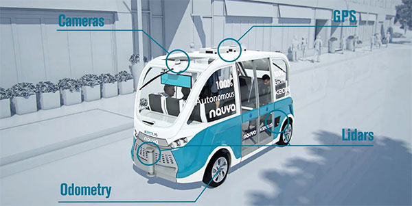
Keolis Canada and Montreal suburb City of Candiac have launched a long-term demonstration project of an autonomous electric shuttle on public roads in Canada. The shuttle will complement the public transit services currently available in Candiac.
The pilot project will take place over a period of 12 months, with about eight months dedicated to serving citizens.
This initiative was made possible through the financial support and expertise of the Quebec government and the collaboration of Propulsion Québec, the Cluster for Electric and Smart Vehicles and the Technopôle IVÉO.
Screenshot from Keolis Canada video.
The NAVYA autonomous shuttle will operate along a two-kilometer route between the park-and-ride lot and exo’s bus terminal and the intersection of Marie-Victorin and Montcalm North boulevards with several stops along the way, including City Hall, a retirement complex and local businesses.
The autonomous shuttle, which will coexist with regular traffic, will allow employees in the area to reach their workplaces from the bus terminal.
Along the route, the shuttle will go through a railway crossing and an intersection where it will communicate with four traffic lights. During the winter period, a research and development project, without passengers on board, will test how the autonomous electric shuttle adapts to Quebec winter conditions.
“This initiative is exciting because it’s the first pilot project in Canada, and the way it’s carried out will set the course for the next one,” said Marie Hélène Cloutier, vice president, Passenger Experience, Marketing & Sales for Keolis Canada. “For Keolis Canada, multimodal service is the key to the future of transportation. Autonomous electric shuttles are a great example of this because they complement existing services. The enthusiasm for this project has surpassed our expectations, which is very promising for the future.”
“We are extremely proud to be enabling Candiac residents to participate in this historic achievement,” said Normand Dyotte, mayor of Candiac. “It’s an outstanding opportunity for our citizens to be able to travel aboard the first-ever electric autonomous shuttle on a public road in Canada. We invite all public transit users and anyone who is curious or interested to come and try it now.”
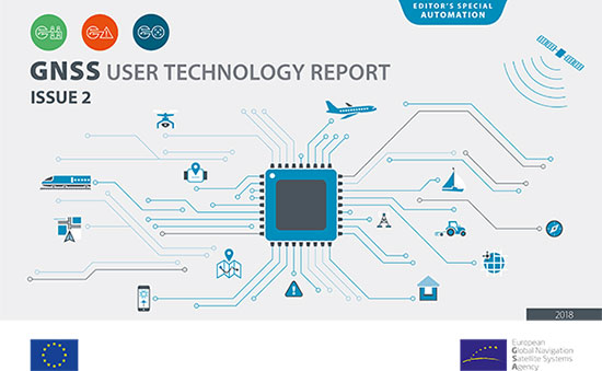
The second edition of the European GNSS Agency’s (GSA) GNSS User Technology Report has been published and is now available for free download, providing an exhaustive review of the latest GNSS trends and developments.
Since its launch in 2016, the GNSS User Technology Report has become the go-to-source for information on the dynamic, global GNSS technology industry.
The GNSS User Technology Report, a sister publication to the GSA’s GNSS Market Report, is published every two years and takes an in-depth look at the latest state-of-the-art GNSS receiver technology, along with providing expert analysis on the trends that will shape the global GNSS landscape in the coming years.
Three key segments
European GNSS Agency
Like the inaugural report in 2016, the second issue focuses on three key macro segments: mass market solutions; transport safety- and liability-critical solutions; and high precision, timing and asset management solutions.
The report opens with an overview of the latest developments and trends in GNSS, with a focus on the multi-constellation and multi-frequency that are driving new trends in the sector.
“With the GNSS User Technology Report, our aim is to provide everybody in the GNSS value chain with a comprehensive overview of the current landscape in the industry and to identify new trends so that stakeholders know in which direction the industry is moving,” GSA Executive Director Carlo des Dorides said.
“The most important new trend identified in this issue is the rapid adoption of multiple frequencies, including for consumer devices, as evidenced by the market introduction of the first dual-frequency smartphone in May 2018,” des Dorides said.
Editor’s special section: Automation
The final section in this year’s report — the “Editor’s special” section — is dedicated to automation and to the increasingly important role GNSS plays in a number of partially — or fully automated tasks and functions. The most publicised examples of these are found in the transport domain — driverless cars, autonomous vessels and drones but, as the report notes, GNSS-based automation applications go well beyond transport.
The analysis of GNSS user technology trends in the report is supported by testimonials from key suppliers of receiver technology, including: Broadcom, Javad, Kongsberg, Leica, Maxim Integrated, Meinberg, NovAtel, Orolia-Spectracom, Qualcomm, Septentrio, STMicroelectronics, Thales, Trimble and u-blox.
In addition, the report includes highlights from around 20 ongoing research projects from the Horizon 2020 and Fundamental Elements programmes, aiming at the development of GNSS receiver technology.
The full GNSS User Technology Report 2018 is available for download here.
GNSS User Technology Report 2018 Highlights
All global and regional GNSS constellations are developing, modernising and innovating, with more than 100 GNSS satellites now available over our heads.
The vast majority of current receivers are multi-constellation, and the most popular way to provide multi-constellation support is to cover all available constellations. Today only around 30% of receivers use GPS only.
In the mass market domain, we are seeing a divide between chipsets optimised for entry-level internet of things (IoT) products, where energy per fix is the primary driver, and high end, where the industry is innovating to propose enhanced positioning performance.
The need for accuracy in the mass market is initiating new solutions, including ones based on Android GNSS raw measurements or, more significantly, using multi-frequency signals.
The frequencies supported across all application areas range from single L1/E1 to 4 frequencies in the professional segment. The dual frequency solution showing the most growth is L1/E1 and L5/E5, however the legacy L1/E1 and L2 are still being used.
Growing interest has been observed in PPP and RTK services proposed by private industry and public system operators, leading to new PPP/RTK concepts aiming to address a wide customer base beyond high precision.
The need to ensure both safety and security of PNT solutions is being highlighted by all solution providers, particularly in systems where humans are out of the control loop, such as in autonomous vessels, cars or drones.
A roundup of recent products in the GNSS and inertial positioning industry from the October 2018 issue of GPS World magazine.
OEM
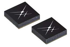
Anti-spoofing
Provides mitigation and reporting
Photo: Regulus
The Pyramid GNSS allows detection, mitigation and reporting of spoofing of the GNSS system, while still providing accurate positioning (jamming protection will be available in a future version). Version 2 of the Pyramid GNSS adds a software-only version, making it available to numerous applications and enabling GNSS to perform seamlessly under spoofing and jamming conditions. The device is designed for any system depending on GNSS navigation or precise timing, including cars, drones, ships, robots, financial institutions and stationary infrastructure, such as power plants and power grids. The Pyramid GNSS connects externally and integrates seamlessly with existing GNSS receivers, adding reliability and protection to the system. It offers full GNSS support including for BeiDou, Galileo and GLONASS.
Swift Navigation has upgraded the firmware of its flagship product — the Piksi Multi GNSS receiver. This marks the sixth major release to Piksi Multi since it was launched in February 2017. The upgrade is available free of charge to Swift customers. The firmware release also enhances Duro, the ruggedized version of the Piksi Multi receiver housed in a military-grade, weatherproof enclosure for long-term outdoor deployments. Firmware Release 2.0 for Piksi Multi and Duro supports two additional major satellite constellations — Chinese BeiDou (B1/B2) which, once completed, will contain 37 satellites, and Europe’s Galileo (E1/E5b), which will eventually consist of 30 satellites. Piksi Multi’s performance will further improve for future satellites. The addition of BeiDou and Galileo creates more robust positioning in a variety of challenging sky-view environments.
The G300D gyro is a three-axis, inertial rate system gyroscope. Measuring 0.67 cubic inches, it features low power and high speed, making it suitable for image stabilization applications. The G300D has message timing under 150 microseconds and output data rates up to 8 kHz with external sync. A micro-electro-mechanical gyroscope, it has an ARW of <0.0028 degrees/sec/√Hz and an option for both 24 and 32-bit LSB for exceptional resolution. Users can configure the G300D using a software development kit or through software protocols to simplify the integration process. The G300D gyro is non-ITAR.
Two new GNSS low-noise amplifier (LNA) front-end modules, the SKY65933-11 and SKY65943-11, integrate Skyworks’ proprietary TC-SAW filters. The modules are designed specifically for internet of things (IoT) applications including smartwatches, action cameras, drones, asset trackers and personal navigation devices. They are designed for wireless module and IoT device manufacturers, providing a turnkey GNSS connectivity solution in a compact form factor. Both solutions offer integrated pre- and post-filter LNA and matching to reduce printed circuit board (PCB) area versus a discrete implementation; single DC supply for design flexibility and simplicity; multi-GNSS compatibility to cover GPS, GLONASS, Galileo, BeiDou and QZSS receiver applications in the 1559–1606 MHz frequency range; extremely low leakage current (1 uA max) benefitting battery-powered IoT devices; and highly manufacturable and low-cost surface-mount technology in a 2.5 x 2.5-millimeter multi-chip module package.
The Net20 Pro provides high-quality data for users interested in the proximity and reliability of a reference station while eliminating real-time kinematic (RTK) corrections service charges. It uses multi-frequency, 555-channel technologies in a rugged casing to deliver accurate and effective positioning data even in harsh environments. It can be configured for correction data reception in client mode to calculate a fixed RTK position and to monitor the antenna position while continuing to work as a GNSS reference server. With NTRIP Caster software, the Net20 Pro provides superior connectivity with an unlimited number of mount points. Users can have permanent transmission of RTK corrections with a local internet connection. Its 32-GB internal and 32-GB external memory is enough for permanent recording even at a 100-Hz high data sampling rate. Its web user interface features upgrade, status and settings management as well as data downloading via smartphone, tablet or other internet-enabled device.
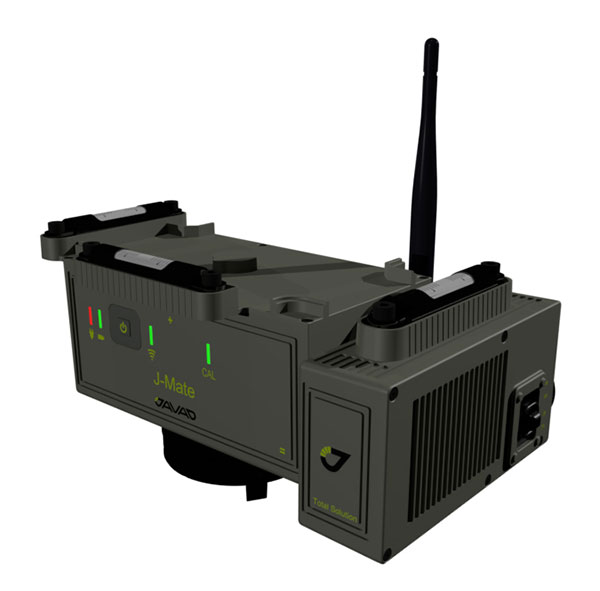
The J-Mate measurement module combines conventional measurement via laser scanning and photographic imagery with the multi-constellation location accuracy of the Triumph-LS receiver. It utilizes precision horizontal and vertical encoders for angular measurement, while the high-definition camera and laser module combine to locate the USB-powered target for accurate measurements. The target rests on top of the receiver and lights up for better visibility to the camera and sensor. The lighting power comes through the USB cord connected to the receiver. Coupled with the onboard data collector screen of the Triumph-LS, operation of the module is done visually with the LS mounted on top of the module or remotely on the J-Pod pole used for GNSS data collection. The module and software is also designed to be an efficient staking application.
The Trimble R10 Model 2 GNSS System is designed to help surveyors work more effectively by enabling reliable, fast and accurate data collection in the field. Enhancements in Model 2 include a custom Trimble survey GNSS ASIC with 672 GNSS channels including GPS, GLONASS, BeiDou, Galileo, QZSS and IRNSS as well as the full range of SBAS. It also will support planned GNSS signals. It has improved reliability against interference and spoofed signals, improved power management by 33 percent, and increased internal memory (6 GB) to store more than 10 years of raw observations. Support for Android and iOS platforms allow field crews to use their own mobile devices. The Trimble R10 Model 2 supports the recently released Trimble TSC7 controller and Trimble Access 2018 field software.
The TerraStar-C PRO correction service provides multi-constellation support, including GPS, GLONASS, Galileo and BeiDou. Combined with NovAtel’s OEM7 positioning technology, TerraStar-C PRO cuts initial convergence times by nearly 60 percent and offers 40 percent better horizontal accuracy than the current TerraStar-C service. In challenging signal conditions, it offers multipath, shading, interference and scintillation. High-rate TerraStar-C PRO corrections provide reconvergence in less than 60 seconds following brief GNSS signal interruptions. Corrections are generated using TerraStar’s proprietary global network of more than 100 GNSS reference stations. The data is delivered worldwide through overlapping geostationary satellites directly to a NovAtel receiver or via cellular IP network.
The C3UBE Command Center enables unmanned beyond-visual-line-of-sight (BVLOS) data collection and near real-time data streaming from almost any point within any critical infrastructure network. The mobile command and distribution center allows for the flight of unmanned aerial systems and is designed to not only allow AviSight to reach the maximum BVLOS distances permitted today, but also to expand its range for UAS operations as limits increase in the national airspace. In addition, it enables near-real-time transmission of data and imagery, which can be disseminated live to anywhere in the world via its proprietary distribution network located at Switch’s Tier 4 data center. It is aimed at the oil, gas, power, transportation and telecommunications sectors.
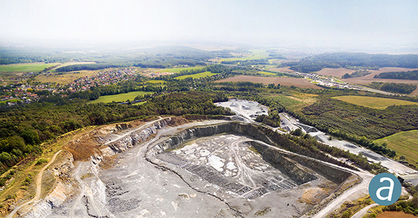
SimActive has updated its Correlator3D end-to-end photogrammetry software to include tools for users to generate precise statistics on mining activities, with improved volumetric calculation. The integrated tools allow users to generate precise statistics on mining activities. The Correlator3D software performs aerial triangulation and produces dense digital surface models, digital terrain models, point clouds, orthomosaics and vectorized 3D features. Applications like mineral extraction monitoring can be done seamlessly within the software. Users can process raw drone data, produce point clouds and DSMs, and perform volumetric calculations in the same Correlator3D workflow.
The improved TruPulse 360 laser features LTI’s TruVector 360° Compass Technology. The rangefinder measures slope distance, inclination and azimuth; instantly calculates horizontal and vertical distances; and calculates 3D missing line values. The enhanced device offers 33 percent increased distance accuracy, 25 percent better target acquisition and a higher azimuth accuracy of 0.5° root mean squared (RMS). Other features include reflectorless technology that enables data capture to any surface type; advanced targeting modes to achieve accurate, repeatable results of the intended target; seven-power superior optics technology that displays all measured and calculated solutions; and smart technology that recognizes adverse measurement conditions and prompts recalibration. Uses include forestry, utilities, construction and GIS mapping.
Synthetic aperture radar imagery from Maxar’s MDA RADARSAT-2 satellite is now available to SecureWatch subscribers. SecureWatch is DigitalGlobe’s powerful, cloud-based geospatial intelligence platform. The service has added the radar imagery to its high-resolution optical imagery, enabling defense and intelligence analysts to deliver actionable insights to decision makers regardless of weather and light conditions. The satellite will refresh hundreds of global sites on a weekly basis using a wide-ultra-fine format (3-meter resolution, 50-kilometer scene width). RADARSAT-2 imagery allows users to observe features and changes that go undetected using other imaging techniques, and provides day and night coverage regardless of weather. SecureWatch users can access timely RADARSAT-2 imagery using current subscription plans. When combined with 30-cm optical imagery, analysts will have a powerful and reliable toolset to make decisions with confidence.
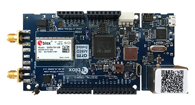
U-blox has introduced a toolset comprising the u-track software and the C030-R410M application board. The toolset is a rapid-prototyping platform that lets product designers test and optimize the position accuracy and power consumption of wireless location tracking applications that use LTE-M and NB-IoT cellular networks, as well as GNSS technology. The toolset targets product engineers working on battery-powered applications such as sport, people and asset trackers. An increasing number of battery-powered consumer and industrial products feature integrated GNSS receivers. These products include virtual reality headsets, smartwatches and devices to track elderly people, containers or parcels. With the ongoing roll-out of low power wide-area cellular networks (LPWAN) such as LTE-M and NB-IoT technologies around the world and the extremely low power consumption they enable, the range of use cases for wireless location trackers is expected to expand further. The u-track software runs from embedded firmware on the new u-blox C030-R410M application board. The board, specifically designed to rapidly prototype applications for the internet of things (IoT), includes an ultra-small, low-power u-blox ZOE-M8B GNSS receiver and a size-optimized SARA-R410M LTE-M/NB-IoT cellular communication module, and u-track includes a PC software application that lets users log, retrieve, and visualize power consumption, accuracy, and other important values, such as the GNSS time to first fix.
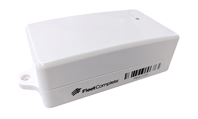
Add-on to AT&T Fleet Complete platform or for separate use
Photo: AT&T
The new GPS Asset Tracker One (AT1) from AT&T and Fleet Complete can track transportation as well as agriculture, food services, pharmaceuticals and emergency services. Users can monitor their assets through the Fleet Complete mobile app. Besides tracking location in near real-time, it also captures humidity, temperature, light exposure and more. AT&T’s nationwide LTE-M network is designed for devices that require low-cost, extended battery life, coverage underground and inside buildings, and carrier-grade security. Two high-capacity Lithium AA batteries power the AT1. They can last up to five years with a once-a-day use.
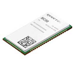
The MC90 is a quad-band GSM/GPRS/GNSS/Wi-Fi module that supports hybrid positioning technologies including GNSS, Cell ID and Wi-Fi aided positioning. It integrates the multi-GNSS system, including GPS, GLONASS, Galileo and QZSS, which makes it suitable for urban areas with high-rise buildings and complex environments. The MC90 also adopts Wi-Fi hotspot positioning technology for blind spots and satellite coverage. It integrates multi-aiding positioning technologies to offer customers with optimized GNSS performance. It also supports EPO technology, which provides predicted Extended Prediction Orbit to speed up TTFF without the need of an extra server. The MC90 features a compact design and lower power consumption, and supports dual SIM single standby function.
TomTom will offer free maps and traffic tiles on its mobile software developer kit (SDK) in both Android and iOS. With global coverage, the Mobile Maps SDKs and its free map tiles will guide developers of mobility and ride-sharing apps. The TomTom Maps APIs (application programming interfaces) also play a role in the internet of things, where traffic data is needed to enable self-driving cars and smart city planning.
MAGNET Inspect is designed for UAV data collection. (Photo: Topcon)
MAGNET Inspect software is designed to facilitate the data-processing workflow for UAV (unmanned aerial vehicle) infrastructure inspection by efficiently managing large UAV data sets to create inspection reports. It allows operators to visually navigate UAV photos, aligning 3D reality meshes with raw georeferenced images in one location and filtering them based on selected criteria including field of view. When combined with Intel Falcon 8+ Drone – Topcon Edition and Topcon ContextCapture, powered by Bentley Systems, the software enables operators to navigate, annotate and create reports with inspection photos, creating a strong end-to-end inspection workflow.
Site Scan Esri Edition is a custom version of the Site Scan iOS app for drone flight planning and data capture that works seamlessly with Esri’s ArcGIS Online and Drone2Map for ArcGIS. The Site Scan Esri Edition app complements Esri’s Drone2Map for ArcGIS software by providing full drone project mission planning and a simple workflow for transferring drone captured data into Esri ArcGIS. Users will be able to connect to ArcGIS Online with an Esri sign-in. The app will allow users to directly use Esri data layers from ArcGIS Online as base and reference data for their drone flight planning mission. Esri customers can use any drone supported by Site Scan, including a variety of DJI drones. Site Scan also supports a custom version of the new Yuneec H520 commercial drone by 3D, which is based on the Dronecode PX4 software and designed to be an open and secure drone option for use on U.S. government projects.
UAS mission-planning software company UgCS has joined with disaster response expert Airborne Response to develop a comprehensive search capability for drones. The search-pattern software, a new feature of the UgCS platform, allows remote pilots to more effectively conduct search-and-rescue operations. Customizable search patterns such as the “expanding square” and “creeping line” can be deployed. Based on the flight altitude input by the operator, the UgCS software will automatically calculate the course heading and track spacing necessary to provide the prescribed coverage area for a search target. UgCS software allows central management of all types and manufacturers of unmanned vehicles, enabling a user to control one or a fleet of drones on a single mission in multi-operator mode and multi-platform environments. Airborne Response will offer the UgCS mission planning software and associated training to public safety and emergency response professionals throughout the U.S.
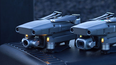
The Mavic 2 Pro is designed for professionals, aerial photographers and content creators. With a folding design, the Mavic 2 is a powerful platform with new gimbal-stabilized cameras and advanced intelligent features like Hyperlapse and ActiveTrack for easier and more dynamic storytelling. Flight time is 31 minutes. Co-engineered in partnership with Hasselblad, the Mavic 2 Pro houses a 1-inch CMOS sensor with a 10-bit Dlog-M color profile. It can capture 20-megapixel aerial shots with utmost color accuracy using the Hasselblad Natural Color Solution (HNCS) technology, while an adjustable aperture from f/2.8-f/11 provides control across a wide variety of lighting conditions.