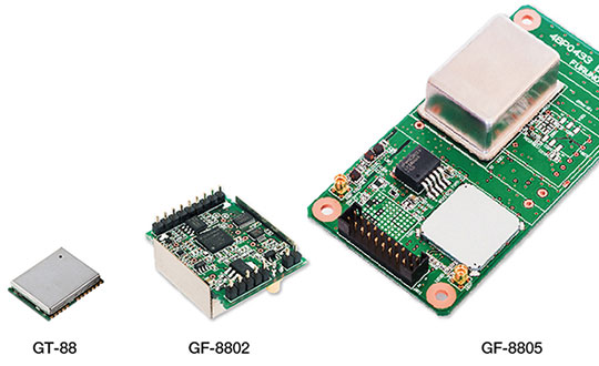
Furuno Electric Co. Ltd., based in Nishinomiya, Japan, has developed the GT-88 timing module and GF-8801/02/03/04/05 disciplined oscillator for users who require UTC time-synchronized signals to meet the new 5G requirements.
They provide UTC time-synchronized timing signals (1 PPS/10 MHz) by receiving GNSS satellite signals. Achieved stability is better than that of an atomic clock, including a rubidium.
Photo: Furuno
The GT/GF-88 series includes a brand-new algorithm, named Dynamic Satellite Selection, that provides outstanding multipath mitigation, especially in urban canyon environments, the company said. The algorithm was developed by Nippon Telegraph and Telephone Corporation (NTT) based in Tokyo, Japan.
Extremely high stability of 4.5 ns (1 sigma) is obtained, only requiring reception of the L1 band (1575.42 MHz) frequency GNSS satellites. It was achieved by improving advanced position estimation algorithms and optimizing position calculation among several different GNSS satellite constellations. It allows users to achieve 5G-required performance without any changes to existing single-band GNSS antennas.
It incorporates the Dynamic Satellite Selection, an advanced multipath mitigation algorithm developed by NTT. Normally typical time synchronization performance deteriorates in urban canyon environments by the effect of multipath. The Dynamic Satellite Selection reduces this time error by one-fifth. This provides more flexibility when installing GNSS antennas. Consequently, the GT/GF-88 series now permits GNSS antennas to be mounted on walls, windows of tall buildings and other difficult reception environments.
The GT/GF-88 series continues to support GPS, GLONASS and QZSS satellite constellations, and now adds Galileo support. As the total number of satellites available increases, operational stability also increases.
Senators Joni Ernst (R-IA) and Tammy Duckworth (D-IL) joined Representatives Dave Loebsack (D-IA) and Don Bacon (R-NE) in launching the Congressional GPS Caucus in March. This bipartisan, bicameral caucus will elevate the ever-increasing importance of GPS technologies to the U.S. economy and infrastructure. As evidence of that, today more than 3.3 million jobs in the United States rely heavily on GPS.
Agriculture is front and center in the states and districts these policymakers represent, and the cost savings as well as jobs and family incomes are noteworthy. Nationwide, GPS has led to $8.2 billion in savings through precision agriculture, while yielding increases in grain production across the country. Further, GPS has become an indispensable and reliable part of the country’s national infrastructure. Public and private investment in GPS-based technologies and services have produced a steady stream of innovations, making the U.S. a global leader in the sector.
The GPS Caucus will prioritize ensuring GPS signals remain continuously available, accurate, reliable and resilient. To better support the long-term health and future of GPS, the caucus plans to host educational briefings and technology demonstrations, in addition to advocating for policies that keep GPS at the forefront. On April 2, these efforts will kickoff with a “GPS 101” educational briefing on the Hill featuring remarks from Senator Duckworth, Representative Loebsack, Colonel Curtis Hernandez, US Air Force Director National Security Space Policy, National Space Council and industry leaders from Deere & Company, Garmin and Trimble.
To further reaffirm the critical importance of GPS, the GPS Caucus introduced concurrent resolutions in both the Senate and House. The resolutions outline the economic benefits of GPS, totaling more than $68 billion to the U.S. economy each year, and the sectors GPS technology supports, none of which would be possible without the contributions made by the men and women of the Air Force who maintain the GPS constellation.
As efforts to advance 5G, precision agriculture and smart cities continue, GPS will only become more valuable to modern-day operations and it remains critical that policymakers, companies and industry leaders alike, foster policy that keeps GPS at the forefront.
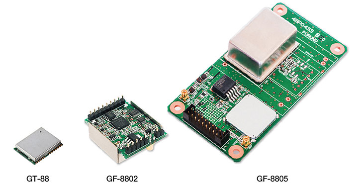
Skyworks Solutions Inc. has launched the Sky5 Ultra, an advanced 5G cellular architecture.
The fully integrated, baseband agnostic solution combines all of the critical front-end functionality required to enable high-performance 5G mobile devices with global coverage in a compact form factor.
Graphic: Business Wire
The comprehensive platform features transmit and receive capabilities with high efficiency and output power, enabling reliable network connections while optimizing battery life — both critical for 5G applications.
In addition, the Sky5 Ultra leverages DSBGA packaging to reduce the footprint and advanced TC-SAW and BAW filtering to provide the best performance at each targeted frequency band.
The solution also supports up to 100-MHz wide bandwidth, maximizing data throughput at ultra-fast speeds.
5G rollouts have already begun and will continue to ramp over the next few years. According to the Global Mobile Suppliers Association, 11 worldwide operators have announced limited 5G service launches and seven additional operators have turned on 5G base stations, with commercial services to follow.
“With industry momentum accelerating towards 5G, Skyworks is leading the way with the technological innovations and systems expertise demonstrated by our Sky5 portfolio, a highly flexible and customizable suite designed to meet customers’ global requirements,” said Joel King, senior vice president and general manager of Mobile Solutions at Skyworks.
“Sky5 Ultra represents another breakthrough in simplifying the growing complexity of 5G device development — delivering unmatched performance while expediting deployment through full integration and optimized form factors. We are empowering top mobile device manufacturers and network providers with complete, turnkey solutions that will ultimately bring 5G to realization,” King said.
About Sky5 Ultra
Sky5 Ultra incorporates Skyworks’ high-efficiency transmit, diversity receive (DRx) and MIMO modules with industry-leading noise figure and low insertion loss, in addition to an array of aperture tuners and antenna swap switches for optimal antenna management.
Like all Sky5 solutions, the comprehensive front-end platform supports new 5G NR waveforms and spectrum in addition to enhanced carrier aggregation and 4G/5G dual connectivity, while delivering exceptional levels of integration and performance. Functional core blocks include:
Primary Transmit (Global)
SKY5-8255 – Dual-chain N77/N79 ultra-high–band power amplifier with integrated low noise amplifier and filters (LPAMiF)
SKY5-8254 – N41 high band power amplifier with integrated filter (PAMiF)
SKY5-8265 – Mid-/high-band power amplifier with integrated low noise amplifier and duplexers (LPAMiD) with DSBGA packaging
SKY5-8211 – Low-band LPAMiD
SKY5-8212 – Low-band LPAMiD with DSBGA packaging
SKY77365 – Global system for mobile communications (GSM) power amplifier
SKY13725 – Low band DRx module with DSBGA packaging
SKY13726 – Mid/High band DRx module with DSBGA packaging
SKY13727 – Mid/High band MIMO module with DSBGA packaging
SKY5-3728 – Ultra high-band N77/79 DRx/MIMO module with SRS support
Antenna Management
SKY5-9269 – SP4T 80v aperture tuning and RF distribution switch
SKY5-9256 – 4 x SPST 45v aperture tuning switch
SKY5-9699 – DPDT antenna swap switch
At Mobile World Congress, Skyworks representatives are in the Executive Meeting Area in Hall 2, 2G3Ex and 2G5Ex.
Advanced AI, robotics and autonomous vehicle services on Sprint’s dedicated IoT network will adapt to the real world using highly accurate, detailed and constantly refreshed maps.
Sprint and Mapbox are launching precision mapping technology with Curiosity IoT, allowing automated services that run on Sprint’s dedicated internet of things (IoT) network to move around the ever-changing world with pinpoint accuracy.
Smart machines, from drones to autonomous delivery carts, will be able to make fast location and routing decisions using highly detailed, accurate maps that are updated as the environment changes.
Sprint made the announcement this week at the Consumer Electronics Show being held in Las Vegas.
High Accuracy and Precise Detail with Live Maps. Mapbox offers what it calls a “live map”, a map built not from traditional data surveys months or years before, but from data collected from hundreds of millions of location-enabled sensors that feed back information about the world in real time.
Mapbox uses artificial intelligence (AI) to turn those massive data flows into a picture of real time transit paths that can be used for precise, up-to-date routing.
Image: Mapbox
Through its relationship with Sprint, Mapbox will leverage the inherent advantages of Curiosity IoT with 5G to take mapping to the next level. The network’s extreme bandwidth and low latency will allow Mapbox to collect higher volumes of richer data from the sensors, including high resolution video.
That data can be processed to identify and detect changes in the physical environment. Those changes are then incorporated into updated maps which can be distributed at scale to a wide variety of smart machines. The result is more accurate, more up-to-date maps that reflect the world in real time.
“Smart machine-based services need to be able to make immediate mobility decisions similar to the way a driver might react to construction, traffic or other obstacles on a street,” said Ivo Rook, senior vice president, IoT and product development at Sprint. “The launch of Mapbox’s precision mapping technology allows all intelligent machines to move at a level of precision never seen before. Our fully dedicated Curiosity IoT network and operating system — soon to be powered by Sprint’s mobile 5G connectivity makes this possible. From autonomous vehicles to advanced AI-based machines, precision mapping is a big step forward in making smart service models a reality for the immediate economy.”
“As maps guide new smart machines on IoT networks, you remove the human in the middle that used to compensate for differences between the map and the real world. Precision mapping services need to reflect the world as it is, at that precise moment so that those smart machines can travel safely and efficiently,” said Eric Gundersen, CEO of Mapbox. “Sprint’s Curiosity IoT network with mobile 5G provides platform services that make that real with high bandwidth, edge computing for object detection and data processing and super low latency.”
Curiosity IoT with 5G. Sprint 5G and Curiosity will create the new standard in IoT which features device data intelligence, over-the-air device management and chip-to-cloud security, the companies said.
When coupled with Sprint mobile 5G technology, Curiosity IoT’s dedicated, distributed and virtualized IoT core network is capable of supporting artificial intelligence, robotics, edge computing, autonomous vehicles and other IoT systems requiring extreme low-latency and high-bandwidth.
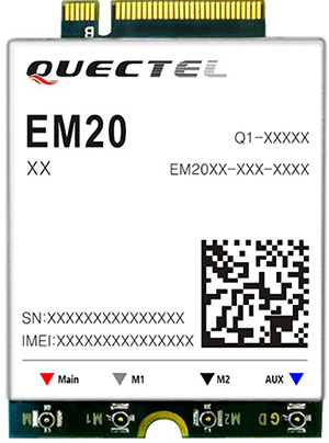
Quectel Wireless Solutions has launched the EM20, an LTE Advanced Category 20 module with location.
The EM20 will debut at Quectel Stand #2115 during the Consumer Electronic Show taking place Jan. 8-11 in Las Vegas.
EM20 offers the maximum LTE throughput of 2.0-Gbps downlink and is optimized specially for Laptop, PC and high-speed industrial internet of things (IoT) applications, the company said.
The EM20 features Qualcomm IZat location technology Gen8C Lite (GPS, GLONASS, BeiDou, Galileo and QZSS). The integrated GNSS greatly simplifies product design, and provides quicker, more accurate and more dependable positioning capability, Quectel added.
Based on Qualcomm’s SDX24 chipset and fully compliant with 3GPP R13 specification, EM20 supports LTE wireless technologies such as up to 7 Carrier Aggregation (CA), 4×4 MIMO technology, 256-QAM as well as LAA (LTE Assistant Access) and CBRS (Citizen Broadband Radio System).
The new module supports FDD LTE frequency bands of B1/B2/B3/B4/B5/B7/B8/ B12/B13/B14/B17/B18/B19/B20/B25/B26/B28/B29/B30/B66 and TDD LTE bands of B38/39/B40/B41/B42/B43/B46 (LAA)/B48 (CBRS). This ensures that IoT devices with EM20 inside can operate on networks of nearly all the mainstream carriers worldwide.
Designed in M.2 form factor and measuring 42.0×30.0×2.3mm, EM20 is compatible with Quectel’s broad portfolio of LTE Advanced products including Cat 16 module EM16 and future 5G modules, which allow for smooth migration between different categories and to next-generation connectivity.
The EM20 is designed for ultra-high-speed laptop, PC, router, industrial gateway, in-vehicle video surveillance system, cloud-based 4K IP-camera and similar applications that require high throughput and low latency.
Rohde & Schwarz and Huawei have successfully conducted cellular-based 5G V2X latency measurements in vehicular environments in field tests in Munich and Shanghai.
In a joint project between Huawei and Rohde & Schwarz, a precision end-to-end delay measurement system for over-the-air IP transmissions was applied to 5G V2X communication for cooperative driving applications in field tests in a moving car.
The precision absolute time standards on both ends were derived from two independent GPS receivers.
URLLC will enable automated driving. (Image: Rohde & Schwarz)
The initial measurements show that it is possible to achieve delays in the millisecond regime in a 5G network, demonstrating superior latency performance in comparison to LTE.
One of the key use cases of 5G is ultra-reliable low-latency communication (URLLC). Important for advanced vehicle-to-X communication use cases, URLLC will enable automated driving in the future.
A measurement accuracy below 2 µs for each transmitted IP packet was demonstrated. The transmitted data contained various IP traffic streams including video, lidar and control data (ITS messages) for a tele-operated vehicle.
While the trial in Munich was related to a tele-operated driving project, the tests in Shanghai were related to a platoon V2X testing site, where a number of vehicles traveling together are electronically connected via wireless communication.
The delay for transmission of one IP packet from source over-the-air to a (moving) receiver (sink) needs to be measured, spanning all delays introduced by the radio transmitter, propagation delay and radio receiver from/to IP packet level.
As latency is one of the key performance indicators of 5G and crucial for safety applications, such measurements could become an important criterion for future certification testing.
“We are delighted to collaborate with Huawei to contribute with our test and measurement expertise to 5G technology development,” said Andreas Pauly, executive vice president, Test & Measurement at Rohde & Schwarz. “With a strong global footprint in the telco ecosystem and close cooperation with partners, Rohde & Schwarz is committed to further expanding our innovative test and measurement solutions to new automotive applications.”
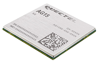
Quectel Wireless Solutions has launched the automotive-grade C-V2X module AG15, which features the Qualcomm 9150 C-V2X chipset solution from Qualcomm Technologies, a subsidiary of Qualcomm Incorporated.
Image: Quectel
The module is now sampling to the automotive industry for the development of commercial C-V2X products.
The AG15 C-V2X module is manufactured in accordance to IATF 16949:2016 quality management system standard for the automotive sector, and it fully complies with the automotive product quality processes, including APQP and PPAP.
Pairing with the Quectel automotive-grade LTE module AG35, Quectel’s AG15 is designed to meet the telematics and vehicle-to-everything (V2X) connectivity requirements of the next-generation automotive applications, such as autonomous driving and road safety.
Also known as LTE-V2X, C-V2X is the V2X communication technology based on the globally recognized Third Generation Partnership Project (3GPP) Release 14 specifications. The PC5-based direct communication mode of C-V2X supports vehicle-to-vehicle (V2V), vehicle-to-infrastructure (V2I) and vehicle-to-pedestrian (V2P) communications on the 5.9-GHz intelligent transport system (ITS) spectrum.
In addition, C-V2X paves a strong evolution path toward 5G new radio (5G NR) and plays an essential part of the future of safe autonomous driving with its capabilities including non-line-of-sight (NLOS) sensing to support high-speed mobility and high vehicular density deployments, the company said.
For positioning function, the AG15 features a built-in multi-constellation high-precision GNSS (GPS/GLONASS/BeiDou/Galileo/QZSS) receiver, with additional support from satellite-based augmentation systems (SBAS) and Qualcomm 3D dead-reckoning technology, which greatly improves the positioning accuracy and speed while simplifying customer designs.
Based on C-V2X technology, the Quectel AG15 module adopts the 3GPP Release 14 C-V2X PC5 protocol. It is designed to allow low-latency, highly reliable and highly dense data exchange between vehicles and their surroundings, enabling effective information sharing among road users in avoidance of collisions, thus improving automotive safety, automated driving and traffic efficiency.
Without the need for a subscriber identity module (SIM), cellular subscription or network assistance, the C-V2X direct communication mode helps reduce complexity and cost for customers.
Additionally, the Qualcomm 9150 C-V2X chipset solution has a built in A7 application processor (1.5 GHz), which could be potentially utilized to run ITS stack and associated C-V2X applications.
“We are very pleased to introduce our first batch of automotive grade C-V2X modules based on the Qualcomm 9150 chipset solution. Automated driving has unique requirements for V2X connectivity, such as lower latency, higher reliability and wider bandwidth, all of which could be addressed by C-V2X technology,” said Patrick Qian, CEO of Quectel. “Built upon Quectel’s expertise in connected vehicles and Qualcomm Technologies’ high-performance C-V2X chipset solution, the AG15 module is expected to help automakers and Tier 1 suppliers to effectively accelerate their efforts towards automated driving.”
“Quectel is a global leader in cellular modules with rich experience in commercial automotive products,” said Nakul Duggal, vice president of product management, Qualcomm Technologies. “We are pleased to work closely with Quectel again to support its modules with our 9150 C-V2X chipset solution to help create safer and more efficient V2X solutions and to help empower road safety and autonomous driving. We look forward to working with Quectel in delivering the solutions required to address the needs of the next generation automobiles.”
Regular readers of GPS World are aware of many of the rapidly developing technologies and navigational systems being created around the world, but often the everyday surveyor shows up late to the party.
While smartphones get the most mainstream media coverage, other navigational devices and measurement systems are adapting to evolving technical breakthroughs and new methods of transmitting a variety of data wirelessly.
This month’s article looks at the increase in satellite navigation networks along with the rollout of 5G cellular technology. Both advancements will benefit the surveying community; to start, I’ll explain what this means for accuracy and precision of survey measurements as well as productivity.
Everybody gets a constellation! (with apologies to Oprah)
I’ve been known to wax poetic in this column about my admiration of GNSS technology, and I continue to marvel at the “accidental” civilian use of a military tool. This method of measurement and navigation continues to expand, refine and transcend everyday life, and surveying is no exception.
The satellite constellation is the mainstay of this navigational system. The United States began the charge several decades ago, but other nations are quickly catching up. Let’s look at the current constellations and their status.
Operational Systems
GPS (United States)
GLONASS (Russia)
Galileo (European Union)
Beidou (China)
QZSS (Japan)
IRNSS (India)
Chart: GPS World
There are now more satellites. What’s the big deal?
The addition of these constellations provides large gains for the surveying community in several different ways.
First, the additional satellites mean more signals to help with the mathematical equations necessary for positional determination. While traditional surveying in the general public’s eye is associated with measurements on the ground, our expansion of services into the air and water relies heavily on GNSS determined positions.
No matter what type of remote sensing equipment is being used (lidar, photogrammetric, sonar, etc.), positional determination for most of those sensors are derived from GNSS-based receivers. Add to these measuring methods the ability to perform operations via remote-controlled or autonomous vehicles in both air and water, and the availability of additional satellite signals enhances the reliability of GNSS-derived data and attributes.
Second, by having more satellite signals to utilize, GNSS receiver manufacturers can improve the software for processing the positional information with greater certainty of accuracy.
Before the introduction of additional constellations and receivers with expanded signal reception, GNSS users relied on less sophisticated software to identify potential “bad” signals that would lead to incorrect positions. While the software generally provided reasonable reliability, it was not foolproof and occasionally would allow bad data to be accepted.
Like most everything tech-related, however, the GNSS industry has benefited from increased computing power to go along with the additional satellite constellations. The latest GNSS receivers can accept well over 500+ signals from a variety of sources (including land-based transmitters). The software used to reduce all that data has increased in complexity along with number of those data sets.
Complex computations that were once limited to mini-computers or even mainframes are now being completed on handheld data collectors in minuscule timeframes compared to their predecessors.
The software has also been enhanced to analyze the data in real-time, compute the likely position of the receiver and notify the user of potential incorrect or “spoofed” data from any number of satellites.
Considering that many of the remote-sensing sources now collect millions of points based upon one GNSS-based position, the need for increased positional verification has become a critical issue. By having many more constellations to provide signals for positional data, the percentage of establishing a correct location for each data point has increase significantly.
The improved computing power and verification ability of today’s GNSS software is helping to eliminate errors in positional accuracy and instill more confidence in the surveyor’s data collection activities.
Add to these additional constellations the planned installation of more land-based signal providers to augment or provide a backup plan for satellite systems, and it’s clear that the future is quite bright for GNSS-based receivers and data collection for everyone — especially the surveying community.
The history of wireless communication
While surveyors marvel at the advancements of GNSS-based measurement, it pales in comparison to the rapid growth of modern technology with cellular devices. Notice I didn’t write cellular phones, as the technology has quickly established itself as much more than voice communication. Before we lay out the future of cellular data networks, let’s take a step back and see how this type of communication has revolutionized GNSS-derived data collection for surveyors and others.
Two-way, CB and shortwave ham radio
1947 two-way radio advertisement. (Image: Motorola)
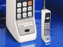
The technology behind wireless communication goes back several decades, but didn’t become a mainstream system until the late 1970s and early 1980s. Motorola is known as the early force behind the two-way radio system, but the base and remote transmitters were not cost effective for small businesses. This type of system was also limited to single-purpose radios with individual crystals wired within that only allowed specific frequencies to be transmitted.
Another type of communication used by some was the citizens band radio, affectionately referred to as CB radio. This radio was limited to 40 channels and didn’t allow for private transmission between two parties. During the 1970s, the use of the CB radio was not limited to long-haul truck drivers — many people used the medium for basic communication.
Vintage CB radio ad from Radio Shack. (radioshackcatalogs.com)
Telephone service during these times was still costly and long-distance calls were not cost-effective, so many found the CB radio as an alternative to conventional phone service. Looking back now, it is not a stretch to classify this type of broadcasting as a primitive social media precursor to today’s methods but limited to live chats and no visuals.
Another method of transmission was short-wave radio. This system was like two-way radios with an established base transmitter, but broadcast on public frequencies over greater distances than CB radios. One of the big drawbacks was the upfront costs, which were much more significant than the other radios. Even more expensive was outfitting a vehicle with a shortwave system, so cost was the biggest limiting factor for this mode of communication.
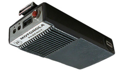
Pagers of all shapes and sizes
Motorola’s Pageboy pager. (Photo: Motorola)
The popularity of telephone-based pagers didn’t hit its zenith until the early 1990s, but the technology and actual use dates to the early 1960s. The first commercial pager was produced by Motorola in 1964 and called the Pageboy. There was no screen or display; the user was notified by a variety of tones preset for distinct situations or needs. As this technology advanced, variations in screens, message types and even two-way communication became possible.
By 1994, there were more than 60 million pagers in use, but a change was in the technological wind; cellular phones were marching toward the mainstream.
While the concept of wireless telephone communication existed in several laboratories around the world for years, the first big breakthrough was made by researcher Martin Cooper, who developed a prototype cellular device for Motorola in the early 1970s. He famously made the first public cellular phone call on April 3, 1973, to Joel Engel, head of research at Bell Labs, during a walk in New York City. Cooper and Engel were engaged in a rivalry to develop the first commercially available cellular phone with the Motorola DynaTAC prototype being the first to make a successful call.
However, the rush to get cellular phones to market took longer than anticipated. It wasn’t until the introduction of the Motorola DynaTAC 8000 in 1983 (available to the public in March 1984) that the reality of wireless phones came to life. The cost of wireless freedom came at a price: $3,500 for a brick-sized phone that took 10 hours to charge for 30 minutes of use. The cost of the service was also expensive due to the limited cellular infrastructure.
The next decade brought us expanded cellular coverage along with miniaturization of phone; each subsequent model provided more features and longer battery life. From the Nokia “candy bar” to the Motorola Razr, the cellphone era had engulfed the mainstream, but more changes were ahead for mobile communications.
The late 1990s saw the introduction of the cellphone as a computer modem, with limited email connectivity and primitive internet browsers built into the operating systems. But like many electronic technologies that came before, the cellphone would begin a radically different life in the mid-2000s.
Enter the smartphone to help us dummies
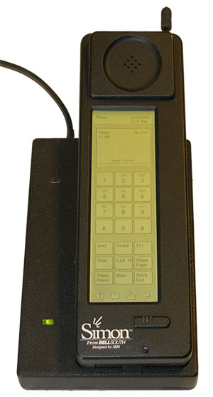
The IBM Simon Personal Communicator and charging base. (Photo: IBM/public domain)
Officially, the smartphone has been in existence since 1992 with the creation of the Simon Personal Communicator from IBM. At a cost of $1,100, with a monochrome screen that was 4 ½ x 1 ½ inches, the Simon allowed the user access to email and faxes (remember those?) along with the phone function — but users had to make it fast; the battery only lasted an hour. IBM sold 50,000 of these units before pulling the plug on the project, but it started the trend toward mobile telephones with a graphical interface and extended uses beyond the standard verbal communications.
Just like the Apple Newton was the failed precursor to the Palm Pilot, various tablets and eventually today’s smartphone platform, the Simon broke ground and established new directions for future communication.
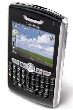
The early 2000s introduced us to the Blackberry personal digital assistant (PDA) and phones from Research in Motion (RIM), a small electronic communications company from Ontario, Canada. RIM started small with a two-way paging system that became popular in Europe and quickly morphed into cellular devices that worked on the DynaTAC network used by Motorola.
A recent model Blackberry PDA. (Photo: Blackberry)
By the mid 2000s, their devices became affectionately known as the “Crackberry” as users became addicted to the functions and capability of this communication tool. These devices were popular with business users as the security encryption was considered more effective than any of the other communication apparatuses of the day.
By 2009, Blackberry had reached the zenith of the mobile device market (second only to the conventional mobile-phone platform dominated by Nokia) but began a rapid decline due to proliferation of the next big thing — the touchscreen smartphone.
After Apple’s introduction of the iPhone in 2007, followed by a crowd of Android-powered phones in 2008 and beyond, Blackberry’s market share has been reduced to a small niche group.
And now, why this relates to the surveyor…
The rollout of Steve Job’s dream of combining Apple’s industry-defining iPod with mobile phone capability revolutionized not only the way we communicate — it has redefined our everyday environment. Many of the tasks we accomplish every day have been incorporated into a smartphone application, which brings us back to the reason this article is directed at surveyors: the device that hangs on your belt or rests in your pocket is revolutionizing the way today’s surveyors work.
Not that long ago, the only navigational devices available were large, expensive and difficult to use. Now, nearly everyone owns a device with GNSS capability. When we combine the ever-expanding number of devices along with the increased coverage of GNSS satellite constellations, the ability to georeference any piece of data to greater precision and accuracy is improving.
Surveyors need to embrace this technology within their smartphones to increase their efficiencies. At the same time, we need to help educate the public on why having better smartphone location capability doesn’t mean the masses can perform their own boundary analyses. For more information on this subject, see the GPS World July 2017 article.
Surveyors should embrace the smartphone as an important tool; the introduction of new survey-grade GNSS receivers that use an app for the user interface will soon become commonplace.
Several GNSS manufacturers have introduced receivers that exclusively use a smartphone and app for data collection, eliminating the need for a dedicated (and usually proprietary) data collector for obtaining centimeter-level location data. I’m not advocating that the surveying community throw their existing systems in the trash in favor of these newer receivers, but the data-collection techniques utilized by smartphones can increase efficiency and reduce equipment costs.
The Mi 8 smartphone offers dual-frequency capability. (Image: Xiaomi)
Another reason to pay attention to the smartphone as a location tool will be the expanded use of dual-frequency chipsets to provide even higher accuracies. One of the fastest growing phone makers worldwide is Xiaomi, based in Beijing, China, which introduced the Mi 8 phone with a dual-frequency GNSS chip. This chip frequency reception (E1/L1+E5/L5) is targeted to embrace the Galileo and GPS constellations for increased accuracies (within a decimeter), well beyond the current norm for smartphones (typically 1-3 meters, plus or minus). For the surveyor, having this capability in their pocket can greatly increase efficiencies, especially when used during reconnaissance efforts. I believe many more phone manufacturers will begin to incorporate dual-frequency chips in their future models to increase location accuracies for users and take advantage of upcoming network enhancements.
Speaking of network enhancements, let’s talk 5G as a gamechanger.
The latest buzz in the general population’s lexicon is 5G and how it will push high-speed internet to all corners of the world. While this is a possibility, it means much more to the surveyor than meets the eye. Yes, there will be increased cellular coverage in places that previously lacked it, or only had limited access, but 5G means much more than that.
Image: NTT DOCOMO Inc. 5G white paper.
Let’s refresh our view of what cellphone coverage currently means to the surveyor. The use of cellular-based RTK receivers has been greatly expanded due to the increased coverage of 4G LTE signals throughout the world, but it’s still scarce is some parts. This is mostly due to the transmission of cellular signals being required from towers and higher placed antennas with powerful transmitters. These transmitters are costly and typically owned and installed by the larger telecom companies, so placement is traditionally in more populated areas.
Enter 5G — while it will provide enhancements for all users, it will be revolutionary for the surveyor. 4G cell coverage was a broad and powerful signal from large transmitters; 5G cellular service consists of smaller cell signals placed in a tight grid of broadcast positions. These transmitters will be more cost effective for many telecom providers and will increase data reception for many users. For surveyors, the additional coverage of 5G will make possible the use of cellular-based RTK GNSS data collection in places not previously possible.
Besides the extended coverage of 5G, the 10-fold speed of the new data transmission protocol compared old 4G LTE creates many possibilities for information collection growth. Soon it will be possible for a field personnel and the office staff to be linked in real time during the data collection process.
From boundary-point recovery to complex topographic surveys, a field crew’s work can be supervised and reviewed while being completed, allowing for instantaneous analysis and guidance from senior staff. This process will allow for more oversight, quality control and mentoring of field staff than is possible for today’s remote crew operations. The new technology will also allow for reduced timeframes when crews are required to provide field data for tight deadline requests and gives us a method of instant feedback on the amount and quality of the data collection.
Some may see this improvement in connectivity as an avenue for office staff to be intrusive on their field activities, but I see this as an opportunity for improved quality control and increased team interaction. More connected teams can lead to improved efficiencies and overall increases in productivity, profitability and morale among team members.
From outside to inside
Another breakthrough created by 5G will be the enhancement of indoor georeferenced location services. By having several transmitters placed throughout a facility, trilateration will be possible to provide more accurate location information for places not typically available to surveyors.
Depending on the accuracy needed and placement of the cell providers, it will possible for surveyors to use devices designed for remote sensing (laser scanners, lidar, SLAM, etc.) and collect georeferenced data with greater accuracy in relation to a known coordinate system. This by-product will also aid rescue and medical providers during emergencies to help pinpoint individuals through their cellphone connection more accurately than before.
5G is more than just bringing YouTube videos to your phone faster; it will improve the data collection process of all shapes and sizes. Surveyors will not get left out, but we will need to be ready to take advantage when it comes online. For more on the 5G revolution, see the GPS World February 2018 article on this topic.
As surveyors, just when we think that technology can’t take us further, we blink and change happens. Moore’s law stated (depending on which revision) that technology would double the number of transistors every one to two years. While some may say that technology is making Moore’s law obsolete, I believe the creativity being used to invent new processes based upon the technology is holding strong.
I, for one, look forward to many more enhancements to follow in the coming years. Surveyors be ready; the future is here.
Telit GE310-GNSS IoT Module fills European demand for GSM/GPRS compact form factors, and is part of Telit’s migration-support program that helps customers leverage 2G’s low cost and broad coverage while preparing for 4G and 5G.
The GE310-GNSS module. (Image: Telit)
Telit has released the GE310-GNSS, an internet of things (IoT) module with GSM/GPRS, multi-constellation satellite positioning and Bluetooth functionality in a 270-millimeter-squared form factor.
The GE310-GNSS enables original equipment manufacturers (OEMs) and system integrators in application areas such as asset management, utilities and telematics, meet strong demand for low-cost, highly compact devices without tradeoffs in performance, reliability and functionality, particularly in regional markets such as Europe, where 2G is forecast to remain in strong growth in number of IoT connections for many years.
The GE310-GNSS features a miniature form factor packaged in an LGA 94-round-pad format. It is designed to meet the robust demand in Europe, Latin America and other regional markets for compact devices such as health and wellness monitors, smart residential and commercial thermostats, commercial fleets and IoT-connected grid equipment for smart utilities.
With support for Europe’s Galileo as well as other satellite positioning constellations, the GE310-GNSS is suitable for IoT applications that require location awareness throughout Europe and the rest of the world. The module’s Bluetooth 4.0 capability makes it easy for OEMs to add connectivity to proximal area network devices, Telit said.
The GE310-GNSS is part of Telit’s future-proofing program, which helps customers leverage 2G’s low cost and gapless European coverage immediately while retaining absolute control of when they switch to a compatible 4G module in the Telit family lineup.
The lineup includes multiple roadmap paths to upgrade to 4G and later to 5G based on the customer business strategies and specific market conditions.
Research firm ABI Research estimated in its “ABI IoT Market Tracker – Worldwide – October 2018” that 2G cellular IoT connections will continue to grow in Europe from 100 million in 2018, reaching a peak of 148 million connected devices in 2022 before slowly dropping to about 89 million in 2026.
“The GE310-GNSS is the newest in our lineup of updated 2G modules for markets like Europe and Latin America which still show a sustained pull for over half a decade,” said Yossi Moscovitz, president products and solutions, Telit. “This svelte module combines proven, reliable 2G connectivity with the latest satellite positioning and Bluetooth technologies, all backed by Telit’s decades-enduring migration-support program. Telit has helped thousands of customers through cellular generational transitions and is now helping 2G customers in Europe, Latin America and other regions develop business-enhancing roadmaps to 4G and 5G.”
For more information about the GE310-GNSS and other Telit IoT solutions, visit booth A.b80 at European Utility Week, Nov. 6-8 in Vienna, Austria.
The next generation of mobile network architectures promises increasing speeds and lower latency for the ever-expanding base of users and the constantly growing data volumes transmitted.
In order to deploy this next generation (5G), the network must be densified. Densification implies more cell sites in more locations and getting the signal closer to the users. This in turn places more stringent requirements on network synchronization to achieve these goals.
Network time and phase synchronization below 100 ns accuracy is critical for the low-latency requirements of 5G networks. As wireless carriers gear up for deployment, new digital GPS repeaters can ensure wireless networks are 5G-ready.
A free webinar this Thursday, Sept. 6, will review different methods of achieving frequency, phase and time synchronization in advanced communication networks, including 5G commercial wireless applications. Join two technical experts as they discuss the requirements for 4G and 5G network synchronization, the role of GPS/GNSS signals in synchronization and the different types of synch architectures.
Location, principally provided by GPS/GNSS, plays a key role alongside deployment of 5G cellular networks, in the realization of the internet of things (IoT).
A free webinar hosted by GPS World on May 17 will cover how location plays a role in the internet of things. The webinar will include presentations by Fergus Noble, co-founder and CTO of Swift Navigation; Oliver Cameron, co-founder and CEO of Voyage; and Steve Thompson, senior director and office of the CTO of Acorn Technologies.
During his presentation, Noble will highlight the benefits of integrating a cloud corrections service with high-precision GNSS receivers. He also will provide an understanding for users of GPS about how high-precision GNSS receivers benefit from a cloud corrections service, including high-precision results in seconds and increased geographic range.
Cameron will cover why private cities make for the perfect first deployments of self-driving cars and Thompson will offer an overview on cellular positioning technology for ultra-low-cost, ultra-long-battery-life IoT applications.
The cellular 5G standard targets latencies under 1 millisecond, data rates of up to 10 gigabits per second, extremely high network reliability and better accuracy in positioning. With location awareness becoming an essential feature in many new markets, positioning is considered as an integral part of the system design of upcoming 5G mobile networks.
The cellular industry is currently implementing Long-Term Evolution (LTE)-Advanced, which might be called “4G” mobile broadband. Simultaneously, the industry is preparing the next step, a fifth-generation (5G) system. It will process communication 10 times faster than 4G, according to experts. 5G rollout will be complete in many international metropolitan areas by 2020.
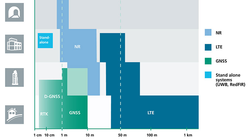
Positioning Performance for 5G NR and other technologies in different environments. (Image: Fraunhofer IIS)
Adaptive array antennas
In addition to the precise positioning it will afford, 5G shares another characteristic with GPS/GNSS: adaptive array antennas for digital beamforming (DBF). Adaptive arrays have many advantages for PNT, primarily in mitigation for multipath, jamming and spoofing.
Emerging applications of DBF in 5G involve dense networks of picocells, small cellular base stations that typically cover a small indoor area. Picocells extend coverage where outdoor signals do not reach well, and add network capacity in areas with very dense phone usage. 5G architectures will use adaptive array technology to achieve high data rates, spectrum reuse and communications robustness.
The implications for PNT are that 5G will require improved (relative) PNT to operate effectively, and picocells will be a source of PNT information in constrained environments.
5G involves massive directional communications via multiple-input, multiple-output (MIMO), enabling high-bandwidth communications in fading (multipath) channels by using multiple antenna inputs to adapt to channels. It can do this without knowledge of user location, but it adds to the processing complexity. The directional capability can enable multiple users to be serviced in a picocell at different frequencies, while permitting spectrum re-use by nearby picocells through narrow beamwidth and the limited range of millimeter-wave (mmWave) frequencies.
The PNT implications of 5G architectures, according to Gary McGraw of Rockwell Collins, are that 5G picocells will be synergistic with PNT in challenged environments — naturally, indoor and dense urban. They will necessitate development of distributed, networked PNT processing and infrastructure.
Fraunhofer
The 5G positioning framework will integrate a multitude of sensors into a hybrid positioning scheme, according to the Fraunhofer Institute for Integrated Circuits (IIS) in Germany. Fraunhofer IIS is currently prototyping low-latency and high-precision positioning systems for legacy LTE and future 5G New Radio (5G NR).
5G NR enables positioning by providing high bandwidths for precise timing, new frequency bands at mmWave, massive MIMO for accurate angle-of-arrival estimation and new architectural options that support positioning. Improved accuracy, robustness and latency can be achieved, according to the institute.
5G provides fast and reliable access to moving objects to achieve time-critical process control and optimization in industrial environments. Increased contextual awareness of goods, parts, machines and workers will enable new interaction and collaboration, the institute said.