Tag: ADAS

  • NovAtel launches new products for automotive GNSS positioning

    NovAtel launches new products for automotive GNSS positioning

    Hexagon | NovAtel has introduced the PIM222A, part of a new family of automotive GNSS positioning products for advanced driver assistance systems (ADAS) and autonomy.  The PIM222A harnesses NovAtel’s decades of experience delivering precise positioning in demanding applications for mass deployment in ADAS applications and autonomous vehicles.

    Built with automotive-qualified hardware in a package that is easy to integrate, the PIM222A leverages SPAN technology from NovAtel to provide accurate position data in urban environments that challenge GNSS availability. Deeply-coupled GNSS receivers and inertial measurement units (IMUs) ensure continuous availability of position, velocity and attitude, even when satellite signals are briefly blocked.

    “I’m excited to introduce the PIM222A, truly the best of both worlds for high-performance GNSS and automotive standards,” said Gordon Heidinger, Segment Manager for Automotive and Safety Critical Systems. “It helps our customers jump-start their development activity for high-precision GNSS, fully supporting performance for all levels of autonomy, ADAS and positioning needs.”

    The PIM222A, which was created in collaboration with STMicroelectronics, is a lightweight, power-efficient, solder-down module that maximizes flexibility for integration. The receiver design can be applied to low-, medium- and high-production volumes while retaining a rich array of features, including options such as multi-frequency, multi-constellation, RTK and dual-antenna precision.

    The degree of slow-speed and initialization performance is maximized with the dual antenna feature, enabling the best possible positioning performance in all ADAS and autonomous driving situations.

    Development kits for the PIM222A are available now for integrators in need of a positioning essentials solution for low- to high-quantity applications.

  • Trimble joins VSI Labs in autonomous vehicle research

    Trimble joins VSI Labs in autonomous vehicle research

    Photo: Trimble
    Photo: Trimble

    Trimble to provide reliable in-lane positioning for the year-long research program

    Trimble and VSI Labs have formed an alliance, with Trimble serving as the GNSS precise positioning supplier for VSI’s autonomous research vehicle program. The alliance officially kicked off in March at Destination ACM, a long-distance driving event for VSI’s research vehicle that continues with additional events throughout the year.

    The collaboration provides the opportunity to showcase Trimble RTX technology as the trusted precise-positioning correction source for car manufacturers and their suppliers. Coupled with Trimble’s inertial positioning, Trimble RTX plays a pivotal role in a vehicle’s ability to maintain accurate and reliable lane-discipline during autonomous driving.

    Destination ACM launched from VSI’s Minneapolis headquarters en route to the American Center for Mobility’s (ACM) test center in southeast Michigan where a day of testing and demonstration took place March 26.

    “The integration of Trimble’s precise RTX positioning is a key element of VSI’s technology stack for advanced driver assistance systems (ADAS) and autonomous vehicle (AV) applications,” said Stephen Ruff, general manager of Trimble’s On-Road Autonomy Division. “VSI Labs is a leading researcher of best-in-class technologies critical to autonomous vehicle development.”

    Suitable for on-road driving applications, Trimble RTX corrections operate on a single, global network. Drivers are not subject to the coverage outages that can exist when relying on local positioning systems — requiring line-of-sight to a positioning source or radio/cellular/internet connections.

    When occasional obstructions are present, such as a bridge, tunnel or deep urban or rural canyon, Trimble augments its precise GNSS positioning with inertial technology to maintain continuous positioning and orientation while on the road.

    Trimble’s innovative GNSS positioning is being used on the road today by a number of automotive OEMs and Tier 1 suppliers to improve the functional safety and performance of ADAS for passenger vehicles. Consumers have logged more than 7 million miles using Trimble RTX for lane-level positioning to date.

    “VSI Labs is thrilled to have Trimble’s RTX technology on board,” said Phil Magney, founder and president of VSI. “Trimble’s positioning capabilities allow us to really expand our applied research on the safety and performance of autonomous and ADAS driving solutions.”

    Trimble GNSS positioning technology will be used in the VSI research vehicle during each of the quarterly Destination ACM events, the Drive World Conference in Silicon Valley in August, the VSI 2021 “Drive South,” and other events this year.

    For more about autonomous vehicles, see our June issue.

  • Trimble RTX corrections now transmitted through Sirius XM

    Trimble RTX corrections now transmitted through Sirius XM

    Photo: Photo: Blue Planet Studio/iStock/Getty Images Plus/Getty Images
    Photo: Blue Planet Studio/iStock/Getty Images Plus/Getty Images

    Trimble RTX GNSS corrections are now being transmitted through the SiriusXM satellite radio network, specifically through Sirius XM Connected Vehicles Services.

    As a result, new cars sold in the contiguous U.S. and Canada equipped with SiriusXM’s Gen8 satellite chipset will be able to receive RTX GNSS corrections, enabling high-accuracy positioning — a key component of autonomous on-road applications.

    With the addition of the Trimble RTX Auto software library, any new vehicle that receives SiriusXM broadcasts with a Gen8 satellite chipset can leverage a positioning solution ideal for advanced driving assistance systems (ADAS), autonomous driving (AD) and vehicle-to-everything (V2X) applications.

    Because the SiriusXM hardware is already installed in most new vehicles, automotive OEMs can avoid the cost of additional hardware to receive GNSS positioning corrections.

    “We are excited to add Trimble RTX Corrections to our suite of Connected Vehicle services,” said John Jasper, senior vice president for SiriusXM Connected Vehicle Services. “By delivering this service over our satellite broadcast network, automakers can access relevant location correction data throughout the contiguous U.S. and portions of Canada to facilitate ADAS, AD and V2X applications without the need to access a cellular network.”

    Trimble RTX is a trusted precise-positioning technology of choice for car manufacturers and their suppliers, and was the first solution adopted for production use in passenger vehicles. RTX technology is a critical component of General Motors’ Super Cruise™ system—the first hands-free driving assistance system for the highway. To date, Super Cruise and Trimble RTX have enabled over 5 million miles of hands-free driving on America’s roadways.

    Designed for automotive applications, the RTX Auto software library is Automotive Safety Integrity Level B (ASIL-B) certified and developed using the Automotive SPICE process maturity framework (Software Process Improvement and Capability Determination – ISO 15504). The RTX network operation is certified according to ISO 20000 standards, providing further peace of mind for any industry deploying safety-critical applications. No other precise positioning solution offers the same level of performance, reliability, versatility and coverage worldwide.

    Trimble RTX technology provides real-time, multi-constellation correction of GNSS observations to provide significantly more precise position estimates. Standard GPS signals can drift up to 25 feet, which could cause incorrect lane identification. When used in conjunction with high-definition maps, cameras, radar and inertial sensors, Trimble RTX provides lane-level positioning performance for semi-autonomous and autonomous vehicles.

    “The alliance with SiriusXM provides an expansive distribution pipeline for Trimble RTX into new passenger vehicles,” said Patricia Boothe, senior vice president of Trimble’s Autonomy Sector. “OEMs now have an easy, cost-efficient alternative to bring high-precision GNSS into their vehicles. Together, Trimble and SiriusXM are helping to accelerate the adoption of real-time positioning in connected vehicles, ultimately supporting safety-critical V2X applications.”

  • Qualcomm teams with Veoneer on ADAS and autonomous driving systems

    Qualcomm teams with Veoneer on ADAS and autonomous driving systems

    Automotive technology company Veoneer Inc. and Qualcomm Technologies Inc. are working together to deliver scalable advanced driver-assistance systems (ADAS) and collaborative and autonomous driving (AD) solutions.

    The platform will integrate Veoneer’s fifth-generation perception software and driving policy software with the current and future Snapdragon Ride portfolio.

    Qualcomm Technologies intends to make this integrated SoC and software stack platform available to global automakers and Tier-1 suppliers.

    Designed for Tier-1 automakers

    The solutions will be powered by Veoneer’s next-generation perception and driving policy software stack and the Qualcomm Snapdragon Ride ADAS/AD scalable portfolio of systems on a chip (SoC) and accelerators. They solutions range from L1 to L4 systems, designed to create an open platform for Tier-1 suppliers and automakers.

    Designed to address the growing complexities associated with developing ADAS, including safety compliance, the integrated software and SoC platform aims to address the growing needs of the automotive ecosystem for scalable and upgradable solutions, which require highly advanced and power-efficient compute, connectivity and cloud service capabilities across all vehicle tiers.

    Veoneer will serve as a Tier-1 system integrator for the new solution, while continuing its current strategies, which include developing, selling and launching its full line of ADAS and collaborative driving products and systems.

    2024 model vehicles

    The open and programmable platform that both companies intend to develop will be designed to create alternatives for automakers and Tier-1s for more customization opportunities while also charting a course for next-generation automotive architecture evolution. The companies expect the integrated platform to be available through automotive Tier-1 suppliers or directly to OEMs for 2024 vehicle production.

    Veoneer’s software stacks are automotive grade solutions designed to meet the requirements of automakers, regulators and rating agencies globally. It has received top performance ratings and enabled automakers to achieve 5-star safety ratings for European New Car Assessment Program (Euro NCAP) in 2018 and 2020.

    The companies plan to launch a state-of-the-art automotive-grade, functional safety compliant and optimized platform, which will include a full range of optimized NCAP features and up to hands-free driving on highways and slow-moving traffic. The platform will be continuously upgradeable through over-the-air updates.

    The next-generation software stack will be developed in a dedicated organization within Veoneer.

    In January, Qualcomm Technologies announced its latest addition to the company’s growing portfolio of automotive products with the new Qualcomm Snapdragon Ride platform.

    Image: adamkaz/E+/Getty Images
    Image: adamkaz/E+/Getty Images
  • Aceinna launches 1.3°/hr automotive IMU sensor

    Aceinna launches 1.3°/hr automotive IMU sensor

    New sensor provides easy-to-integrate, cost-effective, triple-redundant IMU hardware and software for guidance and navigation solutions in autonomous machines and vehicles

    Photo: Aceinna
    Photo: Aceinna

    Aceinna has launched a new high-accuracy inertial measurement unit (IMU), the IMU383ZA. The sensor integrates triple-redundant, 3-axis micro-electromechanical system (MEMS) accelerometer and gyroscope sensors.

    The IMU383ZA is an improved, pin-compatible version of Aceinna’s IMU381ZA. It offers high performance (1.3 deg/hr, 0.08 deg/root-hr) and a triple-redundant sensor architecture for ultra-high reliability.

    The miniature module is factory-calibrated over the -40° C to +85° C industrial temperature range to provide consistent performance through extreme operating environments for a wide variety of applications.

    Applications include automotive advanced driver-assistance systems (ADAS), autonomous systems, drones, robotics, agricultural, construction and other industrial machines.

    The IMU383ZA provides a standard SPI bus for cost-effective board-to-board communications. Other features include advanced synchronization and a bootloader for field upgradeability.

    Measuring 24 x 37 x 9.5 millimeters, the IMU383ZA integrates a triple-redundant architecture that — combined with the small, low-cost packaging — meet the challenging performance, reliability and cost requirements of the automotive market including the areas of autonomous vehicles, self-driving taxis/delivery vehicles, ADAS systems, electronic stability control and lane-keep assist applications.

    The triple-redundant sensor architecture consists of three independent, 3-axis accelerometer and 3-axis gyros for excellent accuracy and reliability. By embedding a triple-redundant sensor array, the IMU383ZA uses Aceinna’s proprietary voting scheme to utilize only valid sensor data. Any defective sensor output or errant dataset will be ignored or de-rated in importance.

  • Spirent SimHIL tests GNSS/sensor fusion for auto industry

    Spirent SimHIL tests GNSS/sensor fusion for auto industry

    New hardware-in-the-loop application programming interface (API) for GNSS simulators enables greater accuracy, integrity and control for growing sensor fusion testing needs

    Spirent Communications plc has released SimHIL, an integrated hardware-in-the-loop (HIL) testing software API for Spirent GNSS simulators.

    SimHIL brings high-fidelity GNSS signal simulation with low latency to automotive industry HIL testbeds, the company said.

    Image: Spirent
    Image: Spirent

    Spirent’s SimHIL software has been developed to meet the automotive industry’s growing need for realistic positioning, navigation and timing (PNT) testing for sensor fusion. As customers apply increasing pressure on car manufacturers for more advanced driver-assistance system (ADAS) features and advanced infotainment systems, test labs need to be able to combine Wi-Fi, camera, lidar, radar, inertial and GNSS data that power these advanced automotive systems.

    SimHIL helps test engineers bring accurate, controlled and coherent data from GNSS and inertial sensors to their sensor-fusion algorithms within HIL test environments. Facilitating the ultra-low latency, complete control, enhanced realism, and ease of use and setup of Spirent GSS7000 and GSS9000 GNSS simulators, SimHIL is suitable for OEMs and tier-one suppliers developing ADAS, V2X and sensor-fusion engines.

    The new SimHIL API enables:

    • external motion input – real-time direct motion and trajectory data input from simulators
    • sensor fusion – introducing GNSS signals into sensor-fusion engines
    • V2X testing – validation and performance benchmarking of V2X applications
    • infotainment system testing – real-time scenario feedback to system and driver responses
    • vehicle-in-the-loop (VIL) – final production form product testing
    • accurate testing – reliable results supported by ultra-low latency simulation. Criticality of ADAS features, such as lane assist and automatic braking, mean that 3+ metres of uncertainty introduced by higher latency systems is not sufficient.

    “With our SimHIL software and GNSS simulators, test engineers can bring realistic, controlled GNSS simulation to their HIL testing environments – a vital requirement in a world where ADAS features are relying more heavily and critically on accurate positioning,” said Martin Foulger, general manager of Spirent’s PNT business.

    Spirent has worked with leading suppliers to ensure SimHIL is compatible with their HIL platforms, and because of its open API, there’s broad scope for additional custom third-party integrations.

    “When used with our GSS7000, SimHIL latency is less than 40 ms from motion command to RF output and supports all GNSS and SBAS signals,” said Ricardo Verdeguer Moreno, product manager for Connected and Autonomous Vehicles at Spirent. “SimHIL is also compatible with all the options and features available in Spirent’s GNSS simulators, including ionospheric and tropospheric modeling, antenna patterns, date and time settings, and obscuration and multipath effects via Sim3D.”

    Users can easily configure and control both the GNSS scenarios, and signal generation and vehicle motion from within the HIL simulator graphical user interface — saving time and the possibility of error.

    Spirent is also offering three service packages alongside SimHIL to help customers mitigate project risk and reduce the time from delivery to useful deployment.

    For more information about Spirent’s SimHIL integrated testing for Spirent GNSS simulators, visit the SimHIL information page.

  • Robotic Research to start testing fully autonomous unmanned shuttles

    Robotic Research to start testing fully autonomous unmanned shuttles

    Robotic Research logoRobotic Research LLC, a leading provider of autonomy and robotic technologies, will begin testing fully autonomous low-speed shuttles that are totally unmanned in the second quarter of this year.

    Current commercial applications of low-speed shuttles use onboard safety attendants to monitor the safety inside and outside the vehicle. Robotic Research plans to start testing without onboard attendants.

    The first step is to have the attendants in fixed on-site locations, with the future goal to move attendants to an offsite safety monitoring facility.

    “Through our work with the U.S. government over the past four years, we have already demonstrated that fully autonomous trucks are a reality. We are committed to making our shuttle and bus manufacturing partners successful by accelerating state-of-the-art technologies for unmanned vehicles ahead of regulatory agencies’ progress,” said Alberto Lacaze, president of Robotic Research.

    “The level of safety certification and redundancy necessary to drive fully autonomous vehicles is a significant undertaking that needs to be designed from the top down. Just adding more ADAS is not a reasonable or cost-effective pathway to full autonomy,” Lacaze said. “The advancements driven by the Robotic Research team will provide a product that significantly reduces the cost of operation and therefore improves market size.”

    Current local, state and federal regulations for most commercial shuttle operations require the safety attendant to be inside the cab of the vehicle. However, many transit operators are seeking to change these regulations to allow remote attendants to oversee system safety operations. The change is integral to the viability of low-speed shuttles, which are an innovative solution to the first/last mile problem, which is the distance between a traveler’s origin or destination, and a transit station or stop.

    Robotic Research has been developing and testing unmanned, autonomous operations for a wide range of vehicles for nearly a decade. The company currently provides autonomy kits that fully automate logistics convoy trucks for the U.S. government and several of its allied nation partners. Nearly 100 trucks have already been delivered. The tests for these vehicles have included operations with no safety attendants on board, with a single operator monitoring three unmanned vehicles.

    Robotic Research’s AutoDrive autonomy kit is platform agnostic and can be retrofitted to vehicles of all sizes, from small, portable robots to large trucks and buses. The system provides autonomous functionality on surfaces ranging from urban-improved roads to off-road terrain, all while the vehicle is collecting and analyzing data to better enhance the future of autonomous vehicles and transportation.

    Robotic Research’s technology provides automation to one of the largest international shuttle providers as well as to the largest U.S. manufacturer of commercial buses. The company’s AutoDrive kit also supports various autonomy programs in commercial and government sectors and is currently operating in communities and cities around the globe, including 30 states and four continents.

  • Qualcomm Snapdragon Ride platform designed for autonomous vehicles

    Qualcomm Technologies unveiled at CES 2020 its newest addition to the company’s portfolio of automotive products — the Qualcomm Snapdragon Ride Platform.

    Snapdragon Ride is an advanced, scalable and open autonomous driving solution consisting of the family of Snapdragon Ride Safety system-on-chips (SoCs), Snapdragon Ride Safety Accelerator and Snapdragon Ride Autonomous Stack.

    CES 2020, the massive annual consumer electronics show, is taking place Jan. 7-10 in Las Vegas.

    Snapdragon Ride aims to address the complexity of autonomous driving and ADAS by leveraging its high-performance, power-efficient hardware, industry-leading artificial intelligence (AI) technologies and pioneering autonomous driving stack to deliver a comprehensive, cost and energy efficient systems solution.

    The unique combination of Snapdragon Ride SoCs, accelerator and autonomous stack offers automakers a scalable solution designed to support three industry segments of autonomous systems, namely L1/L2 Active Safety ADAS for vehicles that include automatic emergency braking, traffic sign recognition and lane keeping assist functions; L2+ Convenience ADAS for vehicles featuring Automated Highway Driving, Self-Parking and Urban Driving in Stop-and-Go traffic; and L4/L5 Fully Autonomous Driving for autonomous urban driving, robo-taxis and robo-logistics.

    The Snapdragon Ride Platform, based on the Snapdragon family of automotive SoCs and accelerator, is built on scalable and modular heterogeneous high-performance multi-core CPUs, energy efficient AI and computer vision (CV) engines, industry-leading GPU.

    The platform with combination of SoCs and accelerator can be used as needed to address every market segment offering industry-leading thermal efficiency, from 30 Tera Operations Per Second (TOPS) for L1/L2 applications to over 700 TOPS at 130W for L4/L5 driving.

    The platform can therefore result in designs that can be passively or air-cooled, thereby reducing cost, and increasing reliability, avoiding the need for expensive liquid cooled systems and allowing for simpler vehicle designs, and extending the driving range for electric vehicles. The Snapdragon Ride SoCs and accelerator are designed for functional safety ASIL-D systems.

    Snapdragon Ride is expected to be available for pre-development to automakers and tier-1 suppliers in the first half of 2020. Qualcomm Technologies anticipates Snapdragon Ride-enabled vehicles to be in production in 2023.

    While the company believes the next wave of innovation may be in the L2+ Convenience ADAS segment, the hardware solutions utilized in Snapdragon Ride from a single system-on-chip (SoC) for an Active Safety ADAS system driven by regulatory mandates to a highly scalable architecture of multiple SoCs and dedicated autonomous driving accelerators allowing for fully autonomous self-driving systems.

    Qualcomm Technologies’ family of ADAS SoCs and accelerators are built on the fundamental approach of heterogeneous compute capabilities designed for application requirements.

    These ADAS SoCs and accelerators effectively manage a large amount of data from onboard systems, leveraging Qualcomm Technologies’ next generation AI engines; image signal processors for camera sensors; enhanced digital signal processors (DSPs) for sensor signal processing; high-performance CPUs for planning and decision making; cutting-edge GPU technology for high-end visualization and immersive user experience; dedicated safety and security subsystems across the SoC and autonomous driving accelerator.

    Through the autonomous driving accelerator, Qualcomm Technologies brings energy efficient compute capabilities to mainstream vehicles, which has so far been largely unavailable to the automotive industry due to exceptionally complex and expensive thermal solutions that are fundamentally unscalable because of their power consumption requirements.


    Snapdragon Ride Benefits

    • Proven and integrated safety board support package with safe OS and hypervisors
    • Safety frameworks from automotive industry leaders, including Adaptive AUTOSAR
    • Optimized and comprehensive foundational function libraries for computer vision, sensor signal processing, and standard arithmetic libraries
    • AI tools for improving model efficiencies, as well as optimizing runtime on heterogeneous compute units
    • Comprehensive autonomous driving stack for highway functions, such as perception and planning for highway driving functions
    • Cost-efficient localization solution with Qualcomm Vision Enhanced Precise Positioning (VEPP)
    • Hardware and Software in Loop Test environment
    • Data Management Tools for intelligent data collection and automated annotation

    Autonomous Stack

    Integrated as a part of Snapdragon Ride is Qualcomm Technologies’ new purpose-built autonomous driving software stack, a modular and scalable solution available to automotive OEM and tier-1 suppliers to accelerate their development and innovations.

    The software stack facilitates automakers’ abilities to offer increased safety and comfort to everyday driving by offering optimized software and applications for complex use cases, such as self-navigating human-like highway driving, as well as choice of modular options like perception, localization, sensor fusion and behavior planning.

    The software infrastructure for Snapdragon Ride supports customer specific stack components to be co-hosted with the Snapdragon Ride Autonomous Stack components.

    “Over the years, we have consistently demonstrated our prowess in large-scale deployment of high-performance and highly intelligent cockpit and connected car solutions that operate in power-constrained environments across virtually every class of vehicle. Today, we are pleased to be introducing our first-generation Snapdragon Ride platform, which is highly scalable, open, fully customizable and highly power optimized autonomous driving solution designed to address a range of requirements from NCAP to L2+ Highway Autopilot to Robo Taxis. Combined with our Snapdragon Ride Autonomous Stack, or an automaker or tier-1’s own algorithms, our platform aims at accelerating the deployment of high-performance autonomous driving to mass market vehicles,” said Nakul Duggal, senior vice president, product management, Qualcomm Technologies, Inc. “We’ve spent the last several years researching and developing our new autonomous platform and accompanying driving stack, identifying challenges and gathering insights from data analysis to address the complexities automakers want to solve.”

  • Universities compete in new autonomous race

    By Kevin Dennehy
    GPS World Contributor

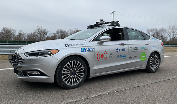
    University teams will go head-to-head in a two-year autonomous race car competition to test new software and other self-driving technologies at Indianapolis Motor Speedway.

    The competition, called the Indy Autonomous Challenge, culminates in a high-speed autonomous vehicle race, scheduled for Oct. 23, 2021, on the speedway’s famed 2.5-mile oval track that is home to the annual Indianapolis 500.

    The competition was inspired by the 2005 Defense Advanced Research Projects Agency (DARPA) Grand Challenge, which pitted university teams against each other and spurred commercial development of autonomous vehicles.

    “The idea for the Indy Autonomous Challenge originated with DARPA’s winning team captain, [Stanford University’s] Sebastian Thrun. Sebastian joined us at the 2018 Indy 500, where he reflected on the inspiration and excitement that came from participating in the DARPA challenge, and how a high-speed automated vehicle race at the Indianapolis Motor Speedway had the potential to be on par with that experience with today’s teams,” said Matt Peak, Energy Systems Network director of mobility.

    Like the DARPA competition, the Indy Autonomous Challenge focuses on university participation. “I can’t speak for DARPA, but our focus on universities is deliberate,” Peak said. “It was advised by not only Thrun, but other original DARPA competitors such as [Aurora CEO] Chris Urmson, all of whom commented on how participation by universities — their students, faculty, departments, alumni — was a key to DARPA’s success.”

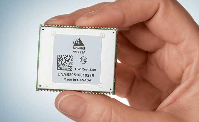
    The autonomous racing software developed through the competition could assist in developing commercial self-driving vehicles and enhance existing advanced driver-assistance systems (ADAS). Some of the cornerstone technologies include GNSS and digital maps, which provide the accurate location for fully autonomous vehicles.

    As was the case with the original DARPA challenge, spurring new innovations and socially beneficial products and services is a goal of the competition, Peak said. “In our case, we see inspiring teams’ creation of software that can solve for edge cases — those problems or situations that occur only at an extreme operating parameter, such as avoiding unanticipated obstacles at high speeds while maintaining vehicular control,” he said. “This applies not only for highly automated vehicles, but also for vehicles equipped with ADAS that aim to help human drivers avoid obstacles altogether. The notion is, if our university innovators can enable cars to outmaneuver others at 200 mph, they certainly can help enable you to avoid that piece of lumber that fell off the pickup in front of you on the 65-mph highway.”

    Peak said that a perfect place to demonstrate these technologies is the famous speedway, which for 100 years has tested automotive technology in a demanding environment. “Tackling automation at 200 mph in a race car is a bit more alluring than with a 20-mph people mover,” he said.

    In addition to ESN and Indianapolis Motor Speedway, other challenge partners include race-car manufacturer Dallara Automobili and the Clemson University International Center for Automotive Research (CU-ICAR).

    $1.45 Million in Prize Money

    During the final race at the speedway, teams will compete for $1 million as the first-place prize. Second- and third-place finishers receive $250,000 and $50,000, respectively.

    The five-round competition starts with the submission of a white paper to demonstrate vehicle automation with a video of an existing vehicle or participation in Purdue University’s self-driving go-kart competition at the speedway.

    During the initial rounds, teams will use sponsor ANSYS’ driving simulator to develop autonomous vehicle software. ANSYS, which will provide $150,000 in prizes to top finishers of a third-round race, will co-host a hackathon to let teams work with the simulator, the company said. The fourth round allows teams to test their vehicles at the speedway in advance of the final race.

    So far, five universities have registered:

    • Korea Advanced Institute of Science & Technology (KAIST)
    • Texas A&M Transportation Institute (TTI)
    • University of Florida
    • University of Illinois
    • University of Virginia.

    Not Everyone Has Championed Autonomous Vehicles…

    The new competition is commencing during a time when media reports show that the once-hot autonomous vehicle industry has vocal critics. Recently, Apple pioneer Steve Wozniak, who once headed a GPS-based fleet company called Wheels of Zeus, said he didn’t expect to see a fully autonomous vehicle operating on the streets in his lifetime.
    In addition, a few automakers have reined in autonomous vehicle development or have scaled back their technology expectations in recent months.

    “Not at all surprising. The traditional OEMs were never going to be disrupters that put driverless mobility-as-a-service cars out there. It isn’t their business model, and it won’t be,” said Alain Kornhauser, Princeton University professor and transportation program director, who was head of the university’s team during the DARPA Challenge, in his Smart Driving Cars weekly newsletter. “Self-driving, I dare say Level 2, is and has always been their sweet spot — it sells cars. Now watch these same companies throw monkey wrenches into those driverless mobility machines to protect their conventional business model.”

    Peak says the recent negative press on autonomous vehicles is what happens when any new technology is rolled out. “For any new technology, such as automation, we’re going to see euphoric coverage (automation will solve all of our problems) and pessimistic coverage (automation will never arrive and, if it does, it will make things worse),” he said. “It’s a cycle, it swings back and forth, and we happen to be touching upon the latter, pessimistic end of that cycle.”

    Taking a moderate and realistic position about the technology is what the Indy Autonomous Challenge is striving to do, Peak said. “Automated vehicle technologies have a role to play, both in helping humans drive better, and eventually in enabling new markets, such as first/last mile transit solutions. The technologies are light years ahead of where they were a decade ago, and low-level automated technologies are already making a difference and saving lives in today’s vehicles,” he said. “We have a bit of a ways to go before the full potential of automation will be realized, and the Indy Autonomous Challenge will help us address the concerns brought about by the media and others to reach this end goal much sooner than we otherwise would.”

    For more, go to www.indyautonomouschallenge.com.

  • Quectel launches security solution for intelligent driving

    Quectel Wireless Solutions has launched its Proactive Security Solution for Intelligent Driving to enhance driving safety.

    The solution supports advanced driver assistance systems (ADAS) and driver monitoring systems (DMS).

    The Proactive Security Solution integrates Quectel multi-mode LTE Cat 6 smart modules SC600Y/SC600T and AI algorithm from a third party to realize ADAS and DMS capabilities including monitoring irregular driving behaviors, conducting precise detection of vehicles and traffic signs, sending warnings of potential risks and more.

    For ADAS, it can precisely identify and locate vehicles, pedestrians, lanes and traffic signs on the road and will send alerts to drivers if an imminent collision or an unintended lane departure is detected.

    Drivers will receive four types of warnings including lane departure warnings (LDW), forward collision warnings (FCW), headway monitoring and warning (HMW) and forward start warning (FSW).

    The DMS supports facial recognition and detection, and is able to monitor driver attentiveness and measure eye blinks as well as head movements. Drivers will receive warnings on any distraction such as making or receiving a call, smoking, yawning or looking around. For buses, taxi-hailing services or long-distance passenger vehicles, this solution also allows administrators to know more about their drivers’ states and improve management accordingly.

    The driver monitoring system supports facial recognition and detection. (Image: Quectel)
    The driver monitoring system supports facial recognition and detection. (Image: Quectel)

    Quectel Proactive Security Solution for Intelligent Driving features a rich set of interfaces and multiple hardware development platforms, designed to cut design-in time and facilitate integration for customers and OEMs.

    SC600T/SC600Y is Quectel’s new generation of multi-mode Smart LTE Cat 6 module with built-in Android 9.0 OS. Based on a Qualcomm octa-core and 64-bit high-performance processors with built-in Adreno 506 GPU, SC600T/SC600Y are designed to support high performance, various multimedia features and Quick Charge 3.0 technology. They are designed for both industrial and consumer applications with high data-rate and multimedia functions. Features include:

    • LTE Cat 6 modem supporting 2x20MHz carrier aggregation, with maximum download speed up to 300 Mbps
    • Worldwide LTE, UMTS/HSPA+ and GSM/GPRS/EDGE coverage
    • Dual-band Wi-Fi and Bluetooth
    • Dual LCDs and dual touch panels for independent display and operation: 1920×1200 @60fps for primary display and 1920×1080 @60fps for secondary display, Wi-Fi display
    • Support up to four cameras, with two of them working simultaneously
    • Multi-constellation GNSS receiver available for applications requiring fast and accurate fixes in any environment
    • Support recording and playback of 4k videos at 30fps@SC600T/ 1080P videos at 60fps@SC600Y
    • Android 9 support
    • Global regulatory and carrier certifications
  • Anatomy of a centimeter-level precise point positioning service

    Anatomy of a centimeter-level precise point positioning service

    By Markus Brandl, Xiaoming Chen, Herbert Landau, Carlos Rodriguez-Solano and Ulrich Weinbach

    This article updates a July 2012 feature in GPS World, “Real-Time Extended GNSS Positioning: A New Generation of Centimeter-Accurate Networks.”

    The Trimble CenterPoint RTX correction service, enabling centimeter-level absolute positioning around the world without the need for RTK reference-station infrastructure, is now available to many users, including integrators of professional high-precision equipment and consumer products such as in the automotive sector. Access is provided via a software library compatible with any GNSS device. The corrections now contain detailed integrity information for safety-critical applications.

    The RTX infrastructure is made up of approximately 120 globally distributed RTX reference stations. Receivers at these stations transmit measurement data at 1 Hz to the RTX server centers, where the correction data is computed. For redundancy purposes, multiple servers in the United States and Europe are operated. A failsafe architecture avoiding any single point of failure in the processing chain has produced a very high availability of corrections. Today the system supports GPS, GLONASS, Galileo, BeiDou and QZSS satellites. It is a multi-frequency system supporting two or more frequencies for each satellite system.

    The correction stream is available to users using L-band signals broadcast via geostationary satellites and IP connections. The L-band transmitted RTX data stream uses a bandwidth of 600–2400 baud, and a highly compressed data format with a resolution of 1 millimeter, with an average latency of 8 seconds in L-band mode and 5 seconds in IP mode. The data stream is encrypted via an Advanced Encryption Standard (AES) with a key length of 256 bits to guarantee safe transmission. Data transmission integrity is assured with a 32-bit cyclic redundancy check attached to every message. The RTX correction stream provides information on satellite position, satellite clock, ionospheric and tropospheric models, and code and phase biases.

    The orbit determination is done in real time using a reduced dynamic approach with dynamic models and exploiting the accuracy of the phase measurements after ambiguity fixing. Based on the computed orbits, the satellite clocks are estimated at 1 Hz, where integer ambiguity fixing is performed for the different satellite systems.

    Next, a single-layer global ionospheric model is computed and represented through spherical harmonics. There are currently two areas with a denser network than the global network; these cover Europe and the mainland U.S. with more than 1,000 base stations. Using these stations, regional ionospheric and tropospheric models are computed, which then provide a fast convergence (RTX-Fast service).

    The satellite position and clock information has centimeter accuracy and allows the client to compute precise point positioning (PPP) with carrier-phase ambiguity resolution. Table 1 shows service accuracy.

    Table 1. Accuracy of the RTX corrections from more than three years (June 2015–July 2018) of residuals computation in the European RTX-Fast network. (Table data: authors)
    Table 1. Accuracy of the RTX corrections from more than three years (June 2015–July 2018) of residuals computation in the European RTX-Fast network. (Table data: authors)

    Once the ambiguities are resolved, the position solution is accurate to a few centimeters. The global RTX-Standard service provides convergence times of 7 minutes to 20 centimeters (cm) horizontal error (95%) and to 2.5 cm (95%) in 13 minutes as shown in Figure 2. The regional RTX-Fast service (U.S., Europe) provides convergence times of less than a minute with centimeter accuracy. The warmstart convergence time is approximately 13 seconds.

    Figure 2. Global convergence of RTX out of 52 globally distributed stations covering one month of data. (Image: Trimble)
    Figure 2. Global convergence of RTX out of 52 globally distributed stations covering one month of data. (Image: Trimble)

    The accuracies specified are achievable with precise Trimble GNSS positioning hardware. For integration into non-Trimble devices, an RTX software library is offered, which gives the user real-time access to the individual data in the RTX correction stream. For use of this library in safety-critical systems such as advanced driving-assisted systems (ADAS) or semi-automated driving, this library was certified to follow the ASIL-B ISO 26262 standard and the automotive ASPICE standard. This library is available for easy integration into third-party applications.

    In addition to the real-time RTX solution, a web-based post-processing solution is available for public use free of charge. It is possible to upload static Trimble or RINEX files to the server, post-process the measurement data, and retrieve a precise position in various coordinate frames.

    Service integrity is continuously monitored at independent stations from the RTX tracking networks in Europe and the US. The integrity of the service is provided at the correction data domain. The integrity monitoring part of the RTX system minimizes the risk due to events such as unplanned satellite maneuvers or wrong broadcast ephemeris; satellite signal or clock anomalies; ionospheric storms; or problems in transmitting the RTX correction stream.

    The monitoring stations compute phase observation residuals (with ambiguity fixing) using the station measurements and the received RTX corrections. These residuals represent the actual errors of the corrections as seen by the monitoring stations at the line-of-sight (Table 1). The thresholds at which corrections are considered as faulty are the following: 0.5 m + QI (quality indicator) for orbit + clock corrections and regional tropospheric models, and 1.0 m + QI for regional ionospheric models.

    The integrity monitoring consists of two steps (Figure 1): a pre-broadcast check, where potentially faulty corrections are detected and filtered out before leaving the computing server, and a post-broadcast check, where additional errors in the transmission channel are detected and alarms are issued to the users.

    Figure 1. Generation and transmission of RTX global and regional corrections, including pre- and post-broadcast integrity monitoring. (Image: Trimble)
    Figure 1. Generation and transmission of RTX global and regional corrections, including pre- and post-broadcast integrity monitoring. (Image: Trimble)

    Integrity flags and alarms are constantly inserted into the correction stream and output by the RTX client library. The integrity information notifies clients of the presence of integrity monitoring and provides timely alerts in case of detected correction-data integrity violations. The time-to-alert limit goals are 17 seconds for L-band transmission and 13 seconds for IP transmission for the RTX service.

    The RTX corrections includes quality indicators. In particular, the quality indicator for the satellite clock includes a “DoNotUse” flag to indicate potential problems with the given satellite. This flag prevents the use of the satellite for positioning when received by the user. The quality indicators of the corrections are indeed a first integrity layer. In 2017 the pre-broadcast integrity monitoring was added to act as a second layer. In 2019, with the addition of the post-broadcast integrity monitoring, a third integrity layer was added to the RTX correction data stream.

    The RTX system provides access to centimeter-level corrections allowing centimeter positioning on a global basis. RTX-Fast services are available in Europe and the U.S. with pre- and post-broadcast integrity monitoring currently being deployed.


    The authors are engineers with Trimble Terrasat GmbH, Germany.

  • New u-blox module aimed at lane accuracy in urban areas

    New u-blox module aimed at lane accuracy in urban areas

    The ZED-F9K module is designed to keep cars in their lanes. (Photo: u-blox)
    The ZED-F9K module is designed to keep cars in their lanes. (Photo: u-blox)

    The new u‑blox ZED-F9K GNSS and dead-reckoning module is designed to bring continuous lane accurate positioning to challenging urban environments.

    The module offers both high-precision multi-band GNSS and inertial sensors. It combines the latest generation of GNSS receiver technology, signal processing algorithms and correction services to deliver down to decimeter-level accuracy within seconds, addressing the evolving needs of advanced driver-assistance systems (ADAS) and automated driving markets.

    The ZED-F9K builds on the u‑blox F9 technology platform. Compatibility with GNSS correction services further improves positioning accuracy by compensating ionospheric and other errors.

    The real-time kinematic (RTK) receiver module receives GNSS signals from all orbiting GNSS constellations. The greater number of visible satellites improves positioning performance in partially obstructed conditions, while increased satellite signals delivers faster convergence times when signals are interrupted.

    Inertial sensors integrated into the module constantly monitor changes in the moving vehicle’s trajectory and continue to deliver lane accurate positioning when satellite signals are partially or completely obstructed, as is the case when the vehicle is in parking garages, tunnels, urban canyons or forested areas.

    When satellite signals become available again, the module combines inertial sensor data with GNSS signals to deliver fast convergence times and high availability of the decimeter-level solution.

    The result of this combination of the latest developments in GNSS technology, correction services and inertial sensing is a tenfold increase in positioning performance over standard precision solutions, according to u-blox.

    By robustly providing lane accurate position information, the ZED‑F9K meets the needs of ADAS and autonomous driving applications, as well as head units and advanced navigation systems. The module’s accuracy and low latency also makes it suitable for automotive OEMs and Tier 1 automakers developing V2X (vehicle-to-everything) communication systems. By continuously sharing their location with other traffic participants, V2X systems contribute to increasing overall road safety and reducing traffic congestion.

    “We designed the ZED-F9K to be a turnkey high-precision GNSS solution that caters to the needs of today’s and tomorrow’s connected cars,” said Alex Ngi, product manager, product strategy for dead reckoning, u‑blox. “The ZED-F9K is unique in that it integrates a multitude of technologies, from the GNSS receiver to the inertial measurement unit and relevant dead reckoning algorithms into a single device for which we can ensure performance throughout the customer product development cycle.”

    Samples will be available upon request by July.