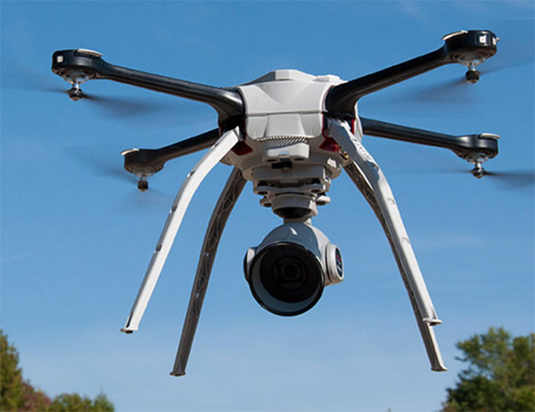
Sentera LLC, a designer of sensors, software, and unmanned aerial vehicles (UAVs), has been granted a Section 333 exemption from the Federal Aviation Administration (FAA) to operate multiple types of commercially available UAVs. Applications for these systems include crop survey, infrastructure inspection, geospatial mapping and other aerial imaging missions.
“We are excited to receive the exemption,” said Sentera CEO, Eric Taipale. “While most exemption holders focus on providing revenue-generating flight services, Sentera flies primarily to demonstrate our products to customers and to gather and analyze aerial data which helps us enhance our OnTop Platform, a data management system designed specifically to support the thousands of images collected during a typical UAV flight.”
Sentera’s exemption for both fixed-wing and quadcopter UAVs ensures the company can capture a wide range of data types that are relevant to customer applications, including very high-resolution visual, multispectral, and thermal imagery, as well as specialized non-image information. Customers use Sentera input data to perform many tasks, such as developing planting and crop management advice for growers, building 3D models of buildings, structures, and terrain for asset owners, and monitoring environmental regulatory compliance for public agencies.
Comprehensive data management solutions are crucial to successful UAV inspections, asset audits, safety inspections, agriculture data collections, and point-cloud collection activities.
“Clients use a myriad of UAV-captured data types to increase safety, assess crop health, and boost ROI (return on investment),” explained Taipale. “Sentera already provides some of the most precise sensors and leading UAV solutions in the industry. Our Section 333 exemption allows us advance our OnTop Platform more rapidly, which ultimately helps our customers manage all of this data most efficiently.”
The FAA authorization allows Sentera to fly UAV platforms built by Lockheed Martin, DJI and Sentera.
VisionMap’s A3 Edge Digital Mapping System was recently used to map wildlife in an African national park. A3 Edge provides an efficient solution for detecting, tracking and estimating wildlife populations, according to maker VisionMap.
The A3 Edge camera surveyed the park from an altitude of 4,000 ft. above ground level (AGL), capturing 3.5 cm resolution imagery at a rate of 225 km2/ hour. A3 Edge uses a “sweep” capture technology that provides quick, high-resolution coverage of vast areas.
Among the animals identified in the images were antelopes, elephants, hippopotamuses and giraffes. The animals’ locations are clearly visible in the aerial images, and the automatic object recognition capability available with VisionMap systems makes it easy to calculate the number of animals in a particular area.
VisionMap’s LightSpeed processing system automatically processes VisionMap images, producing aerial triangulation, orthophoto, digital surface model (DSM), 3D models, and georeferenced vertical and oblique images. The system’s fast turnaround time makes it possible to regularly survey the area, and collect useful information about the animals’ behaviors and trends, VisionMap said.
SkyPixel, an aerial photography community run in cooperation with DJI, has announced a drone photography competition. The 2015 SkyPixel Photo Contest is accepting entries starting Monday, Oct. 26, at 00:00 Hong Kong time (GMT+8). Prizes include cash and DJI drones and related equipment.
The contest invites both budding and professional aerial photographers to enter a selection of their best work. The competition is split into two groups, Professional and Enthusiast, each with their own awards for the following categories: Beauty, Unique Dronies, and Drones in Use (aimed at showcasing drones in the air), in addition to an overall Grand Prize.
To celebrate the rise and popularity of aerial photography, the Popular Award will be given to the contest’s 10 most popular photos, based on number of likes received on SkyPixel. Winners will be announced on Jan. 7, 2016.
SkyPixel users can submit their entries at the competition page.
Aeryon Labs is partnering with Microsoft on its new Microsoft Advanced Patrol Platform (MAPP) vehicle. Microsoft has chosen Aeryon’s SkyRanger UAV to demonstrate aerial image and data capture for MAPP.
Aeryon Labs is a provider of small Unmanned Aerial Systems (sUAS) for military, public safety and commercial operators worldwide.
“Law enforcement organizations throughout the world rely on Aeryon sUAS to collect aerial intelligence wherever and whenever they need it,” said Dave Kroetsch, president and CEO of Aeryon Labs Inc. “Including SkyRanger within the MAPP vehicle rounds out the comprehensive suite of technologies and highlights the value of aerial intelligence for ground-based personnel.”
Aeryon Labs’ SkyRanger UAV provides real-time intelligence to law enforcement. (Photo: Aeryon Labs Inc.)
MAPP will connect its drivers to helpful and easy-to-navigate information, Aeryon said. Currently, patrol officers spend vast amounts of valuable time bound to their cars, clicking between windows on bulky, often dated laptops. MAPP will consolidate the many elements officers must keep track of — providing dispatch information, driving directions, suspect history, a voice activated license plate reader, a missing persons list, location-based crime bulletins and statistics, a feed of shift reports and more.
For first responders, surveillance teams and investigators, high-quality aerial imagery provides the real-time intelligence needed to assess a situation immediately, ensure safety on the ground, and capture detailed evidence and forensics. By integrating aerial images from Aeryon sUAS with other cutting-edge hardware and software solutions, the MAPP program sets a new technological standard in policing and helps officers operate with better awareness, efficiency, mobility and safety.
Aeryon Labs is showcasing the integrated solution at the IACP 2015 law enforcement and public safety conference, being held Oct. 25-27 in Chicago.
DJI is offering two new cameras for its DJI Inspire 1 professional aerial camera platform.
The new Zenmuse X5 is a commercially available micro four-thirds (M4/3) camera designed specifically for aerial use. With a large sensor, aerial image makers will be able to capture up to 13 stops of dynamic range, making it easy to capture high-resolution 16 megapixel photos or 4k, 24fps and 30fps videos in complex lighting environments.
Zenmuse X5 users will have more options for capturing images in the sky through additional supported lenses and full wireless aperture and focus control. At the time of launch, the Zenmuse X5 will support four interchangeable lenses, including the DJI MFT 15mm f/1.7 ASPH lens, Panasonic Lumix 15mm G Leica DG Summilux f/1.7 ASPH lens, Olympus M.ZUIKO DIGITAL ED 12mm f/2.0 lens, and Olympus M.Zuiko 17mm f/1.8 lens. While the Zenmuse X5 is in flight, pilots can adjust both focus and aperture via the DJI GO app or through DJI’s previously announced Follow Focus system.
The Zenmuse-X5 aerial camera.
The camera’s lightweight 340-gram (0.75-pound) body integrates with DJI’s signature three-axis Zenmuse gimbal technology, creating effortlessly smooth video and stabilized long-exposure photos (up to 8 seconds).
“The professional applications of the Zenmuse X5 are almost endless,” said Eric Cheng, DJI’s director of Aerial Imaging. “In addition to shooting professional-quality photos and 4K video, the new camera can be used to create high-quality aerial maps and 3D models, and can also help industrial teams get even more detail from their aerial imaging pursuits, for example, in utility inspection using a drone.”
DJI also announced the Zenmuse X5R camera, which shares the same sensor and lens compatibility with the X5, but records video both to an onboard microSD card as well as to a removable 512GB solid state disk (SSD) on the gimbal’s top plate. The Zenmuse X5R records CinemaDNG (RAW) video to the SSD, and opens up lossless 4k video recording in a compact form factor with video bitrates averaging 1.7 Gbps (with a maximum of 2.4 Gbps).
The Zenmuse X5R also offers a brand-new D-LOG mode that offers a broader array of color correction options in post production.
To support the management of Zenmuse X5R Cinema DNG files, DJI will release software to edit and convert RAW camera footage. CineLight, which will be available when the Zenmuse X5R camera is released later this year, simplifies users’ workflows by offering offline proxy editing before converting the CinemaDNG files to ProRes.
“In order to achieve the quality of video produced by Zenmuse X5 and X5R, pilots used to have to spend many thousands of dollars for large, complicated aerial equipment,” said Frank Wang, DJI CEO and founder. “Now, pilots can simply mount the Zenmuse X5 series cameras to their Inspire 1, put on their props, get up in the air, and have full control of their shot while in flight. This saves valuable time on film sets and makes high quality imaging for industrial applications smaller, lighter and easier to manage.”
By mounting a small, easy-to-install bracket, the Zenmuse X5 series cameras are fully compatible with existing DJI Inspire 1 platforms as an interchangeable option for the Inspire 1’s standard Zenmuse X3 camera.
The Zenmuse X5 is available for pre-order at store.dji.com for $4,499 (€4,999), including a DJI Inspire 1 and DJI’s MFT 15mm F1.7 ASPH lens, and will begin shipping before the end of September. The Zenmuse X5R will be available in Q4 2015 for $7,999 (€8,799). Both can be purchased as stand alone cameras with, or without lens. More information can be found at dji.com.
Satellites, aircraft and unmanned aerial systems (UAS) collect imagery that can be displayed and analyzed within a geographic information system (GIS) to extract important information.
To familiarize GIS professionals and students with the advanced earth imaging technologies available today, Esri has publishedEssential Earth Imaging for GIS. The book is a field guide to Earth imaging, providing guidance to efficiently and effectively display, manipulate, enhance, and interpret features from an image.Essential Earth Imaging for GISprovides a basic education in remote-sensing technology, promoting the effective use of sophisticated multispectral and 3D imagery.
Chapters introduce readers to remote-sensing methods and types of imagery as well as how to display and enhance multispectral images, process images in a GIS to improve quality, generate three-dimensional data, and visually interpret images in a GIS to extract information from them.
The book provides hands-on experience working with imagery in Esri’sArcGIS for DesktopandArcGIS Online. Exercises include assigning colors in multiband images and extracting information from multispectral images by digitalizing features. Companion exercises and a free 180-day trial of ArcGIS are available by accessing theEsri Press Book Resources website.
Essential Earth Imaging for GISwas written by Lawrence Fox III, emeritus professor of forest remote sensing and GIS at Humboldt State University in California. The book serves as a starting point for GIS professionals who want to learn the basics of imaging technology so they can incorporate it more effectively into their work, while students can use this book as a reference for introductory GIS courses that make use of image display and analysis.
Essential Earth Imaging for GISis available in print (ISBN: 9781589483453, 128 pages, US$59.99) or as an e-book (ISBN: 9781589484313, 128 pages, US$59.99). The book is available at online retailers worldwide, atesri.com/esripress, or by calling 1-800-447-9778. Outside the United States, visitesri.com/esripressordersfor complete ordering options, or visitesri.com/distributorsto contact your local Esri distributor. Interested retailers can contact Esri Press book distributor Ingram Publisher Services.
Esri Press publishes books on GIS, cartography, and related topics. The complete selection of GIS titles from Esri Press can be found on the web atesri.com/esripress.
Aerial imagery and visual analytics company nearmap (NEA) iscollaborating with Esri to provide timely, high-resolution imagery for use with Esri’s suite of software. Through the Esri ArcGIS Marketplace, users will be able to instantly access up-to-date imagery captured at better than 2.8 inch GSD. In addition, a nearmap add-in for ArcGIS gives Esri users the flexibility to access current or historic imagery, arming businesses with powerful information to make informed planning and prospecting decisions.
Esri professionals attending the Esri User Conference this week at the San Diego Convention Center will have the opportunity to see a live demo of nearmap technology in Booth 2701.
“Esri has revolutionized the GIS industry from a thought leadership and technology standpoint,” said Simon Crowther, CEO of nearmap. “nearmap’s business partner relationship with Esri will make nearmap’s time and money saving features available to Esri users through the online ArcGIS Marketplace. We hope this is the first of many initiatives we can introduce to the Esri community.”
nearmap’s innovative hardware and software solutions have transformed hundreds of industries including solar, construction, insurance, transportation and government. nearmap expanded to encompass U.S. urban areas in October 2014 and already has captured more than 50 percent of the U.S. population. Imagery is updated at the unprecedented frequency of a minimum of three times per year for all capture areas and as much as six times yearly in major urban areas.
“nearmap’s incredible high-resolution, up-to-date imagery will be invaluable for organizations managing assets in industries such as solar, construction, insurance and local government,” said Lawrie Jordan, Esri’s Director of Imagery. “The ability to quickly roll back time and look at change is a unique benefit. Our users will have access to this imagery much faster and simpler now that it is accessible in the ArcGIS platform through the ArcGIS Marketplace.”
Clear imagery combined with the ability to document change over time has already disrupted the geospatial industry. In the United States the government, solar, construction and insurance industries have quickly leveraged the power of nearmap to transform the way business is done.
Clark County has already been using the new Esri integration capability. “The clear image quality and quantity of flights per year will help Clark County’s Tax, Building and GIS Departments work more accurately and efficiently,” said Brian Bolduc, GISMO/IT Clark County senior programmer analyst.
LizardTech, a provider of software solutions for managing and distributing geospatial content, launched GeoExpress 9.5 at this week’s Esri International User Conference. The conference is taking place in San Diego, Calif., and LizardTech is exhibiting in booth number 2310.
GeoExpress enables geospatial professionals to compress and manipulate satellite and aerial imagery. In addition to compressing raster data, GeoExpress 9.5 now features the ability to natively compress LiDAR data to MrSID and LAZ formats, saving up to 75 percent on storage space.
GeoExpress 9.5 also includes batch color balancing, multipolygon cropping and exporting images to custom dimensions and tiles. Esri UC attendees can see demonstrations of the new features of GeoExpress 9.5 at booth 2310.
“The launch of GeoExpress 9.5 is particularly exciting because of the many benefits this latest version brings not only to our raster image collection customers, but also LiDAR data collection customers,” said Jeff Young, LizardTech global business development manager. “GeoExpress 9.5 is now your one-stop shop to compress raster and LiDAR imagery to MrSID and LAZ formats.”
LizardTech will also showcase the rest of the company’s line of geospatial products: Express Server software for high-performance delivery and publication; LiDAR Compressor software, which turns giant point cloud datasets into efficient MrSID files; and the recently updated GeoViewer software, which a fast way to view MrSID and JPEG 2000 imagery.
ThinkGeo has released version 9.0 of Map Suite, its full line of GIS software components for .NET developers. This major milestone refreshes ThinkGeo’s Map Suite product line with a wide variety of enhancements. It includes Aerial Imagery for the Map Suite World Map Kit Online, Xamarin.Forms in the Map Suite iOS and Android Editions, support for Google Traffic and Street View in the Map Suite Web Edition, and many performance and stability improvements.
Map Suite World Map Kit Online now features beautiful aerial imagery. The all-new Hybrid View combines ThinkGeo’s detailed street-level world-wide maps with aerial imagery to provide the best of both worlds.
Xamarin.Forms has been added to Map Suite iOS and Map Suite Android Editions. Developers are now able to rapidly create maps for iOS and Android devices while sharing the vast majority of the code.
Another notable feature in ThinkGeo’s Map Suite 9.0 is the addition of Google Traffic and Street View to the Map Suite Web Edition. In the Map Suite MVC Edition, data binding and action triggers have been designed in order to simplify development. MapBox tile overlay support in the Map Suite iOS and Android Editions provides another option to the existing Google, Bing, and OpenStreetMap basemaps.
The 9.0 update includes new builds of all of Map Suite’s editions, including WebAPI, iOS, Android, Desktop (WinForms), WPF Desktop, Web (WebForms), MVC, Silverlight, Services and WMS Server Editions, as well as the Map Suite Geocoder and the Map Suite Routing extension. Many performance and stability improvements have been implemented across the Map Suite GIS product range. Complete change logs are available at the ThinkGeo Wiki, the company’s official online source for Map Suite documentation and learning material.
ThinkGeo’s next major release of Map Suite, version 10.0, is expected in the summer of 2016, but developers can expect to start receiving beta features in advance via the daily builds which can be downloaded directly from the ThinkGeo Product Center.
For more information about Map Suite, or to download the ThinkGeo Product Center and access free 60-day evaluation of each Map Suite 9.0 product, visit ThinkGeo’s website. All evaluators and users can discuss and receive support for their Map Suite applications at ThinkGeo’s Discussion Forums.
The unmanned drone RQ-4 Global Hawk in flight in 2007 (Image credit: U.S. Air Force photo by Bobbi Zapka)
By Art Kalinski, GISP
For more than a decade, the military has been struggling with cataloging and retrieving its huge libraries of full motion video (FMV). The video, captured by both manned and unmanned aircraft, rapidly reached unmanageable levels. If you have ever tried to organize vacation photos after returning home from a long trip, you know that it’s easy to lose track of where each photo was taken. Date/time stamps help, but the effort is still difficult if your vacation took you to numerous locations.
The manned U.S. Air Force Beech King Air 350 and 350ER MC-12W Project Liberty Aircraft are designed for intelligence, surveillance and reconnaissance (ISR).
Now imagine trying to retrieve several critical minutes out of thousands of hours of video of barren land or repetitive-looking villages, and you get a sense of the magnitude of the problem. Without some way to catalog the video, critical details can be lost, because finding the right video clip becomes impossible in a reasonable period of time. Everyone agreed that the solution to the problem is to index the video clips by date/time and location, preferably with an exact georeferenced footprint. This is now possible with tools from Esri, Hexagon Geospatial and others.
Several years ago, at the USGIF GEOINT Tech Days, Sarnoff (SRI) demonstrated a system that pinned aerial video to its geographic footprint and maintained that registration despite the movement of the aircraft. It was an achievement that impressed everyone in the audience. I changed jobs soon after that conference and lost track of developments in the FMV field. At the February Esri Federal Users Conference, I was thrilled to see Jack Dangermond briefly demonstrate the same kind of FMV georeferencing capability in ArcGIS 10.2 during his opening plenary session. I learned that Esri developed the capability in 2013, and later learned that Intergraph (Hexagon Geospatial) also developed a similar capability in 2010.
MISB: The Critical Improvement
The key technical development that made this possible was NGA’s creation of “Motion Imagery Standards” and the Motion Imagery Standards Board (MISB). The MISB developed standards for a consistent way to capture and record telemetry data during the video capture as metadata that becomes part of the video stream. This “Open Standard” metadata includes information such as the accurate xyz location of the aircraft, attitude, tilt, camera angle, and camera characteristics. This information travels with the individual video frames and permits the GIS/viewing software to perform the georeferencing.
This process is very similar to the oblique imagery capture system used for years by Pictometry, which at 20 FPS was technically FMV. MISB like Pictometry requires accurate GPS and IMU data to continuously capture and record the metadata. The MISB also gets involved with video compression standards such as the newer H.264 used on Blu-Ray discs and streaming video. H.264 has, for the most part, replaced MPEG2 and older MPEG4 as the video compression standard of choice. Much of the video captured by low-end small UAVs is just a simple video stream with no MISB telemetry data. However, I’m sure that lower prices, increased capability and smaller size of sensors will fix that with time. Sorry, no one has yet figured a way to “hack in” the metadata for legacy video captured without the MISB telemetry data. The one exception is those videos that contain usable telemetry data that was burned into the video and can be read with OCR. It might be possible to insert that information as MISB-compliant data.
The ArcGIS Full Motion Video Add-In
The ArcGIS Full Motion Video 1.2 Add-In (for ArcGIS 10.1, 10.2 and 10.3) is a free tool for ArcGIS users. It permits users to play georeferenced live or previously recorded video files in the map view. The screen capture below shows several features of this tool and is from an online video.
The re-sizeable smaller window displays the video as it runs. The map view shows a changing footprint (green trapezoid) of the video as the aircraft flies over the site. The short green line shows the flight path of the aircraft. Demonstrating the interconnectivity of the two data sets, the user in the demo video drew a light blue polygon on the map view. Note that the Esri Intersect function re-projects and displays the same polygon correctly in the video view.
Frames from the video can be extracted as single georeferenced images or groups of images and stored as a mosaic dataset. Playback of time-stamped video data can be synchronized with other time-enabled data and played together on the map. Features can be digitized directly on the video player and will appear on the map and vice versa.
The extension supports playback and management of multiple simultaneous video feeds. The Add-In also allows you to record the sensor, frame center, and footprint data in a geodatabase so the Bookmark Manager can perform searches for bookmarked video scenes. For more information regarding the Esri FMV tool, visit this ArcGiS site.
Hexagon Geospatial GeoMedia Motion Video Analyst Professional
Another robust FMV system that takes advantage of MISB telemetry is GeoMedia Motion Video Analyst Professional (MVA) from Hexagon Geospatial. The Hexagon Geospatial system includes tools to catalog videos as geospatial features with attributes extracted from the metadata, and has some elegant graphic selection tools that help an operator search and retrieve needed video clips.
In the screen capture below, you can see the map view with the geo-registered color video overlaid on the black-and-white ortho base image. As the video plays, the georeferenced video footprint continuously moves to the correct location as the tracking graphics in red show the position of the aircraft. The transparency of the video can be adjusted so an operator can compare features between the base image and the video and digitize directly in the map window.
MVA also includes a full set of tools for placing clipmarks as geospatial features with attributes and linked to the cataloged video, extracting snapshots and videos clips, on-the-fly enhancements, stabilization, registration and more. The system also facilitates rapid report generation so as an operator searches and plays appropriate video clips, the same operator or a partner can rapidly generate reports as documents or PowerPoint presentations in minutes. Another feature of the system is a “de-hazing” tool that removes a surprising amount of haze or smoke.
See a very good video overview of GeoMedia Motion Video Analyst Professional on this Hexagon Geospatial page. Like the Esri video, both are far better at explaining the capabilities than I can in this short column.
Other defense contractors are taking advantage of the MISB metadata, so check with your provider. Although these systems found their first home with military analysts, the Esri and Hexagon Geospatial reps indicated that many other users are finding the capability valuable in their work. Emergency operations centers come to mind first, but more mundane uses include rail and utility property management, the news media and video used in court proceedings. So, if you shoot lots of aerial video and need to catalog and retrieve video clips quickly, consider using MISB in your capture process.
DigitalGlobe is making available its 30-cm satellite imagery products. Access to the high-resolution commercial satellite imagery captured by DigitalGlobe’s WorldView-3 satellite will improve decision making, enable more efficient operations, and enhance a variety of applications for customers in the civil government, defense and intelligence, energy, mining and global development sectors.
In addition, many customers who previously relied on aerial imagery can now benefit from the improved economics, global availability, and faster refresh rate that DigitalGlobe can provide with its 30-cm satellite imagery, the company said. Imagery of this resolution was previously only available from aerial platforms, which are difficult, costly, or impossible to access in many parts of the world.
DigitalGlobe’s 30-cm imagery products are also a rapid and affordable alternative in locations where aerial imagery is readily available. New imagery orders can be delivered on timescales of days or weeks, as opposed to months, in many cases, and customers can also have access to a rapidly growing volume of available 30-cm archive imagery.
The suitability of 30-cm satellite imagery for aerial imaging applications is confirmed by the National Imagery Interpretability Rating Scale (NIIRS), which is used by the imaging community to define and measure the quality of images and performance of imaging systems. DigitalGlobe’s 30-cm imagery achieves a rating of NIIRS 5.7, meaning it can resolve objects on the ground such as above-ground utility lines in a residential neighborhood, manhole covers, building vents, fire hydrants, and individual seams on locomotives.
“DigitalGlobe’s WorldView-3 satellite data is the highest quality satellite photo data that PhotoSat has ever processed,” said Gerry Mitchell, president of PhotoSat, a satellite elevation mapping provider for energy, mining and engineering firms. “In one test, an elevation mapping grid extracted from stereo WorldView-3 satellite photos matched a highly accurate LiDAR elevation grid to better than 15 cm in elevation. This result takes satellite elevation mapping into the engineering design and construction markets and directly competes with LiDAR and high-resolution air photo mapping for applications like flood plain monitoring.”
The DigitalGlobe’s WorldView-3 commercial imaging satellite is capable of collecting imagery with 30-cm ground sample distance — five times the detail of the company’s nearest competitor. The satellite also features unique shortwave infrared (SWIR) capabilities that will enable new applications such as seeing through smoke and haze, identifying minerals and manmade materials, and assessing the health of crops and vegetation.
The SWIR imagery that the satellite collects has never before been available to commercial customers with this level of spatial and spectral resolution, and it will provide unique value to users in the energy and mining industries, as well as others, DigitalGlobe said. DigitalGlobe also launched a beta program for 7.5 m SWIR imagery, working with partners, customers and users to explore new uses for this capability.
“Companies should be exploiting the competitive advantages of the WorldView-3 data to look for potential ore-related alteration that will have been missed by the previous satellites used for alteration mapping,” said Dan Taranik, managing director of Exploration Mapping Group, a service provider to the global mineral exploration industry. “Detailed inspection of remote areas on the peripheries of alluvium or younger volcanics would be a competitive advantage that could help reveal concealed deposits.”
Data Mapper, an enterprise aerial data software by PrecisionHawk, will expand its cloud-based platform to process data collected by a wider network of unmanned aerial vehicle (UAV) providers. The application provides the ability to upload, store, process and share aerial imagery and is equipped for detailed, automated analysis.
Previously the company was known under the name PrecisionMapper, and the software could only be used when collecting aerial data with the PrecisionHawk UAV platform Lancaster HawkEye Mark III.
“As we began to collect data with the PrecisionHawk UAV across data intensive industries, we discovered a clear gap in the market for an end-to-end, enterprise level solution,”said Christopher Dean, CEO of Data Mapper. “The creation of Data Mapper was a way for us to ensure that what matters most to our customers, the ability to transform aerial data into actionable information, was available quickly and cost effectively.”
The platform is accessible on numerous devices and allows a user to see data in real time, long before a processed orthomosaic is available. Post processing is automated, and processed data can be shared across devices or analyzed using sophisticated algorithms. Data Mapper geospatial experts have been working closely with university partners across the nation to determine the most pressing algorithms for the agriculture industry such as plant height, weed detection, plant counting and canopy cover.
Because of its early integration with the PrecisionHawk platform, Data Mapper has a strong client base that includes Fortune 500 companies, global agriculture companies, education and research institutions and individual agricultural producers, PrecisionHawk said.
As the UAV industry quickly expands, data intensive markets such as agriculture can be equipped with a streamlined, information delivery structure that fits into an everyday workflow. Engineers have bootstrapped the technology to ensure seamless integration with workflows that rely heavily on accurate information to support business practices, PrecisionHawk said.
“UAVs are an extremely effective and efficient means for collecting data, but the value of this technology goes far beyond an aircraft,” said Andrew Slater, VP of software development for Data Mapper. “Data Mapper is a tool designed to close the gap between a service that UAVs provide and the value of that service, which isinformation delivery to the right person at the right time.”
The company has worked with data sets across a variety of industries including agriculture, oil and gas, emergency response, forestry and insurance, and will continue to extend its analysis capabilities to different markets. Data Mapper will significantly grow its employee base, hiring geospatial analysts, software engineers and embedded software engineers to work towards a generalized ingestion method for all UAV data in 2015.