Tag: Africa

  • Finnish Skyfora raises €6.5M to turn GNSS telecom into real-time weather sensors

    Finnish Skyfora raises €6.5M to turn GNSS telecom into real-time weather sensors

    Skyfora, a Finnish weather data company building a new global data layer for weather and AI, has raised €6.5 million to transform GNSS telecom infrastructure into a real-time atmospheric sensing network.

    The funding comes as demand for high-resolution weather data surges, driven by AI forecasting models, climate volatility, and the growing need for weather-resilient operations.

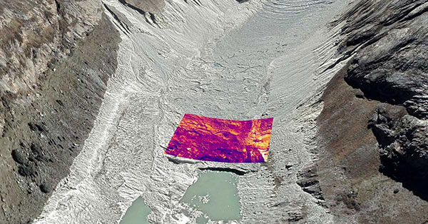
    GNSS metrology system

    Traditional weather forecasting relies on sparse networks of expensive ground stations, weather balloons, and radar systems — methods that leave vast gaps in coverage, particularly in urban areas and developing regions. Instead, Skyfora combines atmospheric physics, advanced signal processing, and artificial intelligence to extract weather intelligence from GNSS data.

    GNSS meteorology turns every GNSS receiver into a weather sensor. The more receivers in an area, the higher the resolution of atmospheric data achievable.

    GNSS signals traveling through the atmosphere are delayed by water vapor. By measuring these delays from multiple satellites and ground stations, Skyfora can create detailed 3D maps of atmospheric moisture — a critical input for weather forecasting.

    Once the atmospheric data is captured and reconstructed, the system uses AI and high-performance computing to turn it into accurate, actionable forecasts.

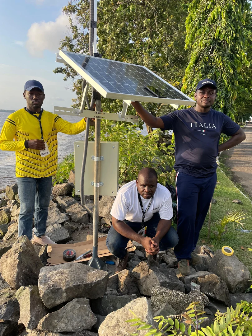
    Using existing GNSS receivers

    Skyfora’s core technology uses GNSS receivers already installed in telecom networks, complemented by StreamGNSS hardware where telecom GNSS is not available, to measure atmospheric humidity with high precision and frequency. The GNSS signal delays are processed into real-time weather data streams that power next-generation AI weather models and forecasting systems, enabling more accurate, earlier, and hyperlocal predictions.

    The company’s approach addresses a structural bottleneck in weather forecasting: most of the world’s atmosphere remains underobserved, and existing observation infrastructure cannot provide the data coverage and resolution required by modern AI models. Skyfora’s solution scales using existing infrastructure, requiring no new hardware at telecom sites.

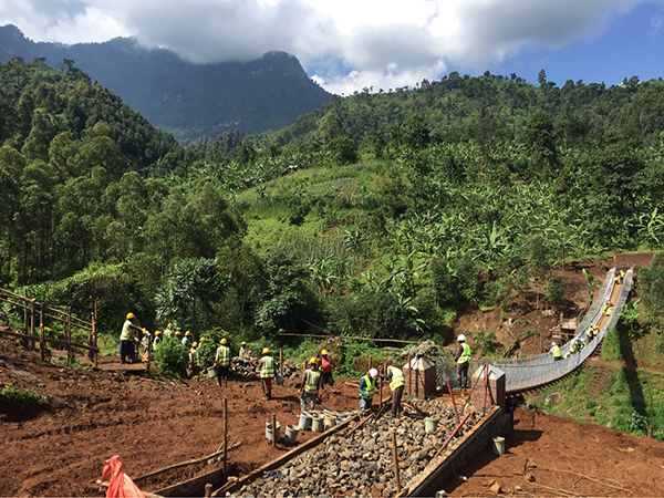
    Skyfora operates active deployments across multiple countries, working with telecom operators, meteorological institutions, forecasting partners and weather-affected industries to build out real-time atmospheric sensing on a global scale.

    Latest capital round partners

    The new capital will be used to accelerate the commercial scale-up of Skyfora’s software platform and atmospheric data products, expand partnerships with telecom operators, forecasting providers, meteorological institutions and weather-affected industries, and grow the team. The primary focus is on scaling deployment and market adoption: bringing Skyfora’s real-time data, API and atmospheric intelligence dashboard to market.

    The round includes equity participation from Eviny Ventures, Ugly Duckling Ventures, Lumo Labs and the European Innovation Council (EIC) Fund, alongside non-dilutive funding from Business Finland.

    The company is actively working to deploy datasets and customer opportunities across several countries in Europe, the United States, Africa and the Middle East.

  • GNSS-IR aids in water-level research

    GNSS-IR aids in water-level research

    Cost-effective sensors from the University of Bonn are measuring water levels along rivers and coastlines in Africa and the Pacific region.

    Using a low-cost sensor and GNSS Interferometric Reflectometry (GNSS-IR), river water levels can be monitored around the clock. The water-level data are automatically transmitted via cellular networks to an analysis center.

    Researchers at the University of Bonn developed the method several years ago and tested it on the Lower Rhine. With support from the European Space Agency (ESA), the monitoring system is now also being used in Africa and the Asia-Pacific region.

    Researchers at the Institute of Geodesy and Geoinformation at the University of Bonn, led by Makan Karegar, have transferred water -level monitoring technology from the Rhine to Africa, Australia and the Philippines as part of ESA projects. Originally developed in the DFG Collaborative Research Center SFB 1502 (DETECT), the technology enables continuous, freely accessible monitoring of inland and coastal waters in data-poor regions worldwide.

    Active on three continents

    The technological centerpiece is the Raspberry Pi Reflector (RPR), a compact, solar-powered sensor developed at the University of Bonn. Using GNSS-IR, it measures water levels with centimeter-level accuracy.

    Only a portion of the signals emitted by the GNSS satellites is directly captured by the antenna. The rest is reflected by the water surface and reaches the receiver via this detour. When superimposed with the directly received signal, it forms specific patterns known as interference patterns. These can be used to calculate the distance from the antenna to the water surface.

    Each unit costs less than 800 euros, is powered by solar energy, and transmits data daily via mobile networks. “Modern gauge stations are prohibitively expensive, and conventional ones are highly vulnerable to flood damage,” said Makan Karegar, project manager. “These two factors together have left many countries in the global south with little to no ground-based water-level monitoring. The low-cost GNSS-IR sensor was developed precisely to address this gap.”

    CAMEO-WAGST Project

    The CAMEO-WAGST project (“Cameroon Advanced Measurements for Enhanced Observations of Water levels using Affordable GNSS-IR and Sentinel-3 & 6 Technology”) has established the first dedicated GNSS-IR network for monitoring water levels along coasts and rivers in Camroon and was funded by ESA. Between May and June 2025, researchers collaborated with Loudi Yap, director of the Research Laboratory in Geodesy at the National Institute of Cartography to install eight RPR sensors in Cameroon: two on the Sanaga River and six along the coast. “A lack of infrastructure for reliable hydrological and coastal monitoring in Cameroon has so far hindered effective flood risk management and early warning systems,” Yap said.

    This collaboration, under the umbrella of the EO Africa Research and Development Facility, is already bearing fruit, said Roelof Rietbroek, research coordinator at ESA’s EO Africa R&D Facility. “We hope this paves the way for more reliable monitoring of flood-prone regions in Africa.”

    St3TART-FO Project

    Building on this success, the follow-up project St3TART-FO also was launched in collaboration with ESA. A total of 17 RPR sensors will be installed in seven countries, including West Africa, Australia and the Philippines. “The goal is to create a freely accessible reference measurement network for calibrating satellite data,” Karegar said. For the first time, the network will provide continuous water-level data at previously unmonitored locations.

    The collaboration is based on years of scientific exchange between Africa and Europe. Partners include:

    • International Institute for Water and Environmental Engineering (2iE), Burkina Faso
    • National Institute of Cartography, Cameroon
    • Environmental Protection Authority (EPA), Ghana
    • Nigeria Hydrological Services Agency (NiHSA)
    • University of Maiduguri, Nigeria
    • Assane Seck University of Ziguinchor, Senegal
    • University of Southern Queensland, Australia
    • University of the Philippines Diliman.

    Technology Transfer and Capacity Building

    Both projects promote technology transfer and local capacity building through training, workshops and mentoring, enabling partner institutions to operate RPR networks independently. “We want to leave behind a sustainable monitoring capacity that is operated by local scientists and institutions, openly shared with the world, and maintained well into the future,” Karegar said.

    With financial support from the Transdisciplinary Research Area (TRA) “Sustainable Futures” at the University of Bonn, Karegar developed the open-access data platform gnss4surfacewater.com, which provides an independent, ground-based service for monitoring current and historical water levels using GNSS-IR. Also visit CAMEO-WAGST GitHub for code and field photos.

  • ArkEdge Space with consortium to accelerate space business co-creation in Africa

    ArkEdge Space with consortium to accelerate space business co-creation in Africa

    ArkEdge Space Inc. has formed a consortium with General Incorporated Association Cross U, Axelspace Corporation, and Double Feather Partners to promote co-creation in the African space market. The four organizations entered into a memorandum of understanding (MoU) on Feb. 18 to establish a framework for collaboration.

    ArkEdge Space is a Tokyo-based space start-up delivering micro-satellite constellations from design to operations.

    The consortium seeks to move beyond conventional official development assistance frameworks by directly connecting Japan’s advanced space technologies with the private-sector dynamism of African nations. It will embed Japanese digital infrastructure, including satellite systems, data platforms, and space-enabled services, into Africa’s social and economic foundations.

    Through this approach, the initiative aims to operationalize within the space domain the principles of Japan’s “Free and Open Indo-Pacific” vision, originally advocated by the Japanese government in 2016 under then-Prime Minister Shinzo Abe.

    Sustainable co-creation model
    Across Africa, countries face urgent challenges, including climate change-driven droughts and floods, food security risks, and growing infrastructure demands from rapid urbanization. Satellite data and space-based technologies offer concrete tools to address these issues; however, limited local infrastructure, institutional readiness, and operational know-how continue to constrain practical implementation.

    Through the Cross U Africa Initiative Working Group established in November 2025, the four organizations collaborated with more than 20 Japanese partners across industry, academia and government to explore concrete models for co-creation with African nations.

    In January, the parties established the consortium to move beyond the cooperation phase and enter an implementation phase, driving concrete, private-sector-led business across the continent, following participation in the Ministry of Foreign Affairs of Japan’s Public and Private Joint Mission for Promoting Trade and Investment in Africa.

    The consortium seeks to bring to life, within the space industry, the principle of “co-creation of innovative solutions” set forth in the Yokohama Declaration adopted at TICAD 9. Rather than simply transferring technology, it aims to build genuine partnerships with African business counterparts and cultivate a space industry ecosystem that drives economic growth for both Japan and African nations.

    Co-creation in Ethiopia using satellite data
    A pilot project was launched in Ethiopia in Ethiopia in January when Axelspace and Ethiopian technology company Jethi Software Development PLC signed a MoU to collaborate on the use of satellite data to address pressing social challenges. Ethiopia will serve as a reference model for future expansion across the continent.

    By integrating Axelspace’s expertise in high-frequency satellite data analytics with Jethi’s local network and software development capabilities, the partners will develop solutions targeting Ethiopia’s most pressing priorities, including agricultural productivity, forest conservation, and urban planning optimization.

    The project aims to establish a sustainable business model in which local enterprises independently operate and monetize satellite-enabled services. Through this model, Japanese space technologies can be embedded into Ethiopia’s social and economic infrastructure, enabling both sustained business growth and measurable social impact.

    Outlook
    In April, consortium members will return to Africa to engage in discussions with local public institutions aimed at forming additional implementable projects and advancing new co-creation models.

    As a key year for translating TICAD 9 commitments into tangible action, the consortium will present progress updates at Nihobashi Space Week 2026 in November, one of Asia’s largest space business events.

    The consortium will continue expanding partnerships across African nations, with the goal of embedding space-based technologies into local economies and fostering industries that endure beyond any single project or funding cycle.

  • Seen & Heard: Mapping electronic warfare, Türkiye’s satellite system and quantum GPS backup

    Seen & Heard: Mapping electronic warfare, Türkiye’s satellite system and quantum GPS backup

    “Seen & Heard” is a monthly feature of GPS World magazine, traveling the world to capture interesting and unusual news stories involving the GNSS/PNT industry.


    West Point Cadets Map Electronic Warfare
    West Point cadets conducted a senior thesis project investigating the use of GNSS technology to map and visualize electronic warfare activities in the South Pacific, specifically focusing on GNSS spoofing. Their research, centered on the Huangpu River and Northeastern Shanghai, aimed to identify patterns of malicious GNSS interference and potential perpetrators, highlighting the strategic and economic motivations behind these actions in the region. By developing data visualizations of spoofing incidents, the cadets created a model that could be scaled up to analyze larger areas.

    Credit: Eric S. Bartelt / USMA PAO-VI
    Credit: Eric S. Bartelt / USMA PAO-VI

    South Africa Rising Above Water
    Researchers from the University of Bonn have found that South Africa’s land is rising by up to 2 mm per year, not because of deep mantle activity, but due to water loss from severe droughts. This uplift was detected using the TrigNet network of GNSS stations, which precisely measures changes in land elevation. As groundwater is depleted, the Earth’s crust rebounds upward — a process GNSS stations can monitor in real time.

    Credit: THEGIFT777 / E+ / Getty Images
    Credit: THEGIFT777 / E+ / Getty Images

    Türkiye to Launch Homegrown Satellite Navigation and Mapping System
    Türkiye is developing the Regional Positioning and Timing System (BKZS) to launch its own GPS and mapping application, in an effort to reduce dependence on foreign technology and enhance cybersecurity amid growing industrial automation. The system will provide precise location, navigation and timing data via Turkish satellites as an alternative to global systems including GPS, supporting critical sectors such as military operations, civilian communications, smart transportation, and precision agriculture.

    Credit: Tippapatt / iStock / Getty Images Plus / Getty Images
    Credit: Tippapatt / iStock / Getty Images Plus / Getty Images

    Quantum Navigation System Serves as GPS Backup
    Q-CTRL, a quantum infrastructure software company based in Sydney, Australia, has demonstrated a new quantum navigation system, Ironstone Opal, as a backup to GPS technology. The Ironstone Opal system uses quantum sensors to detect variations in the Earth’s magnetic field, determining precise geographic coordinates with the help of artificial intelligence-based software. Ironstone Opal is passive and does not emit signals, making it resistant to detection and jamming. Field trials showed the system outperformed a high-end inertial navigation system and served as a reliable GPS backup by up to 50 times in ground vehicles and 11 times in aircraft.

    Photo: Oundum / iStock / Getty Images Plus / Getty Images
    Photo: Oundum / iStock / Getty Images Plus / Getty Images

  • ComNav helps bring GNSS benefits to Africa

    ComNav helps bring GNSS benefits to Africa

    ComNav Technology Ltd. is providing GNSS technology to Africa for projects in land mapping, continuously operating reference station (CORS) construction, precision agriculture and other fields, according to a Feb. 11 article in People’s Daily, the largest newspaper in China.

    Every day, thousands of users in Africa are using GNSS products, the newspaper stated, highlighting specifically the use of China’s BeiDou satellite navigation system. For instance, CORS using ComNav GNSS/BeiDou receivers have been built in 11 sub-Saharan African countries, including Kenya and Uganda.

    Uganda. To meet the demand for high-precision GNSS, the government of Uganda purchased ComNav’s real-time kinematic (RTK) receivers to build its own CORS. Thirty stations have been built so far, creating the most advanced CORS network in East Africa. Its high-precision spatial and temporal information supports land mapping, mining, vehicle management and meteorological monitoring, among other industries.

    In 2015, Mulindwa David, chairman of the Uganda Surveying Association, and others visited the Shanghai headquarters of ComNav to learn about its high-precision products and technologies. After training, David and others mastered basic RTK operation and learned simple maintenance.

    David used to carry heavy optical equipment every day, but now he only needs to hold a BeiDou receiver to process the relevant data, which has greatly improved his work efficiency and accuracy. “It took at least three days to survey a dozen kilometers of road with optical equipment,” he said. “With BeiDou high-precision receivers, only 10 hours is enough.”

    The Uganda CORS network. (Image: ComNav)
    The Uganda CORS network. (Image: ComNav)

    Burkina Faso. In response to the COVID-19 outbreak, the Burkina Faso government decided to build a hospital for infectious diseases. In April 2021, it used ComNav GNSS high-precision technology to provide survey data for the hospital’s construction. The land security and topographic surveying tasks were completed in six days, half the time scheduled, said Augustin Bamouni, secretary-general of the country’s national surveying association.

    A surveyor in Burkina-Faso surveys the site of a new hospital for infectious diseases. (Photo: ComNav)
    A surveyor in Burkina-Faso surveys the site of a new hospital for infectious diseases. (Photo: ComNav)

    Tunisia. The China-Arab BeiDou/GNSS Center is located in the Ghazara Science Park in northern Tunis, the capital of Tunisia. Inaugurated in 2018, it is China’s first overseas BeiDou center, providing satellite navigation training, test evaluation and technical research for African and Arab countries. On average, the center receives real-time data from more than 12 BeiDou satellites at once.

    The center will help Tunisia and other African countries train professionals in GNSS technology to support development of the digital economy, according to Amiri Khalil, state secretary in charge of scientific research at Tunisia’s Ministry of Higher Education.

    China-Arab Beidou/GNSS Center is in Tunis, Tunisia. (Photo: ComNav)
    China-Arab BeiDou/GNSS Center is in Tunis, Tunisia. (Photo: ComNav)

    China-Africa Forum. The first China-Africa BeiDou System Cooperation Forum was held in November 2021 in Beijing to encourage cooperation between China and Africa and promote use of BeiDou. Four cases from ComNav Technology were described in the forum’s document citing application scenarios of BeiDou in Africa.

    ComNav Technology has deepened its cooperation with Africa since China’s Belt and Road Initiative began in 2013. Besides providing products and technologies, ComNav arranged employees to go abroad to provide technical support, traveling to Cameroon, Nigeria, Mali, Zambia, and other African countries. Despite the pandemic, ComNav continues to provide professional service and training both in person and remotely.

  • Joint venture expands SBAS for business development in Africa

    Joint venture expands SBAS for business development in Africa

    A team of companies and government agencies is developing satellite services provided by ASECNA’s A-SBAS (Satellite-Based Augmentation System) for Africa and the Indian Ocean. Besides the current SBAS, the joint venture will deliver precise point positioning (PPP, through CNES and Geoflex) and danger warnings for a wide range of applications in Africa.

    Working together are the Agency for Air Navigation Safety in Africa and Madagascar (ASECNA), Nigerian Communications Satellite Ltd. (NIGCOMSAT) and Thales Alenia Space, the joint venture between Thales (67%) and Leonardo (33%). The project is backed by Geoflex, a provider of cloud services that deliver improvements to GPS/GNSS applications to achieve positioning accuracy to within 4 centimeters on land, at sea and in the air.

    The new SBAS services are expected to aid agriculture and other sectors in Africa. Here,volcanic cinder cones and farming in rich volcanic soils on the border of the Democratic Republic of Congo and Rwanda. (Photo: iStock/Getty Images Plus)
    The new SBAS services are expected to aid agriculture and other sectors in Africa. Here,volcanic cinder cones and farming in rich volcanic soils on the border of the Democratic Republic of Congo and Rwanda. (Photo: iStock/Getty Images Plus)

    Demonstrations

    The three partners successfully demonstrated the additional services on July 7 and 8 in Brazzaville, Congo, by calling on the SBAS signal they have broadcast over the Africa and Indian Ocean (AFI) region since September 2020 to provide the first SBAS open service in this part of the world via the NigComSat-1R satellite. This trial follows successful flight demonstrations this year in Lomé in January and Douala in June.

    The first demonstration of the special urgent situation warning service via satellite showed the system’s ability to broadcast a warning message via the A-SBAS signal to mobile phones, without requiring a terrestrial network. This service sends a message to the populations concerned, providing information on the type of danger and instructions to be followed.

    The second demonstration entailed the transmission of GNSS corrections based on CNES/Geoflex PPP technology and also using the A-SBAS signal. This approach showed the system’s ability to achieve positioning accuracy to within centimeters across the entire African continent.

    The new satellite service paves the way for applications in a broad range of sectors, including precision agriculture, land and maritime transport, rail safety, drone navigation, mapping and surveying. The ASECNA SBAS was developed as part of the ‘’SBAS for Africa & Indian Ocean’’ programme as a first step towards providing robust navigation services in the aviation sector.

    ASECNA’s 18 Member States are Benin, Burkina Faso, Cameroon, Central African Republic, Comoros, Congo, Côte d’Ivoire, France, Gabon, Guinea Bissau, Equatorial Guinea, Madagascar, Mali, Mauritania, Niger, Senegal, Chad and Togo.

  • Topcon GNSS to assist Bridges to Prosperity efforts in Africa

    Topcon GNSS to assist Bridges to Prosperity efforts in Africa

    A shipping container with several pieces of key GNSS and survey instrumentation is bound for the East African country of Rwanda. The equipment, an in-kind donation from Topcon Positioning Group, will be used in support of Bridges to Prosperity (B2P), an organization committed to building trail bridges to improve the lives of people in rural areas worldwide.

    Photo: Bridges to Prosperity
    Photo: Bridges to Prosperity

    According to B2P, almost a billion people around the world lack safe access to critical resources like healthcare, education, or employment due to an impassable river. Building safe, structurally sound trail bridges for people to travel by foot, bicycle, or motorcycle has an immediate, impactful effect on the lives of those in the area.

    “We are fortunate that, even with challenges presented by the COVID-19 pandemic, we have been able to implement new safety measures with limited disruption to our building schedule,” said Devin Connell, B2P’s corporate program director. “Right now, our surveying efforts predominantly involve simple equipment such as auto levels and range finders, which can be time consuming when complex survey information is needed. The equipment from Topcon will increase our surveying capabilities, streamline the design process, and support us in building more trail bridges for isolated communities.”

    Photo: Bridges to Prosperity
    Photo: Bridges to Prosperity

    In addition to the instruments — a pair of GNSS receivers, two total stations and data collectors — B2P will have access to the Topcon suite of software products, which will assist both the design process and the transfer of files from the field to their remote office or the engineering team working with them. According to Ron Oberlander, vice president of Topcon Global Professional Services group, however, the company’s role extends well past the equipment itself.

    “We are excited to be a contributing part of this program,” he said. “But, in order for B2P to use these solutions to their fullest and increase their overall productivity, a training effort will be needed and we’re already setting plans in place for that to happen.

    “In addition to conducting online virtual training sessions with B2P staff, we are making eLearning possible by allowing access to MyTopcon, our company knowledge portal. With these tools, they can gain familiarity with their receiver or total station or use the Topcon software to learn how to collect points — all without having us there. They want to be able to hit the ground running once the equipment arrives and this will help make that happen.”

    Connell said that their improved survey capability will help accelerate the company’s bridge building. “We go out and survey a year in advance, looking at as many as 100 different remote sites and, tough as it might be, establish priorities with the local governments. We are looking forward to our continued growth in 2021 and, thanks to the generosity of companies like Topcon, that process will be a much better one.”

  • Seen & Heard: The new Mayflower, the Africa split

    Seen & Heard: The new Mayflower, the Africa split

    “Seen & Heard” is a monthly feature of GPS World magazine, traveling the world to capture interesting and unusual news stories involving the GNSS/PNT industry. 


    The Mayflower autonomous ship. (Photo: Tom Barnes for IBM)
    The Mayflower autonomous ship. (Photo: Tom Barnes for IBM)

    No pilgrims needed aboard

    The autonomous Mayflower trimaran launched Sept. 16 from Plymouth, England, on a mission to traverse oceans and gather vital environmental data, guided by Veripos GNSS and inertial measurement units from iXBlue and Silicon Sensing. Ocean research non-profit ProMare joined with IBM on the Mayflower Autonomous Ship — an artificial intelligence and solar-powered marine research vessel, two years in the making. Designed to provide a safe, flexible and cost-effective way of gathering data about the ocean, the Mayflower works in tandem with scientists and other autonomous vessels to help understand critical issues such as global warming, micro-plastic pollution and marine mammal conservation.


    Photo: nycshooter/E+/Getty Images
    Photo: nycshooter/E+/Getty Images

    A Guardian on the Bus

    A school bus app aims to help monitor students’ exposure to others. App developer CalAmp’s Bus Guardian uses the same technology from its Here Comes the Bus app with an added layer of contact tracing. With Bus Guardian, parents can opt-in and invite their student to check on and off the bus. It uses telematics to convert a school bus into a contact tracing solution. Schools can deliver instant and actionable reports of ridership based on contact tracing — important if a student or driver becomes ill.


    The Erta Ale volcano. (Photo: guenterguni/E+/Getty Image)
    The Erta Ale volcano. (Photo: guenterguni/E+/Getty Image)

    Rift splits Africa in two…eventually

    GPS data is refining predictions of when Africa will split into two continents. In 5 to 10 million years , the Gulf of Aden and the Red Sea will flood the Afar region and the East African Rift Valley, creating a new ocean and continent. GPS data is precisely measuring ground movement as three tectonic plates peel away from each other at a triple junction, said Ken Macdonald, professor emeritus, University of California, Santa Barbara. “With GPS measurements, you can measure rates of movement down to a few millimeters per year,” Macdonald said. “As we get more and more measurements from GPS, we can get a much greater sense of what’s going on.”


    Image: Rosie Bisset
    Image: Rosie Bisset

    Dangerous Retreat

    In a first for mapping glacier retreat in the Peruvian Andes, the CASCADA UK + Peru glacier project used a drone fitted with a FLIR Vue Pro R 640 thermal-imaging camera for insight. A thicker layer acts as insulation. Researcher Rosie Bisset, Edinburgh University, is building a mosaic of the images to better understand how surface cover is affecting the melt rate. The glaciers have shrunk by about 30% in the past few decades, and pose a serious threat to the water supply of in the Ancash region.

  • ASECNA, Thales provide African early SBAS open service

    ASECNA, Thales provide African early SBAS open service

    Service opens a new era of satellite navigation performance augmentation in the Africa and Indian Ocean Region

    Photo:The Agency for Air Navigation Safety in Africa and Madagascar (ASECNA) has started to broadcast a satellite-based augmentation system (SBAS) signal over Africa and the Indian Ocean (AFI) region.

    This is the first SBAS open service in this part of the world, according to Thales Alenia Space. The signal is broadcast via the NIGCOMSAT-1R satellite managed and operated by Nigerian Communications Satellite Ltd. under the Federal Ministry of Communications and Digital Economy of Nigeria.

    The early open service is provided as part of the “SBAS for Africa & Indian Ocean” program, which pursues the autonomous provision over the continent of SBAS services to augment the performances of the satellite navigation constellations GPS and Galileo.

    With improved accuracy to within a meter — and boosted integrity, availability and continuity of safety-related applications — the SBAS services will improve flight safety and efficiency in Africa. It will also benefit the economy in land, sea and rail transport areas, as well as mass-market applications, supporting user safety, cost-effectiveness and sustainable development.

    Early Service Goals

    The launched open service aims to carry-out technical trials, and to undertake with partner airlines field demonstrations for aircraft to demonstrate the benefits of the future operational safety-of-life SBAS services, expected in 2024. It will also include early precise point positioning (PPP) and emergency warning service, both to be demonstrated.

    The signal in space is generated by a dedicated system testbed, developed as part of the “SBAS for Africa and Indian Ocean” preliminary design phase, financed by the European Union and awarded to a Thales Alenia Space joint venture between Thales (67%) and Leonardo (33%). The system prototype uses the SAGAIE reference station network deployed by CNES and ASECNA with the support of Thales Alenia Space.

    The signal is broadcast via the SBAS payload on Nigcomsat-1R GEO satellite of the Nigerian Communications Satellite and an uplink station deployed in Abuja (Nigeria). It is compliant to the Standards and Recommended Practices of the International Civil Aviation Organisation, and the Minimum Operational Performance Standard developed by the RTCA (Radio Technical Commission for Aeronautics) organization. It will be visible in the whole Africa and Indian Ocean, up to the West Australian coast, and also in Europe.

    “We are proud to be part of this ambitious program to provide satellite navigation services in the Africa and Indian Ocean region. The use of our geostationary communication satellite Nigcomsat-1R navigation payload to broadcast the first signal will be Africa’s premier contribution to SBAS as a regional satellite-based augmentation system for the continent,” said Abimbola Alale, MD/CEO of NIGCOMSAT Ltd.

    “Our long-standing expertise acquired with the development of EGNOS SBAS in Europe and KASS SBAS in Korea combined with our new leading-edge satellite positioning technologies makes Thales Alenia Space the ideal partner to best support countries to implement their own SBAS efficiently. The equatorial region represents also a key engineering challenge for such a system due to difficult ionosphere conditions, for which Thales Alenia Space has developed a proven solution,” said Benoit Broudy, vice president of the Navigation business at Thales Alenia Space in France.

    “The provision of the first African SBAS early service is a crucial major step forward in the development of satellite navigation in the AFI Region, and in the deployment of the ‘SBAS for Africa and Indian Ocean’ system, the navigation solution for Africa by Africa. It demonstrates the ambition and commitment of ASECNA to enhance air navigation safety for the benefit of the whole continent, in line with my vision for the unification of the African Sky,” stated Mohamed Moussa, director general of ASECNA.

    About ASECNA

    ASECNA is an international public organization. Its main mission is to provide air navigation services within an airspace of 16,500,000 square kilometers, divided into six flight information regions (F.I.R) as defined by the International Civil Aviation Organization (ICAO).

    ASECNA also develops solutions for airport management, aviation infrastructure studies and construction, equipment maintenance, calibration of air navigation instruments and training for civil aviation staff.

    Its 18 Member States are: Benin, Burkina Faso, Cameroon, Central African Republic, Comoros, Congo, Côte d’Ivoire, France, Gabon, Guinea Bissau, Equatorial Guinea, Madagascar, Mali, Mauritania, Niger, Senegal, Chad and Togo.

  • Wingcopter wins World Bank drone challenge for emergency delivery

    Wingcopter wins World Bank drone challenge for emergency delivery

    German drone manufacturer wins two prizes at renowned Lake Kivu Challenge in Rwanda

    On May 5, the organizing committee of the Lake Kivu Challenge announced the results and named Wingcopter the winner of the Emergency Delivery category.

    Wingcopter also received a special award for its safety procedures. As a winner, the company receives a prize money of GBP 65,000.

    The Lake Kivu Challenge is a collaboration between the Government of Rwanda, the United Kingdom’s Department for International Development (DFID/UKAID), and the World Bank Group. The drone competition sought to demonstrate use cases for unmanned aircraft systems (UAS) on the African continent.

    The challenge took place at the 2020 African Drone Forum in Rwanda in February — a first of its kind on the continent. Hosted by the Rwandan government and inaugurated by President Paul Kagame, the forum showcased advances in autonomous drone delivery — advances that can make a significant difference for isolated communities and rural areas across Africa.

    Tom Plümmer, Wingcopter CEO, accepts the award from Rwanda's President Paul Kagame. (Photo: Wingcopter)
    Tom Plümmer, Wingcopter CEO, accepts the award from Rwanda’s President Paul Kagame. (Photo: Wingcopter)

    The challenge received 92 applications from 35 countries. Only the top 10 drone companies were invited to put their drones and operators to the test through real-life scenarios at Lake Kivu in Western Rwanda.

    Throughout the three weeks of flights, Wingcopter was able to impress a panel of judges with perfect mission performance. This included fully automated delivery of an emergency package from a droneport on the mainland to Bugarura Island and a secure return landing.

    The roundtrip, beyond-visual-line-of-sight-flight (BVLOS) was 40 kilometers and was completed without a battery swap. Wingcopter drones were able to complete the one-way route to the island within 12 minutes, a drastic reduction compared to more than 50 minutes by boat.

    The package drop-off required no landing or human interaction, an attribute of Wingcopter’s innovative winch mechanism. Wingcopter had already successfully deployed a similar type of on-demand vaccine delivery to 19 remote villages in Vanuatu on behalf of the local Ministry of Health and supported by UNICEF.

    The Wingcopter winch drop. (Photo: Wingcopter)
    The Wingcopter winch drop. (Photo: Wingcopter)

    “We are very proud to be winners of the Lake Kivu Challenge, as this challenge and the African Drone Forum embody the innovative spirit of humanitarian aid and the African drone community as well as the great potential for sustainable drone deployments,” said Tom Plümmer, CEO and co-founder of Wingcopter. “We strongly believe that Wingcopter drones can leapfrog existing infrastructure by delivering significant social and economic value in Africa and beyond.”

    “Wingcopter’s goal is to develop long-term partnerships with local governments, private sector and donor organizations throughout Africa,” added Selina Herzog, project manager at Wingcopter. “It is through these partnerships that we will accomplish the knowledge-sharing and training of the local workforce, ultimately empowering local stakeholders to take over and scale operations. We want our technology to give back to the communities where we operate and create new perspectives.”

    The African Drone Forum created a unique platform to tell the Wingcopter story and exhibit its technology to more than 1,000 key players within the international drone and humanitarian ecosystem, allowing immense networking opportunities with the potential for future partnerships and business deals. An initial memorandum of understanding with a Rwandan startup has already been signed; others will likely follow.

    Wingcopter recently announced a commercial partnership with UPS Flight Forward to jointly develop the next generation of package delivery drones. The combination of UPS’ experience in logistics and its global network with Wingcopter’s contactless drone delivery technology will put the two companies in a better position to contribute to the fight against the COVID-19 pandemic. Wingcopter is preparing multiple coronavirus-related projects.

    Wingcopter on Bugarura Island. (Photo: Wingcopter)
    Wingcopter on Bugarura Island. (Photo: Wingcopter)


  • Seen & Heard: Bats, buses and cows

    “Seen & Heard” is a monthly feature of GPS World magazine, traveling the world to capture interesting and unusual news stories involving the GNSS/PNT industry.


    Batman only wishes he had one

    New miniature GPS “backpacks” are making it possible to track tiny desert bats, providing insight into their lives. Tiny 1-g GPS tags showed University of Helsinki researchers that Africa’s yellow-winged bats struggle during dry periods. The species is one of the few desert bats large enough to carry the tag. Researchers placed GPS trackers on 29 bats, 15 in the rainy season and 14 in the dry season, for one week each, and recorded their positions every 30 to 60 minutes each night.


    Photo: iStock/ MBPROJEKT_Maciej_Bledowski
    Photo: iStock/ MBPROJEKT_Maciej_Bledowski

    The wheels on the bus need GPS

    All New York City public school buses will provide GPS tracking by the first day of class this fall. The city has teamed up with Via to install the equipment and provide an app for real-time tracking of the nearly 10,000 buses. The city council approved the tracking program after a sudden snowstorm in November 2018 left buses stranded in traffic for hours, and parents couldn’t reach their kids.


    Keep on truckin’

    Shipping company UPS is investing in autonomous deliveries, specifically in TuSimple, a robot-trucking startup. UPS is testing self-driving tractor trailers on a route between Phoenix and Tucson, Arizona, to help it understand requirements for Level 4 autonomous trucking. TuSimple completed a two-week pilot with the U.S. Postal Service in May, hauling mail between Phoenix and Dallas. All TuSimple trucks operate with two technicians in the cab, with the aim to operate without drivers within two years.


    A+ for GPS Cows

    High-school students interested in agricultural professions can now learn about the use of GPS for monitoring livestock, and even make their own GPS collars. The collaborative GPS Cows program brings together industry researchers, professionals and educators from the U.S. and Australia. GPS Cows is fighting the misperception that ag-focused students don’t need digital literacy, and is engaging them in agri-tech, specifically tools and systems that provide animal location and behavior data.

  • A geo window on Africa

    A geo window on Africa

    Image: Esri/Joint Research Centre/CARTO
    Image: Esri/Joint Research Centre/CARTO

    Since 1990, the urban population of Africa has doubled, with more than 80 percent of its denizens living in urban areas. Urbanization can contribute to sustainable growth, if managed well.

    However, its speed and scale bring challenges, including meeting accelerated demand for affordable housing, transport systems, infrastructure, basic services and jobs.

    Population data such as shown above is only a sample of the geospatial data available in Esri’s new Africa GeoPortal (www.africageoportal.com). The Esri-led initiative is a cloud-based platform that provides and receives geographic data and imagery from Esri and its partners.

    The African Union, African Development Bank, other international agencies, nongovernmental organizations, academia, businesses and national government funds will be able to use the geoportal to address the most urgent development challenges facing the continent — including economic development, climate adaptation, conservation and health care.

    The complimentary software-as-a-service geoportal is offered to anyone supporting African nations for positive economic, social and environmental outcomes — African citizens, NGOs and international development agencies. The geoportal offers access to spatial analytics capabilities and authoritative content for charting compelling, educational, informational, entertaining and beautiful maps of Africa.

    The Global Human Settlement Layer from the European Commission’s Joint Research Centre (JRC) is a complete, consistent, global, free and open dataset on human settlements, and helps to quantify and understand the issues that drive urbanization. The above example comes from the JRC in its Esri story map “Building Knowledge for Sustainable Development in Africa,” which shows how the JRC contributes to the African Union (AU)-European Union (EU) partnership.