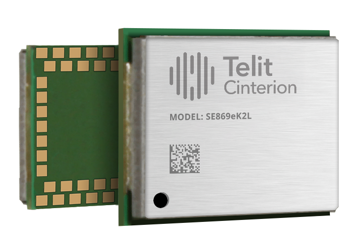
Telit Cinterion has launched the SE869eK2L, a single-frequency L1 GNSS module designed to help device manufacturers upgrade legacy positioning designs with improved performance and cost efficiency, while preserving design continuity.
Built on the Airoha AG3352 platform, the SE869eK2L supports GPS, GLONASS, Galileo, BeiDou and QZSS for reliable multiconstellation positioning. With approximately 1.5-meter accuracy and update rates of up to 10 Hz, it is well-suited for connected devices that require dependable positioning without the cost or complexity of higher-end GNSS architectures.
For OEMs managing product refresh cycles, the SE869eK2L provides a straightforward migration path from Telit Cinterion’s SL869L-V2 and legacy xL869 modules. Its 12.2 x 16 mm footprint maintains pin-to-pin compatibility with the industry-standard form factor, so OEMs can extend existing designs while gaining updated performance and supply flexibility. The footprint includes reserved pins for future use.
The module is designed for a broad range of IoT and industrial use cases, including:
Asset tracking
Fleet management
Smart infrastructure
Cell-tower synchronization
Industrial equipment
Wi-Fi 6E / 7 routers
The SE869eK2L also supports connected devices that require reliable L1 positioning.
Two hardware variants are available: a 3.3 V option and a 1.8 V option, allowing designers to align the module with their system architecture and power requirements.
Dedicated firmware variants provide Windows Location Services compatibility and enable precise timing functionality, delivering synchronization output with ±7 ns jitter.
The module also supports Wi‑Fi navigation mode, enabling compliance with Automated Frequency Coordination (AFC) requirements for Wi‑Fi 6E and Wi‑Fi 7 routers.
Device manufacturers building connected products can pair the SE869eK2L with Telit Cinterion cellular modules — including those without embedded GNSS — simplifying sourcing, integration and support through a single supplier.
Samples of the SE869eK2L are expected to be available soon, with mass production planned for the fourth quarter of 2026.
Telit Cinterion will exhibit at Hardware Pioneers Max, Stand G4, where attendees can learn more about the company’s GNSS, cellular IoT and industrial connectivity portfolio.
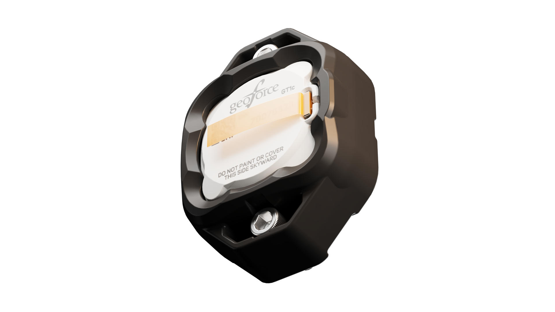
Geoforce has launched the GT1c, which enables rugged cellular equipment tracking at scale. According to Geoforce, the GT1c has a more cost-effective, purpose-built design to complement Geoforce’s full range of satellite tracking devices.
The GT1c operates on AT&T’s network, built for the next era of IoT connectivity for business. The device’s launch builds on a collaboration with AT&T Business announced in March and represents the first product outcome of the relationship.
The GT1c captures and feeds smart location updates to Geoforce’s mobile-enabled asset intelligence platform, providing field operations and asset managers with visibility into the location, movement and utilization of industrial assets and equipment.
The GT1c has an encapsulated design, reinforced bezel, and intrinsic safety certification to ensure that it can survive in hazardous, heavy-vibration environments and extreme temperature ranges. It’s low price means customers can afford to track almost every asset class, the company said.
Pilot programdemonstrates value
In a pilot program with Black Diamond Equipment Rental, the GT1c demonstrated that expanding tracking across mid-tier and small assets is both practical and operationally impactful. The heavy-duty equipment rental company expanded tracked inventory by 26% across smaller and mid-tier construction and oil and gas rental assets. The result was a significant reduction in operational friction and time savings expected to exceed 500 hours per year.
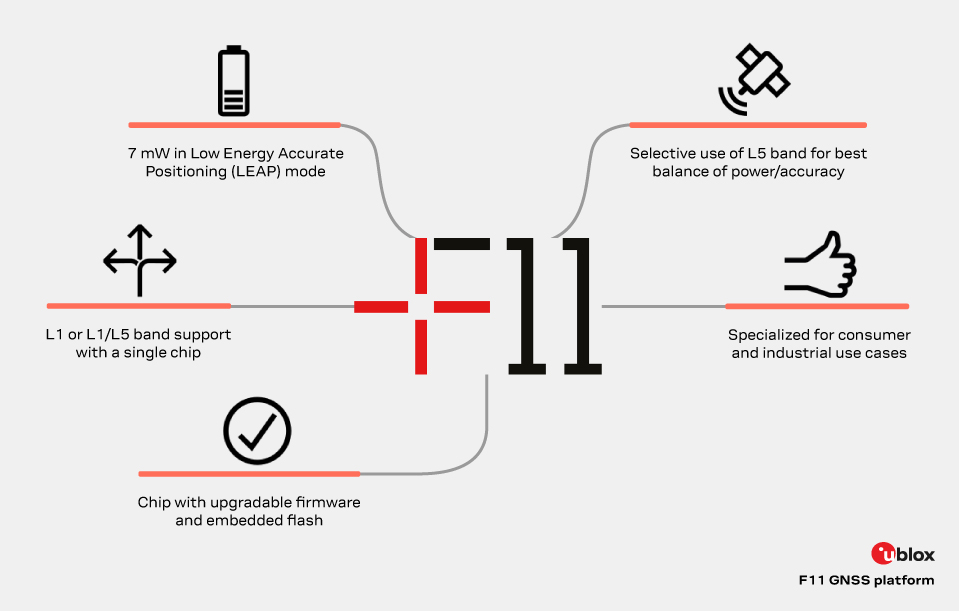
The new u-blox F11 platform provides L1/L5 dual-band standard-precision GNSS designed to significantly improve positioning accuracy while dramatically reducing power consumption to as low as 7 mW in typical configurations using low-energy accurate positioning (LEAP) mode for tracking and wearable applications.
The F11 platform marks a major step forward in meter-level GNSS positioning, the company said. It combines ultra-low power operation with intelligent signal management to meet the evolving demands of tracking, wearables, telematics and mobility applications — including micromobility solutions and drones. The platform enables device manufacturers to achieve longer battery life, faster and more reliable position fixes, and greater design flexibility, u-blox said.
Intelligent dual-band operation
Expanding power saving capabilities, the F11 platform is a new situationally aware GNSS architecture (with integrated geofencing and indoor detections) that dynamically balances accuracy and power consumption. By selectively using dual-band L1/L5 operation only when it helps maintain the positioning performance, the F11 platform reduces energy use while providing resilience and maintaining confidence in location data.
Compared to previous generations, the platform delivers up to 40% lower power consumption during signal acquisition and up to 30% lower power consumption in continuous tracking modes, while improving position accuracy by up to 30% in challenging environments such as dense urban areas. For long-life tracking applications (assets, livestock, pets and people), optimized first-fix performance further reduces GNSS on-time, enabling multi-year battery operation.
For scalable, high-volume applications
The u-blox F11 platform addresses the growing demand for GNSS solutions that are robust, power-efficient, and easy to integrate across a wide range of industries. The platform supports both single-band and dual-band operation within a single footprint, allowing device manufacturers to simplify designs and scale products across multiple market segments.
Key application areas include:
asset and fleet tracking
consumer and fitness wearables
aftermarket telematics
livestock tracking
people/pet tracking
industrial sensing and IoT
micromobility and mobility services
consumer drones and action cameras
By focusing on real-world performance rather than raw specifications, the F11 platform enables faster development cycles, improved user experience, and lower total system cost for OEMs — with form-factor compatibility and firmware upgradeability as a way to future proof designs.
Availability
The platform is being showcased at Embedded World 2026. First products will be available by the end of June 2026.
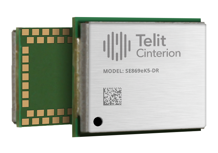
Telit Cinterion, an end-to-end IoT solutions enabler based in Irvine, California, has launched the SE869eK5-DR, a dual-band, multi-constellation positioning receiver with untethered dead reckoning (UDR) built on the Airoha AG3335 chipset family.
The UDR ensures reliable, continuous positioning even when satellite signals are lost due to jamming, interference or physical obstructions, delivering continuous and reliable location data for mission-critical applications without depending on a car connection.
With its power-efficient design, the module is ideal for mission-critical applications in business and government that demand ultra-reliable location information, and long battery life. Applications include fleet management, automotive telematics systems, and high-value asset tracking, where uninterrupted and precise location data is critical for operational efficiency.
Building on the successful Telit Cinterion SL869 series, the SE869eK5-DR adds an integrated six-axis sensor for UDR. This allows the module to maintain a position fix even when signals are blocked or jammed, able to track high-value assets deep inside buildings or in underground parking garages.
The SE869eK5-DR also supports L1 and L5 bands, which maximizes resiliency through frequency redundancy. If one band’s signals are degraded by physical obstructions, the other band provides an alternative set of signals. The module also supports differential GNSS (DGNSS) positioning for applications that require sub-meter-level accuracy.
The SE869eK5-DR includes features that streamline product development. Its UDR technology is simple to integrate because it doesn’t require any external application information, which shortens the design phase. It also automatically identifies the direction of movement (forward or reverse), eliminating the need for a separate heading pin. While the SE869eK5-DR introduces an additional 34 pins for future use, it remains backward compatible with previous 24-pin generations, allowing device OEMs to upgrade existing designs.
SE869eK5-DR engineering validation testing (EVT) samples are available now, with design validation testing (DVT) samples scheduled for November.
Visit the Telit Cinterion booth (E314) at SIDO Sept. 17-18, 2025 in Lyon, France, to learn more.
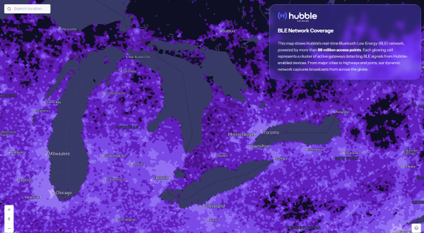
Bluetooth network enables real-time asset tracking for enterprises worldwide
The new Hubble BLE Finding Network is a Bluetooth Low Energy (BLE) finding network built specifically for enterprise use. Hubble, based in Seattle, is a satellite startup enabling Bluetooth devices to connect directly to space.
While consumer platforms like Apple’s Find My and Google’s Find My Device brought BLE discovery to personal devices, Hubble now brings that same reach and simplicity to businesses, offering real-time visibility and full data ownership on a global scale.
“Consumer networks proved what’s possible, but businesses were left out,” said Alex Haro, co-founder of Hubble. “We’re giving them a powerful alternative with global visibility, zero infrastructure and full ownership of their data.”
The Hubble BLE Finding Network leverages nearly 100 million passive scanners across gateways, smartphones and partner infrastructure, powered by low-cost BLE chips already embedded in billions of devices. This extensive network covers homes, cities, transit systems and industrial sites, enabling comprehensive global asset tracking for enterprises.
Key Features
Global Reach: Real-time bluetooth discovery via 88+ million scanners worldwide.
Data Ownership: Maintain full enterprise control with no closed systems or vendor lock-in.
Infrastructure-Free: Activate tracking with existing BLE devices, no hardware required.
Robust Security: Protect data with encryption, rotating IDs, and verified endpoints.
Developer Friendly: Enable seamless integration with open SDKs and APIs.
Enterprise Use Cases
Asset Tracking: Monitor tools, inventory, and equipment globally.
Fleet Management: Track assets in transit, on job sites, or in the field.
Temperature Monitoring: Instantly track temperature with BLE sensor tags.
Workplace Safety: Locate badges and wearables in hazardous environments.
Equipment Sharing: Gain visibility and usage insights across distributed teams.
The Hubble’s BLE Network is now live and available for commercial deployment, including developer tools and onboarding support. To learn more or apply for access, visithttps://hubblenetwork.com.
In March 2024, Hubble made history with its Bluetooth connection to space. With a 96-satellite constellation planned by 2028, the company aims to connect one billion devices worldwide.
VertiGIS has introduced VertiGIS Neo, a secure, cloud-based platform designed to improve sector-specific workflows through artificial intelligence (AI).
According to the company, VertiGIS Neo aims to accelerate business operations, streamline problem-solving and boost productivity by delivering modern web and mobile user experiences across its suite of solutions, including VertiGIS Studio, VertiGIS FM, VertiGIS Networks and VertiGIS ConnectMaster.
The platform incorporates embedded AI to drive innovation for both end users and application development teams. VertiGIS Neo enhances workflow processes in three key areas:
End-user assistants: AI-powered assistants and a low-code/no-code interface help users complete tasks more efficiently in web and mobile applications.
Application builder productivity: AI co-pilots enable administrators to configure and customize solutions with less effort.
Process transformation: AI capabilities fundamentally change how work is performed, from field operations to back-office tasks.
Flexible Cloud Deployments
VertiGIS Neo is built on a cloud-first infrastructure that supports fully managed, private, or hybrid cloud environments, offering operational flexibility, scalability and enhanced security. The platform supports rapid deployment within CI/CD pipelines and provides predictable pricing models for customers.
VertiGIS Neo offers three deployment options:
Cloud managed services: Complete cloud-based solution delivery, including data, infrastructure and applications.
Private cloud: Turnkey deployment into customer environments using prescribed hardware and containers.
Hybrid cloud: Multi-tenant and single-tenant SaaS applications accessing customer data within their environment.
Industry Solutions
VertiGIS Neo is designed to address business challenges across several sectors:
Utilities: Enables customers to model physical network infrastructure as digital twins and manage millions of service points, supporting the entire asset lifecycle from planning to decommissioning.
Telecommunications: Streamlines management of FTTx services and oversees both physical assets and logical circuits for communications providers.
Local Government: Helps build transparent, engaged and sustainable smart cities, improving engagement for both citizens and staff.
Enterprise: Integrates IoT and AI for real-time intelligence, remote sensing and asset tracking, fostering innovation in the private sector.
VertiGIS Neo’s features include dynamic attribute analysis with natural language queries, voice-to-prompt interfaces for map queries and automatic asset inspection and damage assessment using image recognition. The platform also allows users to create intelligent workflows from text prompts and automates the digitization of paper forms into digital records.
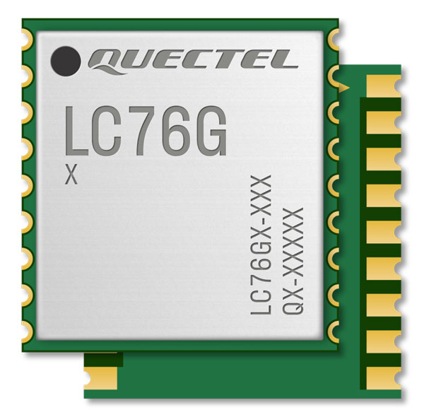
Quectel Wireless Solutions’ LC76G GNSS module has been named a Product of the Year byElectronic Products.The annual awardsrecognizeproducts that represent a significant advancement in technology or its application, an exceptionally innovative design, a substantial achievement in price/performance, improvements in design performance, and a potential for new product designs/opportunities.
Image: Quectel
The LC76G module is a compact, single-band, ultra-low power GNSS module thatfeaturesfast and accurate location performance. The module can concurrently receive and process signals from all satellite constellations including GPS, GLONASS, BeiDou, Galileo and QZSS.
Image: Quectel
The LC76G has an internal surface acoustic wave (SAW) filter and integrated low-noise amplifier (LNA), which can be connected directly to a passive patch antenna and provides filtering against unwanted interference. With a compact size of 10.1 mm × 9.7 mm × 2.4 mm, the footprint of the LC76G is compatible with other industry solutions, as well as Quectel’s legacy L76 and L76-LB modules.
The LC67G is designed for battery-operated, ultra-low power GNSS devices, such as wearable personal trackers, wildlife and livestock tracking, toll tags, portable container trackers, as well as several traditional markets such as shared mobility and low-cost asset trackers.
A roundup of recent products in the GNSS and inertial positioning industry from the September 2022 issue of GPS World magazine.
OEM
Receiver Upgrade
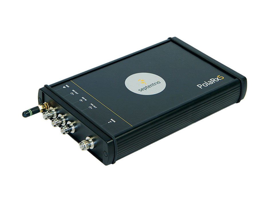
OSNMA anti-spoofing tech now on PolaRx5 GNSS reference receivers
Photo: Septentrio
Open Service Navigation Message Authentication (OSNMA) is now available on the high-end PolaRx5 reference receiver series. OSNMA offers end-to-end authentication on Galileo’s civilian signals, protecting receivers from GNSS spoofing attacks. OSNMA adds another layer of security to the receivers’ existing AIM+ anti-jamming and anti-spoofing technology. The PolaRx5 product range also now supports RINEX format versions 3.05 and 4.0.
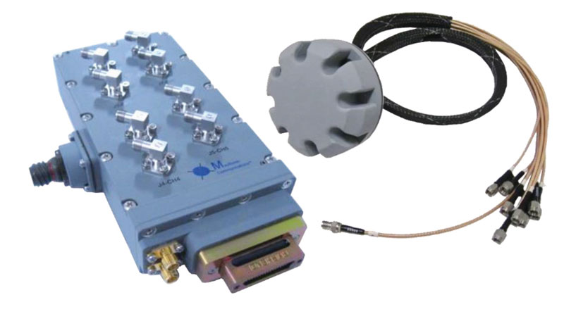
The MAGNA-F and MAGNA-I GPS anti-jam antennas provide simultaneous L1/L2 protection and can protect commercial and military GPS receivers on aircraft. The MAGNA products were developed with sponsorship by the U.S. Navy and further improved by the U.S. Army to support GPS protection requirements for air, sea and ground platforms, such as fixed-wing/rotary aircraft, ships, UAVs and tactical vehicles. The MAGNA-F uses a 3.5-inch-diameter controlled reception pattern antenna (CRPA) compatible with existing fixed radiation pattern antenna (FRPA) footprints. The MAGNA-I (NavGuard 730) is a high-performance yet small GPS anti-jam integrated solution with a 4.5-inch diameter FRPA-compatible footprint.
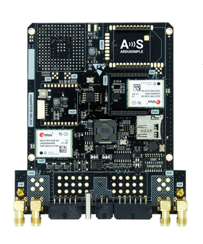
Centimeter-level GNSS for mass-market applications
Photo: ArduSimple
The SimpleRTK2B single-board computer (SBC) is built around up to three u-blox ZED-F9P high-precision GNSS receivers. It simplifies development of centimeter-level positioning solutions supporting real-time kinematics (RTK), making the technology accessible to broader audiences. The SimpleRTK2B-SBC was developed to make RTK technology as close to plug-and-play as possible. In addition to working as a stand-alone solution, customers can program their own applications with the company’s microPython API. The SimpleRTK2B-SBC delivers mechanical integration with centimeter position on three axes (heading, pitch and roll), outputting on NMEA, RTCM, RS232 and CANBus interfaces via Ethernet, Bluetooth, Wi-Fi and 2G/3G/4G communication. It offers configurable input/output and an inertial measurement unit.
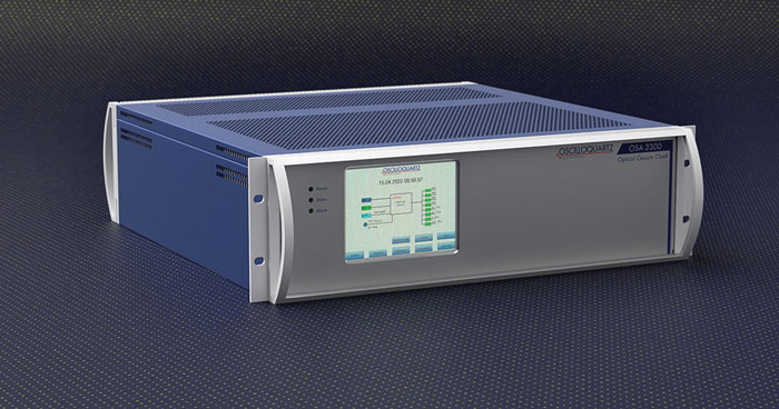
For assured positioning, navigation and timing (PNT)
Photo: ADVA
The OSA 3300-HP is a high-performance optical cesium clock with a 10-year lifetime compared to the five-year lifetimes of high-performance magnetic clocks. It provides the resilience required for PNT assurance in critical infrastructure and empowers service providers to deliver differentiated service-level-agreement timing offerings with integrated GNSS backup. The OSA 3300-HP has embedded Ethernet- and IP-based management as well as a user-friendly touchscreen graphical user interface.
With M-Code capabilities and upgrade paths for other GNSS systems
Photo: Collins Aerospace
NavHub-200M is a vehicle navigation system for the international market with military code (M-code) receiver capabilities. NavHub-200M provides assured positioning, navigation and timing (APNT) while improving overall resistance to threats to GPS, such as jamming and spoofing. Its message formats and signal modulation techniques ensure faster and more accurate performance for ground vehicles on the connected battlespace, while advanced security features prevent unauthorized access or exploitation. NavHub-200M also includes the open interface standards and sensor-fusion capabilities required for a GNSS upgrade path, such as that for Europe’s Galileo constellation, as well as the ability to interface with key vehicle sensors such as the inertial measurement unit (IMU) and odometer.
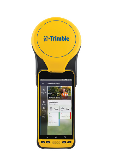
The Trimble TDC650 handheld is built for data collection, inspection and asset management activities. The rugged solution provides scalable high-accuracy GNSS positioning for professional field workflows, including apps such as Esri ArcGIS Field Maps and Trimble TerraFlex software. The TDC650 is scalable, allowing customers to choose their desired accuracy down to the centimeter level.
Powerful solution for manned and unmanned aircraft
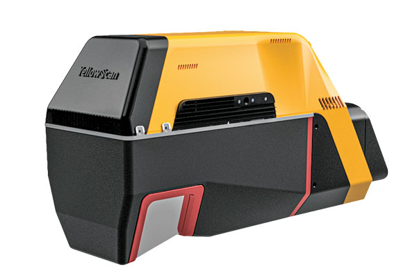
Photo: YellowScan
The Voyager long-range lidar scanner has a wide field of view, with all points collected oriented toward the ground so there is no loss of points. In all, 1.5 million points per second will be usable. Voyager combines a Riegl VUX-120 laser scanner with a Trimble Applanix AP+ 50 AIR or Applanix AP+ 30 AIR GNSS-inertial board, providing a precision of 0.5 cm and an accuracy of 1 cm. Voyager’s detection and processing of up to 15 target echoes per laser pulse allows for excellent vegetation penetration. It has an extremely fast data-acquisition rate of up to 1,800 kHz, suitable for projects requiring the highest point density. The laser scanner’s specifications can be customized and can be combined with YellowScan’s software solutions.
Extends 3D Tiles Next workflow into Esri ArcGIS Pro
Photo: ArcGIS
The 3D Environments Add-In application for Esri ArcGIS Pro allows ArcGIS users to rapidly transform 3D Tiles Next data formats, such as One World Terrain, into ArcGIS Pro projects to create 3D scenes from 2D vector data and 3D models. The add-in leverages Presagis’ building templates and texture libraries that analysts use to create enhanced 3D visualizations of GIS environments, helping increase collaboration across the enterprise. The 3D Environments Add-In contains tools to create, transform and extract a wide variety of 3D formats to provide seamless interoperability between ArcGIS Pro and modeling and simulation applications. It is available on the Esri ArcGIS Marketplace.
Energy performance data helps tackle climate change
Photo: XMAP
Municipal geographic information system XMAP can now incorporate the energy-performance ratings of individual properties to help local authorities tackle climate change, improve housing standards, and ensure landlords comply with legislation. The Energy Performance Certificate (EPC) data layer uses a rating system similar to the one used on new appliances, ranging from A (very efficient) to G (inefficient). It allows tenants and house buyers to make informed decisions. In addition to a color-coded visualization of current ratings, the XMAP EPC layer contains enhanced analysis including generalized ratings and the potential for improvement. Bath and North East Somerset Council, UK (pictured), has embraced this resource and is looking at how the data can be used to raise housing standards.
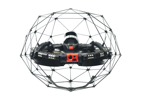
The Elios 3 is a collision-tolerant drone equipped with a lidar sensor for indoor 3D mapping. The drone is powered by a new SLAM engine called FlyAware that lets it create 3D models as it flies. It also hosts a new version of Flyability’s software for inspectors, Inspector 4.0. The Elios 3 comes with an Ouster OS0-32 lidar sensor, allowing inspectors to collect data for the creation of survey-grade 3D models using Connect software from Flyability’s partner GeoSLAM. Protected by a cage, the Elios 3 has advanced collision-tolerance features that allow inspectors to fly it inside dangerous confined spaces such as boilers, pressure vessels and mines.
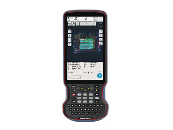
The R60 is a powerful handheld with an ergonomic design. It runs on Android 12 OS, providing a suitable workhorse for surveying professionals in the field. Survey Master field software works seamlessly on the R60, which features a Qualcomm 8-core processor for massive data processing. Its 64-GB memory allows ample data storage and enables the opening of CAD drawings in seconds. Other features include a QWERTY keyboard, a 5.5-inch sunlight-readable high-resolution screen, an IP67 rating (dustproof and waterproof), and a 9,000 mA Li-ion battery for more than 30 hours of continuous functioning.
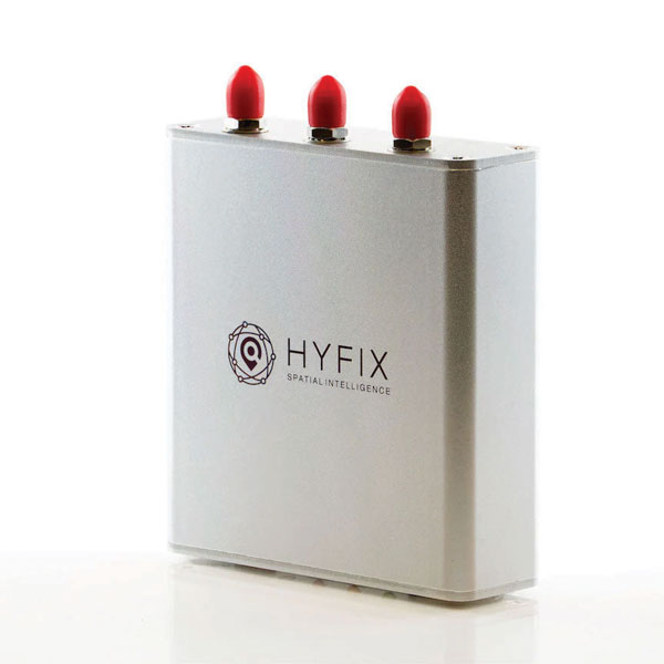
The Mobile Centimeter (MobileCM) Space Weather Station is a ready-to-use GNSS device that will act as a real-time kinematic (RTK) base station and collect space weather data. The device is pre-configured to securely connect with the Global Earth Observation Decentralized Network (GEODNET) using a home Wi-Fi network. The full four-constellation GNSS base station has built-in NTRIP server functionality and is packaged with a survey-grade triple-band roof antenna and required cables.
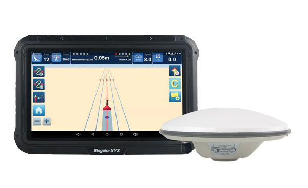
The SAgro10 GNSS guidance system is an entry-level guidance system for precision agriculture, providing users with higher navigation precision and higher productivity, which can be upgraded to an automatic steering system. Embedded with a high-precision GNSS module, the SAgro10 system tracks all four global constellations. For users with network coverage or a UHF base station, the system provides centimeter-level accuracy navigation in real-time kinematic mode. In the absence of base stations, the SAgro10 system provides sub-meter navigation accuracy in single-point smoothing mode. Compatible with most agricultural tractors, its components can be installed within 15 minutes. The 10-inch sunlight-readable touchscreen has a clear and simple graphic interface.
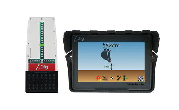
iDig 3D Connect is a solar-powered excavator guidance system with a GNSS receiver that can be removed and used as a rover, rather than permanently installed on the machine. 3D excavator guidance has seldom been used for small projects such as house foundations because of the need for a surveyor to stake out points and map a site. The removable receiver enables contractors to complete these tasks. The software provided creates a GNSS-generated site map, enabling precision digging relative to the area and making the process quicker, simpler and more eco-friendly than with 2D.
The Cloud Locator service takes data from LoRa Edge-enabled devices and uses Semtech’s LoRa Cloud Geolocation and Modem services for asset tracking both indoors and outdoors. It features built-in serverless technology and enables testing of ultra-low-power asset tracking on either a private or public LoRaWAN network. It is designed to work with trackers using Semtech’s LoRa Edge LR-series chips. The LR-series chips combine Wi-Fi and GNSS to obtain the latitude and longitude of devices in any indoor or outdoor location. Once configured on the service, together with Semtech’s LoRa wireless radio frequency technology for transmission to the cloud, customers can view the tracker location on a map in less than 15 minutes.
The Edge 1040 bike computer features solar charging and multi-band GNSS technology. Its multi-band GNSS receiver (GPS, GLONASS and Galileo) provides accurate positioning in challenging ride environments, such as dense urban areas or under deep tree cover. Advanced navigational tools help cyclists stay on track, such as turn-by-turn navigation and alerts that notify riders of sharp curves ahead. Route guidance and off-course notifications can be paused for exploring and turned back on for return to the original route. When using the Trailforks app, Forksight mode automatically displays upcoming forks in the route and where a rider is within a trail network.
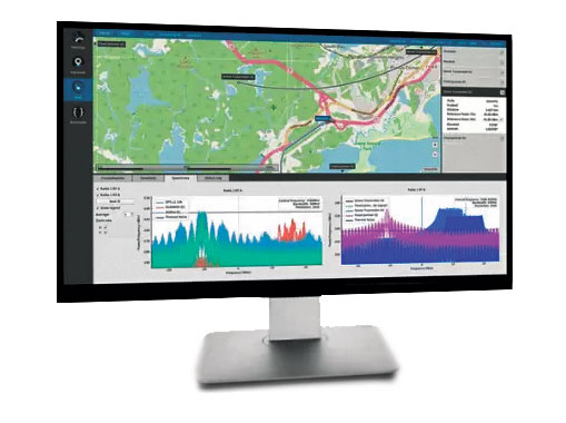
Skydel 22.5 is a significant software upgrade to the Skydel simulation product line. It features advanced hardware-in-the-loop (HIL) testing solutions providing very low to zero effective latency. Enhanced visualization tools can monitor internal latency through real-time curves showing when the data is generated and sent to the RF signal. Users can also review the transmission of HIL packets for optimizing the entire network’s latency, checking its stability (jitter), and that data is available and used at the right time in Skydel. HIL testing is an essential step in the verification process of the model-based design approach because it involves all the hardware and software that will be used operationally.
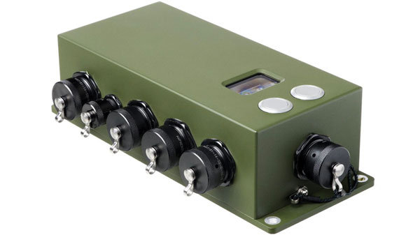
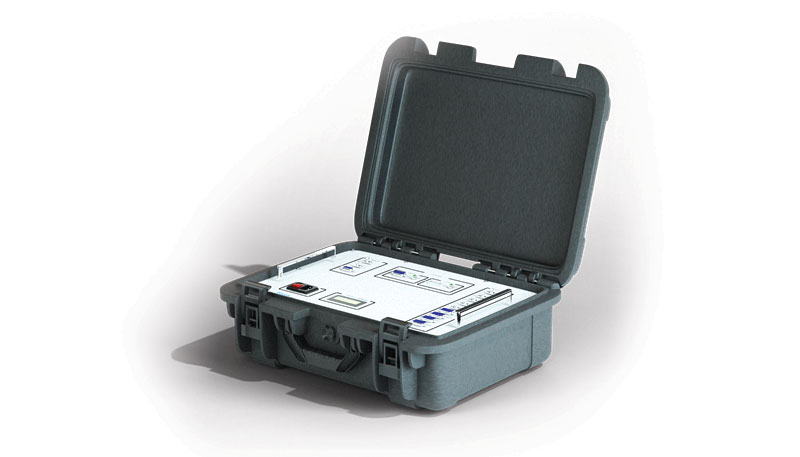
The Time-Loader is designed for defense and mission-critical applications, for deployment in environments where GNSS signals are denied or disrupted. It supports any ground, naval or airborne system that needs real time of day (TOD) and 1PPS external synchronization aligned to the UTC or GNSS. It generates a GPS L1 C/A code RF output as if the signal were coming from a live-sky GPS antenna. It provides full-constellation GPS output and is compatible with external GNSS receivers. Its GPS-disciplined oscillator (GPSDO) is the Microsemi MAC-SA53/55, which provides excellent UTC accuracy with outstanding hold-over rubidium clock performance. A self-contained, miniature GPS simulator provides real-time extremely accurate signals. The 18-channel full-constellation simulator stores location/time/date data in internal memory and stores complex vector data to simulate dynamic scenarios. The simulator also can be used to transcode NMEA or SCPI position/ velocity/time (PVT) data into GPS RF signals.
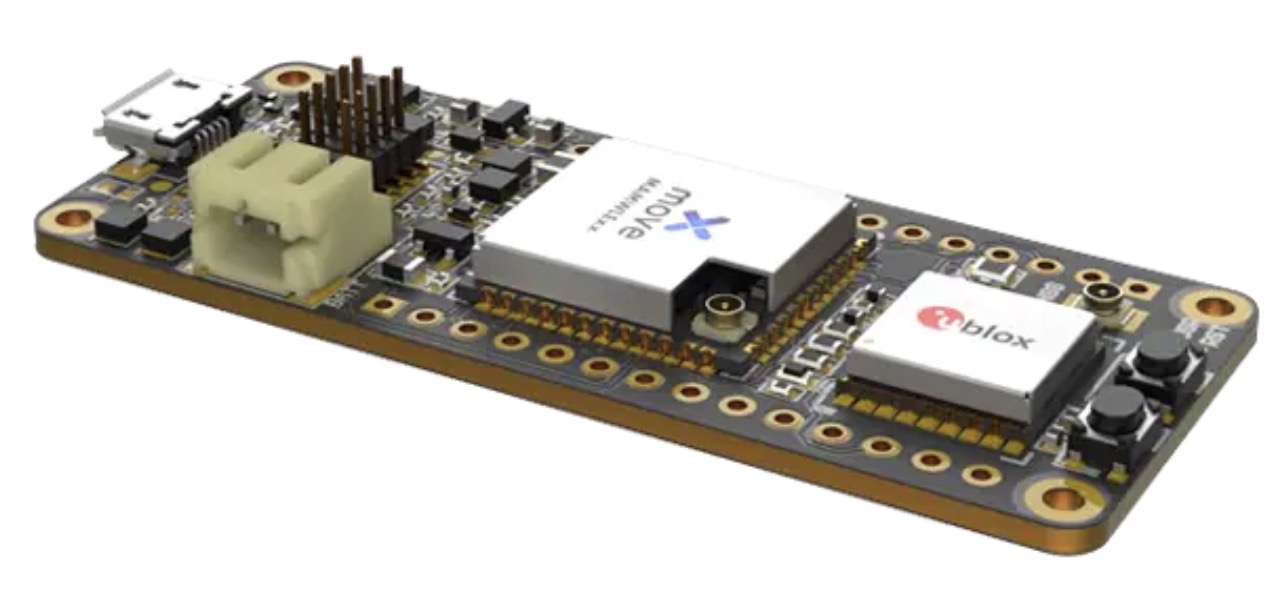
Telecommunication electronics company Move-X is offering a new LoRa/GNSS board. The Cicerone LoRa/GNSS board is a high-performance, low-power, Arduino MKR-compatible development board based on the u-blox MAX-M10S GNSS module and the MAMWLE LoRa module.
The Cicerone board delivers high-performance GNSS, long-range wireless connection, and high-performance MCU processing in a low-power solution for optimal battery life.
The board allows users to build tracking applications worldwide with meter-level accuracy and to communicate long-range, low-power data via LoRaWAN. The integrated Li-Po charging circuit enables the Cicerone board to manage battery charging through the USB port.
The Move-X Cicerone LoRa/GNSS board has a compact 63 x 25 mm form factor and is compatible with all Arduino MKR shield boards. These boards all share a common pinout to enable developers to easily add expansions with minimal software changes.
The new service gives customers the opportunity to experience devices powered by LoRa Edge and evaluate the accuracy and power consumption of the LoRa Edge platform, which offers an ultra-low power and cost-effective solution for indoor/outdoor asset tracking.
LoRa Cloud Locator features built-in serverless technology and delivers a simple end-to-end experience for customers to evaluate LoRa Edge implemented in various ecosystem trackers, either on a private or public LoRaWAN network.
“Asset tracking is one of the most common use cases across industry verticals,” said Karthik Ranjan, LoRa Cloud solutions and partnerships leader in Semtech’s Wireless and Sensing Products Group. “Whether it’s tracking wheelchairs in a hospital, shopping carts in retail, pallets in supply chain, cattle in agriculture, or pets around a home, asset tracking can be found everywhere. Semtech’s LoRa Cloud Locator is the fastest way for customers to easily see for themselves the benefits offered by purchasing trackers with LoRa Edge, provisioning them onto the application and seeing their location on the map.”
LoRa Cloud Locator is designed specifically to work with trackers using Semtech’s LoRa Edge LR-series chips with minimal effort. Once configured on the service, together with Semtech’s LoRa wireless radio frequency technology for transmission to the cloud, customers can view the tracker location on the map in less than 15 minutes.
“Semtech’s LoRa Cloud Locator is the most efficient and fast way to evaluate the LoRa Edge platform as it can measure the performance of the technology and differentiate when a device is tracked by GNSS or Wi-Fi,” said Maximiliano Ruiz, founder and CEO at Galileo RTLS. “With the Wi-Fi location feature, we can now receive GNSS signals without paying for the prohibitive power consumption of traditional GNSS technologies. Through leveraging LoRa Edge, locating assets around the world is much simpler with the unprecedented years of battery life.”
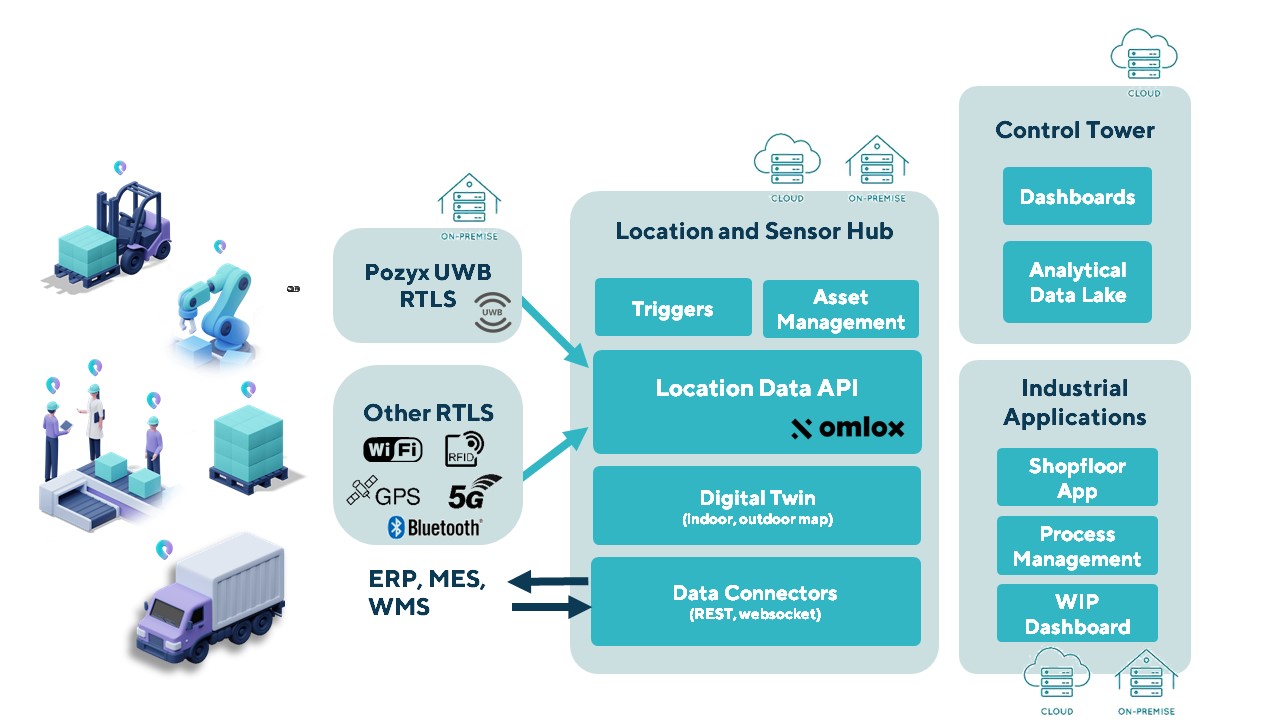
The Pozyx Platform is an asset tracking and identification solution for seamless indoor and outdoor tracking, based on the omlox hub and supporting multiple location technologies.
The omlox hub is an open standard for real-time location systems (RTLS) that combines location data from GPS, ultra-wideband, 5G, radio-frequency identification, Wi-Fi and Bluetooth.
The Pozyx Platform offers a seamless indoor/outdoor transition with zoom-in from a worldwide map to a detailed indoor map, showing highly accurate locations up to 10 cm. It is designed for smart manufacturing, providing a supply-chain solution that supports Industry 4.0.
It tracks and identifies any asset, providing real-time data to facilitate warehouse and inventory control, keep track of critical tools, and slash lost asset costs.
A roundup of recent products in the GNSS and inertial positioning industry from the May 2022 issue of GPS World magazine.
SURVEYING
Measurement Workflows
Field-to-office inspection with survey-grade accuracy
Photo: Trimble
Trimble Access field software now connects with Infotech’s Appia service to streamline the workflow from survey to construction. Aimed at the inspection process for civil infrastructure projects, the software provides high-accuracy measurement workflows for daily work reports and inspection reporting for engineering, construction and public agencies. By streamlining the connection between data collected by Trimble GNSS rovers and simultaneously syncing Trimble Access, Infotech Mobile Inspector and Infotech Appia, inspectors can now complete their daily work reports more efficiently in the field and reduce errors. With manual processes removed, inspectors can more accurately represent infrastructure assets.
For surveying, mapping and construction professionals
Photo: CHCNav
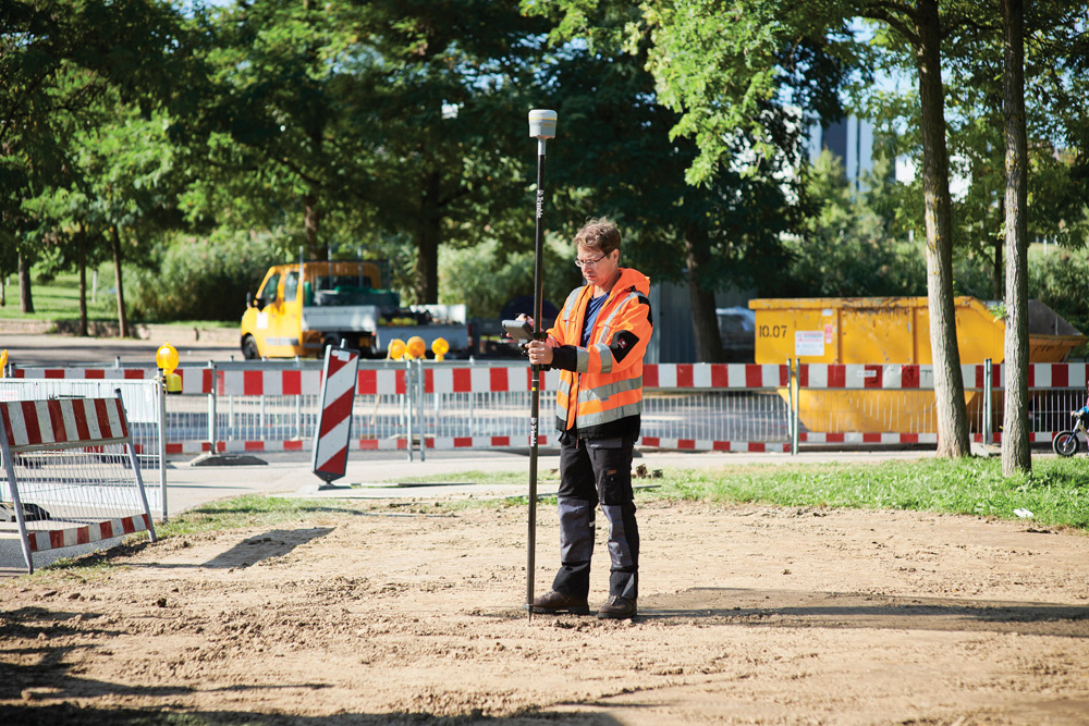
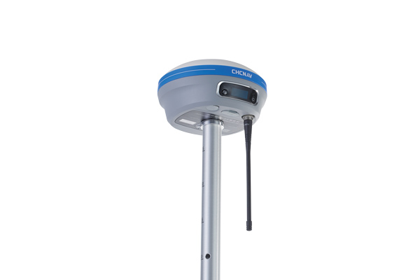
The i83 GNSS receiver is powered by a multi-band GNSS receiver, iStar technology, and a calibration-free, high-end inertial measurement unit (IMU) for faster and reliable field GNSS surveying. The third-generation high-gain antenna with advanced CHCNAV iStar algorithm improves GNSS satellite signal tracking efficiency by more than 30%. The i83 GNSS receiver features 1,408 GNSS channels for high performance across GPS, GLONASS, BeiDou, Galileo and QZSS constellations. Its onboard GNSS technology delivers centimeter-level positioning, maintains reliable fixed real-time kinematic (RTK) accuracy, and collects points faster than previous models, even in demanding conditions. The i83 receiver’s built-in IMU automatically compensates for pole tilt. In less than 5 seconds, the 200-Hz inertial module is initialized to ensure survey-grade accuracy over a pole-tilt range of up to 30 degrees. Productivity is dramatically increased, RTK usability greatly improved, and potential human error reduced, whether you are an engineer, site foreman or surveyor.
Simplifies surveying with both GPS and total station
Photo: Carlson Software
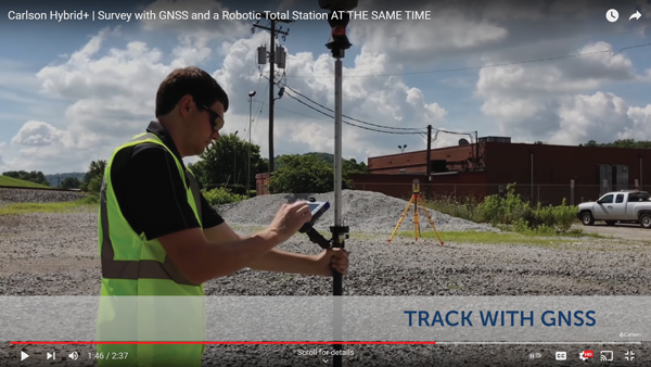
SurvPC Hybrid+ is a module for SurvCE version 6 software that enables surveying with mixed brands of GNSS receivers and total stations. SurvCE is a data-collection software package from Carlson Software. SurvPC Hybrid+ provides driver support for numerous devices, allowing the surveyor to interface with both types. Features include Follow Me, Smart Lock, Smart Staking, Cross Check, Backup Tracking, Hybrid-Resection, Auto-Localize, and Easy Setup Wizard.
SurPad 4.2 is designed to help surveyors work efficiently at all types of land surveying and road engineering projects in the field. It runs on eSurvey handhelds, Android smartphones and tablets, and third-party Android devices. It integrates with professional receiver control, point collection, stakeout, geographic information system (GIS) data collection, road measurement, road design, cross-section measurement and railway stakeout. SurPad 4.2 provides multiple operation and communication systems, has mapping and CAD functions, and has a coordinate system. It also includes a survey mode encompassing topo, control, quick point and COGO civil engineering programs.
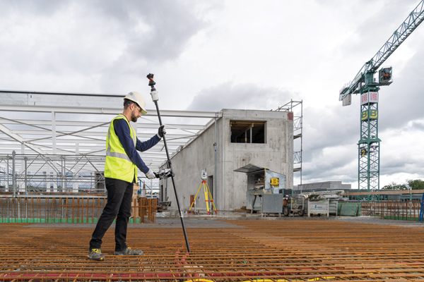
The Leica AP20 AutoPole provides tilt compensation, automatic pole-height readings and unique target identification for automated total stations. It combines an intelligent sensor module with the AP Reflector Pole and operates with existing Leica Geosystems’ automated total stations to create a solution for autonomous workflows. Tilt compensation decreases measurement time and increases flexibility and safety on site by enabling measurement of points in inaccessible or risky locations. By updating the pole height automatically in the field software, the system ensures that the height on record is always correct.
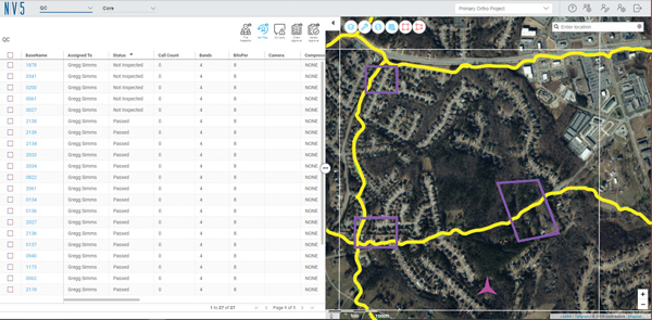
INSITE Data Reviewer moves geospatial data validation to the cloud, giving key stakeholders the ability to collaborate in real time. The third module in the INSITE Lifecycle suite of products, INSITE Data Reviewer provides reviewers real-time access to aerial imagery, lidar data and geographic information system (GIS) layers via the cloud to standardize quality control. This increases data validation speed and reduces costs of geospatial projects. The INSITE Lifecycle suite combines Project Tracker, Data Delivery and Data Reviewer modules through which users can see their projects executed on a map, from data acquisition through processing.
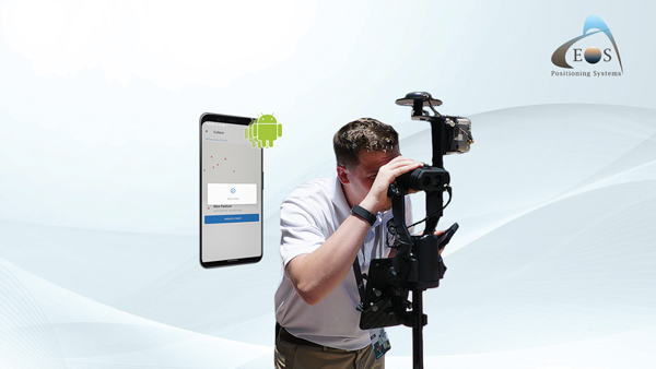
Eos Laser Mapping for ArcGIS is now available on Android devices. It allows mobile crews to capture high-accuracy laser offsets directly into ArcGIS Field Maps with Arrow Series GNSS receivers. The solution combines technology from geographic information system (GIS) provider Esri, laser rangefinders from Laser Tech, and Eos’ own Arrow Series GNSS receivers. The release supports three workflows: standard laser offset (range-azimuth), range-range (range-intersect) and range-backsight (a total station-like method).
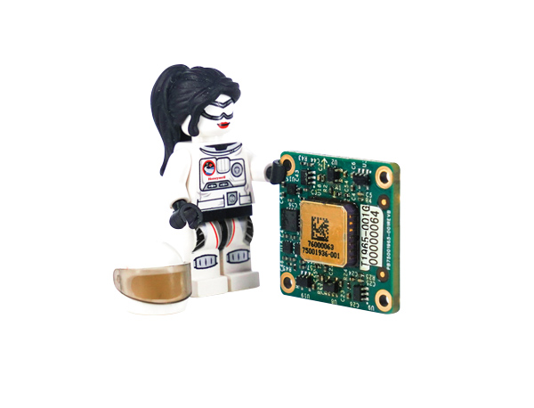
The MV60 micro-electromechanical system (MEMS) accelerometer delivers high performance and reliability in a small, rugged and low-cost package. The MV60 measures the acceleration experienced by an object during movement and is designed for use in inertial measurement units and navigation systems deployed on land, air and sea vehicles to measure velocity. It has a compact footprint of 1.2 square inches and shock survivability of up to 5,000 g. It also offers bandwidth of greater than 300 Hz — important for environmentally demanding missions.
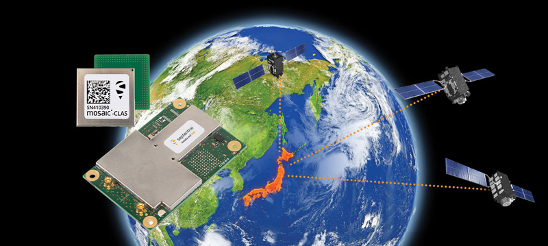
Receivers support Japan’s cm-level augmentation service
Photo: Septentrio
Three multi-frequency GNSS receivers now support the Centimeter-Level Augmentation Service (CLAS), receiving the L6 signal that transmits high-accuracy corrections from Japan’s QZSS constellation. The mosaic-CLAS receiver is in a small form-factor suitable for high-volume industrial applications. The AsteRx-m3 CLAS OEM board combines PPP-RTK CLAS with dual-antenna heading functionality. The AsteRx SB3 CLAS features a ruggedized IP68 enclosure to protect it in harsh environments.
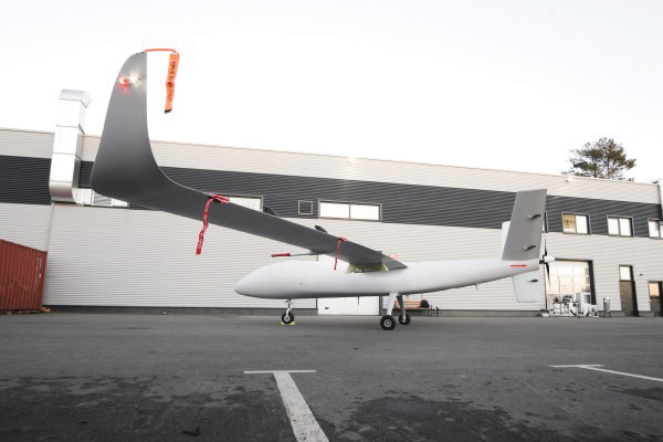
The S1-V300 medium-altitude long-endurance (MALE) unmanned aerial system (UAS) prototype is based on the Saker MALE UAS design that achieved operational capability in 2020. The prototype features a new design and a more powerful heavy fuel engine with 260 HP, offering greater speed, payload and endurance of 28 hours with a range of 4,020 km. The aircraft features unique UAVOS avionics solutions and a redundant flight control system that will enable complex missions, including overland and maritime intelligence, surveillance and reconnaissance (ISR) missions. The improved S1-V300 prototype is equipped with both line-of-sight and beyond-visual-line-of-sight (BVLOS) datalink systems for over-the-horizon operations. It can be integrated with multiple ISR sensors, including electro-optical infrared cameras and a synthetic aperture radar that offers all-weather, day/night performance for a wide-area search capability.
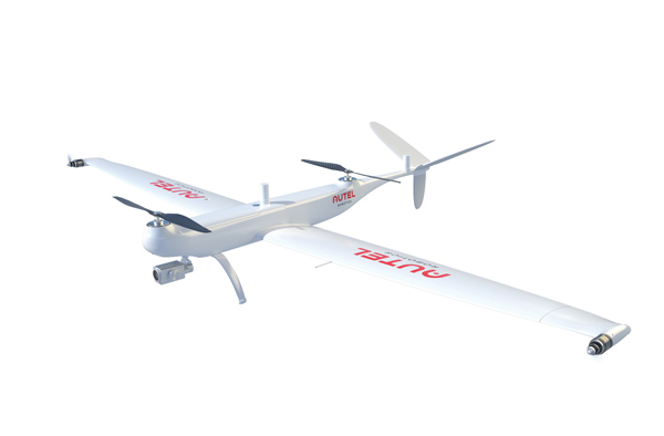
Dragonfish Lite and Pro now available in United States
Photo: Autel Robotics
The rugged Dragonfish UAVs are capable of vertical takeoff and landing (VTOL) with both multi-rotor and winged flight, with an endurance of up to 180 minutes. They are suitable for professional applications such as energy, mining, defense and surveillance. Maximum winged flight speed is 30 m/s (108 km/h, 67 mph), and maximum video transmission range is 30 km (18.6 miles) with a base station. The aircraft can make a smart decision to either land or return to base in case of issues such as loss of GPS signal, loss of operator communications, or low battery power. The tilt-rotor system will automatically transition to multi-rotor mode if adverse conditions cause fixed-winged flight to stall or become unsustainable. The Dragonfish battery, barometer, positioning system, compass and inertial measurement unit all have backup modules to ensure flight safety.
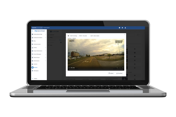
The SureCam connected dash camera system now features a method for capturing video footage from SureCam cameras using Geotab’s telematics device and rule-based system. This results in a seamless display of video within the MyGeotab platform. The enhanced SureCam fleet video solution leverages Geotab’s numerous data-based rules, such as improper seat belt usage and speeding. It also uses G-force triggered alerts that detect unsafe driving behaviors and automatically captures video footage that can be reviewed later. A new Video Request feature in GeoTab enables fleet managers to preview and download additional SureCam video, enabling them to investigate call-ins and other minor incidents that may not have been triggered by an event-based rule.
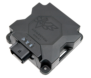
Momentum IoT’s long-life Eagle 1 tracker works without external power for more than six months after a single charge. The device switches on-the-fly between narrowband internet of things (NB-IoT) and LTE Cat-M. The Eagle 1 leverages Telit’s dual-mode ME310G1 module, which delivers low power consumption in a small footprint. The Eagle 1 detects movement with a built-in accelerometer. Using movement and signals from its GPS receiver to determine vehicle trip starts and stops, the device can go into hibernation mode during periods when the vehicle is not in use, further reducing power consumption. Applications include garbage and storage bins, portable toilets, roll-off containers, message-boards, coolers, and other equipment typically stationed in non-powered, remote places for extended periods.