Tag: auto navigation

  • PND Shipments Fell to 22M Units, Despite Nav User Increase

    According to a new research report from the analyst firm Berg Insight, global shipments of personal navigation devices (PNDs) declined from 28 million units in 2012 to 22 million units in 2013. There are signs that the decline is slowing and some emerging markets still experience growth.

    However, on the whole, the PND market is set for a continued downturn on a global basis. Berg Insight forecasts that PND shipments will decline to only 10 million units worldwide in 2019.

    A number of developments are affecting the PND market. Retailers have reduced shelf space and marketing for PNDs in favor of other consumer electronics products. Competition from other navigation solutions, especially navigation apps, is also intensifying.

    Over time, PNDs will also face further competition from in-dash navigation systems as more car brands launch low-cost systems. Moreover, the installed base of PNDs is already high, and replacement cycles are likely to be prolonged since PNDs have matured considerably and many devices are now sold with lifetime map updates, giving users less reason to replace their existing devices as frequently.

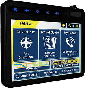
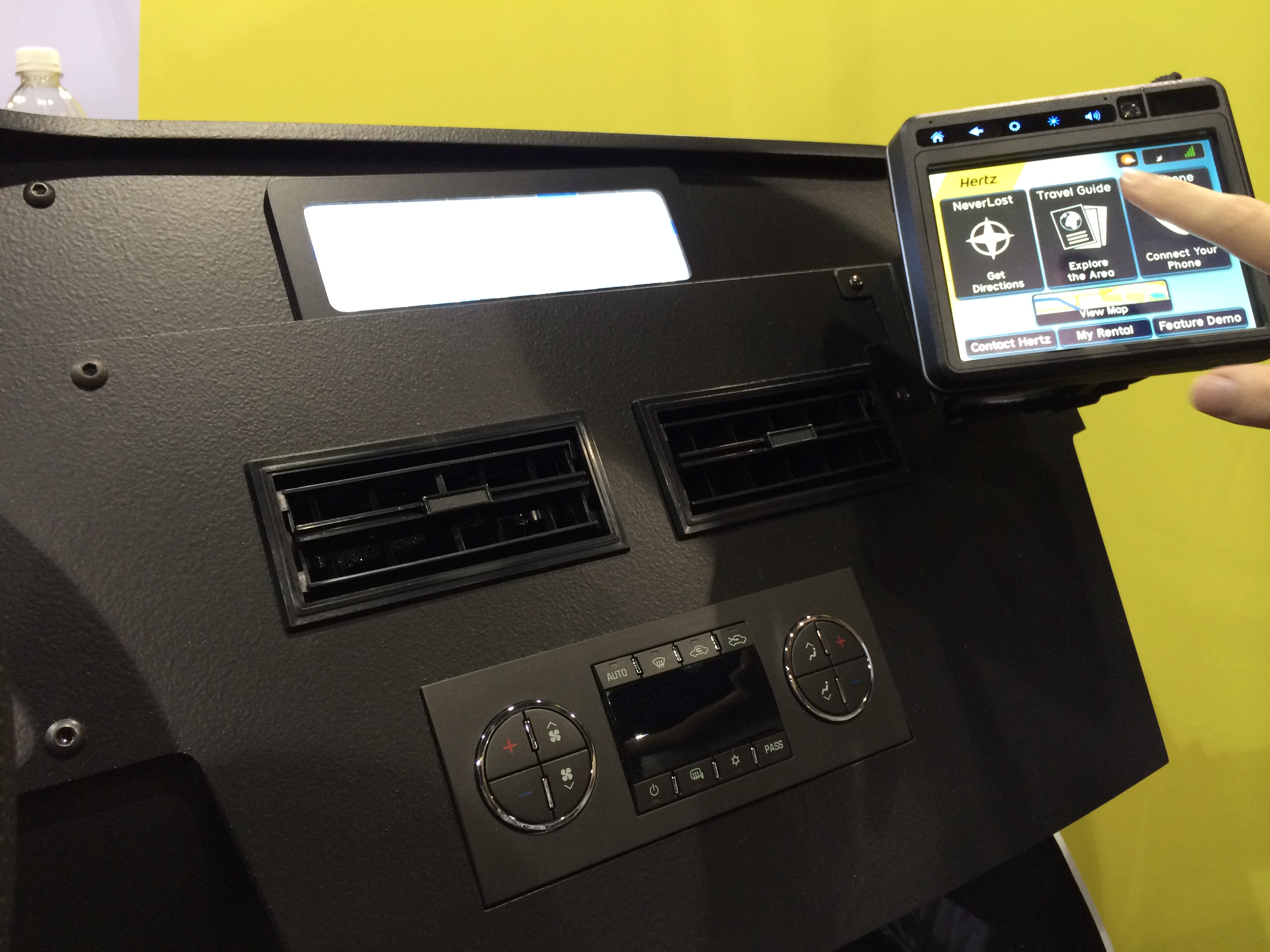
    The user experience for handset-based navigation apps is now improving through better integration in the car. Some vendors have released NFC-enabled car mounts enabling the owner to configure the handset to turn on the GPS and launch a navigation app when the phone is placed in the mount. A majority of car manufacturers have also started to offer smartphone integration solutions that connect the vehicle’s infotainment system with the user’s smartphone via Bluetooth, Wi-Fi, USB or HDMI. It is then possible to display and control smartphone apps using the touchscreen and controls in the car.

    Higher smartphone adoption along with broader availability of low-cost and free navigation apps are important factors for the continued increase in usage of mobile navigation services worldwide. “The number of mobile subscribers worldwide using a turn-by-turn navigation app on their handset at least once per month grew from 150 million in 2012 to 180 million in 2013,” said André Malm, senior analyst, Berg Insight. He adds that in most markets, smartphones from major vendors now come bundled with free navigation apps.

    The leading navigation service providers on a global basis include Google, Apple, Telenav, Appello Systems, Nokia and Garmin. Examples of major local players include AutoNavi and Careland in China, SK Planet in South Korea, NAVITIME and ZENRIN in Japan, as well as Navitel and Yandex in Russia.

    Despite increasing competition from free navigation apps, many mobile operators are still marketing their own navigation services developed by companies such as Telenav, TeleCommunication Systems and Appello Systems. “App developers and operators are now trying to monetize navigation apps by introducing premium features and advertising,” said Malm. “Developers are also forced to reduce costs as competition increases, for instance by adopting OpenStreetMap data to reduce map licensing fees.”

  • Regional Event in Jordan to Focus on Road, Freight with EGNOS

    On October 21, Jordan will host a Euro-Mediterranean Partnership (EUROMED) regional event focused on the use of GNSS, particularly European GNSS, for freight and road transport. The Euromed GNSS II/MEDUSA meeting will be held in Amman, Jordan, at the Sheraton Al Nabil Hotel.

    Jordan-Transport-Ministry-TOrganized by the Euromed GNSS II/MEDUSA project, under the auspices of the Ministry of Transport of Jordan, the event will aim to share experiences and best practices, and to discuss strategies and possible ways forward in relation to the use of the satellite navigation for freight and road transport in the region.

    At the event, MEDUSA will present the results of its case study, which was conducted with Royal Jordanian Customs and with the aid of the Ministry of Transport of Jordan. Since April, supported by European companies involved in MEDUSA, Royal Jordanian Customs have had the opportunity to test and validate the use of European GNSS, and specifically of EGNOS, for tracking and tracing containers shipped across the Mediterranean Sea and vehicles transporting goods in Jordan.

    The case study is one of the technical assistance actions implemented by MEDUSA, and it represents the first life experience of EGNOS services’ usage in areas distant from Europe.

    MEDUSA belongs to the EU Euromed Transport Program. Its objective is to promote the adoption of the European GNSS by the Euromed countries, which include Algeria, Egypt, Israel, Jordan, Lebanon, Libya, Morocco, Palestine, Syria (suspended due to political unrest), and Tunisia.

    GNSS technology is applied to several user applications, and transport is one of the most important, including aviation, road, maritime, rail, freight transport and logistics. The MEDUSA project includes a program of specific technical assistance actions for the Euromed countries, to facilitate the introduction and exploitation of GNSS services in their markets.

    The wide adoption of advanced technology, also including satellite navigation, for freight and road transport applications (such as Intelligent Transport Systems, or ITS) enables the implementation of smart mobility and the enhancement of goods transportation/traffic volumes increasing.

    During the event, the participants from the Euromed countries will share lessons learned from the Jordan case study, and learn about relevant best practices in Europe and in the Euromed region, as well as debate strategies and possible ways forward in the light of national interests and common regional perspectives.

    Opened by an institutional panel, with representatives of the Jordan Ministry of Transport and the European Commission, the event will consist of a session dedicated to the case study and a session addressing opportunities in other Euromed countries, including the presentation of European success cases as examples of suitable paths to guide the GNSS operational introduction and adoption.

    At the conclusion of the event, the participants will elaborate guidelines and recommendations, to be possibly translated into action plans for the Euromed countries.

    The meeting agenda is available to download.

  • Hertz Joins with Navigation Solutions on NeverLost GPS System

    Hertz Joins with Navigation Solutions on NeverLost GPS System

    The Hertz NeverLost GPS navigation system. Photo: Hertz
    The Hertz NeverLost GPS navigation system. Photo: Hertz

    Hertz and Navigation Solutions have launched the next-generation Hertz NeverLost GPS navigation system across the U.S.

    The award-winning in-vehicle system now offers more customization capabilities for travelers along with new navigation tools for convenience and personalization when planning trips. The new system syncs directly with the recently launched Hertz NeverLost Companion app, giving travelers access to more than 10 million U.S. destinations on their mobile devices to plan trips at their leisure, then instantly begin navigation in their Hertz rental.

    “Our innovation goes beyond a typical navigation device, offering hands-free calls and instant Bluetooth connection, personal and customizable rental information, exploratory travel guides, weather, flight information, and even access to a concierge to provide the traveler with an enhanced rental experience,” said Mark P. Frissora, Hertz chairman and CEO. “With the latest Hertz NeverLost, customers can experience a new way of trip planning and navigation with a one-of-a-kind travel tool that allows them to see more, do more and discover more.”

    Hertz NeverLost is available to rent along with a Hertz vehicle and offers groundbreaking features for rental GPS systems within the car rental industry, including:

    • Hands-Free Calls – For ease and safety on the road, pair with a smartphone to make and receive calls and access contacts. Phone numbers for points of interest within the device can also be dialed.
    • Travel Guide – Explore the city and discover local events. Quickly search through thousands of points of interest and get even more out of the trip with accompanying audio, images and descriptions.
    • Weather, Flights & More – Discover special events and local attractions and get access to weather and flight information.
    • NeverLost Concierge – Live concierge operators are available to help search for destinations, build custom trips and send route information directly to the NeverLost system.
    • Companion App – Stay connected with the NeverLost Companion app to sync favorites, explore the area and search for destinations from any location.
    • My Favorites – Enter download codes or use the USB flash drive to access trips built on NeverLost.com, the Companion app, or excursions built by the NeverLost Concierge team.
    • Contact Hertz – The device is programmed with all necessary Hertz phone numbers. And with hands-free calling, Hertz can be contacted with a paired smartphone with the press of a button.
    • Rental Record Info – View current rental record information on the device.

    “We’re thrilled to be rolling out the newest version of Hertz NeverLost across the U.S. to offer travelers a sophisticated, yet easy-to-use navigation tool when renting with Hertz,” said Rob Moore, Hertz Chief Technology Officer. “With the instantaneous connection to our new Companion app, the NeverLost system has become a first-of-its-kind within the travel industry, shaping the wave of the future for navigation technology.”

    Hertz NeverLost GPS navigation system now incorporates Bluetooth connection, hands-free calls, travel guides, weather, flight information and more.
    Hertz NeverLost GPS navigation system, demonstrated at CTIA Super Mobility Week, now incorporates Bluetooth connection, hands-free calls, travel guides, weather, flight information and more.
  • Connected Car Isn’t a Smart Car

    Janice Partyka
    Janice Partyka

    The most interesting thing in mobile and location in 2014 is the connected vehicle. Back in the early 1990s, a bigger vision of smarter highways began to be explored. The technology was refined, and resulted in successful demos of cars talking to each other and to roadside infrastructure like traffic lights. If you lived in Southern California, you might remember seeing platoons of automated vehicles zipping along a closed section of Route 15.

    Since those heady days, the timing and visioning for smart highways and vehicles were tempered by the massive cost of the infrastructure required. Now we are seeing the “connected vehicle” starting to roll out of the doors of dealerships, but with a different and more limited type of connectivity than we started to envision in the 1990s.

    Reminiscent of the mission started decades ago, a new year-long “smart car” project and demo will be held in Ann Arbor, Michigan. The objective of the smart car project is to determine whether wireless communication between vehicles can improve safety  Three thousand cars, buses and trucks will utilize data recorders and a technology similar to Wi-Fi that can transmit information about accidents or hazardous traffic conditions.

    Drivers participating in the demo will be warned of sudden changes in traffic patterns or potential collisions through data transmitted from similarly equipped cars and roadside devices. Eight major automakers will provide vehicles and engineering assistance to the study.

    Currently, some new car models are equipped with active safety devices that can alert drivers if they are drifting out of a traffic lane or traveling too close to another car. But the smart car demo differs because will share safety information with other smart cars on the road.

    The smart car system can give drivers visual or audio warnings about sudden traffic changes experienced by another connected vehicle. Several cameras installed in the connected vehicles will also capture data on how the drivers respond to accidents and sudden changes in traffic conditions.

    Today’s connected vehicle is sometimes referred to as a smartphone on wheels, a limited vision of what can be. Now is the time to determine if the savings of fewer accidents or increased capacity on our roads will outweigh the cost of new infrastructure and added functionality in vehicles.


  • Omnitracs Tracking Offers Enhanced Mobile Workforce Management

    Omnitracs, LLC, a provider of fleet management solutions to transportation and logistics companies, is making available Omnitracs Tracking powered by Roadnet, a mobile workforce tracking application for smart devices. Omnitracs Tracking offers basic capabilities to help companies track the locations of their mobile workers throughout the day and get additional performance data to help make them safer and more productive, the company said.

    “Every transportation company with a mobile workforce wants to know the location and key behaviors of their drivers,” said Dan Speicher, chief technology officer at Omnitracs. “Omnitracs Tracking powered by Roadnet enables companies that have not adopted a fully featured mobile fleet management solution to utilize their existing smart devices in order to track locations of mobile workers, improving safety, productivity and customer satisfaction.”

    Benefits of Omnitracs Tracking include:

    • Location Tracking. By leveraging existing smart device GPS positioning technology, location tracking pinpoints drivers’ locations in real-time using satellite and street maps.  Fleet managers access this information through a web-based application, enabling them to provide customers with timely updates on the status of their delivery or service call.
    • Speed Tracking. The application monitors drivers’ speed throughout the day, allowing fleet managers to take prompt action to help preempt potential safety issues.
    • Exception Reporting. Users can predefine thresholds for maximum speed allowed, GPS gap, over road speed and stationary position time limits. Exception reporting helps to quickly identify driver behaviors that may lead to unsafe driving and reduced productivity.

    “Omnitracs is committed to leveraging the expertise and capabilities of our business units to continuously bring value to our customers. Our newest basic tracking application will give companies the tools they need to better manage their mobile workforce and take fast, appropriate action to improve safety and productivity,” added Speicher.

    Omnitracs Tracking is available exclusively through Roadnet and Omnitracs’ resellers. For more information about the application, visit.

  • CSR, Maestro Offer High-Performance GNSS Module

    CSR, Maestro Offer High-Performance GNSS Module

    maestro-a5100-a-W

    Hong Kong-based Maestro Wireless Solutions, a manufacturer of location receivers, and CSR plc, a global provider of silicon and software solutions for location-aware applications, announce the immediate availability of the A5100-A, a next-generation SiRFstarV GNSS positioning module that combines high-performance GPS and GLONASS receiver technology in a small 10 x 15 mm package.

    The A5100-A is designed for a wide range of applications including wearable devices, cameras and automotive trackers.

    The A5100-A is the first release within Maestro’s new line of GNSS receivers. It achieves high accuracy with quad-constellation support, up to 30 percent faster time-to-first-fix (TTFF), and up to 20 percent lower power consumption using CSR’s TricklePower and Push-to-Fix (PtF) modes. The module also accelerates customer time to market and reduces development risks by integrating a number of features, including TCXO, SAW filter, RTC, antenna-control mechanism, and flash memory for future-proof upgrades, as well as offering a drop-in replacement capability for Maestro’s previous SiRFstar4 generation modules. The castellated-edge form factor also enables simpler manufacturing and reduces assembly cost, the companies said.

    Supporting all currently deployed GNSS, the A5100-A acquires and tracks all visible GPS, GLONASS, QZSS, and SBAS satellites. Concurrent GNSS performance enables the A5100-A to choose the best satellites from different constellations and deliver optimal location information. Immediate benefits are better coverage, enhanced stability, and accuracy in difficult environments, such as urban canyons, and stronger resilience to multipath and signal jamming. This ensures consumers maintain a position fix whether they’re in the middle of a busy city or in a remote rural location, the companies said.

    The A5100-A offers a range of other features including:

    • Direct to Battery connectivity: Connects directly to a rechargeable 1.8V-3.6V Lithium battery enabling system cost reduction and increased power efficiency.
    • Low Power technology: Optimized for power consumption by incorporating CSR’s PtF technology.  PtF rapidly establishes a valid position fix enabling the module to hibernate for longer periods of time, and adaptively changes power depending on the operating environment and motion conditions. Advanced algorithms and a powerful on-chip DSP processor maintain high accuracy (QoS) while achieving the lowest power level possible for the given environmental and motion conditions.
    • InstantFix Extended Ephemeris (EE): Accelerates TTFF for devices without internet connectivity such as cameras and wearable devices, by autonomously predicting EE for as long as three days and up to 31 days when connected to a network that supports SiRFInstantFix server generated extended ephemeris data (SGEE).

    “Maestro Wireless has worked closely with CSR for many years to design and commercialize highly accurate and reliable location products,” said Anthony Murray, senior vice president, Business Group at CSR. “But to win in today’s highly competitive consumer electronics market performance isn’t enough. That’s why we’ve worked with Maestro Wireless to develop a solution that excels in a range of performance metrics but also offers the small form factor essential for today’s compact devices and is highly integrated to help them get to market fast.”

    “The A5100-A is perfect for customers designing highly integrated products that need uncompromising performance but are pressured by the speed required to go-to market and lack of development resources,” said Olivier Bernard, EVP of Business Development at Maestro. “By combining low power consumption with high sensitivity, high jamming immunity and concurrent GNSS operation, and with its drop in upgrade path to the A2200-A, the A5100-A creates a fast and convenient route to the latest GNSS offering in the marketplace, to meet these needs quickly.”


  • TireStamp Chooses Telit for Tire Pressure Monitoring with GPS

    TireStamp Chooses Telit for Tire Pressure Monitoring with GPS

    TireVigil-Telit

    Telit Wireless Solutions has announced that TireStamp, a TPMS 2.0-certified vendor of Tire Pressure Monitoring Systems, embeds Telit cellular and positioning modules into its product.

    For fleet managers, tires represent the second-highest operating cost of running a fleet, second only to fuel. Tire maintenance can significantly impact highway safety, revenue potential, operational efficiency, and maintenance costs.

    The TireStamp TireVigil solution communicates with tire pressure sensors to provide real-time monitoring of tire pressure and temperature across vehicle types, tire brands, and location. The comprehensive tire data enables fleet managers to schedule maintenance, intervene in the event of an emergency, improve on-time delivery, and enhance regulatory compliance.

    Telit's Jupiter JF2 GPS module.
    Telit’s Jupiter JF2 GPS module.

    The TireVigil solution uses Telit’s Jupiter JF2 GPS module, a compact, low-power device that provides enhanced accuracy to help locate vehicles in the event of an emergency or at any time. TireVigil receives tire data from TMPS sensors, then communicates in real-time over the cellular network using the Telit HE910 cellular module. Part of the xE910 module family, the HE910 is pin-to-pin compatible with a suite of modules enabling TireStamp to customize its products to enable connectivity across cellular technologies and geographies.

    “Our customers are typically in the maintenance space,” said Scott Feagan, Chairman and CEO of TireStamp. “Reliability and support are extremely important to them – and to me. Pair that with family compatibility for fast time-to-market and global expansion, the opportunity to bundle connectivity with positioning, affordable pricing and on-time availability, and it’s easy to see why we chose to work with Telit.”

    “Between fleets and personal vehicles, more than a billion tires are sold around the world each year,” said Mike Ueland, president of Telit Americas. “Telit has a long history of supporting fleet telematics and automotive solutions and we’re pleased to enable the world’s leading tire pressure management system.”

  • Azuga Takes on Distracted Driving for Fleet Managers


    To recognize National Safety Month and to highlight the growing dangers of distracted and reckless driving, Azuga has published a Fleet Stats infographic showing the dangers of auto accidents its fleet tracking programs are designed to prevent.

    Of the 41,000 Americans killed each year in traffic accidents, nearly 5,000 die as a result of crashes involving large fleet trucks. An additional 13,000 die as a result of a speeding-related accidents. Azuga offers two programs for fleet managers: SpeedSafe and DriveSafe.

    The programs combine GPS, a driver behavior and rewards system, vehicle health reports, and plug-and-play installation to combat reckless and distracted driving. DriveSafe prevents talking and texting when the vehicle is in motion. The distracted driving technology locks down a driver’s screen and only allows phone numbers that the employer’s policy allows. Policies can be applied at the individual driver level to allow certain calls and texts (for instance, allow incoming calls from home, the office, and school.)

    With SpeedSafe, a fleet manager controls speeding on residential streets, in school zones, and in adverse weather conditions. Going beyond simple control, a fleet manager also gets reporting and analytical tools to help quickly identify problem areas and track and train drivers over time.

    National Safety Month is sponsored by the National Safety Council. According to distraction.gov, using a mobile device while driving causes an estimated 28 percent of traffic accidents. Further, the National Safety Council estimates $40 billion cost to United States citizens each year.

    Azuga says its customers have been able to decrease the number of speeding events by 40 percent and decrease overall liability, which translates into an average 15 percent savings on insurance premiums.

  • Pitney Bowes, INRIX Join on Location Intelligence for Traffic

    Pitney Bowes Inc. has entered into a multi-year partnership with INRIX, Inc., provider of traffic information and driver services, to deliver advanced location intelligence solutions through the company’s traffic intelligence platform.

    By integrating location capabilities with traffic analysis, INRIX and Pitney Bowes will enhance the driving experience of today’s connected drivers, the companies said. By delivering this information through INRIX’s mobile app, users are empowered to make better location-based decisions in real-time.

    “Pitney Bowes’ location intelligence solutions can add compelling new capabilities to the existing products of mobile-oriented companies such as INRIX,” said James Buckley, Senior Vice President and General Manager, Location Intelligence, Pitney Bowes. “Our products help unearth non-obvious relationships between specific locations to improve the customer experience and drive loyalty.”

    INRIX has designed a leading traffic intelligence platform that uses smart data and advanced analytics to solve transportation issues worldwide. The company uses a unique approach called “smart crowd-sourcing” that analyzes real-time traffic speed and incident data from a wide variety of public and private traffic sources ranging from road sensors and up-to-the-minute traffic speeds and community reports crowd-sourced from millions of vehicles and mobile devices throughout the day. Whether through an in-car or smartphone navigation application, a local newscast or the company’s INRIX Traffic app, INRIX offers up-to-the-minute traffic information and other driver services to help more than 150 million drivers save time, fuel and money.

    Pitney Bowes Location Intelligence solutions merge organizational data with location data to provide users with the capability to make more informed decisions. For INRIX, this technology compiles and correlates addresses with coordinates from a mobile device to establish real-time location or a desired destination. Combining that with other data such as specific traffic flow, demographics and behavior patterns, users can uncover key points of interest by accessing Pitney Bowes advanced location search. For example, if a consumer is planning to visit a popular department store in a specific region, the technology makes it possible to suggest a relevant restaurant recommendation for lunch, based on the data that is collected about user preferences, convenience, proximity and projected traffic patterns.

    “INRIX had a number of compelling reasons to partner with Pitney Bowes,” said Scott Sedlik, Vice President, Product Planning and Market Development for INRIX. “Our customers are looking to make real-time decisions using location data, and Pitney Bowes has the most comprehensive suite of offerings to fulfill that need. Other key reasons for teaming include a strong customer focus and alignment with our own strategic goals and approach.”

  • Three More Companies Sign on to AT&T Connected Car Center

    Three More Companies Sign on to AT&T Connected Car Center

    AT&TDriveStudio

    Three additional companies — Qualcomm, Red Bend and QuickPlay — have signed on to work with the connected car industry at the AT&T Drive Studio, a connected car center for innovation and research in Atlanta, Georgia.

    “This is an exciting ecosystem and we are committed to leading the way to take the connected car to the next level for auto manufacturers and their drivers,” said Glenn Lurie, president, AT&T Emerging Enterprises and Partnerships, AT&T Mobility. “That’s the essence of the AT&T Drive Studio, to bring together the best players in the auto industry ecosystem to collaborate and create the future faster.”

    The AT&T Drive Studio will now include support from the following companies:

    Qualcomm Technologies, Inc., intends to showcase its newly announced Qualcomm Snapdragon Automotive Solutions for infotainment and telematics at the AT&T Drive Studio. Qualcomm Technologies plans to integrate these solutions with AT&T’s Drive portfolio, including AT&T’s global SIM, bifurcated billing, voice recognition, and the nation’s most reliable 4G LTE network.

    AT&T has selected Red Bend Software to be a solution provider to remotely manage automotive software in the new AT&T Drive Studio. Hosted in the AT&T cloud, the Red Bend Software Management Center is an OMA-DM standard-based platform designed for car manufacturers to manage in-vehicle software and applications over the air with reliability and efficiency. Red Bend’s comprehensive software management platform significantly reduces the time and cost for automotive OEMs to manage the lifecycle of all in-vehicle software, from head units to map content and ECUs.

    AT&T has selected QuickPlay Media to develop an in-vehicle video service. The offering will be powered by QuickPlay’s OpenVideo platform and will deliver Live Linear TV and streaming video on demand services to automotive manufacturers collaborating in the AT&T Drive Studio. QuickPlay’s solution will enable AT&T to provide in-car “infotainment” by delivering secure streaming of hundreds of live linear TV channels and hours of premium VoD content. The solution includes a configurable, customizable client application, support for adaptive streaming, complete content protection with DRM solutions like Microsoft PlayReady, user entitlements, dynamic advertising, banner ad support, multi-language support and featured content.

    Opened in January 2014, the AT&T Drive Studio is a dedicated facility for connected car innovation and research. Located in Atlanta, the more than 5,000-square foot AT&T Drive Studio features working garage bays, a speech lab, and a full showroom to exhibit the latest innovations.  The AT&T Drive Studio integrates AT&T solutions across multiple companies and serves as a hub where AT&T can respond to needs of automotive manufacturers and the auto ecosystem at large.

  • Blue Sky Network Debuts Mobile Tracker with Geofencing

    Blue Sky Network Debuts Mobile Tracker with Geofencing

    Blue Sky Network's HawkEye 7200 Portable  Tracking Solution.
    Blue Sky Network’s HawkEye 7200 Portable Tracking Solution.

    Blue Sky Network has released the portable HawkEye 7200 with geofencing. The Hawkeye 7200, released in September 2013, is a small mobile device designed specifically for Iridium and GNSS satellite tracking of aviation, land/mobile or marine assets. The company will demonstrate its new AVR (advanced variable response) geofencing capabilities at the upcoming HAI Heli-Expo tradeshow in Anaheim, California, February 25-26.

    “Advanced variable response or AVR delivers functionality and utility one level beyond traditional geofencing alarms or alerts. It allows the asset manager or geofence designer to set a conditional response for what happens or does not happen when an aircraft, vehicle, or vessel is in, or out of a geofenced area,” explains John Peterson, Blue Sky Network’s vice president of Business Development. “For example, position reporting frequencies could be turned off when an asset is at its home base, resume normal reporting after leaving the base, and increase reporting frequency when entering regions considered more dangerous. AVR gives asset managers more control, ultimately making fleet management easier, safer, and less expensive.”

    In addition to AVR, the HawkEye 7200 offers three significant advantages over traditional satcom asset tracking devices

    • An all-in-one design including internal long-lasting lithium ion battery and dual Iridium and GNSS antenna;
    • true concurrent multi-national GNSS for faster, more accurate positioning; and
    • Bluetooth connectivity using Blue Sky Network’s custom APP for iPhone and iPad, facilitating easy messaging and custom form transmission from Apple devices.

    The HawkEye 7200 portable satcom solution works directly with Blue Sky Network’s cloud-based web portal SkyRouter. Skyrouter is a secure online website that provides tracking and management of globally dispersed assets.

  • u-blox Launches EVA-7M Standalone GNSS Module

    u-blox Launches EVA-7M Standalone GNSS Module

    u-blox EVA-7M.
    u-blox EVA-7M.

    Swiss-based u‑blox has introduced its smallest standalone GNSS positioning module, the EVA-7M. Designed for cost and space sensitive applications, the highly integrated 7 x 7 x 1.1 mm LGA module comprises all necessary components, including crystal and passives: only an  antenna is needed for global positioning capability.

    The module supports GPS, GLONASS, QZSS, and all SBAS augmentation systems. Based on u-blox’ advanced GNSS technology u‑blox 7, the module achieves -160 dBm sensitivity when tracking GPS satellites (-158 dBm with GLONASS satellites), fast acquisition time and the lowest power of any u-blox 7 module (16.5 mA at 3 V), thanks to an innovative high-efficiency power converter.

    The EVA-7M eases implementation in end-products because RF and digital domains are kept well separated, and the LGA pads are configured in single rows. EVA is a standalone GNSS receiver which provides a position without the need for host integration or extra RF components. It is optimized for keeping eBOM and system costs to an absolute minimum.

    “The EVA-7M brings embedded satellite positioning to the next level of portability. The module has been developed with ease-of-manufacturing as a high priority. Its QFN-like footprint with connections along four sides and high-level of component integration makes it a perfect solution for medium and high volume production runs. This ensures high first-pass production yield, crucial criteria especially for cost-sensitive, high-volume industrial and consumer applications,” said Thomas Nigg, VP Product Marketing at u-blox.

    A UART, USB, SPI and I2C interface provide flexible connections to a host processor. EVA-7M can also communicate directly with u‑blox’ SARA 2G, LISA 3G and TOBY LTE cellular modules to support advanced tracking and location-aware applications.

    The module is suitable for consumer, industrial, and after-market vehicle applications. First samples will be available in Q1 2014.