Tag: BAE Systems

  • BAE Systems awarded a $316M contract to deliver military GPS modules

    BAE Systems awarded a $316M contract to deliver military GPS modules

    Image: BAE Systems
    Image: BAE Systems

    The U.S. Defense Logistics Agency has executed a $316 million contract option for BAE Systems’ advanced M-code GPS modules, raising the contract funding to $641 million.

    The modules provide dependable positioning, navigation, and timing for ground troops, vehicles, aircraft and precision munitions. The contract will ensure the availability of Common GPS Modules (CGM) for advanced military GPS receivers with anti-jamming and anti-spoofing capabilities that enable operation in contested environments.

    Under the contract option executed in November, BAE Systems will manufacture CGMs for future ground, airborne and weapon GPS receivers for the U.S. Department of Defense (DoD) and its allies. The award builds on a May $325 million contract and enables BAE Systems to continue to meet domestic and international demand for Military GPS User Equipment (MGUE) Increment 1 M-Code modules in GPS receivers through the end of the decade.

    “Military operations require assured positioning, navigation and timing, and our customers are shifting to M-code to harden their GPS receivers against jamming and spoofing,” said Frank Zane, Navigation and Sensor Systems business development director at BAE Systems. “We’re ready to meet this need today with secure, reliable M-code GPS solutions, and we’re developing the next-generation of solutions to stay ahead of the threat.”

    BAE Systems is delivering two advanced M-code GPS receivers: the Miniature Precision Lightweight GPS Receiver Engine – M-Code and the NavStrike-M GPS receiver.

    Deliveries of the ultra-small MicroGRAM-M are expected in 2022, and deliveries of the Strategic Anti-jam Beamforming Receiver – M-Code are expected in 2024.

  • BAE Systems unveils tiny M-code military GPS receiver

    BAE Systems unveils tiny M-code military GPS receiver

    Photo: U.S. Army/Spc. Brooke Davis, Operations Group, National Training Center
    Photo: U.S. Army/Spc. Brooke Davis, Operations Group, National Training Center

    BAE Systems has unveiled its ultra-small MicroGRAM-M GPS receiver that receives the new M-code military GPS signals resistant to jamming and spoofing.

    About the size of a postage stamp, MicroGRAM-M is a small, lightweight and power-efficient M-code embedded GPS receiver, capable of delivering assured positioning, navigation and timing (PNT) for size-constrained and other micro-applications.

    “We’re delivering reliable PNT where our customers need it — from soldiers’ handheld devices to small unmanned aerial vehicles,” said Greg Wild, director of Navigation and Sensor Systems at BAE Systems. “MicroGRAM-M provides our armed forces and allies with a low-SWAP M-code GPS solution that’s resistant to adversaries’ disruption efforts in highly contested environments.”

    MicroGRAM-M features rapid, secure GPS signal acquisition, enhanced security and resiliency, anti-jamming and anti-spoofing capabilities, and very low power consumption for an M-code device. The 1.0 x 1.25 x 0.275-inch MicroGRAM-M has the same physical dimensions as its predecessor, enabling quick upgradability to M-code and reduced system integration costs. At its core is a proven, tamper-proof M-code Common GPS Module that encapsulates classified data and signal processing.

    “MicroGRAM-M is the latest BAE Systems M-code military GPS product, joining MPE-M and NavStrike-M, which deliver enhanced awareness in highly contested environments and precision munitions guidance,” said John Watkins, vice president and general manager of Precision Strike & Sensing Solutions at BAE Systems. “Qualification of MicroGRAM-M is underway, with full-rate production expected in 2022.”

    Delivering M-code User Equipment to Germany

    On June 29, BAE Systems received the first contract from the Space and Missile Systems Center’s Space Production Corps to deliver M-code military GPS user equipment to Germany. Under a Foreign Military Sales contract, the company is delivering the advanced M-code GPS technology to Germany, enabling precise, resilient, and secure geolocation and positioning capabilities that improve the effectiveness of allied operations.

    The German FMS order focuses on BAE Systems’ Miniature PLGR Engine — M-code (MPE-M), which delivers precise positioning, navigation and timing capabilities; anti-jamming and anti-spoofing capabilities; a modern security architecture; and a size suitable for space-constrained applications.

    BAE Systems will provide the first MPE-M receivers to Germany for integration, test and evaluation in 2021. Work on the program will be performed at BAE Systems’ facilities in Cedar Rapids and Coralville, Iowa.

  • BAE Systems chooses Spirent Federal CRPA test system

    BAE Systems chooses Spirent Federal CRPA test system

    For controlled reception pattern antenna (CRPA) testing and M-code testing for military GPS receivers

    Image: Spirent Federal
    Image: Spirent Federal

    BAE Systems has selected Spirent Federal Systems to provide a CRPA Test System to support M-code military GPS technology development.

    BAE Systems is developing an advanced military GPS receiver and improving the capabilities of size-constrained and power-constrained military GPS applications, including precision-guided munitions and handheld devices.

    Spirent Federal is qualified to provide essential test equipment and support in the pursuit of resilient, accurate PNT data in GPS-degraded Navigation Warfare (NAVWAR) situations, Spirent stated in a press release.

    The Spirent CRPA Test System is a development of its GSS9000 Series platform. It can test

    • controlled reception pattern antennas (CRPAs)
    • MNSA and AES M-code
    • jamming and spoofing threats and mitigation
    • ultra-high-dynamic vehicle applications
    • inertial navigation systems
    • additional encrypted military signals, Y-code and SAASM
    • and more

    CRPAs provide proven and effective protection against jamming in high-interference environments. The Spirent CRPA Test System can simulate 16+ individual elements with a separate RF output per antenna element.

    For the 16-element test system, concurrent simulation of GNSS signals, signals from spoofers and repeaters, and interference from multiple jammers — including Blue Force Electronic Attack (BFEA) jamming waveforms — results in more than 1,000 simultaneous independent channels and signals simulated across a phase-calibrated precise wavefront.

    “The CRPA Test System is the culmination of over 35 years of R&D and industry leadership and is perfectly positioned to help with next-generation MGUE modernization,” said Ellen Hall, president/CEO of Spirent Federal. “Our robust M-code test capabilities support BAE Systems’ advances in M-code technology.”

    Spirent can provide GNSS and interference signal simulation solutions for every stage in the CRPA design and verification process. To learn more, visit Spirent Federal’s CRPA Test System page.

  • BAE Systems to open Iowa facility for mission-critical GPS work

    BAE Systems to open Iowa facility for mission-critical GPS work

    Illustration: BAE Systems
    Illustration: BAE Systems

    BAE Systems is investing more than $100 million to build a state-of-the-art facility in Cedar Rapids, Iowa, expected to be completed in 2022. The facility will support the company’s newly acquired Navigation & Sensor Systems business, which makes mission-critical military GPS products.

    The new building will bring the company’s local design and production employees from multiple locations into a single center of excellence with modern manufacturing, engineering and office space.

    “Our world-class military GPS business is built on the rich talent pool in Greater Cedar Rapids,” said John Watkins, vice president and general manager of Precision Strike & Sensing Solutions at BAE Systems. “This investment will provide our high-tech engineering and manufacturing experts with a world-class workspace and the tools to enhance operational excellence.”
    The facility will improve operational efficiency, optimize production, and enhance the company’s ability to deliver high-quality military GPS products to the warfighter.

    The 278,000-square-foot research and development center will be located on a 32-acre site. The building will include a large factory; several hundred offices, workstations, and flexible work spaces; and classified and unclassified labs. The building was designed for growth, with the ability to add 50,000 square feet of additional space.

  • Quantum positioning system could fill GPS gaps for aviation

    Quantum positioning system could fill GPS gaps for aviation

    The High-BIAS2 project advances cold-atom quantum gyroscope

    The High-BIAS2 (high-bandwidth inertial atom source) project today announced new milestones that move the industry closer to safer skies with more precise inflight navigation systems. The project has advanced its development of a cold atom-based quantum positioning system (QPS), which enables vehicle navigation without a GPS or GNSS signal.

    Reducing the reliance on GPS and GNSS technologies is critical for scenarios where signals from these systems are not available, such as underwater or in space, or when they suffer disruptions due to technical issues, cyberattacks and atmospheric or reflection effects.

    High-BIAS2 is designed to demonstrate the rapid commercialization of quantum technologies for real-world applications.


    “Inertial navigation systems enhanced by ColdQuanta’s Cold Atom Quantum Technology hold the promise of navigation in the absence of GPS and GNSS.”


    Inflight Trials. The project will culminate with inflight trials via BAE Systems’ test aircraft to validate the gyroscope’s use for aerospace applications. The airborne technology demonstrator will consist of a quantum gyroscope sensor and control system, reference gyroscope and commercial navigator system.

    “Gyro technology is a key aspect of navigation for airborne platforms. Improving performance whilst still being compatible with the aerospace environment is something that BAE Systems sees as important in aiding navigation when GNSS signals aren’t available,” said Julia Sutcliffe, air chief technologist, BAE Systems. “We can see exciting applications across our defense, security and commercial businesses including land, sea and air environments for the quantum devices being developed in the High-BIAS2 project.”

    UK Backing. High-BIAS2 is partially funded by the United Kingdom’s government through the National Quantum Technologies Programme, which is focused on accelerating the translation of quantum technologies into the marketplace and securing the UK’s status as a world leader in quantum science and technologies.

    High-BIAS2 is backed by UK quantum end users and supply-chain partners. Technology, application and commercialization development partners include:

    Cold atom quantum technology serves as the foundation for the project’s gyroscope and QPS. Its quantum sensor uses tightly confined ultra-cold atoms, which are cooled to a billionth of a degree above absolute zero and organized in a novel configuration. This approach to harnessing cold atom quantum technology is crucial to success in aerospace applications where motion sensing in highly dynamic environments is the norm.

    “High-BIAS2 is a huge step forward in developing practical use cases for quantum sensors and will showcase the real power of quantum in action,” said Dan Caruso, CEO and executive chairman of ColdQuanta. “Inertial navigation systems enhanced by ColdQuanta’s cold atom quantum technology hold the promise of navigation in the absence of GPS and GNSS. This technological breakthrough benefits a wide range of billion dollar industries including aerospace, autonomous vehicles, marine transportation, oil and gas excavation and more.”

    This velocity-distribution data for a gas of rubidium atoms confirmed the discovery of the Bose–Einstein condensate in 1995. In these three snapshots in time, atoms—cooled to near absolute zero—condensed from less dense areas on the left (red, yellow, and green) to very dense areas at the center and the right (blue and white). (Image: NIST/JILA/CU-Boulder)
    This velocity-distribution data for a gas of rubidium atoms confirmed the discovery of the Bose–Einstein condensate in 1995. In these three snapshots in time, atoms—cooled to near absolute zero—condensed from less dense areas on the left (red, yellow, and green) to very dense areas at the center and the right (blue and white). (Image: NIST/JILA/CU-Boulder)
  • BAE Systems to develop advanced GPS chips for warfighters

    BAE Systems to develop advanced GPS chips for warfighters

    Logo: BAE SystemsBAE Systems has received a $247 million contract from the U.S. Space Force’s Space and Missile Systems Center to design and manufacture an advanced military GPS receiver and next-generation semiconductor.

    The technology will provide positioning, navigation, and timing (PNT) capabilities to warfighters so they can execute missions in challenging electromagnetic environments.

    MGUE Increment 2

    The contract is related to November’s U.S. Department of Defense contract for M-Code military GPS technology.

    The Military GPS User Equipment (MGUE) Increment 2 Miniature Serial Interface program will provide improved capabilities for size-constrained and power-constrained military GPS applications, including precision-guided munitions and battery-powered handheld devices.

    The program will focus on the certification of an advanced application-specific integrated circuit (ASIC) and the development of an ultra-small, low-power GPS module.

    Both products will work with the next-generation military M-code signal technology, which provides reliable GPS data with anti-jamming and anti-spoofing capabilities to protect against electronic warfare threats.

    “This program enables us to further develop our core M-code technology to deliver high-performance, next-generation GPS capabilities,” said Greg Wild, director of Navigation and Sensor Systems at BAE Systems. “Our M-code receiver and next-gen ASIC will enable secure and reliable military GPS capabilities in a broader range of platforms.”

    BAE Systems’ Precision Strike business has 45 years of military GPS experience and more than 1.5 million GPS devices on over 280 platforms around the world. The company is currently producing M-code GPS receivers in multiple form factors, including a low power, small form factor M-code solution.

    Additional prototypes are in development for ground, weapons and airborne mission applications, and the company’s M-code GPS products are available to U.S. allies via foreign military sales.

    Work on the program will be conducted at the company’s facility in Cedar Rapids, Iowa.


    Feature image: An Airman with the 374th Security Forces Squadron uses a Defense Advanced GPS Receiver (DAGR) to track the team’s current during a 2018 field training exercise at Camp Fuji, Japan. (Photo: Senior Airman Matthew Gilmore/U.S. Air Force)

  • MGUE Increment 2 contracts awarded to BAE, L3 and Raytheon

    MGUE Increment 2 contracts awarded to BAE, L3 and Raytheon

    The United States Space Force’s Space and Missile Systems Center awarded the Military Global Positioning System User Equipment (MGUE) Increment (Inc) 2 Miniature Serial Interface (MSI) with Next-Generation Application Specific Integrated Circuit (ASIC) to BAE Navigation & Sensor System, L3 Technologies (now L3Harris) and Raytheon Technologies.

    According to the U.S. Space Force, the three MSI contracts are valued at $552 million and will be executed as Middle Tier Acquisition rapid prototyping efforts. The first delivery is scheduled for early fiscal year 2026.

    Enhanced processing and security features associated with M-code drove the decision to develop a smaller and more powerful receiver card for handheld and dismounted applications, the U.S. Space Force said. The MSI with Next-Generation ASIC will enable Military-Code GPS receiver production, mitigating the obsolescence issue of current ASICs and providing significant security and performance improvements for GPS-enabled weapons systems. MGUE Inc 2 will be compatible with all existing and future spacecraft and ground systems, it added.

    MGUE Inc 2 enables military GPS user equipment to receive allied GNSS positioning, navigation and timing (PNT) signals to increase both the resilience and capability of military PNT equipment, and deter attacks on GPS, the U.S. Space Force said. These signals will supplement GPS-based PNT in accordance with Department of Defense policies regarding usage of allied GNSS signals, ensuring identification and mitigation of cyber risks, and compatibility with existing PNT equipment.


    Feature photo: EvgeniyShkolenko/iStock / Getty Images Plus/Getty Images

  • Collins Aerospace wins contract to improve anti-jamming for warfighters

    Collins Aerospace wins contract to improve anti-jamming for warfighters

    The United States Army has awarded Collins Aerospace a Phase III contract to build the second generation of its Mounted Assured Position Navigation and Timing System (MAPS).

    The MAPS program adds anti-jamming capability for soldiers in GPS-contested environments. In 2019, MAPS Gen I units were installed on Stryker vehicles of the 2nd Cavalry Regiment in Germany.

    Phase 3 of the MAPS Gen II program “begins combat platform integration in preparation for low-rate initial production,” according to an Oct. 7 Army press release.

    MAPS Gen II includes M-code GPS receivers, provided by BAE Systems, along with anti-jamming antennas, sensor fusion and inertial measurement units to deliver assured PNT to soldiers.

    MAPS Gen II is part of the Army’s goal to accelerate the development and fielding of modernized soldier capabilities.

    “Less than a year after we equipped the first generation of MAPS in Europe we’re already pushing forward with the development of Gen II,” said Willie Nelson, director of the the Assured Positioning, Navigation and Timing (APNT) Cross-Functional Team (CFT). “This award comes less than a month after our Mounted APNT requirement was approved. The timing could not be better.”

    MAPS Gen I includes A and B kits, consisting of cable and mounts to use on a vehicle and a military GPS paired with non-radio frequency technologies.

    The Phase III Other Transaction Authority contract covers product maturation and begins combat platform integration, clearing the path to low rate initial production.

    Army Stryker ground combat vehicle. (Photo: Karolis Kavolelis / Shutterstock.com)
    Army Stryker ground combat vehicle.
    (Photo: Karolis Kavolelis / Shutterstock.com)

    The MAPS GEN II is comprised of the NavHub-100 PNT Distribution Device, the Multi-Sensor Antenna System (MSAS-100) and an optional speed sensor. The NavHub-100 works in concert with the MSAS-100 to produce a trusted A-PNT solution that can be distributed through serial interface, Victory Ethernet and RF distribution to multiple client systems. 

    MAPS GEN II supports the U.S. Army PNT Reference Architecture by leveraging modular technologies from across Collins’ A-PNT portfolio and industry. This scalable architecture builds upon the modular open system architecture (MOSA) standards and includes the All Source Positioning and Navigation (ASPN) generic message definition to support plug-and-play sensor integration and the Future Airborne Capability Environment (FACE) to host portable software capabilities.

    The MAPS GEN II system not only supports direct replacement of the Defense Advanced GPS Receiver (DAGR) on military platforms, it also provides exceptional A-PNT performance in GPS-contested and GPS-denied environments.

  • The GPS Innovation Alliance adds BAE Systems as member

    The GPS Innovation Alliance adds BAE Systems as member

    The global security, defense and aerospace company joins alliance dedicated to protecting, promoting and enhancing the use of GPS technology

    GPSIA logoThe GPS Innovation Alliance (GPSIA) is welcoming BAE Systems Inc. as the newest member of the organization. BAE Systems, a global defense, security and aerospace company, joins member companies John Deere, Garmin, Trimble, Lockheed Martin and Collins Aerospace, a unit of Raytheon Technologies Corp., as well as 11 national organizations that make up GPSIA’s affiliates program.

    As the newest member of the alliance and the third aerospace and defense corporation to join the organization in eight months, BAE Systems will work with GPSIA to support its goal of enhancing GPS innovation, creativity and entrepreneurship — while advocating as the voice of the GPS industry in Washington.

    Logo: BAE Systems“We are excited to welcome BAE Systems as the newest member of the Alliance — a monumental addition that marks the doubling of our membership in the past eight months,” said GPSIA Executive Director J. David Grossman. “The continued growth of GPSIA demonstrates the criticality of protecting GPS and the substantial value our organization delivers through advocacy, information sharing, and technical standards. We remain committed to ensuring the economic and societal benefits of GPS are fully realized.”

    BAE Systems is a global leader in designing and implementing high-end technology to extend the reach and significance of GPS in defense. BAE Systems’ radiation-hardened electronics have been on board satellites and spacecraft for almost 30 years and are currently providing the high-performance onboard processing capability for the GPS III satellite mission. Promoting space resiliency for over 30 years, BAE Systems is a cornerstone of the growing importance of GPS technologies on the space frontier.

    BAE Systems has not only pioneered critical technologies suitable for GPS applications in space, but has also developed, manufactured, integrated and supported GPS receivers and guidance systems for advanced military applications on land, sea or air.

    The company was instrumental in the development of NAVWAR sensor technology, intended to meet growing challenges associated with maintaining military positioning, navigation and timing (PNT) advantage using satellite navigation, and has engineered top-tier jammers and navigation systems for decades. Their work has been critical in securing the safety and technological supremacy of our nation’s defenses.

    “GPS is an essential part of our world — from our infrastructure and economy to the security of our nation,” said Frank Ruggiero, senior vice president, government relations, BAE Systems. “As a leading provider of defense electronics and communications systems, we are excited to join the GPS Innovation Alliance to expand the development of cutting-edge GPS technologies.”

  • BAE Systems to get Collins GPS and Raytheon ATR businesses

    BAE Systems to get Collins GPS and Raytheon ATR businesses

    Logo: BAE SystemsBAE Systems Inc. has reached definitive agreements for the proposed acquisitions of Collins Aerospace’s military GPS business and Raytheon’s Airborne Tactical Radios (ATR) business.

    The two high-performing businesses are being sold in connection with obtaining the required antitrust clearances for the previously announced pending merger between Raytheon and United Technologies Corporation (UTC).

    The proposed acquisitions are structured as asset transactions with associated tax benefits, and they remain subject to customary closing adjustments. The asset purchase agreement for the Collins military GPS business calls for cash of $1.925 billion, with an expected tax benefit of approximately $365 million. For Raytheon’s ATR business, the purchase agreement calls for cash of $275 million, with an expected tax benefit of approximately $50 million.

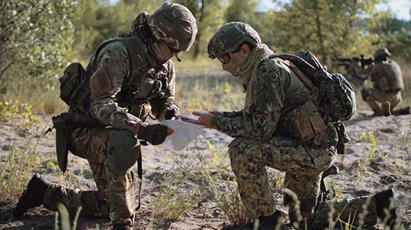
    “As militaries around the world increasingly operate in contested environments, the industry-leading, battle-tested products of these two businesses will complement and extend our existing portfolio of solutions we offer our customers,” said Jerry DeMuro, CEO of BAE Systems, Inc. “This unique opportunity to acquire critical radio and GPS capabilities strengthens our position as a leading provider of defense electronics and communications systems, and further supports our alignment with the modernization priorities of the U.S. military and its partners.”

    These proposed acquisitions are subject to the successful closure of the Raytheon-UTC transaction, as well as the satisfaction of other customary closing conditions, including receipt of the required U.S. regulatory approvals. Upon closure, both business lines would be integrated into the company’s Electronic Systems sector.

    “These are strong businesses with talented employees who share our focus on quality and technology innovation,” said Tom Arseneault, president and COO of BAE Systems Inc. “We are confident of a smooth transition that will accelerate our future together and look forward to welcoming these new employees to the BAE Systems team once the transactions are approved.”

    Collins’ Military GPS Business

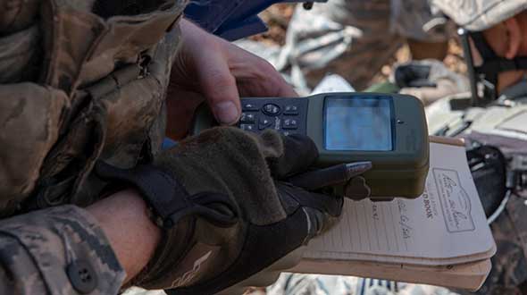
    Based in Cedar Rapids, Iowa, Collins’ military GPS business is a longstanding provider of mission critical military GPS receiver solutions and has been a pioneer in military GPS receiver markets for over 40 years. Today, it designs and produces advanced, hardened and secure GPS products to include M-Code, anti-jamming, and anti-spoofing technologies. The business has an installed base of over 1.5 million devices on approximately 280 platform types around the world, including ground, airborne, and weapon systems.

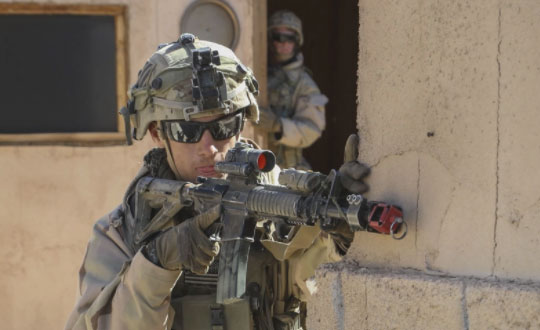
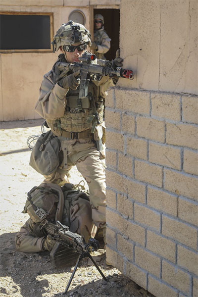
    Given the requirement for ubiquitous, secure geo-positioning in contested battlefields, this technology offering will continue to be critical to the U.S. military and partners worldwide. For example, the business is currently developing the next generation of M-Code GPS technologies for the U.S. military, which will advance our collective position to address the priority growth area of precision guided munitions.

    Raytheon’s Airborne Tactical Radios Business

    Raytheon’s ATR business is a leading provider of airborne tactical radio solutions. Based in Fort Wayne, Indiana, and Largo, Florida, the ATR business designs, manufactures, and supplies a wide array of mission-critical communication systems to the U.S. Department of Defense, allied governments, and large defense aircraft manufacturers. The business has leveraged its innovative technologies to develop secure communications solutions that are installed on a broad range of military airborne platforms.

    Coupled with the Electronic Systems sector of BAE Systems, Inc., Raytheon’s ATR business will enhance our positions in airborne communications with broad spectrum, multi-band, multi-channel radios including battle proven, robust, anti-jam, and encryption capabilities. The ATR business brings both complementary waveform expertise and a long trusted partnership with the U.S. Army.

    These businesses will be excellent strategic fits with the strong BAE Systems Electronic Systems sector, and our combined capabilities will benefit our customers and all of our stakeholders.

  • BAE Systems demonstrates XTS Guard 5 for military cyber security

    BAE Systems’ XTS Guard 5, equipped with the company’s Geospatial eXploitation Products (GXP), has successfully demonstrated its ability to provide U.S. intelligence organizations with access to geospatial imagery and data from BAE Systems’ GXP Platform, ensuring secure sharing between networks of various security classifications and sections.

    The innovative software demonstrated secure information sharing between government agencies and networks at the Enterprise Challenge, referred to as the EC-18, held this past spring.

    “Our expertise in developing technologies that quickly exploit massive amounts of data has allowed us to a product that brings numerous advantages to U.S. military intelligence organizations to securely transfer data from multiple sources,” said Kevin Malone, vice president of analytics systems at BAE Systems. “The EC-18 demo proved XTS Guard 5’s readiness to deliver operational success for a number of agencies.”

    EC-18 is an annual exercise sponsored by the Office of the Under Secretary of Defense, which allows Department of Defense agencies and international partners to demonstrate information sharing across disparate networks prior to their solution’s deployment. A guard is a cybersecurity appliance solution that resides between classified and unclassified domains for agencies using intelligence libraries.

    As an intelligence organization accesses geospatial imagery and data from BAE Systems’ GXP Platform, XTS Guard 5 provides cross-domain search functionality. This breaks down information stovepipes and secure boundaries that currently exist, providing a bridge between security domains to allow intelligence analysts to quickly and easily gather information that was previously cumbersome and time consuming to obtain. It saves analysts’ time, reduces operating costs, and allows decision makers to act more quickly, the company said.

    The product is further enhanced by SMARTXD from Sterling Computers, which is a key enabling component to secure multi-domain information sharing within an agency or large organization. It allows existing customer applications to become multi-domain enabled and share releasable data across security domains, including coalition partners. This capability has been successfully demonstrated in the last three Enterprise Challenge events.

    The XTS Guard 5 demo at EC-18 showed that the product’s architecture will support multi-enclave and multi-compartment controlled information sharing, for information that is subdivided based on its sensitivity, with advanced administration and auditing, ensuring that releasable information stored on a section of an internal network is sharable. It proved the effective transfer of multiple data types in near-real time, including email, attachments and chat.

    Offering industry-leading geospatial intelligence and movement intelligence solutions, including licensed software and professional services, BAE Systems’ GXP 5 delivers advanced data management, image exploitation, tracking analytics, geospatial production and intelligence reporting, the company said.

  • TerraGo launches GXP InForm application for BAE Systems’ GXP Xplorer

    TerraGo launches GXP InForm application for BAE Systems’ GXP Xplorer

    TerraGo is now offering GXP InForm, a new add-on module for BAE SystemsGXP Xplorer platform.

    The application, built using the TerraGo Magic platform and available today from BAE Systems, offers iOS, Android and web apps that make it easy to securely capture and share field reports from any location.

    With GXP InForm, users can customize forms, maps and workflows so field applications can be quickly configured and instantly deployed to support any operation, in any location.

    GXP InForm’s mobile features, including basemaps and forms, are available without network connectivity so personnel can get the job done in the most remote locations and demanding conditions. When a network connection is available, GXP InForm enhances situational awareness for all stakeholders with the bi-directional flow of information between headquarters and on-site personnel.

    “We constantly look for ways to help our customers extend the value of GXP Xplorer across the enterprise and improve the quality of geospatial intelligence for all stakeholders,” said Damon Brady, director, product development and programs at BAE Systems. “With GXP InForm, mobile users get access to actionable imagery, while command units gain access to site reports, photos and videos that enhance the fidelity of their common operating picture.”

    “We’re proud of this collaboration to build GXP InForm,” said Dave Basil, president and CEO at TerraGo. “It’s the result of a long-running and successful partnership with BAE Systems that goes back to 2008. The combination of GXP Xplorer, as an open data-management platform, and GXP InForm, as a customizable reporting application, provides great value to our customers that need to leverage vast geospatial data sources and tailor field workflows to all types of operations and missions.”

    TerraGo is offering a webinar at 1 p.m. ET on Feb. 21, with a discussion and demonstration of GXP InForm. Register here.