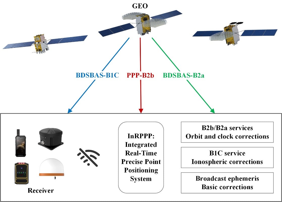
The development of an Integrated Real-Time Precise Point Positioning (InRPPP) system leveraging BeiDou Navigation Satellite System (BDS) B2b, B2a, and B1C services has significantly enhanced satellite-based positioning accuracy.
By resiliently utilizing these augmentation messages, the InRPPP system corrects satellite orbit and clock errors and mitigates ionospheric delays, outperforming traditional methods. Experimental results from both static and kinematic conditions demonstrate superior performance, showing improved positioning accuracy, faster convergence times, and greater stability in challenging environments. This breakthrough offers potential for applications in real-time navigation, precision positioning, and disaster monitoring, with a broader impact on industries requiring reliable and continuous positioning data.
The implications of the InRPPP system are vast, with applications spanning multiple sectors that depend on high-precision satellite navigation.
Satellite-based navigation systems, like the Real-Time Precise Point Positioning (RTPPP), are crucial for many industries that require accurate location data. However, these systems face limitations in areas with weak Internet connectivity or signal interference. BeiDou’s satellite augmentation services, namely B2b, B2a, and B1C, have emerged as a promising solution.
Yet, integrating these services into one cohesive system for optimal performance remained unexplored. This study pioneers the Integrated InRPPP system, which integrates all three services including correcting satellite clock, orbit errors, and ionospheric delays, unlocking new levels of positioning accuracy. The results from this research address critical limitations in current satellite-based positioning technology, setting the stage for real-world applications in complex environments.
In a 2025 Satellite Navigation publication (DOI: 10.1186/s43020-025-00172-x), researchers from the State Key Laboratory of Geo-Information Engineering and Key Laboratory of Surveying and Mapping Science and Geospatial Information Technology of MNR, State Key Laboratory of Spatial Datum, and Hohai University introduced the InRPPP system, a new approach that leverages the B2b, B2a, and B1C services of the BDS.
Scenes of the static experiment. The left and right panels denote the west and south sides of the station. (Photos: Study authors)
By combining these services, the InRPPP system corrects satellite orbit and clock errors while mitigating ionospheric delays. With enhanced accuracy, stability, and faster convergence times, this system has the potential to transform satellite-based positioning, offering more reliable and continuous service in real-time applications, especially in environments where traditional positioning systems struggle to perform.
The InRPPP system brings a new level of precision to satellite navigation by combining the best of BeiDou’s B2b, B2a, and B1C services. Through this integration, the system corrects satellite orbit and clock errors with B2b and B2a services, while B1C handles ionospheric delays. This resilient approach allows the system to deliver superior performance, even in high-occlusion or remote environments. The static experiments showed the InRPPP system surpasses other methods, with a 59.6% improvement in positioning accuracy and a 65.9% reduction in convergence time compared to using B2b, B2a, or B1C individually.
In dynamic conditions, the system demonstrated enhanced stability and reduced signal interruptions, achieving up to a 34.3% improvement in accuracy. The integration of these services increases the number of visible satellites, enhancing the Position Dilution of Precision (PDOP) values and ensuring better satellite geometry. This integrated approach not only improves accuracy but also ensures continuous, reliable solutions, making it a game-changer for fields like geodesy, navigation, and disaster monitoring.
Academician Yuanxi Yang of the Chinese Academy of Sciences, the lead researcher behind the InRPPP system, remarked, “The ability to integrate multiple BeiDou augmentation services into a single real-time positioning system represents a major breakthrough. By leveraging B2b, B2a, and B1C, our system offers a more reliable and accurate solution than anything available today. In both static and kinematic tests, the InRPPP system has outperformed traditional positioning methods, demonstrating its robustness and resilience in environments where signal conditions are far from ideal. This system is already applied in real applications and has potential to reshape industries reliant on satellite navigation and positioning.”
The implications of the InRPPP system are vast, with applications spanning multiple sectors that depend on high-precision satellite navigation. From autonomous vehicles and precision agriculture to disaster management and geospatial services, the enhanced accuracy and stability offered by InRPPP can support real-time decision-making in critical environments. This system also promises to improve the resilience of navigation systems in regions with poor satellite visibility or signal interference. As technology advances, the InRPPP system could pave the way for even more robust solutions, advancing global sustainability goals and improving disaster response capabilities by offering uninterrupted, reliable positioning data.
The International Symposium on Satellite Navigation 2023: Advances, Opportunities and Challenges (ISSN 2023) will take place Nov. 20-22 in Jiaozuo, Henan, China.
ISSN 2023 will provide a platform for GNSS scientists and engineers to communicate and exchange theories, methods, technologies, applications and future challenges.
The event is open to all scientists who may have the latest results and developments in BeiDou (BDS) and GNSS+, including constellations, signals, orbits, receiver design and multi-sensor fusion, as well as positioning, navigation and timing theory, algorithms, models and applications in engineering and Earth science.
Manuscripts on new advances in multi-GNSS and other regional systems, compatibility, interoperability and new applications are also welcome.
ISSN 2023 is jointly sponsored by Henan Polytechnic University and the Editorial Office of Satellite Navigation. Main topics and sessions include:
GEODNET has released a real-time kinematic (RTK), centimeter-precision, GNSS corrections service designed for OEMs and system integrators of agricultural robotics. GEODNET is compatible with several GNSS receivers from major brands, on-vehicle automated steering, spraying kits, and most UAVs and robots.
The GEODNET corrections service has more than 1,700 total full-constellation reference stations worldwide and supports GPS, Galileo, GLONASS and BDS signals. It also has the RTCM 3.2 data format for maximum rover/receiver compatibility and NTRIP sign-on and access.
Additional local reference stations can be added.
Free GEODNET correction service trials are available now for qualified OEMs and system integrators in most agricultural regions globally. Interested parties can apply for a trial stream here.
In 2022, the BeiDou Navigation Satellite System (BDS) continued to improve its service performance, expand global applications, and deepen and promote international cooperation.
On Nov. 4, 2022, a white paper titled “China’s BeiDou Navigation Satellite System in the New Era” was published. The paper shows the continuous, stable and reliable operational capability of BDS, its applications achievements across the industries, international development with openness and integration, and unremitting pursuit of helping to build a community with a shared future for humanity and a better world.
System Services Performances
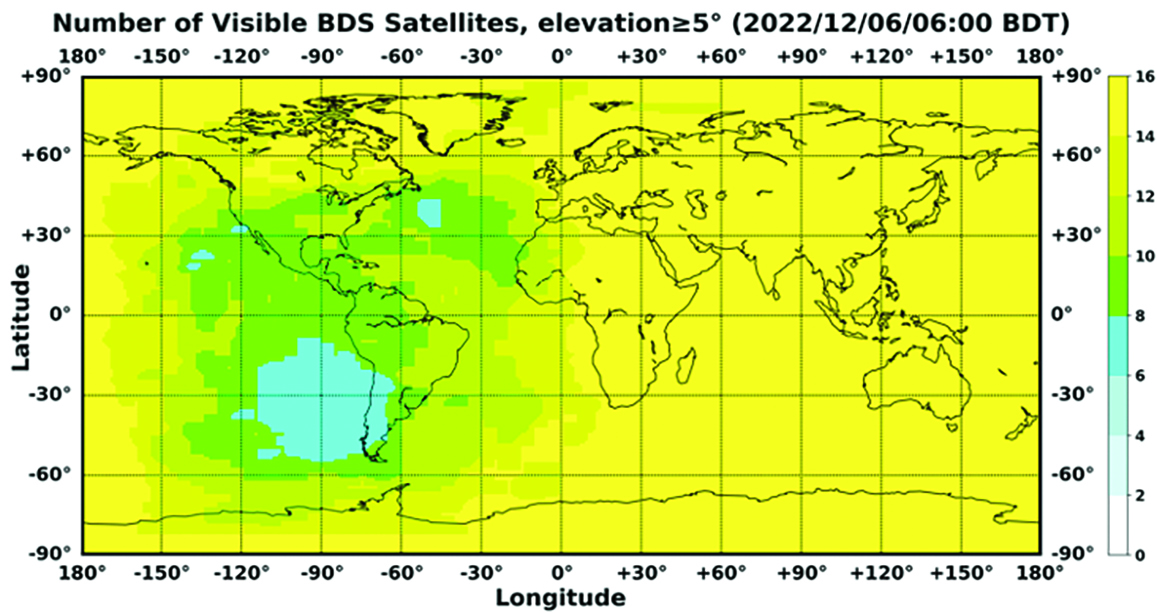
In orbit are 45 BDS operational satellites, including 15 BDS-2 satellites and 30 BDS-3 satellites. Figure 1 shows the number of visible BDS satellites worldwide as of BDT 06:00 on Dec. 6, 2022.
Figure 1. Number of visible BDS satellites. (Image: www.csno-tarc.cn)
BDS has reached a continuity of 99.996% and an availability of 99%. The innovative constellation involves inter-satellite links, signal system optimization, intelligent operation and maintenance, software reconstruction and upgrading of in-orbit satellites, and global test and assessment.
As measured by the International GNSS Monitoring and Assessment System (iGMAS), the BDS global positioning accuracy is less than 1.5 m horizontally and 2.5 m vertically (95% confidence) — better than the nominal service performance parameters.
So far, the measured signal power spectrum envelope of the BDS satellites remains consistent with the superior signal quality; the signal-in-space accuracy of any BDS satellite is better than 4.6 m. The time offset between BDT and UTC (NTSC) remains within 26 ns.
The BDS Coordination Framework has maintained consistency with the International Terrestrial Reference Frame 2014, and the accuracy is better than 3 cm. The orbital accuracy of the broadcast ephemeris of the BDS-3 medium Earth orbit (MEO) satellite is better than 0.5 m, and the clock offset of the broadcast ephemeris of the BDS-3 satellites is better than 5 ns.
BDS concentrates on construction of the application infrastructure and has established four major characteristic service platforms:
Short Message Communication Service
Satellite-based Augmentation System Service
Search-and-Rescue Service
Ground Based Augmentation System Service.
These platforms will expand and upgrade the applications and provide more efficient and convenient services for users.
The BDS Short Message Communication Service platform realizes the interconnection with ground mobile communication systems and networks, and integrates the BDS short message communication functionality into smartphones without the need to change the SIM card or contact number.
For the BDS Satellite-based Augmentation System Service platform, the system’s ground segment includes 30 monitoring stations and two data processing centers. The system will provide single frequency (SF) and dual-frequency multi-constellation (DFMC) services through GEO satellites. The Civil Aviation Administration of China has initiated and organized the technical testing and certification of SF service before applications.
The BDS Search-and-Rescue Service provides users with distress alert information access and distribution, as well as return link services. It is currently at the initial operational stage with sound performances. The operational status of the BDS SAR payload has been submitted to Cospas-Sarsat.
The BDS Ground-Based Augmentation System Service platform’s real-time positioning accuracy can reach 2 cm horizontally and 5 cm vertically. The post-processing accuracy can reach 2 mm horizontally and 5 mm vertically. At present, the BDS ground-based augmentation network has provided the A-BDS positioning and the BDS high-precision services for more than 1.5 billion users in more than 230 countries and regions, with services delivered 2 trillion times in total, equivalent to nearly 3 billion on average per day. BDS has provided high-precision positioning services for more than 20 million mobile phones in the country.
The BDS Applications Industry
The BDS applications industry has achieved sustainable development. In 2021, the total output of China’s satellite navigation and location-based service industry reached about 469 billion yuan (about 67.4 billion U.S. dollars), with a compound annual growth rate of more than 20%. A complete industrial chain covering chips, modules, antennas, boards, terminals and services has been established.
Industrial applications. BDS has been fully applied in various industries — including transportation, agriculture, forestry and fishery, public security, disaster mitigation and relief — and has been integrated into infrastructure such as electric power, water conservation, finance and communications.
As BDS applications fields expand, its in-depth applications have been growing as well. As of June 2022, more than 8 million BDS terminals had been installed in the transportation sector. More than 1.3 million terminals were used in the farming, forestry, livestock and fishing industries, and more than 1.8 million terminals were adopted by public security agencies. Large-scale BDS applications have been advanced in communication and timing services, meteorological monitoring, emergency response and disaster mitigation, and urban management. In emerging applications sectors, BDS has served epidemic prevention and control, telemedicine, caring for seniors, promoting the realization of intelligent health services that serve everyone, and accelerating intelligence and modernization in related fields.
Mass market applications. BDS has been widely used in mass market applications, such as mobile phones and wearable devices. In the first half of 2022, among all types of smartphones that applied for network access in China, 128 supported the BDS-based positioning function. More than 130 million smartphones supporting BDS services were shipped, accounting for more than 98% of the country’s total volume. The BDS positioning service is used more than 100 billion times daily on average for a platform that supports mobile map navigation. In particular, mobile phones have been fitted with high-precision positioning services. Lane-level navigation has been implemented in eight cities in China, including Shenzhen, Chongqing and Tianjin. The first mobile phone in the world that supports BDS-3 regional short message communication services has been officially released, enabling users to send short messages through BDS.
BDS international applications. BDS has been applied in more than half the countries and regions in the world, with more diversified application modes and application fields.
BDS products, technologies and services have been recognized by more international users:
In Mozambique, BDS-based UAVs have greatly improved the efficiency of plant protection operations
In Lebanon, BDS-based high-precision technology has been successfully applied to the construction and measurement of the port of Beirut
In Burkina Faso, BDS supported surveying and mapping during the construction of hospitals to prevent and control local infectious diseases, such as COVID-19
In Saudi Arabia, BDS is widely used in fields such as surveying and the collection of geographic information, the construction of urban and municipal infrastructure, and the positioning of personnel or vehicles in deserts
In Asia, BDS-based high-precision positioning services are contributing to the monitoring of Sarez Lake Dam in Tajikistan, the completion of the China-Kyrgyzstan-Uzbekistan Highway, the China-Kazakhstan crude oil pipeline, and the routine operation of China-Europe Railway Express.
International Cooperation
Following the principles of openness, cooperation and resource sharing, BDS has been actively carrying out practical international cooperation and exchanges as well as facilitating the development of global satellite navigation.
Multilateral cooperation. BDS representatives continue to participate in international activities under the framework of the United Nations International Committee on GNSS and other multilateral forums, to advocate joint development of global satellite navigation by contributing Chinese wisdom and proposals. BDS has also participated in international academic conferences in the field of satellite navigation, such as the Institute of Navigation meetings, the Munich Satellite Navigation Summit, and the Multi-GNSS Asia Conference.
Bilateral cooperation. The Ninth Meeting of the China-Russia Project Committee on Major Strategic Cooperation in Satellite Navigation was successfully held in September 2022. Under the framework of the Committee, BDS and GLONASS have carried out continuous cooperation in such areas as compatibility and interoperability, system performance testing and assessment, and joint applications. China’s Satellite Navigation Office signed cooperation documents in the field of satellite navigation with partners from the United Arab Emirates and the Arab Civil Aviation Organization, to carry out extensive cooperation and continue to deepen cooperation with Pakistan, Iraq, Thailand, Argentina, South Africa and other countries.
International Standards. BDS is increasingly recognized by international organizations such as the International Maritime Organization (IMO), the International Civil Aviation Organization (ICAO), Cospas-Sarsat, IEC, 3GPP and RTCM. In November 2022, the BDS Message Service System (BDMSS) was ratified by the Global Maritime Distress and Safety System (GMDSS), making BDMSS the third GMDSS satellite communication system recognized by the IMO. The Declaration of Intent for Cospas-Sarsat MEOSAR Cooperation was signed between the cooperating agencies (from Canada, France, Russia, and the United States) of the International Cospas-Sarsat Program and the Maritime Safety Administration of China, meaning China formally becomes the provider of the Cospas-Sarsat space segment.
The Future
In the future, BDS will launch back-up satellites to ensure better performance by upgrading the constellation’s availability. While maintaining stable operation, BDS will speed up in combination with new technologies such as 5G, artificial intelligence and Big Data to build a more ubiquitous, more integrated, and more intelligent national comprehensive PNT system by 2035. BDS will continuously adhere to the development concept that “BDS is developed by China, dedicated to the world and aiming to be world class,” promote system development and make contributions to social development and construction of the community with a shared future for mankind.
For analogous updates on the other three GNSS constellations, please see:
The first International Summit on BeiDou Navigation Satellite System (BDS) Applications took place Sept. 16 in Changsha, in central China’s Hunan Province. (Photo/Xinhua)
An enhanced version of the BeiDou short message service was showcased at the First International Summit on BeiDou Navigation Satellite System (BDS) Applications held in Changsha, in central China’s Hunan Province, on Sept. 16, reports China.org.bn.
The short message service enables two-way communication on mobile phones in areas not covered by ordinary mobile communication signals or when base stations are damaged, the website reports. This service would prove useful in the event of an earthquake or other emergencies, as well as offshore fishing.
“Short message service needed a larger satellite terminal such as maritime satellite phone,” said Li Jingyuan, director of the BeiDou short message team at National University of Defense Technology (NUDT). “But the enhanced version’s low-power-consumption feature enables mobile phones to send emergency messages through BeiDou satellites, even without ground mobile communication signals. The information transmission rate of the enhanced version has increased 10 times, which means pictures and voice messages can be sent out quickly.”
At the summit, NUDT, the government of Hunan, and China Electronics Corporation signed an industrial cooperation agreement to further expand short message service to low orbit satellite users. The short-message service could play a role in global satellite internet of things, international life rescue, global emergency communication and other industrial applications, the website reports.
Yang Changfeng, chief architect, BeiDou Navigation Satellite System, speaks at an international event. (Photo: BDS)
On July 31, 2020, BDS-3, the global version of the BeiDou Navigation Satellite System (BDS), was formally commissioned, marking the completion of its three-step development process. BDS enters a new era of global services. With the principle of “serving the world and benefiting mankind,” BDS provides seven types of services to users worldwide, including positioning, navigation and timing (PNT) services, a global short-message communication (GSMC) service, a regional short-message communication (RSMC) service, an international search-and-rescue (SAR) service, the BeiDou satellite-based augmentation system (BDSBAS), the BDS/GNSS ground-based augmentation system (BDGAS), and the precise point positioning (PPP) service. BDS has been continuously making contributions to improving GNSS capabilities and promoting the development of GNSS applications and technologies.
In 2020, as BDS construction was successfully completed, BDS has made fruitful achievements in application development and internationalization.
System Construction
Space Constellation Deployment. From March to June 2020, two BDS-3 GEO satellites were launched, while the in-orbit tests of two IGSO satellites, two GEO satellites, and two MEO satellites were completed. As the result, the global system constellation was successfully deployed.
By the end of October 2020, 45 in-orbit operational BDS satellites provide services to global users, including 15 BDS-2 satellites and 30 BDS-3 satellites.
Ground System Development. More than 40 new ground stations have been built, tested and commissioned. The BDS ground system is operating stably, supporting daily BDS operations.
Basic Service Enhancement
Generally speaking, the accuracy of the BDS signal-in-space is better than 0.5 m, BDS global positioning accuracy is better than 10 m, BDS velocity measurement accuracy is better than 0.2 m/s, and BDS timing accuracy is better than 20 ns. In the Asia-Pacific region, BDS positioning accuracy is better than 5 m, the velocity measurement accuracy is better than 0.1m/s, and timing accuracy is better than 10 ns.
In the key service area, there are 30 BDS-3 satellites and 15 BDS-2 satellites that jointly provide the services using B1I and B3I signals. The actual average measured positioning accuracies are about 1.48 m horizontally and 2.99 m vertically (95% confidence), which are improvements of about 30% and 5% respectively as opposed to solely relying on the BDS-2 system.
Globally, with the B1I, B3I, B1C and B2a signals, BDS-3 offers service availability of 100% (PDOP ≤6,). The actual measured positioning accuracies are about 1.54 m horizontally and 2.65 m vertically (95% confidence).
Featured Services Benefit Users
Presently, the BDS PPP service covers China and its surrounding areas. By broadcasting the high-precision orbit and satellite clock error corrections through the B2b signal, the high-precision positioning service is provided, while initial testing measurements show that the positioning accuracies are about 0.18 m horizontally and 0.26 m vertically (95% confidence).
BDSBAS was developed in accordance with International Civil Aviation Organization (ICAO) standards to provide SBAS services with superior accuracy and integrity, enabling aircraft approach with vertical guidance of class I (APV-I). The BDSBAS services cover China and its surrounding areas, and the SBAS data, following ICAO standards are broadcast by the three BDS GEO satellites. In particular, the single frequency SBAS service is being provided through the BDSBAS-B1C signal. At the moment, the civil aviation certification process of the BDSBAS SF service is being prepared. The BDSBAS-B2a signal will provide the Dual Frequency Multiple Constellation (DFMC) SBAS service. BDS has been actively participating in the development process of the DFMC standards and carrying out the verification of the draft DFMC SBAS Standard and Recommended Practices.
BDGAS consists of 155 framework reference stations and nearly 2,200 regional stations in China. The system carries out high-precision applications in many fields, such as surveying and mapping, land resources, earthquake monitoring, transportation and meteorology. Its basic services include real-time positioning at the meter, decimeter and centimeter levels, as well as precise post-processing positioning at the millimeter level.
Being developed in accordance with Cospas-Sarsat standards, the BDS MEO-SAR service provides the detection probability of the international search-and-rescue service of better than 99%, with the characteristic return link capability. In July, a joint test was carried out using the BDS MEO-SAR satellites with the Cospas-Sarsat ground station in Maryland, U.S., and the relevant technical documents and the equipment admittance testing reports were formally submitted to Cospas-Sarsat, which provides Chinese contributions to the international MEO-SAR family.
RSMC provides service to China and its surrounding areas through three GEO satellites. Its communication capability is greatly improved compared to BDS-2. With service capacity of 12 million times per hour, the transmitting power of user terminals is reduced to 1-3 W and the single message capacity reaches 1,000 Chinese characters. The construction of the RSMC service platform has been completed to promote the organic integration of short message and mobile communication services, and to further exert the advantages of the BDS featured services.
GSMC provides global services through 14 MEO satellites with single message capacity of 40 Chinese characters.
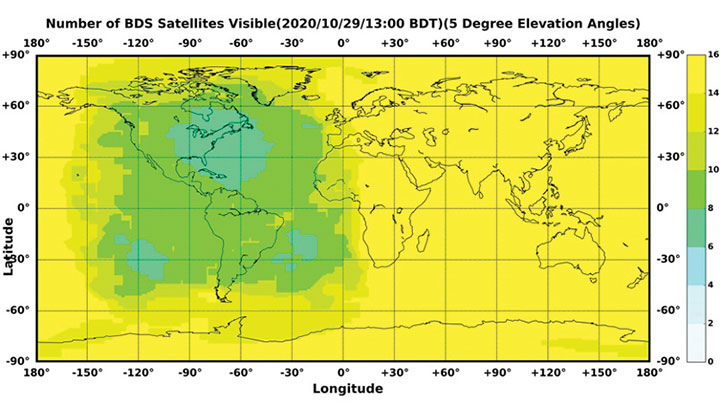
Figure 1. The number of visible BDS satellites as of BDT 13:00, Oct. 29, 2020. The number of visible satellites at Asia-Pacific Region is greater than 20. (Source: www.csno-tarc.cn)
Integrated Applications
As the system construction accelerates, BDS is also making great efforts to strengthen the development of BDS fundamental products and promote large-scale applications in various fields. The integrated applications and innovative development adopt the “BDS+” and “+BDS” models to improve quality and efficiency as well as to stimulate a healthy and fast-growing GNSS industry.
Fundamental Products. At present, the fundamental BDS products have been used in areas such as mass-market applications, where the performance has reached or is close to the world-class level. Progress has been made in the research and development of multi-system baseband-RF integrated high-precision chips. The 28 nm chips have been mass-produced, and the 22 nm chips are about to be mass-produced. As a result, the function and performance of the chips will reach a new level. The BDS navigation chips, modules, high-precision boards and antennas have been exported to more than 120 countries and regions, serving millions of users worldwide.
Industrial Applications. BDS has been widely used in various fields, including communication and transportation, public security, agriculture, forestry, animal husbandry and fishery, hydrological monitoring, meteorological forecasting, time synchronization, power dispatching, and disaster prevention and mitigation. Significant economic and social benefits have been generated.
In the field of transportation, in the first three quarters of 2020, more than 7 million road vehicles were using BDS. The number of postal and express delivery vehicles using BDS reached 314,000, and the number of ships is about 1,369. In general aviation, 300 planes are using BDS.
In agriculture, BDS-based automatic steering systems are on more than 45,000 pieces of agricultural machinery and equipment, saving 50% of the labor cost. BDS-based agricultural machinery operation supervision platforms are serving 10 million units of agricultural machinery equipment, greatly improving management and operational efficiency.
In forestry, the BDS positioning and short message communication services are widely used in forest fire prevention, natural forest protection, forest inspection, pest control and so on.
In the fishery field, BDS provides fishery managers and fishing vessels with ship position monitoring, emergency rescue, information dissemination, vessel management and other services. BDS terminals have been installed on more than 70,000 fishing boats and law enforcement vessels in China. More than 10,000 people have been saved.
For disaster prevention and mitigation, a three-level platform covering the national ministries and the provinces was built to offer six-tier application services, deploying more than 45,000 BDS terminals.
BDS plays an important role in the emergency response to major disasters such as flooding in South China and forest fire in Southwest China this year. BDS is accelerating entry into new infrastructural construction, and is deeply integrated with new technologies such as next-generation communication, blockchain, the internet of things, artificial intelligence, and more. New modes, formats and markets for BDS applications are constantly emerging.
Mass-Market Applications. BDS-based navigation and positioning services have been adopted by various enterprises in the fields of e-commerce, smart mobile terminals, location-based services, the sharing economy and people’s livelihood, profoundly changing people’s production and lifestyles. Just like water and electricity, BDS provides public services that are easily accessible and available on demand. In smartphone applications, domestic and international mainstream chip manufacturers have released communication-navigation integrated chips compatible with BDS. More than 90% of mobile-phone companies applying for access to China’s domestic network support BDS positioning. Smartphones from Huawei, MI, Apple, VIVO, OPPS and other big brands in China are BDS-enabled.
BDS Standards. The updating and upgrading of the BDS standard system is progressing smoothly, with Version 2.0 to be released soon. The BDS application standard systems will be published in electric, railway and other industries. The revision of the national BDS standards is advancing steadily. Four national standards were issued in early 2019, and 28 national standards will be released by the end of 2020. Forty-two standards related to the BDS program have been issued in three batches, while 58 new standards are being formulated.
The work related to BDS intellectual properties is being carried out, and various innovation entities continue to improve BDS’ intellectual property creation, utilization and protection capabilities. Statistics shows that Chinese GNSS-related patent applications reached 12,170 in 2019 and 9,411 by the end of October, with an average growth rate of 21.7% in the past three years.
International Cooperation
Bilateral Cooperation. BDS continues to carry out bilateral cooperation with other GNSS to promote compatibility, interoperability and joint applications. Under the China-U.S. civil GNSS cooperation platform, working groups have been set up to continuously engage in cooperation and exchanges in areas such as compatibility and interoperability, augmentation systems and aviation applications, civil service provisions, etc. China and the Russian Federation held their seventh bilateral meeting in October, and have been pushing forward landmark demonstration projects such as joint ground station set-up, cross-border transportation and precision agriculture. China and the European Union are carrying out coordination, exchanges and cooperation under the framework of the China-EU space cooperation dialogue.
Multilateral Cooperation. The BDS team participates in meetings of the International Committee on Global Navigation Systems (ICG), and continuously promotes discussions on relevant topics. The experience fighting COVID-19 using BDS/GNSS, as well as BDS applications in pandemic prevention and control, are being shared with the international GNSS community. During the ninth ministerial meeting of the China-Arab States Cooperation Forum held in July, video conferences promoted the deepening of China-Arab satellite navigation cooperation.
International BDS Applications. With the export of BDS high-precision products, BDS is widely used in different regions and fields, such as land registration, precision agriculture, warehouse logistics in ASEAN countries, construction in Western Asia, airport timing and plying the seas in South Asia, power plant inspections in Eastern Europe, and land surveys in African countries. BDS high-precision products are exported to more than 120 countries and regions. BDGAS technologies and products are systematically exported, serving more than 100 million users worldwide.
International Standards. BDS has been adopted by many international organizations including the ICAO, the International Maritime Organization, Cospas-Sarsat and mobile communication. A number of international standards supporting BDS have been released. In March, the International Electrotechnical Commission (IEC) officially issued the first international standard for BDS vessel receiving equipment inspection (IEC 61108-5), which provides the basis for global classification societies to carry out type certification of BDS equipment on vessels. In July, the first batch of 3GPP standards supporting the BDS B1C signal was officially released. The series of standards will support BDS signals in Assisted GNSS (A-GNSS) of 5G communication. By year’s end, the Radio Technical Commission for Maritime Services (RTCM) 10403.X standard, which fully supports BDS, will be officially released, marking an important milestone in the creation of a general data format standard for BDS receivers.
Adhering to the development concept of “the Chinese BDS, the World’s BDS and the First Class BDS,” BDS development vigorously carries forward the Beidou spirit in the new era — independent innovation, open integration, unity and pursuit of excellence. By 2035, a more ubiquitous, integrated and comprehensive national PNT system with a spatial-temporal information service infrastructure covering space, sky, Earth and sea, and offering unified high precision, high intelligence, high security and high efficiency, will be built. It will provide core support for future intelligent and unmanned development; continuously promote system upgrading; integrate new technologies such as new generation communication and low orbit augmentation; strive to develop high-quality capabilities such as quantum navigation, full-source navigation, and micro PNT; and build a spatial-time information service infrastructure covering space, sky, Earth and sea, with high precision, high intelligence, high security and high efficiency.
On Sept. 23, the China BeiDou Application Conference and the Ninth Annual Conference of China Satellite Navigation and Location Services were held in Wuhan, according to a press release from haiwainet (People’s Daily), an official Communist Party newspaper of China.
Attending the conference were 700 experts, officials and entrepreneurs, as well as company representatives from BDStar Navigation, Amap, Allystar, Unistrong and Wuhan Exsun. “Delegates agreed that China’s BDS PNT (positioning, navigation and timing) industry has just started and is ushering in a golden decade of rapid growth,” the press release stated.
Zhou Xianwang, mayor of Wuhan, said that Wuhan, an important city for BDS construction and industrial development in China, is accelerating Beidou industry innovation, application promotion and enterprise development with first-class talents and services, and striving to make Wuhan a new highland for Beidou industry innovation and development.
Yu Xiancheng, president of the GNSS and LBS Association of China, said the Beidou industry in China has reached about $58.8 billion and the industrial ecology has taken shape.
According to the press release, “China’s Beidou is the first-class Beidou and the world’s Beidou as well. The application and space-time services of Beidou technology will become more popular in China and the world, ushering in a golden decade of development.”
BDS basic products have been exported to more than 120 countries and regions, and Beidou-based land ownership confirmation, precision agriculture, digital construction and smart ports, etc. have been successfully applied in ASEAN, South Asia, Eastern Europe, West Asia and Africa.
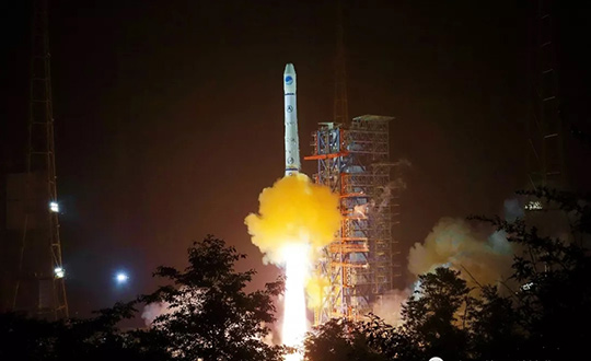
China sends two BeiDou satellites into space a Nov. 23. (Photo: Guo Wenbin/Xinhua)
China launched two satellites of the BeiDou Navigation Satellite System (BDS) into space from the Xichang Satellite Launch Center in Sichuan Province at 8:55 a.m. Saturday, Nov. 23.
Launched on a Long March-3B carrier rocket and the Yuanzheng-1 (Expedition-1) upper stage attached to the carrier rocket, the two satellites have entered their planned orbits. They are the 50th and 51st satellites of the BDS satellite family.
The two medium earth orbit (MEO) satellites are also network satellites of the BeiDou-3 system.
The two new satellites, the carrier rocket and Yuanzheng-1 were all developed by the Innovation Academy for Microsatellites of the Chinese Academy of Sciences and the China Academy of Launch Vehicle Technology under the China Aerospace Science and Technology Corporation.
The launch was the 319th mission for the Long March series carrier rockets.
With 35 satellites, the completed BeiDou-3 will provide better coverage inside buildings and in urban canyons, according to researcher Jin Shuanggen, Shanghai Astronomical Observatory. Shuanggen was addressing the second Beidou Summit Forum.
China has deployed three systems, BDS-1, BDS-2 and BDS-3, to provide accurate positioning and navigation services to the world, said Jin Shuanggen, a researcher at the Chinese Academy of Sciences, at the second China (Nanjing) BeiDou Satellite Navigation Application Expo and Beidou Summit Forum.
The BDS system currently has 38 in-orbit satellites including 18 BDS-2 and 20 BDS-3.
“Traditional satellites navigation service is hardly available in the interior of buildings, underground, underwater and other locations. The BDS system provides better accuracy in these locations,” he said.
“BDS will play a large role as it is used in different scenarios including smart city, agriculture and meteorology, autopilot, and intelligent transportation,” said Jing Guifei, dean of BeiDou Belt and Road School of Beihang University.
Along with the summit, a three-day exposition displayed BeiDou applications with more than 400 exhibitors. Fields covered included drones, autonomous ships, surveying and mapping, and intelligent robots and vehicles.
China launched another BeiDou satellite into space from the Xichang Satellite Launch Center in Sichuan Province at 10:41 p.m. April 20, according to Xinhua.
The inclined geosynchronous Earth orbit (IGEO) satellite was launched on a Long March-3B carrier rocket. It is the 44th satellite of the BDS satellite family and the first BDS-3 satellite in inclined geosynchronous Earth orbit.
After in-orbit tests, the satellite will work with 18 other BDS-3 satellites in intermediate circular orbit and another IGEO satellite.
Yang Changfeng, chief designer of the BeiDou system, told Xinhua that the hybrid constellation design will increase the number of visible satellites in the Asia-Pacific region.
According to Yang, the positioning accuracy of the system has reached 10 meters globally and five meters in the Asia-Pacific Region after the system started to provide global service at the end of last year.
The BDS has been widely used around the world, such as in building construction in Kuwait, precision agriculture in Myanmar, land survey and mapping in Uganda and warehousing and logistics in Thailand.
About 8-10 BDS satellites are scheduled to be launched this year, wrapping up launch missions of all BDS-3 satellites in medium Earth orbit. The BDS-3 system is to be completed in 2020.
China is also planning to finish building a high-precision national comprehensive positioning, navigation and timing (PNT) system based on BeiDou by 2035.
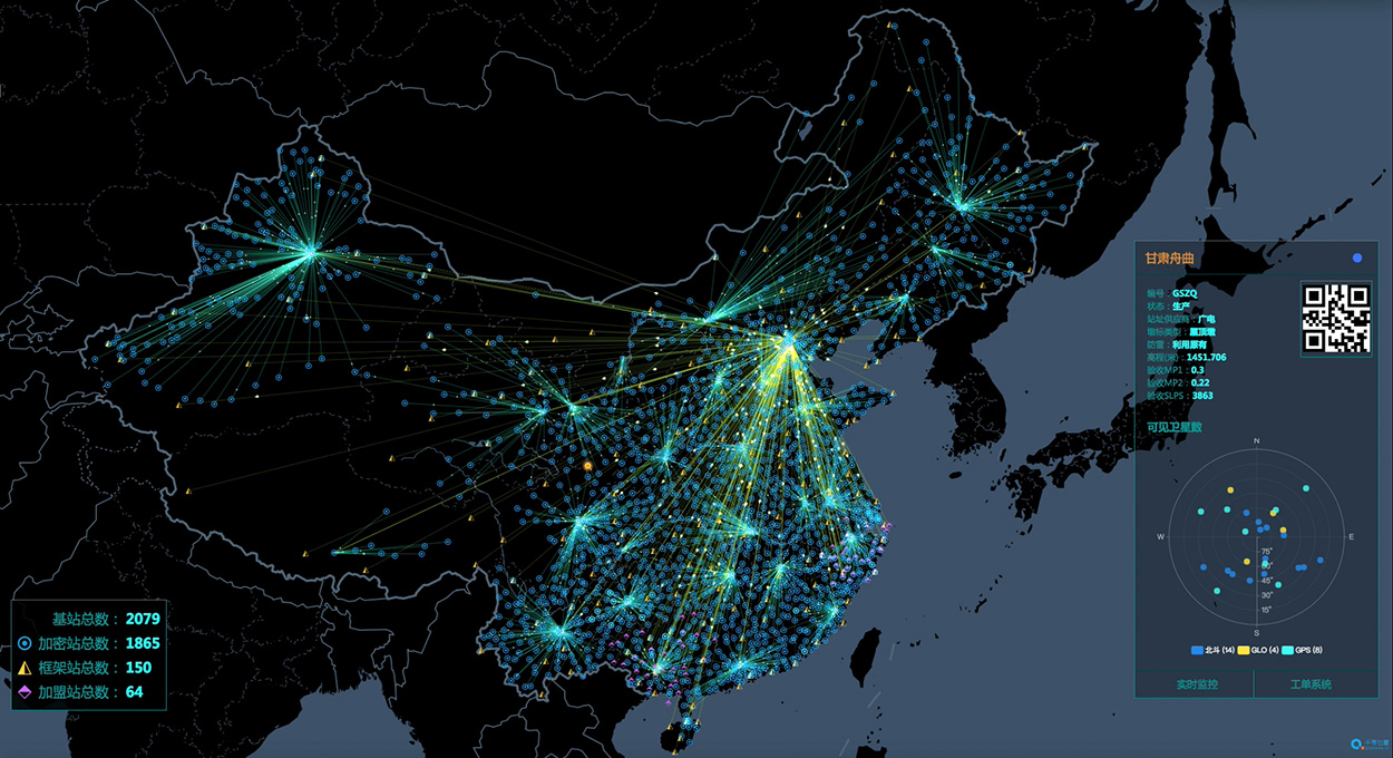
China’s National Reference Station Network. (Image: BeiDou)
The second China-Arab States BDS Cooperation Forum, held April 1 in Tunis, Tunisia, covered measures and initiatives that will increase the use of China’s Beidou navigation satellite system (BDS) in the Arab world. The aim is to establish a Space Silk Road that elevates cooperation in high-technology between China and the Middle East and North Africa, reports spacewatch global.
The forum concluded that increased BDS use in the Arab world, as well as technological cooperation with China, could be achieved by establishing the Space Silk Road.
By formally establishing a Silk Road conceptual theme, forum participants believe that Arab countries will step up their use of BDS for everything ranging from precision agriculture and maritime domain awareness to disaster management and telecommunications.
“The BDS cooperation is the best example for the strategic cooperation between China and Arab states, as satellite navigation integrates many high-tech areas, including telecommunication and space technologies,” said Slim Khalbous, Tunisia’s minister for higher education and scientific research in an address to the forum. “This is an important opportunity for Tunisia, while the BDS cooperation also means the further upgrade of the China-Arab relations.”
“Satellite navigation has provided many conveniences and benefits for us, and we are determined to push forward with our cooperation,” said Mohamed Ben Amor, secretary-general of the Arab Information and Communication Technologies Organization (AICTO), in the forum’s opening speech.
Amor added that the establishment of the China-Arab States BDS/GNNS Centre in Tunis in 2018 is an important step in increasing Sino-Arab cooperation in satellite positioning, navigation, and timing (PNT) applications through BDS.
Kamal Hassen Ali, assistant secretary general of the Arab League in charge of economic affairs, celebrated the burgeoning cooperation between China and Arab states. “The size of our cooperation will grow bigger, as the China-Tunisia cooperation has borne many fruits, and it will achieve greater progress in other countries in the region too.,” Ali said.
The China-Arab States BDS Cooperation Forum is a multilateral initiative for promoting cooperation and exchanges between China and Arab states in the field of satellite navigation within the framework of the China-Arab States Cooperation Forum. The first forum was held in Shanghai, China, in May 2017.
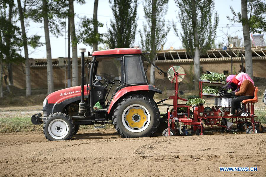
A self-driving tractor using the BeiDou Navigation Satellite System (BDS) was tested successfully March 10 in northwestern Tunisia, according to China.org.cn.
The representatives of China-Arab BDS/GNSS center and the Arab Information and Communication Technologies Organization (AICTO), as well as the academic staff of an engineering school in Mjez El-Beb region in northwestern Tunisia, attended the test ceremony.
The smart tractor, used in various agricultural activities, was equipped with a BDS receiver so that it could be controlled remotely without a driver.
“I am very impressed and surprised by the quality of the equipment offered by BeiDou,” said Sami Trimech, the strategic planning and development director at AICTO.
“We had a dream to bring BeiDou to the Arab countries,” said Nour Laabidi, the project manager at AICTO and head of China-Arab BDS/GNSS center in Tunisia.
“This is a pilot project. We are happy to implement it in our country and I hope that all Arab countries will be able to use this Chinese technology,” Laabidi said.
Hassan Kherroubi, a specialist in the mechanical industry at the Mjez El-Beb engineering school, stressed the contribution of this Chinese technology to the agricultural sector in Tunisia.
Agricultural activities, including harvest, will be more profitable and more effective with such technologies, according to Kherroubi.
“Our main concern is to benefit all Arab and African countries of this fruitful cooperation between Tunisia and China,” Kherroubi said, adding that this advanced technology will bring a bright future to the region.
BDS is compatible with other navigation systems, such as GPS, and users can receive services from both systems at the same time, improving positioning accuracy.