Tag: Boeing

  • Last of 12 GPS IIF Satellites Arrives at Cape Canaveral

    Last of 12 GPS IIF Satellites Arrives at Cape Canaveral

    A quality assurance team from the 45th Launch Group off-loads a GPS IIF-12 satellite from a C-17 Globemaster III on Cape Canaveral Air Force Station, Fla., Oct. 8. A crowd from the government and industry partnership, who will complete the satellite’s final assembly, gathered on the Cape’s “Skid Strip” to watch the off-loading of the satellite they will prepare to launch aboard a United Launch Alliance rocket in 2016. (U.S. Air Force photo/James Rainier)
    A quality assurance team from the 45th Launch Group off-loads a GPS IIF-12 satellite from a C-17 Globemaster III on Cape Canaveral Air Force Station, Fla., Oct. 8. (U.S. Air Force photo/James Rainier)

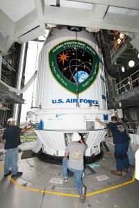
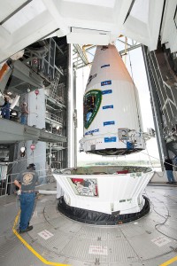
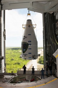
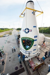
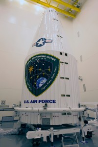
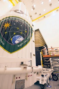
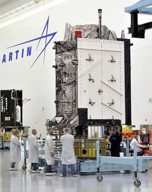
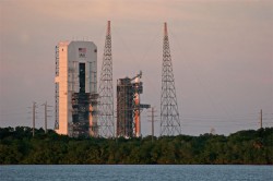
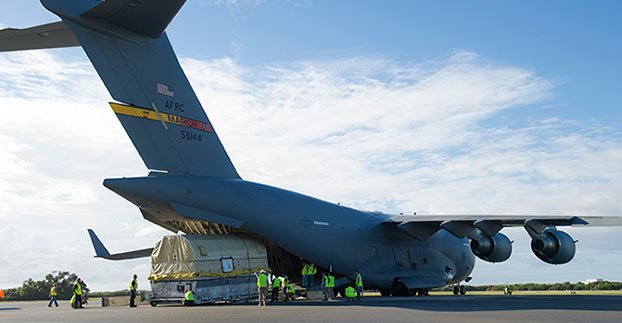
    The last Air Force GPS IIF in a block of 12 satellites was delivered to Cape Canaveral Air Force Station, Florida, from Boeing’s manufacturing facility in El Segundo, Calif., Oct. 8 via a C-17 Globemaster III.

    A crowd from the government and industry partnership, who will complete the satellite’s final assembly, gathered on the Cape’s “Skid Strip” to watch the off-loading of the satellite they will prepare to launch aboard a United Launch Alliance rocket in 2016.

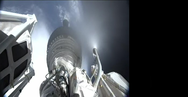
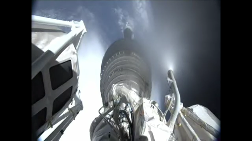
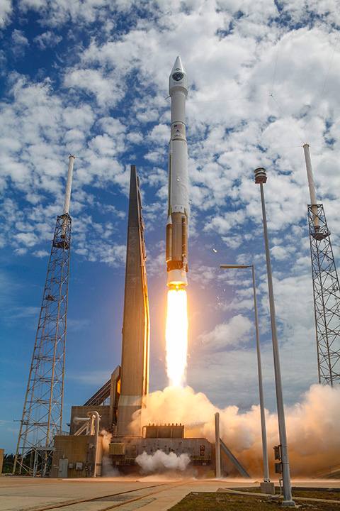
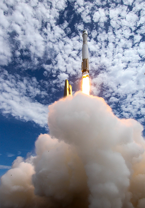
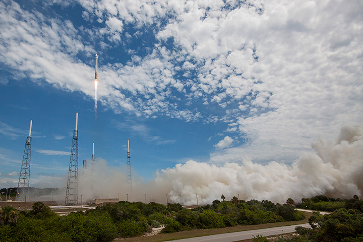
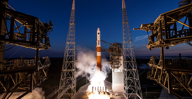
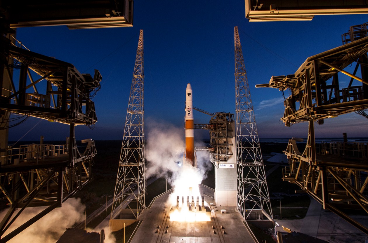
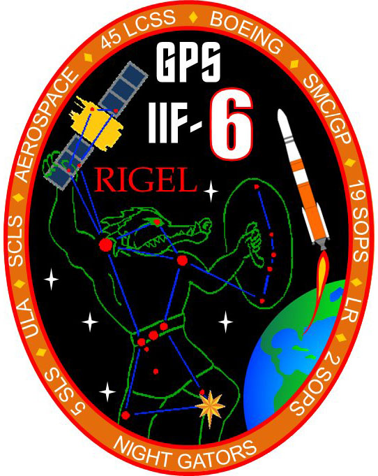
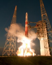
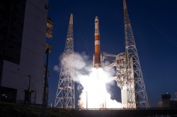
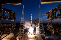
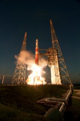
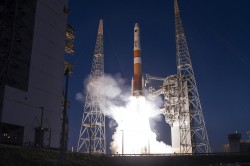
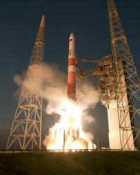
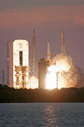
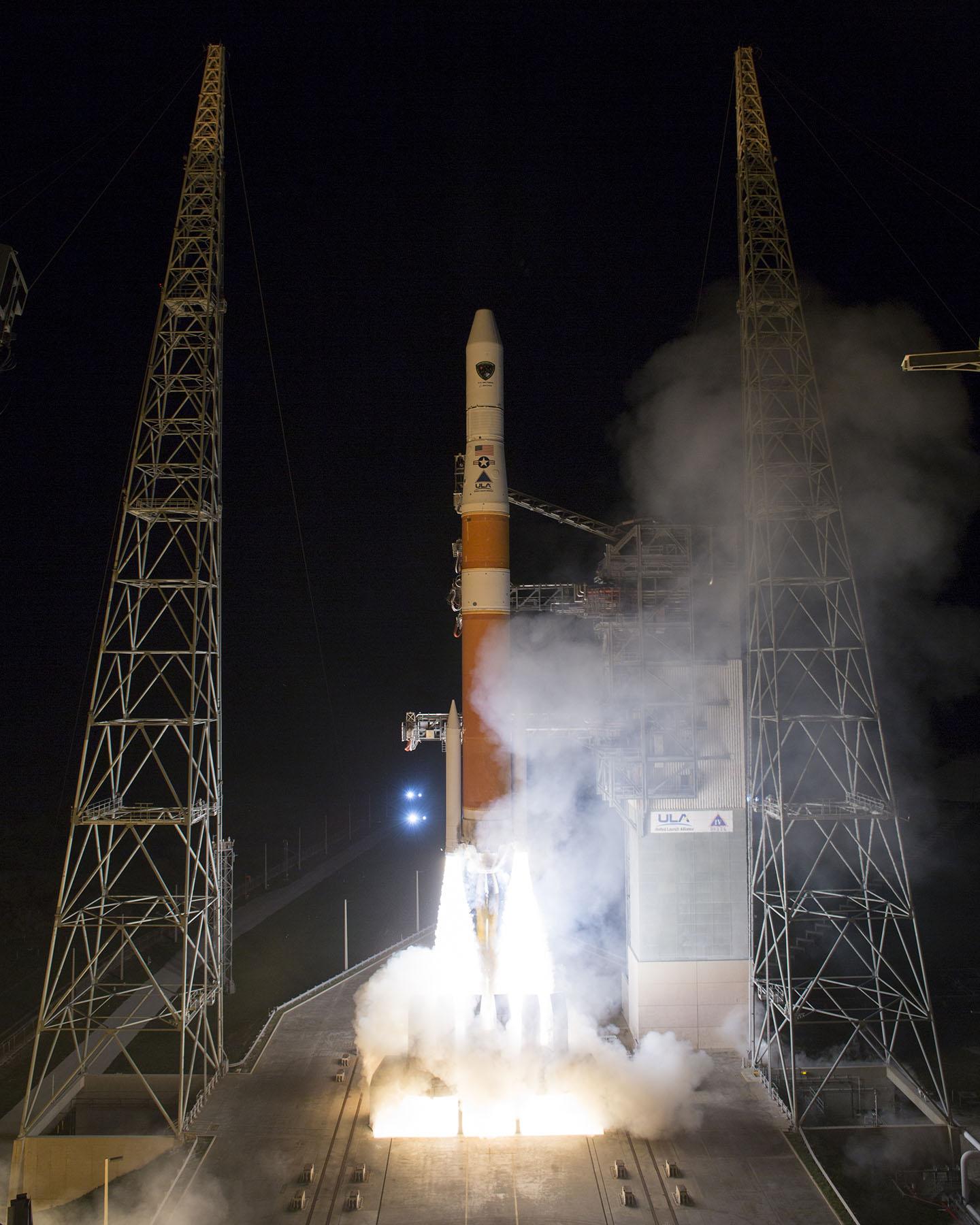
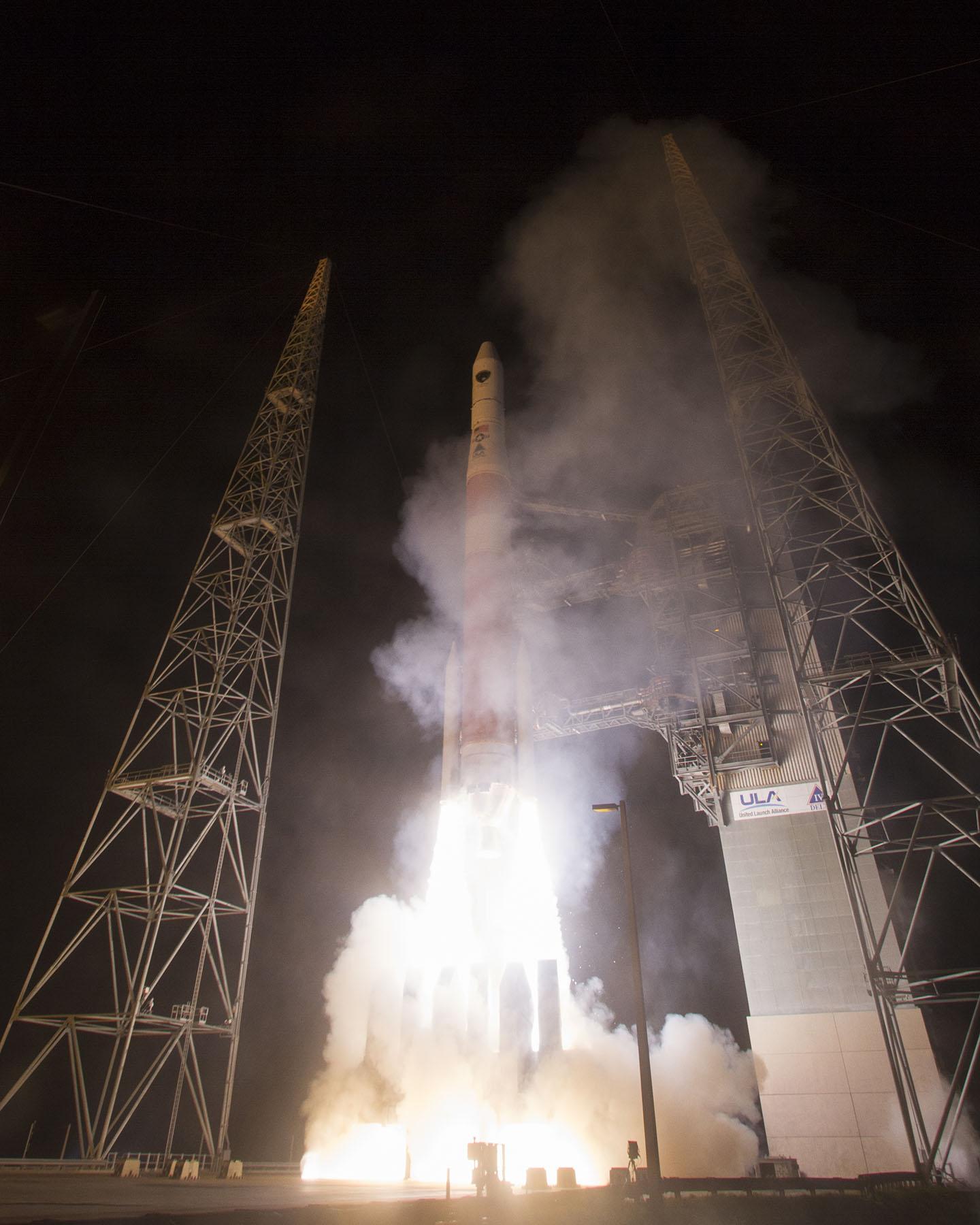
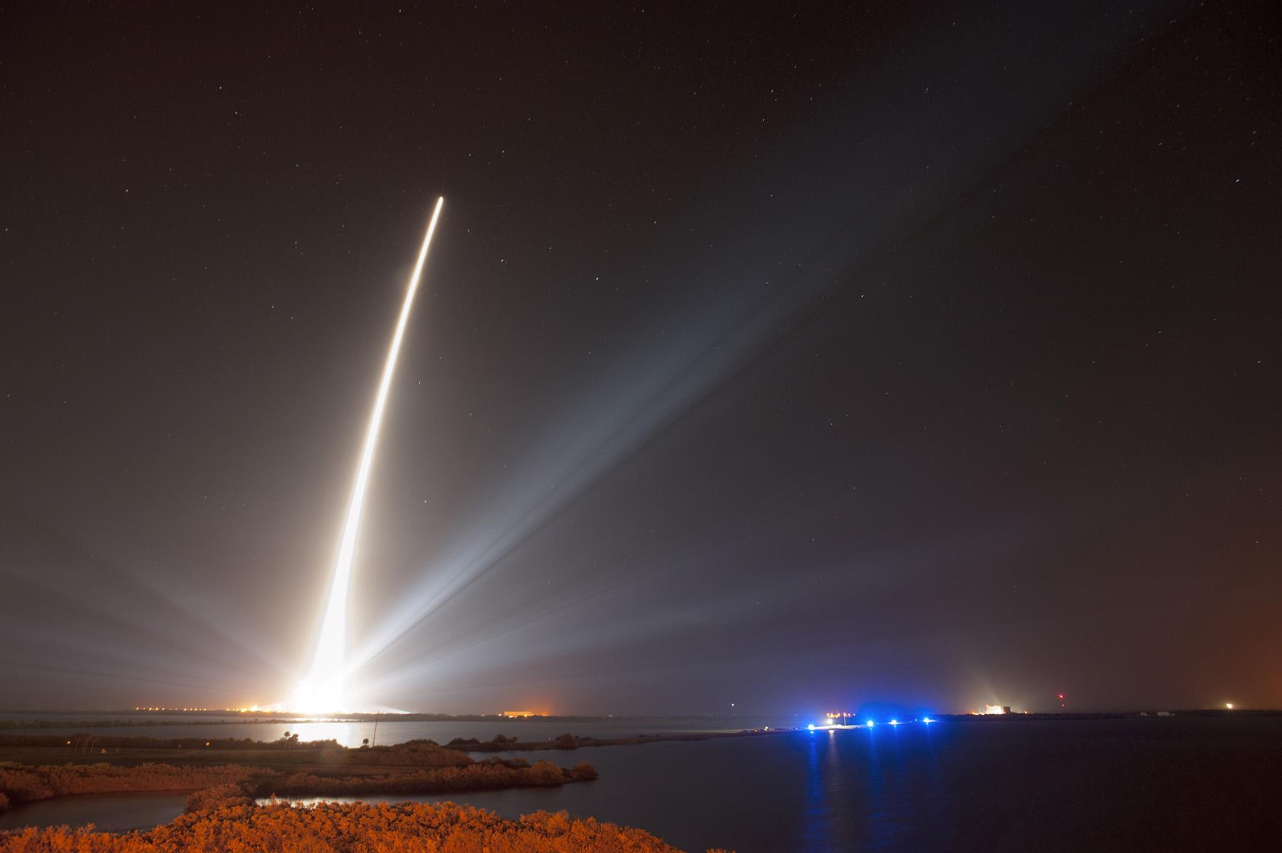
    In related news, GPS IIF-11 is set to launch Oct. 30. Launch of GPS IIF-12 is scheduled for February 3, 2016.

    “This GPS IIF-12 satellite represents the end of a legacy as it will be the last of the 61 GPS satellites processed here at (Cape Canaveral Air Force Station),” said Brig. Gen. Wayne Monteith, the 45th Space Wing commander. “This culminates an incredible 27-year legacy at our Area 59 Satellite Processing Facility. We are the nation’s premier gateway to space and are humbled to be a part of the team that provides GPS and its capabilities to the world.”

    Although there have been other models of GPS launched into space, the Airmen-led processing team at Area 59 is particularly proud to begin preparations to send the last IIF block satellite into orbit. They’ve been behind every launch of the series since the first GPS IIF launched here in May 2010.

    “Our combined team’s objective is 100 percent mission success each and every time,” said Col. Eric Krystkowiak, the 45th Launch Group commander. “My Airmen work, in partnership, with Boeing and the system program office at the Space and Missile Systems Center throughout the final stages of satellite processing prior to launch. From spacecraft containerization, shipment from California, the arrival at the Cape Canaveral Air Force Station Landing Strip, final checkouts, fueling and encapsulation, the team is laser focused on identifying and mitigating any issues that could potentially jeopardize mission success.”

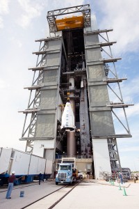
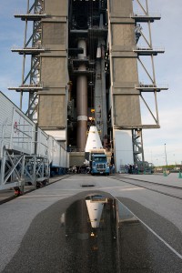
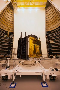
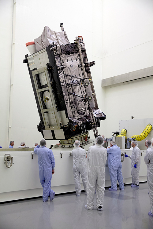
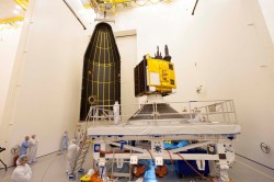
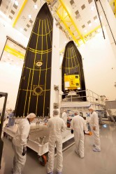
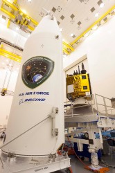
    The Boeing-assembled GPS IIF 12 that arrived at the Cape Canaveral will undergo a series of prelaunch preparations, checks and rehearsals. These included functional checkout of the spacecraft, compatibility testing, battery installation, fueling, mating to the payload adapter and obtaining a final flight weight.

    Members of the quality assurance team range from young military officers to career enlisted troops and seasoned civilians.

    “Mission assurance at the launch base is executed with our ‘triad’ of professionals,” Krystkowiak said. “Our mission assurance technicians are enlisted personnel with many years of experience in missile maintenance who are fully engaged and observe the contractor’s work with the satellite. They bring their hands-on experience, strict technical compliance and discipline to the satellite processing realm. Beside them are our company grade officers and civilian engineers who bring their engineering rigor and innovative ideas into the process. Lastly are our Aerospace Corporation partners who provide invaluable experience and legacy system insight to the team with their continuity of satellite processing. Many of these members have been here at the Cape since GPS first launched in 1989 and achieved full operational capability in 1995.”

    A field program manager for the team interfaces with 45th SW leadership, the Air Force SMC and the contracted partners throughout the months in between the satellite’s delivery and its launch.

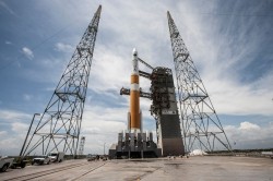
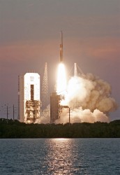
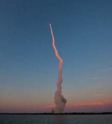
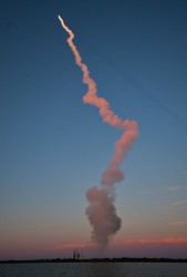
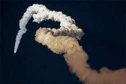
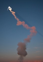
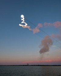
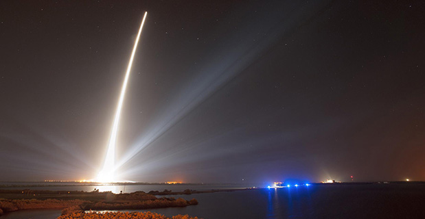
    The Evolved Expendable Launch vehicle is used to launch GPS satellites from Cape Canveral into nearly 11,000-mile circular orbits. While circling the Earth, GPS satellites transmit extremely accurate timing data on multiple L-band frequencies. Design life across the satellite blocks range from 7.5 to 12 years, but many are lasting more than 20 years, with the oldest vehicle turning 25 in November.

    The GPS Master Control Station, operated by the 50th SW’s 2nd Space Operations Squadron at Schriever Air Force Base, Colo., is responsible for monitoring and controlling the GPS as a 24-satellite system, consisting of six orbital planes, with a minimum of four satellites per plane. There are currently 39 vehicles in the GPS constellation.

  • GPS IIF-10 Launches from Cape Canaveral

    GPS IIF-10 Launches from Cape Canaveral

    After the first main engine cut-off, the GPS IIF-10 mission entered a three-hour coast phase. (Courtesy:  ULA)
    After the first main engine cut-off, the GPS IIF-10 mission entered a three-hour coast phase. (Courtesy: ULA)

    UPDATE (July 15, 4 p.m. ET): United Launch Alliance (ULA) officials have declared the launch mission a success. The Centaur upper stage completed its second burn and released the GPS IIF-10 satellite into the navigation network to complete today’s launch of the Atlas 5 rocket.

    “Congratulations to the U.S Air Force and the entire mission team on today’s successful launch of the 10th GPS IIF satellite! In just a few days, on July 17, the Global Positioning System will celebrate the 20th anniversary of GPS achieving fully operational status,” said Jim Sponnick, ULA vice president, Atlas and Delta Programs. “ULA is very proud to play a role in delivering these satellites to orbit, with Atlas and Delta rockets having launched all 58 operational GPS satellites.”

    “Today’s successful launch is a testament to the outstanding teamwork of  government and industry partners’ commitment to mission success. The GPS IIF satellites are critical for GPS constellation global service for years to come,” said Lt. Gen. Samuel Greaves, Space and Missile Systems Center commander. “Thanks to the men and women of SMC, the 45th, 50th, 310th Space Wings, Boeing, United Launch Alliance, The Aerospace Corporation, the GPS IIF, and the Atlas V launch teams, we are sustaining and modernizing the world’s greatest space-based, precise positioning, navigation and timing service.”


    The tenth GPS IIF satellite lifted off from the Space Launch Complex (SLC)-41 at Cape Canaveral, Fla., on schedule at 11:36 local time (15:36 UTC) on July 15,  at the start of a nineteen-minute launch window.

    This is the second of three GPS constellation replenishment flights planned in 2015. The first launch, of GPS IIF-9 using a Delta IV rocket, occurred on March 25. A third launch, of GPS IIF-11 using an Atlas rocket, is scheduled for Sept. 22. The launch of GPS IIF-12 is scheduled for Jan. 26, 2016.

    The Boeing-built GPS IIF-10 is one of the next-generation GPS satellites, incorporating various improvements to provide greater accuracy, increased signals, and enhanced performance for users. GPS IIF-10 was the 70th spacecraft to be launched as part of the GPS constellation and the tenth in the Block IIF series that began launching in May 2010.

    GPS IIF-10 marks the 55th Atlas V launch since the vehicle’s inaugural launch in 2002 and the 27th flight of the 401 configuration. Every operational GPS mission has launched on a United Launch Alliance or heritage rocket. While the government has certified ULA competitor SpaceX for GPS III launches, a SpaceX Falcon 9 rocket exploded June 29, two minutes after launch of an International Space Station resupply mission.

    The Boeing-built GPS IIF satellites provide improved signals to support both the warfighter and the growing civilian needs of the global economy, the U.S. Air Force said in a statement. The GPS IIF satellites will provide improved accuracy through advanced atomic clocks, a longer design life than previous GPS satellites, and a new operational third civil signal (L5) that benefits commercial aviation and safety-of-life applications. It will also continue to deploy the modernized capabilities that began with the GPS IIR satellites, including a more robust military signal.

    Launch Photos

    Pre-Launch Photos

  • FAA: GBAS Operational at Airports Worldwide

    FAA: GBAS Operational at Airports Worldwide

    Delta Boeing 737 lands at Newark using GBAS.
    Delta Boeing 737 lands at Newark using GBAS.

    Delta Airlines made a perfect Ground-Based Augmentation System (GBAS) Landing System (GLS) landing at Liberty Newark International Airport on Feb. 18, according to the Federal Aviation Administration’s SatNavNews newsletter.

    Delta now joins United Airlines and British Airways as airlines that use the GBAS at Newark.

    More GBAS locations around the world are reaching operational status, and airline operations using GBAS are increasing as additional GLS-equipped aircraft are entering service for the various airlines. Boeing has confirmed that many of the customers who have ordered multiple 787s, 747-8s or 737s have publicly stated their intention to use the GLS capability on these aircraft.

    More than 1,000 Boeing GLS-equipped aircraft are now in use, and this number is growing by an estimated 25 airplanes per month. This estimate is based upon current production rates — one third of 737s are being equipped with the GLS option. GLS is standard on 787 and 747-8 aircraft.

    The list below provides a summary of the airlines using GBAS and the airports where GLS approaches are flown on a regular basis.

    U.S. Carriers

    • Delta Airlines – Houston, Newark
    • United Airlines – Houston, Newark

    Non-U.S. Carriers

    • Air Berlin – Bremen, Malaga
    • British Airways – Newark
    • Cathay Pacific – Houston, Sydney (plans for Newark in the future)
    • Emirates Airlines – Frankfurt, Houston, Sydney, Zurich
    • Lufthansa – Frankfurt, Houston
    • Qantas – Sydney
    • Swiss Air – Zurich
    • TUIfly – Malaga
    • Various Russian airlines (S7, Transaero, Utair, Sakhalin Energy, Gaspromavia Russia). Fifteen GBAS locations in Russia have been approved with each airline using different airports (Domodedovo, Pulkovo, Tyumen, Ostafyevo, Nogliki and others).

    The commitment to GBAS development and implementation continues to grow, according to the FAA, with plans to implement GBAS in these additional locations:

    • Dubai, United Arab Emirates
    • Chennai, India
    • Gimpo, South Korea
    • London Heathrow, United Kingdom
    • Melbourne, Australia
    • Oslo, Norway
    • Rio de Janeiro, Brazil
    • St. Helena, United Kingdom.
  • GPS Glitch Two Years Older than First Stated

    On Wednesday, the GPS Directorate said further data analysis shows that a technical error affecting some Boeing GPS IIF satellites first appeared in 2011, two years earlier than originally stated, according to a Reuters report.

    The error first appeared one year after the GPS IIF satellites became operational. The error affects the way the ground control system builds and uploads messages transmitted by the satellites, but does not affect the accuracy of GPS signals. It involves the ground-based software used to index messages.

    Lockheed Martin runs the GPS ground control segment, which enables Air Force officials to operate all GPS satellites, including the IIF satellites built by Boeing.

  • Air Force Working on Glitch for GPS IIF Satellites

    The U.S. Air Force is working to resolve a technical error that affected some Boeing GPS satellites, according to a report by Reuters.

    The error does not affect the accuracy of GPS signals. It involves the ground-based software used to index some messages transmitted by GPS IIF satellites built by Boeing, Air Force Space Command said according to Reuters. Still, officials are investigating other possible causes.

    Lockheed Martin runs the GPS ground control segment, which enables Air Force officials to operate all GPS satellites, including the IIF satellites built by Boeing.

    Air Force Space Command Public Affairs released the following statement:

    “A GPS message indexing issue was recently identified that affects a limited number of active GPS IIF satellites, but does not degrade the accuracy of the GPS signal received by users around the globe. The result is an occasional broadcast not in accordance with U.S. technical specifications. The issue appears to be related to the ground software that builds and uploads messages transmitted by the GPS constellation during regular system operations, although the Air Force continues to investigate all possible causes.

    “Although the issue was brought to light in the last few days, a close examination of archived GPS message data reveals that the message indexing error has gone unnoticed since 2013. Air Force Space Command has implemented a workaround to prevent further message indexing violations and is taking steps to permanently correct the error.”

    The U.S. Air Force will be launching the ninth Boeing Block IIF satellite on Wednesday.

  • Obstacles in the Orbit Path of GPS III

    Source: Alan Cameron
    The Lockheed Martin GPS III Non-Flight Satellite Testbed (GNST).

    A Lockheed Martin vice president has stated that the first GPS III satellite will likely launch in 2017, not 2016 as had been projected in the most recent update.

    The company is readying the first satellite for launch availability by the end of 2015, for launch as early as the end of this year, but Space News reports that Mark Valerio, vice president and general manager of Lockheed Martin’s military space business, stated in a Feb. 18 news briefing that he expects the Air Force will schedule its launch for early 2017.

    The GPS III generation of modernized satellites — with new signals, added signal strength, and resistance to interference and jamming — was originally projected to begin orbiting in 2014. Technical difficulties have delayed the program. The principal issues, those with the payload, have now been resolved, according to Valerio.

    Valerio expects a firmer GPS III launch announcement for 2017 in March. He expected the final launch date “will depend on the health of the existing constellation, the availability of launch slots and synchronization with the ground system.”  Ultimately, the Air Force always makes the final decision on the launch date.

    Source: Alan Cameron
    Lockheed Martin is contracted to build eight GPS III satellites.

    Late last year, a spokesman for the Space and Missile Systems Center said that “The first GPS III launch is tentatively considered for the first half of FY17, based on booster availability and Air Force launch priorities.”

    The Air Force has put out feelers for other contractors to finish out the full generation of GPS III satellites. Lockheed Martin is building eight, with an option for four more, totalling 12; a complete constellation of III-generation satellites would require 24. Boeing Space and Intelligence Systems and Northrop Grumman Aerospace are reportedly interested.

    “The best thing I can do is keep marching along the plan we have,” Valerio said. “We’re certainly not afraid of the competition.” Lockheed Martin has submitted cost-cutting proposals for the current GPS III satellite design, he added.

    Ground Control

    The corresponding new ground system for GPS III, the Operational Control Segment (OCX), has also fallen behind schedule. Just this month, the Air Force announced that Lockheed Martin may develop an interim control capability, a set of changes implemented upon the current control segment, the Architecture Evolution Plan (AEP), as a backup.

    Michael Gilmore, the Defense Department’s director of operational test and evaluation, recently stated that OCX delays have pushed back GPS III operational testing “until after at least six, and as many as eight,” satellites have been launched into orbit. “This introduces significant risk that effectiveness and suitability deficiencies in GPS III satellites will not be discovered until it is too late to prevent their introduction to the operational constellation.”

    Budget Blues

    Don Jewell, GPS World’s contributing editor for defense, has written at length about the GPS III and OCX situations in his February newsletter column, “USAF FY16 Budget Plus $10B More, Please!”. We condensed some of his remarks, particular to the budget battle on Capitol Hill, for the Out in Front column of the March issue of the magazine, due out soon. Here is a further digest of those comments.

    The 2016 President’s Budget, submitted in February, contains an Air Force requested a budget of $122.2 billion. This may be too little, too late.

    On the satellite side of the house, GPS III has problems centering on development and delivery issues with a subcontractor. In this case, however, the whole satellite program is not failing, just a component, albeit an important one: the Mission Data Unit (MDU).

    For GPS III+, the Air Force plans for a two-phased competition process: a Production Readiness competition for up to three firm-fixed price contracts to mature competitors’ production designs for a competition in a full and open competition for up to 22 GPS III Production SVs [satellite vehicles] with an expected award in FY17/18.

    This sounds great if you need an entirely new GPS III system, which consists of, at a minimum, a new payload, satellite, launcher and ground C2 system. In fact, the government only needs an MDU. Failure to produce the MDU on time has delayed GPS III by 18 months to date.

    More troubling are the government proposals to entertain other bids to finish the second half of the GPS III constellation. Such a competition or re-bid will take at least three years and cost hundreds of millions of dollars — and Lockheed Martin may well win again in the end

    A significant added cost to the GPS budget concerns the need for a new ground C2 system if the total new systems approach is taken. If preliminary elements of the GPS space segment are developed without cross-checking the impact to the GPS control segment, technical, operational, budgetary and schedule impacts will be significant.

    The already perturbed OCX budget likely has not considered the integration costs of a newly developed, yet-to-be-procured GPS III+ SV. OCX today is geared for the GPS III already contracted for, and it is failing to meet that challenge.

    Budget constraints are tight and getting tighter, mandating the Air Force “do more with less” in every context. For GPS III SVs, this should — but by no means necessarily does — indicate developing an alternate MDU rather than buying a new block of GPS SVs.


  • ION GNSS+ 2014: The Boeing Company

    Larry Davidoff, director of advanced navigation systems at The Boeing Company, highlights the company’s Position, Navigation and Timing (PNT) system solutions at ION GNSS+ September 9-12 in Tampa, Florida. Jeffrey Goldstein shares digital navigation technology, which includes a GPS-enabled Jeppesen aeronautical aviation chart.

  • Boeing, Northrop Grumman Enter GPS III Bid

    Northrop Grumman and Boeing have responded to a U.S. Air Force call for contractors interested in building a follow-on set of GPS III satellites, according to a report in Space News.

    Lockheed Martin is under contract to deliver the first eight GPS III satellites, but the award for up to 22 further IIIs remains open. Difficulties with the payload for the first batch of satellites mean that although the Lockheed has three space vehicles ready, it has no signal payload to put aboard them. Subcontractor Exelis is at work on that. Delivery delays have prompted the Air Force to look about for alternatives.

    Lockheed Martin itself began investigating options for its supply line last year.

    Air Force “Sources Sought” Call

    The U.S. Air Force issued an official “Sources sought” notice in June on a production-ready GPS space vehicle, equipped with an alternate payload, for consideration alongside the Lockheed Martin-built GPS III vehicle. The first phase of the contract would include two firm-fixed price contracts worth $100–$200 million to demonstrate a competitor to GPS III.

    Key requirements are that the satellite must offer a payload alternative to that built by Exelis; the satellite must be ready to launch by 2023; and the production line must turn out two to three new satellites per year.

    The second phase features a competition between Lockheed Martin and one or more other companies for as many as 22 satellites. A final contract award would be made in 2017 or 2018.

    Current GPS III contractor Lockheed Martin reportedly sent an engineering team to help Exelis expedite a resolution of payload holdups, while simultaneously investigating a switch to other suppliers, beginning with the ninth satellite in the GPS 3 series. Lockheed Martin says five companies responded to its solicitation last year.

    Air Force Gives Free Hand. Gen. Ellen Pawlikowski, head of the Air Force Space and Missile Systems Center (SMC), told the national Space Symposium in Colorado in June, “Obviously we want a GPS III that does what its supposed to do, delivered on time, and it’s up to Lockheed to manage its subcontractors. My view is if Lockheed is not happy with their subcontractors nav payload, and they believe that they can get a lower risk approach to delivering a nav payload by seeking a secondary source for that, then that’s clearly a decision for them to make.

    “They [Lockheed ] know we are disappointed at the delays that we have seen, the technical issues that their subcontractor has had, and probably they are considering whether an alternative source could provide them a better opportunity.“

    Lockheed Martin spokesman Chip Eschenfelder issued a statement: “Exelis has made good progress on the first GPS III space vehicle, SV01 navigation payload. All GPS III SV01 navigation payload components have successfully completed unit acceptance and environmental testing, with the exception of one component, the mission data unit.

    “To date, significant MDU hardware testing indicates signal cross talk issues are resolved. The SV01 navigation payload forecast delivery to Lockheed Martin is fall 2014.”

    Boeing built the platform and major payload components for the GPS IIF satellites and is one of three companies that received contracts in January 2013 to study how to improve the accuracy, coverage, and efficiency of GPS using smaller satellites.

    Northrop Grumman Aerospace of Redondo Beach, California, has already delivered deployable antenna sets to Lockheed Martin for the first six GPS III satellites. The division has delivered more than 1,000 antennas for previous generations of GPS spacecraft, Northrop Grumman said.

  • GPS IIF-6 Launched into Orbit Following Weather Delay

    GPS IIF-6 Launched into Orbit Following Weather Delay

    div_gpsiif6_l3517201433120AM63

    The sixth GPS Block IIF satellite was successfully launched Friday at 8:03 p.m. local time. Built by Boeing Space and Intelligence Systems of El Segundo, California, GPS IIF-6 launched aboard a United Launch Alliance Delta 4 rocket from Cape Canaveral Air Force Station in Florida.

    The launch was originally planned for Thursday evening, but bad weather led to a 24-hour hold. One hour remained in the countdown when the launch was scrubbed.

    Two more GPS IIF satellites are scheduled to launch before the end of the year.

    Below is a video of the launch.

    Here are launch highlights.

    This patch commemorates the launch of GPS IIF-6, nicknamed Rigel.
    This patch commemorates the launch of GPS IIF-6, nicknamed Rigel.

    GPS IIF-6 is nicknamed Rigel. All of the Block II-F satellites have been named after stars. Rigel is is the brightest star in the constellation Orion and the seventh brightest star in the night sky, with a visual magnitude of 0.12.

    In the patch commemorating the launch, Orion is depicted with an alligator head. This is in reference to the “Night Gators,” the part of the launch team that is responsible for moving payloads to the launch pad, which has typically occurred at night.

    A slideshow of photos from United Launch Alliance:

    A slideshow of images from Spaceflight Now.

    Innovation Editor Richard Langley helped compile this report.

  • GPS IIF-6 Launch Delayed until Friday Night

    Update: The launch of the GPS IIF-6 satellite has been delayed one day due to bad weather.


    Another GPS IIF satellite is expected to lift off aboard a United Launch Alliance Delta 4 rocket from Cape Canaveral at 8:08 p.m. EDT May 15 at the opening of an 18-minute launch window.

    The satellite, designated GPS IIF-6 and built by Boeing, is one of the next-generation GPS satellites, incorporating  improvements to provide greater accuracy, increased signals, and enhanced performance for users. According to Boeing, each GPS IIF satellite has:

    • greater navigational accuracy through improvements in atomic clock technology.
    • a new civilian L5 signal to aid commercial aviation and search and rescue operations.
    • improved military signal and variable power for better resistance to jamming in hostile environments.
    • a 12-year design life providing long-term service and reduced operating costs.
    • an on-orbit, reprogrammable processor that can receive software uploads for improved system operation.

    GPS IIF-6 will be the United Launch Alliance’s fifth launch of 2014 and 82nd overall. It also will mark the 26th flight of the Delta IV launch vehicle since its inaugural flight in November 2002.

    ULA will provide a live webcast of the launch, beginning at 7:48 p.m. EDT. Also, those interested can hear updates to the launch countdown via phone, by dialing the ULA launch hotline at 1-877-852-4321, or join the conversation at www.facebook.com/ulalaunch and twitter.com/ulalaunch, hashtag #GPSIIF6.


  • New GPS IIF Satellite Launched

    New GPS IIF Satellite Launched

    A United Launch Alliance Delta IV lifts off from Space Launch Complex-37 with the Air Force's Global Positioning System (GPS) IIF-5 satellite. This launch marked the 25th Delta IV flight since the first flight in 2002. Credit: Ben Cooper/ULA
    A United Launch Alliance Delta IV lifts off from Space Launch Complex-37 with the Air Force’s Global Positioning System (GPS) IIF-5 satellite. This launch marked the 25th Delta IV flight since the first flight in 2002. Credit: Ben Cooper/ULA

    News compiled with the assistance of CANSPACE listserv.

    After a brief delay due to concerns over solar radiation trends, the GPS IIF-5 satellite was successfully launched at the end of the designated launch window at 01:59 UTC on February 21. The satellite, attached to the launch rocket’s upper stage, was initially placed in a highly elliptical orbit. Following a third burn of the rocket, the satellite was released into its assigned orbit at about 05:37 UTC today.

    Here is a video showing highlights of the launch:

    GPS IIF-5 will replace the aging spacecraft known as GPS IIA-28 in Plane A, Slot 3 of the constellation.The GPS IIA-28 satellite was launched aboard Delta 249 on November 5, 1997, as the final member of the Block IIA series. It will go into a reserve role in the network for the remainder of its useful life.

    This is the first of three GPS launches planned through July to replace aging craft in the constellation. GPS IIF-5 incrementally upgrades the constellation with improved accuracy, enhanced internal atomic clocks, better anti-jam resistance, a civil signal for commercial aviation, and a longer design life, all features of the Boeing-build Block IIF series. This will be the fifth of 12 Block IIF spacecraft being built to form the backbone of the GPS fleet for the next 15 years.

    Launch logo. The nickname of the IIF-5 satellite is Canopus, the brightest star in the modern constellation Carina and the second brightest star in the night-time sky, after Sirius.
    Launch logo. The nickname of the IIF-5 satellite is Canopus, the brightest star in the modern constellation Carina and the second brightest star in the night-time sky, after Sirius.

    According to the Air Force, the new capabilities of the IIF satellites will provide greater navigational accuracy through improvements in atomic clock technology, a more robust signal for commercial aviation and safety-of-life applications, known as the new third civil signal (L5), a second civil signal (L2C) available for the dual-frequency GPS receivers and a 12-year design life providing long-term service. These upgrades improve anti-jam capabilities for the warfighter and improve security for military and civil users around the world.

    “I am pleased with the outcome of today’s launch. The new capabilities provided by the IIF satellites will improve operations, sustainment and overall GPS service for the warfighter, international, commercial and civil communities,” said Col. Bill Cooley, director of the Space and Missile Systems Center’s Global Positioning Systems Directorate.

    “The modernized capabilities that are coming on board with the successful launch of GPS IIF-5 will support the worldwide GPS community for years to come. I would like to recognize the outstanding commitment and the superb dedication to mission success from the 45th and 50th Space Wings, our industry partners: Boeing and United Launch Alliance, and the GPS IIF and Delta IV program teams at the Space and Missile Systems Center,” said he said.

    The GPS Block IIF satellites are built by Boeing, and are operated by the United States Air Force following their launch by United Launch Alliance, using Evolved Expendable Launch Vehicles.

    • The first GPS IIF satellite was launched on May 27, 2010, and entered service on Aug. 26, 2010.
    • The second satellite, which launched on July 16, 2011, entered service on Aug. 22, 2011.
    • The third satellite launched on Oct. 4, 2012, and entered service 22 days later.
    • The fourth IIF was launched May 15, 2013, and entered service on June 21, 2013.

    Every modern GPS satellite was launched from Cape Canaveral Air Force Station.

    Each GPS IIF satellite delivers:

    • Greater navigational accuracy through improvements in atomic clock technology,
    • A new civilian L5 signal to aid commercial aviation and search and rescue operations,
    • Improved military signal and variable power for better resistance to jamming in hostile environments,
    • A 12-year design life providing long-term service and reduced operating costs,
    • An on-orbit, reprogrammable processor that can receive software uploads for improved system operation.

    “Once again, a group of talented mission partners rose to the challenge of launching another successful mission from the Cape,” said Col. Douglas Schiess, commander, 45th Operations Group, who served as the Launch Decision Authority. “Those mission partners include the 45th Space Wing, the Space and Missile Systems Center, the 50th Space Wing, United Launch Alliance, Boeing, and our other industry partners with the Delta IV and GPS IIF launch teams.”

    A United Launch Alliance Delta IV lifts off from Space Launch Complex-37 with the Air Force's Global Positioning System (GPS) IIF-5 satellite. This launch marked the 25th Delta IV flight since the first flight in 2002.
    A United Launch Alliance Delta IV lifts off from Space Launch Complex-37 with the Air Force’s Global Positioning System (GPS) IIF-5 satellite. This launch marked the 25th Delta IV flight since the first flight in 2002.
    div_gpsiif5_l5
    A United Launch Alliance Delta IV lifts off from Space Launch Complex-37 with the Air Force’s Global Positioning System (GPS) IIF-5 satellite. This launch marked the 25th Delta IV flight since the first flight in 2002.
  • Satelles Announces Patent and Technology License Agreement with Boeing

    Satelles, a division of iKare Corporation, has entered into a patent and technology license agreement with The Boeing Company. This license allows Satelles to provide timing and location solutions to commercial markets delivered over the Iridium constellation of 66 low-Earth-orbiting satellites.

    The timing and location signals are available anywhere on Earth, without the need for local infrastructure, making the system perfect for augmenting GPS and other location-based technologies, Satelles said. Unlike standard GPS, the high-power signals can reach into many building structures. The signal-in-space provides a location-specific signature that can reliably prove (or authenticate) the location of a mobile device or other equipment, while being virtually impervious to spoofing and other attacks, Satelles said.

    Gregory Gutt, CEO of iKare Corporation, stated, “After working closely with Boeing for years to create a global indoor-positioning solution, we are thrilled to be entering this license agreement, which includes over 30 issued and pending patents.”

    Michael O’Connor, CEO of the Satelles business, agreed. “We see tremendous dual use potential for the technology going forward. Indoor location is an exciting area, and we are seeing keen commercial interest in a solution that delivers trusted location for secure network communication or network transaction security.”

    Satelles is headquartered in Silicon Valley, in Redwood City, California, with an office in Ashburn, Virginia.