Most of you will know that during summertime I can usually be found in Calgary, Alberta — the “GPS Capital of Canada.” I usually try to pick up on developments in this area, and having recently bumped into my friends at Baseband Technologies, I found that they have made significant progress since the first time they appeared in my articles a number of years ago.
Baseband has now been around for 10 years, and has always focused on building reliable applications which are an adjunct to basic GPS, improving performance for integrated GPS in cell phones and other portable devices such as personal location watches, glasses, tracking devices, and such. Cell phones, of course, have had integrated GPS for a long time for personal navigation and 911 location.
Baseband aims to provide “instant position” with extremely low-power, low-cost positioning technologies. The company has several patents well into the approval loop, and have drawn heavily on the GNSS-rich’ availability of skilled people in and around Calgary for its significant R&D.
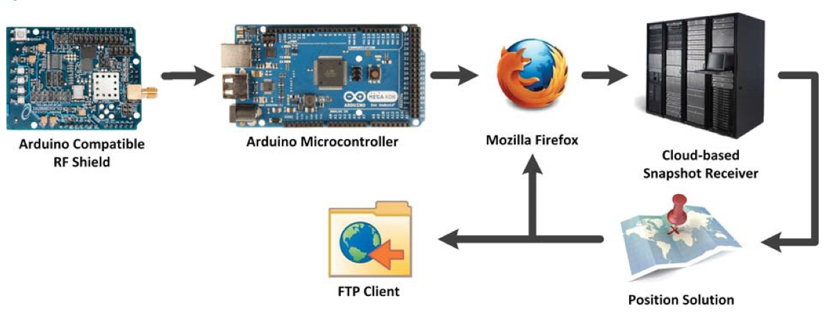
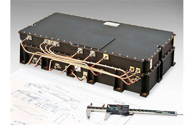
Baseband’s first product offering is a self-contained GNSS RF front-end that enables capture of satellite signal data for its cloud-based snapshot positioning receiver. The software receiver kit allows integrators to readily build prototypes that integrate Wi-Fi, Bluetooth, Ethernet, cellular modem, MEMS sensors, memory, and LCD that is compatible with the Arduino open-source electronics prototyping platform to quickly test and validate new product concepts. The snapshot receiver can also be integrated with other OEM hardware to greatly improve time-to-first-fix (TTFF) and power consumption. For customers who want to integrate snapshot positioning into silicon at the chip level, or into other hardware or software, Baseband offers system design services and a simple licensing scheme.
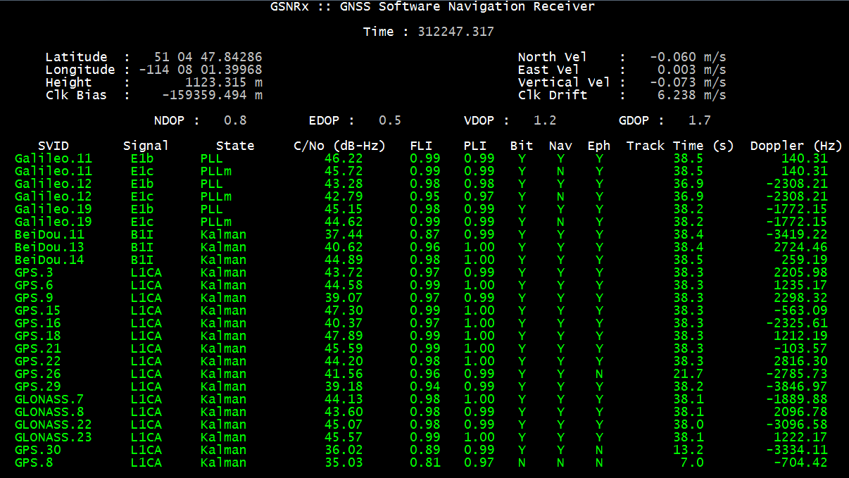
Nevertheless, acquiring satellites can be somewhat of a delicate operation for regular GPS receivers, and this can be especially true when a receiver is operating downtown where open sky can be intermittently blocked by buildings. The net effect is that a receiver could take a long time to calculate position, or sometimes even fail to provide a position altogether. Time is money, or in the case of cell phones, battery power is everything. So reducing power consumption and TTFF is something that a lot of OEMs are interested in achieving.
Turns out that pulling ephemeris or satellite location from satellite data can be the real issue, as the data rate of the satellite for this information is so slow. To get an initial position from four satellites could take between 16 and 36 seconds under best-case conditions — normally in a downtown core or dense forest this ideal situation is rarely achieved, and acquisition times can be much longer and become a real problem for users. Imagine how frustrating it could be for people like taxi cab or delivery trucks drivers operating downtown, where users have to constantly operate in harsh environments and may be subjected to loss of position data due to ephemeris renewal many times during a day.
Depending on the receiver that you’re using, satellite ephemeris may only be valid for up to four hours, whereas Baseband’s extended ephemeris can last for up to one month and still maintain acceptable accuracy. This means once you’ve downloaded an extended ephemeris file, there is no need to download it again for another month. Instead of relying on receiving ephemeris from satellite broadcast and suffering through its limitations under poor conditions, extended ephemeris (or satellite prediction) technology offers several advantages.
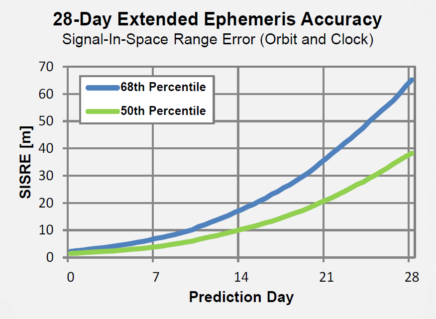
With extended ephemeris, a satellite’s ephemeris is always usable regardless of data errors and gaps in the actual transmitted satellite data. In other words, satellites that the receiver can still see, but which have low signal strength, may nevertheless be used to go directly into acquiring the lower power satellite signal, generating the Doppler and code phase, and ultimately proceed to the position calculation. So Baseband has developed and is marketing 28-Day Extended Ephemeris service to address these problems.
For a regular embedded receiver working with 28-day Ephemeris, Baseband claims to reduce TTFF from 30-60 seconds down to around 2 seconds. Even in intermittent satellite signal conditions, acquisition or reacquisition isn’t necessary, so signals can still be used for tracking. Ephemeris transmissions to the device are extremely compressed, and can be as small as 20 KB per week, while accuracy is maintained. Baseband claims its patent-pending techniques provide unparalleled orbit and clock accuracy, which allows users to obtain highly accurate predictions. Client software for the user device is platform independent and has been designed from the ground up to operate extremely efficiently with low-power processors.
So there we have it — a new approach to achieve very fast initial position for portable digital devices including cell phones and a method to overcome lengthy initial position determination under poor signal conditions, with the added bonus that power consumption is also greatly reduced.
For high-volume commercial applications where GNSS performance is important, but conditions may be far from favorable, Baseband may well have something which could really improve how OEMs take advantage of more reliable position determination with longer time between battery recharges.
Tony Murfin
GNSS Aerospace