Tag: Earth Observation

  • EUSPA launches new EU Space Market Report, strong GNSS growth predicted

    EUSPA launches new EU Space Market Report, strong GNSS growth predicted

    A new edition of the European Union’s Space Market Report is now available. According to the EU’s Agency for the Space Programme (EUSPA), it offers a comprehensive overview of the latest developments, emerging trends, and market dynamics shaping the global space downstream sector.

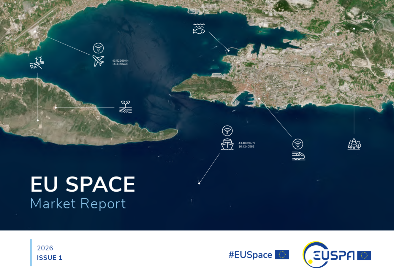
    The report provides a comprehensive overview of the latest developments and trends in GNSS, as well as Earth observation (EO), secure satellite communications (Secure SATCOM), and space situational awareness (SSA) in one place for the first time. It also highlights the evolution of user technologies and the growing synergies between these domains.

    “As Europe’s space capabilities become increasingly interconnected, it is essential to move beyond viewing them as standalone technologies,” explained Rodrigo da Costa, EUSPA executive director. The publication “reflects the growing synergies between these domains and their strategic importance for Europe’s economy, resilience and autonomy.

    “By providing a comprehensive view of the evolving space ecosystem, EUSPA aims to foster innovation, strengthen collaboration across the sector, and support the development of a more competitive, agile and responsive European Union space economy,” da Costa said.

    GNSS and EO

    The report highlights sustained growth for both the GNSS and EO markets across all 16 analyzed market segments. The current €3.5 billion of EO market revenue in 2024 is expected to grow to €7.9 billion by 2034 with agriculture representing the largest share.

    GNSS revenues are forecast to rise from €300 billion in 2024 to €580 billion by 2034. GNSS service revenues outpace device revenues and confirm the increasing role of digital ecosystems and value-added services in the space economy, the report said.

    Revenues are mainly driven by consumer solutions, and road and automotive, with a global installed base of GNSS-enabled devices that will reach almost 10 billion by 2034.

    Secure SATCOM

    The Secure SATCOM market addresses the needs of surveillance, key infrastructure and crisis management. In this sector, data service revenues generated by EU users are forecast to grow significantly, increasing from more than €200 million in 2025 to nearly €1.2 billion by 2040.

    While maritime surveillance drives demand in 2025, by 2040 the market is expected to be led by law enforcement interventions, civil protection and force deployment, fueled by growing security and resilience needs, demand for reliable connectivity, and stronger crisis-response capabilities.

    Existing and future synergies

    The report also examines how major macroeconomic trends —including climate change, geopolitical instability and rapid urbanization — are reshaping space markets and strengthening synergies between EO, GNSS and Secure SATCOM technologies. Together, these capabilities are becoming increasingly important for security, resilience, disaster response, environmental monitoring, and smarter urban and infrastructure management.

    Download the EU Space Market Report.

  • Seekr launches beta for dual-use geospatial reasoning engine

    Seekr launches beta for dual-use geospatial reasoning engine

    Seekr has launched the beta testing of SeekrGeo, a geospatial reasoning engine. SeekrGeo provides advanced geospatial intelligence to enterprises and government agencies, accelerating actionable insights with launch partner Wyvern to deliver hyperspectral imaging capabilities.

    Wyvern, a hyperspectral imaging and Earth observation data company, provides a comprehensive licensing agreement as Seekr’s inaugural data partner. The alliance accelerates enterprise access to scalable, high-resolution hyperspectral imaging powered by AI-driven analysis that can reason, detect changes over time, and identify meaningful patterns in activity for both national security and commercial use cases including wildland fire management, supply chain intelligence, and countless other actionable VLM-based insights.  

    As geospatial intelligence (GEOINT) grows to a projected $63B market by 2030, the gap between data availability and usable intelligence continues to widen. Bringing together Wyvern data and Seekr technology fills the gap in the market, giving enterprises and government customers a way to both access multimodal hyperspectral data, and synthesize intelligence and actionable insights with SeekrGeo’s Remote Sensing Foundation Model built for multimodal understanding, contextual reasoning, and autonomous analysis.

    “Our first SeekrGeo customers required the use of Hyperspectral imaging to solve the most complex recognition problems. We recognized Wyvern for their best-in-class Hyperspectral LEO constellation and are very pleased to be working with them,” said Rob Clark, Seekr president.

    “The biggest barrier to hyperspectral adoption has never been the data, it’s been the difficulty of turning that data into applications,” said Chris Robson, Co-Founder and CEO of Wyvern. “Seekr’s geospatial foundation model changes the equation entirely. Instead of needing months of specialized development work, our customers will be able to build new applications in a fraction of the time at scale.”

  • Xplore and UP42 partner to bring satellite data to geospatial customers

    Xplore and UP42 partner to bring satellite data to geospatial customers

    Xplore's multi-sensor XCRAFT satellite. (Image: Xplore)
    Xplore’s multi-sensor XCRAFT satellite. (Image: Xplore)

    The agreement will enable direct access to Xplore’s satellite tasking and archive of high-resolution data

    Xplore Inc., a commercial space company providing space as a service, has signed a partnership agreement with UP42, a geospatial developer platform and marketplace. The agreement will enable direct access to Xplore’s satellite tasking and archive of high-resolution data.

    Xplore’s XCRAFT satellite platform is engineered to collect data with multiple instruments including still and video imagery, hyperspectral, ultraviolet and infrared spectroscopy. Xplore’s satellite is capable of achieving user-defined video flyovers.

    Data generated with Xplore’s diverse sensors will address a wide variety of use cases across the Earth observation industry including agriculture, forestry, oil and gas, maritime, change detection and intelligence, and creative media content. Additionally, customers can obtain more informative, rich layers of data from Xplore’s data-fusion products.

    The combined power of bringing Xplore’s high-value imagery products to market via the UP42 platform will accelerate the commercial use of private remote-sensing data, according to Xplore.

  • EUSPA’s 2nd Horizon Call seeks projects for GNSS, Earth observation

    EUSPA’s 2nd Horizon Call seeks projects for GNSS, Earth observation

    EUSPA logoEurope’s 2nd Horizon Europe call has been launched for European GNSS, Galileo and Earth observation projects, offering total funding of €48.1 million.

    The Horizon program is managed by the European Union Agency for the Space Programme (EUSPA). It funds research and innovation by small and mid-size enterprises, academia, public actors and others that will stimulate development of space applications and solutions using EUSPA data and services.

    The 2nd call aims to to strengthen downstream capabilities and modernize the EU public sector by offering cutting-edge solutions based on Galileo, Copernicus, EGNOS and GOVSATCOM.

    Funding is being offered for projects that make use of Galileo and EGNOS in smart mobility applications. Other projects fuse Copernicus data with artificial intelligence to boost the European economy and help modernize the public sector. For the first time, the call seeks to deliver satellite communication use cases based on the forthcoming GOVSATCOM system.

    Below is a breakdown of the funds’ distribution per thematic area.

    Visit the EU’s funding & tender opportunities portal for detailed information about the EUSPA call and the topics available. The deadline for applications is March 2, 2023.

  • EUSPA publishes EO and GNSS market report

    EUSPA publishes EO and GNSS market report

    The European Union Agency for the Space Program (EUSPA) has published “EUSPA EO and GNSS Market Report,” a guide to reaping the benefits of space technology.

    The 216-page report is designed to help anyone who seeks to make EU space technologies part of their business plan, develop new space downstream applications, and see a tangible return on investment.

    More than ever society relies on innovative solutions to deal with the big data paradigm, respond to and mitigate climate change, natural and man-made disasters, curb the spread of diseases and strengthen a global supply chain that underpins our daily lives.

    Download report here.
    Download report here.

    Earth observation and GNSS data is becoming increasingly important to innovative solutions for climate change, disaster and disease response, and global supply chain management. Dozens of applications are emerging or already in use by citizens, businesses, governments, industry, international organizations, NGOs, and researchers around the world.

    The report provides analytical information on the dynamic GNSS and EO markets. In 2021, GNSS and EO downstream markets generated more than €200 billion in revenues and are set to reach almost half a trillion over the next decade.

    The report also offers in-depth analyses of global trends and developments through illustrated examples and use cases. Using advanced econometric models, it also offers market evolution forecasts of GNSS shipments or EO revenues spanning to 2031.

    Green Investments

    EUSPA is committed to helping the EU deliver on the Green Deal agenda and the fight against climate change, starting with embedding space data and services into professional activities. According to EUSPA, accelerating Europe’s engagement in space is pivotal to enabling the green transition and reaching climate neutrality by 2050.

    The report emphasises how users of EO and GNSS contribute to compliance, monitoring and efficiency of green investments, benefiting companies, regulators and society as a whole. It focuses on concrete examples across the 17 identified market segments.

    For instance, Galileo can provide smart power grids with robust timing and synchronization down to a nanosecond, improving their performance. In another example, EU space plays a role in green energy, as Copernicus helps optimize performance of tidal power generators by providing tidal current prediction systems.

    Key Report Findings

    • Global GNSS- and EO-enabled revenues crossed €200 billion in 2021 and are set to reach almost €500 billion over the next decade.
    • The global installed base of GNSS devices in use will reach more than 10 billion units in 2031.
    • The market for Earth observation applications is boosted by a large pool of value-added services (85% of global revenue).
    • The European EO industry is dominated by SMEs and start-ups; from a supply perspective, European companies hold more than 41% of the global EO market.
    • The downstream space application market accompanied by the EU Space Programme will continue growing and thereby effectively contributing to European policies (such as the European Green Deal and EU’s Digital Decade), as well as global policies (such as the United Nation’s Sustainable Development Goals and the Paris Agreement) in combination with other technologies.

    Download the report.

  • ESA and NASA launch open-source biomass platform

    ESA and NASA launch open-source biomass platform

    The European Space Agency (ESA) and National Aeronautics and Space Administration (NASA) have publicly released a globally harmonized assessment of aboveground biomass — information vital for managing global climate change.

    The Multi-mission Algorithm and Analysis Platform (MAAP) provides seamless access to aboveground biomass information from both NASA and ESA Earth observation data. The open-science tool is now fully operational and accessible online.

    The beta of the dashboard is now available.

    Circumboreal forest biomass density mapped at high spatial resolution (30 m) with NASA’s ICESat-2, the joint NASA/USGS Landsat-8, and ESA Copernicus Digital Elevation Model (DEM) data. This provisional product is representative of 2020 conditions and is an open-source science product created on the NASA-ESA MAAP platform that will be validated in the coming months. (Image: NASA/ESA)
    Circumboreal forest biomass density mapped at high spatial resolution (30 m) with NASA’s ICESat-2, the joint NASA/USGS Landsat-8 and ESA Copernicus Digital Elevation Model (DEM) data. This provisional product is representative of 2020 conditions and is an open-source science product created on the NASA-ESA MAAP platform that will be validated in the coming months. (Image: NASA/ESA)

    MAAP is the culmination of a two-year NASA and ESA effort and reflects the cooperation between the two agencies under the NASA and ESA Joint Program and Planning Group (JPPG) Joint Working Group (WG) on Ground Segment and Operations.

    The MAAP platform enables international scientists and researchers to collaboratively develop algorithms and code as well as analyze and visualize large datasets acquired from sources including satellite instruments, the International Space Station, and airborne and ground campaigns. The large data and high-performance computing required for MAAP, along with a shared code repository and catalog, are stored and managed in the cloud. MAAP capabilities are supported and shared between NASA and ESA.

    “Biomass is the first ESA mission with open-source algorithms,” said Clement Albinet, ESA’s Biomass data quality manager. “Thanks to that, the community will be able to access all the source code, the test data and all the documentation, and will be able to contribute in a collaborative way to the improvement of the biomass products. MAAP will allow scientists to easily work with large datasets at a global scale and to finally focus on science.”

    The initial application of MAAP focuses on aboveground biomass to help determine the size and carbon content of Earth’s forests. These data are vital for informing our understanding and forecasting of climate change, including regular updates to the Intergovernmental Panel on Climate Change (IPCC).

    While biomass is the first application of MAAP, it can be adapted for collaborative exploration across the breadth of science data and scientific disciplines available through NASA, ESA and similar research agencies.

    MAAP includes data from missions such as NASA’s Global Ecosystem Dynamics Investigation (GEDI) and the joint NASA/ESA AfriSAR campaign, and will eventually support data from upcoming NASA and ESA missions such as the joint NASA/Indian Space Research Organization SAR (NISAR) and ESA’s Biomass mission.

    Several projects are producing continental to global biomass maps for 2020, including ESA’s Climate Change Initiative Biomass and JPSs global map, both at 100 m, as well as NASA’s GEDI 1-km map. GEDI, the Global Ecosystem Dynamics Investigation, is a spaceborne laser instrument that measures the structure of Earth’s forests in high resolution and three dimensions.

    The world’s Earth observation biomass community is undertaking an exercise on MAAP aimed at resolving discrepancies between those products and producing harmonized estimates of biomass and uncertainty at a policy-relevant, jurisdictional-level scale.

  • Spire awarded contract for Earth observation data

    New task order continues delivery of comprehensive space data and opens availability to all U.S. government-funded researchers and federal agencies

    Image: Just_Super/iStock/Getty Images Plus/Getty Images
    Image: Just_Super/iStock/Getty Images Plus/Getty Images

    Spire Global,  a global provider of space-based data and analytics, has announced the continuation of its participation in NASA’s Commercial Smallsat Data Acquisition (CSDA) Program with a $6 million contract extension.

    The contract continuation, Task Order 6 (TO6), is a subscription data solution that includes radio occultation (RO) data, grazing angle GNSS-RO, total electron content (TEC) data, precise orbit determination (POD) data, soil moisture and ocean surface wind speed GNSS-Reflectometry data and magnetometer data.

    This data will be available to all federal agencies, NASA-funded researchers and, more broadly, to all U.S. government-funded researchers for scientific purposes.

    Under CSDA Program TO6, Spire will deliver a comprehensive catalog of data, associated metadata and ancillary information from its Earth-orbiting small-satellite constellation. The company operates its constellation in low Earth and collects upwards of 10,000 radio occultations per day with consistent global coverage.

    For TO6, Spire will provide rolling access to 12 months of radio occultation data with a 30-day latency. This data will be archived and maintained by NASA under the CSDA Program’s SmallSat Data Explorer (SDX) database.

    “Programs like CSDA highlight the incredible potential of private-public partnerships in the federal government to drastically accelerate our ability to confront some of the greatest challenges of our time, such as climate change,” said Peter Platzer, CEO of Spire. “With the end-user license agreements, our data is now available to all federal agencies and the larger NASA scientific community to help support Earth observation research across fields.”

    The program includes end-user license agreements (EULAs) to enable broad levels of dissemination and shareability. All federal agencies and U.S. government-funded researchers will have access to Spire’s data for scientific purposes under TO6 and will be able to request access to the data via the CSDA Program’s Commercial Datasets webpage.

    “At NASA, the CSDA Program has continued to blossom as a valuable resource to our team for our Earth observation research and analysis. We are committed to growing the program as well as continuing the work we have started,” said Will McCarty, project scientist at the CSDA Program and  research meteorologist at NASA Global Modeling and Assimilation Office. “Spire has been a valued partner through CSDA’s development since its inception, and with this additional task order, we are excited about the new insights and results that will come not only from within NASA, but also through broader collaboration through the domestic government scientific community.”

    NASA has used Spire data in its research on water and sea-ice levels in the polar regions, the height of the planetary boundary layer (PBL), and the day-to-day variability of thermospheric density at flight level.

    NASA also noted that Spire data has shown positive benefit to its GEOS Atmospheric Data Assimilation System, which uses space-based data to analyze the Earth’s atmosphere and assimilate the data into its Earth observation systems.

    As one of the original vendors for the CSDA Program, Spire provides NASA yearly updates to the scope of work under this agreement to ensure alignment of data to the agency’s needs.

  • HEAD Aerospace satellite imagery now on UP42 marketplace

    Vatican City satellite image. (Photo: UP42)
    Vatican City satellite image. (Photo: UP42)

    Deal makes data from 40 Chinese satellites available through UP42 now, another 40 by late 2021

    UP42 has signed an agreement with HEAD Aerospace of Beijing to make image data from more than 40 Chinese Earth Observation satellites available on the UP42 marketplace.

    The broad selection of imaging capabilities from the constellations dramatically expands the range of applications in multiple sectors, with the most significant benefits expected in infrastructure, transportation, utilities, agriculture and government.

    The UP42 marketplace contains more than 50 geospatial data sets, including satellite imagery from six international organizations. The newly added satellites’ diverse and often unique imaging capabilities include wide-swath imaging at very high resolution, nighttime acquisitions, frequent intraday revisits, tri-stereo collection and hyperspectral imaging.

    “This partnership is an important milestone for us as a company but, more importantly, for our customers. By diversifying our data sets, we are unlocking a broader spectrum of use cases for our users in multiple sectors. This is the true meaning of ‘democratizing access to Earth insights’,” said UP42 CEO Sean Wiid.

    HEAD Aerospace is an international distributor of satellite imagery collected by commercial Earth Observation missions. The UP42-HEAD agreement includes imagery from multiple constellations, including SuperView, Earthscanner, Gaofen-7, DailyVision, NightVision, Hyperscan, and Tri-Stereo ZY3. These seven constellations will total more than 80 satellites by the end of 2021.

    “Sharing a similar approach facilitating users’ easy access to an agnostic data source by a centralized portal with a wide choice of satellite attributes, we are glad to have partnered with UP42. This partnership represents another new milestone for us in expanding our global network.” said Kammy Brun, managing director of HEAD Aerospace.

    While each satellite constellation was designed with one or more imaging specialties, a remarkable variety of operational capabilities are shared across the constellations to support numerous applications and industries. Examples include:

    • Large-Area Very High-Resolution Mapping – Planning and monitoring critical infrastructure, including utility transmission grids and transportation networks, can be performed for entire states, countries and regions. Up to 40,000 square kilometers can be covered with wide-swath (136 km) imagery captured at a half-meter spatial resolution on a single pass.
    • Intraday and Early Morning Monitoring – The EarlyEye tasking product leverages multiple HEAD Aerospace constellations to deliver early-morning frequent images, an hour earlier than usual commercial offer at 10:30 a.m. Designed for frequent monitoring of critical assets and rapidly changing situations related to energy security, defense/intelligence and infrastructure management, a high-resolution revisit schedule of four times per day is possible, with 15-minute revisit between 09:00 and 13:30 anywhere on Earth to be possible by the end of 2021.
    • High Vertical Accuracy Mapping – Multiple satellites perform stereo imaging at high resolution for high-quality land use and cadastral mapping. One constellation captures single-pass tri-stereo imagery validated with onboard laser altimetry data, generating digital elevation models (DEMs), digital terrain models (DTMs), and other large-scale 3D mapping products with vertical accuracy of 5 meters. Additionally, the SuperView constellation captures daily stereo imagery with vertical accuracy of better than 2 m.
    • Hyperspectral Imaging – Imaging in 25 spectral bands spanning the visible, near-infrared, and mid-infrared portions of the spectrum is designed for regional natural resource management: detecting crop stress and planning pesticide/fertilizer applications, species mapping of forests and vegetative land cover, and protecting environmentally sensitive areas. These data sets can also be used in agriculture monitoring, mineral exploration and water-quality monitoring.
    • Nighttime Imaging – Monitoring and surveillance activities by government entities, energy utilities and security organizations can be carried out around the clock with true-color, high-resolution at 1 m optical and video imaging during daylight and dark of night. Nighttime collection is suitable for surveillance such as illegal camping, border surveillance, change detection (especially in rapidly evolving events), powerline incidents and designing streetlight placement in urban settings. Day and night video can detect vehicle and ship movement.

    UP42 users have a growing selection of satellite imagery to choose from on the geospatial marketplace. UP42 technical experts are available to assist customers in selecting the best data set to meet the needs of specific end-use applications in all industries and sectors. These experts can also help in tasking a satellite for new image acquisition or querying the archive to obtain existing imagery.

  • Spire’s Earth observation contract includes GNSS-RO, GNSS-R data

    Spire’s Earth observation contract includes GNSS-RO, GNSS-R data

    New task order continues delivery of comprehensive space data and opens availability to all U.S. government-funded researchers and federal agencies

    Image: Just_Super/iStock/Getty Images Plus/Getty Images
    Image: Just_Super/iStock/Getty Images Plus/Getty Images

    Spire Global,  a global provider of space-based data and analytics, has announced the continuation of its participation in NASA’s Commercial Smallsat Data Acquisition (CSDA) Program with a $6 million contract extension.

    The contract continuation, Task Order 6 (TO6), is a subscription data solution that includes radio occultation (RO) data, grazing angle GNSS-RO, total electron content (TEC) data, precise orbit determination (POD) data, soil moisture and ocean surface wind speed GNSS reflectometry (GNSS-R) data and magnetometer data.

    This data will be available to all federal agencies, NASA-funded researchers and, more broadly, to all U.S. government-funded researchers for scientific purposes.

    Under CSDA Program TO6, Spire will deliver a comprehensive catalog of data, associated metadata and ancillary information from its Earth-orbiting small-satellite constellation. The company operates its constellation in low Earth orbit and collects upwards of 10,000 radio occultations per day with consistent global coverage.

    For TO6, Spire will provide rolling access to 12 months of radio occultation data with a 30-day latency. This data will be archived and maintained by NASA under the CSDA Program’s SmallSat Data Explorer (SDX) database.

    “Programs like CSDA highlight the incredible potential of private-public partnerships in the federal government to drastically accelerate our ability to confront some of the greatest challenges of our time, such as climate change,” said Peter Platzer, CEO of Spire. “With the end-user license agreements, our data is now available to all federal agencies and the larger NASA scientific community to help support Earth observation research across fields.”

    The program includes end-user license agreements (EULAs) to enable broad levels of dissemination and shareability. All federal agencies and U.S. government-funded researchers will have access to Spire’s data for scientific purposes under TO6 and will be able to request access to the data via the CSDA Program’s Commercial Datasets webpage.

    “At NASA, the CSDA Program has continued to blossom as a valuable resource to our team for our Earth observation research and analysis. We are committed to growing the program as well as continuing the work we have started,” said Will McCarty, project scientist at the CSDA Program and  research meteorologist at NASA Global Modeling and Assimilation Office. “Spire has been a valued partner through CSDA’s development since its inception, and with this additional task order, we are excited about the new insights and results that will come not only from within NASA, but also through broader collaboration through the domestic government scientific community.”

    NASA has used Spire data in its research on water and sea-ice levels in the polar regions, the height of the planetary boundary layer (PBL), and the day-to-day variability of thermospheric density at flight level.

    NASA also noted that Spire data has shown positive benefit to its GEOS Atmospheric Data Assimilation System, which uses space-based data to analyze the Earth’s atmosphere and assimilate the data into its Earth observation systems.

    As one of the original vendors for the CSDA Program, Spire provides NASA yearly updates to the scope of work under this agreement to ensure alignment of data to the agency’s needs.

  • SSTL’s HydroGNSS satellite gets green light for climate mission

    SSTL’s HydroGNSS satellite gets green light for climate mission

    The small satellite will measure climate variables using GNSS Reflectometry

    The European Space Agency (ESA) has selected HydroGNSS from Surrey Satellite Technology Ltd. (SSTL) for its second Scout Earth Observation small satellite mission. HydroGNSS is a 40-kg satellite that will be built and operated by SSTL.

    ESA selected the first ESA Scout satellite, ESP-MACCS, in December 2020. ESP-MACCS focuses on understanding and quantifying processes in the upper atmosphere over the tropics — processes that play an important role in the overall evolution of the atmosphere.

    HydroGNSS will take measurements of key hydrological climate variables, including soil moisture, freeze thaw state over permafrost, inundation and wetlands, and aboveground biomass, using GNSS reflectometry. It will complement missions such as ESA’s SMOS and Biomass, Copernicus Sentinel-1 and NASA’s SMAP.

    Both small satellites are expected to be the first in a series of ESA Scout missions demonstrating how small satellites on a budget of less than €30 million and a three-year schedule can play an important role in Earth observation, and be scaled up for future missions.

    Knowledge of these variables helps scientists understand climate change and contributes towards weather modelling, ecology mapping, agricultural planning and flood preparedness.

    “SSTL pioneered GNSS reflectometry, providing the payloads on TechDemoSat-1 and the NASA CYGNSS mission for measuring ocean wind speeds, and I am delighted that we will now launch the first satellite mission specifically addressing hydrological measurements using this innovative technique,” said Phil Brownnett, SSTL managing director.

    Previously, addressing hydrological variables such as these has required sizable and higher cost satellites with large aperture antennas, but GNSS reflectometry uses existing signals from GNSS as radar signal sources. These signals are reflected off the land, ice and ocean and can be collected by a low power receiver on a small satellite in low Earth orbit, and used to yield important geophysical measurements.

    Image: SSTL
    Image: SSTL

    SSTL is working closely with partners to tackle the scientific and technological challenges involved. Partners include Sapienza, Tor Vergata and IFAC-CNR in Italy; FMI in Finland; IEC/IEEC in Spain; and NOC and the University of Nottingham in the United Kingdom (UK),

    “The decision to implement HydroGNSS after ESP-MACCS demonstrates that the Earth observation community is very interested in the concept of Scout missions. We are confident that this interest will further flourish when we see the first data in 2024,” said Toni Tolker-Nielsen, ESA’s acting director of Earth Observation Programmes.

    As well as the already established GNSS-Reflectometry measurements, new techniques will be explored on HydroGNSS, including use of Galileo signals, dual polarization, dual frequency and recovery of coherently reflected components. These new measurements are expected to improve the separation, resolution and quality of the climate variables under observation.

    The HydroGNSS mission exemplifies the UK’s innovation in climate change research, according to SSTL. The 26th United Nations Climate Change Conference takes place in the UK Nov. 1-12.

    Image: SSTL
    Image: SSTL

    “The UK is leading the way in using space to tackle climate change, with Earth Observation satellites providing some of the most important data to monitor our environment as we build back greener,” said Science Minister Amanda Solloway. “Using a UK satellite just the size of a microwave oven, this pioneering mission will build on the UK’s expertise in space research by measuring changes in the Earth’s water, providing crucial information to address climate change, improve farming and support wider disaster management.”

    HydroGNSS paves the way for an affordable future constellation that can offer measurements with a temporal-spatial resolution not accessible to traditional remote-sensing satellites, thus offering new capacity to monitor very dynamic phenomena and helping to fill the gaps in our monitoring of the Earth’s vital signs for the future.


    Featured image: SSTL

  • Stratospheric exploration craft aloft for more than a month

    World View, the stratospheric exploration company, has reached an important milestone representing a key step toward persistent and navigational stratospheric flight.

    After achieving the goal of more than 30 days aloft with full navigational control, the Stratollite completed its 32-day mission over the weekend, showcasing its enhanced long-duration flight capability.

    Before this mission, the longest Stratollite flight was 16 days, achieved in June 2019. This mission moves World View closer to scaled commercial operations, making the unique data and information sets it can provide available to commercial and government Earth-observation and remote-sensing customers around the world.

    Notable accomplishments from the mission:

    • Executed four continuous days of station-keeping (mission objective) with an average distance of 20 km from the first predetermined target location, followed by an intentional navigation to the second station-keeping target location 1,230 km away.
    • Achieved 2.5 days of continuous station keeping at the second station-keeping target with an average of 40 km from the second target location.
    • Averaged an altitude of 19.5 km during both station-keeping exercises.
    • Traveled more than 11,200 km during the mission, covering Arizona, Utah, Nevada, Colorado, New Mexico, Texas, Oklahoma, Nebraska, Iowa and Kansas.
    • Demonstrated complete navigational control during the mission from World View’s remote Mission Control in Tucson, Arizona.
    • The total mission duration was 32 days, 5 hours and 14 minutes
    • Executed more than 1,000 trajectory-control maneuvers over the entire mission.

    “This is another encouraging milestone for the team and our customers that confirms we are on the right track,” said Ryan Hartman, World View president and CEO. “It sets the stage for a challenging set of missions ahead of us as we continue to push the envelope and demonstrate the ability of the Stratollite to meet customer requirements.”

    World View’s flight operations team landed the Stratollite at a predetermined landing zone in Iowa on Saturday, Sept. 28, to conclude the mission. The system landed on command, was recovered, and will be refurbished for reuse on future missions.

    World View will continue to increase the cadence of its Stratollite flight operations. The company plans to launch multiple missions focused on demonstrating optical imaging and synthetic aperture radar sensing systems with further enhancement of station-keeping and navigational performance.


    About the Stratollite. World View’s Stratollite is a long-endurance stratospheric flight vehicle capable of station-keeping over areas of interest for remote sensing and communications.

    The craft can travel 95,000 feet above the Earth. World View is already routinely flying payloads to the edge of space for a wide variety of government, commercial, and education customers.

    World View’s proprietary altitude-control technology allows it to harness stratospheric winds to steer the Stratollite to and from desired locations and loiter above them for long durations.

    Stratollites can carry a wide variety of commercial payloads (sensors, telescopes, communications arrays, etc.), launch rapidly on demand, and safely return payloads back to Earth after mission completion.

    Among its wide variety of uses, the Stratollite will help researchers greatly advance knowledge of planet Earth, improve our ability to identify and track severe weather, and assist first responders during natural disasters.

  • Esri location intelligence to integrate with SAP HANA Spatial Services

    Esri location intelligence to integrate with SAP HANA Spatial Services

    Esri’s ArcGIS software is being integrated into SAP’s latest cloud-based offering, SAP HANA spatial services, to help customers create location-aware business applications faster, according to spatial analytics company Esri.

    Based on SAP Cloud Platform, the new offering enables businesses to process location data such as complex imagery, as well as visualize and analyze their authoritative data in a geospatial context.

    The new geo-enabled solution from SAP will allow users to deliver their data through consumer-friendly maps and integrate the results into custom business applications, the company said. Customers using SAP software will also be able to create custom models that efficiently process streams of Earth observation data such as water content or soil temperatures and see this data on high-quality basemaps provided by Esri’s ArcGIS Online.

    Most business objectives — such as increasing revenue growth, reducing operational costs or improving customer service — rely on some sort of location data. Unfortunately, many executives lack an accurate and up-to-date understanding of where performance is going well and where improvements need to be made.

    This new offering from SAP, which leverages Esri technology, lets organizations extract high-value business information from satellite, drone and open data sources and then easily discover and share location-based insights.

    “As an SAP global technology partner, we are very excited about this offering, as it demonstrates that SAP and Esri products work better together,” said Chris Cappelli, director of strategic business development at Esri. “Users of SAP HANA spatial services can now achieve native integration of spatial and enterprise data across all business processes. By putting the power of location information into the hands of key stakeholders, businesses can make better-informed decisions with their own data.”

    The integration follows SAP’s announcement on Jan. 24 that Esri supports SAP HANA as an enterprise geodatabase with the release of ArcGIS 10.6 and ArcGIS Pro 2.1.

    Esri and SAP customers can benefit from enhanced performance and scalability as well as full integration of both enterprise and spatial data. Both Esri and SAP continue to deliver new innovations that help lower total cost of ownership and administration costs brought on by the tight integration of IT and geospatial landscapes, Esri said.

    Esri will showcase its new integration of location intelligence technology with SAP HANA spatial services at SAPPHIRE NOW and ASUG Annual Conference in booth #1239.