Tag: Ellen Hall

  • Editorial Advisory Board: GNSS constellations and receivers

    Editorial Advisory Board: GNSS constellations and receivers

    Which GNSS constellations do most receivers currently use? How is that mix changing?

    Ellen Hall

    “Most modern commercial receivers today are moving to receive all GNSS signals: GPS, GLONASS, Galileo, BeiDou, QZSS, IRNSS and so forth. Also important, in which bands does the receiver operate, and how many channels does it have for optimum accuracy and quicker cold start? Application and location for local stability are also factors. If the operation is in India, IRNSS would be important, in Japan QZSS, and so forth.”

    — Ellen Hall
    Imminent Federal


    Jean-Marie Sleewaegen

    “The current standard in commercial receivers is to exploit the interoperability between the various GNSS signals and to make use of all satellites in view, regardless of their constellation. While the L1/E1/B1 frequency band continues to be the primary frequency in almost all GNSS systems, the legacy L2 band is gradually losing its importance as most satellites are already broadcasting more advanced signals in the L5/E5 band.”

    — Jean-Marie Sleewaegen
    Septentrio

    Bernard Gruber

    “The newest phones offered by Google and the largest manufacturers in the world — Apple, Samsung, OPPO and Vivo — support the following positioning systems: Google — Pixel 7 and Pixel 7 Pro: GPS, GLONASS, Galileo, BeiDou, QZSS, and other // Apple — iPhone 14: GPS, GLONASS, Galileo, QZSS, and BeiDou // Samsung — S23 and most other recent versions: GPS, Galileo, GLONASS, and BeiDou // Xiaomi — Xiaomi 13 Pro: GPS (L1+L5), Galileo (E1+E5a), GLONASS (G1), BeiDou, NavIC (L5A-GPS supplementary positioning) // OPPO — F21: GPS, A-GPS, BeiDou, GLONASS, Galileo, and QZSS // Vivo — Vivo X90: GPS, A-GPS, GLONASS, Galileo, BeiDou, QZSS, NavIC, Cell ID, Wi-Fi. // For farming, John Deere’s SF-RTK uses GPS, GLONASS, BeiDou and Galileo.”

    — Bernard Gruber
    Northrop Grumman


    Bradford W. Parkinson “All modern generation cell phones use virtually all GNSS signals. This includes GPS, Galileo, GLONASS and BeiDou. In addition, they receive the correction signals, such as WAAS and EGNOS. This capability is embedded in the chips that are currently used. We are told that they have the capability to track on the order of 50 satellites at once. We expect that dual frequency is close to realization and the use of the new civil L5 signal will make cell phones even more capable.”

    — Bradford W. Parkinson
    Stanford Center for Position, Navigation and Time 

  • Editorial Advisory Board: The “geodesy crisis” and GNSS satellites

    Editorial Advisory Board: The “geodesy crisis” and GNSS satellites

    What are your thoughts on the “geodesy crisis” and what do you propose to address it?

    Bernard Gruber
    Bernard Gruber

    “Evidence seems to be very clear that we, as a country, need geodesists and that there has been a decline in investments, training, and research in geodesy. While our decline relative to China may be shocking, it should not be surprising. U.S. industry and government relentlessly pursues STEM graduates, or those with relevant experience, but that does not meet current needs. Besides maybe surveying, it is unclear to the public what the geodesy profession is all about, why it is needed, and quite frankly, why it is an exciting career choice.”

    — Bernard Gruber
    Northrop Grumman


    Does crowding of low-Earth-orbit (LEO) space — with new satellites and space debris — pose any problems for the launch or operations of GNSS satellites in medium
    Earth orbit (MEO)?

    Ellen Hall
    Ellen Hall

    “This was a focused topic at SATELLITE 2022, where the discussion centered on the 6,000 tons of space debris circulating in LEO. Even the smallest piece of debris can be lethal to a satellite, so the key is to track and maneuver where possible. Add to that about 5,000 active satellites and plans to launch tens of thousands of additional ones into LEO over the next few years, and you have a serious problem to overcome. While there are treaties and plans for tracking and maneuvering these satellites, the debris is the real challenge.”

    — Ellen Hall 
    Spirent Federal Systems


  • Editorial Advisory Board Q&A: Improving the GPS program

    What works well and what needs improvement in the GPS program regarding technology, policy, or management?


    Jules McNeff
    Jules McNeff

    “GPS technology and operational performance continue to set the standard for GNSS, but necessary modernization is late to need, and becoming later by the day. This reflects what I see as loss of focus on ‘Job 1’ (delivering effective GPS service to the Joint Force) and a diminution in the sense of ‘GPS uniqueness and exceptionalism’ in its management as it was fragmented within the old SMC and is no longer the ‘shiny new object’ within the evolving Space Force. Even so, its value to its global user base, and particularly to U.S. and allied militaries, is stronger than ever and it remains the cornerstone among diverse complements within the Department of Defense PNT Enterprise. It is incumbent on the DOD to ensure the GPS services our warfighters will depend on can sustain that vital role.”

    — Jules McNeff
    Overlook Systems Technologies


    Ellen Hall
    Ellen Hall

    What works well? There is good focus on the areas that need development: M-code, CRPA, resiliency. What needs improvement? More thorough and timely sharing of information by the government with industry. — Ellen Hall, Spirent Federal Systems


    Mitch Narins
    Mitch Narins

    The ‘GPS program’ has set the standard for all other GNSS efforts, but there are always lessons to be learned. I have full confidence that USSF leadership is well equipped to deal with both the technology and management aspects of the program. As for policy, which supports military and civil uses worldwide, there is a clear distinction, based on mission areas and acceptable risk. However, risks to civil users have increased as GPS PNT services permeate all civil critical infrastructure systems. Therefore, system improvements directed at civil user PNT resilience should be given a higher priority and funded through appropriate civil channels. I encourage a policy to enable more resilient PNT services from space — and to consider that by looking both ‘up’ and ‘down’ for PNT services, unfortunate ‘situations’ might be avoided.
    — Mitch Narins,
    Strategic Synergies


    Bernard Gruber
    Bernard Gruber

    “One of the most consistent and enduring enablers of the GPS program is national policy. NSPD-39 re-baselined requirements buttressed by GPS being provided to the world for free, that it must be sustained and have an ever-present focus on performance improvement and robustness. Accordingly, NSPD-7 acknowledges an ever-changing world with a nod to cybersecurity, augmentations and direction to “improve NAVWAR capabilities to deny hostile use of United States Government space-based PNT services, without unduly disrupting civil and commercial access to civil PNT services.”
    — Bernard Gruber,
    Northrop Grumman

  • Editorial Advisory Board Q&A: Location accuracy

    What is the most promising approach to increasing the location accuracy of smartphones?

    Headshot: Ismael Colomina
    Ismael Colomina

    “In addition to the use of increasingly available augmentation services, such as Galileo’s free High-Accuracy Service (HAS), I see two development directions that may help, particularly in the context of positioning in urban areas where smartphones are most used. One is the use of 3D city models — in general, 3D geoinformation — to compensate for multipath, non-line-of-sight and occlusion effects. The other is to use signals that are robust against those effects, which today are only available in geodetic-grade receivers.” — Ismael Colomina, GeoNumerics


    For the navigation of autonomous vehicles, will GNSS become essential, or will it be relegated to a secondary role by robotic navigation methods?

    John Fischer
    John Fischer

    “The PNT solution cannot be from a single source because autonomous navigation requires high integrity. Therefore, it’s not that GNSS will be relegated to secondary status, it’s that no one method will be primary. An intelligent fusion of diverse sensors —including GNSS — will provide the PNT solution along with an integrity metric that safeguards operation. The various sensors must agree. If they don’t, no trust can be put into the solution and autonomous navigation will cease. The definition of a new integrity metric that quantifies this trust level is needed.” — John Fischer, Orolia

    Ellen Hall
    Ellen Hall

    “Because GNSS provides high precision and widely available PNT, it will continue to be a critical component in navigation while working with computer vision, inertial measurement units (IMUs) and lidar through sensor fusion. As a secondary component, GNSS serves a vital role for localization and validation.” — Ellen Hall, Spirent Federal Systems

  • Editorial Advisory Board Q&A: The role of AI and ML

    What role do artificial intelligence (AI) and machine learning (ML) play in analyzing GNSS signals? How might that evolve?


    Ellen Hall
    Ellen Hall

    “ML is gaining adoption across many GNSS application areas due to its ability to extract data and classify signal information often within complex operational environments. By combining ML with AI, systems are now able to characterize receiver correlator outputs and ranging residuals, and then fuse this with identified environmental features — all potentially increasing GNSS accuracy, integrity and availability. As AI and ML mature, we can expect to see new novel methods to optimize PNT sensor-fusion engines. This will include the combination of GNSS signals with other sensor signals such as inertial and vision.”

    — Ellen Hall
    Spirent Federal Systems


    Bernard Gruber
    Bernard Gruber

    “AI will come to the battlefield and I would like to think that AI and ML will play a large part in GNSS solutions and specifically protection from adversaries in the future. As AI can ‘anticipate’ threats (i.e., spoofing, jamming, poor coverage) based upon what it sees and knows one should be able to reduce the cycle time to combat that threat (e.g., find/fix/identify and then target, change frequencies, evade). Seeing this data, ML can adapt to morphing threats as well as ‘fuse’ data from all different domains (air, space, sea and land) to provide solutions.”

    — Bernard Gruber
    Northrop Grumman


    Jules McNeff
    Jules McNeff

    “I would like to turn the question around and ask ‘How does GNSS contribute to enabling AI and ML to function in physical space?’ Many AI and ML experts don’t think about this aspect of the technologies. Of course, timing is essential to AI and ML operation, but both must be spatially oriented as well if they are to interact effectively with things in the ‘real world.’ The more complex the interactions, the higher the need for precise, continuous PNT information. Depending on the applications, the relationships can become synergistic.”

    — Jules McNeff
    Overlook Systems Technologies


    Greg Turetzky Principal Engineer Intel
    Greg Turetzky

    “AI and ML have a great opportunity to fundamentally change the way GNSS signals are used for positioning. In particular, the new modernized signals with wider bandwidths and higher chipping rates create a fundamentally richer data set than classic range/range rate measurements. By analyzing the channel response and using AI/ML techniques, the entire signal environment of LOS and NLOS signals can all be used to make more accurate measurements. In fact, in deep urban canyons with appropriate training, it is even possible to accurately position using only multipath signals such that more multipath makes the position more accurate, not less.”

    — Greg Turetzky
    oneNav

  • Editorial Advisory Board Q&A: What will OCX bring?

    What improvements will the Next Generation Operational Control System (OCX) bring?


    Ellen Hall
    Ellen Hall

    “The OCX system is a part of an enormous modernization effort to enhance the ground control segment of the current GPS. This enhancement alone increases accuracy, but coupled with modernized satellites, the next generation OCX will increase and improve coverage and security of GPS. In terms of coverage, the Next Generation OCX will be able to fly twice as many satellites, including both legacy equipment as well as GPS IIIF satellites. In terms of security, the modernized receivers host anti-jam capabilities and information assurance features.”
    — Ellen Hall
    Spirent Federal Systems


    Bernard Gruber
    Bernard Gruber

    “The latest GPS modernization program was envisioned in the 1990s and started with the U.S. Air Force awarding the Lockheed Martin Team a $1.4 billion contract in 2008 to build the GPS III space system. As part of the modernization effort the initial OCX contract award was given to Raytheon two years later, in 2010, while a series of development contracts have been awarded, primarily Inc 1 and Inc 2, for the Modernized GPS User Equipment (MGUE) programs to L3Harris, Raytheon and then Rockwell Collins. The improvements of OCX aligned to the space and user efforts and substantially increased security protection of this world asset. Specifically, OCX controls all legacy satellites (GPS II) and civil signals (L1 C/A) and military signals (L1P(Y), L2P(Y)). It also controls the new modernized civil signal (L2C) and the aviation safety-of-flight signal (L5). Moreover, it also will have control functions for the MGUE signals (L1M and L2M (M-Code)), and the globally compatible signal (L1C). The next Block IIIF will finally upgrade capabilities to synchronize the entire system to include a worldwide network of dedicated monitoring stations, ground antennas and backup capabilities.”
    — Bernard Gruber
    Northrop Grumman


  • Editorial Advisory Board Q&A: Do we need a new PNT office?

    Given that space is increasingly a congested and contested arena, should the U.S. government establish a new office to manage both space-based and terrestrial-based PNT systems?

    Photo: Orolia
    John Fischer

    “The U.S. government already has the National Executive Committee for Space-Based PNT (see gps.gov), which coordinates policy among all the branches of government. There is also a PNT Advisory Board, which includes some international members to inform the committee, and a National Coordination Office to execute the policies. This is in addition to the new U.S. military’s Space Command under which GPS operates. So, space-based issues are being addressed, but maybe more could be done to coordinate terrestrial-based PNT systems with space-based ones.”
    — John Fischer


    Ellen Hall
    Ellen Hall

    “As new technology advances, government, along with its policies and laws, struggles to keep pace. This was certainly true of the internet and cybercrime. This is also true of terrestrial-based PNT, where new technology emerges in areas not currently covered. Policy gaps and overlapping technologies need to be addressed and coordinated. It certainly seems that this would be one of those areas that could benefit from oversight. Space-based PNT is currently addressed by the National Executive Committee for Space-Based PNT, among others.”
    — Ellen Hall


    Bernard Gruber
    Bernard Gruber

    “The threat to U.S. space-borne assets and the signals they generate is very real. Both commercial and military users of GPS continue to seek independent alternatives to current PNT systems that are diverse and robust. The National Coordination Office supports the National Executive Committee (NEC) for Space-Based PNT. I believe the role of the NEC should be broadened to include terrestrial and alternative PNT as a first step to charter/secure a new or expanded program office.”
    — Bernard Gruber


    Editorial Advisory Board

    Tony Agresta, Nearmap 

    Miguel Amor, Hexagon Positioning Intelligence

    Thibault Bonnevie, SBG Systems

    Alison Brown, NAVSYS Corporation 

    Ismael Colomina, GeoNumerics

    Clem Driscoll, C.J. Driscoll & Associates

    John Fischer, Orolia

    Bernard Gruber, Northrop Grumman

    Ellen Hall, Spirent Federal Systems

    Jules McNeff, Overlook Systems Technologies

    Terry Moore, University of Nottingham

    Mitch Narins, Consultant

    Bradford W. Parkinson, Stanford Center for Position, Navigation and Time

    Stuart Riley, Trimble

    Jean-Marie Sleewaegen, Septentrio

    Michael Swiek, GPS Alliance

    Julian Thomas, Racelogic Ltd.

    Greg Turetzky, Consultant

  • Editorial Advisory Board Q&A: Russian threats to GPS

    Editorial Advisory Board Q&A: Russian threats to GPS

    Photo: Stanislav Ostranitsa/iStock/Getty Images Plus/Getty Images
    Photo: Stanislav Ostranitsa/iStock/Getty Images Plus/Getty Images

    Is Russia’s recent threat to destroy GPS satellites technically realistic? Specifically, how many satellites would it have to destroy to essentially incapacitate GPS-dependent U.S. weapons systems? Would the 1,100-km separation between the orbits of GPS and GLONASS satellites spare the latter from the debris field?

    Ellen Hall
    Ellen Hall

    “It appears technically possible because they destroyed one of their own retired Soviet satellites on Nov. 15 with anti-satellite technology. Russia threatened to destroy up to 32 satellites, which would incapacitate GPS-dependent weapons and create a virtual mine field of debris with little ability to project trajectories of debris fallout. It is imperative that LEO and ground-based sensor alternatives be developed that will make an enemy attack less likely to be incapacitating.”
    — Ellen Hall, Spirent Federal Systems


    Photo: Mitch Narins“Some still appear to believe that the number of satellites and their orbital height offer some level of protection. They refuse to look to the ground for resilient solutions using proven and highly reliable technology — which, coincidently, both Russia and China continue to operate as their resilient PNT solutions. The United States and its allies cannot continue to be dictated to by financial analysts who resist these solutions for fear of exposing the poor decisions they supported in the past and continue to support regarding a solution with a higher power and low frequency.”
    — Mitch Narins, consultant


    Bernard Gruber
    Bernard Gruber

    “Yes, it is technically realistic, but this act of war against a truly worldwide utility would be politically and economically disastrous. GPS IOC was based upon 24 MEO satellites that offered full, but not overlapping, worldwide coverage with spares — there are now 31 satellites that can be utilized through the control segment. The GPS constellation is ~1,100-km deeper than GLONASS. As made evident by the now-destroyed Kosmos 1408 debris cloud simulations, and the actual debris cloud spread by the Chinese 2007 ASAT test that now encompasses most of the LEO regime, the debris field will expand, thus increasing risk to GPS satellite placement and possibly risking physical damage to currently orbited satellites.”
    — Bernie Gruber, Northrop Grumman

  • Spirent Federal launches flex power capability

    Spirent Federal launches flex power capability

    Spirent Federal announced a new positioning, navigation and timing (PNT) test capability commonly referred to as programmable power — or flex power — available at no additional cost to qualified customers under support. The new capability allows the user to apply flex power configurations to existing scenarios.

    Flex power is the reallocation of transmit power among individual signals in GPS satellites, providing a countermeasure against GPS jamming. Spirent simulators fully support programmable power for M-code, Y-code and C/A (coarse acquisition) code.
    “From the time that we ascertained the need for flex power simulation, to the delivery of a completed easy-to-use utility, was a very short time,” said Ellen Hall, president and CEO of Spirent Federal. “It is this kind of responsiveness that we strive for here at Spirent Federal, so we can pass along the benefits to our customers.”

    Flex power is available on the Spirent GSS9000 GPS / GNSS constellation simulator.

  • Editorial Advisory Board Q&A: The fate of the SAASM P(Y) code

    Editorial Advisory Board Q&A: The fate of the SAASM P(Y) code

    Photo: Editorial Advisory Board

    The U.S. military is transitioning to M-code. When the transition is complete, what will become of the SAASM P(Y) code? What should be done with it? Should the U.S. government use it as a public authenticated service?


    Jules McNeff
    Jules McNeff

    “In my opinion (not speaking on behalf of the Defense Department), eventual use of the P(Y) code as a public authenticated service is not feasible based on both time and accessibility. Even with the transition to M-code, the legacy P(Y) code will continue to be used by the U.S. military and by U.S. allies and partner nations as long as there are military requirements for it. More importantly, public access to the encrypted P(Y) code would require general distribution of classified cryptographic keys and associated hardware/software by the DOD. That will not happen, even if the P(Y) code use is discontinued.”
    Jules McNeff
    Overlook Systems Technologies


    Bernard Gruber
    Bernard Gruber

    “Broadly speaking, GPS user equipment security architectures transition every 10 years (such as PPS-SM/AOCs to SAASM to Modernized CGM/MSI.) It can be argued that implementation of these security measures generally takes 10 years or longer to implement. SAASM P(Y) receivers will be around for a long time, implementation can be expensive, backwards compatibility is critical. Personally, I would like to see SAASM architectures evolve to support critical services within other U.S. government departments first, and then determine a path that supports a public service as threats, unfortunately, move forward.”
    Bernard Gruber
    Northrop Grumman


    Photo: Orolia
    John Fischer

    “Why not? Authentication protects against spoofing. I don’t know all the obstacles involved, but even if an internet connection is required to overcome the one-way limitation of GPS, that isn’t a problem for most applications. Our credit card transactions are secured this way, why not our PNT information? Decades ago, the U.S. Air Force gave the world a gift with the open GPS signal; they could do it again with a secure signal. The world would be a better place.”
    John Fischer
    Orolia


    F. Michael Swiek
    F. Michael Swiek

    “It’s premature to forecast when military operations will transition from P(Y) code even after M-code operations achieve Initial and Final Operating Capability (IOC and FOC). SAASM P(Y) code will continue to support military operations for an extended period since all MGUE receivers (both increments 1 and 2) are YMCA capable, meaning they support P(Y) code, M-code and C/A code operations. As a military-encrypted signal with military utility, military leaders must carefully weigh any potential P(Y) code transition and its impact on military operations.”
    Michael Swiek
    GPS Alliance


    Ellen Hall
    Ellen Hall

    “If P(Y) code is offered as a new service to the public, it will have to be maintained. This carries a great cost. This is a legacy product that had a specific military need, which has been replaced and improved upon by M-code. In today’s uncertain times, we need to be wise with our tax dollars. The cost to continue both SAASM and M-code is greater than the benefit to the public, in my opinion.”
    Ellen Hall
    Spirent Federal Systems


    Feature photo: U.S. Marine Corps/Capt. Joshua Hays

  • Editorial Advisory Board Q&A: Public or private sector?

    All four current GNSS and two regional systems have been built and are operated by public agencies. Many correction services and complementary PNT services are operated by private companies. 

    Going forward, what do you expect the division of labor to be between the public and private sectors in building and maintaining PNT capabilities? What should it be?


    Ellen Hall
    Ellen Hall

    “The space race was championed by governments. Space travel, communications and other technologies were born from government exploration into space. Today we see many private companies engaged in space. Several are intent on supplementing GNSS navigation, and some envision competing. Private companies have a way to go if they plan to compete with systems like GPS, but competition is often at the center of innovation and may benefit everyone.”
    — Ellen Hall
    Spirent Federal Systems 


    Jules McNeff
    Jules McNeff

    “GNSS and regional systems are established and sustained to meet the needs of the governments and public agencies that operate them. They cover wide areas and provide services to extremely diverse user communities at levels of performance based on resources that are justified by user requirements and limited by technical affordability. When the global/regional service levels don’t meet the needs of a particular user group or require backup for security, the opportunity is opened for other agencies or private companies to create augmentations and complements to meet the additional needs. The mix is variable and will be determined by the user groups and the market.”
    — Jules McNeff
    Overlook Systems Technologies 


    F. Michael Swiek
    F. Michael Swiek

    “There is really no single ‘correct’ answer or specific division of labor between public- and private-sector entities in GNSS. The situation we see today is the result of decades of constructive and successful ad hoc evolution of roles among and between public- and private-sector entities. Public agencies are better suited to provide foundation technologies and infrastructure due to the large costs and long timelines associated with establishing the constellations and maintaining stable and consistent service. The private sector is better positioned to provide variety and timely flexibility in developing innovative solutions to the broad range of constantly emerging user requirements across all market segments. This unofficial and continually evolving division of labor has worked successfully and continues to adapt to the evolving world of PNT.”
    —Michael Swiek
    GPS Alliance

  • EAB Q&A: How should we secure PNT resilience?

    EAB Q&A: How should we secure PNT resilience?

    Two decades ago, the Volpe National Transportation System Center released its landmark report on the vulnerability of GPS. Have this study and its many successors helped move us to the necessary levels of PNT resilience? Have we done enough? What is left to be done?

    Bernard Gruber
    Bernard Gruber

    “This study and others underscore that safety must be maintained in the event of GPS loss. Among the many recommendations, I maintain that ‘systems and procedures to monitor, report, and locate unintentional [and intentional] interference should be implemented.’ Similar to GPS integrity monitoring, awareness of signal vulnerability ‘hot spots’ may allow an understanding of the RF landscape, and thus users may employ tactics, tools and techniques to combat against it. This ‘issue’ will not be solved with a singular solution; rather, continued education and urgency will produce innovative solutions over time. I just hope that a large ‘trigger event’ is not needed to do so.”
    — Bernard Gruber, Northrop Grumman

    Photo: Orolia
    John Fischer

    “We have widespread awareness now, but not enough implementation of safeguards. There is no one simple solution – a single alternative system to GPS is not the answer. Rather, the integration of several diverse alternative PNT sources will provide the necessary resiliency. DHS and NIST have taken the proper initial steps to set standards for resiliency, but the next step is implementation. Twenty years without a major incident has only reinforced complacency, but we can’t keep betting our luck will continue. We have everything we need now — the technology, the standards, the exec orders — let’s implement!”
    — John Fischer, Orolia

    Ellen Hall
    Ellen Hall

    “This study was instrumental in getting the U.S. government to face the fact that GPS is vulnerable on many fronts. It seems that the first response was to focus on making signals more robust and therefore less vulnerable. The backup systems, alternatives, or simply additional sensors have come onto the scene very slowly due to factors that include funding, politics, and difficulty in deployment on all platforms, where the costs could be astronomical. I hope that it doesn’t take a catastrophic event to force all factions to come together to find best solutions, but that is sadly often the case.”
    — Ellen Hall, Spirent Federal Systems

    GPS World Editorial Advisory Board

    Tony Agresta
    Nearmap

    Miguel Amor
    Hexagon Positioning Intelligence

    Thibault Bonnevie
    SBG Systems

    Alison Brown
    NAVSYS Corporation

    Ismael Colomina
    GeoNumerics

    Clem Driscoll
    C.J. Driscoll & Associates

    John Fischer
    Orolia

    Bernard Gruber
    Northrop Grumman

    Ellen Hall
    Spirent Federal Systems

    Jules McNeff
    Overlook Systems Technologies

    Terry Moore
    University of Nottingham

    Mitch Narins
    Consultant

    Bradford W. Parkinson
    Stanford Center for Position,
    Navigation and Time
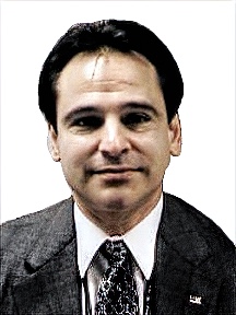
    Stuart Riley
    Trimble

    Jean-Marie Sleewaegen
    Septentrio

    Michael Swiek
    GPS Alliance

    Julian Thomas
    Racelogic Ltd.

    Greg Turetzky
    Consultant