Tag: Ellen Hall

  • Editorial Advisory Board PNT Q&A: GNSS diminishing returns?

    As the number of GNSS constellations and satellites in orbit continues to grow,
    will we reach the point of diminishing returns?

    Ellen Hall
    Ellen Hall

    “More satellites equal more data, and redundant constellation systems — through GNSS interoperability — can give us more robust PNT, as restated in the January Memorandum on Space Policy Directive 7. That said, there are always diminishing returns. Treaties place liability on the launching country if something goes wrong, but with tens of thousands of small satellites expected to be launched over the next decade, it will be getting increasingly crowded. Concerns are growing about the necessity of increased maneuvers to keep these satellites from a chain reaction of collisions, which ultimately could cause debris to fall to inhabited areas of Earth.”
    — Ellen Hall / Spirent Federal Systems

    Jean-Marie Sleewaegen
    Jean-Marie Sleewaegen

    “With already more than 130 GNSS satellites in orbit, the benefit of new satellites decreases while the risk of satellites interfering with each other increases. However, this is only considering GNSS as we know it, in the MEO orbit (altitude about 22,000 km). The future of GNSS may well be closer to Earth, in the LEO orbit (<1,000 km), with well-known benefits in terms of convergence time and resilience to jamming. Sooner than later, we can expect constellations of hundreds or thousands of LEO satellites carrying a GNSS-like payload supporting PNT services. No worries, there is still growth potential!”
    — Jean-Marie Sleewaegen / Septentrio

    Headshot: Stuart Riley
    Stuart Riley

    “With the current four GNSS constellations and a typical survey elevation mask of 10˚in North America, we average around 30 visible satellites. Far more are visible in Asia with the addition of the regional systems. In an area with a clear view of the sky, this provides more than enough satellites for precision centimeter positioning. However, most professional GNSS users do not have the luxury of operating exclusively in open areas with ideal conditions. Accessing many satellites across multiple constellations increases the probability of receiving sufficient satellites that produce high-quality measurements in obstructed areas. As the constellations expand, we observe improvement in precision position availability in these locations. The large number of satellites, coupled with independence across the four systems, improves system integrity and continuity while also helping to reduce the converge time in PPP solutions.”
    — Stuart Riley / Trimble
    Bernard Gruber
    Bernard Gruber

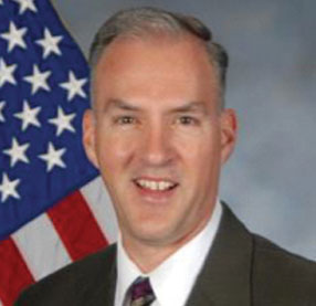
    “In a utopian vision of navigation, data gluttons and like-users of GNSS would say that there will never be enough! If capabilities remained static, then yes, I believe we would reach the point of diminishing returns. I would offer that innovation and competition will continue to drive capability improvements via power, signal quality, coverage, integrity and clock/timing accuracy. These innovations, coupled with user equipment flexibility utilizing signals from space, will drive an ever-maturing market balance and increasing return.”
    — Bernard Gruber / Northrop Grumman
  • Editorial Advisory Board PNT Q&A: Lessons from Galileo and BeiDou

    What is the single most valuable lesson GPS can learn from Galileo and/or BeiDou?

    Bernard Gruber
    Bernard Gruber

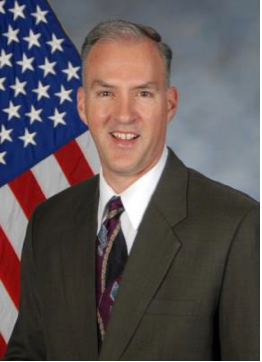
    Service continuity. Given that GNSS are so ubiquitous today, similar to the electrical grid, it is imperative that GPS continue the superb system of outage reporting via NANUs, transparency via GPS.gov, and statutory commitments via U.S. Code. Aligning to the U.S. commitment, continued Open Service Signal-in-Space, such as GPS-Galileo-BeiDou, allows thousands of planned and interoperable “apps” such as Google Maps and Waze to thrive. Although not directly in line with the question, terrestrial timing backup systems, similar to what China and some other countries do, is a valuable lesson in continuity from BeiDou.

    Bernard Gruber
    Northrop Grumman


    Ellen Hall
    Ellen Hall

    Perhaps the lesson could be, ‘It’s easier not to be first!’ Newer navigation constellations have the benefit of watching and learning from GPS — things done well and things to improve. From technology to operational procedures, a global navigation satellite system (GNSS) is difficult to execute. Would it have been easier or cost less if the United States had decided to land on the Moon after someone else had paved the way? Probably, but there is something very satisfying about being first! And, despite the fact that GPS satellites outlive their life expectancy, we keep launching new ones, with improved technology, to give the world better accuracy and more robust signals. The world of navigation welcomes Galileo, BeiDou, and all the others to follow.

    Ellen Hall
    Spirent Federal Systems


    Alison Brown
    Alison Brown

    “GPS could benefit from lessons learned from BeiDou as to the importance of resilience in providing PNT services. BeiDou has a total of 42 satellites now in operation and open signals are broadcast on six frequencies (B1I, B1C, B2I, B2a, B2b, and B3I). In comparison, GPS has currently 29 operational satellites and provides open signals on three frequencies (L1, L2, L5). As the global threat to GPS grows, from frequency incursions by evolving 5G systems as well as deliberate interference or spoofing, the ability to operate on different frequencies to provide resilience against harmful interference will become increasingly important.”

    Alison Brown
    NAVSYS Corporation 


    Jean-Marie Sleewaegen
    Jean-Marie Sleewaegen

    “While GPS remains a gold standard with decades of reliable service, the advent of BeiDou and Galileo has undoubtedly stirred up competition. While BeiDou is exceptionally fast at deploying new signals and services, Galileo is now transmitting the first ever authenticated OSNMA signals, helping secure GNSS receivers against spoofers. The main lesson is that it is better to have company than to be alone. Having multiple GNSS not only increases the number of satellites and signals, which improves positioning accuracy and reliability, but more importantly, it fosters continuous innovation, for the benefit of all users.”

    Jean-Marie Sleewaegen
    Septentrio

  • Editorial Advisory Board PNT Q&A: Autonomous vehicles & GNSS

    How is the completion of Galileo and BeiDou affecting the development of autonomous vehicles?

    Headshot: Ismael Colomina
    Ismael Colomina, chief scientist, Geonumerics

    “GNSS has had a limited impact on the development of AVs because their developers regard it as insufficiently accurate, reliable, and ubiquitous. Only a minority of them are aware of the benefits that the new/modernized constellations bring. More and improved signals and new services— both commercial and public—such as Galileo’s HAS, NMA and CAS will enable and complement visual, lidar and radar sensors for SAE levels of automation 2 and higher and for ASIL D safety levels.”
    Ismael Colomina
    GeoNumerics


    Ellen Hall
    Ellen Hall, Spirent Federal System

    “Safety is critical to the implementation of AVs and this safety relies upon PNT accuracy, availability and robustness. These three requirements all benefit from constellation diversification in terms of multiple signals, frequencies, satellites, and constellation providers. In addition to the four civilian signals available on three frequencies from the GPS constellation, signals from Galileo and BeiDou provide suitably equipped receivers with extra satellites, signals and ground segment diversity.”
    Ellen Hall
    Spirent Federal Systems


    Brad Parkinson
    Brad Parkinson

    “The economic potential of self-driving vehicles is the major driver for their development. Can they be made affordable, safe, dependable, and useful? More operational GNSS constellations may help resolve these issues favorably, but GNSS progress should not significantly influence the large number of developers. My favorite such application is long-haul trucking, which may have some very favorable profit and safety benefits.”
    Bradford W. Parkinson
    Stanford Center for Position, Navigation and Time

  • Spirent Federal to support NASA for GNSS testing

    Spirent Federal to support NASA for GNSS testing

    Photo: Elen11/iStock / Getty Images Plus/Getty Images
    Photo: Elen11/iStock / Getty Images Plus/Getty Images

    NASA has selected Spirent Federal Systems for testing GNSS for lunar exploration.

    The U.S. Space-Based Positioning, Navigation and Timing (PNT) Policy tasked the NASA Administrator to develop and provide requirements for the use of GPS and its augmentations to support civil space systems. NASA is exploring the viability and enhancement of GPS and GNSS signals in the Space Service Volume and beyond to support operational U.S. missions and civil space systems. Spirent GNSS solutions and expertise will support testing of the GNSS receivers intended to be deployed in the upcoming lunar exploration, the company said.

    “For over two decades, NASA and other space users have selected us to provide leading-edge test and development solutions for missions ranging from short suborbital flights to weeks-long orbits beyond geosynchronous altitudes,” said Ellen Hall, president at Spirent Federal Systems. “Working collaboratively with our customers enables us to meet their demanding test and development needs with the trusted solutions for which Spirent is known.”

  • History of the GNSS industry and milestones ahead

    History of the GNSS industry and milestones ahead

    Headshot: Ellen Hall
    Ellen Hall, president & CEO, Spirent Federal Systems

    The history of GPS is fascinating. In 1957, a study by JHU’s Advanced Physics Laboratory (APL) utilized the Doppler effect to monitor the recently launched Sputnik, allowing researchers to pinpoint the satellite’s position. This endeavor led to the development of the Navy Transit program, the first satellite navigation system, which was successfully testing in 1960. The United States Global Positioning System (GPS) was officially launched in 1973 as a worldwide solution designed to overcome previous limitations. The U.S. Air Force developed the GPS, which designated 24 satellites for full operational capability (FOC) in 1995.

    As a result of a horrific incident in 1983, in which Korean Air Lines Flight 007 wandered into Soviet airspace due to a navigation error and was subsequently shot down by the Soviets, the Reagan administration ordered worldwide access to GPS to ensure a tragedy like this could never happen again. The Clinton administration discontinued Selective Availability to make GPS more responsive and accurate to civil and commercial needs. This led to prolific global use and dependence on GPS for everything from providing data for precision farming applications to the critical timing of financial transactions. This increasing demand for and dependence on GPS has accentuated the importance of securing and safeguarding the system. Vulnerability testing, anti-jamming measures and alternative navigation solutions have become vital in both augmentation and backup for this critical utility.

    As often happens with inventions created through government-sponsored studies, civilian uses become so ubiquitous that the original studies that led to GPS are long forgotten. It is as if GPS has simply always existed. Accordingly, the ground-breaking contributions of certain individuals should be remembered, such as Gladys West for her work in the development of computational techniques necessary for GPS precision. Pioneers such as Roger L. Easton of the Naval Research Lab, Ivan A. Getting of The Aerospace Corporation and Brad Parkinson of APL are credited with inventing GPS and changing, quite literally, how the world works.

    I cannot imagine the world without GPS in some form. The content of what was once only in sci-fi movies is quickly becoming reality with driverless cars, pilotless aircraft and spacecraft. There are no limits on the possibilities in this field. The excitement about the future motivates brilliant minds from classified military installations to the latest civilian laboratories financed by the “Rocket Billionaires,” such as Elon Musk and Steve Bezos.

  • Editorial Advisory Board PNT Q&A: Matching receivers and antennas

    Editorial Advisory Board PNT Q&A: Matching receivers and antennas

    What are the key technical criteria in matching GNSS receivers and antennas from the same or different manufacturers? For what uses does it matter most?

    Photo: Orolia
    John Fisher. (Photo: Orolia)

    “For fixed-pattern antennas, it’s fairly simple: RF + DC to power the antenna. Most vendors are compatible. The challenge is more for controlled radiation pattern antennas (CRPA). Power requirements vary greatly, and performance can be improved with a two-way data exchange between the CRPA and receiver, but there is no industry standard yet for this interface. An example: tilt angles from the receiver’s IMU can greatly aid beam pointing.”
    John Fischer
    Orolia


    Ellen Hall
    Ellen Hall

    “Antenna selection is exceptionally critical for our military and high-precision users. The platform and environment are the primary drivers of these antenna requirements. In general, SWaP (size, weight and power) is at the forefront of all criteria. As operational plans are developed, requirements for a single or multi-element array,  element gain, and noise figure must be considered.”
    Ellen Hall
    Spirent Federal Systems


    Members of the EAB

    Tony Agresta
    Nearmap

    Miguel Amor
    Hexagon Positioning Intelligence

    Thibault Bonnevie
    SBG Systems

    Alison Brown
    NAVSYS Corporation

    Ismael Colomina
    GeoNumerics

    Clem Driscoll
    C.J. Driscoll & Associates

    John Fischer
    Orolia

    Ellen Hall
    Spirent Federal Systems

    Jules McNeff
    Overlook Systems Technologies, Inc.

    Terry Moore
    University of Nottingham

    Bradford W. Parkinson
    Stanford Center for Position, Navigation and Time

    Jean-Marie Sleewaegen
    Septentrio

    Michael Swiek
    GPS Alliance

    Julian Thomas
    Racelogic Ltd.

    Greg Turetzky
    Consultant

  • Editorial Advisory Board PNT Q&A: Simulation challenges

    Editorial Advisory Board PNT Q&A: Simulation challenges

    What’s the biggest challenge in simulating new GNSS signals for manufacturers’ product testing?

    John Fischer
    John Fischer

    “Anyone can follow a spec, but real expertise is required for interpreting nascent ICDs, looking for inconsistencies and pitfalls. The first receivers to market may not always get it right, especially before and during early live-sky signal broadcasts.” — John Fischer, Orolia


    Ellen Hall
    Ellen Hall

    “The challenge is twofold. Manufacturers are constantly implementing new signals, which is extremely difficult and expensive to do without the use of a simulator in a lab. The second problem manufacturers are facing is integrating secure signals across international constellations.” — Ellen Hall, Spirent Federal Systems


    Julian Thomas
    Julian Thomas

    “The industry has been stimulated by growing constellations and the arrival of new signals, resulting in an increasing number of sophisticated receivers hitting the market. Our biggest challenge is ensuring that all simulated signals work on all of these receivers.” — Julian Thomas, Racelogic Ltd.

  • Spirent Federal’s SimMNSA granted security approval by GPS Directorate

    Spirent Federal’s SimMNSA granted security approval by GPS Directorate

    Spirent Federal Systems, provider of GPS/GNSS test equipment, has announced that its new M-code solution, SimMNSA, has been granted security approval by the Global Positioning System Directorate.

    Spirent Federal is the first company to provide such a solution for simulating classified GPS signals, and is currently taking orders, the company said.

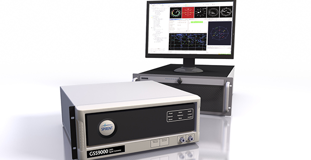
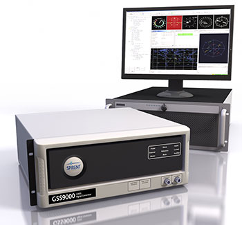
    The GSS9000 simulator.(Photo: Spirent)
    The GSS9000 simulator. (Photo: Spirent)

    In 2017, Spirent Federal Systems partnered with Rockwell Collins to develop new software that will use the Modernized Navstar Security Algorithm (MNSA). This new approach of M-code simulation adds to Spirent Federal’s portfolio of classified signal simulation solutions, and will be available to authorized users of the GSS9000 series simulators.

    “With the increased focus on M-code by the GPS Directorate, we are pleased that our team has paved the way in the development of SimMNSA,” said Ellen Hall, CEO of Spirent Federal Systems. “It was a great challenge to get to this point, but we are excited about what we have accomplished.”

    The new test solution continues Spirent Federal Systems history of innovation and being first to market with M-code simulation software, the company said. Spirent’s GPS/GNSS solutions have supported numerous government, military and U.S. Department of Defense programs for more than 30 years.