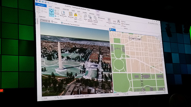
LizardTech, a provider of software solutions for managing and distributing geospatial content, launched GeoExpress 9.5 at this week’s Esri International User Conference. The conference is taking place in San Diego, Calif., and LizardTech is exhibiting in booth number 2310.
GeoExpress enables geospatial professionals to compress and manipulate satellite and aerial imagery. In addition to compressing raster data, GeoExpress 9.5 now features the ability to natively compress LiDAR data to MrSID and LAZ formats, saving up to 75 percent on storage space.
GeoExpress 9.5 also includes batch color balancing, multipolygon cropping and exporting images to custom dimensions and tiles. Esri UC attendees can see demonstrations of the new features of GeoExpress 9.5 at booth 2310.
“The launch of GeoExpress 9.5 is particularly exciting because of the many benefits this latest version brings not only to our raster image collection customers, but also LiDAR data collection customers,” said Jeff Young, LizardTech global business development manager. “GeoExpress 9.5 is now your one-stop shop to compress raster and LiDAR imagery to MrSID and LAZ formats.”
LizardTech will also showcase the rest of the company’s line of geospatial products: Express Server software for high-performance delivery and publication; LiDAR Compressor software, which turns giant point cloud datasets into efficient MrSID files; and the recently updated GeoViewer software, which a fast way to view MrSID and JPEG 2000 imagery.
Progressive Technology Federal Systems Inc. (PTFS) has introduced Droneware, a geospatial content management system (GeoCMS) for unmanned aerial systems. Droneware facilitates the storage, discovery and dissemination of virtually any type of sensor data captured by a UAS or unmanned aerial vehicles.
PTFS is the provider of the Knowvation Enterprise Content Management System (ECMS) for users of geospatial data. PTFS unveiled the new system at the 2015 Esri User Conference being held July 20-24 in San Diego, Calif. PTFS will demonstrate Droneware GeoCMS in booth #N1332 at the San Diego Convention Center.
“Unmanned Aerial Systems capture large volumes of data that must be quickly organized, interrogated and disseminated immediately,” said Dan Quinn, PTFS vice president. “Droneware makes it easy to manage enormous archives of UAS data so the right image, video or other sensor data can be found and accessed instantly.”
A thin client/server-based solution requiring only a web connection, Droneware runs on a PC in the office or handheld device in the field enabling the user to interrogate local or remote UAS data storage anytime from anywhere. Droneware is built on the Knowvation ECMS technology, which commercial and government organizations use to manage raster and vector geospatial data as well as video, audio and text-based content across multiple large data archives.
The primary appeal of Droneware to UAS and UAV data users is its simple and intuitive search and browse capability for data discovery. Users can perform geospatial queries by typing a geographic name or word, entering latitude/longitude coordinates or preforming a visual search by drawing a rectangle on a map interface. Droneware performs the search on the entire archive regardless of data type or file format.
“Droneware is configured and ready for use in minutes for fast and effective support of any UAS data application,” Quinn said.
PTFS offers the option of deploying Droneware as the client’s repository of record in which all UAS content is ingested, stored, managed and searched inside the application. Droneware can be purchased on the Amazon Marketplace and deployed in various EC2 cloud instances for commercial use or for the hobbyist.
AWS Marketplace enables customers to compare options, read reviews, and quickly find the software they want. Visitors seeking Droneware in AWS Marketplace can purchase and launch Droneware with 1-Click deployment. Droneware is then available for consumption on an hourly or annual basis.
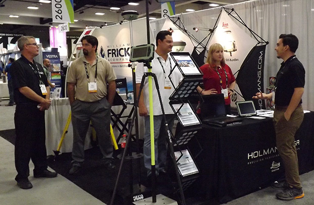
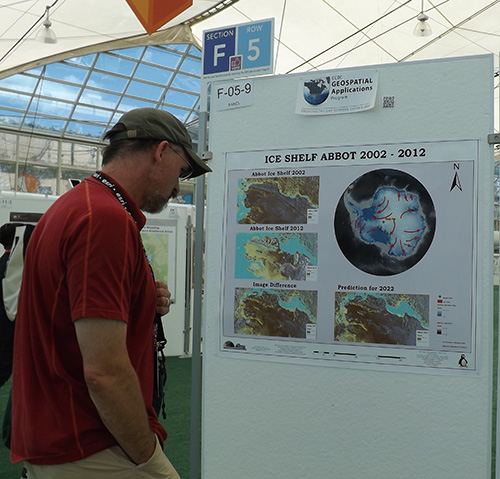
The Esri 2015 Exhibit Hall. (Photo: Tracy Cozzens)
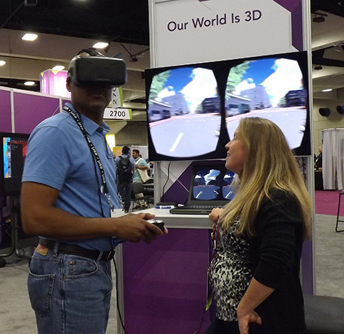
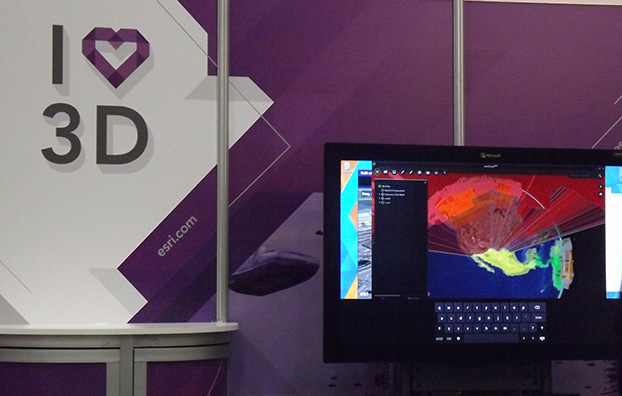
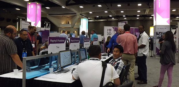
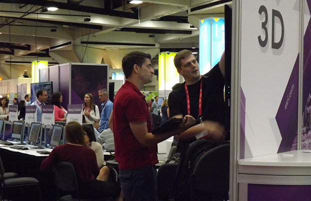
More than 16,000 people from 120 countries around the world are expected to converge in San Diego, Calif., this week to discuss the power of maps and applying geography at the 2015 Esri User Conference (Esri UC). The Esri UC and related events are taking place July 18–24, featuring a variety of speakers from a presidential candidate to global first responders. Attendees will share ideas and best practices for improving our world through maps.
GPS World/Geospatial Solutions staff is on site, and we will be posting news, photos and videos live from the show on this page. Also follow us on Twitter at @GSS_NCM and @GPSWorld.
Septentrio, a designer and manufacturer of GNSS receivers, has launched a new software suite called PinPoint-GIS, which is designed to make GIS data collection and visualization straightforward. Septentrio’s PinPoint-GIS provides several methods of data collection, based on a standard web browser hosted on the Altus APS-NR2 and a mobile app integrated with Esri’s ArcGIS or other GIS mapping systems.
Users of PinPoint-GIS benefit from bringing the data-collection process into their familiar GIS environment, Septentrio said. Data collected with Altus and Septentrio receivers is directly available in the user’s GIS application. This data is processed into the database without any intermediary steps, greatly reducing the time and complexity of the collection process for the user. This allows the user to focus on the project objectives by easily customizing and updating maps instead of losing time on the mechanics of data collection and transmission.
Altus APS-NR2 and GeoPod are well known for providing consistent and accurate data. Thanks to PinPoint-GIS, this data becomes seamlessly integrated with the GIS database. The data becomes easily accessible to the field worker though existing hardware such as commercial and ruggedized mobile devices, regardless of their operating system.
“By introducing PinPoint-GIS, Septentrio is committed to making accurate and reliable GIS collection as simple and cost effective as possible. Once installed Pinpoint GIS works without user involvement to place high quality positions into the users existing GIS data collection tools by using the three components of the software,” said Gustavo Lopez, PinPoint-GIS product manager. “Thanks to PinPoint-GIS, Septentrio provides a seamless interface for capturing data in the field, customizing maps, access to data and user functionality. More field workers can get greater productivity from their existing GIS tools.”
Septentrio will be presenting PinPoint-GIS at Esri AEC Summit, held at the Manchester Grand Hyatt July 18-21, and at the Esri User Conference, held July 20-24. Both events take place in San Diego, Calif.
Esri President Jack Dangermond will deliver the keynote speech at Esri UC.
More than 16,000 people from 120 countries around the world are expected to converge in San Diego to discuss the power of maps and applying geography at the 2015 Esri User Conference (Esri UC). The Esri UC and related events will take place from July 18–24, featuring a variety of speakers from a presidential candidate to global first responders. Attendees will share ideas and best practices for improving our world through maps.
“We have millions of users around the globe who do amazing things with our technology every day,” said Esri president Jack Dangermond. “The User Conference is our opportunity to recognize their important work, learn from them, and empower them with even better tools and techniques to continue their mission.”
Other featured speakers will include operations staff from Hartsfield-Jackson Atlanta International Airport, executives from JPMorgan Chase, the director of Strategic Cooperation at the International Centre for Integrated Mountain Development (ICIMOD), and the president and CEO of the National Geographic Society. Former Maryland governor Martin O’Malley headlines a list of innovators from across every industry who will demonstrate how geospatial technology can make government smarter, combat global health challenges, ensure public safety, and drive greater revenues for businesses.
With a full week of activities, the 2015 Esri User Conference is shaping up to be the biggest yet.
Starting Off the Week with a Bang. Before the Esri UC even kicks off, a series of concurrent events related to business; education; national security; architecture, engineering, and construction (AEC ); and 3D mapping will take place July 18 and 19 in and around the San Diego Convention Center. These focused events will give attendees a deeper dive into various functional areas and equip them with an action plan to immediately invigorate their own organizations.
Real Stories from Real People. Throughout the week, more than 1,000 users will deliver presentations detailing how GIS helps their organizations in a number of ways. Whether they’re onstage for Monday’s Plenary Session or leading one of the nearly 300 moderated paper sessions, speakers will share lessons learned and best practices that can help their peers succeed.
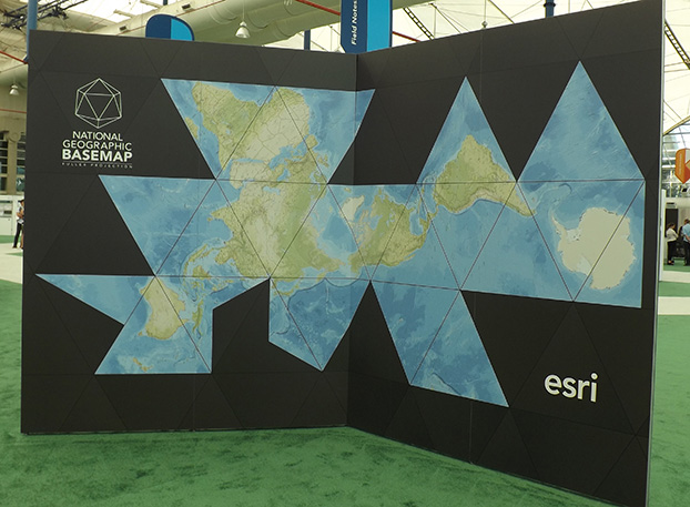
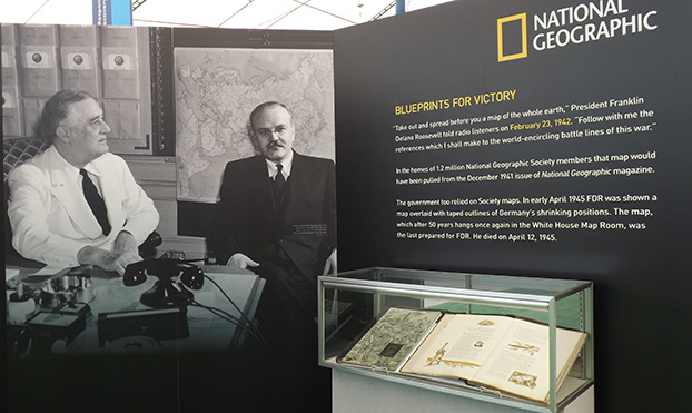
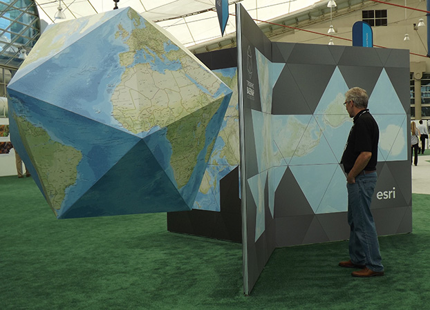
Celebrating 100 Years of Mapping. The National Geographic Society will be on hand to continue celebrating the organization’s 100 years of making maps. A chronicle of the history of maps and the American presidency, from future President Dwight Eisenhower carrying maps into battle during World War II to President Barack Obama receiving official presidential maps in the White House, will present the art and science of where. Gary E. Knell, president and CEO of the National Geographic Society, will also speak at the Plenary Session about the importance of geography in science, technology, engineering, and mathematics (STEM) education.
Innovation on Display. From hundreds of expert-led technical workshops to the expansive GIS Solutions EXPO featuring more than 300 technology companies and start-ups, attendees will immerse themselves in the latest and greatest in mapping and spatial analysis. Attendees will find a range of demos, talks, and resources about hot topics—big data, 3D visualization, unmanned aerial vehicles (UAVs), and more.
The Esri UC and related events will span seven days and offer opportunities for both technologists and managers to understand how geography can be applied to every organization’s challenge to drive better outcomes. For more information, visit esri.com/uc.
Juniper Systems is exhibiting its sub-meter GPS solution using Esri ArcPad, Effigis’ EZSurv Post-Processing software, and its ultra-rugged handheld computers — a combination the company says is budget-friendly and easy-to-use — at the Esri User Conference, being held in San Diego July 20–24.
The sub-meter solution involves collecting GIS data using a Juniper Systems rugged handheld running ArcPad data collection software, and then using Effigis’ EZSurv software to post-process the data, resulting in sub-meter GPS accuracy. Users can import and export data, including custom attributes, from their GIS. The data collection process bypasses the need for expensive survey-grade GPS receivers, providing both an affordable and simple solution for professionals who require sub-meter accuracy, Juniper Systems said.
“This solution is a great option for people looking for sub-meter accuracy without the steep price,” said Trevor Brown, Natural Resources market manager at Juniper Systems. “The range of applications that can benefit from this type of solution is very broad, with uses in forestry, agriculture, environmental monitoring, and asset management, to name a few. And not only is it inexpensive, it’s also super simple. You can have sub-meter accuracy with the click of a button.”
Those attending the Esri User Conference can see this affordable sub-meter solution at Juniper Systems’ booth #2212. The data sheet can be downloaded, or visit Juniper Systems’ website to learn more.
Avineon Inc.will unveil the Metrics Extension to ArcGIS for Server at the 2015 Esri User Conference, being held July 20-23 at the San Diego Convention Center in San Diego, Calif. The Metrics Extension gives ArcGIS users better visibility into their enterprise geodatabase by revealing trends in their global and regional data updates.
The Metrics Extension enhances the value and usability of GIS data in ArcGIS by creating a spatial data warehouse in which key business intelligence metrics can be created and stored for historical reporting. It computes and stores key metrics such as asset quantity, length or area coverage for a specified period. Storing this data permits important historical trends to be documented and evaluated for potential performance improvements and cost savings.
One of the most common applications of the Metrics Extension is tracking the installation, operation and decommissioning of assets for telecommunications, electric, gas, oil, water, waste water and sewer utilities. For instance, a telecommunications company can use ArcGIS for Server and the Metrics Extension to determine how many miles of buried fiber its network contained on a certain day or how many linear feet of fiber were laid in the past 30 days.
Likewise, an electric utility can report the quantity and type of smart meters, poles and cable installed by month and location. Outside of the utility industry, local, state and federal government agencies can trend geodatabase objects such as fire hydrants, real property parcels, land use and environmental classifications, vegetation, and crime instances not only by neighborhood, zip code and political district but also by timeframe.
“Avineon’s Metrics Extension elevates ArcGIS geodatabase to a true spatial data warehouse for historical reporting and data analysis. Once we release, you can download the Metrics Extension and have it installed and running in less than a day,” said Joel Campbell, Avineon Vice President of Commercial Systems. “Users can expect a quick return on their investment by deploying this technology.”
A long-time Esri Business Partner, Avineon develops and implements a wide variety of geospatial services.“Avineon has been working closely with Esri for more than 10 years to create innovative solutions for GIS clients worldwide,” Campbell said. “We invite all Esri Conference attendees to visit our booth and learn how Avineon can make your geospatial content more intelligent.”
Avineon will demonstrate the Metrics Extension publicly for the first time in booth #1015 at the Esri User Conference, as well as offering presentations and demos of its other products. For more information on the Metrics Extension, Avineon will conduct free 30-minute webinars on Aug. 11 and 25. To register for the Aug. 11 webinar click here. To register for the Aug.25 webinar, click here.
Avineon, Inc., a global provider of information technology and engineering support services, will be presenting its complete portfolio of geospatial offerings at the 2015 Esri User Conference in San Diego, Calif., on July 20-24. A long-time Esri Business Partner, Avineon develops and implements a wide variety of geospatial services.
Avineon will be making presentations and providing demonstrations in booth #1015.
Avineon offers geospatial products and services to Esri clients in numerous industries, including energy water, and communications utilities and all levels of local, state, and federal government agencies. Avineon specializes in assuring and enhancing the quality of existing data through extensive data conversion, migration, conflation, and enrichment services. In addition, the firm extracts new data sets, such as orthoimagery, digital elevation models (DTMs), and 3D visualizations from aerial photography and LiDAR acquisitions.
Avineon also provides support for version upgrades and cloud migration, software testing and help desk staffing. In the web/mobile arena, Avineon has a long history of creating custom applications and server extensions for outage management, field workforce management, wire down monitoring, and other efficiency-enhancing applications. When consolidating to a single system is not practical, Avineon implements cross-platform technologies that normalize spatial data and establish data governance programs across diverse GIS data sets.
“Avineon has been working closely with Esri for more than 10 years to create innovative solutions for GIS clients worldwide,” said Joel Campbell, Avineon’s vice president of commercial systems. “We invite all Esri Conference attendees to visit our booth and learn how Avineon can make your geospatial content more intelligent.”
Esri President Jack Dangermond is asking for geospatial professionals to provide illustrations for his opening presentation at the 2015 Esri User Conference in July.
“Each year, the Plenary Session provides an inspiring overview of the state of geospatial technology today, and one of the best ways to illustrate that is by sharing examples of your work,” Dangermond writes in an email. “I invite you to submit up to three images for us to consider including in the presentation.”
Dangermond said he is interested in:
Maps that helped make a decision
Maps that helped with collaboration
Maps that helped communicate
High-quality cartographic displays
3D visualizations
Built environment
Nature landscapes
Cartography (statistics)
Maps that illustrate spatial analysis, modeling, and science
Web maps
Image submissions must be received by Friday, June 12, via Esri’s online portal.
The Esri User Conference has issued a call for papers for its 2015 event, scheduled for July 20-24 at the San Diego Convention Center. “Every year, ArcGIS users tell stories of inspired solutions, insightful best practices, time-saving apps, and game-changing maps,” conference organizers said in a statement. “The most innovative and influential GIS work comes into focus at the Esri User Conference. You could tell your GIS story at the 2015 Esri UC. This is a chance to show your peers what you can do.”
The 2015 call for papers covers 90+ session topics highlighting GIS solutions today and in the future. The user sessions combined with the UC plenary and lightning talk presentations will bring more than 900 speakers together covering more than 260 sessions dedicated to the success and advancement of geospatial technology.
Paper sessions help attract peer recognition and provide valuable feedback, organizers said. “As an Esri UC presenter, you will gain recognition and exposure to over 16,000 Esri users who represent over 26 unique and diverse fields, coming together with the common goal of answering today’s challenges with tomorrow’s GIS to create a better world.”
LizardTech, a provider of software solutions for managing and distributing geospatial content, has launched GeoGofer, a new addition to its product line. GeoGofer is a software solution for finding geospatial imagery quickly and efficiently, regardless of where it is located.
GeoGofer was designed to streamline the process of finding, organizing, and tracking geospatial imagery. To that end, GeoGofer comes with powerful search and filter features that can be used to find imagery by keyword, by projection, by file format and more.
“Our customers will never again have to struggle to find their geospatial images,” said Jon Skiffington, director of product management at LizardTech. “Our product preview demonstrations have received overwhelmingly positive feedback from existing LizardTech customers and from a sampling of Esri User Conference attendees.”
With GeoGofer, users can browse all of their imagery on a single map, tag images for later use, and perform powerful queries using simple tools. Users can search by modification date, by number of bands, or by resolution to find the imagery they need.
GeoGofer integrates fully with trusted Esri technology. GeoGofer uses an existing ArcGIS Online subscription to store and query image information. Additionally, if users have ArcMap installed on the same machine that runs GeoGofer, they can open images directly in ArcMap.
More product information, purchase options, and a free 14-day trial are available at the website.
GPS World is at the 2014 Esri User Conference, being held July 14-18 in San Diego. Check out our slideshow for key photos from the first day of the conference. Follow tweets from GPS World and Geospatial Solutions for live updates from the conference.
Welcome to the 2014 Esri User Conference (UC) Photo Slideshow.
SmarterBetterCities creates 3D scenarios using its 3D Cities Libraries, functional in Esri CityEngine and ArcGIS Desktop.
Conference exhibitors at the Esri UC take a seat.
The 2014 Esri UC is being held July 14-18 in San Diego.
Motorola is focusing on its PremireOne public safety applications suite with realtime data.
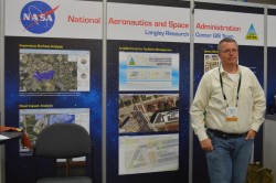
A member of NASA Langley’s GIS Team mans the booth on the show floor.
Topcon’s Sirius Pro is designed for high accuracy mapping using GNSS RTK.
GPS World will be producing a live webinar in this booth outside of room 27 at 1 p.m. EDT on Thursday.
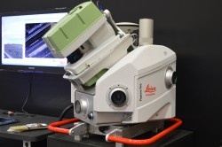
Leica’s Pegasus:Two is a mobile mapping solution integrates hardware platforms including cameras and lidar profilers.
The Trimble UX5 focuses on image quality and photogrammetric accuracy.
Topcon Positioning Group announces the integration of the Android platform to the eGIS field software system.
A view of the Esri UC from the outside looking in.
Cityworks’ booth at the Esri UC.
TomTom is at the Esri UC for the 22nd year.
Cedar Tree Technologies is a recently launched rugged handheld company founded by Juniper Systems.
Riegl’s VUX-1 laser scanner.
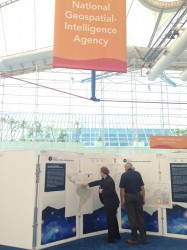
Exhibitors checking out the National Geospatial-Intelligence Agency’s Latin American physical and political geography map.
Juniper Systems is featuring its Archer 2 at the Esri UC.


 More than 16,000 people from 120 countries around the world are expected to converge in San Diego, Calif., this week to discuss the power of maps and applying geography at the 2015 Esri User Conference (Esri UC). The Esri UC and related events are taking place July 18–24, featuring a variety of speakers from a presidential candidate to global first responders. Attendees will share ideas and best practices for improving our world through maps.