PenBay Solutions, a developer of GIS-based facility management and public safety software, is introducing InVision 1.5 in booth #F116 at the Esri User Conference in San Diego, July 14-17. The new technology will also be featured at the InVision Special Interest Group Lunch in room 28B at 12 p.m. on July 16 at the conference.
InVision software is built on the Esri ArcGIS platform to help users visualize, analyze and interpret data in ways that reach beyond individual buildings and site maps. InVision bridges the gap between managing exterior and interior built environments by aggregating all facility and infrastructure data from various sources into a single, comprehensive, visual system for portfolio management, operations, and safety and security.
The 1.5 release of InVision software introduces several new features and enhancements with an emphasis on mobile capabilities. InVision 1.5 introduces mobile viewers for:
Space Management: view space types, uses and assignments while in the field to more easily find and understand space use and classification.
Asset Management: remotely view utility and asset types, statuses and conditions to more quickly locate and evaluate assets.
Campus Viewing: provide information about campus points of interest so employees, residents and visitors can easily find what they are looking for.
Security Planning: view security plans – including both indoor and outdoor environments – and share that security information via mobile devices with outside public safety agencies and response personnel.
Security Operations: view critical building, floor, space and security asset information in the field to better understand the location and status of security assets in real time.
“Mobility is critically important to our customers,” said Stu Rich, Chief Technology Officer at PenBay Solutions. “These new InVision Mobile Viewers are just the beginning. We’re in the process of developing mobile applications designed for data collection, data editing and inspection workflows as well. Watch for announcements around those exciting new applications in the coming months.”
The InVision Secure Event Management Solution supports a range of activities and users throughout event planning, coordination, and operations. With InVision Secure, users can coordinate plan creation, manage the review and approval process, and securely share information that is relevant to the safety and security of events. The solution helped make Super Bowl XLVIII a safe and successful event, according to PenBay Solutions.
“PenBay Solutions was instrumental in helping us with all the agencies we worked with to gather data, and for implementing a public safety system that met our needs for the Super Bowl,” said Captain Steven Pollackov of FDNY’s GIS Unit. “As we move forward, we will be utilizing this platform more and more.”
CompassCom will offer Esri User Conference attendees a sneak peek at advanced asset tracking capabilities in the upcoming version of its CompassTrac software powered by Esri ArcGIS technology. Scheduled for release in late summer, CompassTrac 6 provides Esri users with custom digitizing tools for geofencing applications and map optimization for any electronic device.
CompassCom will demonstrate the new CompassTrac 6 capabilities in booth #2307 at the Esri User Conference, being held July 14-18 in San Diego.
“The newest version of CompassTrac will enable Esri GIS users to keep track of their vehicles and high-value assets with greater ease than ever before whether they are in the office or out in the field,” said CompassCom CEO W. Brant Howard. “On-the-fly geofence alerts increase fleet efficiency and improve crew safety.”
CompassTrac is the software tool that enables Esri ArcGIS users to view the locations and statuses of vehicles and other high-value assets on their GIS map in real time. Leveraging existing Esri architecture and GIS data files, CompassTrac locates addresses and displays vehicle positions, speeds, and heading on the fly using selected ArcGIS data layers as the map background, including satellite and aerial imagery, the company said.
Over the past 16 years, CompassTrac has provided field service management services for thousands of vehicles operated by organizations involved in public safety, public works, utilities, road maintenance, delivery and transportation.
The premier upgrade to CompassTrac version 6 is a set of digitizing tools that allows the user to draw a geofence polygon around any feature or area — a street, neighborhood or town — on the GIS map. If any vehicle or asset being tracked by the system crosses the geofence boundary, CompassTrac will automatically send a text or email alert to select users and highlight the vehicle in question on the map display. These geofence alerts occur instantly and on the fly in real time, providing enhanced tracking of mobile resources to help operators manage their mobile work force.
Now with version 6, CompassTrac is also hardware agnostic. The software will automatically scale, or optimize, its map view to fit on the screens of desktop computers, laptops, tablets and smartphones, giving Esri users the ability to track assets from any location where they have Internet.
Visitors to CompassCom’s booth #2307 at the Esri User Conference will also view demonstrations of the new CompassLDE Connector, which provides plug-and-play capabilities to link AVL and mobile resource management tracking to the Esri ArcGIS GeoEvent Processor.
LizardTech, a provider of software solutions for managing and distributing geospatial content, is announcing the newest addition to its product line at the 2014 Esri International User Conference this week. LizardTech GeoGofer is a software solution for finding geospatial imagery quickly and efficiently and will be available later this summer.
The conference takes place in San Diego, California, where LizardTech will demonstrate GeoGofer in booth #1516.
GeoGofer was designed to streamline the process of finding, organizing, and tracking geospatial imagery. GeoGofer comes with powerful search and filter features to find imagery by keyword, by projection, by file format and more, LizardTech said. With GeoGofer, users can browse all of their imagery on a single map, tag images for later use, and perform powerful queries using simple tools. Users can search by modification date, by number of bands, or by resolution to find the imagery they need.
GeoGofer integrates fully with Esri technology. GeoGofer uses an existing ArcGIS Online subscription to store and query image information. If users have ArcMap installed on the same machine that runs GeoGofer, they can open images directly in ArcMap.
Those interested in GeoGofer can enter their names at www.lizardtech.com/geogofer to be notified of the product launch later this summer.
Scene Sharp USA has introduced its Fuze Go Plugin for ENVI this week at the Esri User Conference in San Diego. The plugin gives ENVI software users access to Fuze Go MS Sharp, an automated multispectral image fusion software that can simultaneously fuse up to 30 spectral bands of data from inside the ENVI geospatial processing package.
“The Exelis ENVI software is widely known for its multi- and hyperspectral image processing capabilities and is an ideal platform for geospatial information users to access the automated Fuze Go MS Sharp image fusion software,” said Ian Lucas, President and CEO of Scene Sharp Technologies Incorporated.
Scene Sharp is demonstrating the Fuze Go plugin along with the full line of Fuze Go software products in booth #410 at the Esri User Conference being held July 14-18 in San Diego.
The plugin gives users the option of accessing the Fuze Go MS Sharp software either within the ENVI workflow or outside of it so that fusion can be performed as a stand-alone application. This frees up the ENVI software license for other image processing activities. No GIS or image processing experience is needed to utilize the Fuze Go tools.
Fuze Go is a fully automated technology that enables users to quickly and easily fuse data sets to add color to non-colorized satellite and aerial imagery with just a few mouse clicks. One of its most common applications is pan-sharpening. By colorizing image data, GIS users can visualize and extract richer information content from remotely sensed data to make better informed decisions.
Also at the 2014 Esri UC, Scene Sharp USA is demonstrating the processing capabilities in its Fuze Go SAR Sharp application, which was designed for more effective exploitation of data captured by satellite-based synthetic aperture radar (SAR) sensors. Fuze Go SAR Sharp fuses gray-scale radar data with optical multispectral bands to colorize the SAR data set. The Dynamic Reader allows pre-process on-the-fly viewing of SAR imagery with real-time adjustment of color intensity being added to the scene.
Fuze Go MS Sharp and SAR Sharp are available for purchase for an annual license fee. Batch processing versions of the software packages are also offered to perform automatic fusion of multiple optical or SAR scenes.
Icaros Inc., a provider of advanced aerial remote sensing and 3D visualization solutions, will introduce its Icaros Measurement Tool (IMT), a simple but powerful photogrammetric visualization application based on ArcGIS technologies, at the 2014 Esri User Conference. The 2014 Esri User Conference will be held July 14-18 in the San Diego, California, Convention Center.
The IMT enables customers working within Esri’s GIS environment to view and measure structures in oblique aerial imagery captured by any commercial oblique sensor system, including those from Pictometry, Vexcel/Microsoft, IGI, Leica, Midas, as well as oblique sensors mounted on unmanned aerial vehicles (UAV).
“Icaros is opening the oblique imagery market to all GIS users by building our IMT’s coming functionality upon Esri’s Arc Engine,” said Richard Baumgartner, vice president of business development at Icaros. “IMT lets users unlock the full potential of their imagery by combining 3D analysis capabilities with their GIS data.”
IMT is specifically designed to make highly accurate vertical and horizontal 3D measurements of structures and surfaces, including calculating distances, areas, slopes and azimuths in complex 3D features.
For too long, Baumgartner explained, oblique imagery has been limited by proprietary collection systems and metadata formats. Usage beyond tax assessment and public safety applications is very rare. The Icaros vision is to expand the use, visualization and analysis of oblique aerial images into the entire spectrum of the GIS market with special focus on local and state government segments.
Beyond tax assessment and public safety, oblique analysis of structures can be beneficial to a host of new applications such as facility management, pipeline corridor infrastructure monitoring, energy audits, economic development, and asset management. In addition, as Esri users continue the move to 3D, oblique imagery will be critical for constructing accurate image-based realistic 3D models.
“Icaros has done a terrific job designing easy to use, yet highly sophisticated, measurement tools for any client wanting to do 3D oblique measurements. Not only are these tools well developed, but they are integrated completely within Esri’s ArcGIS platform, which is a critical advantage for our clients,” said Paige Parker, Vice President at Control Cam, an Icaros distributer serving the state and local markets.
IMT enables users to manipulate and view oblique imagery while leveraging other geospatial data layers within their GIS environment. This capability allows users to navigate multi-image scenes in three dimensions while zooming and panning. The software also provides an optional Icaros Digitizer Tool (IDT).
“IDT provides additional tools to extract physical building structures and digitize them into open format models, such as Collada, Obj, and Ply, textured from the source imagery,” said Baumgartner. “Automated 3D model generation from oblique imagery is at the intersection between imagery and GIS.”
To view a demonstration of the Icaros Oblique Viewer, visit Icaros in booth #619 at the conference.
The Esri Survey Summit and Esri International User Conference (UC) were held in July in San Diego, California (they’re held San Diego every year). As always, these events are a whirlwind of spatial data technology, covering surveying software to handhelds/tablets, GNSS/GPS units, UAVs, handhelds/tablets, and plotters. There are only two conferences in the world where you will experience such a breadth and depth of hardware/software spatial technology: the Esri International User Conference (UC) and Intergeo.
The Esri UC, which is preceded by the Esri Survey Summit, is a vendor-specific conference, so you won’t see any Esri competitors there (such as Autodesk, Intergraph, MapInfo, Bentley, and Smallworld). Intergeo, set for October 8-10, is vendor-independent, so anyone can attend if you pay the fee, but it’s always located in Germany, which puts it out of reach for many North and South Americans. It’s also much more focused on business and a trade show than the UC. Finally, the Esri UC offers many more technical sessions than Intergeo. In my opinion, one of the greatest values of the Esri UC is the diverse, GIS-centric technical sessions available for about any vertical market you can imagine, from utility infrastructure to municipal engineering and wetland science. If you’re interested in browsing the technical sessions from last month’s Esri UC, you can do so here.
Survey Summit
The bulk of the Survey Summit was held the weekend before the Esri UC. This is an event where surveyors and GIS professionals (sometimes the same person) interact. The concept is solid, as surveying and GIS technologies are converging. However, this year’s Survey Summit suffered from a lack of attention from the organizers and, consequently, attendance took a hit. Only about 150 people attended, when the conference really should attract 750-1,000 people. Yes, tight travel budgets can be attributed to the decline in attendance, but there wasn’t buzz created leading up to the conference, and the content was marginal. For the first time since I can remember, there was no exhibition area for vendors. Note to Survey Summit organizers: I get that you’re busy on other projects, but if you want this to be a serious conference, you’ve got to put more energy into it.
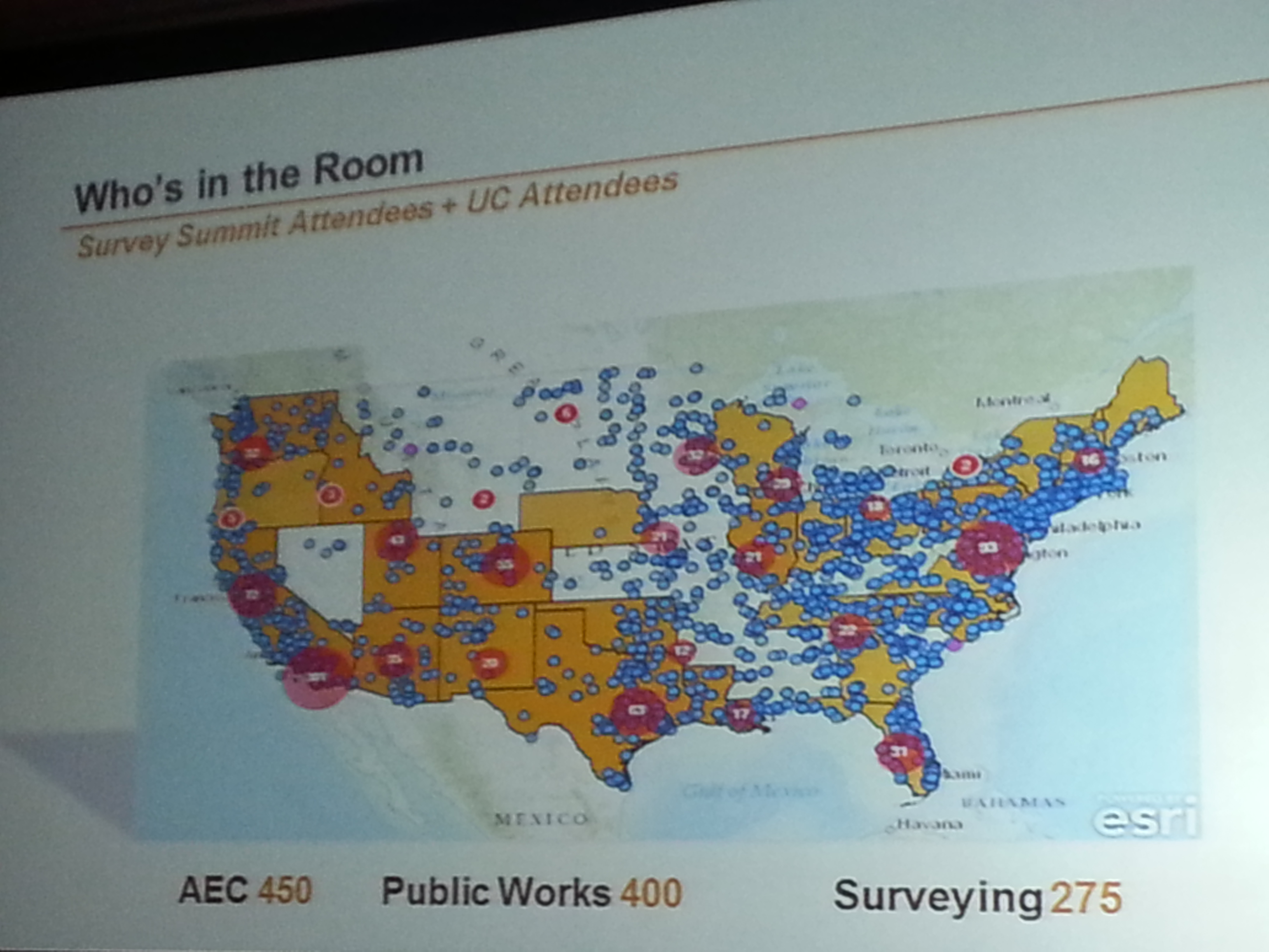
Who’s in the Room. Survey Summit + UC.
Who’s in the Room. Survey Summit + UC.
Most interesting take-aways from the Survey Summit:
• Esri programmers responsible for the geographic datum transformations in ArcGIS were at the Survey Summit and engaged. Esri needs to do a lot of work in this area to accommodate high-precision GIS and surveying, and it seems the company is taking it seriously, but it can’t come soon enough.
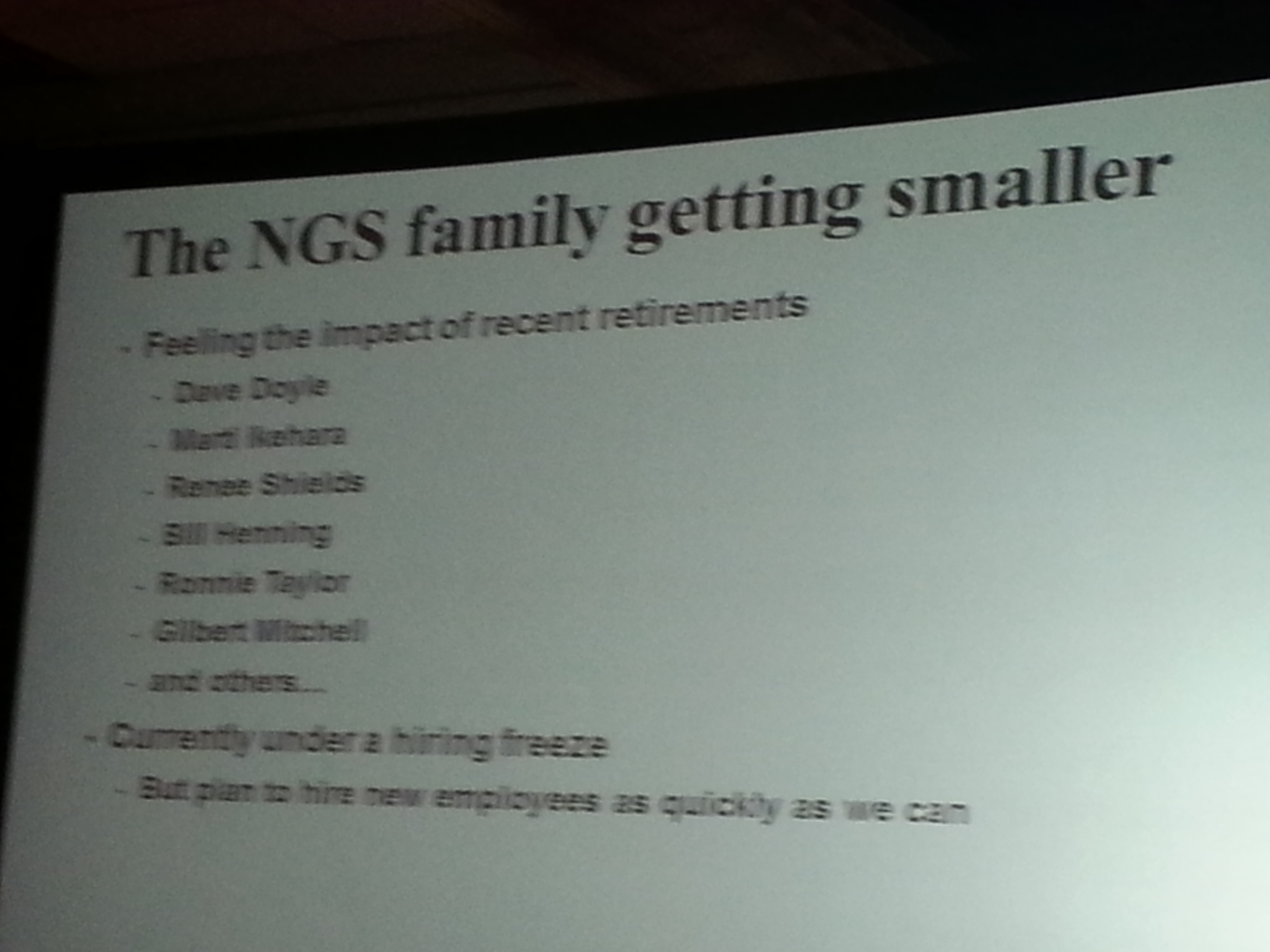
• National Geodetic Survey (NGS) usually sends a pack of people to the conference. This year, it all fell on Michael Dennis, who delivered a record number of presentations. The NGS is getting smaller. It employs about one third of the people it used to. People with a tremendous amount of knowledge and outreach throughout the years such as Dave Doyle and Bill Henning have retired recently, and there’s a hiring freeze at NGS. While geodesy for GIS is becoming more important, we are losing geodesy expertise at the federal level.
Most interesting quotes from the Survey Summit:
• “GIS isn’t an acronym for Get It Surveyed; it’s an acronym for Get Involved Seriously.” — Curt Sumner, National Society of Professional Surveyors
• “Think about what’s not going to change in the next 10 years, that’s the more important question.” — Brian Matsubara, Amazon Web Services
Esri International User Conference Keynote
The challenge is that Esri President Jack Dangermond sets the bar so high every year that there’s an expectation that he will “wow” us again. That didn’t happen this year. Mind you, I’m a huge fan of Mr. Dangermond. I love it that he’s kept Esri a privately held company (no public shareholders) and the way he dismisses investor community analysts. I love it that he has a vision, sticks to it, and yet doesn’t hesitate to make significant changes as he sees fit. He told Investor’s Business Daily, “We’ve never borrowed money,” conceding that this meant the company grew more slowly than it might have. “We had to be very, very, very conservative with money. …It drove careful decision making. We were never at the (beck) of outside shareholders or banks. What that means is we could focus on our users and employees.”
Think about a guy who, at 67 years of age, struck up a relationship with pop musician Will.I.Am, who ended up speaking in front of thousands of attendees at the Esri UC this year. You can view a video of Will.I.Am’s and other keynote conversations here. By the way, Will.I.Am says he’s going to attend the Massachusetts Institute of Technology (MIT) this fall, studying computer science. I’m impressed.
Esri International User Conference
Attendance at this year’s conference was probably down from last year, likely from reduced government travel budgets. On the conference opening day, Jack reported that 12,000 people were in attendance from 130 countries, making it the largest gathering of geospatial users in North America.
During the plenary session, four technologies were emphasized. None of them are new or earth-shattering, but each are pushing forward:
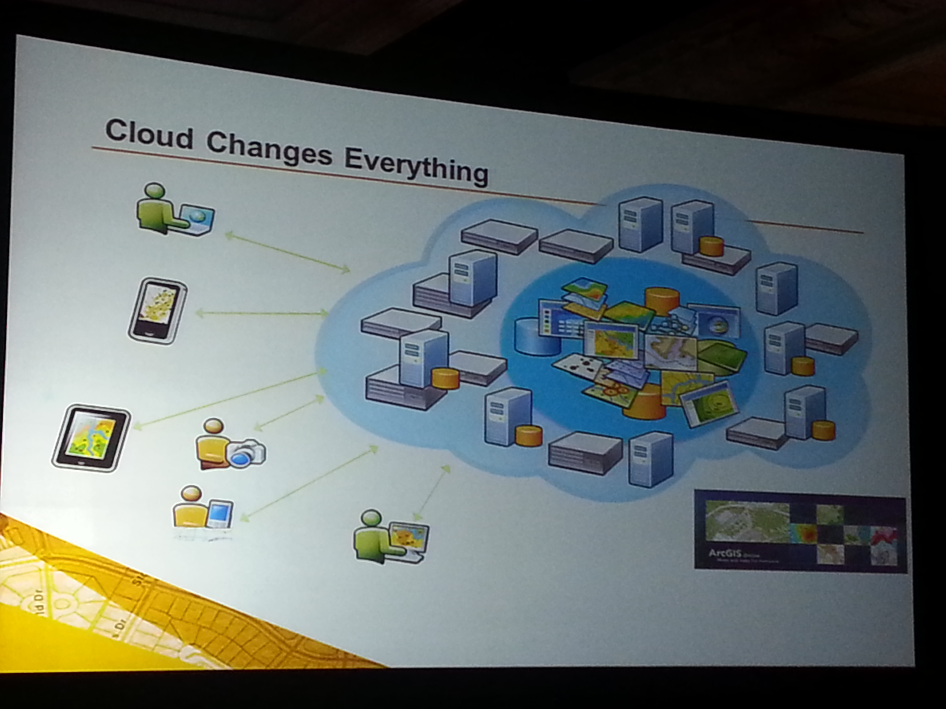
Cloud-based GIS: Esri is pushing cloud-based GIS hard. It’s a significant transformation, and there’s no turning back. During the plenary session, Jack announced that starting with ArcGIS 10.2, each license will also include a subscription to ArcGIS online. The cloud is a natural segue into Big Data.
More Data: If GIS software is the engine, then data is the fuel. More data usually translates into more apps. More granular data usually translates into better decision-making capability.
Esri reported that 100 million square miles of imagery was added or updated to ArcGIS online. DigitalGlobe announced that ArcGIS Online users will now have access to DigitalGlobe’s Global Basemap, FirstLook, and Multispectral Premium Services.
More Apps: Taking a lesson from Apple, Jack reported that “in a couple of months Esri will introduce an itunes-like appstore for GIS apps.” Seeing how GIS apps are largely customized, it will be interesting to see what this offers to the user community. It’s a super-smart idea from an Esri strategy perspective, allowing users to derive greater value from their Esri investments.
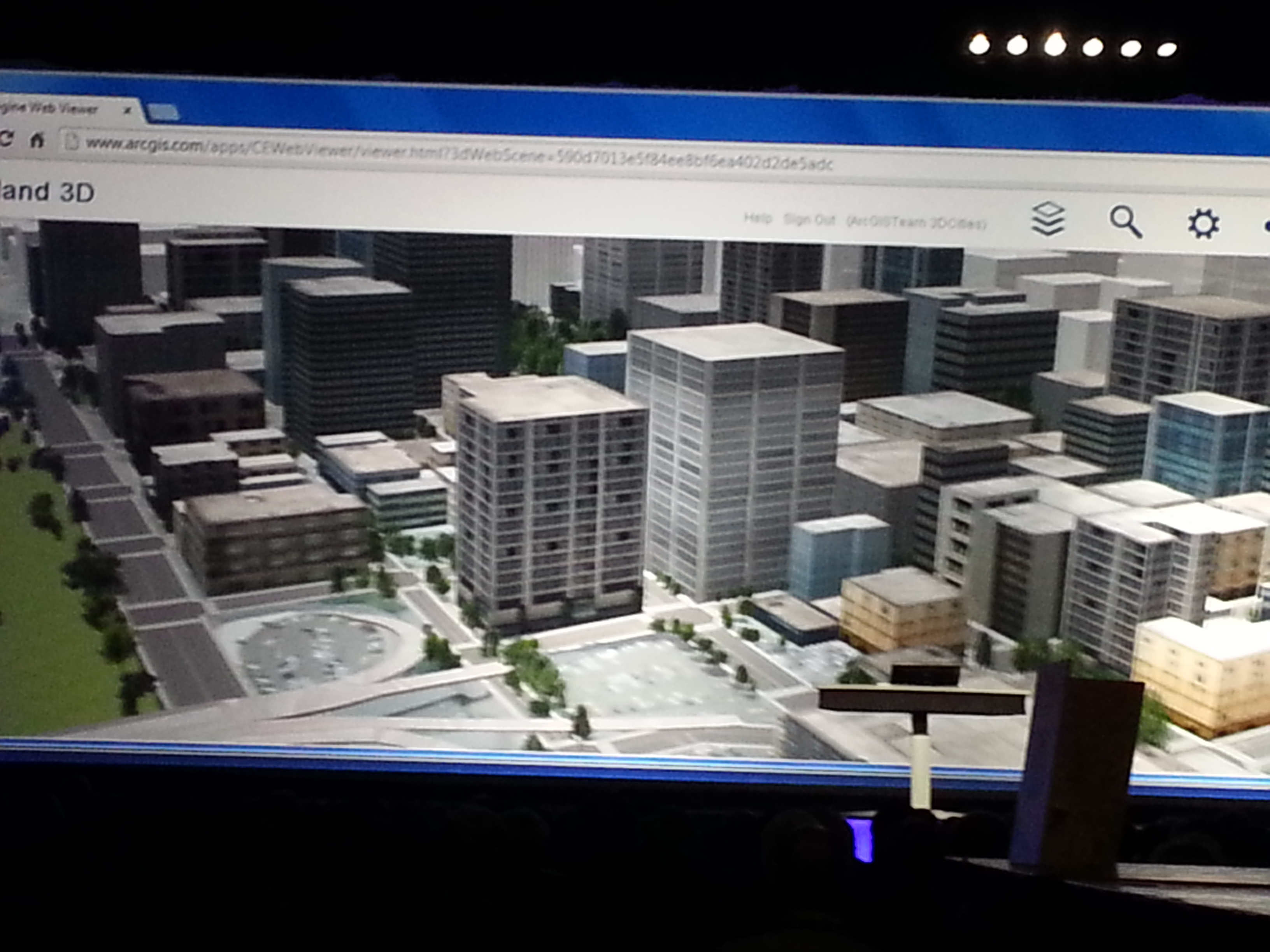
3D: Esri is spending time promoting 3D online. Jack said, “Once you get there, it’s hard to leave. 3D is a major footprint for us.” Ten years ago, I was involved with 3D visualization in landscape architecture and accident reconstruction. Generating 3D models was a painfully slow process. Jack is correct. If you can generate 3D visualizations relatively easily and inexpensively, why would you stay in 2D? This is the future. Check out Autodesks’s free Recap software for easily generating 3D visualizations from scan data and photos (even from your smartphone).
The most interesting take-aways from the Esri International User Conference:
Most interesting quotes from the Esri International User Conference:
• “One quarter of all Esri licenses are used by NGO’s or non-profits at little or no cost.” — Jack Dangermond, Esri
•”The poorest of the poor must obtain the best education possible. Information will be the fourth pillar of democracy in 21st century.” — Dawn Wright, Esri
• “In the past year, ArcGIS online has transformed from a web mapping tool to a true GIS.” — Jack Dangermond, Esri
• “Gangs are a business too, and they recruit (kids) earlier than companies do. To get a job, you have to graduate from college. What do you want these kids to be? If you’re not going to tell (them) what to do, (they’re) just going to go over here (to the gangs). Our system is broke.” — Will.I.Am
If you missed it, I along with Michael Dennis (Geodesist, NGS) were guests on the NSPS Radio Hour <ACSMJuly22_2013>. We talked about geodesy, LightSquared, and a few other subjects. It’s anMP3 file so you can download it onto your smartphone, i device or computer to listen at your convenience.
Altus Positioning Systems has made three announcements at the Esri 2012 Users Conference in San Diego this week. The company introduced a new GPS-based data-acquisition system for the GIS industry, introduced a portable integrated system for GIS applications, and announced the commercial availability of a GNSS receiver.
New GIS system. Altus introduced a new GPS-based data-acquisition system for the GIS industry. The new system from Altus includes an ikeGPS multi-sensor data-acquisition system and a variety of built-in software tools for specific data-collection projects.
The ikeGPS product combines a GPS receiver, laser rangefinder, 3D compass and digital camera in a single ruggedized handheld device, providing a fully integrated low-cost solution for capturing geospatial data and 3D GIS imagery. The versatile system permits the user to geolocate objects quickly and easily from a single location with the laser rangefinder and compass, using the recorder’s GPS coordinates as a reference. The digital camera provides a visual reference for each object captured into the database, and the system can even calculate position coordinates for target items directly from the photographs.
“The ikeGPS multi-sensor platform enables the capturing of GIS data in situations that would be otherwise impossible using traditional GIS equipment,” said Neil Vancans, CEO and president of Altus Positioning Systems. “The ikeGPS mobile GIS solutions provide unique improvements on conventional GIS data-collection efficiency. It also enables the user to capture accurate measurements of remote objects — for instance, across a busy highway, barbed-wire fence, or stream — from safe distances with its point-and-shoot capability, producing verifiable, geo-referenced data collection.”
Vancans noted that for applications requiring higher-precision positioning, the ikeGPS device can be interfaced with Altus’ APS-3 GNSS RTK survey-grade receivers for centimeter-level accuracies.
Portable Integrated System for GIS Applications. Altus also introduced the new ProCyon, which integrates the flexible, rugged Psion Workabout Pro handheld computer with Altus’ APS-3 RTK GNSS receiver for a powerful GIS data-acquisition platform, the company said.
The ProCyon system delivers one-centimeter RTK accuracy using an external antenna, integrated camera, and quad-band GSM modem. Additionally, the ProCyon has hardware expansion slots, making the addition of new modules fast and easy, as well as a range of available add-ons, including fingerprint scanners and the largest selection of RFID readers on any handheld device, Altus said.
The ProCyon Windows Mobile operating system accommodates ESRI ArcPad and ArcGIS applications. Both programs use NMEA messages that are standard outputs from the integrated GNSS receiver in the ProCyon.
“The ProCyon is built on the industry-standard platform of the Psion Workabout, one of the world’s top-selling Windows Mobile devices,” said Neil Vancans, CEO and president, Altus Positioning Systems. “The ProCyon is an answer to the needs of many utilities already using Psion products.”
Commercial Availability of GNSS Receiver. Altus Positioning Systems also announced the commercial availability of its new APS-U GNSS receiver. For maximum flexibility, the APS-U is scalable from a single stand-alone GNSS receiver to full options with heading, wireless links, precise point positioning, and RTK capability. The unit has an additional processor for on-board configuration and custom applications separate from the GNSS engine. It has an extensive suite of interfaces for data output, timing, event marks and a second antenna port for GNSS heading.
“The APS-U provides multi-frequency capability together with GNSS heading, L-Band positioning and wireless communications, all within a hardened housing that meets military environmental specifications,” said Neil Vancans, CEO and president, Altus Positioning Systems. “With its wide range of interfaces and 9-30V power input options, the APS-U is an ideal GNSS solution for GIS data collection as well as machine control, agriculture, aerial photogrammetry, heading sensors and military applications. It can also be used in a variety of different formats, without heading information, in a robust receiver or base station configuration.”
The 136-channel receiver is designed to use all GPS, GLONASS, and Galileo frequencies. Integrated wireless options include Bluetooth for easy configuration, plus a GSM or CDMA cellular modem and UHF radio modem for transmission and reception of RTK corrections. It also works with WAAS, EGNOS, and other satellite-based augmentation systems.
The rugged new APS-U units incorporate Septentrio GNSS receiver engines, and meet MIL-STD-810G specifications for humidity, dust, shock, and vibration, and operates under temperatures from 30 to minus 65 degrees Celsius.
I had a great visit at the ESRI User Conference earlier this month. If you recall last year, I wrote:
“As much as surveyors, engineers, and constructors may not appreciate geographic information systems (GIS) technology, at some point everyone should attend at least the ESRI Survey/Engineering Summit and the first couple of days of the ESRI User Conference held every summer in San Diego, California. This is not a GIS sales pitch. It’s a networking sales pitch. When other conferences are struggling to maintain attendance levels, the ESRI conferences seemingly never fail to grow in attendance. This year, it attracted some 15,000 people from 120 countries. That means gobs of GIS people, and also gobs of surveyors and engineers.”
The statement rang true this year too. Even in today’s economy where conferences are severely impacted or even cancelled due to travel budget cuts, the ESRI User conference still attracted ~11,000 people this month.
On another note, I think conference organizers are getting the message. People just can’t justify attending so many conferences. Next Spring, the ACSM (American Congress for Surveying & Mapping) is combining with the GITA (Geospatial Information & Technology Association) conference in Phoenix, AZ. Instead of 1,000-1,500 for each conference, it’s a larger event at 2,000-3,000. Even more interesting is talk in the rumor mill about a joint conference including ACSM and the ESRI Survey Summit in 2011. Include the GITA conference with those and that makes a lot of sense to me.
As usual, there were many things happening at this year’s ESRI UC conference and I attended many briefings. I’ll try to stay focused on the highly GPS/GNSS-related subjects:
Javad GNSS. One of the bigger news items on the GPS front was the joint Javad/ESRI effort in developing an ArcPad extension for Javad’s line of receivers. The demonstration was very cool. We loaded up a local map (San Diego) from their server located in Moscow (Russia) then took a Javad RTK receiver outside with the data collector (running ArcPad w/Javad’s extension). I collected data on a few points. The data was sent off to Moscow from the data collector (via GPRS while we were outside) to update the map. After we walked back into the convention center, the demonstrator clicked the workstation “refresh” button and viola, the map was updated with the points I collected at the cm-level.
According to the JAVAD engineer, “we make it look easy.” I agree. There’s a lot of heavy-lifting going on in the background to make this happen. With the heavy-lifting done, it still needs a bit of tweaking. There weren’t any quality control indicators (RMS values) on the data collector for the operator to reference and also ArcPad doesn’t recognize GLONASS satellites so while the GNSS receiver was utilizing GPS and GLONASS, ArcPad only reported GPS satellites. The operator really does need to know what’s going on before tapping on the STORE button. But, 95% of the work is done and the heavy lifting is complete so I don’t doubt they will finish off the last 5% in short order.
Topcon Positioning Systems. I’ve had a few questions from readers on Topcon’s new GRS-1 receiver. Is it single frequency? Is it dual frequency? Is it for GIS? Is it for survey?
The answers are Yes, Yes, Yes and Yes.
The entry-level GRS-1 is a single-frequency hand-held GIS data collector. That’s about US$5,000.
Add US$4,000 and you get a 5cm high accuracy GIS receiver.
Add another US$2,500 and you have a full-blown, cm-level RTK rover.
There are other options beyond this (eg. GLONASS), but I think you get the picture as I did. It’s a full L1/L2 GPS and GLONASS receiver. You pay to have features activated (plus some added hardware/software).
I haven’t tried one yet so I couldn’t tell you how it performs, but it’s worth a look.
Juniper Systems. Although they don’t design GPS receivers, their Archer hand-held is starting to show up in a lot of places. Hemisphere GPS has designed the XF-101 receiver as a plug-in for the Archer as well as having a similar model for the Trimble/TDS Recon and Nomad hand-helds. Javad was also offering the Archer with their systems. IkeGPS also introduced a new hand-held mapping system named the Ike1000 that is based on the Archer.
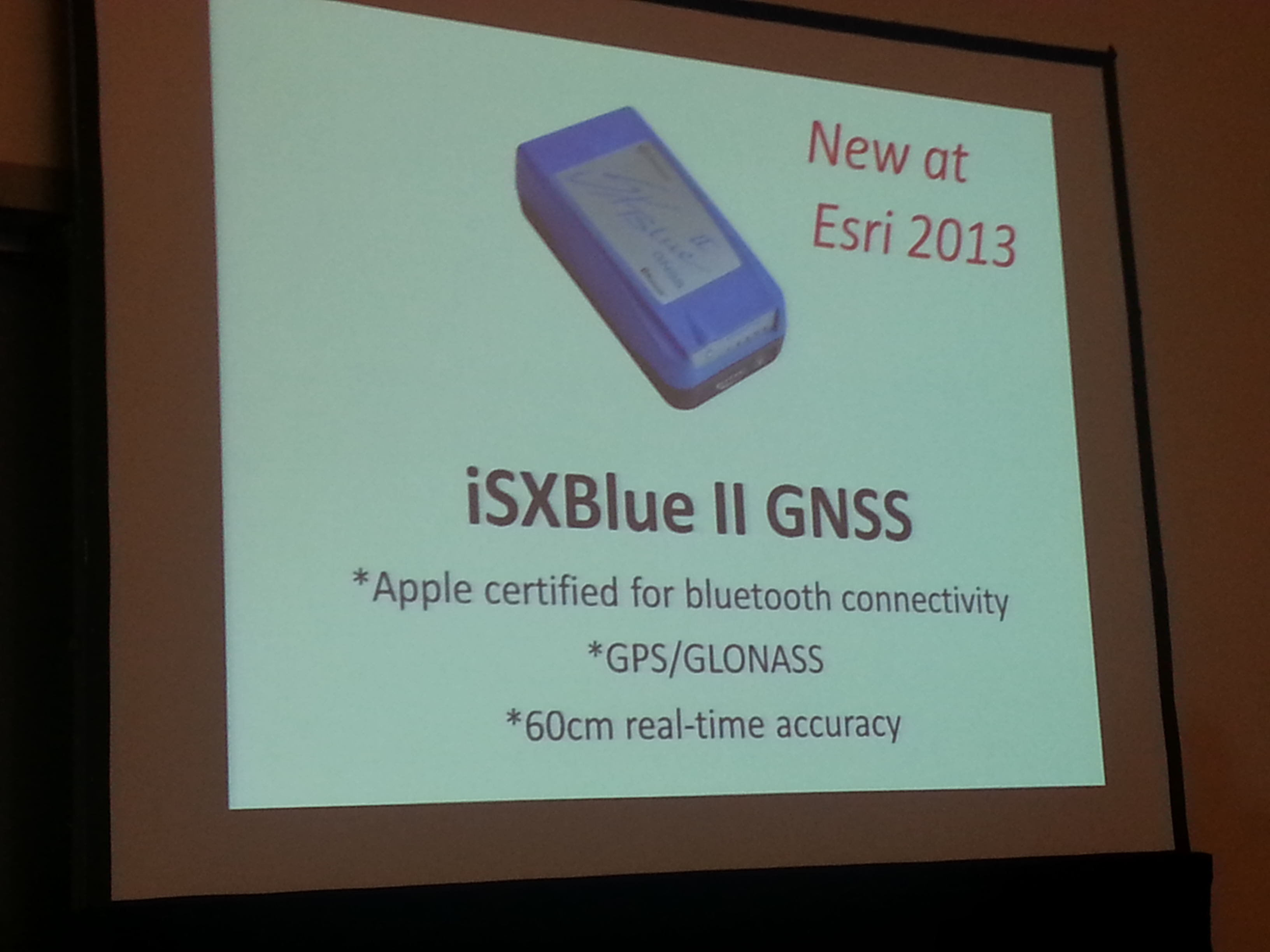
Geneq. Their flagship product, the SXBlue GPS, seems to be gaining momentum in the GIS marketplace. They have introduced a new model that utilizes the OmniSTAR correction service called the SXBlue II-L GPS. Their use of WAAS (via Hemisphere GPS Coast technology) and performance under tree canopy has created some buzz.
Trimble Navigation. It’s hard to leave Trimble out of the conversation, but nothing really new in the GPS product area. However, they continue their run of acquiring companies with the latest being Farm Works Software in the precision agriculture industry. In 2009, they’ve acquired four niche-market companies.
Magellan Professional. Introduced an upgrade to support ArcPad 8.0 for post-processing on their Mobile Mapper 6 hand-held for sub-meter accuracy. FYI: Magellan consumer GPS products is no longer part of Magellan Professional. Rumor has it that Magellan Professional will revert back to the Ashtech brand name of the1990’s.
I gave a presentation at the ESRI UC on Tuesday morning as part of the Survey (SUR) track. I focused on three core issues listed above. You can view my presentation here.
I’ll stick to the highlights…
<
p>SVN-49 troubles. It’s broke and will never be as good as the other Block IIR-M satellites. Don’t expect it to be declared healthy in the immediate future. Even if a patch is developed and it’s declared healthy, it’s likely that pseudorange-based safety-of-life applications like SBAS (WAAS, EGNOS, MSAS) and NDGPS will not incorporate it into their solutions. Although more study is necessary, it appears that carrier-phase applications (cm-level real-time and post-processing) will be able to utilize SVN-49.
Solar Cycle 24. NOAA reports that the number of sunspots during the next solar cycle (2009-2020) will be the fewest since the 1920’s. That doesn’t mean the next solar cycle will be any easier on GPS than the last one. On the contrary, it could be worse for GPS. No one knows at this point. High performance GPS L1 receivers are the most exposed. Those utilizing NDGPS, WAAS and OmniSTAR’s VBS service need to be watchful. You can sign up to receive alerts from NOAA giving a three-day forecast of activity. NOAA predicts the peak of the next solar cycle will be in May 2013. Note that typically the geomagnetic activity that most affects GPS occurs after the peak. Links and more details are in the presentation.
GAO Report. I wrote an article on this subject back in June as it relates to medium and high precision users. You can read it here. High precision users will be affected more than other users because high precision GPS receivers perform better with a lot of observables. A loss of 2-3 GPS satellites can be significant and require users to begin using GPS mission planning software again to optimize the use of field time. Survey receivers using GPS and GLONASS will be less affected. The presentation references a report from the University of New Brunswick that takes a look at how GLONASS can compensate for a loss of GPS satellites.


 Portable Integrated System for GIS Applications. Altus also introduced the new ProCyon, which integrates the flexible, rugged Psion Workabout Pro handheld computer with Altus’ APS-3 RTK GNSS receiver for a powerful GIS data-acquisition platform, the company said.
 Commercial Availability of GNSS Receiver. Altus Positioning Systems also announced the commercial availability of its new APS-U GNSS receiver. For maximum flexibility, the APS-U is scalable from a single stand-alone GNSS receiver to full options with heading, wireless links, precise point positioning, and RTK capability. The unit has an additional processor for on-board configuration and custom applications separate from the GNSS engine. It has an extensive suite of interfaces for data output, timing, event marks and a second antenna port for GNSS heading.